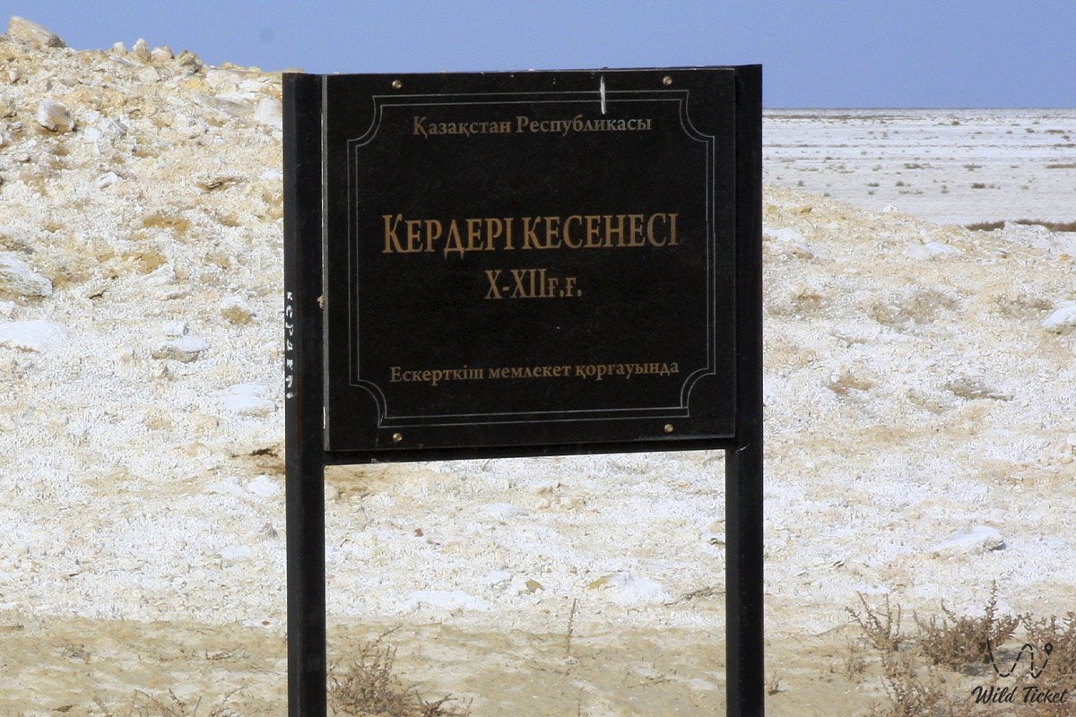
Kerderi Mausoleum
Unique medieval monument on the dried seabed -
Kerderi Mausoleum represents one of the most sensational and unique monuments of memorial architecture on the territory of Kazakhstan. Located on the exposed bottom of the Aral Sea in the Aral district of the Kyzylorda region, this medieval mazar has become an essential archaeological discovery and a bright symbol of large-scale climate changes in the region.
For a long time, the structure was underwater at a depth of about 20 meters. The discovery of the Kerderi Mausoleum was a major event, as the find visually proved that the Aral Sea had grown shallow before – in the 10th–14th centuries, during the Mongol invasion and the heyday of the Golden Horde, this region was already populated by people. It is best to travel to the mausoleum from the city of Aralsk through the Karateren village or from the Ayteke-Bi village (Kazalinsk).
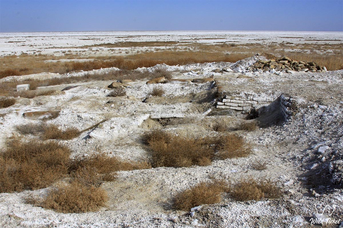
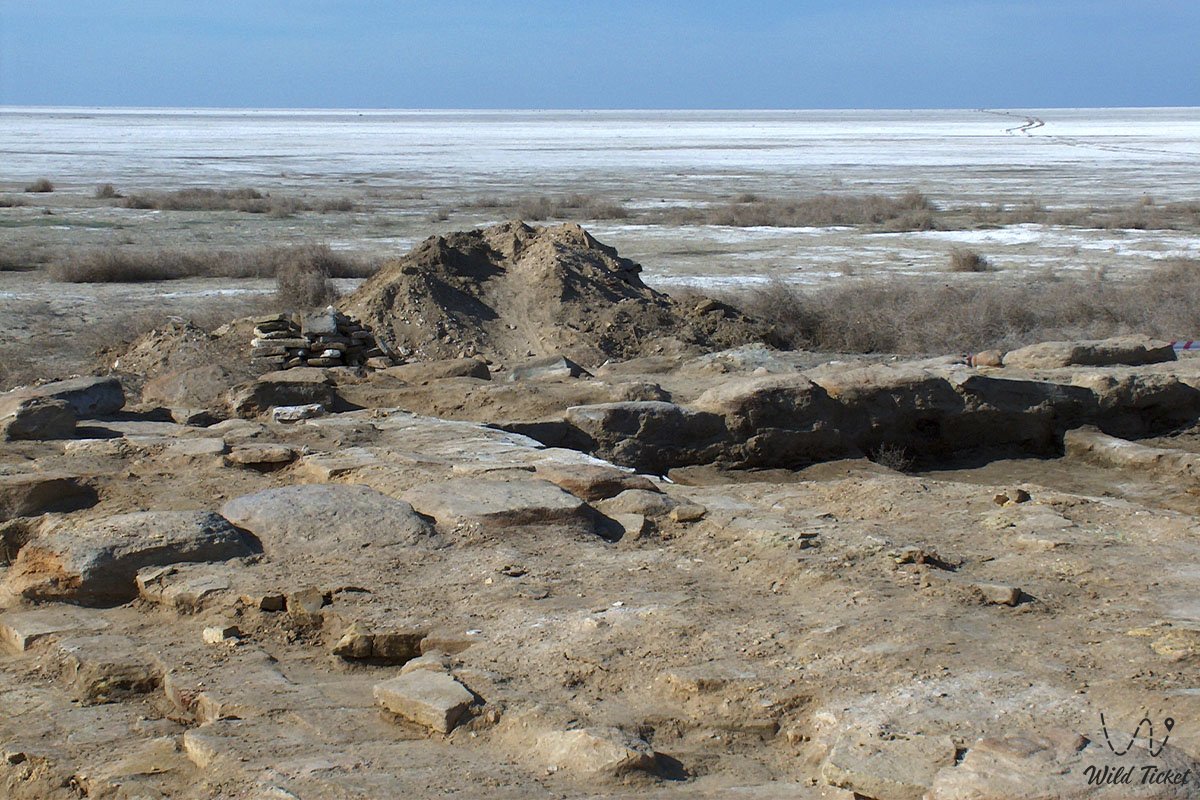
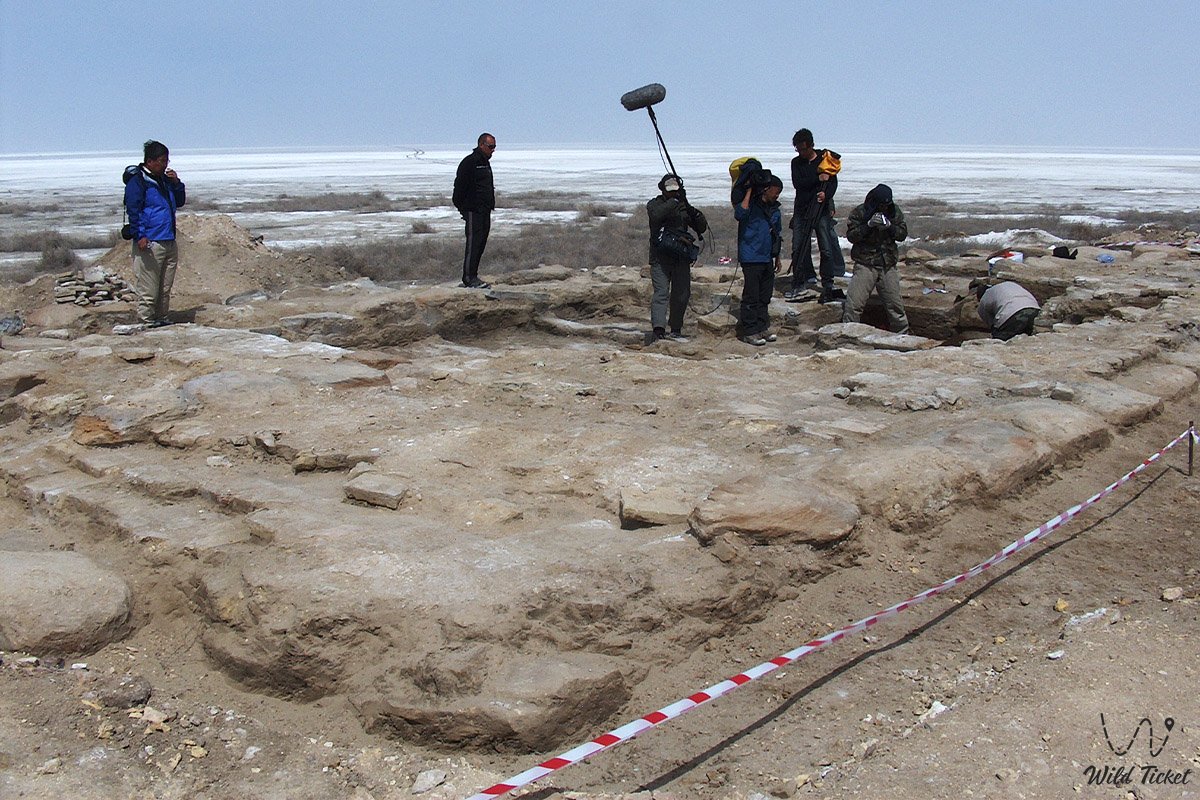
The monument was discovered on July 27, 2001, by an archaeological expedition from Kyzylorda State University. Before the start of excavations, the site was a washed-out oval mound less than two meters high (from 1.6 to 2.3 meters) with base dimensions of about 42×30 meters. Near the mausoleum is the ancient settlement of Aral-Asar and the former Barsakelmes island.
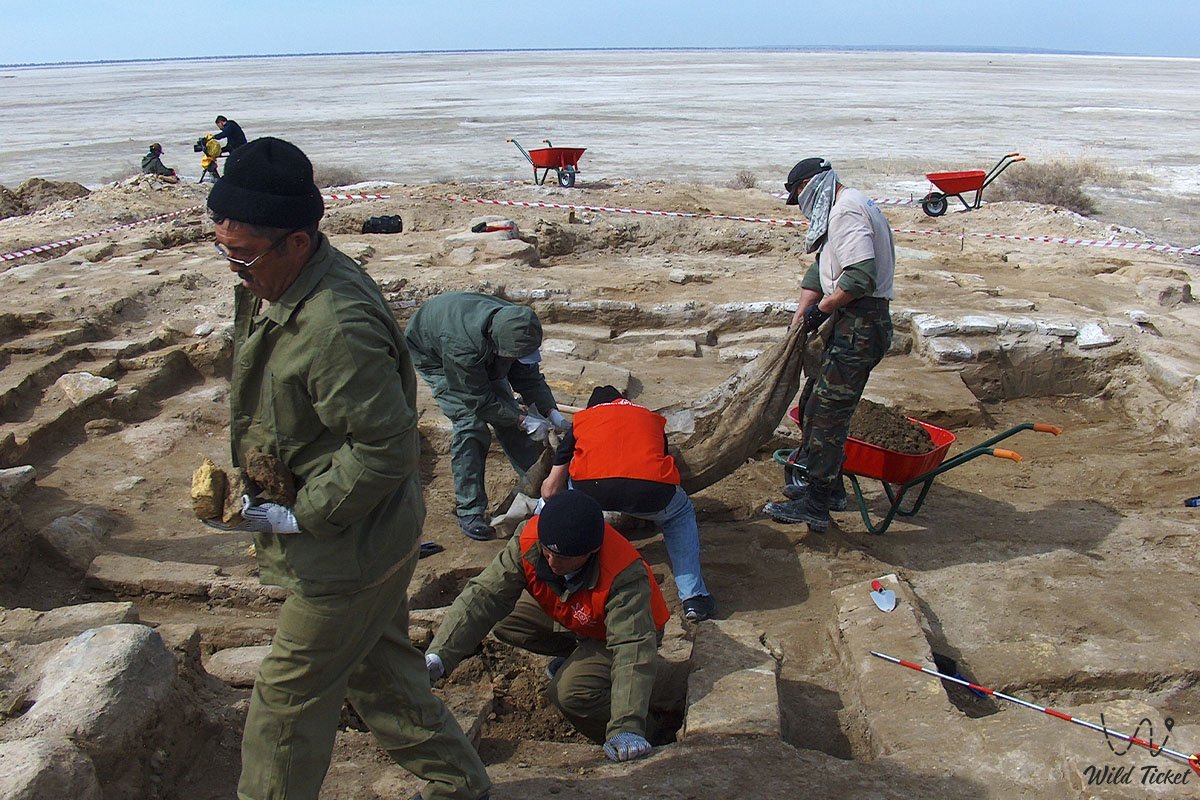
During large-scale studies, it turned out that Kerderi was built of fired square brick and clad with glazed and unglazed decorative tiles, and the mausoleum itself was the central part and the boundary of a large necropolis. Such a durable construction visually illustrates the high level of craftsmanship of the ancient architects of the Aral region near the Small Aral Sea.
Today, the Kerderi Mausoleum (which includes the studied objects Kerderi 1 and Kerderi 2) is recognized as an essential historical and cultural monument and a key point for scientific-local history, ecological, and extreme tourism in the Aral region. The surrounding territory of the former seabed attracts historians, archaeologists, and travelers from all over the world, as this object serves as direct physical evidence of the cyclical nature of the Aral's water resources. According to research data, water returned here and completely flooded the mazar only at the end of the 16th century, when the Amu Darya River changed its course towards the Aral Sea.
---------------------------------------------
How to get there and visit -
Kerderi Mausoleum is located on the former bottom of the Aral Sea, in the Aral district of the Kyzylorda region, Republic of Kazakhstan.
The monument is located 56–57.6 kilometers southwest of the Karateren village, 71 kilometers southeast of the Kulandy village, and 4.5 kilometers northwest of the ancient settlement of Aral-Asar.
GPS geographical coordinates: 45°43'25"N 60°15'42"E
The transport logistics of this secluded desert area completely exclude urban public transport – no regular buses or city taxi services operate to the monument on the seabed.
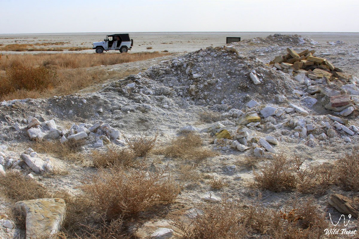
Reaching the medieval monument is possible exclusively within specialized off-road expeditions from the city of Aralsk. The path from the district center first lies northwest through the Zhalanash village (63 km from Aralsk), after which the asphalt ends, and the road to the Koktyrnak peninsula and Tastubek village passes along a heavy grader and steppe tracks. Further, the route continues directly along the dried seabed.
Only a prepared four-wheel-drive SUV (4x4 jeep) with high cross-country capability is suitable for a trip to the site. Moving along the dried bottom of the Aral Sea involves serious danger: the hilly relief abounds in unstable salt marshes and takyrs that are capable of trapping a vehicle tightly.
It is categorically forbidden to head into this area in a single car – there must be at least two SUVs in the expedition for mutual assistance and safety. Drivers must carry satellite navigators, reliable shovels, tow ropes, additional fuel, and a large supply of fresh drinking water.
Opening hours: the territory around the monument is open for visits around the clock and all year round. Access to the archaeological zone is completely free; no ticket offices, tickets, or paid checkpoints are provided here.
Trips to this region are recommended to be planned for the spring period (April – May) or early autumn (September – October). In summer, extreme heat holds here (the average July temperature is +32°C), and in winter, the region is subject to severe frosts down to -10°C and strong blizzards.
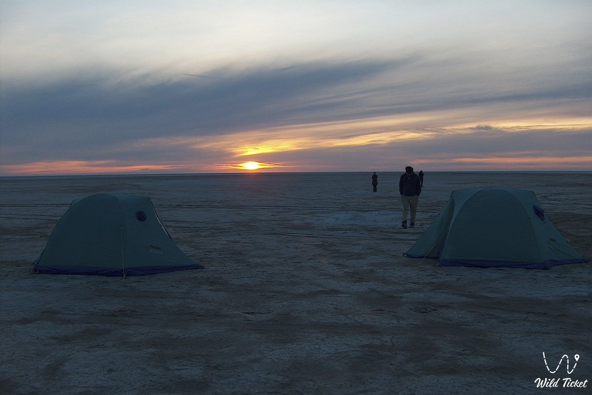
All tent camps are organized by expedition groups independently in wild conditions (popular places for sites are the Kaltybay mountains or the Kelmes tract near the Akbasty village). Replenishing supplies of drinking artesian water and finding an overnight stay is possible with local residents in the nearest villages.
---------------------------------------------
History
The history of the Kerderi Mausoleum dates back to the Golden Horde period (11th–14th centuries), when the Aral Sea receded significantly, exposing fertile silty lands. A developed urban and agricultural civilization — the Aral-Asar settlement — arose on the former bottom. Local residents successfully engaged in growing rice and wheat, equipped irrigation plots and canals, raised livestock (kulans, horses), and also actively participated in trade, taking advantage of stopping on the Great Silk Road.
The Kerderi necropolis enclosed this settlement and served as its boundary. At the end of the 16th century, the environmental situation changed sharply: the Amu Darya turned its course towards the Aral, the sea level began to rise rapidly, and the big water suddenly flooded the region. The city of Aral-Asar and the mausoleums went underwater to a depth of 20 meters. Only in the 1960s, after a large-scale anthropogenic change in the flow of the Amu Darya and Syr Darya rivers, the sea began to dry up again, returning the ruins of Kerderi to modern historical science.
Information
By the type of structure, Kerderi belongs to the category of facade portal-domed mausoleums. The mazar is oriented strictly to the cardinal points and has the shape of a rectangle in plan. The surrounding territory was built up with numerous craft workshops and burials of the sagana type dating back to the end of the 14th century. In these gurkhanas (halls), both men and women with children were buried.
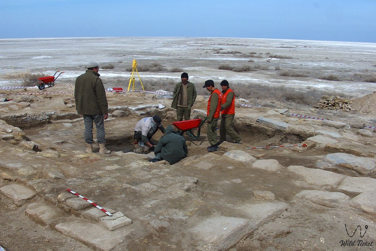
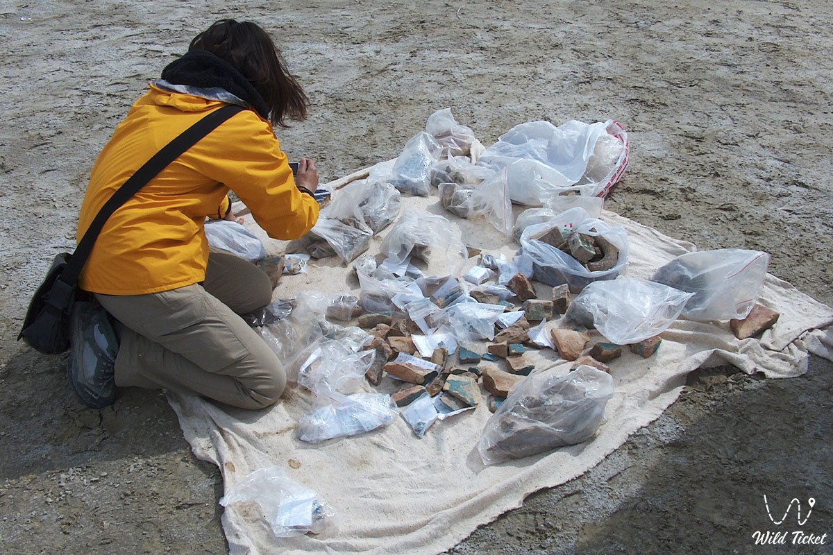
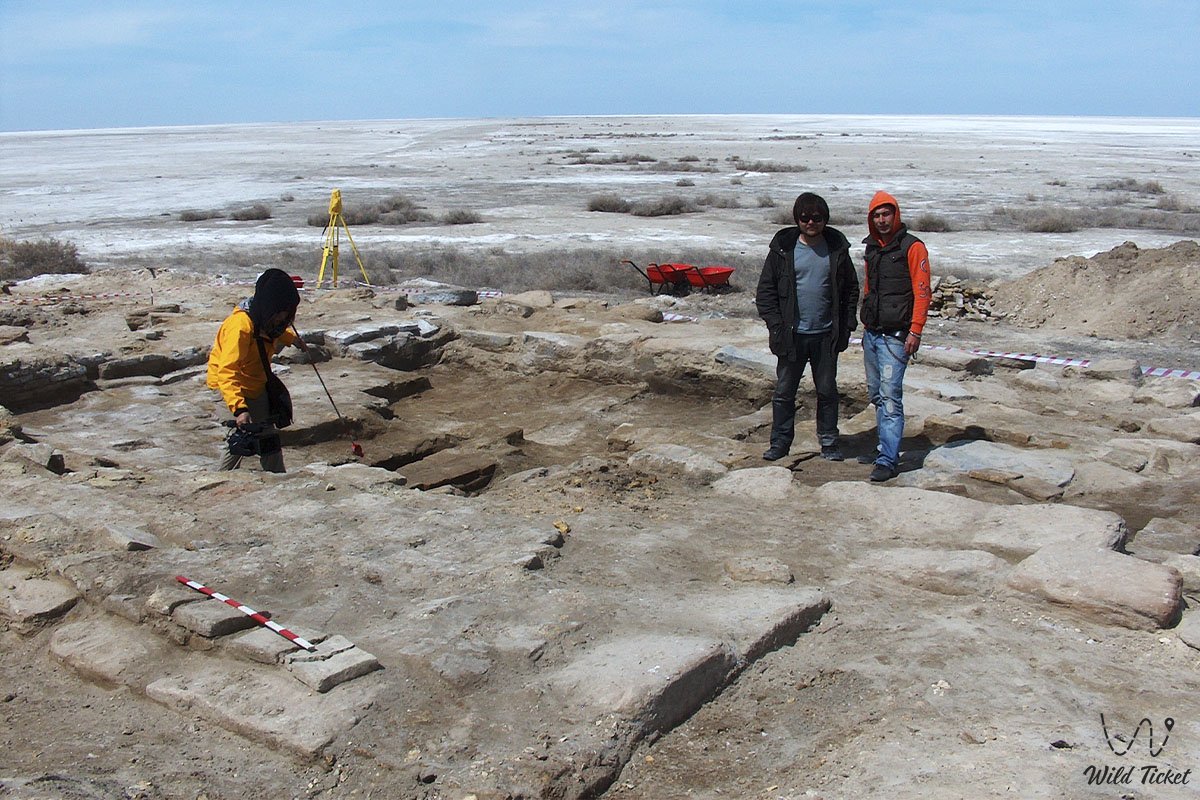
Scientists from Kyzylorda State University and the Institute of Archaeology conducted detailed stratigraphic pits and planned surveys of the contours of ancient fields during the field seasons. Excavations brought world fame to this place due to unique finds, among which are silver coins from the middle of the 14th century, numerous yellow glass beads, bronze coins, and tools. Expedition organizers and ecologists of the Barsakelmes State Nature Reserve ask tourists to move around the territory of the monument with caution, not to destroy the washed-out walls, and not to pollute the sandy-alluvial layer of the former seabed.
Detailed description of the venue
The well-thought-out infrastructure of the historical and archaeological complex includes the following original locations and geographical features:
• Massive stone foundation – a solid base 1–1.2 meters high (in some places up to 1.5 meters) made of six rows of massive stone slabs ranging in size from 20×30×15 cm to 100×50×25 cm, created to stabilize the building on silty soil.
• Square gurkhana (central hall) – an internal burial chamber measuring 5.5×5.5 meters, the floor of which is laid with rectangular fired slabs.
• Axial internal niches – four deep recesses (about 1 meter) in the internal walls of the hall used for equipping elite burials.
• Main entrance portal – a monumental entry zone in the southwestern part of the structure with a portal niche width of 2 meters and massive pylons 3 meters wide.
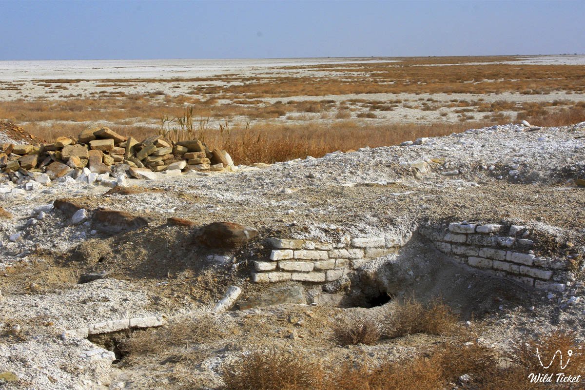
• Collapsed portal wall – a glazed artifact perfectly preserved under a layer of sand washed up by water, which fell as a whole when the sea undermined the structures.
• Northwestern elite burial – a unique, stone-lined grave pit in the form of a cist under three massive slabs, which presumably belonged to a tribe leader and was plundered.
• Rectangular sagana No. 3 – an undamaged burial measuring 2.25×0.5 meters made of fired brick, covered with 33 bricks on edge, where a perfectly preserved wooden coffin was found.
Architecture
The architectural appearance of the Kerderi Mausoleum reflects the advanced building technologies of the Golden Horde era. The walls of the mazar had a striking thickness — no less than one meter at the narrowest point. They were laid from high-quality fired brick of a standard size of 25×25×5 cm. The southwestern part of the wall by the time of excavations survived to a height of six rows of brickwork.
The rectangular framing, pylons, and vault of the portal niche were richly decorated with majolica, glazed and unglazed tiles with elegant floral and geometric ornaments, as well as gold inscriptions and epigraphy in Arabic. Fragments of decorative rounded bricks prove that the archivolt of the niche arch rested on three-quarter columns built into the corners. Due to the unstable, silty soil, the ancient town planners applied a technique unique to Central Asia — they laid the floor slabs directly on top of a powerful six-row stone foundation that overlaps the base of the external walls.
Legend
Most burials in the central hall of Kerderi were conducted according to a strict Muslim rite in wooden coffins on the back with the head to the southwest. Following the canons of Islam, the deceased were buried without inventory, but archaeological finds have generated many legends about the dual faith of local tribes.
The main mystery of the necropolis became a pair of gold earrings found in the female burial of sagana No. 3. They are made in the form of a stylized head of a predator (a leopard or a lion) biting its tail, and complemented by a suspended blue stone. This object, executed in the famous Sarmatian "animal style" of the Iron Age, is completely uncharacteristic of Islam and indicates that ancient ancestral traditions of Tengrism and shamanism – the worship of the supreme deity Tengri – were strong in Aral-Asar.
Another legend is connected with a real treasure found under the floor in the southern corner of the mausoleum. Scientists extracted a large clay jug 40 centimeters high with a side handle. Inside were heavily rusted metal tools: sickles, scythes, hoes, and knives for tilling the land. In those distant times, iron was valued at its weight in gold.
Local residents believe that in the last days before the sudden advance of the Aral waters, one of the farmers hid this valuable vessel within the sacred walls of the mazar, hoping to return after the flood. But the turbulent waters swallowed the oasis for hundreds of years, turning the city into a steppe Atlantis, and the treasure itself went to archaeologists centuries later.
Conclusion
The Kerderi Mausoleum is a magnificent historical bridge connecting the Golden Horde culture of nomads and farmers with the modern ecological chronicle of the Kyzylorda region. A visit to this landscape monument, risen from the bottom of the sea, allows guests of the Aral region to personally appreciate the scale of the Aral disaster, touch the unique architectural traditions of pre-revolutionary Kazakhstan, and realize the cyclical nature of global natural processes.
The Kerderi Mausoleum and the Aral-Asar settlement remain essential reference points for scientific-research and extreme tourism. Expedition routes along the former seabed open fascinating pages of history before travelers, proving that even the desert is capable of returning the lost treasures of ancient civilizations.
Interesting sights nearby:
• Shevchenko Bay on the Small Aral;
• Barsakelmes Nature Reserve;
• Kokaral Dam;
• Dried bottom of the Aral Sea.
Photogallery:


Comments 2