Climbing Bayankol Peak -
Travel to Bayankol, gorge, mountain camp, tract -
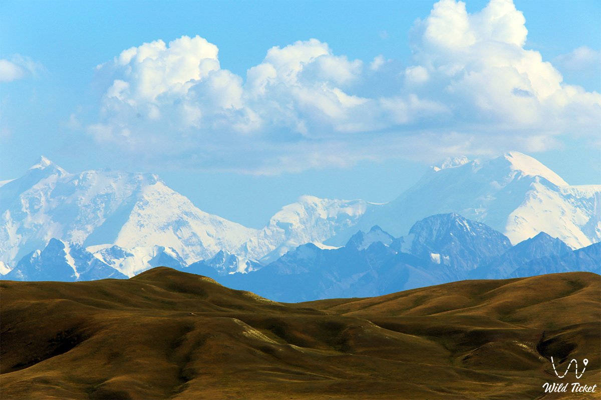
Bayankol is a mountain peak, located in the famous Bayankol mountain gorge, its height is 5790 meters above sea level, difficulty category 4B, 5B. The domed peak of Bayankol Peak is located between the peak of Kazakhstan with a height of 5769 meters above sea level in the east and slightly to the south and the peak of Eleven West with a height of 5428 meters above sea level in the northwest. The distance from Bayankol Peak to Eleven West Peak is 2 kilometers, to Kazakhstan peak is 1.9 kilometers. The Western Bayankol glacier with a length of 7.2 kilometers descends along the northern slope of the Saryjaz ridge from Bayankol Peak.
---------------------------------------------
How to get there, visit -
Bayankol Peak is located in Kazakhstan, Saryzhas mountain range, Raimbek mountain district, Almaty region, Bayankol Gorge area.
GPS coordinates: N42°16'59" E80°12'26"
---------------------------------------------
Information
The first ascent to the top of Bayankol, along the northern ridge from the side of the Central Bayankol glacier, was undertaken in 1953 by a team of the Kazakh Republican Mountaineering Club consisting of 7 people under the leadership of V.P. Shipilov.
On August 21, 1955, 11 people of Almaty climbers of the Turkestan Military District under the leadership of the master of sports Shipilov Vladimir Petrovich died while climbing the peak of Pobeda with a height of 7439 meters above sea level along the route through the eastern ridge – from the Chon-Toren pass to the main peak of Pobeda.
To the south, along the western couloir, a 3.4-kilometer-long glacier descends from Bayankol Peak, which connects with the Severny Inylchek glacier at an altitude of 4185 meters above sea level. A small ridge descends to the south from the summit, which after 630 meters ends with a steep rocky slope with a length of about 700 meters.
The top of the peak is ice-snow. South of the summit, from east to west, at the beginning of the descent of the southern glacier, a crack extending more than 230 meters stretched. The entire northern slope is snow-ice. The tongue of the Central Bayankol glacier ends at an altitude of 3305 meters above sea level, from here the sources of the Sarykoinou River begin. The difficulty category of classic routes to Bayankol Peak is estimated at 4B, 5B.
Photogallery: