Mountain peaks of the Sarydzha range -
Climbing to Semenov Peak in the Sarydzhas ridge -
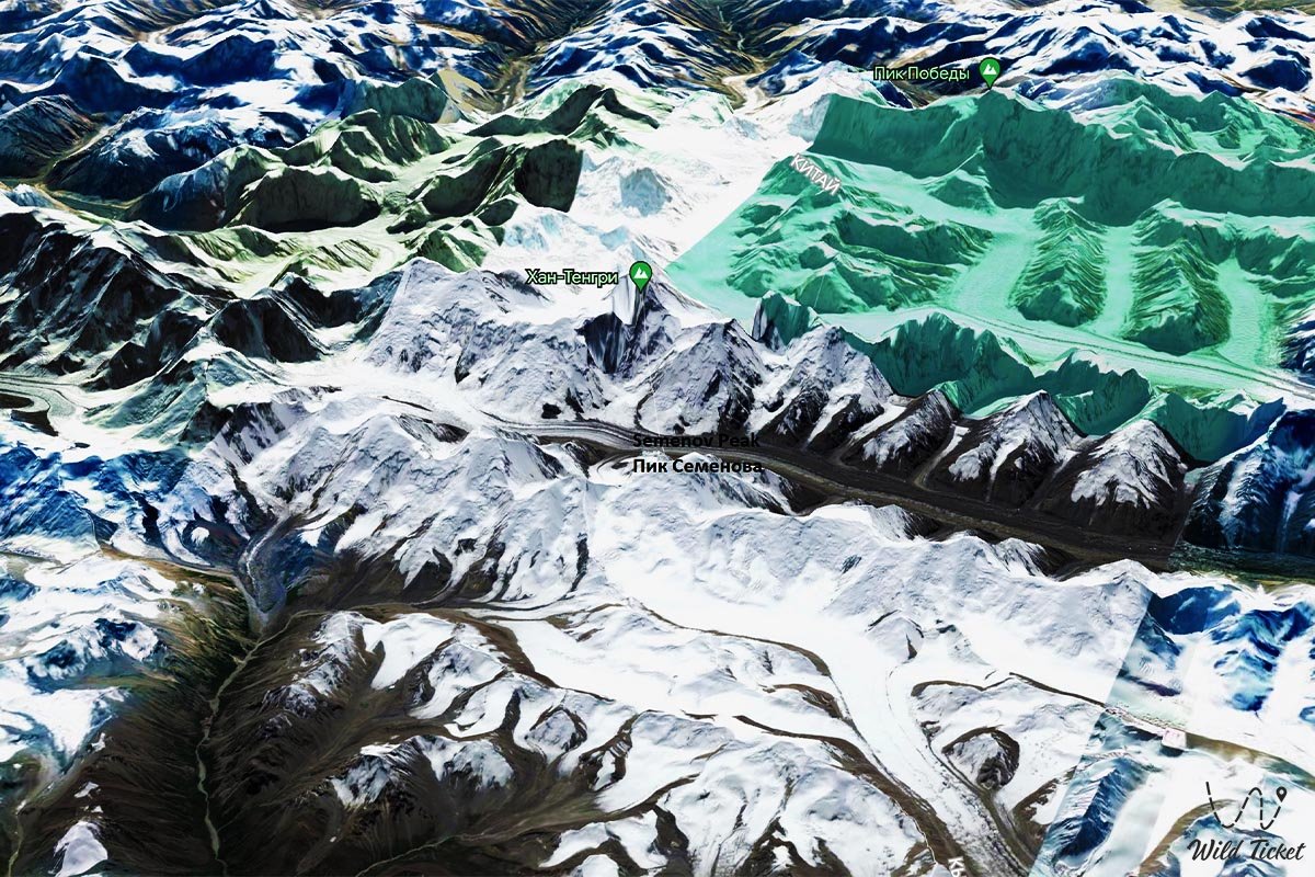
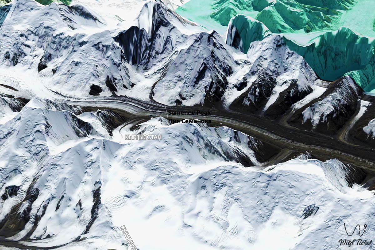
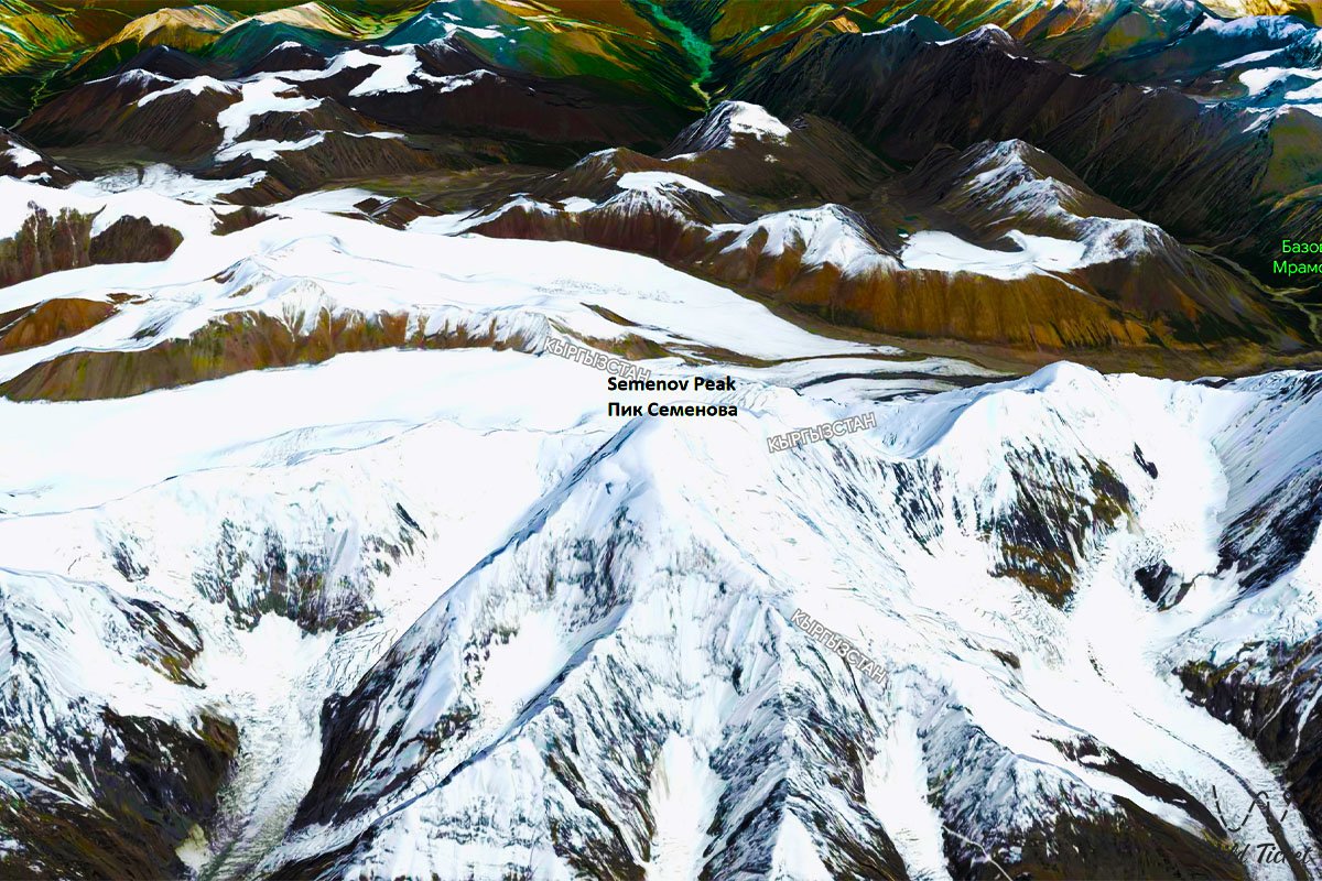
Semenov Peak is a mountain peak that is part of the Sarydzha ridge in the Bayankol gorge, its height is 5816 meters above sea level. Part of the mountain is located on the side of Kazakhstan, the other side is located on the territory of Kazakhstan.
The state border between the Republic of Kazakhstan and the Kyrgyz Republic runs through the peak from the southwest to the northeast. The peak is located 6.3 kilometers (in a straight line) to the east and just south of Ignatiev Peak with a height of 5488 meters above sea level, located in the Sary-Jazz ridge.
---------------------------------------------
How to get there, visit -
Semenov Peak is located in the Sarydzha mountain range, Raimbek district, Almaty region.
GPS coordinates: N42°16'33" E80°07'06"
---------------------------------------------
Information
From the top of Eleven West, Semenov Peak is located in the west and a little to the south at 5.5 kilometers. The peak has the shape of a snow dome. A glacier descends from the eastern slope of the peak, which at an altitude of 4176 meters above sea level connects with a glacier that descends from a peak of 5163 meters above sea level. The total length of the Semenov Zapadny Glacier is 5 kilometers.
The peak rises above the valleys of the Northern Inylchek and Semenova glaciers. The length of the Semenov glacier, whose sources begin from the western slope of the peak is 19.2 kilometers. The tongue of the Semenov glacier is located at an altitude of 3447 meters above sea level. The peak was named after the traveler and geographer Pyotr Petrovich Semenov, who explored the Central Tien Shan in 1857.
Photogallery: