Off-road expedition to the heart of the Western chink of Ustyurt is a route to the fourth panoramic point of the Bozzhyra tract, opening the most famous postcard-perfect view of the valley. While the previous viewpoints (first, second, third) led along the northern terraces of the Ortasha plateau, here the expedition ventures into the central sector of the chink, which opens a frontal vista of the iconic Oynak-Bozzhyra clearing and vertical limestone towers.
The fourth panorama of Bozzhyra no. 4 is located in the central part of the Western chink of the Ustyurt plateau in the Karakiyan district of the Mangistau region. The observation platform is situated 2.4 kilometers east and slightly south of mount Borly-Tau, and 2.7 kilometers southeast of mount Yurt. The distance along the steppe tracks from the third panorama of Bozzhyra to the fourth is 9 kilometers, skirting deep cirques and ravines of the upper plateau.
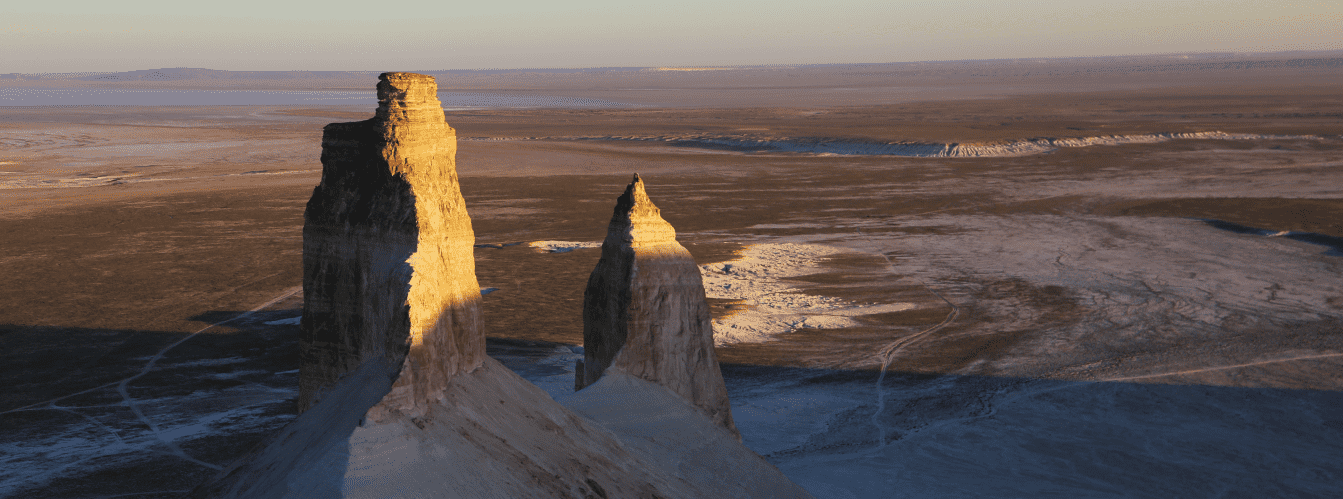
From the fourth panoramic platform, one of the most expressive and monumental landscapes of the chalk valley on the Mangyshlak peninsula unfolds. Spreading directly in front of the observer is the completely flat, whitish-clay surface of the Oynak Bozzhyra clearing—a natural amphitheater of the ancient Tethys Ocean. Rising majestically above it are the vertical residual buttes of Azu tisteri (Fangs of Bozzhyra): the massive Southern (Ontustik) and the sharp Northern (Soltustik). From here, you also get an unobstructed view of the stepped Zhogarly plateau at an elevation of 243.1 meters, the monolithic mount Borly-Tau, and the flawless cone of mount Yurt (253.3 m).
Every bend of the trail along the brow of the chink in this section creates an ever-changing arrangement of planes: the contrast between dazzling white chalk skirts, ochre sandstone layers, and the flat mirror of the clearing below leaves a powerful emotional impression.
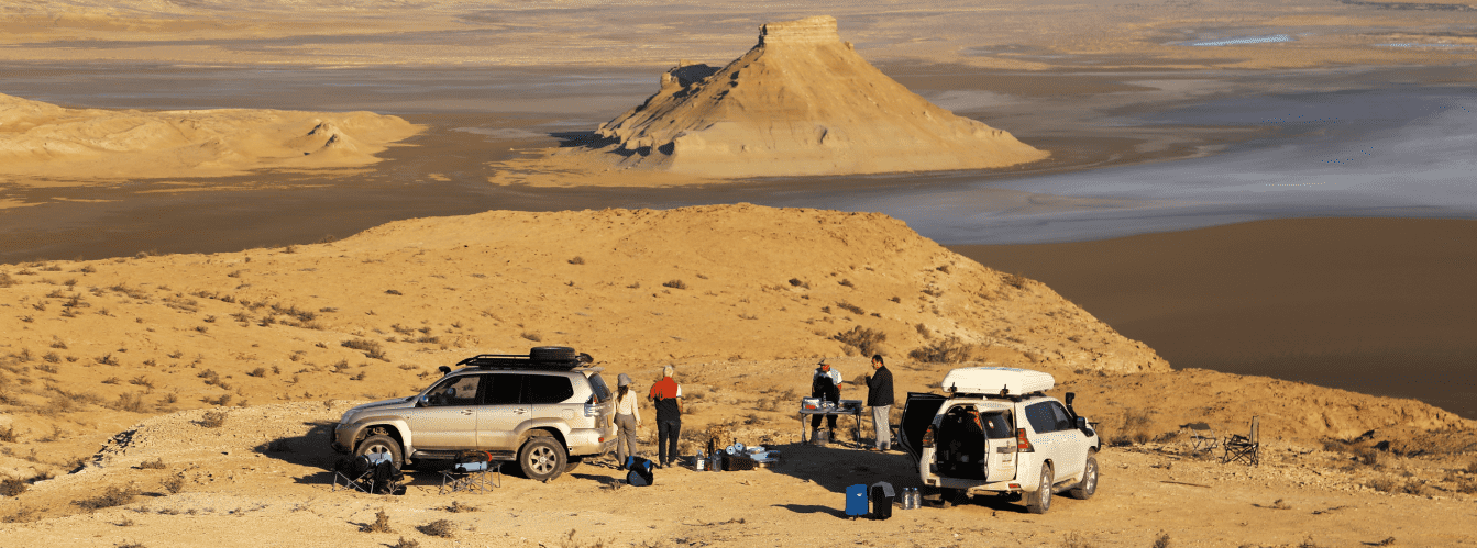
A journey in prepared 4x4 vehicles along the rim of the chink is the optimal way to experience the central amphitheater of the tract at a comfortable pace. You can study the detailed 5-day tour itinerary across Mangystau.
--------------------------------------------
How to get there and visit –
The fourth panoramic point of the Bozzhyra tract is situated on the brink of the central sector of the Western chink of the Ustyurt plateau in the Karakiyan district of the Mangistau region, Republic of Kazakhstan.
GPS geographic coordinates of the fourth panorama of Bozzhyra no. 4:
43°25'35"N 54°06'28"E
Key landmarks: mount Borly-Tau 2.4 km to the west, mount Yurt (253.3 m) 2.7 km to the northwest, Oynak clearing at the bottom of the canyon, and the Azu tisteri buttes (Fangs of Bozzhyra) directly in the field of view.
The turnoff from the paved Zhanaozen – Beket-Ata underground mosque highway is located at the 79th kilometer. The distance from the highway turnoff to the fourth panorama platform across the steppe tracks of the plateau is 11 kilometers. The drive from the third panorama to the fourth takes 9 kilometers along a beaten dirt road winding beside the deeply indented cliff edge.
Access and seasonality: the route is negotiated in four-wheel-drive 4x4 vehicles with a reliable suspension and high ground clearance. The plateau soil here is clayey-saline, with inclusions of crushed stone. In dry weather, the track is easily passable, but during and immediately after rain, driving is strictly discouraged: clay quickly clogs tire treads, turning the track into a slick surface.
The best time to visit is spring (April – May) and early autumn (September – early October), when comfortable air temperatures prevail across the steppe and extreme summer heat is absent.
IMPORTANT: the depth of the precipice near the fourth panorama exceeds 150–200 meters. Wind erosion undercuts the edge of the chink from below, creating fragile overhanging cornices. Do not park vehicles near the very edge and maintain a safe distance when walking along the drop-off.
--------------------------------------------
Photography specifics and site tips:
• Frontal composition with the Fangs: from the fourth point, the Azu tisteri buttes and the Oynak clearing line up in classic perspective. A lens with a focal length of 50–85 mm allows you to compose a tight frame, compressing the distance between the white plain below and the spires of the buttes;
• Golden hour and backlighting: in early morning, the sun rises from behind the photographer, evenly bathing the white cliffs of the Fangs and the dome of mount Yurt in soft, warm light. In the afternoon, the sun moves west, casting expressive backlighting and long dramatic shadows across the entirety of the Oynak clearing;
• Aerial drone shooting: the open central cirque allows drones to execute sweeping passes over the Oynak clearing and descend toward the base of the buttes. Be mindful of continuous updrafts pushing upward against the chink wall: return the drone to the launch site with at least 30% battery reserve;
• Optics and accessories: an ultra-wide-angle lens (14–20 mm) is essential to capture the vast scale of the amphitheater. A circular polarizing filter (CPL) is critical in sunny conditions to cut bright glare reflecting off the white salt flat of the Oynak clearing and chalk screes;
• Safety and self-sufficiency: mobile reception is completely absent on the central chink. For walking excursions, always wear sturdy footwear with non-slip soles, carry a drinking water supply of at least 4 liters per person, and protect equipment from fine chalk dust.
Tours and expeditions to the fourth panorama: visiting the fourth panorama of the Bozzhyra tract is included in the key itineraries of our 4x4 jeep tours across Mangystau departing from Aktau. We take care of full route coordination in expedition 4x4 vehicles, provide a field camp, three hot meals daily, and the guidance of experienced leaders who know the safest and most scenic observation ledges of the Ustyurt chink.
Nearby attractions:
• Azu tisteri buttes (Fangs of Bozzhyra);
• Snow-white Oynak Bozzhyra clearing;
• Mount Borly-Tau;
• Mount Yurt (253.3 m);
• Zhogarly plateau (243.1 m);
• Third panorama of Bozzhyra;
• Mount Ulkenkeme.
Photogallery: