Mount Sherkala
Solitary chalk colossus of the Silk Road shaped like a snow-white yurt –
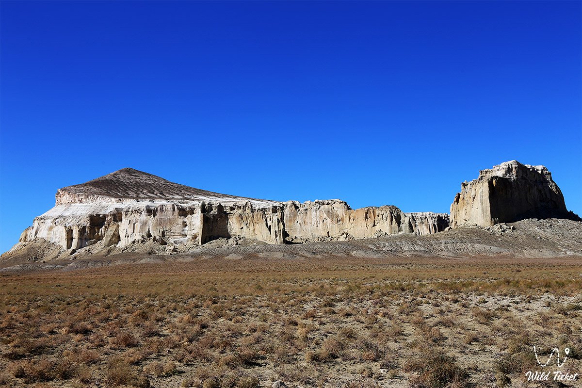
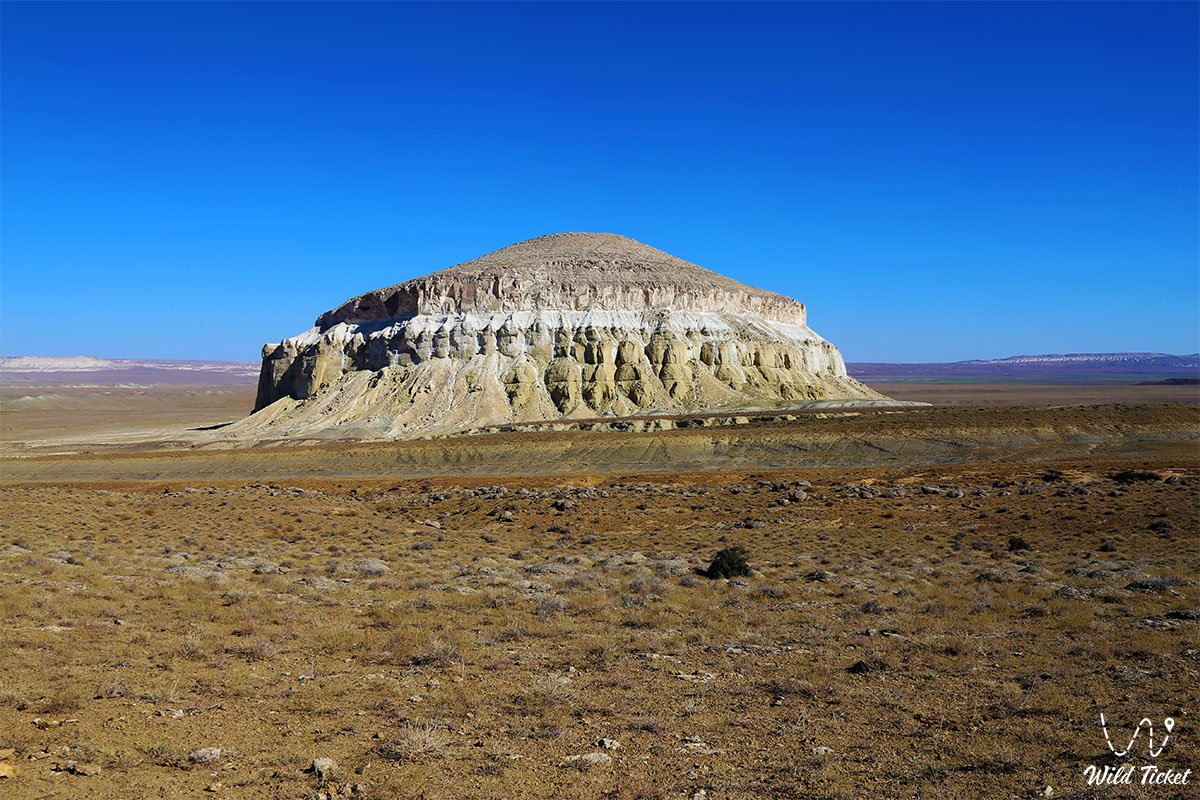
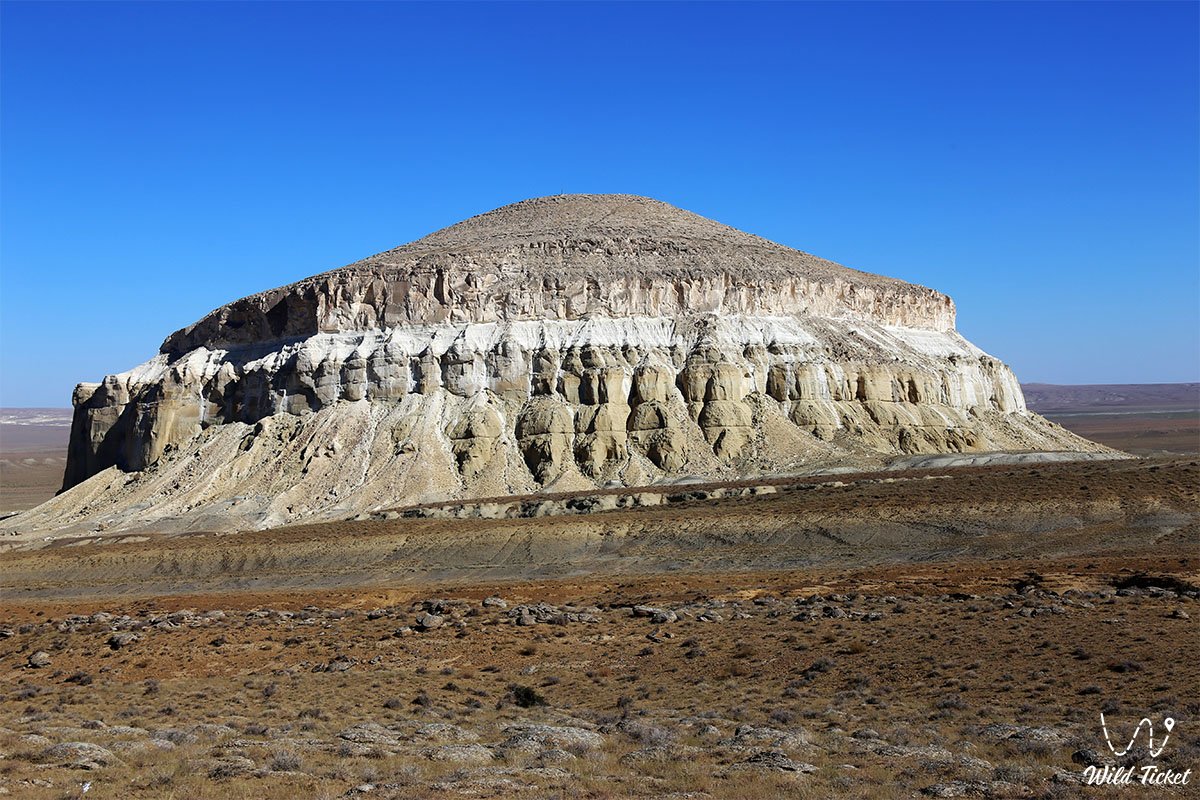
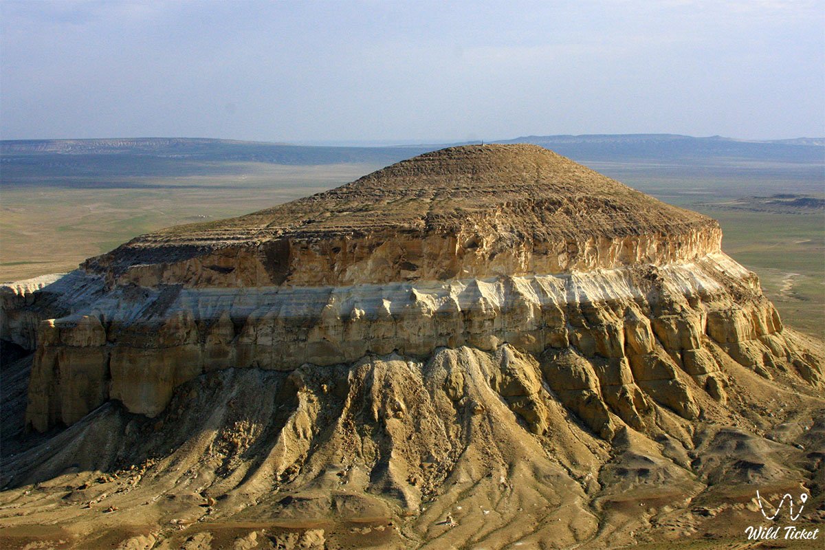
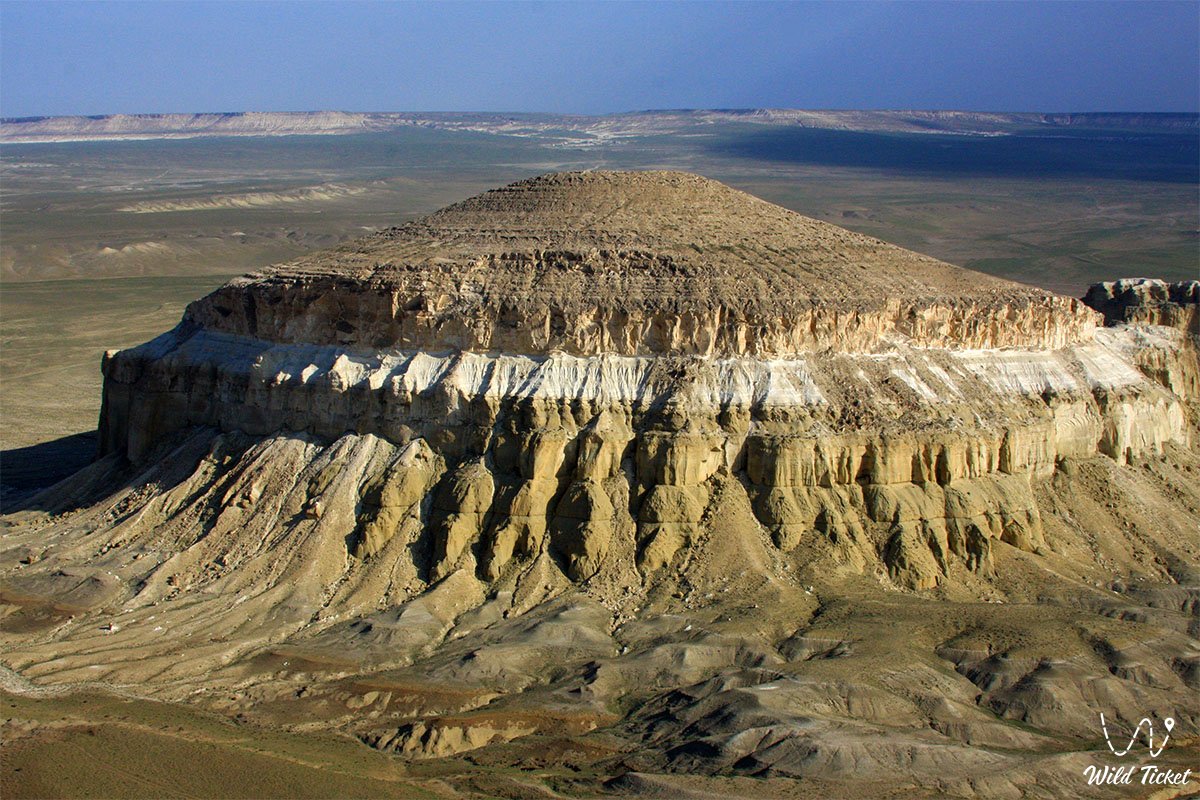
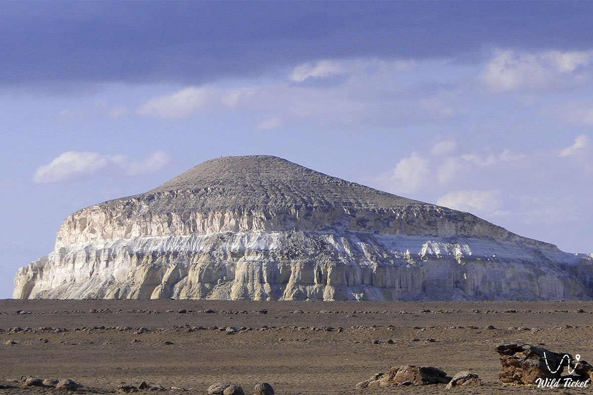
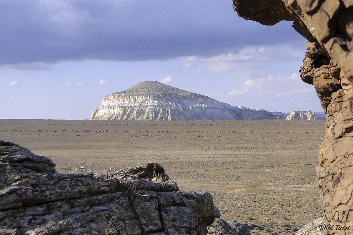
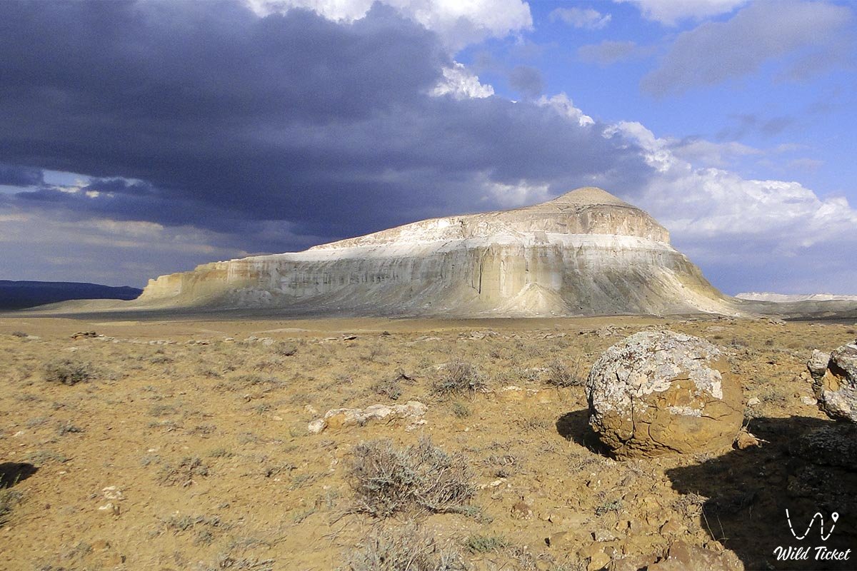
Mount Sherkala (in historical sources and guidebooks also Shergala, Chirkala-Tau, Pers. "Lion's Fortress", Turkic "Lion Mountain", in Arabic translations "tiger city") represents a grandiose table-topped remnant mountain-outlier and a recognized symbol of the Mangystau region. Situated in an intermontane depression between the Western Karatau and Northern Aktau ranges, this solitary snow-white and ochre monolith towers over the flat steppe plain to an absolute elevation of 307.7–332 meters above sea level (the relative height of its precipices exceeds 200 meters).
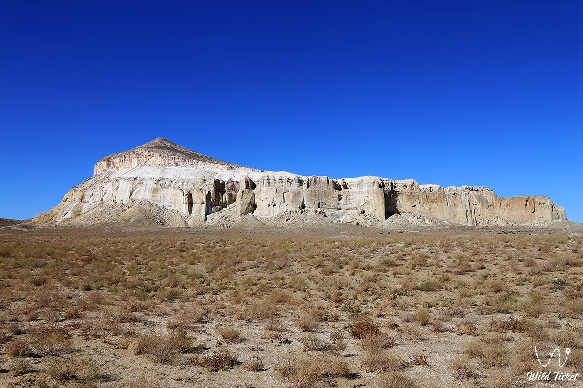
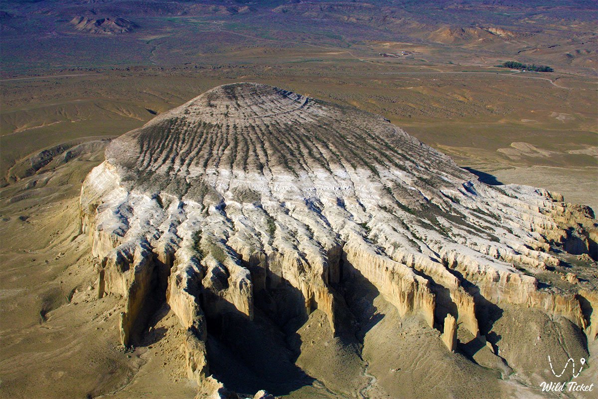
The mountain possesses phenomenal visual variability: from the west it appears as a gigantic white Kazakh yurt or an inverted bowl, from the south and east it emerges in the guise of a crouching lion resting its head on massive paws before leaping, while from above its silhouette resembles an unidentified flying object.
The geographical surroundings of Sherkala connect it to the most critical historical and natural hubs of the Mangyshlak Peninsula. Just 1.5–1.6 km to the southwest, the dry bed of the Akmysh stream nourishes a green spring oasis amid the torrid semi-desert, while 1.7 km to the southwest lie the ruins of the medieval 10th–13th-century city of Kyzyl-Kala, erected by Khwarazmshah Atsiz at the Shetpe Gates.
Extending 6.8–10 km to the east are the table-topped outliers of the Airakty-Shomanay tract (Valley of Castles) and the Kogez ethno-village, 10 km to the west lie the variegated Jurassic clays of Kokkala, 17.6 km to the southeast is the hub settlement of Shetpe, while to the northwest stretch the multi-kilometer fields of spherical stone concretions of the Torysh valley-tract. The sacred ancient Sherkala necropolis is also situated right beside the mountain.
Sherkala is a geological outlier of the ancient Tethys Ocean, composed of strata of chalk, marls, limestones, clays, and Paleogene sandstones. The length of the mountain from north to south ranges from 721 to 1,000 meters, its width from east to west is from 477 to 650 meters, the area of the massif equals 0.34 sq. km, and the overall base perimeter measures between 2.5 and 2.84 km. The southern sector of the mountain is the steepest and most monumental (a 1st-class geodetic survey pyramid is installed 91 meters from the cliff edge), while the northern side is dissected by small gorges, grottos, and caves.
Today, Mount Sherkala is recognized as a key attraction for cultural, sacred, and overland 4x4 tourism in Kazakhstan, drawing Silk Road researchers, historians, artists, and photographers from all over the world.
--------------------------------------------
How to get there and visit –
Mount Sherkala is situated in the Kurturmas tract of the Mangystau district in the Mangystau region, 1.7 km from the Kyzyl-Kala settlement, 17.6–18 km northwest of the settlement of Shetpe, 21.7 km northeast of Zhyngyldy village, and approximately 170–180 km northeast of the city of Aktau.
GPS geographical coordinates: 44°15'19"N 52°00'22"E
From Aktau, the driving route proceeds northeast along a paved motorway through the settlement of Shetpe (about 2.5–3 hours of travel). From Shetpe, asphalt leads north toward the Akmysh tract, after which it transitions into a compacted steppe graded track (about 16–18 km from the settlement directly to the foot of the mountain). Shetpe can also be reached by passenger train, with off-road vehicles available for hire at the railway station.
Another expedition route leads from the north through the village of Tauchik and the Torysh Valley of Balls. A visit to Sherkala integrates seamlessly into a circular itinerary: the Torysh spherical concretion valley, the Jurassic clays of Kokkala, the Akmysh oasis, the Kyzyl-Kala excavations, the cliffs of Sherkala, and the castle chinks of Airakty-Shomanay.
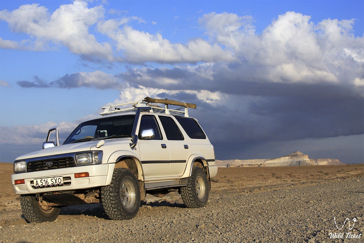
Reaching the area of the Akmysh tract is possible even in a standard passenger car; however, driving right up to the scree slopes and circling the mountain requires a four-wheel-drive vehicle (4x4) with high ground clearance and durable tires (AT/MT). In dry weather the ground remains solid, but after rain the clay softens into treacherous mud.
Infrastructure is developed in distinct pockets: 5 km to the southeast in the Kogez tract operates a comfortable ethno-village with yurts, a restaurant, and a swimming pool, while resting spots are arranged in the Akmysh oasis. Gas stations, grocery shops, tire repair services, and cafes are available in the settlement of Shetpe. Mobile reception near the mountain is unstable across open steppe sections, and there are no drinking water sources directly at the rocks (potable water can be gathered at the Akmysh spring); therefore, carrying a personal water supply of at least 4–5 liters per person is mandatory.
Walking around the perimeter of the mountain along the trail takes from 1 to 3 hours depending on photographic stops. Ascending to the summit is strictly discouraged for unprepared visitors: all slopes are near-vertical and composed of friable chalk. Climbing is possible only via a single cleft on the western flank for those with rock-climbing experience and specialized mountaineering gear. Entering deep unexplored caves is hazardous due to the danger of rockfalls.
The best time for a trip is spring (from late April to early June) and autumn (September – October). In July and August, the heat beside the white cliff faces exceeds +40...+44 °C.
--------------------------------------------
History
The history of Mount Sherkala is tied to the operation of the northern branch of the Great Silk Road linking East and West. Trade caravans traveled through these foothills from Baghdad to Volga Bulgaria along the Volga and Kama rivers, as did merchant trains heading from Khiva and Khwarazm toward Caspian ports. To guard the Shetpe Gates at the foot of the mountain, Khwarazmshah Atsiz founded the fortified city of Kyzyl-Kala, turning Sherkala itself into an impregnable natural bastion.
On the flat summit of the mountain, medieval builders constructed a fortress approximately 300 meters long with positions for archers, carving out observation platforms, sentry outposts, and a deep vertical well shaft to supply the garrison with water. Access to the top was maintained through a complex system of concealed fissures and a tunnel divided into two sections. During the rise of maritime trade routes following the voyages of Vasco da Gama, overland caravan trade declined, and in the early 13th century the fortifications fell before the tumens of Jochi (eldest son of Genghis Khan). Archaeological excavations at the Kyzyl-Kala settlement have yielded medieval coins and weaponry attesting to bloody sieges.
The beauty of the mountain has long drawn artists and explorers. In the summer of 1851, Ukrainian poet and artist Taras Shevchenko explored the mountain as part of an expedition led by mining engineer A. I. Antipov, producing a series of plein-air drawings on toned paper and the famous watercolor "Chirkala-Tau." That same year, Polish exiled revolutionary Bronisław Zaleski sketched the mountain, comparing its grandeur to Roman pantheons, and included an engraving of it in his album "Life in the Kirghiz Steppes," published in Paris in 1865.
Located 965 meters north of the mountain, an earthen dam was constructed during the Soviet era to catch rainwater and snowmelt cascading from the dome (the dam is currently breached). In the 20th century, a metal 1st-class geodetic survey pyramid was erected on the highest point of the mountain.
Information
Geomorphologically, Sherkala represents an erosional witness-outlier (table mountain) dating to the Upper Cretaceous and Paleogene periods. The absolute summit elevation is 307.7–332 meters above sea level, with a relative prominence over the surrounding steppe of roughly 200 meters.
The massif is built of stratified beds of clays, sandstones, white writing chalks, marls, coarse gypsum, and limestones. A resistant upper cap of limestone shields the plateau from rapid degradation, while the underlying strata undergo intensive water erosion and wind deflation. The northern facade is scored by deep gullies and caves, whereas the southern and eastern precipices remain vertical walls.
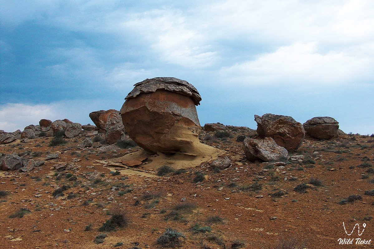
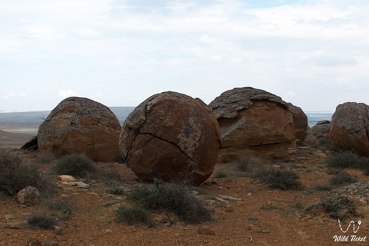
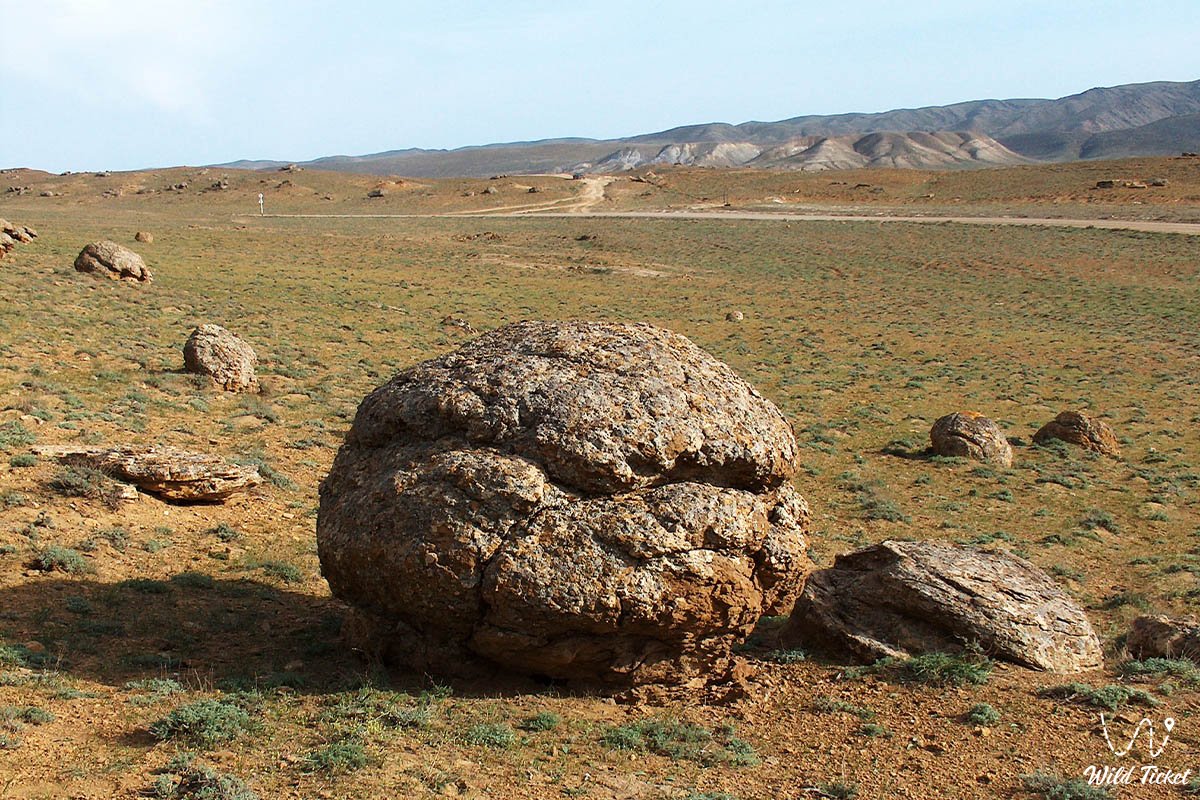
Around the base of the mountain, predominantly on its southern side, lies a belt of spherical sandstone concretions ranging from 1.5 to 3 meters or more in diameter. The concretions weathered out of the enclosing loose sand beds. Many of these spheres have cracked or are hollow inside, revealing petrified cores – fossil mollusk shells, ammonites, and prehistoric fish imprints.
The climate of the area is sharply continental and arid. Summers are dry and hot, with average July temperatures of +27...+32 °C and peaks up to +44 °C; winters are windy, with frosts dropping to -15...-20 °C. Average annual precipitation totals 100–140 mm. Mount Sherkala is protected by the state as an integrated geological, geomorphological, and historical monument of Mangystau.
Detailed description of the venue
The landscape, natural, and historical ensemble of Mount Sherkala comprises several distinctive zones and features:
• Dome-shaped summit ridge of Sherkala – a difficult-to-access plateau bearing a 1st-class geodetic pyramid, remains of a 300-meter medieval fortress, and defensive firing points.
• Western slope of the mountain – a sector with gentler topography and erosional channels, generating the silhouette of a giant white yurt and providing the sole route for a rock ascent.
• Southeastern cliff facade ("Sleeping Lion") – a monumental profile of a crouching predator with massive "paws" and a smoothed summit "head."
• Northern cave and fissure network – deep erosional niches, grottos, and secret vertical shafts where ancient warriors sought refuge.
• Belt of spherical concretions – a natural scatter of rounded stone spheres up to 3 meters in diameter at the southern base, containing fossils of the Tethys Ocean.
• Ancient necropolis at the foot of the mountain – a historic cemetery with gravestones and steppe petroglyphs from diverse historical eras.
• Akmysh tract oasis – a green enclave 1.5 km to the southwest featuring a flowing spring, a cool stream, and mature groves of poplar, elm, and mulberry.
• Kyzyl-Kala archaeological complex – ruins of a fortified 10th–13th-century Khwarazmian trade town with foundations of homesteads and ceramic workshops.
Flora and fauna
Vegetation surrounding Sherkala is divided into a semi-desert belt around the base and riparian vegetation along the Akmysh stream valley. Gray-soil and Lerche's wormwood, biyurgun, boyalych, Caspian saltwort, and camelthorn (dzhantak) grow on stony debris aprons and clay slopes. In spring, the adjacent steppe blooms with poppies, wild tulips, and ephemeral grasses. The Akmysh oasis sustains dense growths of mulberry, poplar, elm, willow, tamarisk, and thickets of blackberry, wild rose, and wild mint.
The fauna is adapted to rugged cliff terrain. Birds of prey nest on the sheer ledges of Sherkala: golden eagle, saker falcon, steppe eagle, long-legged buzzard, and kestrel. Rock doves, desert wheatears, and chukar partridges inhabit fissures.
Tolai hares, corsac foxes, badgers, steppe polecats, and long-eared hedgehogs dwell among the boulder screes at the foot. Ustyurt mouflons occasionally scale the rocky terraces. Reptiles are represented by the steppe agama, toad-headed agama, sand boa, and arrow snake.
Legend
Several legends reflecting its heroic and sacred past are associated with Mount Sherkala:
The first legend tells of an internecine war between Turkmens and Nogais. Retreating Turkmen warriors sought refuge atop impregnable Sherkala. Besieging enemies hoped to starve the stronghold, knowing there were no open springs on the rock. Yet the besieged held out for months. A captured spy discovered that the warriors had bored a deep well shaft through the body of the mountain, drawing water up on ropes. Digging a deep subterranean tunnel, the enemy infiltrators located the hidden shaft, cut the ropes, and deprived the garrison of water. Left without a single drop, the defenders perished as martyrs rather than surrender, earning eternal renown for lion-like valor.
Another tradition recounts that the batyrs defending the summit from foreign invaders fought like enraged lions. Despairing of taking the cliff by storm, the enemies named it Sherkala – "the fortress of lions." When their strength was exhausted, the surviving guardians retreated into secret subterranean tunnels within the mountain, lingering there forever as invisible spirit guardians.
Local residents also preserve a belief: if you make a heartfelt wish with pure intentions and walk clockwise around the foot of Mount Sherkala, the wish will come true. Meanwhile, proponents of mystical lore assert that deep in past ages, the dome of the mountain concealed an ancient craft stranded on the seabed of the dried Tethys Ocean, which is why wandering lights are said to appear in the night sky above its summit.
Conclusion
Mount Sherkala is a monumental landmark of Mangystau's nature and history, combining the contours of a sleeping lion, the geometry of a white yurt, traces of ancient Silk Road sieges, and the raw energy of the primeval steppe. A journey to Sherkala offers travelers the chance to touch centuries of history at the ruins of Kyzyl-Kala, follow the routes of Taras Shevchenko's expeditions, rest in the shade of the Akmysh oasis, and take in the silence beneath Mangyshlak's boundless starry dome.
Interesting sights nearby:
• Karaman-Ata Underground Mosque;
• Shakpak-Ata Underground Mosque;
• Sultan-Epe Underground Mosque;
• Bozzhira Tract;
• Fangs of Bozzhira (Chalk Outliers);
• Torysh Tract (Valley of Stone Balls);
• Karagiye Depression;
• Saura Tract Canyon and Turtle Lake;
• Tamshaly Canyon-Oasis and Lake;
• Sultan-Epe Canyon;
• Lake Kuzdykary;
• Airakty-Shomanay Tract;
• Zhygylgan Tectonic Sinkhole;
• Fossilized Traces of Ancient Animals in the Zhygylgan Tract;
• Kyzylkup Tract (Tiramisu);
• Shakpak-Ata Canyon (Shakpaktysay);
• City of Aktau.
Photogallery: