Snow-white labyrinth of Tupkaragan, mysterious hermit's cave, and mulberry oasis –
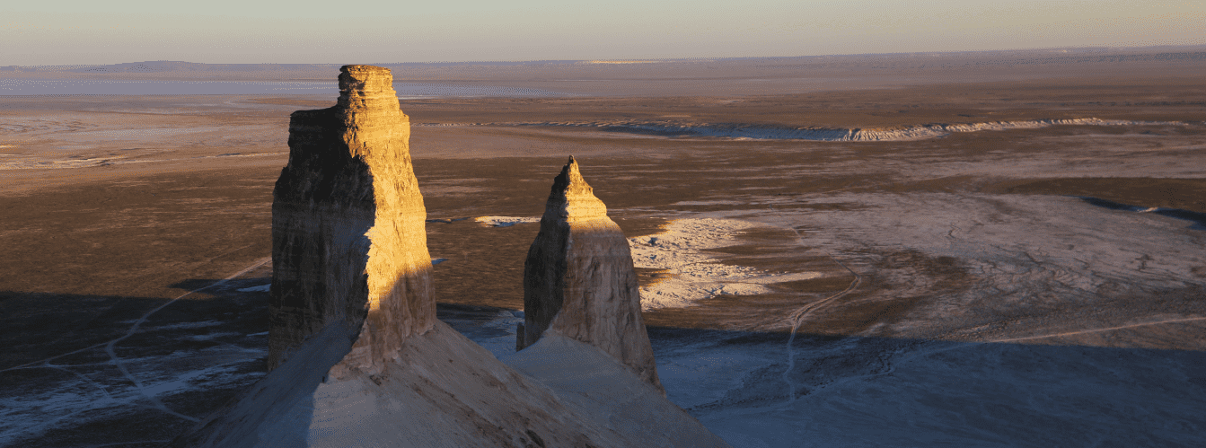
Kapamsay Canyon (Kaz. Qapamsai shatqaly) represents a grandiose erosional canyon with sheer seventy-meter walls of cream and silvery-white hue in the west of Kazakhstan. This vast geological corridor cuts through the arid limestone plains in the east of the Tupkaragan district, sheltering cool, shaded oases at the floor of an ancient dried-up watercourse.
The entire area serves as an extraordinary landscape and historical landmark of the Mangystau region, concealing relict mulberry and hawthorn groves alongside rich deposits of black flint within its side branches. To the north and west, the stormy Caspian Sea washes the coastline, toward which the winding dry channels of ancient water arteries descend across the stony plateaus.
In the tourism and expedition logistics of Northern Mangystau, Kapamsay Canyon serves as one of the most spectacular waypoints on off-road itineraries. The regional center Aktau is located just 130–140 kilometers to the southeast along vehicular roads, from where overland convoys travel through the seaside village of Akshukur toward Tauchik.
Literally 7.5 kilometers northeast of the gorge stands the sacred rock-cut Shakpak-Ata mosque with its ancient necropolis, while just a few kilometers away lie the Shakpaktysay and Kokbulaksay canyons, the Zhygylgan sinkhole, the spring-fed Tamshaly Canyon with its weeping cliffs, the freshwater lake of Saura Canyon, and Cape Tyub-Karagan.
The geological foundation of the canyon is composed of thick sequences of chalk, marls, and limestones of the Jurassic-Cretaceous period, deposited on the floor of the vanished prehistoric Tethys Ocean and shaped over millions of years by water and wind erosion. From Kapamsay, caravan trails and steppe tracks lead deep into the Mangyshlak Peninsula: toward the sacred height of Mount Otpan-Tau with the Aday-Ata Otpantau memorial, the mystical spherical concretions of the Torysh Valley, the residual Mount Sherkala, the variegated Jurassic clays of the Kokala tract, and the narrow slate defile of Karadayirmen Gorge.
The primary highlight of the gorge is a giant natural grotto featuring a rain-carved skylight aperture in its stone ceiling, beneath which flourishes a grove of centuries-old mulberries, as well as a man-made cave carved three meters above the ground bearing traces of an ancient hearth. After exploring the chalk labyrinths of Kapamsay, long-distance expeditions steer southeast toward the snow-white chinks of the Bozzhira tract, the Tuzbair salt flat, Mount Bokty, the Karynzharyk depression, and the strictly protected lands of the Ustyurt Reserve.
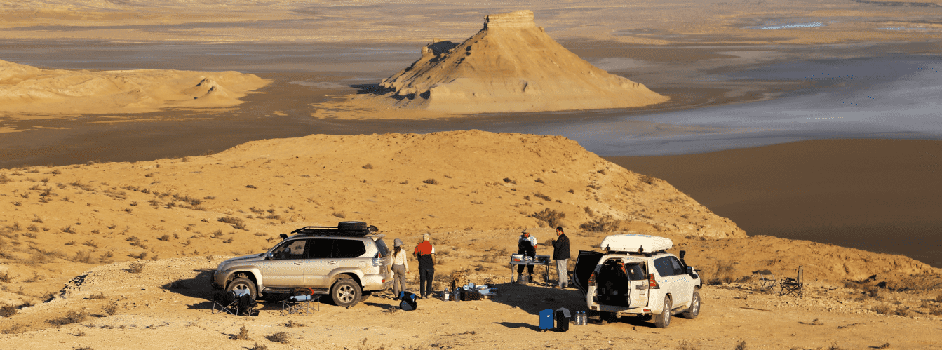
For overland drivers and travelers, Kapamsay Canyon serves as an ideal desert refuge: people journey here for wild camping sheltered from harsh steppe winds by monumental vertical bastions, peaceful walks beneath the shade of ancient mulberry groves, and the singular thrill of discovering prehistoric flint workshops and hermits' cliff chambers. Today, Kapamsay Canyon is recognized as a jewel of the Silicon Valley of Mangystau, attracting off-road drivers, geologists, archaeologists, and wildlife photographers with its monumental chalk ramparts, scatters of prehistoric Stone Age implements, secrets of ancient hermits, and the sheltering coolness of its mulberry oasis.
--------------------------------------------
How to get there and visit –
Kapamsay Canyon is located in the eastern part of the Tupkaragan district, 20–25 km northwest of Tauchik village and just 2 km north of the motorway connecting the town of Fort-Shevchenko with Tauchik. Major geographic landmarks include Mount Kapam (199.4 m) to the northeast and the ruins of the abandoned Soviet fishing settlement Put k Kommunizmu to the south. The distance from the city of Aktau is around 130–140 km, from Fort-Shevchenko – roughly 95–100 km, and to the Shakpak-Ata underground mosque – 7.5 km.
GPS geographical coordinates of Kapamsay Canyon:
44°24'35"N 51°04'42"E
The road route from Aktau leads north along the paved highway via Akshukur village to Tauchik village (about 95–100 km of excellent asphalt). Continue along the highway toward Fort-Shevchenko. Approximately 20–25 km past Tauchik, a well-defined dirt track branches right into the steppe toward the canyon mouth (about 2 km off the asphalt). Driving time from Aktau takes about 2–2.5 hours.
Access roads and vehicle requirements: during dry weather, passenger sedans and crossovers can reach the upper rim of the cliff and the descent point at the canyon mouth. However, navigating rocky scree slopes, the dry stony bed, and deep sand-clay ruts strongly requires a prepared four-wheel-drive vehicle (4x4) with high ground clearance. In wet weather, the clay access tracks become slick and impassable.
Foot trekking and route specifics: driving down to the floor of the canyon is impossible; descent is accomplished strictly on foot through the canyon mouth. There is no developed trail; the one-way hike spans about 2 km along the winding rocky bed of the ancient watercourse amid cyclopean boulders and shrubs.
Deeper inside, the canyon narrows into a cleft only 2–3 meters wide with sheer three-story walls, ending abruptly at a three-meter vertical siphon ledge with negative-grade walls. Do not attempt to climb out through the head of the canyon – return by the same route back to the mouth.
The trek along the canyon floor takes 1.5–2 hours and requires attentiveness, as returning involves carefully scrambling down rock steps and boulders. Sturdy trekking boots with rigid, non-slip soles, a sun hat, sunglasses, and drinking water are mandatory.
Environmental safety rules: the tract is a vulnerable natural and archaeological monument.
Within the canyon, the following are STRICTLY PROHIBITED:
– Lighting open campfires beneath mulberry and hawthorn canopies (portable gas camping stoves only);
– Damaging or felling centuries-old mulberry trees;
– Leaving plastic trash, glass, and food waste;
– Painting graffiti or scratching inscriptions onto the soft chalk and limestone walls;
– Damaging ancient stone masonry or leaving soot inside the man-made cave;
– Conducting unauthorized excavations of prehistoric flint workshops.
Infrastructure: the tract is an undeveloped wilderness. Organized tourist camps, shops, and lodges are completely absent. The nearest brand-name gas stations, grocery stores, cafes, and tire repair services are in Tauchik (20–25 km). Tent camping on the canyon floor (where walls shelter against harsh steppe winds) requires full autonomy: potable water (at least 3 liters per person per day), rations, gas stoves, sleeping bags, and warm clothing for night drops. Cellular coverage on the canyon floor is blocked by seventy-meter walls, though it can intermittently connect along the upper plateau rim near the highway.
The best season to visit is late spring and early summer (May – early June), when the Mangystau steppe blooms, air temperatures measure a comfortable +22...+26 °C, and the grove under the grotto rustles with lush foliage. Early autumn (September – October) is also ideal due to clear, mild weather free of summer heat. In July and August at midday, the canyon floor turns into a scorching oven exceeding +40 °C, and vegetation withers; summer hikes should be planned strictly for early morning or pre-sunset hours.
--------------------------------------------
History
The history of Kapamsay Canyon spans vast epochs – from Stone Age hunter-gatherers to medieval Sufi hermits and Soviet-era fishing cooperatives.
During the Paleolithic and Neolithic periods, the Kapamsay tract and surrounding plateaus formed part of Mangystau's celebrated Silicon Valley. In outcrops of limestone-chalk strata, rich seams of dense black and smoky flint lie exposed. Prehistoric humans established extensive stone-flaking workshops along the floor and terraces of the canyon. Archaeologists have documented thousands of flint cores, scrapers, burins, dart points, and arrowheads here, proving human activity spanning millennia.
The canyon received its name from the holy elder and righteous ascetic Kapam, who, according to local tradition, lived and found eternal rest among these cliffs. His mazar is marked by a stone enclosure atop the summit of nearby Mount Kapam (199.4 m).
One of the most enigmatic chapters of the gorge's history is a man-made cave carved into the sheer chalk cliff three meters above the ground. Inside the rock lies a square chamber where researchers identified circular traces of an ancient hearth, alongside decaying wooden fragments of a yurt frame and a cradle that crumble to dust at a light touch. Who left the wooden ladder at the entrance and sought refuge here – a Sufi hermit, a fugitive traveler, or a shepherd's family – remains an intriguing historical mystery.
During the Middle Ages, the canyon served as a caravan corridor and a shelter from dust storms for merchants traveling toward the Shakpak-Ata rock-cut complex.
In the Soviet era, the fishing village of Put k Kommunizmu operated south of the canyon, harvesting fish in the waters of the Northern Caspian. Following the decline of regional fisheries and economic restructuring, the settlement was abandoned, leaving stone ruins against the steppe horizon.
Information
Morphometrically, Kapamsay Canyon is a deep corridor-type erosional fissure extending roughly 4 kilometers from south to east. The depth of incision into the plateau is striking: sheer vertical cliffs soar 50–70 meters high. The width of the canyon near the lateral branch known as The Grove reaches a maximum of 277 meters, whereas in its upper reaches the gorge tightens into an impassable cleft only 2–3 meters wide. The plateau sits at absolute elevations around 100–140 meters, with Mount Kapam dominating the area at 199.4 meters above sea level.
The geological section of the canyon walls exposes thick sedimentary strata of the Jurassic-Cretaceous period of the Mesozoic era from the ancient Tethys Ocean. The walls are formed of horizontal layers of dense cream, silvery, and brilliant-white writing chalk, marls, and coquina. Parallel horizons of spherical and nodular concretions of crystalline black flint are embedded throughout the chalk.
The primary hydromorphological phenomenon of the canyon is a giant rock grotto with a natural skylight in its dome, scoured through by torrential storm vortices. Rainwater pouring through this ceiling opening during storms cascades down the walls and collects in bed sediments, maintaining an isolated pocket of moisture in the arid desert.
The hydrological regime is hyper-arid. There are no permanent streams or open springs on the canyon floor, though surface soils are often veiled with a fine mineral salt bloom. The relict grove survives entirely on precipitation entering through karst rifts and capillary moisture held within alluvial sediments.
Soil cover on the canyon floor consists of thin alluvial-clay sediments overlain by chalk and gravel scree, while primitive gravelly gray-brown desert soils cover the upper plateau.
The climate is sharply continental desert. In summer, the white chalk cliffs reflect solar radiation intensely, creating a furnace effect on open ground with temperatures reaching +40...+43 °C; however, beneath the stone ceiling of the grotto and in the shade of mulberries, temperatures remain 10–12 degrees lower. Winters are moderately cold and windy, with average January temperatures of -4...-7 °C; strong gales sweep the plateau, against which the deep canyon provides shelter.
Detailed description of the venue
The natural and archaeological ensemble of Kapamsay Canyon includes the following morphological sectors, distinctive landmarks, and historical monuments:
• Sheer seventy-meter chalk bastions – colossal rock precipices of cream and silvery-white tone rising above the canyon floor in sheer cyclopean walls.
• Great rain grotto – a massive karst niche in the rock with an oval skylight opening carved through by floodwaters from the plateau above.
• Relict mulberry grove in the side gorge – a green oasis of centuries-old black and white mulberry trees and spreading hawthorns nourished by moisture gathered beneath the grotto dome.
• Man-made hermit's cave – a square room carved into the chalk wall three meters above ground level, preserving traces of an ancient hearth and wooden fittings.
• Prehistoric flint workshops – extensive outcrops of black flint veins and scatters of Paleolithic stone tools along the floor and shelves of the gorge.
• Blind rock siphon – the terminus of the two-kilometer foot route, where three-story chalk walls converge into a narrow cleft with a negative three-meter rock step.
• Panoramic summit of Mount Kapam (199.4 m) – the highest elevation with the mazar of Saint Kapam, offering 360-degree views over Kapamsay, Kokbulaksay, and the blue Caspian.
• Ruins of Put k Kommunizmu village – stone remnants of a Soviet fishing settlement south of the canyon along the way to the coast.
Flora and fauna
The vegetation of Kapamsay Canyon exhibits a stark contrast between barren chalk screes and the lush greenery of the floor oasis. In the side gorge sheltered by the rock grotto rustles a relict grove of black and white mulberry trees with centuries-old trunks, accompanied by dense hawthorn and Dzhungarian willow thickets. The understory comprises tamarisk, wild rose hips, and wild blackberries. Along the dry main canyon floor cling saltworts, camelthorn (dzhantak), gray-soil wormwood, and sparse Anabasis bushes. In spring, gravelly patches come alive with desert grasses and dwarf wild tulips.
The wildlife finds shelter from scorching heat within shaded rock crevices. Corsac foxes, badgers, steppe polecats, long-eared hedgehogs, tolai hares, and colonies of midday gerbils den in niches and grottoes. At dawn, cautious groups of Ustyurt mountain sheep (mouflons / urials), listed in the Red Data Book of Kazakhstan, venture onto narrow chalk ledges of the upper tier.
Avifauna in the canyon is rich. Songbirds sheltering in the mulberry canopies include common nightingales, European turtle doves, Turkestan shrikes, and warblers. Rock doves, desert ravens, swallows, swifts, and chukar partridges nest in niches along the chalk cliffs. Raptors soaring and nesting on the heights include golden eagles, steppe eagles, long-legged buzzards, saker falcons, common kestrels, and Eurasian eagle-owls.
Herpetofauna is represented by the agile steppe agama, toad-headed agama, Caspian and gray geckos, arrow snake, and dione snake.
Invertebrates active on sun-baked stones include solifuges (camel spiders), tarantulas, and steppe scorpions sheltering under flat limestone fragments by day.
Legend
An ancient Mangystau legend tells of Saint Batyr Kapam and the Secret Hearth of Hope in connection with Kapamsay Canyon.
Tradition recounts that in centuries past, when bands of ruthless raiders roamed the steppes of Mangyshlak plundering peaceful caravans, a righteous elder and brave warrior named Kapam lived upon the plateau. He was renowned not only for heroic strength, but for deep compassion, tending wounded wanderers and sheltering orphans.
When enemies encircled his clan's aul, Kapam led his people into the waterless chalk cliffs. To shield them from the scorching sun and conceal hearth smoke from scouting patrols, the holy warrior carved a secret refuge into the vertical white cliff three meters above the ground with his battle-axe, lifting women and cradles with infants inside. Day and night, the batyr prayed to Heaven for water for his people.
In answer to his prayer, a storm broke over the canyon. Lightning split the stone dome of a giant grotto, and torrents of rainwater poured through the aperture, saturating the parched soil and giving rise to a mulberry grove.
Barring the enemy's path at the narrow siphon of the gorge, Batyr Kapam fought a valiant stand, protecting his people at the cost of his own life. His clan buried their defender upon the highest ridge, raising a sacred stone cairn over his resting place. Kazakhs believe that the cliff-cut cave preserves the saint's blessing, and that the shade of the mulberry grove brings healing and peace to every traveler who enters the canyon with a pure heart.
Conclusion
Kapamsay Canyon is a monumental natural stronghold and one of the most cinematic landmarks of Mangystau, where the austere geometry of seventy-meter chalk walls merges with the rustle of ancient mulberries, the secrets of Paleolithic stone workshops, and primeval desert silence. A journey through Kapamsay offers the thrill of authentic discovery, unforgettable photography beneath towering chalk massifs, and a rare encounter with the ancient history of Tupkaragan.
Interesting sights nearby:
• Shakpak-Ata Mosque (9th–10th c.);
• Shakpak-Ata Necropolis;
• Shakpaktysay Canyon;
• Zhygylgan Geological Sinkhole;
• Fossilized Tracks of Machairodonts;
• Tamshaly Canyon;
• Saura Canyon and Lake Karakup;
• Cape Tyub-Karagan;
• Tyub-Karagan Bay;
• Torysh Valley of Spherical Concretions;
• Mount Sherkala Outlier;
• Kokala Tract;
• Kokbulaksay Chalk Canyon;
• Summit of Mount Kapam (199.4 m);
• Ruins of Soviet fishing village Put k Kommunizmu.
Sacred sights and pilgrimage destinations:
• Beket-Ata Underground Mosque;
• Karaman-Ata Underground Mosque;
• Sultan-Epe Underground Mosque;
• Kolbas Ishan Mosque;
• Koben Mosque;
• Zholaskan Mosque;
• Nurbergen Kalyshev Mausoleum;
• Zhaman Sauran Mosque;
• Ishan Khozha Mosque;
• Itolla Mosque;
• Sonabay Underground Mosque;
• Masat Ata Mosque;
• Uytoly Ata Underground Mosque;
• Bayte Sanctuary.
Photogallery: