Фото тур на гору Шеркала и урочище Торыш -
Организация экскурсий и туров по полуострову Мангышлак и его достопримечательностям -
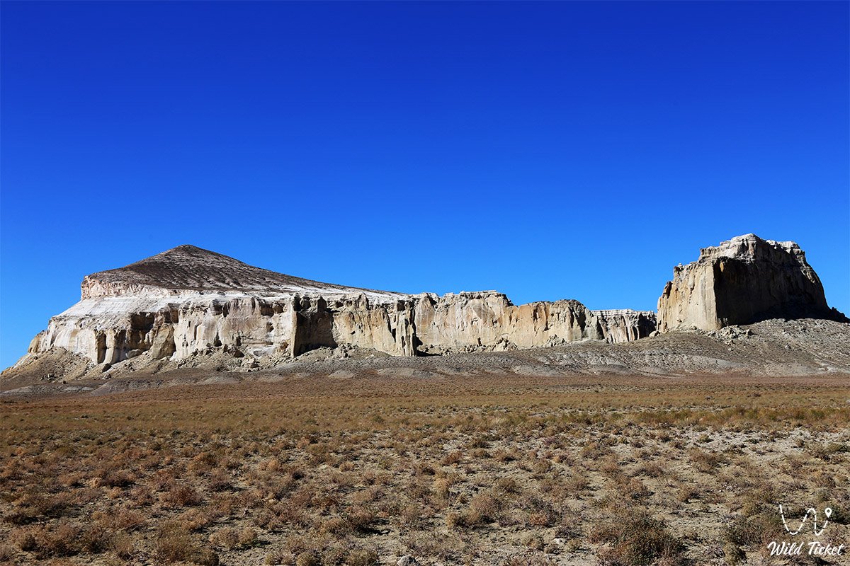
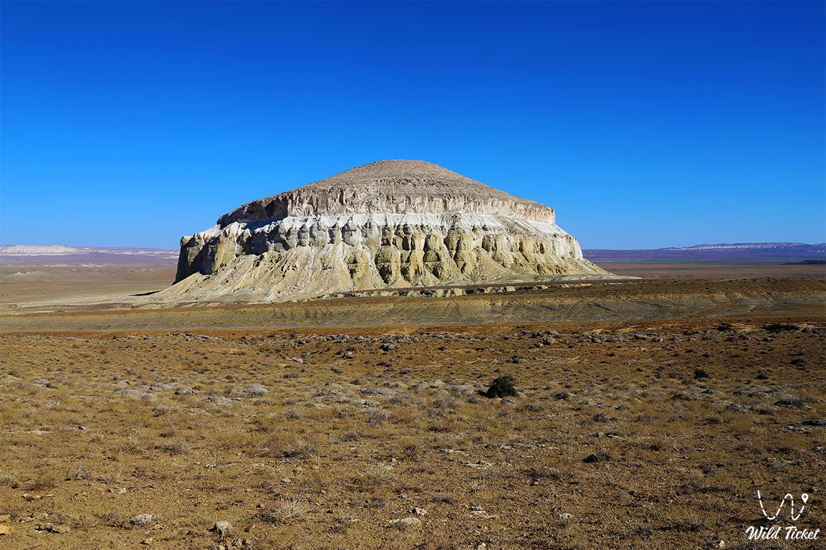
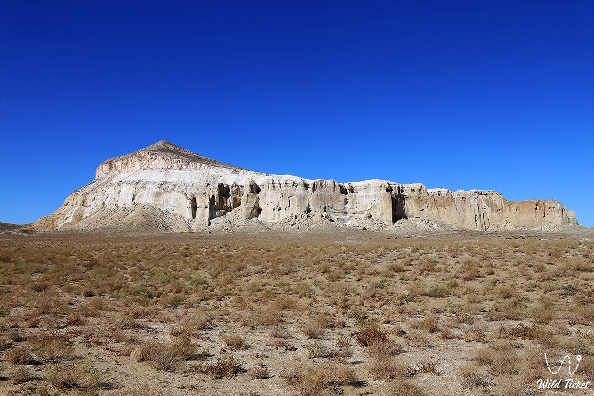
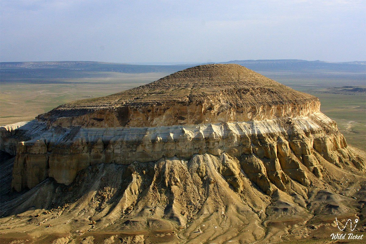
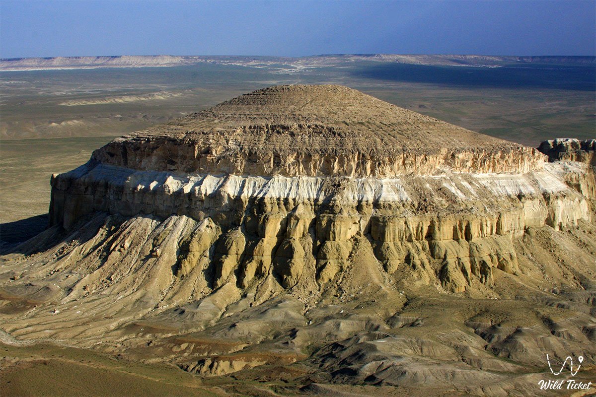
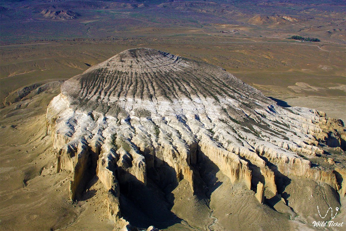
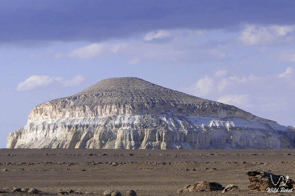
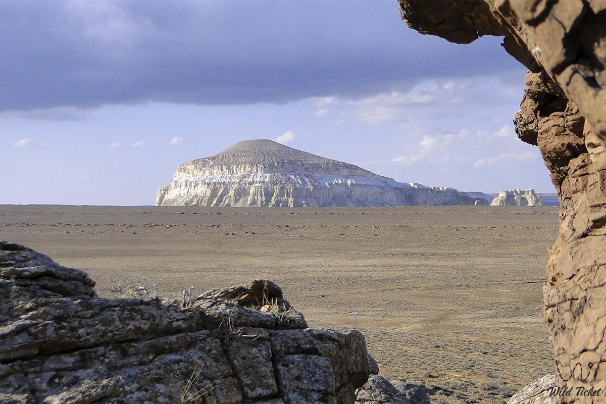
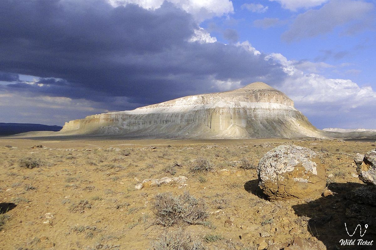
Шеркала-гора, так же известна как «Крепость Льва», природная достопримечательность, место притяжения всех путешественников по Мангистау. Гора похожа на пиалу, казахскую юрту, инопланетную летающую тарелку (НЛО) или сфинкса с крутыми южными и восточными склонами и более размытую северную сторону.
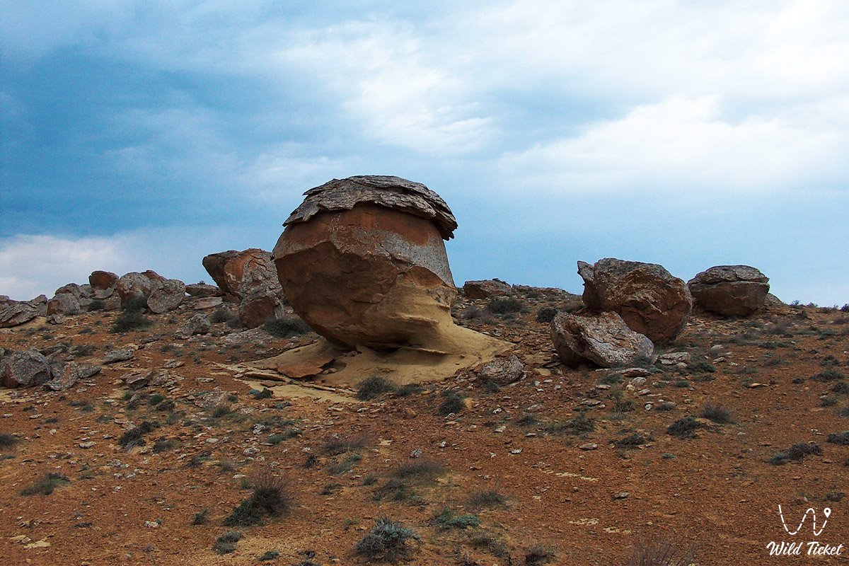
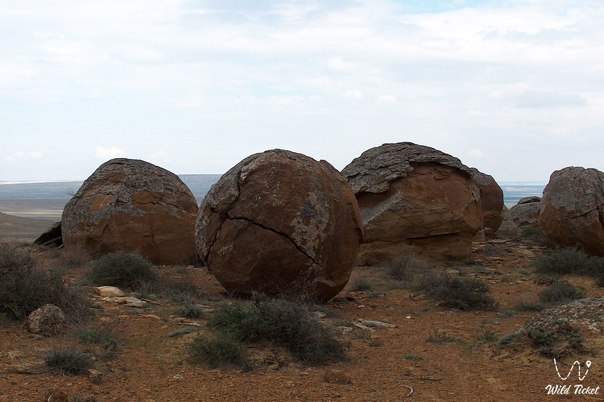
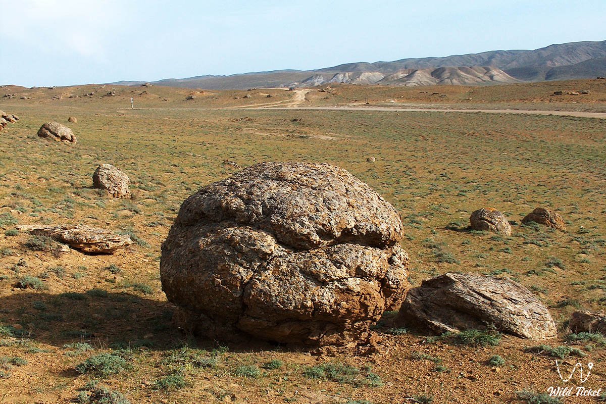
Рядом с горой расположено место где вы можете увидеть круглые каменные шары-образования известные как (шаровые конкреции на горе Шеркала) неизвестного происхождения. Так же рядом с горой расположена подземная мечеть Темир Абдал и небольшой некрополь, священное сакральное место.
---------------------------------------------
Как добраться, посетить -
Гора Шеркала находится в 18 километрах от села Шетпе, в 94 километрах от города Актау, Мангистауский район, Мангистауская область, Республика Казахстан.
GPS координаты: 44°15′23″N 52°00′22″E
---------------------------------------------
Информация
Гора Шеркала образована известняковыми, глинистыми породами палеогенового периода. Польский революционер Б. Залесский, побывавший в Мангистау в составе геологической экспедиции 1851 году, писал: “издалека, глядя на гору Шеркала, можно увидеть великолепные пантеоны Рима и памятники античности. Когда вы приближаетесь, вы видите колонны отдельных стен, а колонны белых гор выглядят как разрушенные античные статуи”, - написал он, нарисовав гребень Шеркалы. Эта картина была опубликована в альбоме Залесского “жизнь в киргизских степях” в 1856 году в Париже.
Шеркала в переводе с арабского языка значит «Город Тигров», когда-то здесь проходил маршрут, по которому караваны шли в Хорезм и Хиву и здесь же находилась военная крепость.
Фотогалерея: