Unique natural monument with fantastic red-and-white layering –
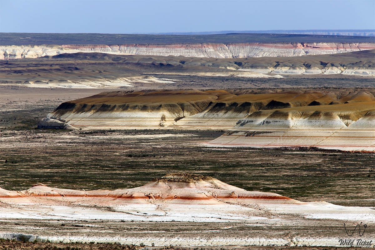
The Kyzylkup tract (Kaz. Qyzylkop – "much red", widely known in tourism circles as the "Tiramisu" tract) represents a unique geomorphological phenomenon and one of the most picturesque landscape attractions of the Karakiyan district of the Mangystau region on the Mangyshlak Peninsula.
The tract extends for more than 10 kilometers from east to west and more than 8 kilometers from north to south, occupying an intermediate position between the Shopan-Ata Underground Mosque and Mount Zhosaly at an elevation of 268 meters above sea level. The historical hydronym of the site is linked to the ancient dried-up Kyzylkup reservoir, once situated in its northeastern part.
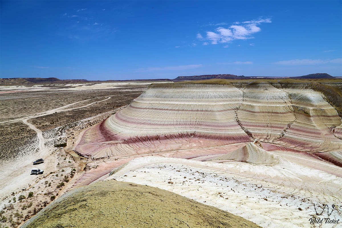
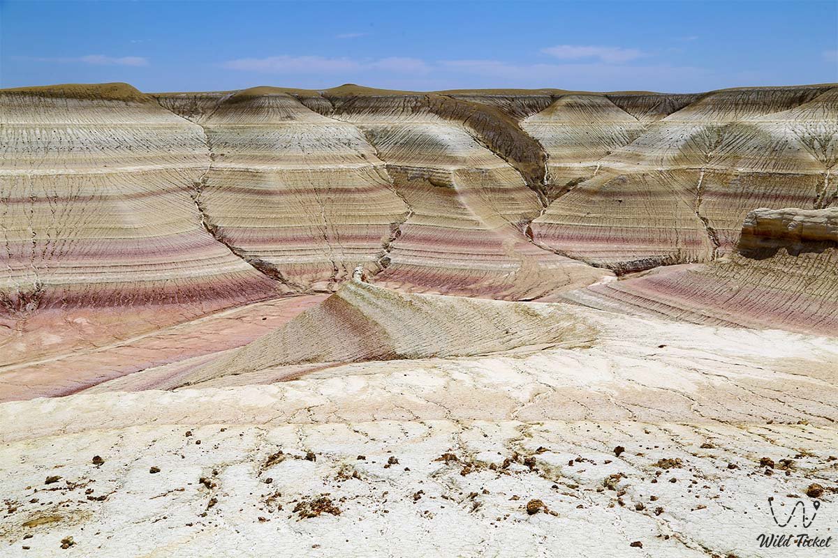
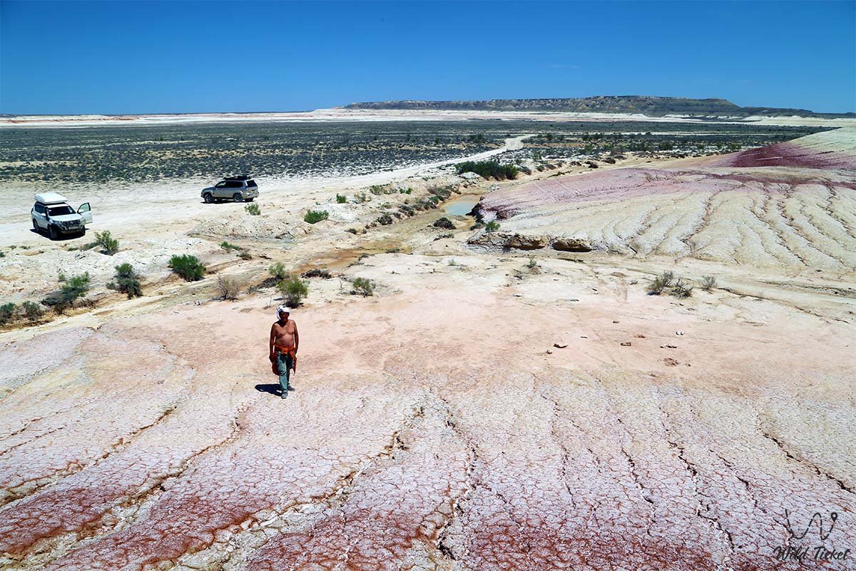
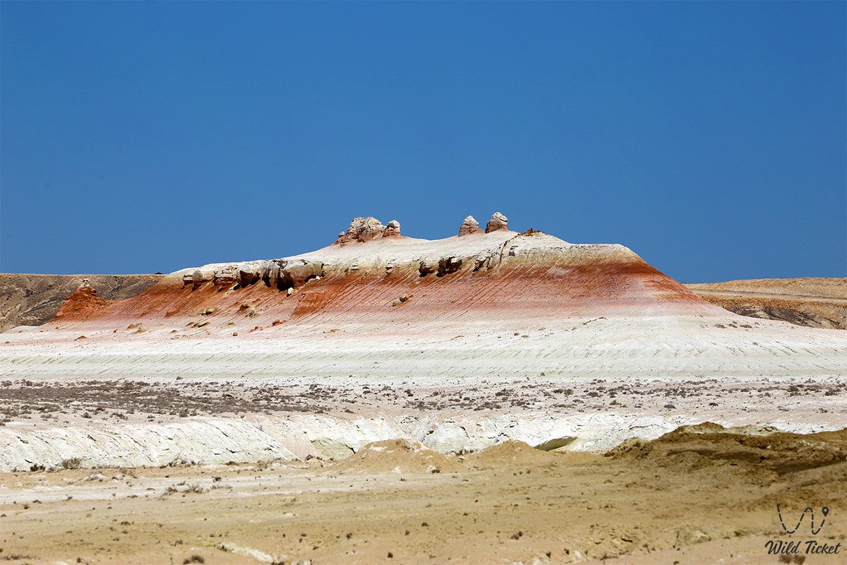
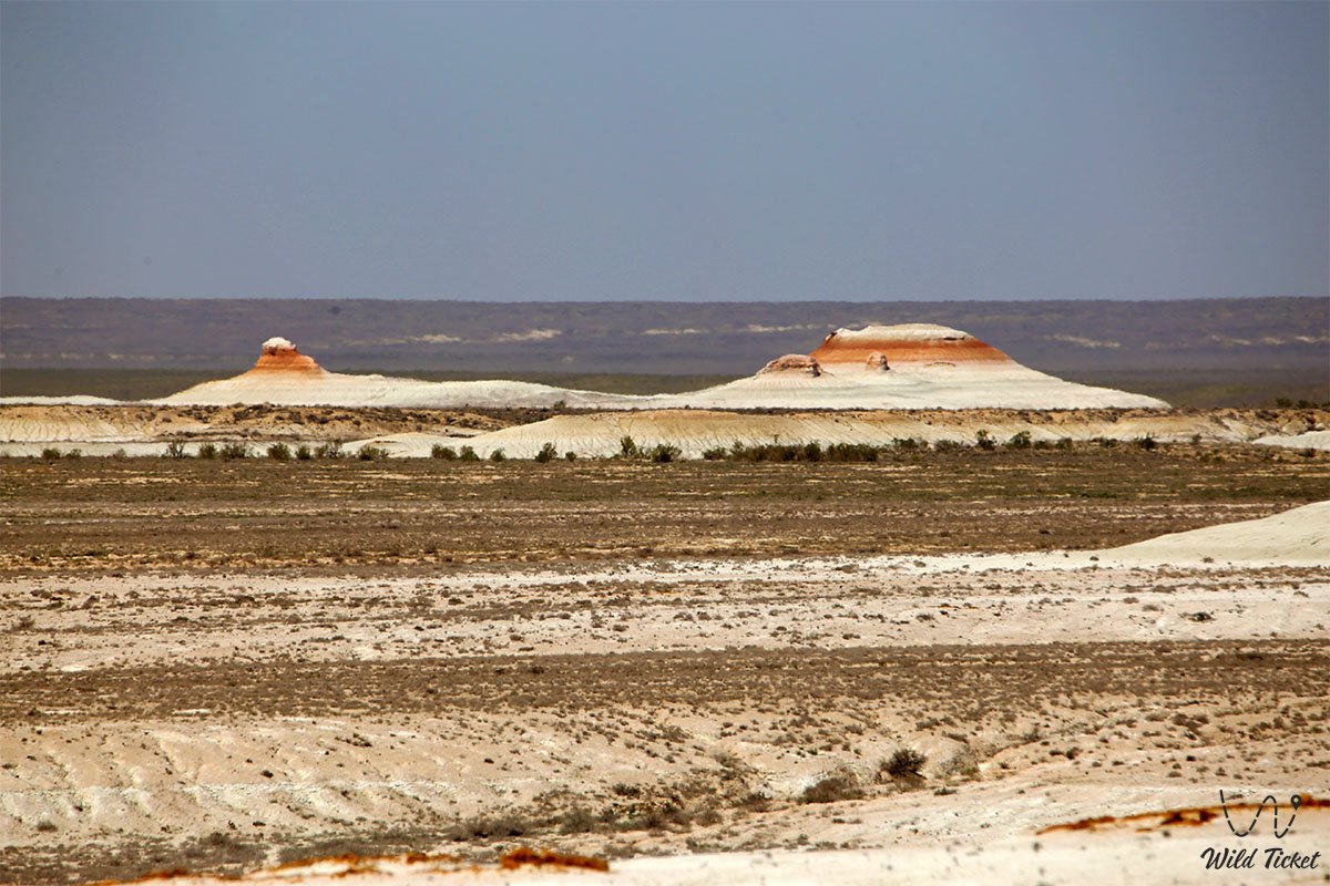
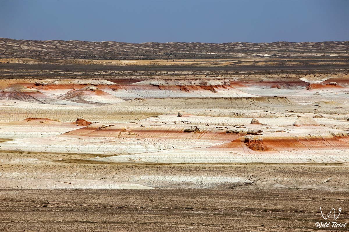
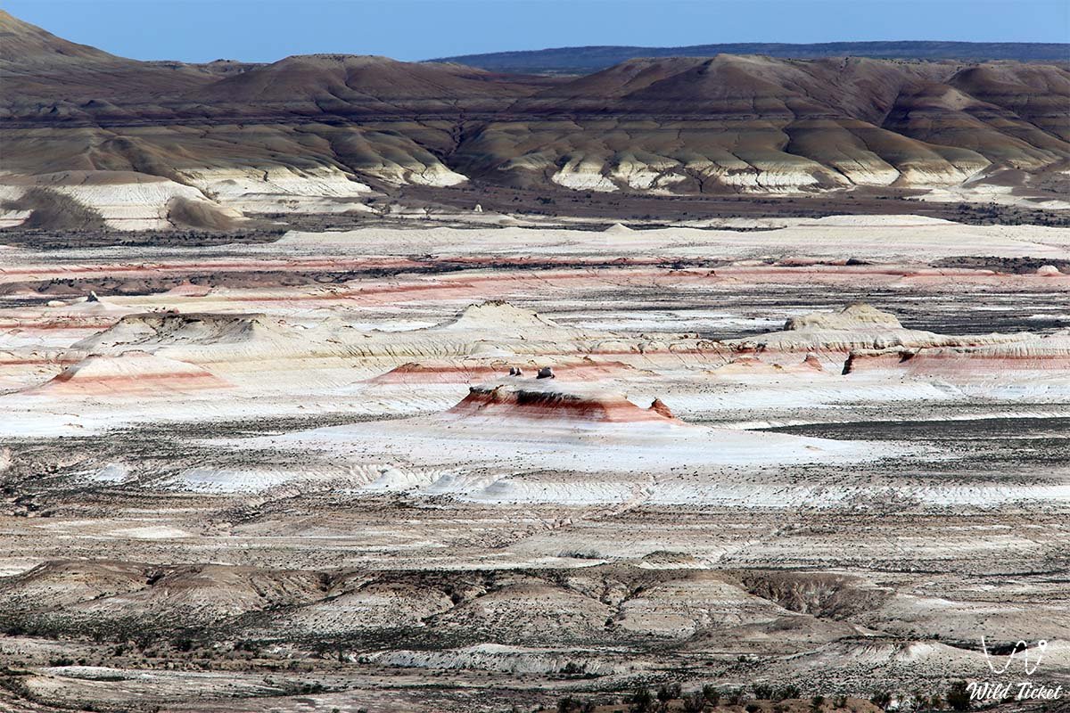
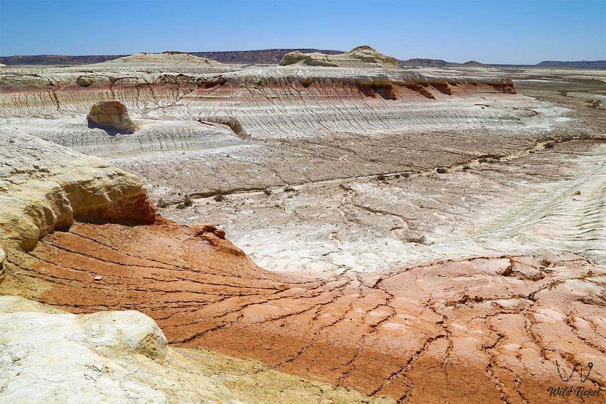
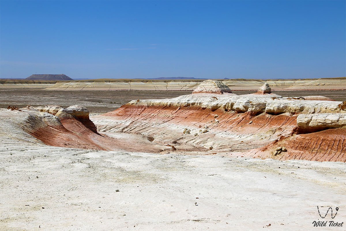
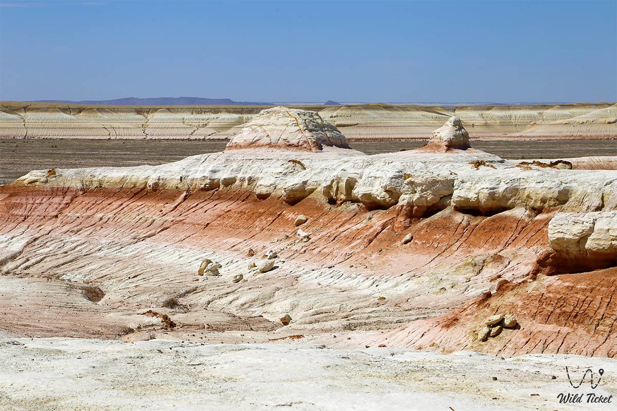
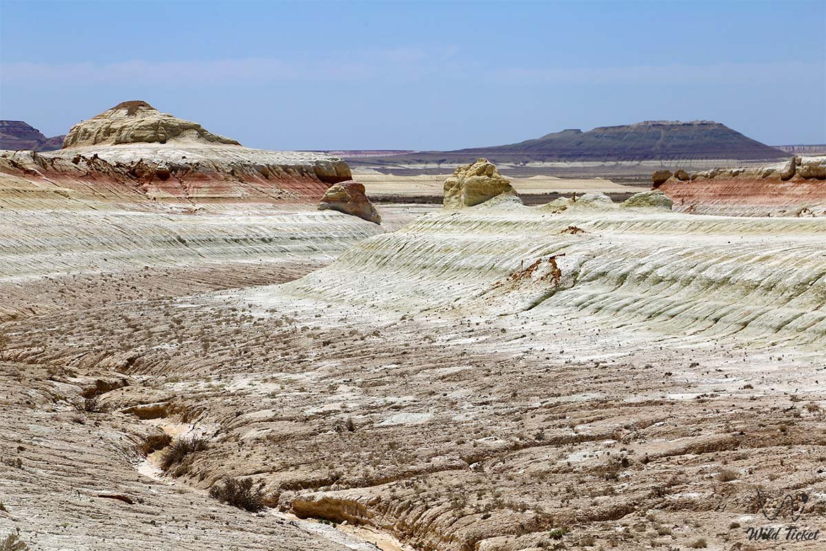
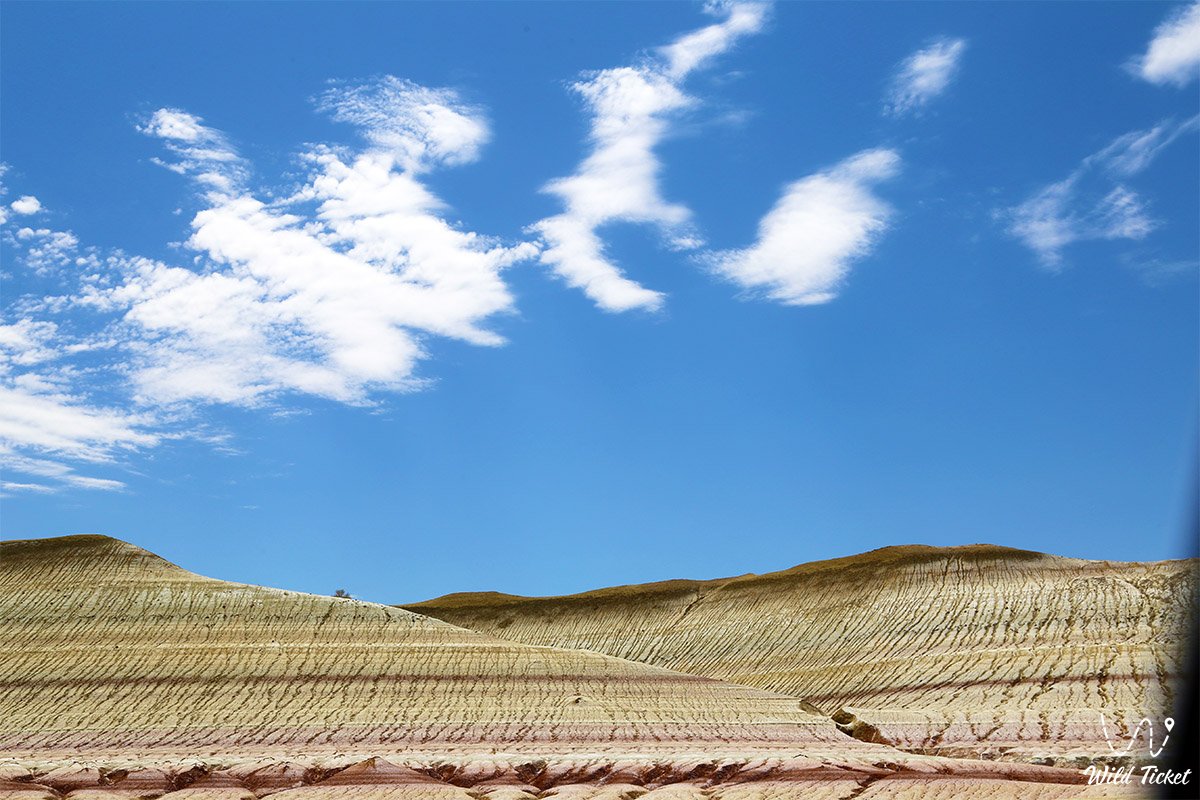
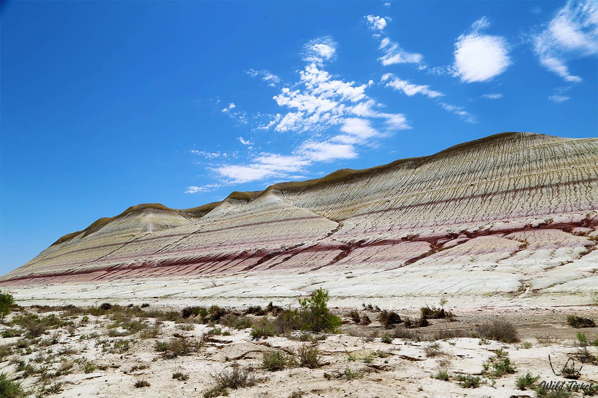
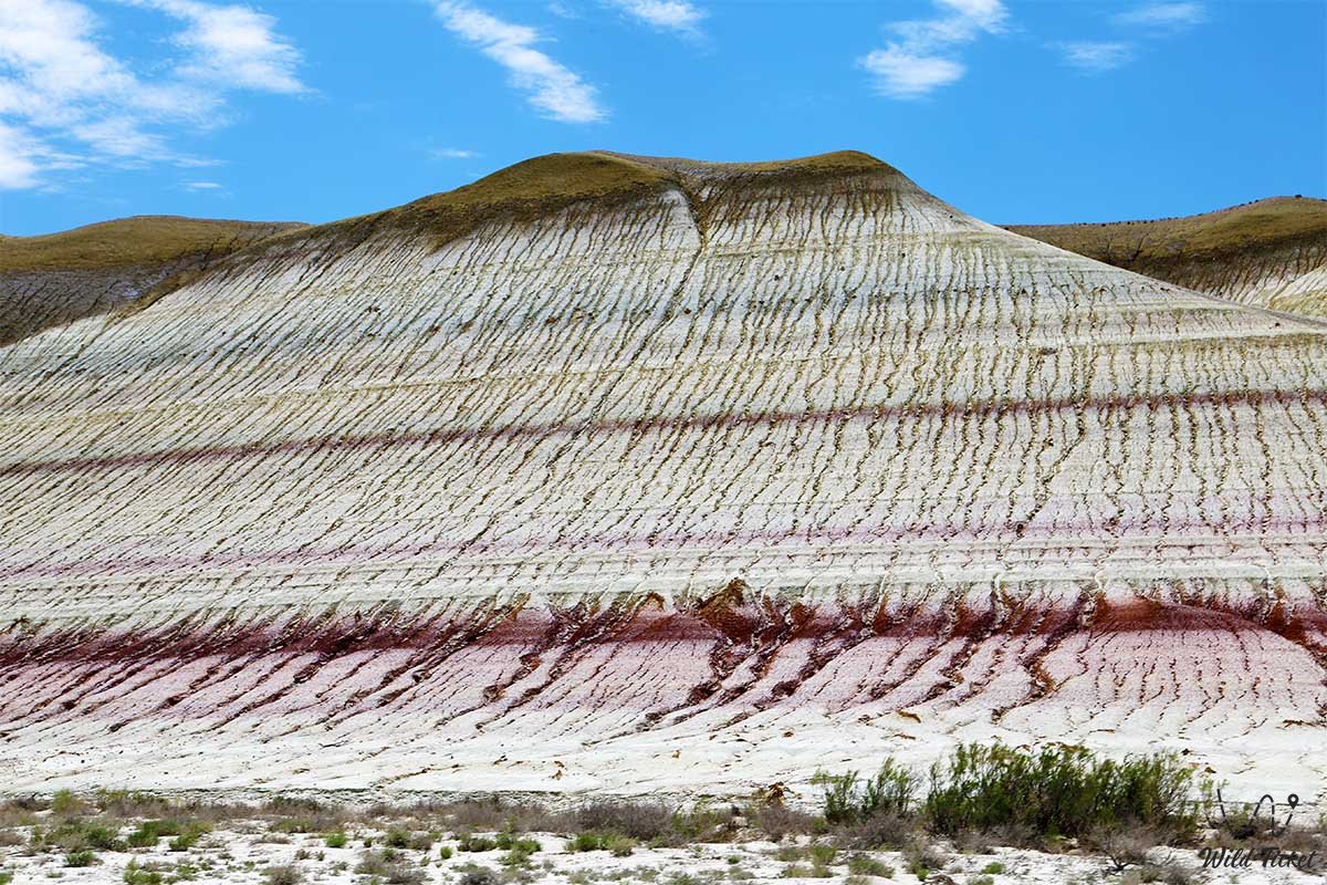
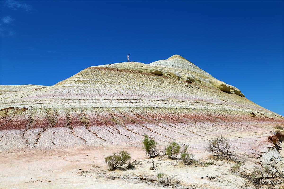
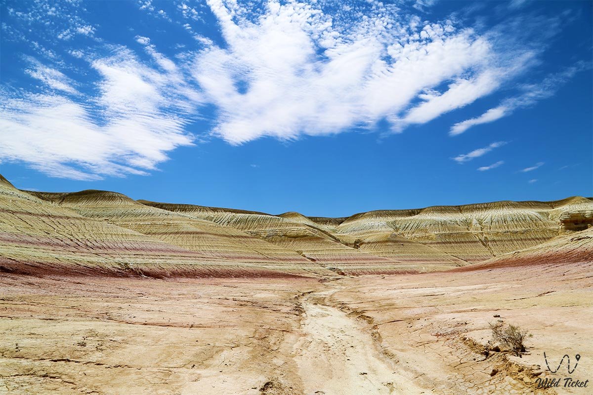
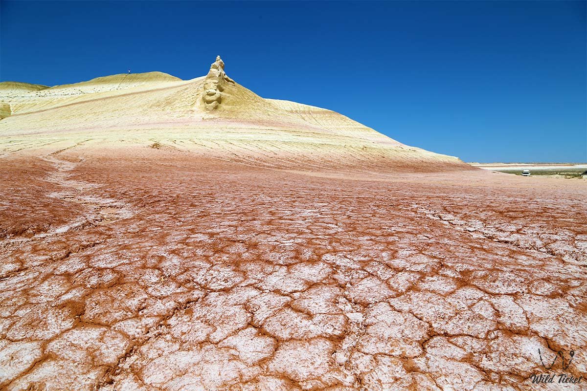
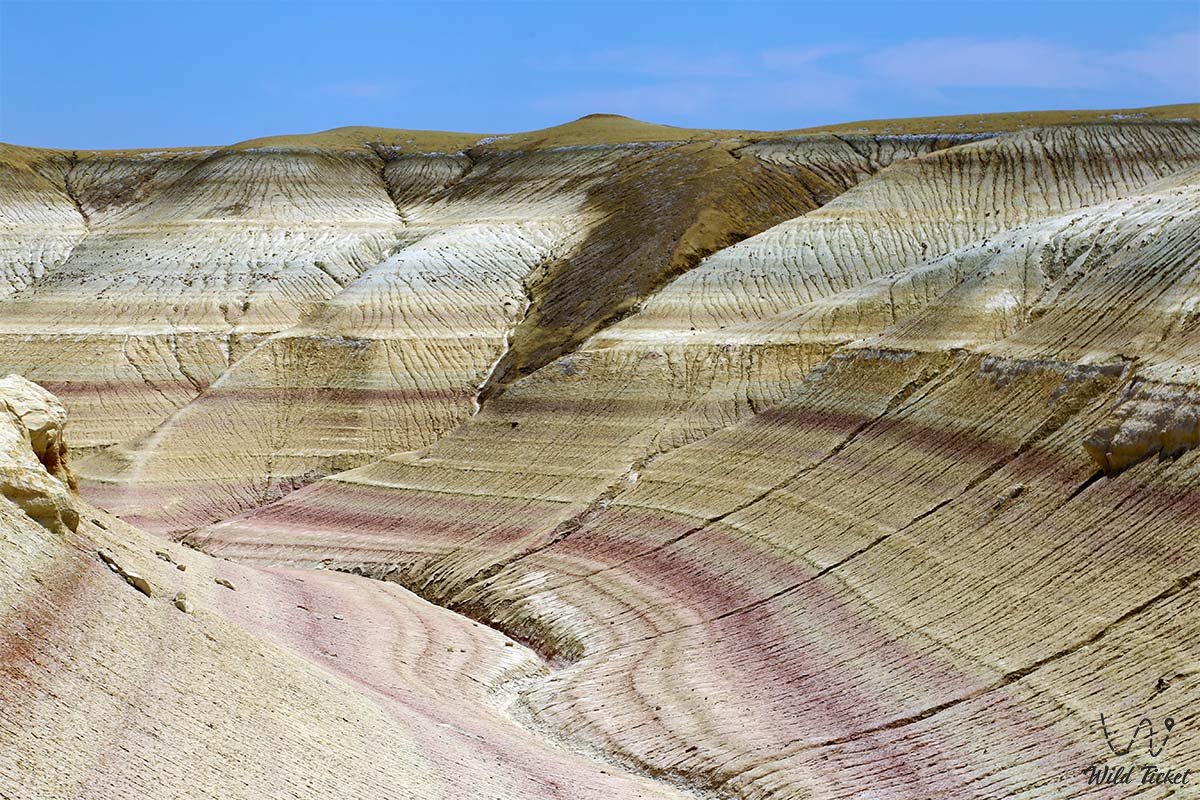
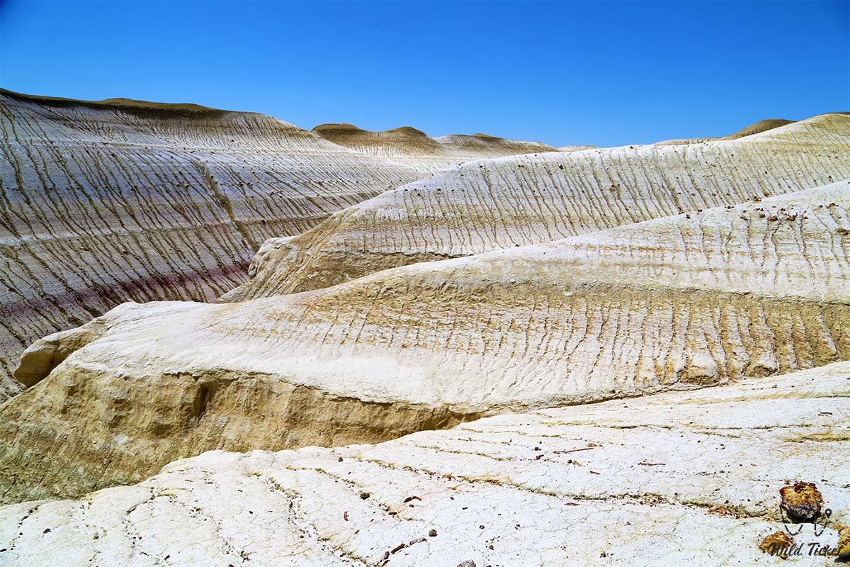
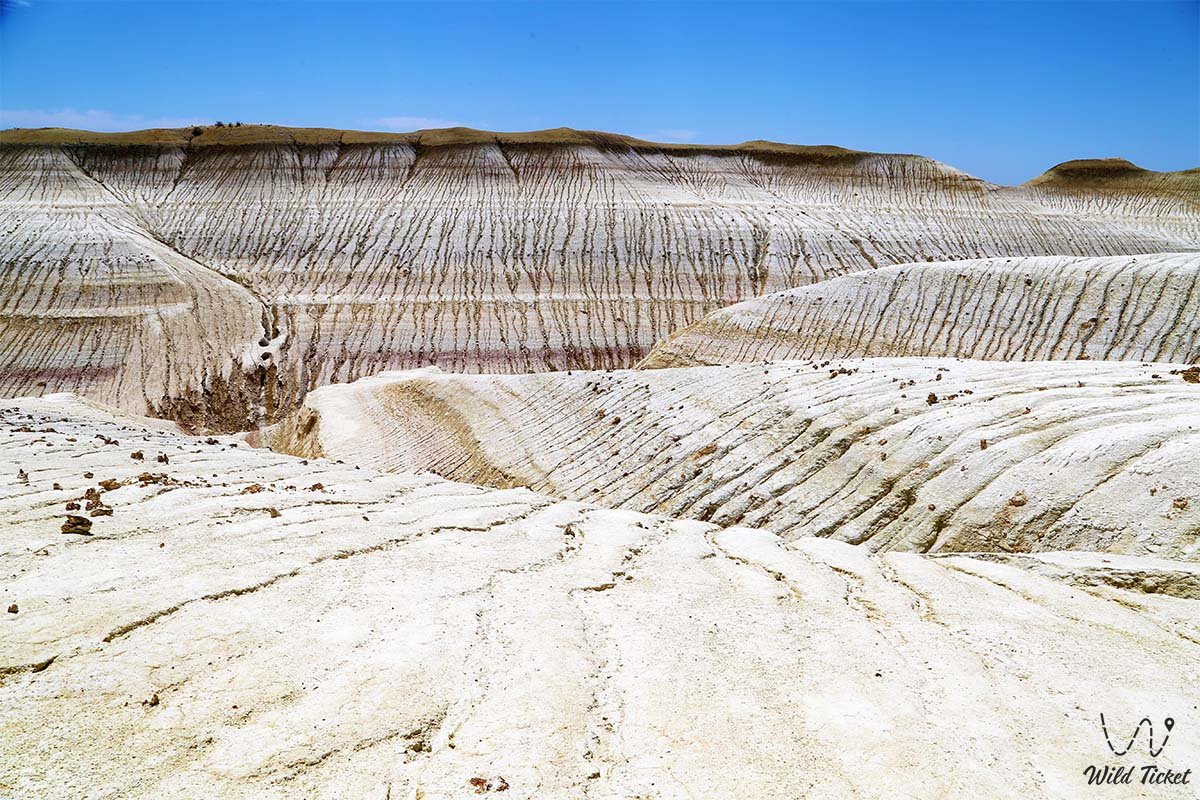
The primary visual calling card of the tract is its picturesque soft hills featuring a contrasting alternation of snow-white chalk and terracotta, pink, brown, and ochre clays enriched with iron and manganese minerals. This layered splendor gave rise to the popular tourist moniker "Mangystau Tiramisu."
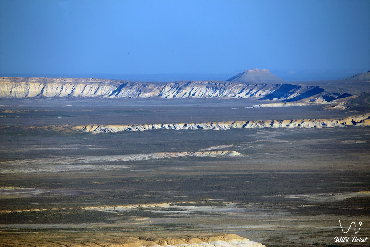
A visit to the Kyzylkup tract seamlessly complements a journey across the iconic natural and spiritual sites of the region: just 7 kilometers south of here rises the layered Mount Bokty with a height of 165 meters (its silhouette is immortalized on the 1000 tenge banknote), 20 kilometers to the east lie the grandiose white Fangs of Bozzhira (chalk remnant outliers) in the Bozzhira tract, and 33 kilometers to the east is the greatest sanctuary of the land – the Beket-Ata Underground Mosque in the Oglandy tract.
The relief of the tract was formed at the bottom of the prehistoric Tethys Ocean, which surged here tens of millions of years ago. Today, Kyzylkup is a recognized jewel of photography tourism in Kazakhstan, attracting travelers with fantastic Martian panoramas, soothing silence, and accessibility for radial walking excursions. Another interesting attraction located near the Caspian Sea in this region is the Torysh Valley of Balls (round spherical concretions of unknown origin).
--------------------------------------------
How to get there and visit –
The Kyzylkup tract is located approximately 250 kilometers east of the regional center – the city of Aktau. A trip here fits comfortably into a single-day or multi-day excursion itinerary covering key sights of southern Mangystau: on the way to Kyzylkup, tourists pass the ancient Shopan-Ata underground mosque and the Senek sands, admire tiered Mount Bokty directly from the valley (7 km to the south), and continuing eastward reach the chalk castles of Bozzhira (20 km away) and the pilgrimage center of the Beket-Ata underground mosque (33 km away).
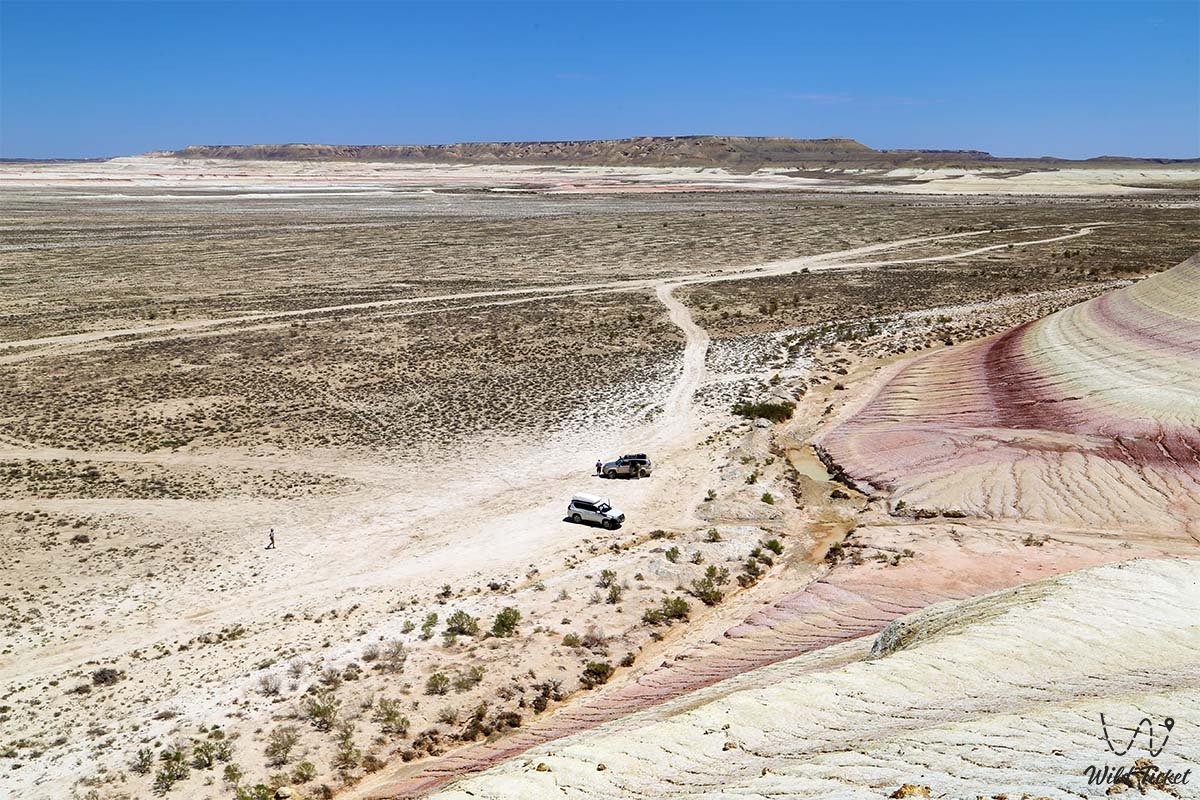
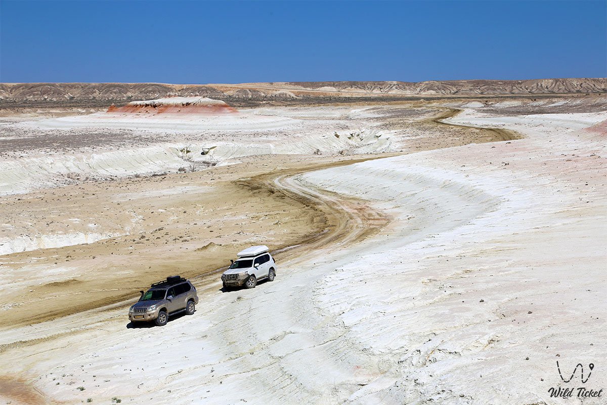
The route from Aktau runs along a high-quality paved highway through the city of Zhanaozen and Uzen village. For a long time, this territory was accessible only to prepared expeditions; however, a modern paved road laid in the direction of the Beket-Ata mosque made the location open to mass tourism. From the asphalt road on the southern side, red-and-white striped slopes come into view, leading to an exit onto a well-worn dirt track about 5 kilometers long.
GPS geographical coordinates: 43°28'20"N 53°48'28"E
In dry weather, access to the base of the hills is possible for crossovers and standard passenger cars, but for confident travel along steppe spur tracks and further journeying toward Bozzhira, a four-wheel-drive off-road vehicle (4x4) with high ground clearance is preferable. During periods of rain, clay sections of the tract turn to mud instantly, transforming into an extremely slick surface.
For walking excursions across loose chalk slopes, tourists need footwear with grippy tread, sunglasses, a hat, and a drinking water supply (no less than 3–4 liters per person). The best time of day to visit is early morning or the pre-sunset golden hour, when low-angled sunlight emphasizes the texture of the layers, whereas at midday the stripes visually lose their contrast.
Infrastructure in the tract itself is absent: there are no cafes, shops, or gas stations here. The nearest places for civilized overnight stays and meals are in the guest houses of the Beket-Ata complex or in hotels in the city of Zhanaozen.
--------------------------------------------
History
The geological chronicle of Kyzylkup is inextricably linked with the evolution of the ancient Tethys Ocean, which existed between 850 and 60 million years ago between ancient continental platforms. At the bottom of the giant marine basin, thick sedimentary strata accumulated continuously. During quiet epochs of pure carbonate sedimentation, layers of soft, snow-white chalk formed from the remains of plankton and calcareous algae.
In periods when terrestrial erosion intensified and currents shifted, marine sediments were saturated with clay particles carried by river flows. The enrichment of clay interlayers with iron compounds imparted rich red, brick, and terracotta tones to the rocks, while manganese oxides and associated minerals formed rare streaks of pink, yellow, and brownish-ochre shades.
Following the retreat of the ocean and the tectonic uplift of the Turan Plate, multi-meter sedimentary massifs emerged onto the surface. Over millions of years under the influence of wind, seasonal rains, and solar radiation, the soft rocks acquired a smoothed, undulating relief, forming an extensive system of hills and shallow picturesque canyons.
Humans have been present in these parts for centuries. Ancient caravan routes of the Oguz and Aday clans, which linked Mangyshlak with the cities of Khwarazm and the shores of the Caspian Sea, ran along the chinks of Ustyurt and through the Kyzylkup tract. In the lowlands of the tract, earthen dikes were constructed to retain spring meltwater runoff – this gave rise to the Kyzylkup reservoir, which bestowed its historical name upon the entire locality. Prior to the construction of the modern highway to the Beket-Ata mosque, the tract remained a remote, secluded corner of the steppe accessible only to shepherds and occasional geologists.
Information
Geomorphologically, Kyzylkup represents a denudation stepped basin with an area of more than 80 square kilometers. Elevation differences between the bottom of the hollow and the crests of the cuesta ridges range from 20 to 50 meters, making the ascent to panoramic viewpoints convenient for hikers of any fitness level.
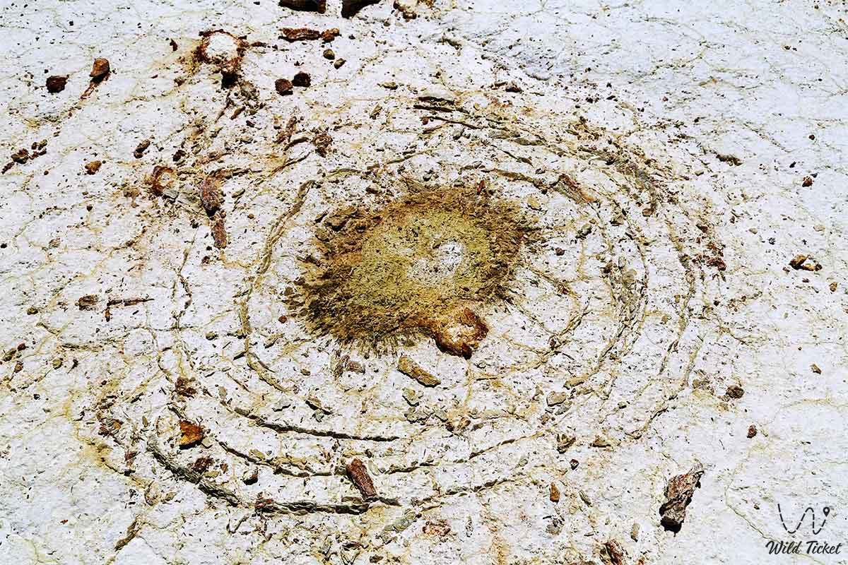
In outcrops and screes at the base of the chalk hills, researchers and tourists regularly find paleontological artifacts: fossilized shells of ancient mollusks, belemnite rostra, fragments of sea urchins, and fossil shark teeth from the Paleogene period.
The climate in the tract is extra-continental and sharply arid. Average annual precipitation does not exceed 120–140 mm. In summer, the air temperature in open areas often exceeds +40 °C, and the blinding white chalk creates a powerful reflective light effect that requires eye protection.
The ecosystem of the tract is exceptionally fragile: soft limestones and clays are easily damaged by vehicle wheels, creating deep erosional ruts. Driving off-road onto the slopes of the hills is strictly prohibited – tire tracks destroy the natural patterns and do not heal for years.
Detailed description of the venue
The landscape complex of the Kyzylkup tract includes several distinct natural sectors:
• "Tiramisu" Hill Massif – the central group of remnant elevations with a distinct alternation of horizontal layers of white chalk and red ferruginous clay, reminiscent of pastry layers.
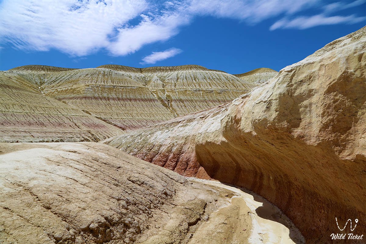
• Picturesque Kyzylkup Gorge – a winding canyon with gentle slopes, where multi-colored stratified layers emerge onto the surface in smooth, elongated curves.
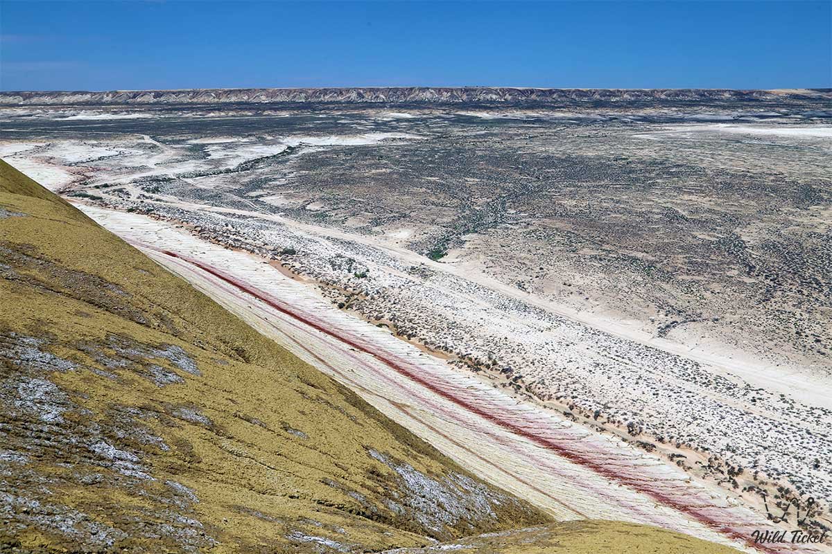
• Upper Panoramic Point – the summit of the central hill, reached by a convenient path; it offers an expansive vista over the boundless yellow steppe, Martian hills, and the outline of Mount Bokty.
• Basin of the Dried-Up Kyzylkup Reservoir – a flat depression in the northeastern part of the tract with dense takyrs and traces of ancient hydraulic earthen embankments.
• Karst Gullies and Micro-Canyons – lateral ravines carved by rainwater flows in marl strata, attracting macro-photography enthusiasts.
• Surrounding Plain – open expanses with sparse wormwood and saltwort shrubs, providing the finest overall panoramas of the elongated red-and-white ridge.
Flora and fauna
The vegetation cover of the tract is typical of stony-clay arid expanses of the Turan Lowland. On saline and chalk soils, drought-resistant species thrive: grey-soil wormwood, salt-marsh biyurgun, boyalych, itsegek, bean caper, and occasional bushes of camelthorn (dzhantak). In deep hollows where seasonal moisture collects, thickets of tamarisk occur. In spring, during April and early May, the stony slopes briefly come alive: wild tulips, small ephemerals, and desert irises bloom, withering away completely by the arrival of the June heat.
The animal kingdom is adapted to water scarcity and open landscapes. Goitered gazelles, saiga antelopes, and tolai hares are encountered around the tract; Ustyurt mountain sheep (mouflons) sometimes descend from the chinks of Ustyurt to drink. Common small predators include the corsac fox, steppe polecat, badger, and marbled polecat.
Numerous reptiles bask on sun-warmed rocks: toad-headed agamas, Ustyurt geckos, whipsnakes, rapid fringe-toed lizards, and Central Asian tortoises. Birds of prey circle in the skies above the Kyzylkup hills: steppe eagles, long-legged buzzards, golden eagles, and kestrels hunting gerbils and jerboas.
Legend
An ancient Mangystau legend about the treasures of a master jeweler is associated with the Kyzylkup tract. Lore tells that during the heyday of the Great Silk Road, a skilled artisan lived here, capable of creating unprecedented adornments from colored clay, river pearls, and precious gems. When ruthless foreign invaders attacked the peaceful nomadic encampments, the craftsman refused to surrender his creations to the enemies.
Gathering all his accumulated pigments – white pearl powder, terracotta minium, ochre, and noble carmine – he scattered them across his native valley and appealed to ancestral spirits with a plea to conceal the wealth. The earth trembled, and a harsh steppe wind sealed the master's colors inside the chalk hills forever, transforming the valley into a fabulous stone carpet. Ever since, people believe that Kyzylkup grants inspiration to every artist and traveler who arrives here with a pure heart.
Conclusion
The Kyzylkup tract is a striking natural wonder of Mangyshlak, visibly demonstrating the centuries-old history of the planet's geological transformations. Its soft red-and-white "Tiramisu" slopes evoke a sense of harmony and provide unforgettable impressions for lovers of pristine nature.
Easy transport accessibility and proximity to such grandiose sites as Mount Bokty and the Bozzhira tract make Kyzylkup an essential and visually vibrant highlight on the tourist map of Mangystau.
Interesting sights nearby:
• Ustyurt State Nature Reserve;
• Fort Shevchenko;
• City of Zhanaozen;
• Senek Necropolis;
• Nurbergen Kalyshev Mausoleum;
• Karagiye Depression;
• Karynzharyk Depression;
• Ustyurt Plateau;
• Beket-Ata Mosque;
• Shopan-Ata Mosque.
Photogallery: