Relict endorheic depression of Southern Mangyshlak and precipitous chinks of Kenderli-Kayasan –
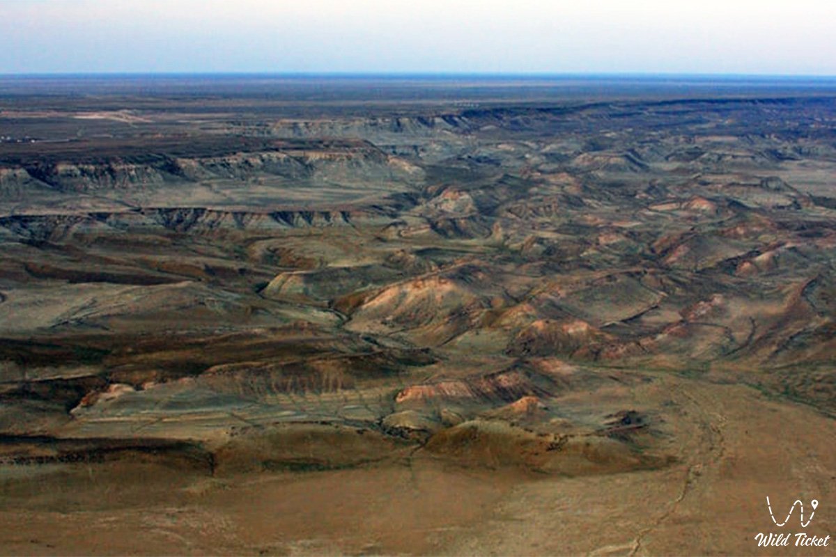
The Zhazgurly Depression (Kaz. Zhasgurly oiysy, also written as Zhazgurly) represents a deep enclosed endorheic tectonic-deflational depression, an ancient erosional basin, and an outstanding geomorphological phenomenon located in the Mangystau region. The natural complex occupies the northern wing of a unified twin system alongside the neighboring Basgurly depression across the expanses of the Kenderli-Kayasan Plateau, carving deeply into the dense limestone shield of the upland and forming a contrasting natural amphitheater amid the boundless semi-desert.
The genesis of the basin is directly linked to the geological chronicle of the ancient Tethys Ocean and subsequent continental dynamics: the depression evolved during arid epochs over the past 5–6 million years (in post-Pontian times) as a result of salt disintegration of bedrocks, chemical leaching of minerals, and intense wind deflation (aeolian deflation). Consequently, the Zhazgurly depression is recognized as a classic "relict" basin, whose floor drops in places below global sea level.
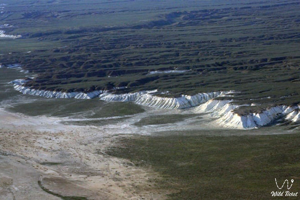
The surrounding landscape of Mangystau represents a transitional zone of northern desert featuring pronounced southern desert elements – clay and sandy-clay plains dominated by communities of wormwood, saltwort (sarsazan), and biyurgun (Anabasis salsa). On its northern and eastern flanks, the Zhazgurly depression is dramatically framed by sheer stepped scarps composed of Sarmatian coquina limestone and white chalk, dissected by a branching network of deep ravines and karst gullies. The gentle southern slope transitions smoothly into a low-relief depositional saddle that divides the broader basin into two isolated sections – the northern Zhazgurly and southern Basgurly.
Situated within the territory of the Kenderli-Kayasan State Nature Sanctuary, the tract serves as a vital refuge and natural migratory corridor for the rarest wildlife of the region. Across the flat stony plains surrounding the depression nests the cautious MacQueen's bustard (houbara bustard, or zhek), while graceful goitered gazelles and Ustyurt mountain sheep (mouflons / urials) roam the slopes and ravines. In the rocky niches of the chalk scarps, saker falcons, steppe eagles, and golden eagles rear their chicks.
Today, the Zhazgurly depression is recognized as a benchmark locality for geologists, geomorphologists, ornithologists, and self-contained off-road expedition travelers navigating the untrodden tracks of the Mangyshlak Peninsula.
--------------------------------------------
How to get there and visit –
The Zhazgurly depression is situated in the southern part of the Karakiyan district of the Mangystau region, roughly 55–60 km south-southeast of the city of Zhanaozen, 50–55 km east of Kenderli Bay on the Caspian Sea, directly north of the Basgurly depression, and approximately 200–215 km southeast of the regional center Aktau. An off-road drive from Aktau takes about 4–4.5 hours.
GPS geographical coordinates of the central part of the Zhazgurly depression:
42°49'38"N 53°24'18"E
The primary driving route from Aktau runs southeast along the paved highway of republican significance through the Karagiye depression to the city of Zhanaozen (150 km of excellent asphalt). From Zhanaozen, continue south along the paved motorway through the settlement of Stary Uzen toward the settlement of Senek (about 60 km) or through the settlement of Bostan. From Senek or Bostan, the asphalt terminates, and the journey continues over a network of unpaved steppe graders and stony-gravel ruts leading south across the Kenderli-Kayasan Plateau directly to the northern precipices of Zhazgurly.
An expedition into the depression requires high levels of self-reliance and vehicle capability: travel is feasible exclusively in prepared body-on-frame four-wheel-drive vehicles (4x4) with high ground clearance, heavy-duty suspension, and reliable all-terrain tires (AT/MT). Sharp coquina limestone scree on the plateau rims carries a severe puncture and sidewall-cut risk; carrying an air compressor, tire repair kit, and at least two spare wheels per vehicle is essential. Traveling in a convoy of at least two vehicles is strongly advised.
During rainy periods, the dry clay sectors of the plains and the floor of the basin soften rapidly into slick, treacherous mud that immobilizes wheeled transport. Descending by vehicle down to the floor is exceptionally hazardous due to sheer drop-offs and deep ravines; it is safer to leave vehicles at upper panoramic viewpoints and make radial ascents and descents on foot.
The territory is part of the Kenderli-Kayasan Nature Sanctuary and is regularly patrolled by "Okhotzooprom" conservation rangers. Driving off established tracks onto virgin soils and salt flats is strictly prohibited to prevent damaging fragile soils and disturbing nesting MacQueen's bustards. Given the proximity of the frontier zone, each visitor must carry an original identity card or passport.
Infrastructure in the vicinity of the tract is completely absent: cellular connectivity does not function. Across the surrounding expanses there are only scarce brackish wells; other water sources do not exist. The nearest gas stations, shops, tire repair workshops, and hospitals are located in Zhanaozen, with small local supply stores in Senek and Kulandy. Every vehicle crew must carry an autonomous drinking water supply (at least 5 liters per person per day), spare fuel in jerrycans, navigation equipment with pre-downloaded offline satellite maps, and a satellite phone.
The best time to visit is spring (from mid-April to late May), when the surrounding semi-desert turns green and the air is fresh and pleasant, as well as the warm autumn (September – October). In July and August, the enclosed bowl of the depression traps extreme heat exceeding +42...+45 °C accompanied by dry sand and dust storms.
--------------------------------------------
History
The history of the Zhazgurly depression spans more than 5–6 million years of landscape evolution in Western Kazakhstan. The basin formed during arid post-Pontian geological epochs when tectonic shifts exposed marine limestone-clay strata to subaerial weathering. A combination of salt weathering processes (disintegration of minerals driven by crystallizing salts) and persistent wind deflation carved out a colossal stepped depression.
In deep antiquity, this isolated basin with precipitous walls served as a natural catchment and trap for wild game. Archaeological surveys across the Mangyshlak plateau have recorded flint flakes, scrapers, and arrowheads from Neolithic and Bronze Age campsites along the margins of the depression. Stone Age hunters used the natural shelves of the chink for battue hunting of kulans (wild asses), saigas, and argali descending through gullies toward temporary watering holes.
During the Middle Ages, nomadic caravan tracks connecting the Caspian Sea coast with the oases of Khwarazm crossed the heights of Kenderli-Kayasan. Caravaneers bypassed the steep precipices of the depression from above, relying on deep brackish wells excavated into the limestone beds.
For nomads of the Kazakh Aday clan throughout the 18th to 20th centuries, the Zhazgurly depression served as a valued wintering refuge (kystau). Sheer hundred-meter cliffs of white chalk and coquina limestone reliably shielded sheep flocks and camel herds from the freezing northern gales and blizzards that swept the open plateau.
In the Soviet era, hydrogeologists and geomorphologists documented the karst-deflational origin of the tract in detail. In 2001, the depression was incorporated into the newly established Kenderli-Kayasan State Nature Sanctuary of republican significance, gaining status as an international field monitoring area for the conservation of the MacQueen's bustard.
Information
Geomorphologically, the basin represents an enclosed denudation-deflation depression of elongated form, extending approximately 16 kilometers in length with a width of up to 6 kilometers in its central portion. The vertical elevation drop between the flat surface of the enclosing plateau and the depression floor reaches 100–130 meters, with the lowest parts of the floor descending below global sea level.
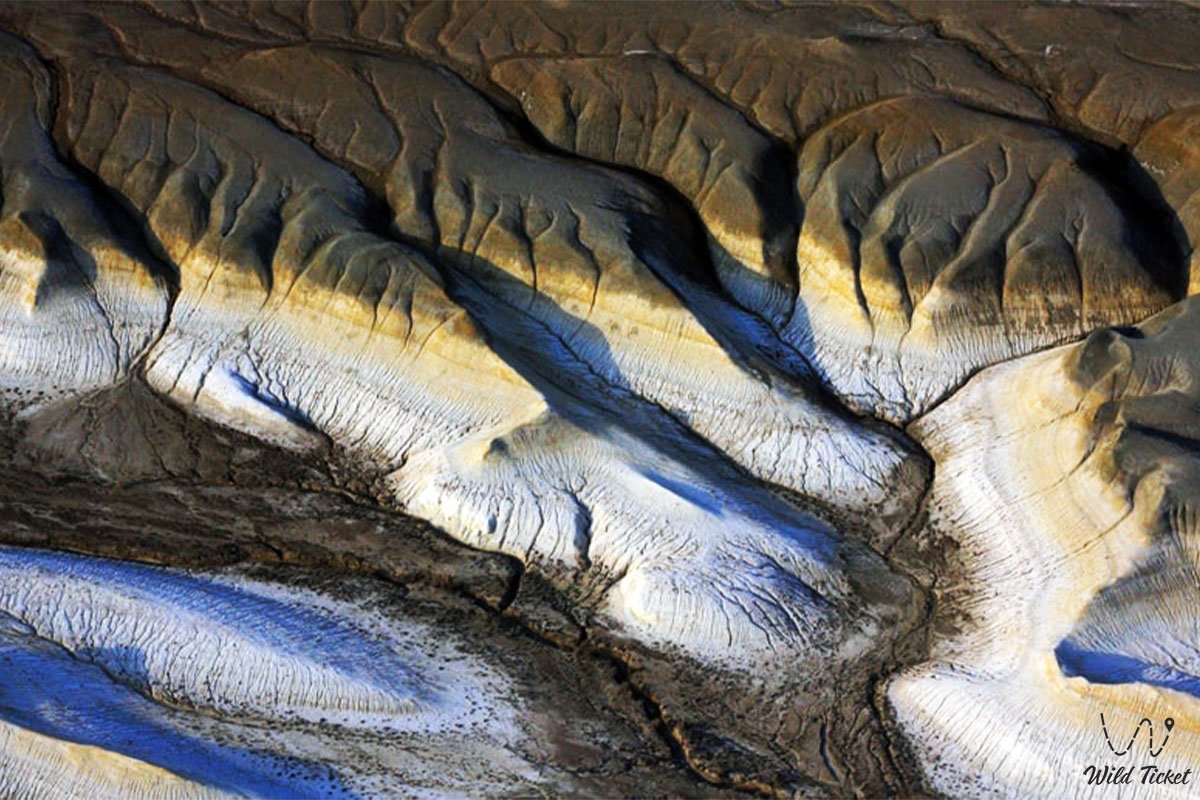
The geological cross-section is composed of a thick bedded complex of marine carbonate-clay deposits belonging to the Sarmatian and Pontian stages of the Upper Miocene. The cornices and scarps expose oolitic coquina limestones, writing chalk, dense marls, and interlayers of gypsum resting upon impermeable variegated clays. Marine fossils of the ancient Tethys Ocean are preserved in abundance within the eroding limestone layers: mollusk shells, fossilized oyster valves, and prehistoric shark teeth.
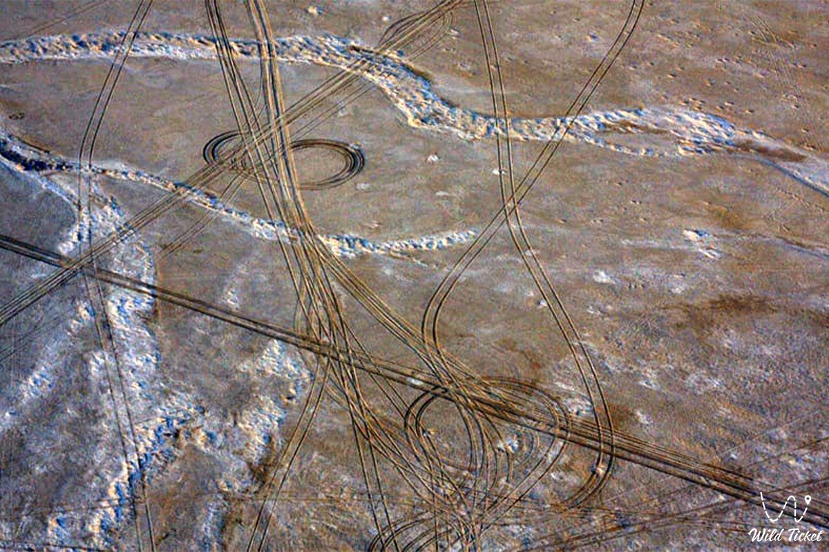
Soil cover across the bottom consists of polygonally cracked takyrs and crustal salt flats with high concentrations of sodium sulfate and chloride salts. Stony gray-brown desert soils cover the plateau rims and terraces.
The hydrological balance is governed entirely by an arid regime. Perennial surface watercourses are absent; ephemeral runoff occurs only in spring during snowmelt and downpours, collecting on the impermeable floor as shallow saline pools. Subterranean fracture-karst waters occur at depths ranging from a few meters to dozens of meters, with mineralization between 3 and 8 g/L, accessible through occasional pastoral wells.
The climate of the area is extremely arid and sharply continental. Average daytime July temperatures range between +34 and +38 °C (with soil surface temperatures reaching +60 °C), while winter temperatures plunge to -18...-22 °C under fierce winds. Annual precipitation does not exceed 100–120 mm, while evaporation potential exceeds rainfall by more than tenfold.
Detailed description of the venue
The natural complex of the Zhazgurly depression includes the following characteristic landscape sectors and panoramic zones:
• Northern stepped chink – steep precipitous cliffs of the plateau rising 100–130 meters high, composed of horizontal beds of white chalk and golden-buff coquina limestone, carved by deep erosional gullies.
• Elongated salt-flat floor – the flat central bowl of the basin featuring cracked clay takyrs and pale salt-encrusted patches, lying below sea level.
• Southern depositional saddle – a gentle sandy-clay drainage divide connecting the plateau with the floor and dividing the twin depression into northern and southern halves.
• Weathering outlier towers and crests – sculptural limestone pillars, columns, and ridges separated from the main cliff face by gravity slides and wind scouring.
• Network of deep canyon-like ravines – winding gullies at the junction of the plateau and the basin floor through which spring runoff rushes, exposing ancient fossil-bearing layers with shells and shark teeth.
• Panoramic points on the plateau rim – natural scenic vantage points over 100 meters above the basin floor offering sweeping vistas across the elongated bowl of Zhazgurly and the desert horizons of Kenderli-Kayasan.
Flora and fauna
The plant life of the territory combines communities of the northern and southern deserts. The stony terraces of the plateau are dominated by drought-resistant dwarf subshrubs: gray-soil wormwood, Lerche's wormwood, Anabasis salsa (biyurgun), boyalych, eastern saltwort, and Krascheninnikovia (teresken). Rare calciphytic species colonize sheer chalk and coquina cliffs: Malacocarpus crithmifolius, Atraphaxis, Convolvulus persicus, and crustose lichens.
Halophytic communities develop on the saline floor of the depression: Halocnemum strobilaceum, European glasswort, and Caspian Kalidium. Clusters of black saxaul and Calligonum (dzhuzgun) appear on sandy-clay slope sections. In spring, the slopes and plains come alive with blooming wild Sogdian tulips, two-flowered tulips, steppe irises, and small ephemerals that wither by early June.
The fauna is protected under the sanctuary status of the reserve. Across the flat stony plateau surrounding the basin lie nesting biotopes of the endangered MacQueen's bustard (houbara bustard). In the niches and ledges of steep scarps, raptors raise their young: saker falcon, peregrine falcon, golden eagle, steppe eagle, long-legged buzzard, Egyptian vulture, and eagle-owl. Desert larks, Pallas's sandgrouse, and black-bellied sandgrouse are common across the depression floor.
Among mammals, herds of goitered gazelles navigate the slopes and basin floor. On the inaccessible crags of the chink, Ustyurt mountain sheep (mouflons / urials) find refuge, using narrow ledges to evade carnivores. During seasonal migrations, herds of saiga antelopes cross the plateau.
The carnivore and small mammal community includes the sand cat, caracal, corsac fox, steppe polecat, marbled polecat, tolai hare, long-eared hedgehog, Brandt's hedgehog, and colonies of gerbils and jerboas. Wolves and jackals approach the scarce wells and ravines at night.
The herpetofauna includes the desert monitor, Central Asian tortoise, agile steppe agama, toad-headed and secret toad-headed agamas, plate-tailed gecko, arrow snake, four-lined snake, sand boa, and the venomous Halys pit viper. Solifuges, scorpions, and black widow spiders (karakurt) inhabit rock fissures.
Legend
An ancient steppe legend concerning the Secret of the Young Batyr and the Sunset Cliff is tied to the origin of the Zhazgurly depression.
Tradition tells that during eras of nomadic conflicts, a young and fearless dzhigit named Zhasgur lived on the Mangyshlak plateau, his name signifying "young and steadfast, like a mountain crag." He was the finest scout among the Aday clans, able to navigate the waterless upland under star-filled skies guided solely by the scent of wormwood.
When enemy warbands advanced from the east seeking to cut off access to coastal wells, Zhasgur volunteered to lead the pursuers away into the deep desert. Drawing the chase toward the sheer rims of the plateau, the batyr led them in circles across sun-baked stony wastes until the enemy horses collapsed from thirst and exhaustion.
Realizing they had fallen into a trap, the hostile horsemen cornered the youth at the edge of a towering precipice. Refusing to surrender, Zhasgur called upon the heavens to safeguard his homeland's borders and stepped into the abyss. At that moment the earth trembled, and a deep, winding chasm with sheer white ramparts opened in the plateau, severing the enemy's retreat forever.
Ever since, this northern basin has been called Zhazgurly. Local inhabitants believe the spirit of the brave dzhigit protects wanderers lost on the stony tracks of the plateau, while the white scarps glow with a golden radiance in the setting sun in honor of his devotion to ancestral soil.
Conclusion
The Zhazgurly depression is an untouched natural monument of Mangystau where the rugged grandeur of chalk chinks meets the silence of a salt-flat floor and the primeval peace of the arid world. An expedition to its wild precipices offers a rare sense of discovery, allowing travelers to encounter the ancient geological chronicle of the Tethys Ocean, watch the soaring flight of steppe raptors, and experience the authentic majesty of Kazakhstan's desert expanses.
Interesting sights nearby:
• Neighboring Endorheic Basgurly Depression;
• Kauyndy (Kuandy) Endorheic Depression;
• Kenderli-Kayasan Limestone Plateau;
• Kenderli Bay on the Caspian Sea coast;
• Rocky chinks of Kulandy and Cape Tokmak;
• Sand Massif and Dunes near Senek Village (Tuyesu);
• Picturesque rocky Kamysbay Gorge;
• Warm radon spring near Kuryk;
• Seaside sand spit of Saura;
• Rocky Tamshaly Bay with Spring Cascade;
• Chalk Outlier Canyons of the Bozzhira Tract;
• Oil Town of Zhanaozen.
Photogallery: