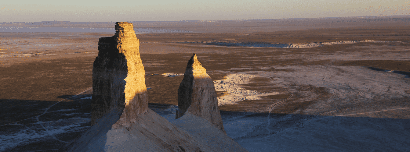
Dome-shaped chalk butte with the silhouette of a traditional nomadic dwelling –
The chalk Mount Yurt is an isolated dome-shaped erosional butte, a monumental geological landmark, and one of the primary visual symbols of the world-famous Bozzhyra tract in western Kazakhstan. This natural monument is located in the Karakiyan district in the southwestern sector of the Ortasha table plateau, just 2.4 kilometers from the rim of the Western chink of the Ustyurt plateau and 254 meters east of the scenic Shatkala canyon.
The mountain rises above the flat floor of the tract to an absolute elevation of 252.3 meters above sea level (some cartographic sources indicate an elevation of 250–260 m), forming the focal dominant of the lower amphitheater of Oynak Bozzhyra. The butte received its name from travelers due to its near-perfect hemispherical form with a gentle conical crown, bearing a striking resemblance to the felt yurt dwellings of steppe nomads.
The geological framework of Mount Yurt is formed of thick marine sedimentary sequences of Upper Cretaceous and Paleogene age dating back 30 to 40 million years, when the basin formed the bed of the colossal prehistoric Tethys Ocean. The body of the butte consists of dense writing chalks, marls, and bedded coquinas, which were subjected to arid weathering, wind deflation, and water erosion gullies over millennia.
In 2006, the National Bank of the Republic of Kazakhstan placed the silhouette of Mount Yurt on the reverse side of the 1,000 tenge banknote, where the contours of this chalk butte are unmistakably recognizable within the map of the country.
In the spatial and travel geography of Ustyurt, Mount Yurt occupies a central position within the panoramic sector of the Bozzhyra canyon system. Literally 3–4 kilometers to the south rise the renowned limestone bastions of the "Fangs of Bozzhyra" rocks, while Shatkala canyon, the Oynak plateau, the cliffs of the Kyzylkup tract, Mount Ulken Keme, and the salt bowl of the drying lake-salt flat Karashek 12 kilometers to the south are all within hiking and driving distance.
Mount Yurt displays a unique characteristic of visual transformation: from the Oynak plateau, it appears as a solid felt yurt; from the Ortasha plateau, it looks like a chalk massif neatly cleaved in half; from the third panorama, it showcases smooth chalk mudflows with vertical cornices; and from the fourth panorama and the slopes of Mount Ulken Keme, it exposes a gigantic vertical shear of its southern wall, bared by an ancient tectonic collapse. Likewise, another well-known chalk landmark, Mount Borly-Tau, is situated near Mount Yurt.
Today, Mount Yurt is included in the essential itinerary of all expedition routes across Mangystau, drawing researchers, road travelers, and landscape photographers with the striking symmetry of its chalk slopes, the diversity of perspectives from viewpoints along the chink, and the contrast of snow-white rocks against the azure sky of the Ustyurt plateau.
--------------------------------------------
How to get there and visit –
Mount Yurt is located in the Bozzhyra tract on the southwestern margin of the Ortasha plateau in the Karakiyan district of the Mangistau region. The distance from the city of Aktau is around 270–300 km, roughly 140–150 km from the town of Zhanaozen, 254 m east of Shatkala canyon, 2.4 km east of the Western chink of Ustyurt, about 3.5 km northwest of the "Azu tisteri" rocks, and 12 km north of the Karashek salt flat.
GPS geographic coordinates of Mount Yurt:
43°26'14"N 54°04'38"E
The route from Aktau heads east along a paved highway through the town of Zhanaozen toward the Beket-Ata underground mosque (Oglandy)—about 240 km of asphalt. Twenty kilometers before the Oglandy tract, turn south into the steppe toward the upper viewpoints along the Bozzhyra chink (the third panorama and fourth panorama, from where Mount Yurt can be seen from above).
To reach the base of the mountain on the canyon floor, use the southern bypass descent into the Oynak Bozzhyra tract via the ravines near Mount Bokty or the ridges of the Ortasha plateau.
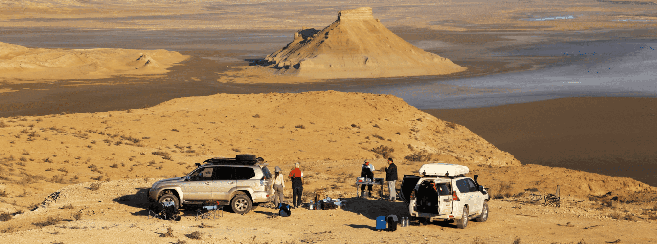
The track inside the tract is a challenging dirt road with loamy stretches, gravel fields, and chalk dust. Pure driving time from Zhanaozen to the foot of the mountain takes between 3 and 4.5 hours.
Regulations and documents: the Bozzhyra tract is open for visits and does not fall within the restricted border zone, but it is located in a remote desert area. All participants must carry original identification documents (Kazakhstani citizens must have national ID cards; foreign tourists must have passports).
If planning to continue the expedition south into the territory of the Ustyurt state nature reserve (the Karynzharyk depression, the Kenderlisor salt flat, and the Onere tract ranger station), an official permit must be obtained in advance from the reserve office in Zhanaozen.
Vehicle requirements: access to the base of Mount Yurt is possible exclusively in prepared four-wheel-drive 4x4 expedition vehicles with ground clearance of at least 220–250 mm and All-Terrain or Mud-Terrain tires. Driving across the canyon floor requires caution: after rare rainstorms, chalk and loamy tracks soften immediately into slick clay, making movement impossible without four-wheel drive and differential locks.
Travel to remote points of Bozzhyra should be undertaken in a convoy of at least two vehicles. Each crew must carry a fuel reserve for at least 400 km of autonomous travel, two operational spare tires, an air compressor, dynamic tow straps, a hi-lift jack, sand ladders, and a shovel.
Safety precautions and prohibition of ascent:
ATTENTION: ascending to the summit of Mount Yurt is strictly discouraged and life-threatening. The slopes of the butte are formed of soft, weathered chalk rocks and loose marls lacking structural strength. Entire slabs can crumble underfoot, and the upper tier forms a nearly vertical cliff wall without natural belay anchors.
The landmark should be observed visually from the side, either on a walking circuit around the base or from the viewpoints along the upper Ustyurt chink. Sturdy high-top trekking boots with rigid tread are mandatory for walking around the base to protect against sharp flint fragments.
Venomous snakes and arthropods inhabit fissures at the foot and across chalk screes: the Halys pit viper, Steppe ribbon racer, scorpions, camel spiders, and black widows.
During the warm season, wearing sunglasses with high UV protection, headwear, and long-sleeved clothing is mandatory, as the white chalk reflects up to 80 percent of solar radiation.
Environmental safety rules:
In the Bozzhyra tract and near Mount Yurt, it is STRICTLY MANDATORY TO:
– carry all household trash back to municipal collection dumpsters in settlements;
– stay on beaten tracks and avoid driving onto the soft chalk screes and mudflows of the butte to prevent damage to the erosional relief;
– strictly refrain from writing on or defacing the chalk surface of the cliffs;
– avoid using open fire and refrain from lighting campfires;
– maintain quiet and avoid disturbing wild animals.
Infrastructure: the Bozzhyra area is entirely autonomous and uninhabited. There are no campsites, cafes, mobile reception, power lines, or sources of drinking water in the tract. Drinking and utility water must be brought along, calculated at a minimum of 5 liters per person per day. Overnight stays are organized in field tent camps on flat sand-gravel terraces at a safe distance from sheer chalk walls and potential rockfall zones.
The best time to visit is April, May, September, and October. During spring months, the steppe comes alive, daytime temperatures are comfortable (+18...+24 °C), and there is no scorching heat. In autumn, the heat subsides, and unpaved steppe tracks are dry and firm. From mid-June through August, temperatures at the bottom of the Bozzhyra canyon climb above +42...+45 °C, which, combined with the glare of the chalk, creates extreme heat stress.
--------------------------------------------
History
The history of Mount Yurt's formation reaches back tens of millions of years into geological time, linking global tectonic processes of ocean retreat with the development of nomadic civilization in Kazakhstan.
During the Mesozoic and Paleogene epochs (from 70 to 30 million years ago), the entire territory of the Turan lowland and the modern Mangyshlak peninsula was submerged beneath the waters of the ancient warm Tethys Ocean. Over geological eras, thick sedimentary sequences accumulated on the seabed from the skeletons of microscopic plankton, mollusk shells, corals, and calcitic silts. Following the uplift of the earth's crust, the sea retreated, exposing horizontal beds of white limestone and chalk.
During the Quaternary period, exogenous weathering forces came into play: sharp diurnal temperature swings from freezing to blistering heat, gale-force winds of Ustyurt, and spring torrents of rain runoff. Rushing water cut deep ravines and canyons, carving the unified plateau into detached residual blocks. Mount Yurt survived thanks to a denser lens of upper marly strata, forming a hemispherical dome while the surrounding rocks were eroded dozens of meters down.
With the rise of expeditionary travel, the descriptive name "Yurt" took firm hold—reflecting its visual match to the silhouette of the Kazakh kiiz ui (felt yurt).
In 2006, the mountain gained nationwide prominence with the release of a new banknote series of Kazakhstan's national currency. On the reverse of the 1,000 tenge banknote, designers placed the silhouette of Mount Yurt inside the map of the country, highlighting its status as one of the republic's primary natural monuments.
Information
Geomorphologically, Mount Yurt is a denudational chalk butte of table-conical type carved into horizontally stratified sedimentary rocks.
Morphometric parameters:
– absolute summit elevation above sea level: 252.3 m (up to 260 m in regional sources);
– elevation of the butte body above the chalk mudflow apron: about 15 m;
– total relative height above the canyon floor: from 120 to 150 m;
– diameter of the circular conical base: about 400–500 m;
– distance from the rim of the Western chink of Ustyurt: 2.4 km;
– distance to Shatkala canyon: 254 m to the east.
Lithological composition:
The massif is formed of alternating beds of Upper Cretaceous and Paleogene age. The lower tier consists of dense white writing chalks and chalk-like marls. The middle section is represented by compact gray and pale marls with thin coquina interbeds. The upper dome-shaped cap consists of more durable silicified limestones, which slowed down the vertical erosion of the summit.
Morphological transformation of perspectives:
– perspective from the Oynak plateau (from below): a symmetrical dome shape of a yurt with gentle shoulders;
– perspective from the third panorama of the chink: wide chalk mudflows along the northern and southern slopes, transitioning into steep ledges and a conical crown;
– perspective from the Ortasha plateau: the structure of the butte is clearly visible, appearing split in half;
– perspective from the fourth panorama and Mount Ulken Keme: the full profile of the southern vertical rockfall, exposing the internal bedding of the strata.
Climatic conditions:
The climate of the area is sharply continental and ultra-arid. Average midsummer temperatures exceed +35 °C with daytime highs reaching +45 °C in the sun, while winter temperatures drop to -25 °C. Annual precipitation does not exceed 120–140 mm.
Detailed site description
The natural landscape ensemble of Mount Yurt and adjacent sectors of the Bozzhyra tract comprises the following key features and elevated viewpoints:
• Chalk butte of Mount Yurt – a standalone denudational massif 252.3 meters above sea level composed of alternating dense marine chalks and Paleogene marls, featuring a circular base, gentle erosional mudflows, and an inaccessible summit cap that resembles the felt dwelling of nomads.
• Erosional rift of Shatkala canyon – a deep rocky gorge with steep bedded walls extending 254 meters west of Mount Yurt, serving as a natural drain for the basin during spring snowmelt and exposing ancient stratigraphic horizons of the Tethys Ocean.
• Residual bastions of the "Fangs of Bozzhyra - Azu Tisteri" – two vertical limestone spires about 200 meters high rising south of Mount Yurt as the primary elevation symbol of the tract, sculpted by uneven water and wind erosion of a unified plateau.
• Table terrace of the Ortasha plateau – an extensive intermediate hypsometric tier of the chink offering a geological view of the internal structure of Mount Yurt, which appears visually split in half by a vertical fissure.
• Flat floor of the Oynak Bozzhyra tract – an open, level canyon floor at the base of the massif strewn with pale chalk dust and flint shards, from where Mount Yurt appears from below in a symmetrical hemispherical form.
• Rocky ship-butte Ulken Keme – a monumental flat-topped table mountain resembling an ocean liner, from whose hiking approach slopes the large-scale vertical rockfall of Mount Yurt's southern wall can be seen in detail.
• First panorama viewpoint of the chink (base northern) – a frontal observation platform on the plateau rim offering a classic view of the entrance group of Bozzhyra canyons, the gentle steppe plain, and the pale contours of northern chalk mudflows in morning light.
• Second panorama viewpoint of the chink (flank perspective) – an elevated rocky ledge above a deep ravine providing a detailed view of the tiered steps of the Ortasha plateau, the transition of horizontal limestone beds into erosional screes, and the profile of Shatkala canyon.
• Third panorama viewpoint of the chink (dome panorama of Mount Yurt) – a scenic rim of the Western chink of Ustyurt looking directly across to the symmetrical chalk mudflows of Mount Yurt's northern and southern flanks, merging into sheer monolithic walls and a rounded conical summit.
• Fourth panorama viewpoint of the chink (Martian panorama) – an elevated platform on the brink of a sheer cliff opening a dramatic view of the vertically sheared southern wall of Mount Yurt, the amphitheater of chalk cirques, and the "Fangs of Bozzhyra" rising on the horizon.
• Sixth panorama viewpoint of the chink (southern distant) – the southernmost promontory of the plateau above the salt flat basin, providing an unbroken view over the drying bitter-saline Lake Karashek, isolated Mount Karashek (195 m), and the hummocky sands of the Karynzharyk massif.
• Salt depression of the Karashek salt flat – a drying bitter-saline lake 12 km south of the tract situated beneath the sheer walls of the chink at negative elevations, completing the southern panorama of Bozzhyra with a white salt field.
• Flint and gypsum scree belt at the base – a stony apron surrounding the base of Mount Yurt with exposures of prehistoric marine fossils, selenite crystal clusters, belemnite rostra, and fossil shark teeth from the ancient Tethys Ocean.
Flora and fauna
Plant life around Mount Yurt is sparse due to the high calcium carbonate concentration in the soil and a severe deficit of moisture. Higher plants do not survive on the chalk cone itself. At the base and along clayey screes, a specific calciphytic and gypsophytic flora develops: Anabasis salsa (biyurgun), white and gray wormwood, boyalych, eastern saltwort, and winterfat. In early spring, desert ephemerals bloom for brief weeks: Sogdian tulips, hornhead, and small grasses that wither away with the onset of May heat.
Wildlife is typical of the arid habitats of Ustyurt. Ustyurt mouflons (mountain sheep) appear on the flat summits of the chink and the ledges of neighboring buttes, using chalk crests as natural refuges from predators.
In the lower valley at the foot of the mountain, groups of goitered gazelles graze, alongside saiga antelopes during spring and autumn migrations.
Predatory mammals inhabiting the area include the steppe wolf, corsac fox, badger, and marbled polecat. Tolai hares, long-eared hedgehogs, gerbils, and jerboas nest among rocks and fissures.
Raptors soar above Bozzhyra and the summit of Mount Yurt: golden eagles, long-legged buzzards, Egyptian vultures, saker falcons, and kestrels, utilizing thermal updrafts rising from the hot chalk. Rock doves, desert wheatears, and ravens nest in rock clefts.
Reptiles are represented by toad-headed and spotted toad-headed agamas, steppe agamas, tartar sand boas, the Steppe ribbon racer, and the venomous Halys pit viper. Camel spiders, scorpions, and black widows are active across the ground during the warm season.
Legend
A Mangystau legend of the White Tent of the Steppe Giant is told of Mount Yurt.
The tale recounts that in immemorial times, when the Bozzhyra tract was a vast plain, a mighty batyr lived here, safeguarding peace along the borders of ancient nomadic encampments. He possessed a giant snow-white tent made of felt, given to him by the spirits of the Ustyurt chinks for his honesty and courage. This tent was not merely a dwelling: all travelers caught in the steppe by sandstorms or freezing blizzards found refuge and safety within it.
When an enemy horde swept onto the lands of Ustyurt, the batyr rose to defend his people at the canyon mouth. The battle raged for days and the invaders retreated, but the mortally wounded warrior returned to his tent. Knowing his time was near, the batyr prayed to the Creator to preserve his sacred white tent for future generations, so it would stand as an eternal reminder of fortitude, hospitality, and endurance.
The heavens heard the warrior's prayer. The great tent petrified, absorbing the whiteness of marine chalk and the resilience of rock, transforming into a dome-shaped mountain. Steppe elders say that anyone who greets the dawn at the foot of Mount Yurt with a pure heart receives peace of mind and the protection of the spirits of Ustyurt.
Conclusion
The chalk Mount Yurt is a natural monument of the Bozzhyra tract, where millions of years of marine geological history blend with the symmetry of natural landforms. The changing play of perspectives, captured on Kazakhstan's national currency, snow-white slopes, and the stillness of Ustyurt make Mount Yurt a required stop on any route across Mangystau.
Nearby attractions:
• Shatkala canyon;
• "Fangs of Bozzhyra" rocks;
• Oynak Bozzhyra plateau;
• Mount Ulken Keme;
• Mount Borly-Tau;
• Mount Shokytau;
• Mount Ushkirtau;
• First panorama of Bozzhyra;
• Second panorama of Bozzhyra;
• Third panorama of Bozzhyra;
• Fourth panorama of Bozzhyra;
• Fifth panorama of Bozzhyra;
• Sixth panorama of Bozzhyra;
• Karashek salt flat and lake;
• Kyzylkup tract (Tiramisu);
• Bokty butte mountain;
• Beket-Ata underground mosque;
• Town of Zhanaozen;
• City of Aktau.
Sacred pilgrimage sites in Mangystau:
• Masat-Ata underground mosque;
• Sonabay underground mosque;
• Koben mosque;
• Kolbas Ishan mosque;
• Uytoly-Ata mosque;
• Bayte sanctuary;
• Usen-ata necropolis.
Photogallery: