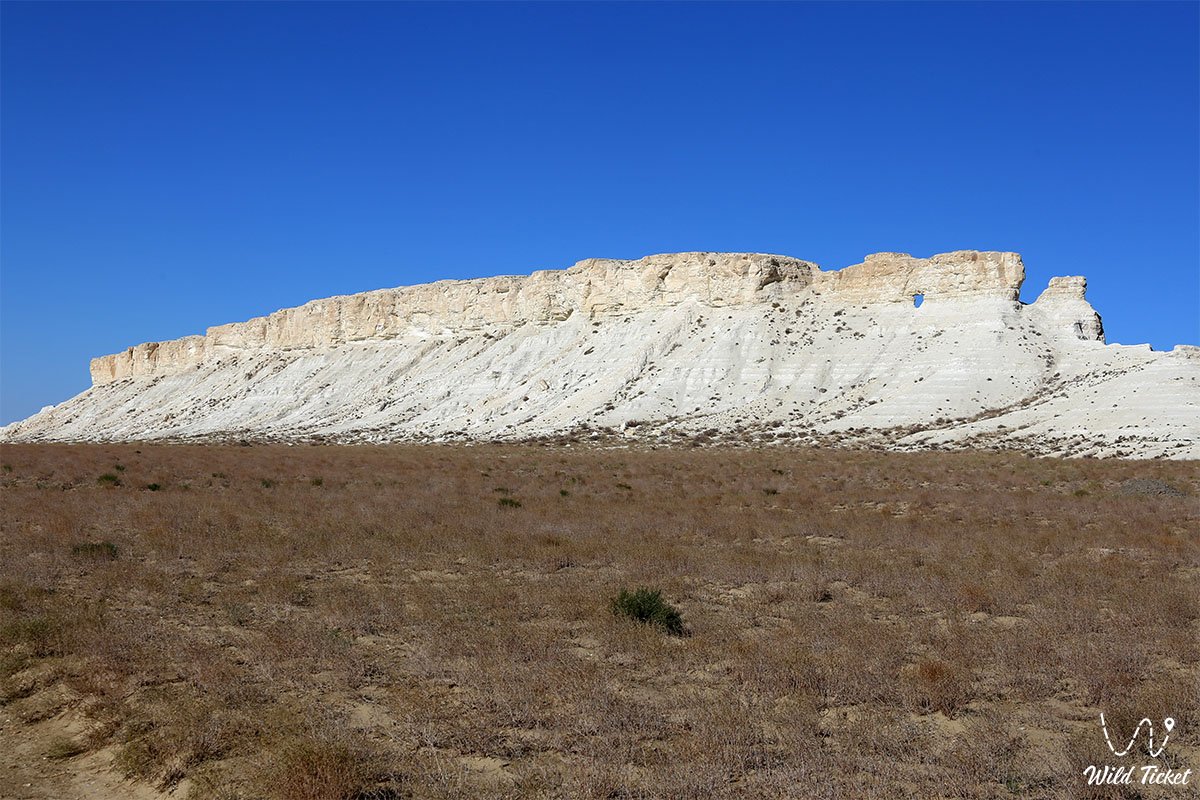
Snow-White Natural Bastion by the Road to Buzachi and Gateway to the Torysh Valley of Balls –
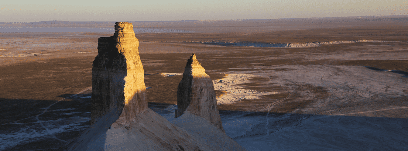
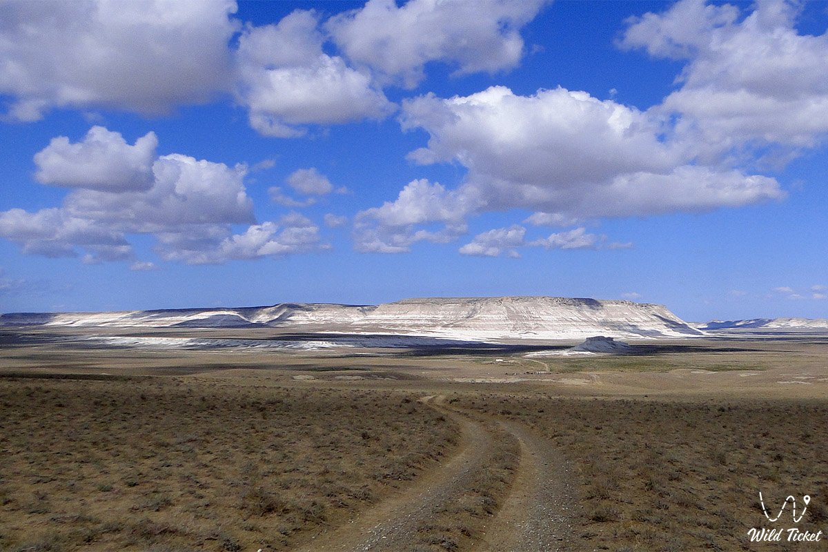
Mount Akmaya (Akmayya) is an expressive relict chalk butte and a striking geomorphological landmark in the central part of the Mangyshlak Peninsula within the Mangistau Region. Hundreds of millions of years ago, this entire territory was the floor of the colossal prehistoric Tethys Ocean. In the warm waters of the ancient oceanic basin across geological epochs, continuous accumulation of carbonate muds, plankton shells, and skeletal remains of extinct marine fauna occurred, forming thick beds of Upper Cretaceous limestones and marls.
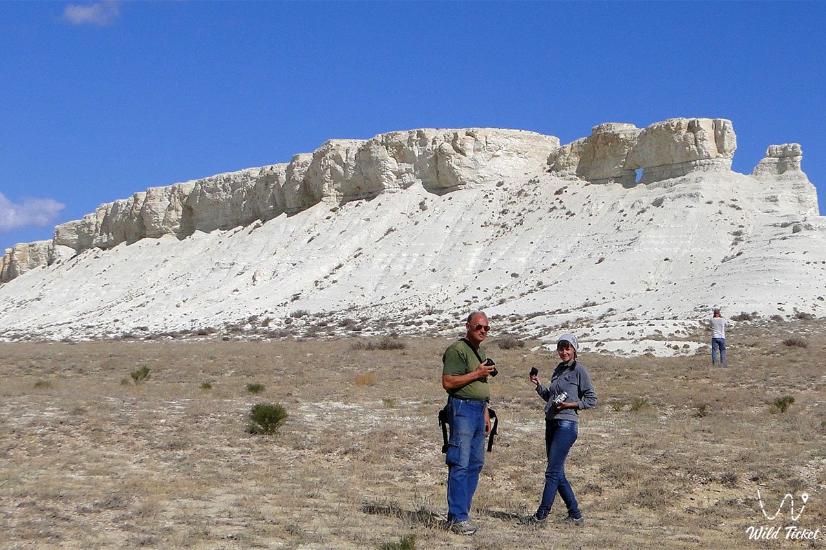
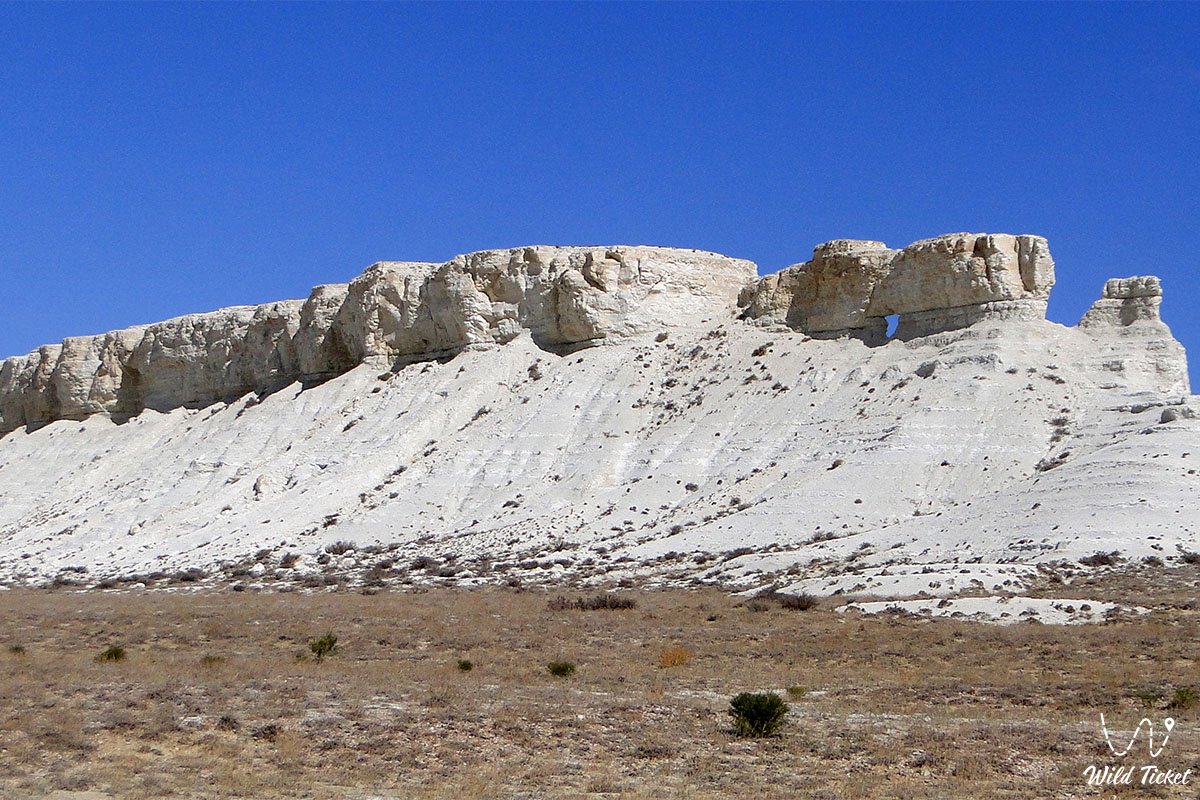
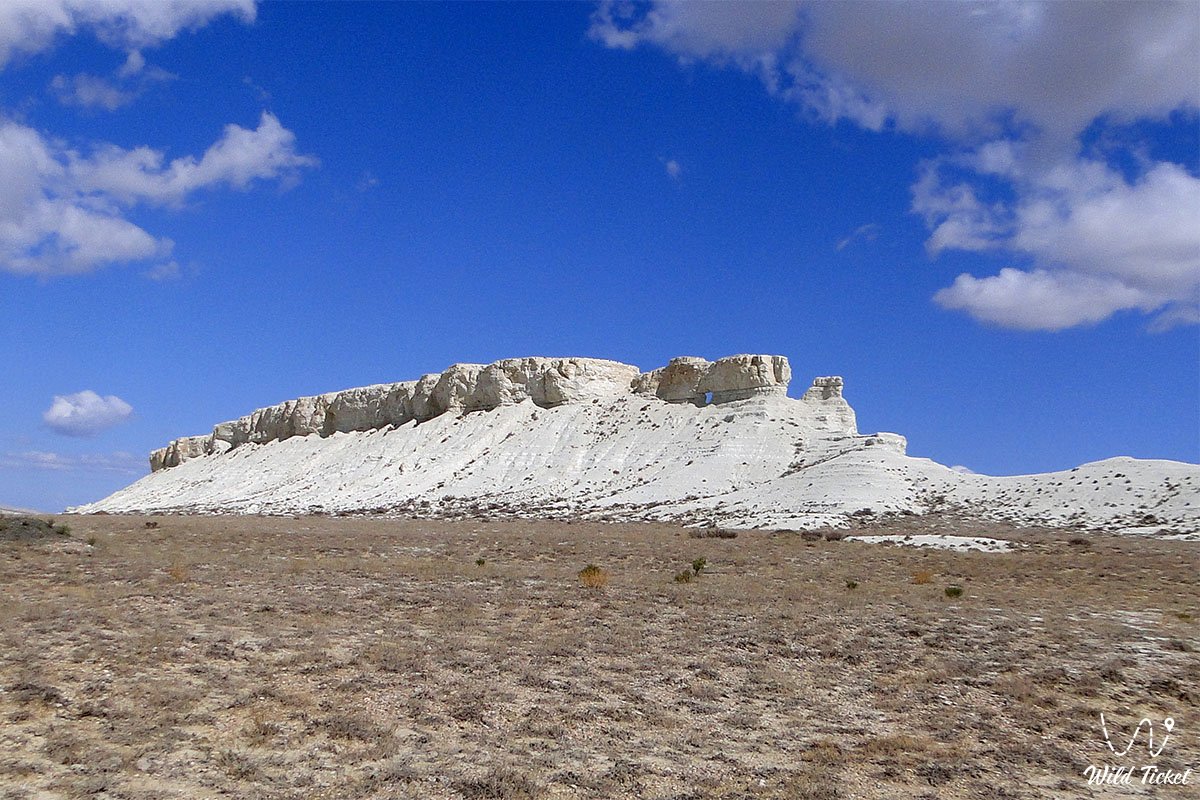
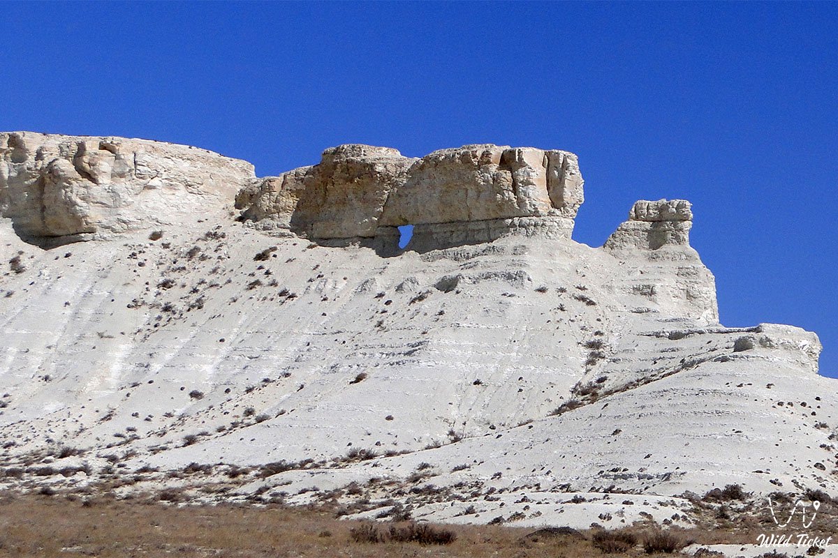
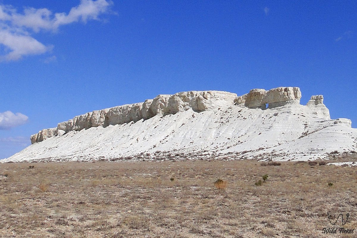
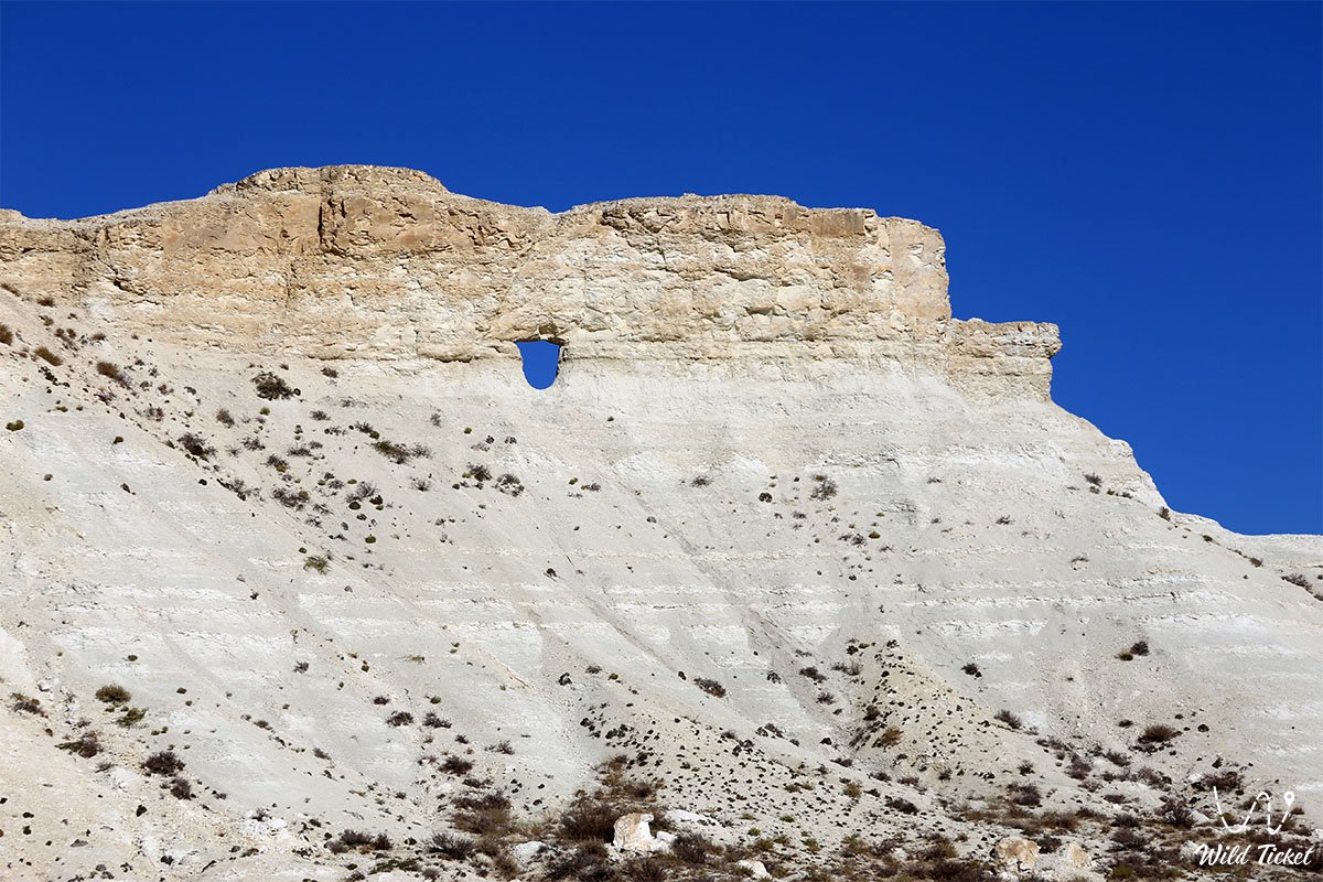
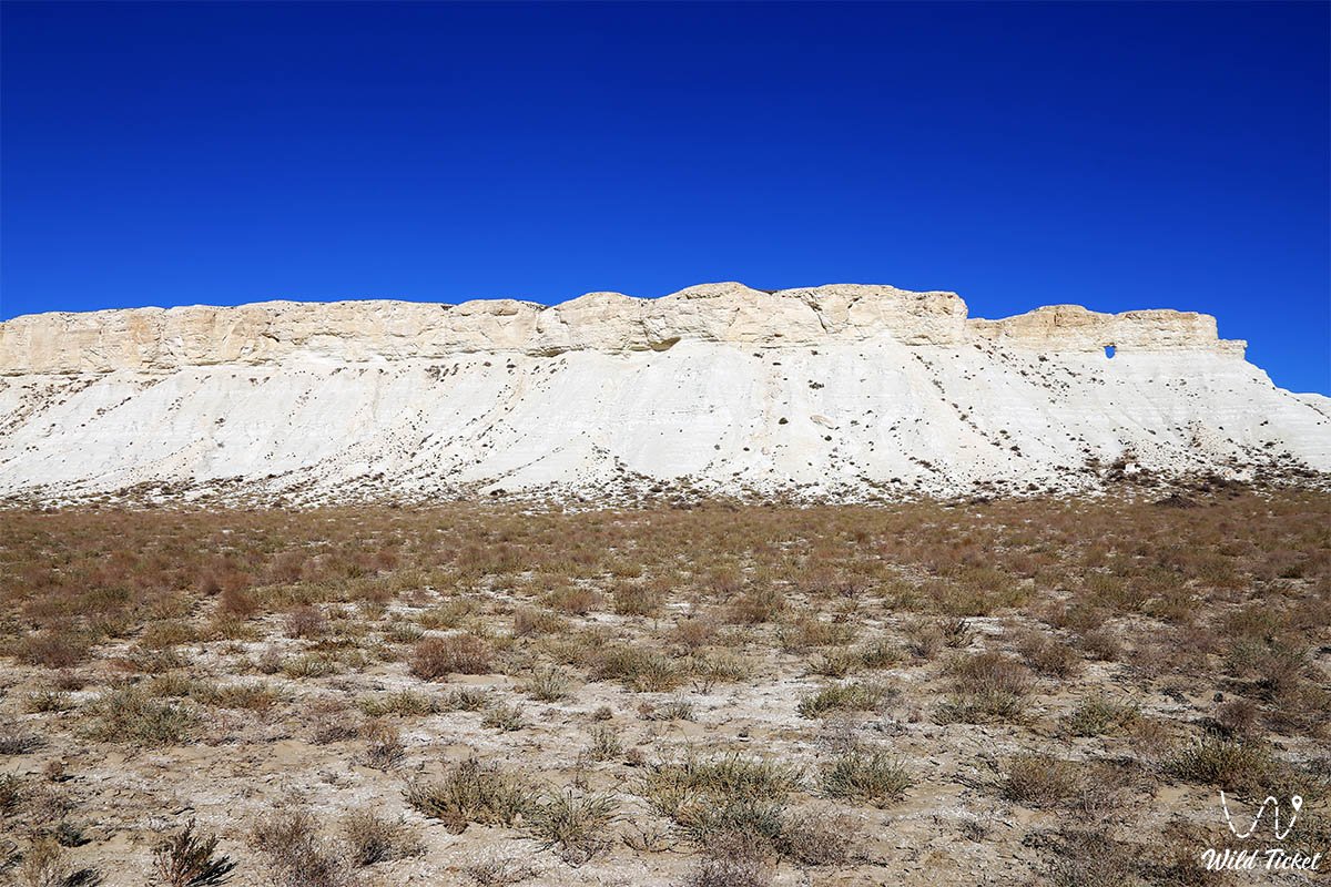
After the waters of the ancient ocean receded, intense processes of physical weathering, wind deflation, and occasional water flows eroded the surrounding soft sedimentary layers, transforming the elevation into an isolated snow-white butte. On the prow of this mountain, weathering carved a through-hole resembling the porthole of a ship or the eye of a giant animal.
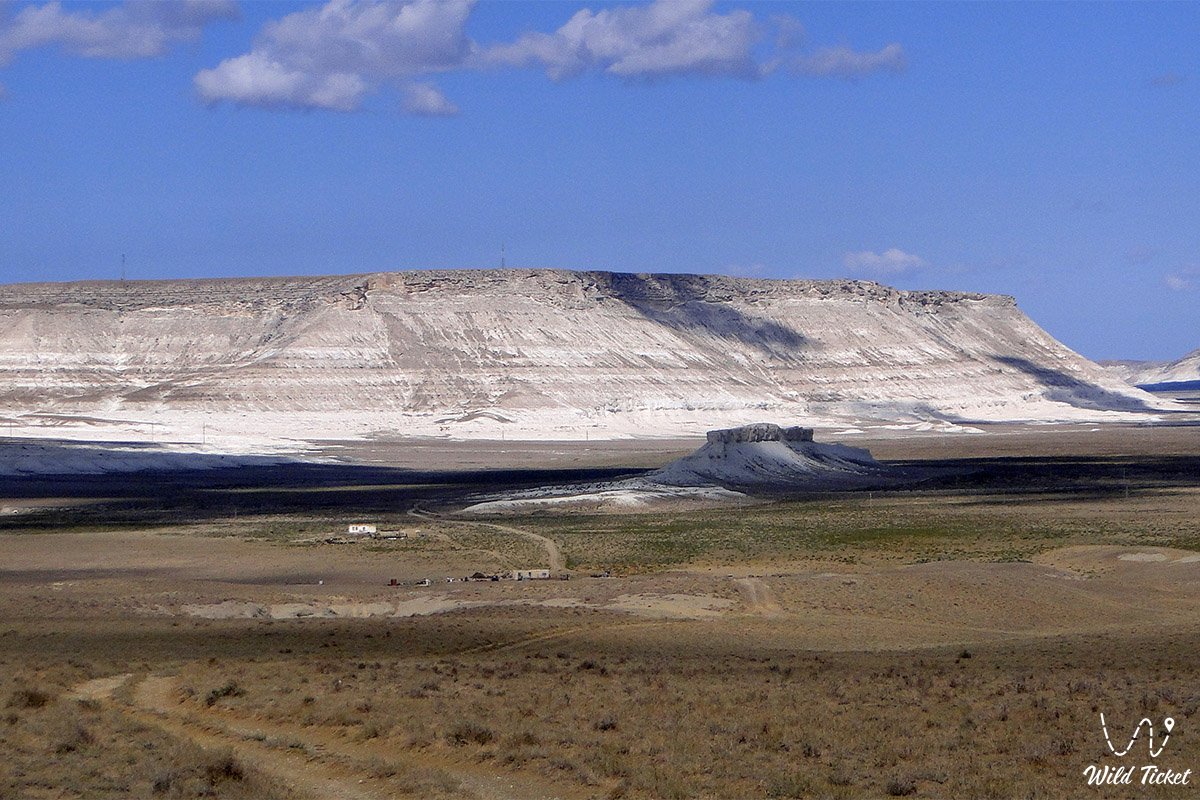
In the structure of tourist routes and expedition logistics of Mangystau, Mount Akmaya serves as a natural landmark and key viewpoint en route to the northern regions of the peninsula. The elevation is situated in the Ulken-Karasay valley east of the Alasa tract, approximately 11 km southeast of the Yemdy Mountain Range and only 15 km from the eastern waters of Koshak Bay on the coast of the Caspian Sea.
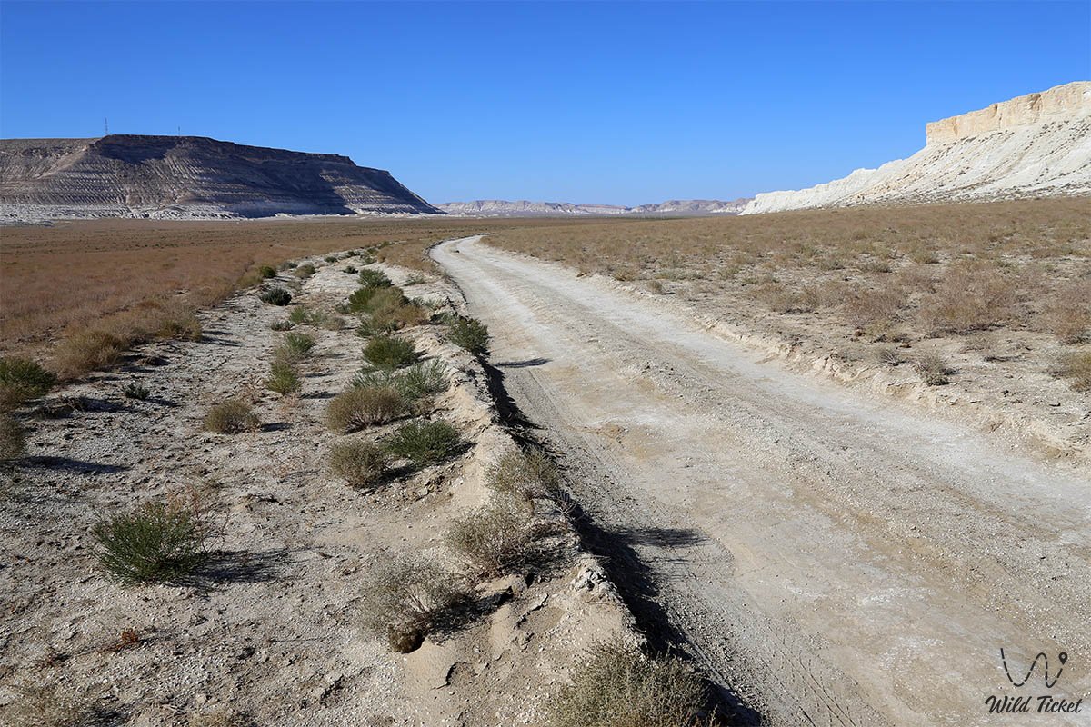
The location fits seamlessly into the circuit of the region's most popular natural monuments. Directly from Mount Akmaya, well-traveled steppe tracks lead into the famous Torysh spherical concretion valley, toward picturesque clay tracts of Akespe and Usak, to the colorful exposures of the Kokala Tract, and to the relict butte of Mount Sherkala.
Heading northwest, travelers reach the deep snow-white Kapamsay Canyon, the Shakpaktysay Gorge with the underground Shakpak-Ata Mosque, Samal Canyon, and Sarytash Bay.
Mount Akmaya owes its unusual shape to eolian processes: locals have long called it the "White Female Camel" (or simply "The Camel"), as from certain angles the contour of the mountain strikingly mirrors the silhouette of a resting dromedary with an outstretched neck or even a line of a caravan traversing the steppe. Standing solitary above the flat sagebrush plain, the mountain attracts travelers with opportunities for panoramic photography, a rest stop on the way to the Caspian Sea, and direct contact with the purest strata of the ancient seabed.
--------------------------------------------
How to Get There and Visit –
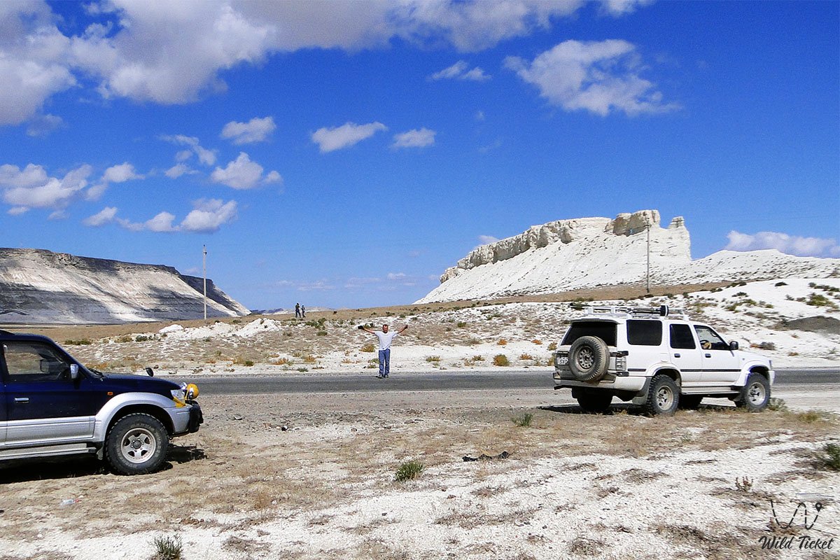
Mount Akmaya is located in the Mangystau District of the Mangistau Region, in the Ulken-Karasay valley, Republic of Kazakhstan. The mountain stands in close proximity to the regional paved highway connecting the city of Aktau with the oil and gas fields of Karazhanbas, Kalamkas, and Northern Buzachi.
The distance from the regional center of Aktau to the base of the mountain is about 115–125 km, around 15 km from the village of Tauchik (and the nearby Tauchik oil pumping station), and about 15 km from the coast of Koshak Bay.
GPS geographic coordinates of Mount Akmaya:
44°22'06"N 51°31'45"E
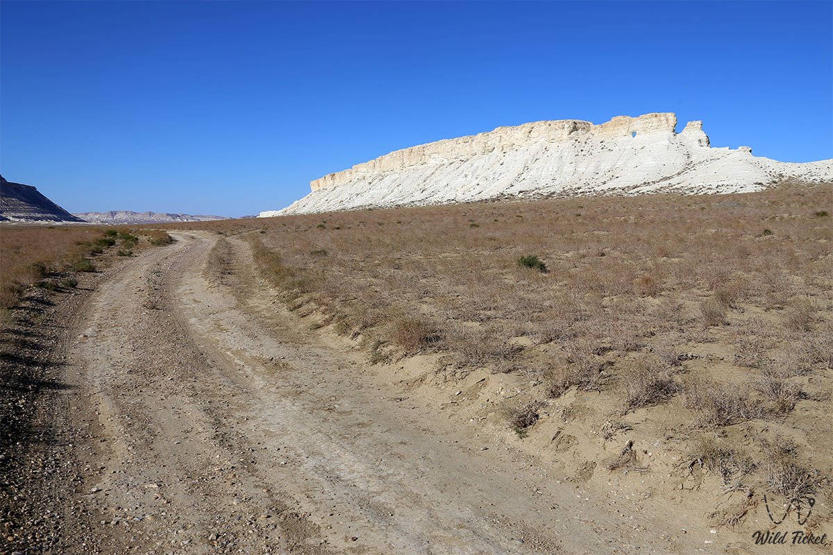
The route from the city of Aktau begins north along the national paved highway through the settlement of Akshukur toward the village of Tauchik (around 95–100 km of high-quality asphalt). Further, the route continues toward the Karazhanbas and Kalamkas fields. Approximately 15 km past the Tauchik area, the snow-white massif of Mount Akmaya appears on the right directly along the course of travel. A farm is clearly visible from the highway, next to which a turnoff onto an unpaved country track is situated: passing past the farm buildings, a field track about 1.5–2 km long leads directly to the foot of the chalk hill. Total travel time from Aktau by car is approximately 1.5–2 hours.
Access roads and terrain passability: thanks to its proximity to the paved highway, reaching the turnoff to the mountain is possible in any standard passenger vehicle throughout the year. The country track from the highway to the base is driven over compacted ground; however, during extended spring or autumn rains, the clay sections of the Ulken-Karasay valley soften significantly, so continuing deeper into the Torysh Valley or toward Kapamsay Canyon strictly requires a four-wheel-drive 4x4 SUV with a minimum ground clearance of 200 mm.
Hiking and ridge ascent: exploring Mount Akmaya does not require technical mountaineering skills. The hill's elevation ranges from 109.7 to 154 m above sea level, and its ridge extends from northwest to southeast for approximately 580 m. Ascending the white chalk slopes takes no more than 15–20 minutes, though caution is required: dry chalk underfoot can crumble and slip. Sturdy trekking boots or trail sneakers with grippy soles are recommended.
Of particular interest to photographers is the natural through-grotto in the rock (the "porthole"), through which expansive views open across the boundless steppe and the spurs of the Yemdy range.
Environmental safety rules: the natural complex of the Ulken-Karasay valley represents a fragile arid-zone ecosystem.
At the base and on the slopes of Mount Akmaya, it is STRICTLY FORBIDDEN to:
– paint inscriptions or scratch names and signatures into the soft chalk strata of the butte;
– drive vehicles off established field tracks onto pristine grass-covered areas of the valley;
– leave behind plastic waste, bottles, bags, and tin cans;
– build open ground campfires during strong steppe winds (cooking is permitted exclusively using portable gas stoves);
– damage the ledges of the through-grotto or provoke collapses of the fragile chalk formations.
Infrastructure: Mount Akmaya stands in the open steppe. The nearest fuel stations, tire repair services, shops, and basic dining spots are located in the village of Tauchik, 15 km to the west. For self-supported camping and picnicking near the mountain, visitors need a drinking water supply of at least 4–5 liters per person per day, a sunshade against midday heat, and an individual first aid kit.
Cellular reception around the mountain and along the adjacent highway is stable. After touring Mount Akmaya, travelers can comfortably set up camp overnight on the wild, pebble-and-sand coast of Koshak Bay on the Caspian Sea, located just 15 km to the west.
Best time to visit is spring and early summer (from late April to mid-June), when the steppe valley of Ulken-Karasay is filled with vibrant colors, wild tulips and wormwood bloom, and daytime temperatures remain comfortable within +20...+25 °C.
The autumn season in September and early October is equally pleasant, offering mild warmth and clear air. In July and August, arid heat sets in, with temperatures across the steppe regularly exceeding +38...+40 °C, and the dazzling white chalk intensely reflects sunlight, placing heavy strain on the eyes.
--------------------------------------------
History
The history of Mount Akmaya traces back into deep antiquity, combining the geological memory of the prehistoric Tethys Ocean with the multi-century chronicle of nomadic paths on the Mangyshlak Peninsula.
During ancient geological epochs, the area was a shallow sea where carbonate beds accumulated layer upon layer. Following the uplift of the seafloor and the emergence of dry land, the low-lying Akmaya hill served as a navigation landmark for early humans across the uniform semi-desert plains.
During the Bronze and Early Iron Ages, the environs of the Ulken-Karasay valley and the foothills of the Yemdy range were actively used by pastoral nomadic tribes. Archaeologists observe that the name "Akmaya" appears in various regions of Kazakhstan as a marker of ancient sacred sites and encampments (including a known Bronze Age complex in Central Kazakhstan). On Mangyshlak, this chalk mountain acted as a guiding beacon for caravans traveling from Caspian coastal camps and Koshak Bay toward the Ustyurt Plateau and the oases of Khwarazm.
During the expansion of the Kazakh Aday tribe in the 17th–19th centuries, Mount Akmaya retained its importance as a vital natural landmark along northwestern seasonal migration routes. Nearby passed the trails of nomadic herders moving herds of horses and camels toward pastures near the Karatau ranges and Sarytash Bay. The through-hole in the rock lent the mountain an aura of mystic mystery: wayfarers often took shelter in the shade of its escarpments from the scorching sun and dust storms.
During the Soviet era and modern times, a strategic highway was constructed nearby, linking the city of Aktau with major northern oil fields – Karazhanbas, Kalamkas, and Northern Buzachi. Today, this historic landmark of the nomads greets geologists, petroleum workers, and tourists from across the globe, remaining an iconic hallmark of the road landscape in the Tupkaragan District and Mangystau District.
Information
From a geological and geomorphological perspective, Mount Akmaya is a relict mesa-butte formed through profound erosion and denudation of the sedimentary cover of the Turan Plate. The development of its constituent rocks took place during the Upper Cretaceous epoch of the Mesozoic Era on the bottom of the Tethys Ocean.
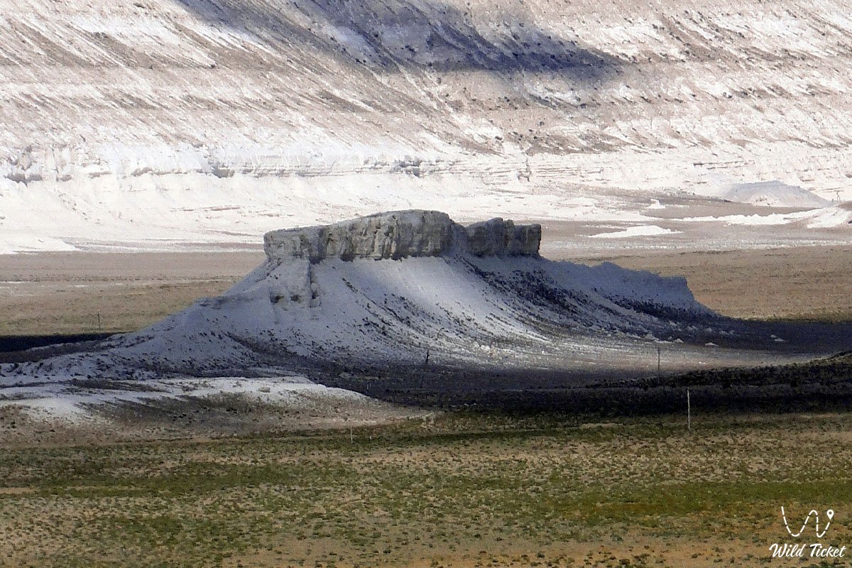
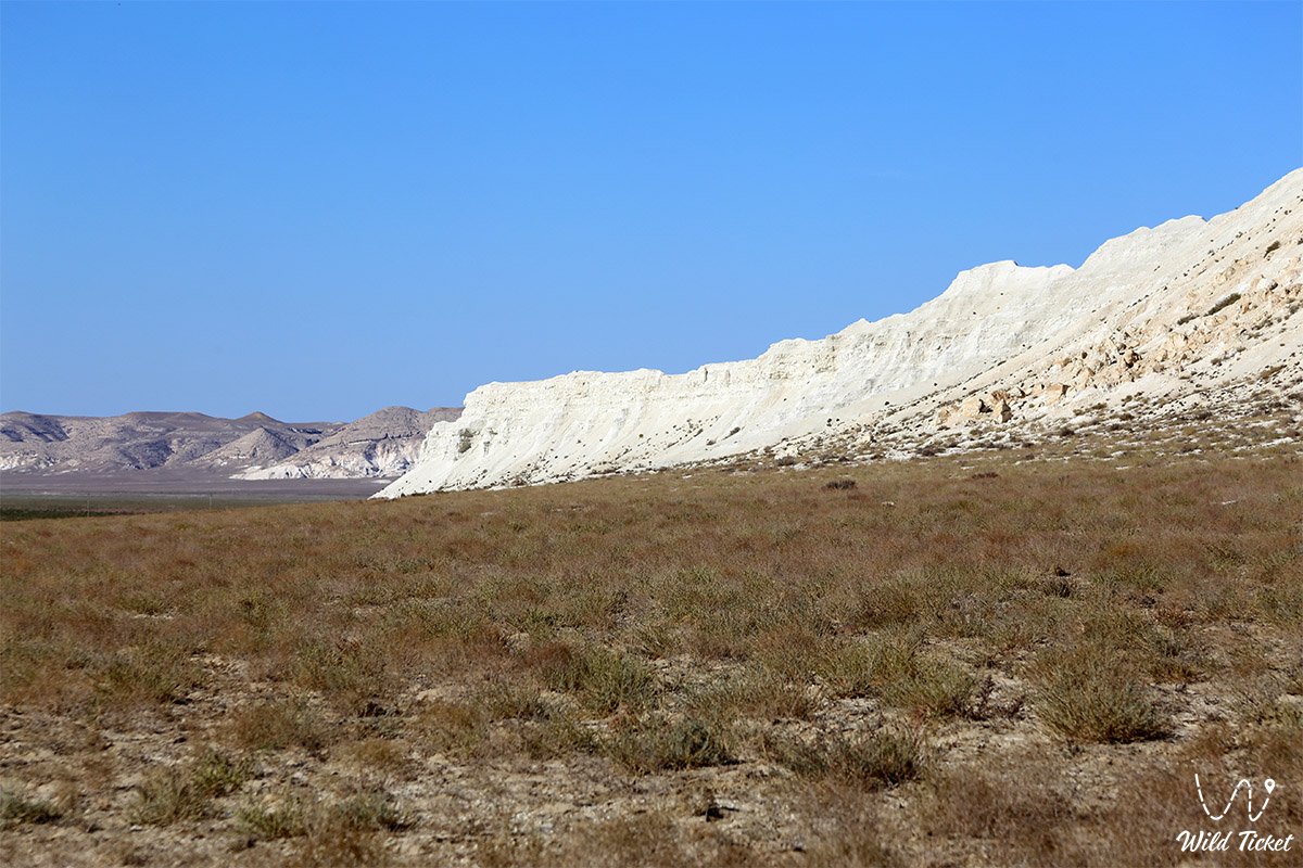
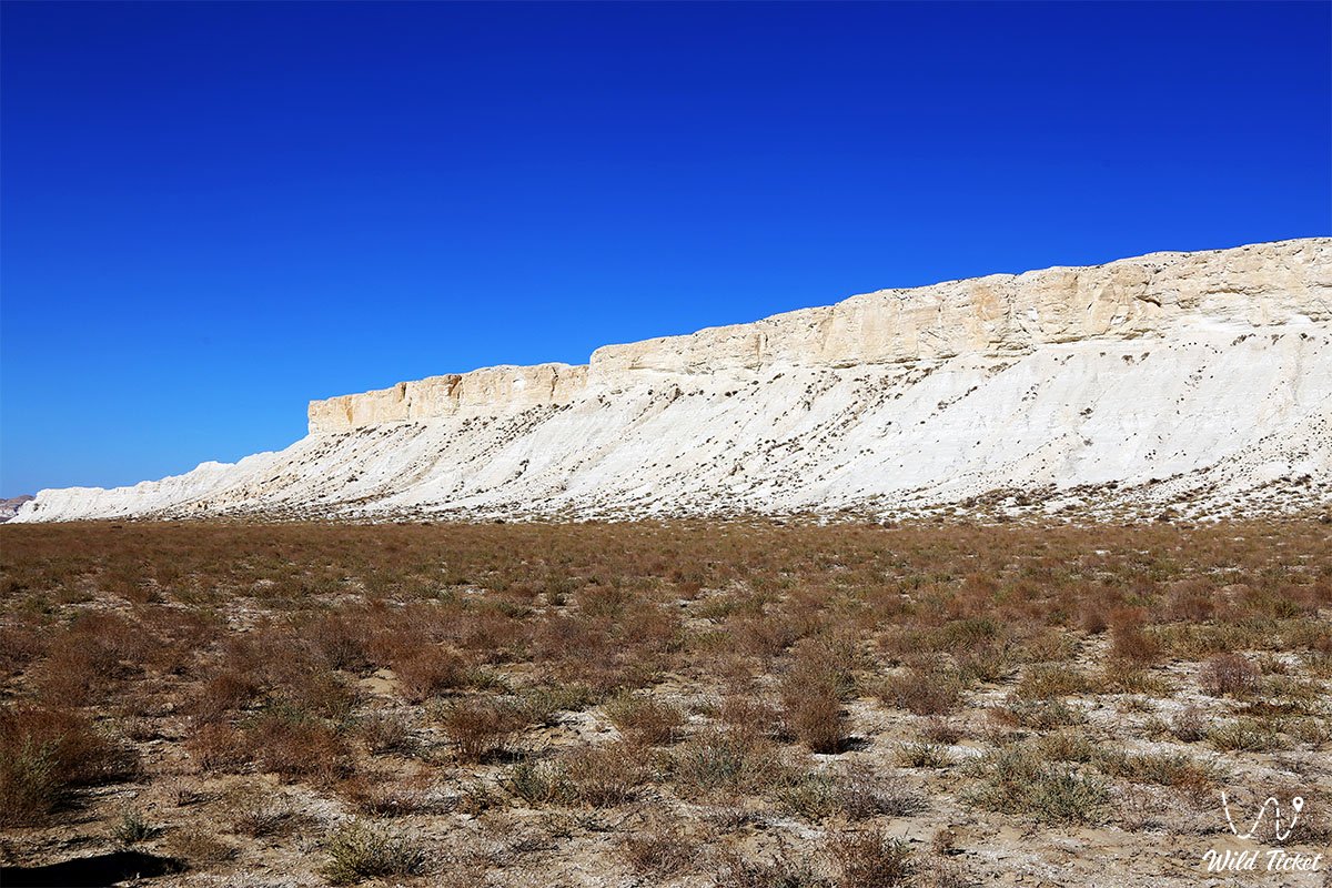
The mass of the mountain is composed of dense writing chalk, marls, and light-toned carbonate limestones. The absolute elevation of the formation ranges from 109.7 to 154 m above sea level. The mountain has a distinct elongated profile: its massive ridge extends northwest to southeast over a distance of approximately 580 m, with a base width of around 150–200 m.
Optical characteristics of the chalk rock give the mountain remarkable visual variability depending on lighting and atmospheric conditions. Under direct sunlight on a clear summer day, the hill appears brilliant white, sharply contrasting against the yellow-green steppe and blue sky. In overcast or cloudy weather, the limestone slopes absorb moisture and diffused light, taking on muted ash-gray, smoky, and warm brownish tones. The primary landmark feature of the mountain is a through deflation-suffosion aperture (grotto) in its ridge, carved out of the soft chalk by persistent steppe winds.
Soil cover around the mountain belongs to the zonal carbonate gray-brown soils of the northern desert subzone, featuring patches of gravelly and clayey takyr-like surfaces.
Climate in the area is temperate desert and arid, with noticeable maritime influence from the adjacent Caspian basin. Winters are relatively mild yet windy, with average January temperatures between -3 and -5 °C. Summers are prolonged, dry, and hot: average July temperatures stand at +26...+28 °C, while maximum daytime peaks under open steppe sun exceed +40 °C. Annual precipitation is minimal, ranging between 130 and 160 mm, with peak rainfall during the spring months.
Detailed Description of the Site
The natural complex of Mount Akmaya includes the following characteristic elements:
• Chalk butte massif of Akmaya – a standalone snow-white elongated hill up to 154 m high and 580 m long, resembling the profile of a resting camel;
• Eolian through-grotto "porthole" – a natural erosional through-hole in the rocky ridge of the mountain, serving as an ancient landmark and scenic observation portal;
• Carbonate scree aprons of the Tethys Ocean – the base of the hill composed of screes of soft writing chalk, marls, and Mesozoic shell fragments;
• Panorama of the Yemdy Range – sweeping views of the higher Yemdy mountain ridge rising 11 km to the northwest, creating a striking contrasting background;
• Clay valley of Ulken-Karasay – a wide semi-desert intermontane basin spreading around the mountain and merging smoothly into the Akespe Tract and Alasa tract;
• Observation points over the transport corridor – open terraces on the slope overlooking the busy Aktau – Karazhanbas highway and limitless steppe horizons.
Flora and Fauna
Vegetation surrounding Mount Akmaya is typical of Turanian carbonate sagebrush and saltwort deserts. On the gentle loam slopes of the Ulken-Karasay valley, communities of gray-soil wormwood, biurgun, boyalych (tree-like saltwort), and prickly Atraphaxis dominate. In sandy-clay depressions, camelthorn (alhági), jointed Anabasis, and eastern saltwort occur. In May, the valley briefly transforms during a short spring bloom: wild Sogdian tulips, desert rhubarb, poppies, and ephemeral grasses blossom against the backdrop of white cliffs.
Wildlife consists of species adapted to the open semi-desert plains of Mangyshlak. Mammals frequently encountered here include the corsac fox, steppe polecat, badger, tolai hare, long-eared hedgehog, and colonies of gerbils and jerboas. Proximity to the mountain massifs of the Yemdy range and Karatau occasionally brings saiga antelopes and Ustyurt mouflons down to the area during quiet morning hours.
Avifauna includes characteristic raptors and open-ground nesting species. Steppe eagles, long-legged buzzards, saker falcons, and common kestrels soar over the white slopes of Akmaya. Nesting among the wormwood bushes on the ground are crested larks, desert wheatears, Eurasian stone-curlews, and black-bellied sandgrouse.
Herpetofauna is diverse: sun-drenched limestone talus supports the Central Asian tortoise, toad-headed agama, rapid fringe-toed lizard, Caspian bent-toed gecko, non-venomous racers (dione and Caspian whip snakes), and the tartar sand boa.
Legend
A beautiful and poignant ancient Kazakh legend associates Mount Akmaya with the White Female Camel and her lost calf.
According to the story, when early nomadic camps first arrived on the Caspian shores, a renowned batyr possessed a sacred white female camel of an extraordinary breed – Akmaya. She possessed immense stamina, capable of traversing waterless sands for days without fatigue, and yielded healing milk that cured every ailment.
One day during a violent sandstorm, her only offspring – a young white camel calf – strayed from the herd and vanished into the boundless steppe. Stricken with grief, Akmaya rushed across the valleys of Mangyshlak, filling the air with mournful cries as she searched for her young. She scaled the crests of the Yemdy mountains, searching the distance in hopes of catching sight of her lost calf.
Exhausted from relentless searching and thirst, the sacred camel sank to her knees in the middle of the Ulken-Karasay valley, turned her head eastward toward the rising sun, and froze in waiting. The ancient spirits of the steppe, moved by her profound maternal grief, transformed the camel into a snow-white chalk mountain so that nothing could ever disturb her peace again. The opening through the rock is said to be Akmaya’s open eye, through which across the ages she continues to watch patiently over the flat steppe expanse, waiting for her calf to return.
Conclusion
Mount Akmaya is an expressive and easily accessible natural monument of Mangistau, blending the geological heritage of the ancient Tethys Ocean, poetic folklore, and the romance of the Caspian region's open highways. A brief stop at the white chalk slopes of the butte rewards travelers with memorable photographs, restful moments in the shadow of ancient strata, and an unforgettable sense of open space.
Interesting Nearby Attractions:
• Torysh Valley of Spherical Concretions;
• Akespe Tract;
• Yemdy Mountain Range;
• Koshak Bay;
• Mount Sherkala;
• Kokala Tract;
• Kapamsay Canyon;
• Shakpaktysay Canyon;
• Sarytash Bay;
• Zhygylgan Tract;
• Samal Canyon;
• Saura Canyon;
• Mount Otpan-Tau;
• Usak Tract;
• Alasa Tract.
Sacred Sites in Mangystau:
• Beket-Ata Underground Mosque;
• Karaman-Ata Underground Mosque;
• Shakpak-Ata Underground Mosque;
• Sultan-Epe Underground Mosque;
• Shopan-Ata Underground Mosque;
• Masat-Ata Underground Mosque;
• Sanctuary of Bayte.
Photogallery: