Glaciers and mountains of Almaty region -
A walk in the Bayankol Gorge -
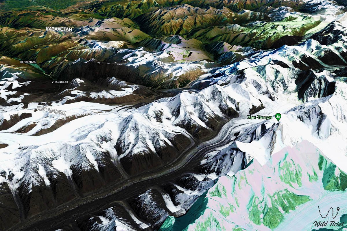
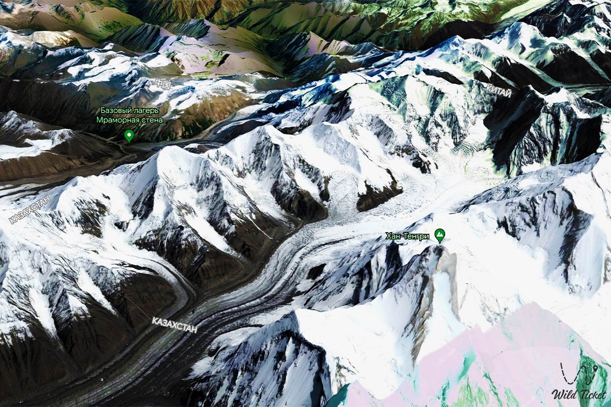
Bayankol Glacier is a mountain glacier located in the upper reaches of the famous Bayankol Gorge. The glacier belongs to the mountains of the Central Tien Shan, the Bayankol River originates from the glacier. The glacier consists of three parts: Central Bayankol, Western Bayankol and Eastern Bayankol. The length of the glacier is 16 kilometers, the glacier is considered huge in its length. The heights here range from 3000 meters to 5500 meters above sea level.
---------------------------------------------
How to get there, visit -
The Bayankol Glacier is located in the mountains of the Northern Tien Shan, Almaty region, the upper reaches of the Bayankol Gorge, the upper reaches of the Sarykoinou River (one of the sources of the Bayankol River), is located on the northern slope of the Saryjaz ridge in the Narynkol district.
GPS coordinates: N42°18'19" E80°11'18"
---------------------------------------------
Information
The length of the Bayankol Central Glacier, which descends from the northern slope of Eleven Peak with a height of 5437 meters above sea level - 4.8 kilometers, an area of 5.4 square kilometers. The upper borders of the Central Bayankol glacier are located in the main ridge of the Saryjaz ridge at an altitude of 5437 meters above sea level. The tongue of the glacier is located at the headwaters of the Sarykoinou River at an altitude of 3389 meters above sea level. The length of the upper border of the glacier along the ridge from the western part of the Eleven Pass and to the western peak of the Eleven Peak is 2.3 kilometers.
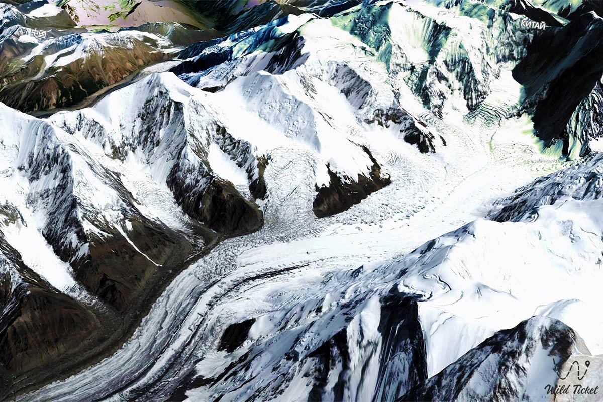
The Bayankol East Glacier is located on the northern slope of the Saryjaz ridge and on the northwestern slope of the Meridional Ridge. The upper boundary of the glacier along the ridge of the Saryjaz ridge stretches from west to northeast. From Bayankol peak with a height of 5790 meters above sea level through Kazakhstan peak with a height of 5769 meters above sea level, a mark of 5450 meters above sea level, Karlytau peak with a height of 5550 meters above sea level and after 13 kilometers connects to the Meridian Ridge.
The length of the upper border of the Bayankol West Glacier is 15 kilometers. The border begins west of the summit of the Western Peak of Eleven with a height of 5428 meters above sea level in the main ridge of the Saryjaz ridge. It passes further through a mark with a height of 5163 meters above sea level, then through a mark of 5437 meters above sea level. From the 5437 marks, the border moves northwest along the main ridge of the Katta-Ashutor ridge through a peak with a height of 4651 meters above sea level and ends in the southwest from Alaskuz peak with a height of 4520 meters above sea level. The length of the northernmost part in the group of Eastern glaciers is 5.2 kilometers. This glacier is the smoothest and most gentle among the Bayankol glaciers. The tongue of the Western Bayankol glacier is located at an altitude of 3551 meters above sea level.
Photogallery: