Katta-Ashutor ridge in the Saryjaz Mountains -
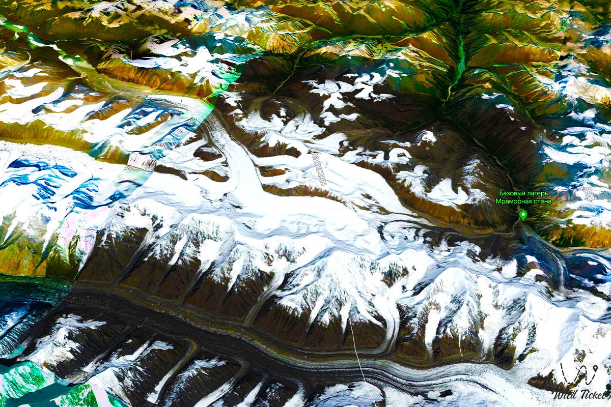
Glacier in the Katta-Ashutor ridge -
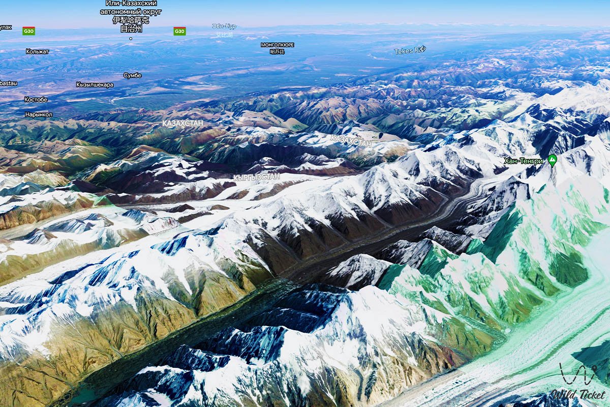
Katta-Ashutor is a mountain range located in the eastern part of the Sary-Jazz ridge, the heights that prevail here are over 5000 meters above sea level. The main ridge of the ridge stretches for 28 kilometers from an altitude of 5437 meters above sea level to the Ashutor Zapadnaya River from southeast to northwest. Altitude 5437 is located 2.2 kilometers to the east and just north of Semenov Peak with a height of 5816 meters above sea level, in the eastern part of the Saryjaz ridge.
---------------------------------------------
How to get there, visit -
Katta-Ashutor ridge is located in the mountains of Almaty region, Sary-Jazz ridge, Central Tien Shan Mountains, Raimbesky district, Kegensky district, Bayankol gorge area.
GPS coordinates: N42°18'35" E80°06'38"
---------------------------------------------
Information
The western border of the Katta-Ashutor ridge is the western edge of the Semenov Glacier, stretching from northwest to southeast for 19.7 kilometers. The northern and north-western border of the ridge is the valley of the Ashutor Western River with a length of 11.2 kilometers, which is the right tributary of the Saryjaz River. The southern border of the ridge is the main ridge of the Sarydzhaz ridge in the vicinity of Semenov Peak, height 5437 and the upper reaches of the Semenov Glacier.
The state border between the Kyrgyz Republic and the Republic of Kazakhstan runs along the ridge. Most of the ridge, its entire eastern and northeastern part, is located on the territory of Kazakhstan. The southern part of the ridge is under extensive glaciation, glaciers drain from the main ridge to the west and east forming valley glaciers.
In the north-western part of the ridge on the territory of Kazakhstan there is the Ashutor glacier, which consists of two branches: the Western Ashutor with a length of 4.6 kilometers and the Eastern Ashutor with a length of 5.4 kilometers. On the territory of Kyrgyzstan, at the westernmost tip of the ridge, there is the Ashutor glacier consisting of three branches. From the north-eastern slope of the ridge flows the Bayankol Western glacier with a length of 11 kilometers. The Katta-Ashutor ridge is a watershed between the Saryjaz rivers in Kyrgyzstan and Bayankol in Kazakhstan.
Photogallery: