Mountain routes in the mountains of Kazakhstan -
Expeditionary mountaineering in Kazakhstan -
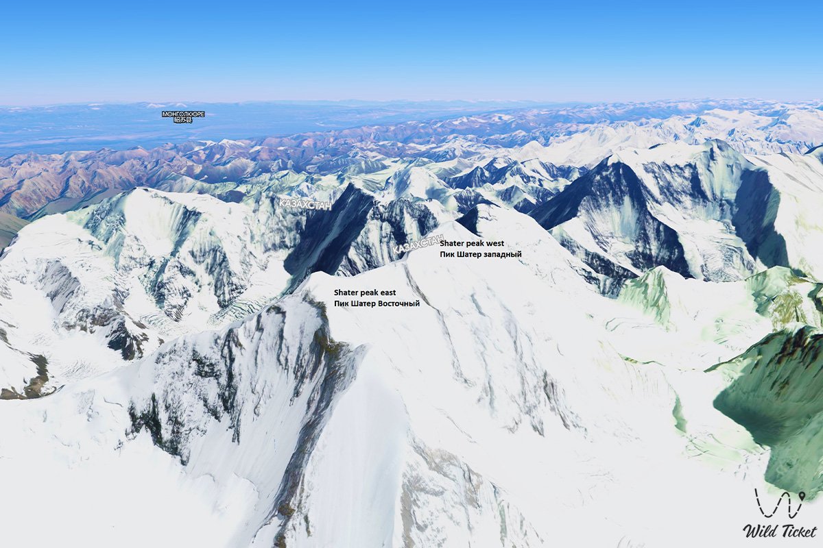
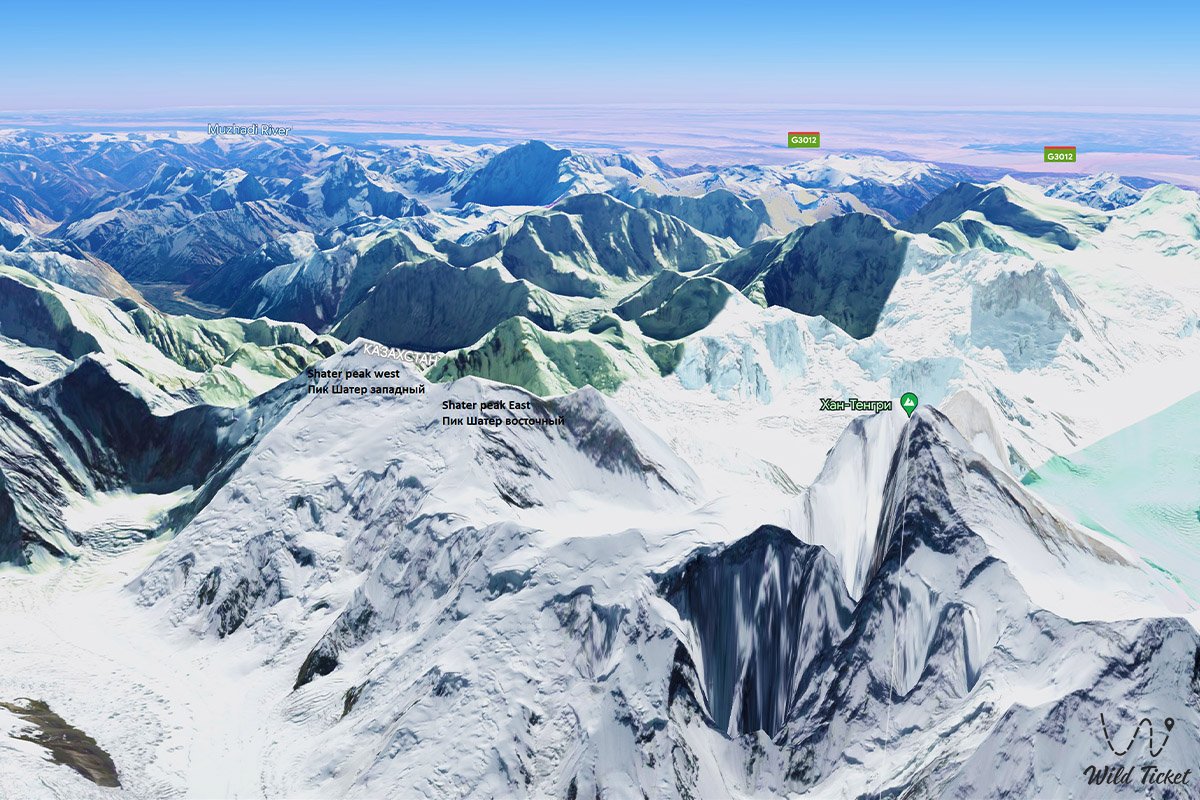
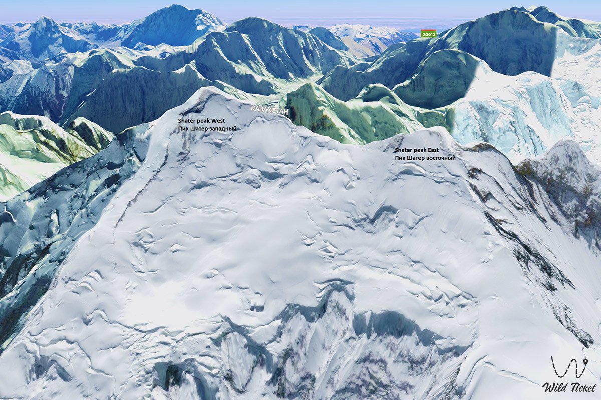
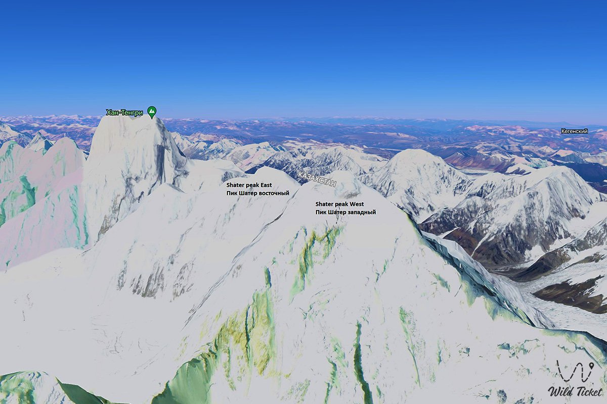
Peak Shater (Western) is a mountain peak, the height of the mountain is 6511 meters above sea level, located next to the Khan-Tengri peak, the mountain is part of one ridge. In the main ridge of the Tengri-Tau ridge, at a distance of 6 kilometers to the east and a little north of the top of Khan-Tengri, there is a peak under the general name of Shatry. In turn, the peak loses its individuality and is divided into two independent peaks - the Western Shater and the Eastern Shater.
---------------------------------------------
How to get there, visit -
Western Shater Peak is located in the mountains of the Dzungarian Alatau, in the easternmost part of the Tengri tau ridge in the Narynkol district, Almaty region.
GPS coordinates: N42°13'01" E80°13'34"
---------------------------------------------
Information, history
The classic route of the peaks is rated 5B difficulty category. The state border between the Republic of Kazakhstan and the Republic of China passes through the peak from northeast to east. From the northern slopes of the peak, located in Kazakhstan, the sources of the Northern Inylchek glacier begin, 42 kilometers long and 11 kilometers through the territory of Kazakhstan.
The first ascent to Shater Peak was made in 1968 by a Kazakh team led by G. Kireev. In 1968, the first traverse of the tops of Shatra - Khan-Tengri was made. This traverse of the 6th category of difficulty, made by the team of CA DSO Spartak under the guidance of B. A. Studenin (coach) as part of the team: A. Afanasiev, V. Zapeki, V. Popov, V. Tokmakov, E. Ilyinsky, E. Kambarov, A Toporkova. The team won first place and gold medals in the traverse class in the Championship of the Soviet Union.
Shater West Peak is closest to the dominant peak in the ridge - Khan-Tengri Peak, which is 4.5 kilometers away from it (in a straight line) to the west and a little to the south. The distance from the top of the Western Shater to the top of the East Shater is 1.8 kilometers. From a peak with steep avalanche-prone slopes resembling a tent, an almost vertical rocky wall breaks off to the west, ending at an altitude of 5692 meters above sea level on the Razorvanny glacier, which is located under the eastern slopes of Khan-Tengri peak.
Photogallery: