14th-century archaeological monument and medieval seaport –
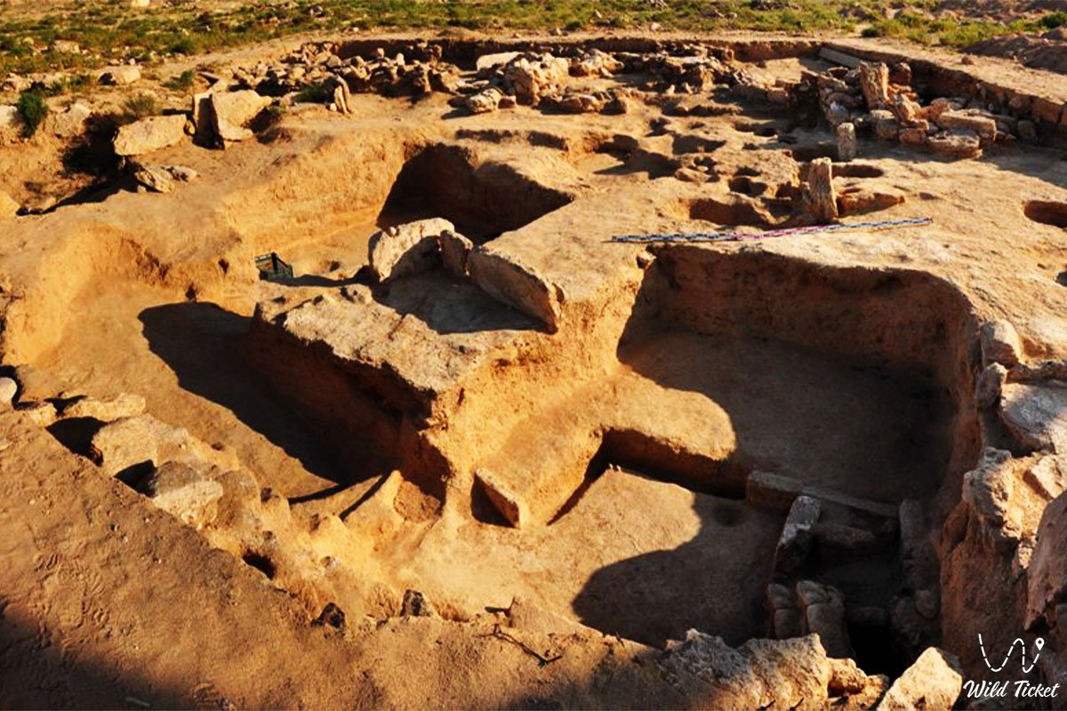
The Ketikkala settlement (also recorded in historical and scientific sources as Kettikkala, Ketik-kala) represents a medieval archaeological monument from the middle and second half of the 14th century, situated on the Mangyshlak Peninsula in the Tupkaragan district. Sprawling along the shores of Bautino Bay in close proximity to the village of Bautino and the town of Fort-Shevchenko, this ancient coastal hub served as the only known maritime port-city across the boundless Kazakh steppes during the zenith of the Golden Horde.
According to the authoritative conclusion of renowned Kazakhstani archaeologist Andrey Astafyev, who directed extensive excavations at the site, Ketikkala was a direct historical prototype of the modern Aktau International Sea Commercial Port, connecting five Caspian littoral states of the medieval world into a single trade and transport network.
Originally, the city occupied an impressive territory of approximately 16 hectares for its era, functioning as a bustling trade and handicraft hub. However, due to natural erosion and human land-use activities, only about 2–3 hectares of the cultural layer have survived to the present day.
The ruins of the ancient settlement attracted researchers long before academic expeditions began: during his seven-year exile on Mangyshlak, Ukrainian poet and artist Taras Shevchenko visited this location and sketched the picturesque ruins of its medieval stone edifices.
The port's geopolitical and navigational importance stemmed from its deep-water setting in Bautino Bay on the Caspian Sea, securely sheltered from the ferocious storms of the open waters. By sea, the city received sturdy merchant vessels arriving from Iran, Azerbaijan, the lower Volga capital of the Golden Horde (Sarai), and the port of Saraichik on the Zhaiyk (Ural) River. By land, active caravan routes linked the port with wealthy oasis cities across Khwarazm.
Today, the Ketikkala settlement is recognized as a vital monument of Eurasian historical and cultural heritage, visually substantiating the presence of advanced maritime trade and urban culture in western medieval Kazakhstan.
--------------------------------------------
How to get there and visit –
The Ketikkala settlement is situated on the western shore of the Tyubkaragan Peninsula in the Mangystau region, right on the Caspian Sea coastline between the village of Bautino and the town of Fort-Shevchenko, Republic of Kazakhstan.
The distance from the regional center – the city of Aktau – is roughly 140–145 kilometers in a northwesterly direction.
GPS geographical coordinates: 44°31'33"N 50°15'54"E
The road from Aktau to Fort-Shevchenko is entirely paved and open to all passenger vehicles year-round, requiring about two hours of travel time. From Fort-Shevchenko and the Bautino docks, unpaved dirt turnoffs lead to the archaeological area over a distance of 2–3 kilometers.
To visit the ruins of Ketikkala in dry conditions, a standard passenger car or crossover is fully sufficient. However, if travelers intend to pair their visit to the medieval port with off-road routes to Kapamsay canyon, the Zhygylgan sinkhole, or the underground rock mosques of Shakpak-Ata and Sultan-Epe, a prepared 4x4 vehicle with high ground clearance is recommended.
The village of Bautino and the town of Fort-Shevchenko offer well-developed amenities, including hotels, cafes, grocery stores, gas stations, and pharmacies. Mobile network coverage remains consistent around the monument.
The site requires conscientious care: during the Soviet decades, a sand quarry operated on the northern section of the settlement, and part of the land was subsequently used for construction waste disposal. Currently, the surviving 2–3 hectare perimeter requires ongoing conservation, perimeter fencing, and protective roofing to safeguard the fragile walls of stone and friable strata from sun, rain, and wind.
The best time to travel is spring (from April to early June) and autumn (September – October).
--------------------------------------------
History
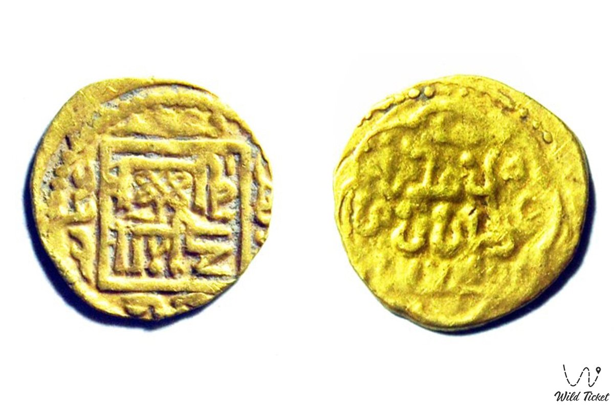
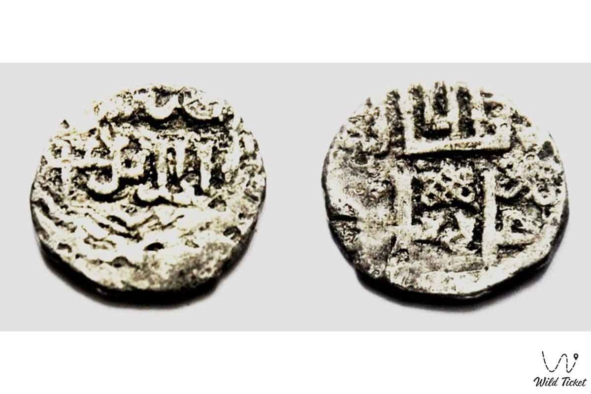
The historical heyday of Ketikkala was intimately tied to the dominance of the Golden Horde. Drawing upon comprehensive numismatic finds, archaeologists date the active lifespan of the port to the middle and second half of the 14th century, principally corresponding to the reign of Khan Jani Beg.
The archaeological remains of the port were first documented scientifically in the 1980s by a Moscow expedition led by Lev Galkin; however, excavations were soon suspended. Kazakhstani scholars began systematic investigations of the site in 2008, followed in 2014–2015 by large-scale field campaigns directed by archaeologist Andrey Astafyev under a regional three-year heritage program.
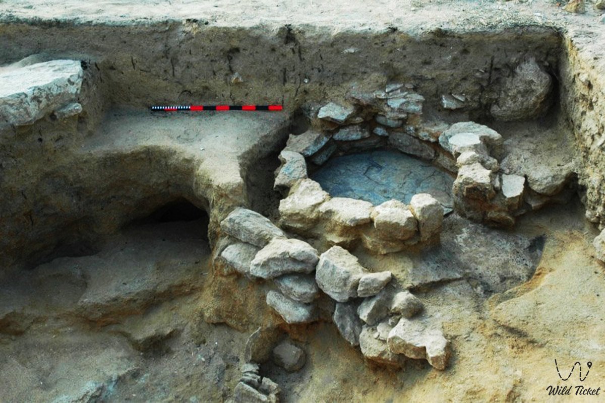
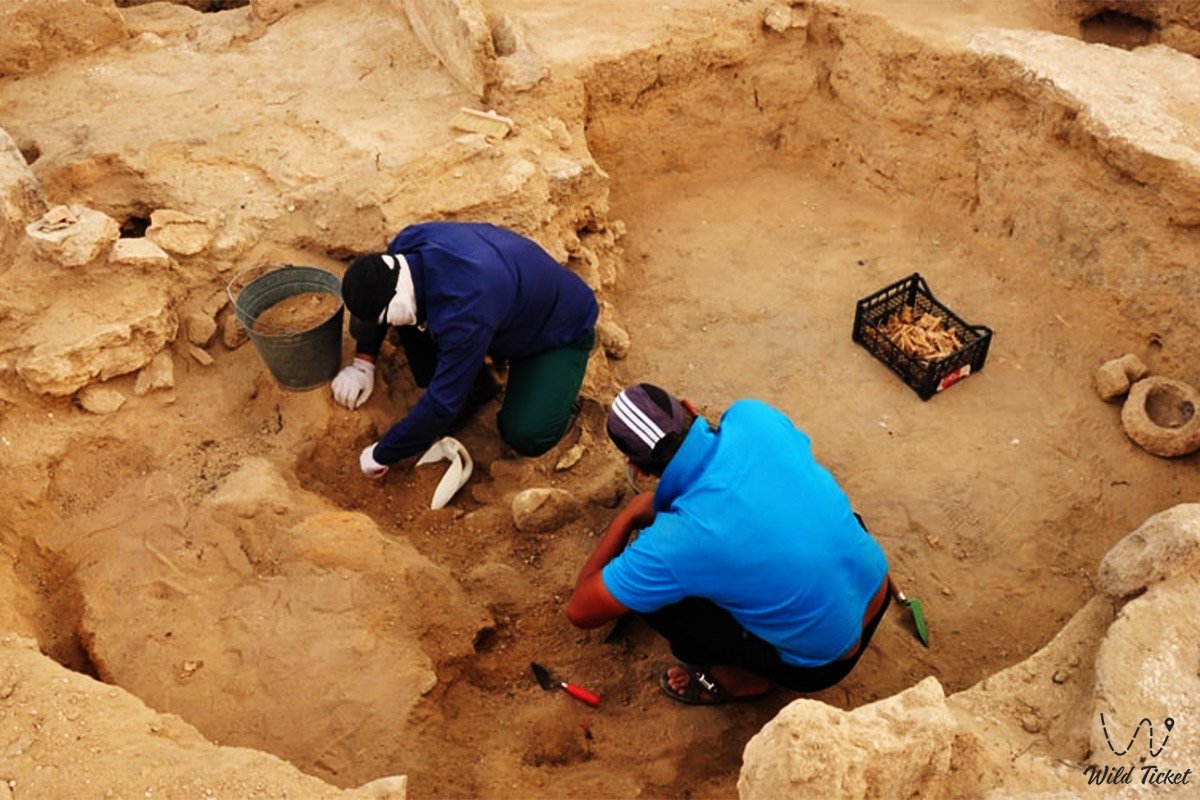
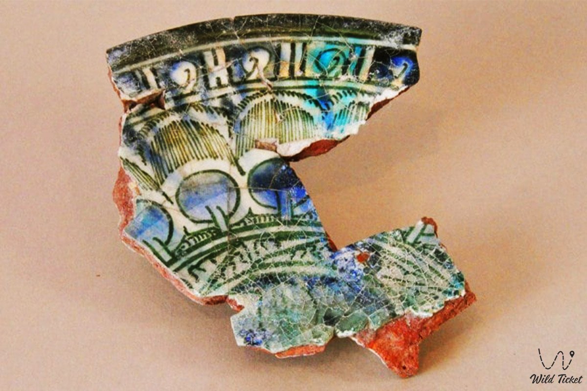
During the 2015 field season, Astafyev excavated more than 300 square meters of the settlement, unearthing structural foundations of residential homesteads and port facilities, thereby verifying the hypothesis of continuous sea routes. The city served as a pivotal crossroad connecting five medieval realms: maritime fleets arrived from Iran, Derbent, and Shirvan (Azerbaijan), as well as the Lower Volga and Saraichik, while overland camel trails stretched to Khwarazm, which supplied large volumes of Khwarazmian coinage and distinctive glazed ceramics.
Close to Ketikkala lies another ancient settlement, Kozgantas, dating from the 10th to 13th centuries. Future investigations here could demonstrate that Caspian navigation along the Mangyshlak coast emerged well before the Golden Horde period.
Information
Geomorphologically, Ketikkala occupies a gentle marine terrace bordering Bautino Bay within the Tyubkaragan Gulf of the Caspian Sea. Sheltered by the natural coastal curvature, the bay provided optimal harbor conditions for anchoring heavy trading ships and longboats.
The cultural layer of the settlement is rich in everyday artifacts of the seafaring population. Excavations have yielded immense quantities of domestic animal bones and sturgeon skeletal remains, underscoring Caspian fisheries as a cornerstone of local sustenance and commerce.
A major archaeological discovery was the recovery of 10 broken stone millstones used for milling grain into flour. As researchers emphasize, transporting bulk grain by sea was commercially unviable due to low profit margins and volume constraints; flour was imported pre-milled. The presence of multiple heavy millstones provides direct evidence that the climate of Mangyshlak in the 14th century was significantly more temperate, allowing local residents to cultivate cereal crops, especially wheat, directly in the area.
The climate around the site is arid and maritime moderately continental. Coastal breezes temper the summer heat (+26...+30 °C), while winters remain milder than on the interior Ustyurt Plateau owing to the thermal mass of the Caspian Sea. Nevertheless, recurring winds generate elevated erosional strain on unroofed masonry walls.
Detailed description of the venue
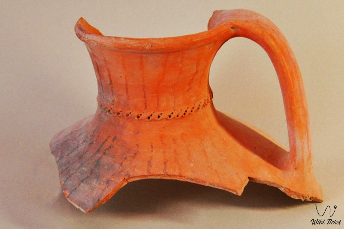
The material culture of Ketikkala reflects expansive geographic ties and rich finds:
• Numismatic collection – gold, silver, and bronze coinage minted in Volga cities of the Golden Horde, as well as Khwarazmian monetary issues largely dating to the era of Khan Jani Beg.
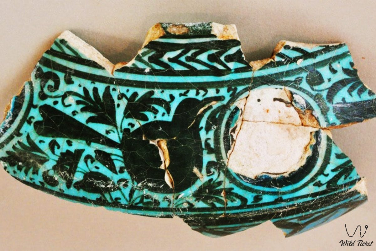
• Luxury goods and imported wares – exquisite Chinese porcelain from the Yuan dynasty, decorated tableware from Khwarazm, and objects overlaid with fine gold leaf.
• Exotic Indian Ocean corals – branch segments of natural red corals. One recovered sample was wave-rounded, while two others preserved sharp, freshly cut fracture surfaces. Because corals never grew in the colder Caspian waters, they were transported across thousands of kilometers from the Indian Ocean basin via the Persian Gulf and Iranian merchant markets. In that era, coral ranked as a precious gemstone and commanded enormous wealth. Coral branches up to half a meter in length were also documented on Kulaly Island and inside the historic church of Nikolayevskaya Stanitsa (Bautino).
• Maritime merchant fleet – all vessels delivering overseas commodities to the port were constructed in Iran. Persian shipwrights of that era were uniquely adept at building heavy seagoing vessels capable of withstanding the Caspian's severe year-round storms for weeks at sea.
• Stone architecture and harbor life – solid foundations constructed from coquina limestone and porous stone strata, domestic hearths, and residential quarters for port administrators, merchants, and customs officials.
Flora and fauna
Vegetation surrounding the settlement is representative of coastal semi-deserts: Lerche's wormwood, Caspian saltwort, boyalych, sea lavender, biyurgun, and camelthorn (dzhantak) predominate. Glassworts and reed clusters grow along the shoreline.
Wildlife is closely tied to the Caspian marine ecosystem: valuable sturgeon (beluga, Russian sturgeon, stellate sturgeon), pike perch, Caspian roach (vobla), and mullet inhabit the waters year-round. Yellow-legged gulls, cormorants, grey herons, and waders nest along the shallows and sandbars of Bautino Bay. In winter and early spring, Caspian seals appear on the sandy spits of Tyubkaragan and near Kulaly Island.
Legend
An old maritime legend regarding a sunken Iranian coral caravan is linked to Ketikkala's sea lanes and Kulaly Island, situated 30 kilometers offshore. Lore recounts that a merchant fleet laden with treasures, Chinese silk, and half-meter branches of precious red coral was engulfed by a ferocious nighttime storm upon approaching Bautino Bay. The flagship struck underwater reefs near Kulaly Island and sank to the seabed. For centuries thereafter, stormy Caspian waters cast coral fragments onto sandy spits, inspiring a belief among local Cossacks and fishermen that sacred spirits of the Caspian continue to safeguard the sunken wealth of the merchants beneath the waves.
Conclusion
The Ketikkala settlement is an authentic archaeological sensation of the Mangystau region, reviving Kazakhstan's legacy as an ancient maritime realm. Serving as the lone Golden Horde seaport within the steppes, it proved that a crucial maritime artery of the Great Silk Road traversed Tyubkaragan, linking the civilizations of East and West.
A visit to this historical site offers a direct encounter with early Caspian maritime chronicles, allowing travelers to inspect the foundations of ancient homesteads and experience the heritage of past centuries amid the salty coastal wind.
Interesting sights nearby:
• Caspian Sea;
• Village and Seaport of Bautino;
• Zhygylgan Fallen Land;
• Traces of Ancient Animals in the Zhygylgan Tract;
• Tyubkaragan Peninsula;
• Cape Tyubkaragan;
• Cape Bagarzhik;
• Cape Sagyndyk;
• Mangyshlak Bay;
• Seal Islands;
• Kazakh Bay;
• Kenderli Bay;
• Blue Bay;
• Adamtash Monk Rock.
Photogallery: