Harsh rocky outpost on the coast of the Caspian Sea with a dramatic history –
Cape Tupkaragan (Kaz. Tupqaraghan, in historical sources also Tuk-Karagan, Tyup-Karagai) represents the extreme northwestern tip of the Mangyshlak Peninsula, jutting deeply into the open waters of the Caspian Sea in the Tupkaragan district. Situated north of Bautino Bay and the historical town of Fort-Shevchenko, the cape serves as a key natural and maritime navigational landmark of the eastern Caspian coast.
For centuries, this austere rocky scarp served as the primary beacon and natural guiding point for seafarers navigating through the stormy sea from Astrakhan, Derbent, Baku, and the ports of Persia.
Geographically, Cape Tyub-Karagan crowns the eponymous Tyubkaragan Peninsula, washed by the cold currents of the northern and middle waters of the Caspian Sea. The landscape of the cape was formed by thick strata of Neogene coquina limestones, weathered marls, and clays left behind after the retreat of the ancient Tethys Ocean. The sheer precipices of the cape, soaring tens of meters above the foaming waves of the Caspian, plunge into the marine abyss in stepped stone ledges and fields of cyclopean rock fragments polished for centuries by ferocious surf.
The toponymy of the name is rooted in the Turkic languages: according to one widespread version, "Tupqaraghan" translates as "caragana bush" (steppe acacia), thickets of which historically covered the rocky ravines; according to another version, the root "tyub" denotes "base", "bottom", or "summit", while "karagan" means "observation post" or "guard", which perfectly describes the profile of the cape rising above the Caspian Sea like a colossal stone sentinel-warrior.
The primary historical and engineering landmark of the cape is the Upper and Lower Tyubkaragan lighthouses, erected in the second half of the 19th century to ensure safe navigation across a complex nexus of Caspian shoals, submerged reefs, and sand spits. It was in the vicinity of Cape Tyub-Karagan in May 1716 that the famous expedition of Prince Alexander Bekovich-Cherkassky made landfall, establishing the first Russian fortification of Saint Peter on the eastern shore of the sea.
Today, Cape Tyub-Karagan attracts travelers with stunning vistas of the boundless azure Caspian, salty winds, the romance of historic lighthouses, and the primeval energy of the edge of the world, where the steppe meets the marine deep.
--------------------------------------------
How to get there and visit –
Cape Tyub-Karagan is situated on the northwestern edge of Mangyshlak in the Mangystau region, approximately 150 kilometers northwest of the city of Aktau. The nearest base settlements are the village and seaport of Bautino (8–10 km to the southwest) and the town of Fort-Shevchenko (11–15 km to the southwest).
GPS geographical coordinates: 44°38'18"N 50°19'00"E
The main route from Aktau to Fort-Shevchenko and Bautino village runs along a high-quality paved highway of republican significance, taking about two hours in any passenger car. Beyond Bautino toward the cape lead compacted stony-dirt steppe roads and tracks laid across the summits of limestone plateaus and coastal terraces.
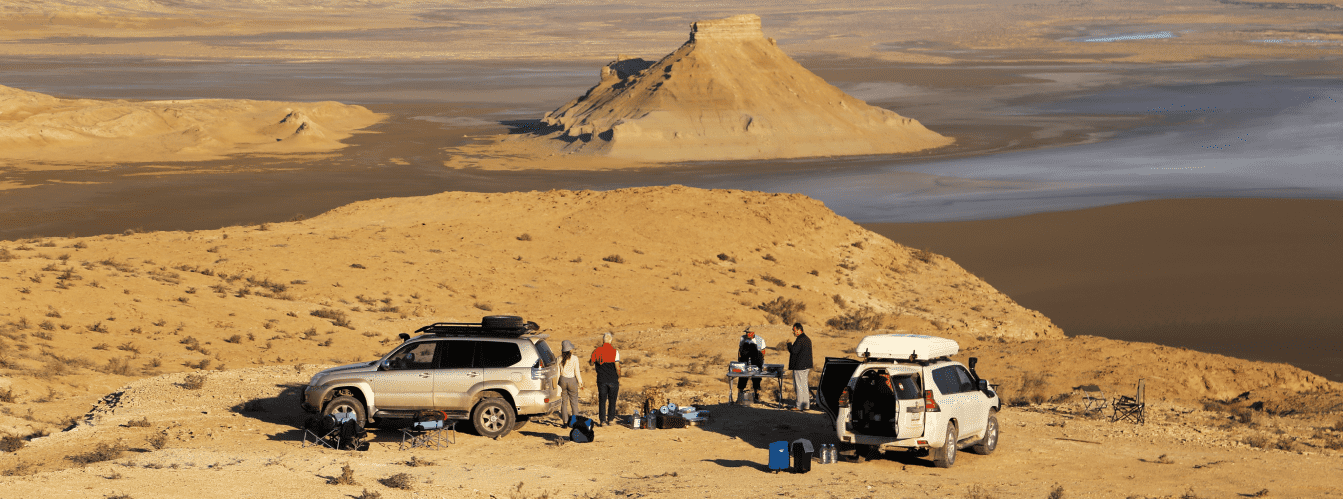
For a trip directly to the cliffs of Cape Tyub-Karagan and the Upper Lighthouse in dry weather, a crossover or a vehicle with increased ground clearance is suitable. However, for navigating rocky descents to the sea, sandy segments, and continuing along the northern coastline of the peninsula, it is strongly recommended to use a dependable four-wheel-drive off-road vehicle (4x4) with durable all-terrain tires (AT/MT) and skid plates, as sharp coquina limestone shards and rocks pose a puncture hazard.
Travelers can find basic infrastructure (hotels, cafes, grocery stores, gas stations, tire repair shops) in nearby Fort-Shevchenko and Bautino. Directly on the cape, tourist infrastructure is absent: this is a harsh, wind-swept wild coastal zone.
At the tip of the cape, mobile network reception can be unstable; therefore, it is necessary to carry autonomous offline maps, a drinking water supply (no less than 4–5 liters per person), and windproof clothing.
The best time to visit is spring (from late April to early June), when the steppe turns green and the air is filled with the scent of blooming herbs, and warm autumn (September – October) with clear skies and transparent sea water.
In summer, daytime heat reaches +35...+40 °C; however, the proximity of the open sea and steady sea breezes make being outdoors more comfortable than in the basins of interior deserts.
--------------------------------------------
History
The history of Cape Tyub-Karagan extends deep into millennia. Archaeologists have discovered numerous Paleolithic sites across the plateau with flint cores, flakes, and scrapers belonging to primitive hunters. In antiquity and the Middle Ages, the cape became a vital junction on the caravan route "from Khiva to the Rus": here, the arduous desert trek on camels came to an end and the transshipment of goods onto vessels sailing by sea to the mouth of the Volga began.
In May 1716, by decree of Emperor Peter I, the fleet of the Caspian Military Expedition led by Prince Alexander Bekovich-Cherkassky approached the cape. Near the cape, the first Russian fortress of Tyub-Karagan with earthen ramparts and redoubts was founded. However, the garrison faced severe trials: a rampant pestilence from disease began, the threat of attacks by nomadic Turkmen hung over from the steppe, and news of the demise of Bekovich-Cherkassky's detachment in the Khiva Khanate forced the command in 1717 to level the fortification completely and evacuate the garrison to Astrakhan.
In 1846, near the cape on the shore of the bay, Captain M. I. Ivanin founded the Novo-Petrovskoye fortification, renamed in 1857 to Fort-Aleksandrovsky (now Fort-Shevchenko). Between 1850 and 1857, the Ukrainian writer and artist Taras Shevchenko served his exile here. The poet planted a shaded orchard near the fort and created outstanding graphic and watercolor works. Art historians have given special acclaim to his nocturnal watercolor "Cape Tyup-Karagai on the Mangyshlak Peninsula" (1856–1857), where to convey the moonlight glints upon the Caspian waves Shevchenko employed a unique technique of scratching away the dark pigment layer down to the white paper.
A paramount chapter in the chronicle of the cape was the construction of the Tyub-Karagan lighthouses. Located 4.6 kilometers south of the cape (8 km northeast of Bautino) on a commanding highland, the first Upper Tyub-Karagan Lighthouse was erected in 1851. Its fate proved dramatic: a landslide along the eroded cliff caused the tower to collapse into the sea. The second permanent stone lighthouse entered service in 1863. In April 1870, the lighthouse was set ablaze by participants in the Aday Uprising on Mangyshlak, and in 1929 it survived an attack and gunfire from Basmachi detachments.
Following the construction of the Trans-Caspian Railway, the significance of the caravan branch through the fort declined, and local inhabitants concentrated on harvesting fish, seal blubber, and dispatching them to Astrakhan. During the Soviet years, the cape remained an off-limits zone, preserving its pristine nature.
Information
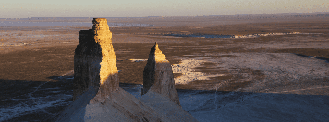
Geomorphologically, Cape Tyub-Karagan represents a narrow, elongated massif of Sarmatian coquina limestones and sandstones terminating at the Caspian Sea in stepped scarps. The height of coastal cliffs reaches 20–30 meters, while the cliffs of the Zhygylgan tract situated further east soar to 180–200 meters above sea level. Under the action of surf, coastal cornices periodically collapse in colossal blocks over 10 meters high, forming chaotic stone breakwaters.
The climate of the cape area is extra-continental, semi-arid, and sharply dry. Annual atmospheric precipitation does not exceed 100–150 mm. Winter is moderated by the ice-free sea basin, while in summer the Caspian tempers peak temperatures, creating a steady circulation of fresh marine air.
The ecology of the cape is fragile: coastal cliffs are prone to crumbling under the wheels of heavy vehicles, and vegetative cover recovers extremely slowly. Owing to the remoteness and purity of the surrounding waters, the shores of the cape serve as a vital ecological sanctuary for rare wildlife representatives.
Detailed description of the venue
The landscape and historical ensemble of Cape Tyub-Karagan encompasses several landmark features:
• Westernmost rock of Tyub-Karagan – a twenty-meter monolithic rock promontory surrounded on three sides by the marine deep, serving as the geographical boundary of Mangyshlak.
• Upper Tyub-Karagan Lighthouse – the oldest active stone lighthouse in Mangystau, built in 1863 on a commanding hill, having survived uprisings and armed assaults.
• Lower Tyubkaragan Lighthouse – a leading line navigation complex near the water's edge that ensured the safe piloting of vessels through reefs.
• Site of Fort Tyub-Karagan (1716–1717) – the historic campsite and fortifications area of Prince Alexander Bekovich-Cherkassky's expedition.
• Rock screes and cyclopean boulders – ten-meter limestone monoliths that broke off from cliffs into the frothing surf, coated with salt crusts and algae.
• Mulla-Tash Rock – a distinctive remnant rock stack south of the cape, also immortalized in drawings by Taras Shevchenko.
• Ancient Paleolithic campsites – surface scatters of Stone Age flint tools and flakes on the plateau at the base of the cape.
Flora and fauna
The vegetation cover of the cape is typical of coastal stony deserts. Wormwood, saltworts, biyurgun, itsegek, and camelthorn (dzhantak) occur everywhere. In wind-sheltered fissures and ravines, relict bushes of steppe caragana (acacia), which gave the cape its name, have been preserved.
The animal kingdom is rich in rare species. Colonies of Caspian gulls, Pallas's gulls, and great cormorants settle on the coastal cliffs. Birds of prey regularly soar in the sky: eastern imperial eagle, golden eagle, steppe eagle, and saker falcon.
In the transparent waters of the Caspian Sea surrounding the cape live valuable sturgeon species (beluga, Russian sturgeon, stellate sturgeon), pike perch, carp, mullet, and Caspian roach. On the rocky shoals and secluded stone slabs of the cape, Caspian seals (nerpas), listed in the Red Book of Kazakhstan, regularly bask in the sun.
Legend
An ancient tale about the stone sentinel of the Caspian is associated with Cape Tyub-Karagan. Legend recounts that in the days when merchant caravans traveled from Khiva to the sea, a noble batyr stood on the edge of the cliff, guarding the shore against pirates and lighting signal fires in foul weather. When a treacherous enemy surrounded the protector, he prayed to ancestral spirits to let him remain on eternal guard over his native soil.
The steppe spirits heard the batyr and turned his body into an impregnable twenty-meter rock, and his faithful steed into a stone reef at its base. Ever since, the petrified sentinel of Tyub-Karagan sleeplessly meets the storm swells of the Caspian, guarding the peace of mariners and providing a lifesaving beacon to every caravan that has lost its way.
Conclusion
Cape Tyub-Karagan is a grandiose confluence of elements, where dramatic 18th-century military history, memories of Taras Shevchenko's exile, and the oldest lighthouses of Kazakhstan intertwine with the rugged beauty of wild cliffs and the turquoise surface of the Caspian Sea.
A visit to this extreme point of Mangyshlak grants an incomparable sense of primeval freedom, filling the heart with the sound of Caspian waves and the boundless breath of the steppe wind.
Interesting sights nearby:
• Tupkaragan Peninsula;
• Cape Bagarzhik;
• Medieval Settlement of Ketikkala (14th century);
• Zhygylgan Sinkhole ("Fallen Land");
• Traces of Ancient Animals in the Zhygylgan Tract;
• Shakpak-Ata Underground Mosque (10th–13th centuries);
• Sultan-Epe Underground Mosque and Necropolis;
• Kapamsay Canyon;
• Tamshaly Oasis and Canyon;
• Relict Saura Gorge and Turtle Lake;
• Koshkar-Ata Necropolis;
• Ustyurt Plateau;
• Karagiye Depression;
• Karagiye-Karakol Nature Sanctuary.
Photogallery:








Comments 2