Grandiose monument of the ancient Tethys Ocean and natural symbol of the Mangystau region –
The Bozzhira tract (also spelled Bozzhyra in geographical sources – "grey land", "pale valley", or "grey-blue depression") represents a grandiose natural complex and the calling card of the Mangystau region. Located in the Karakiyan district on the western edge of the colossal Ustyurt Plateau, the tract sprawls across an area of more than 3,000 square kilometers, of which about 40 square kilometers are occupied by the most expressive remnant mountain massifs, canyons, and panoramic bluffs.
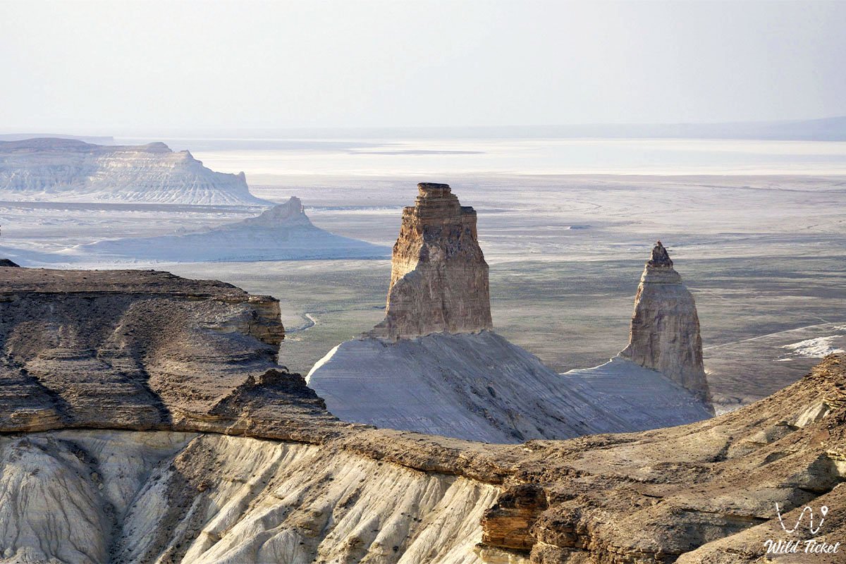
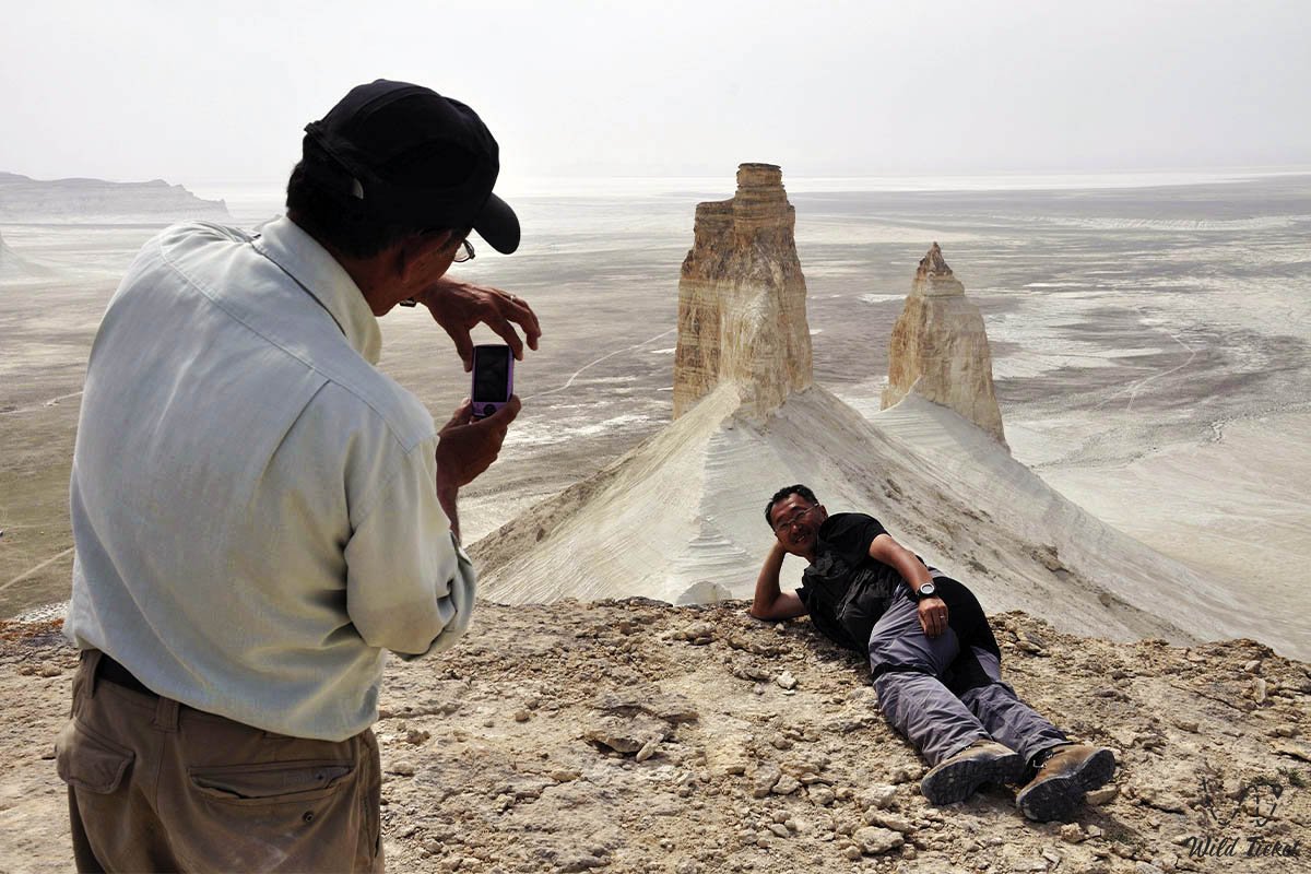
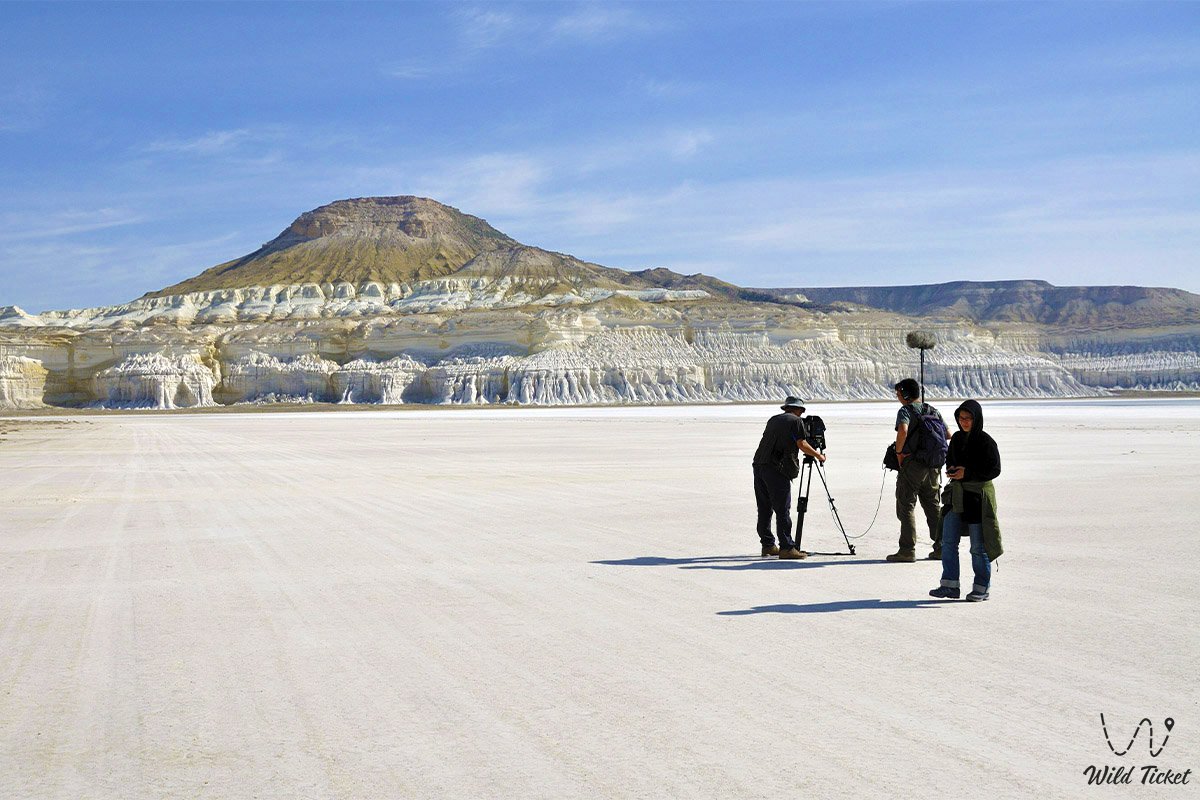
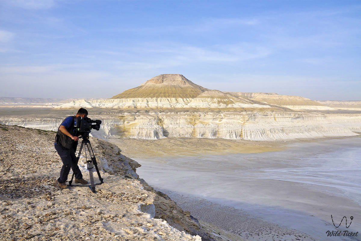
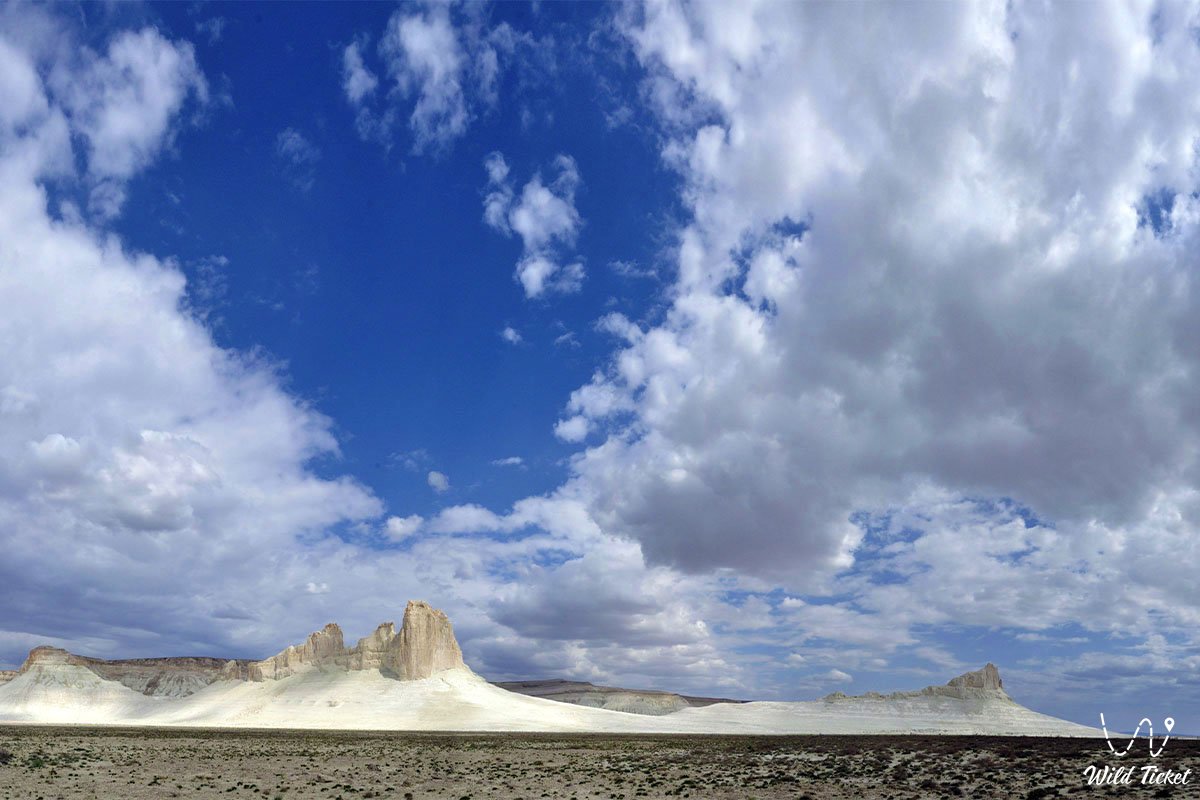
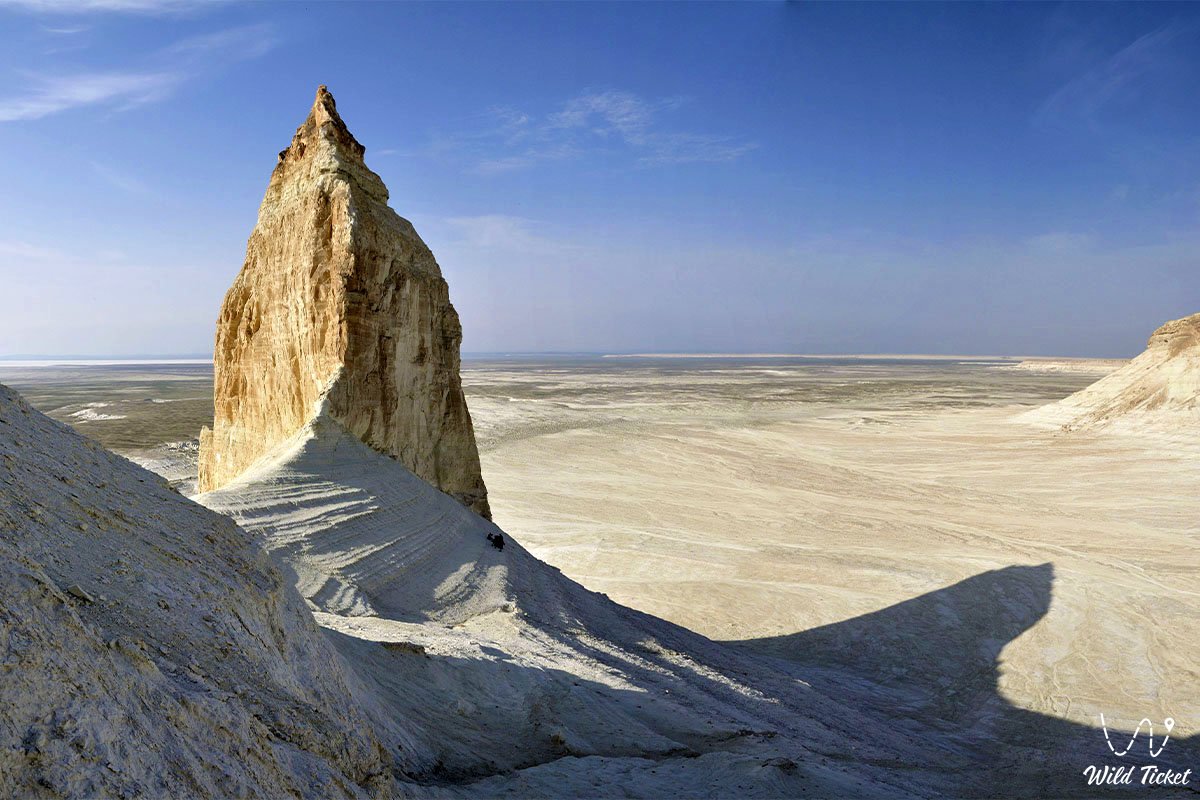
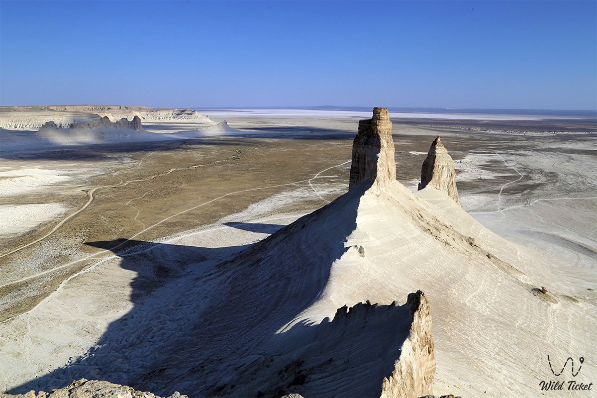
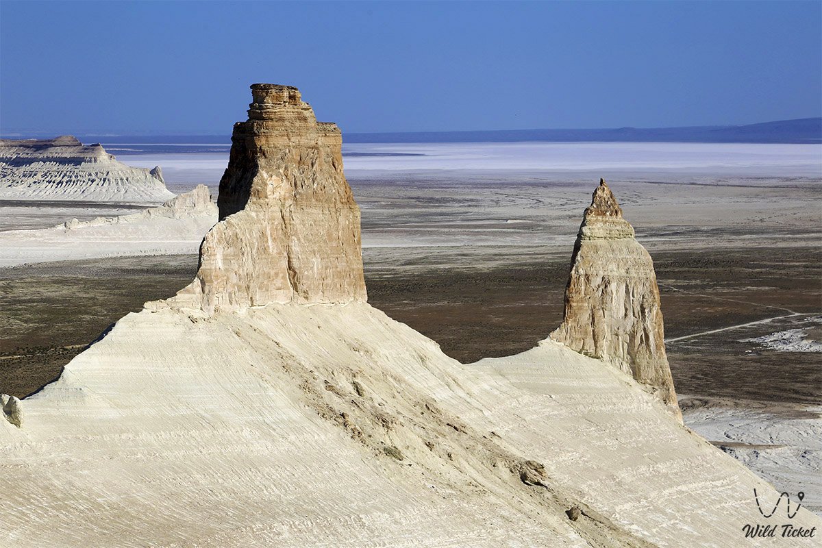
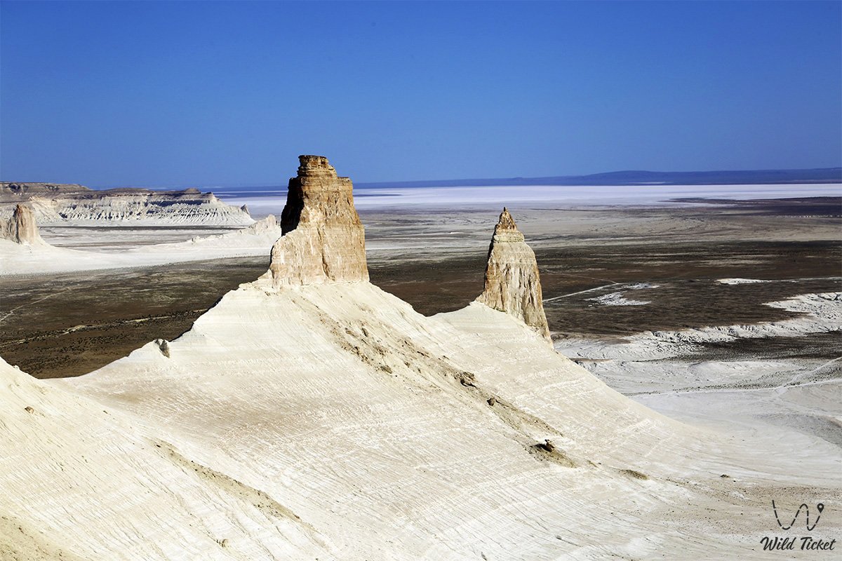
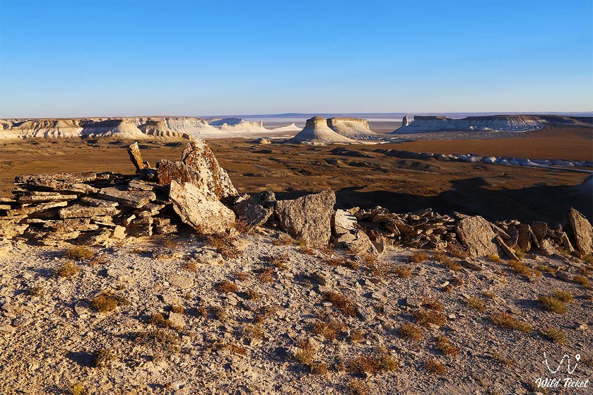
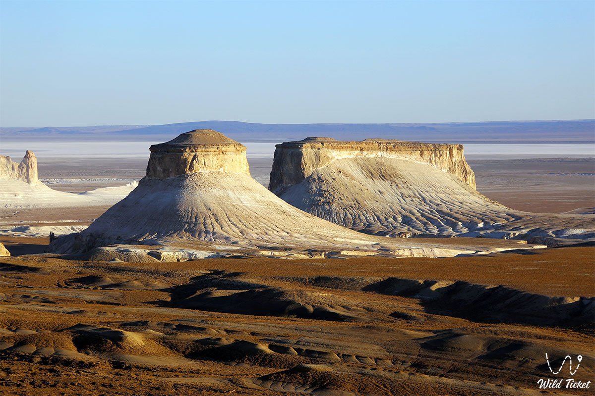
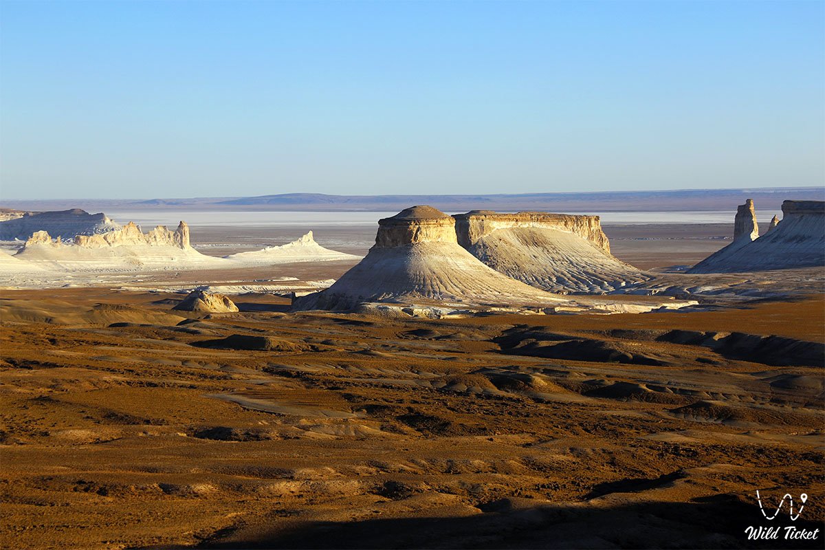
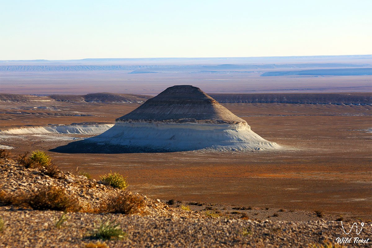
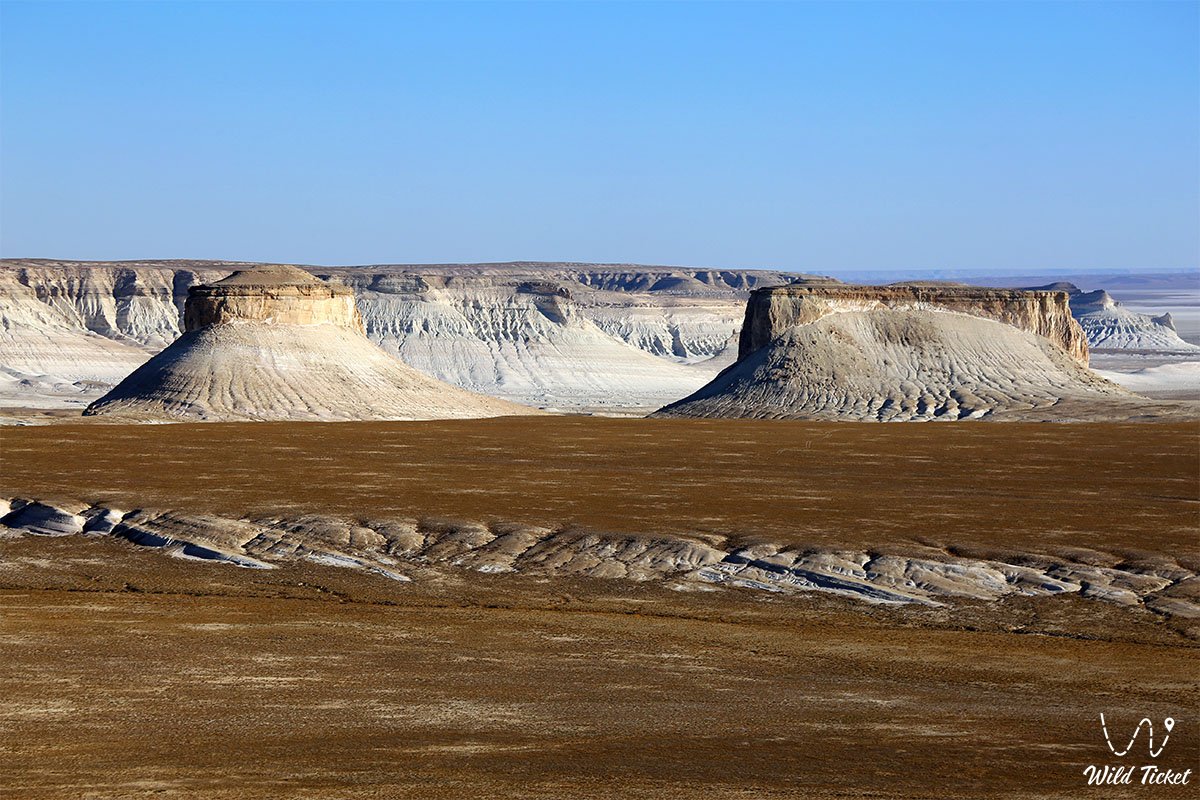
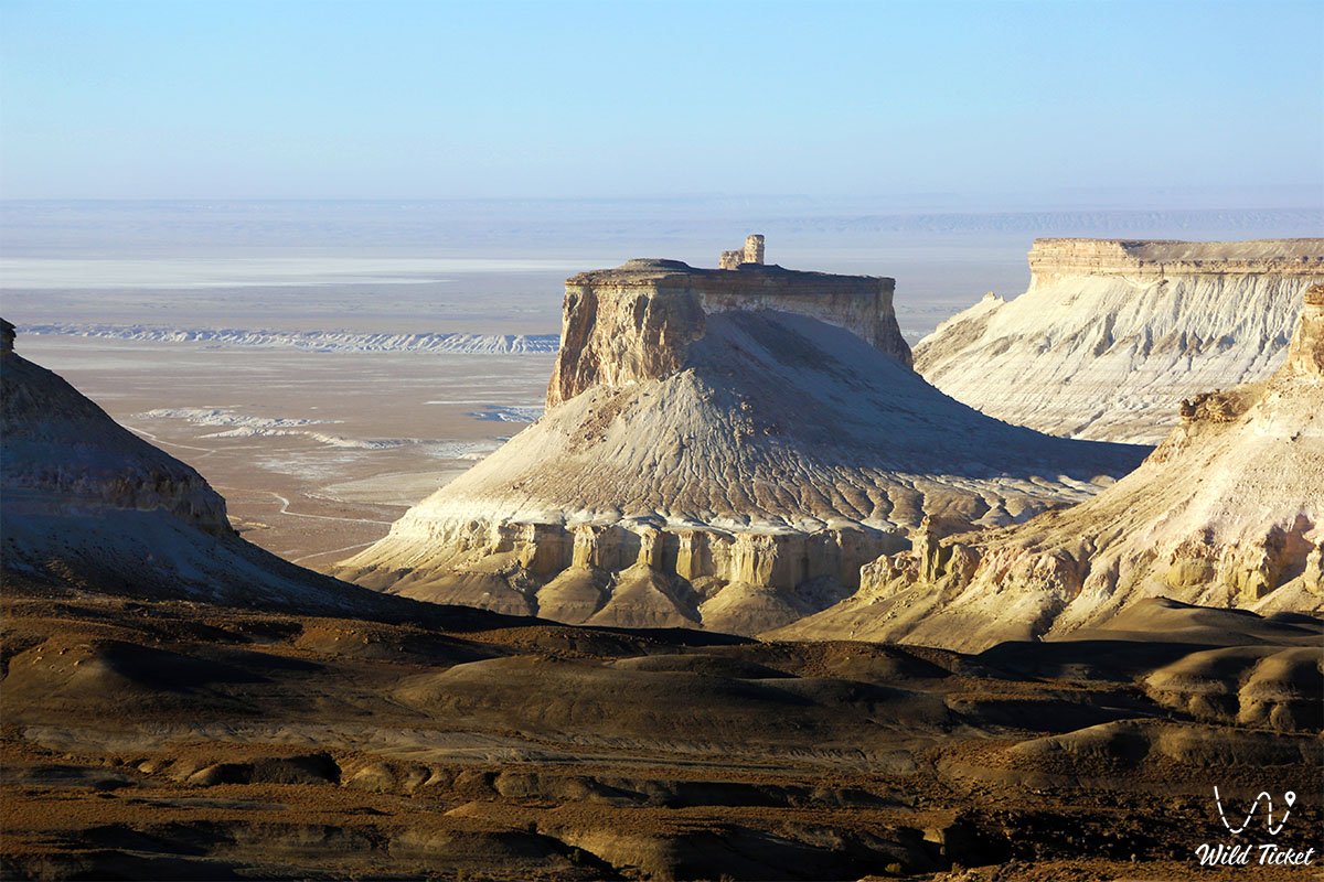
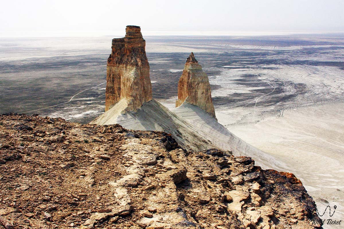
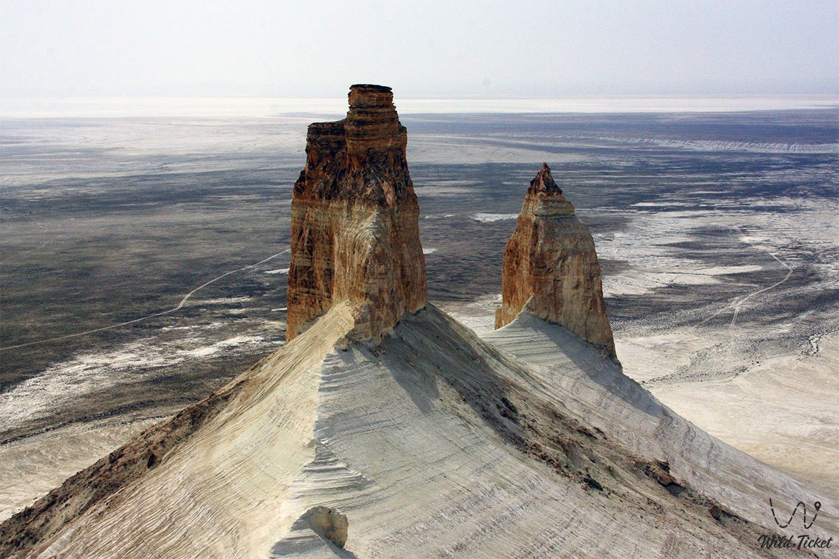
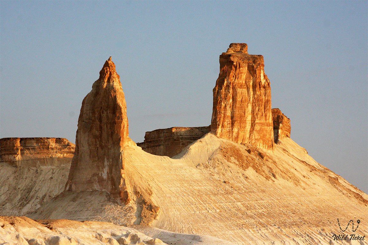
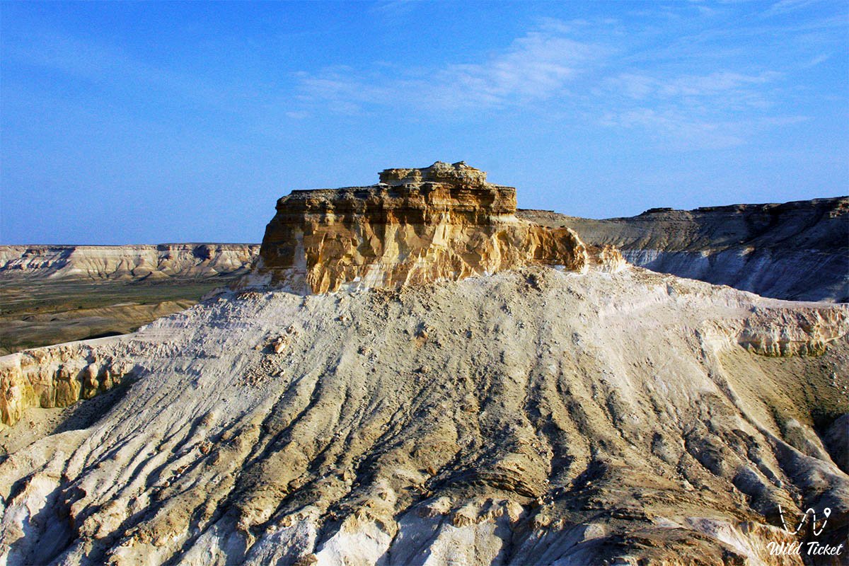
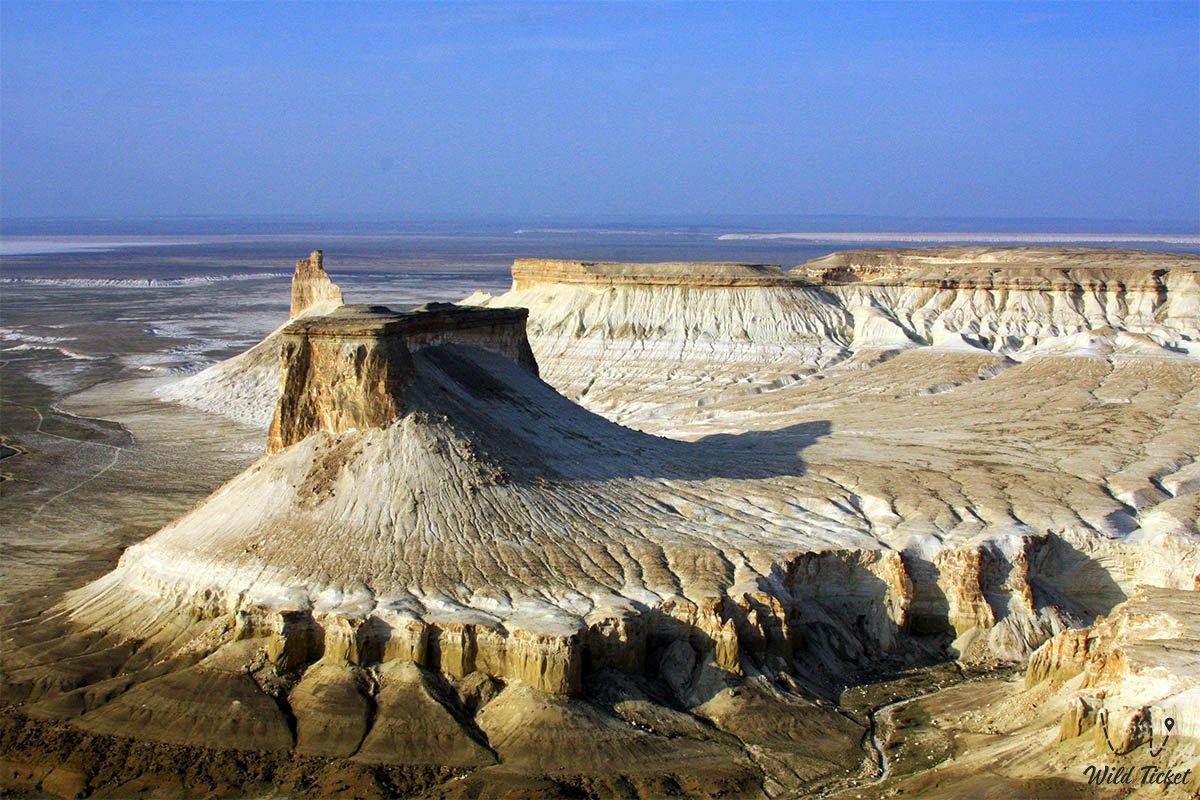
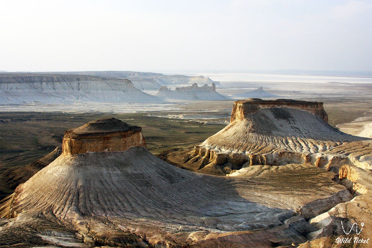
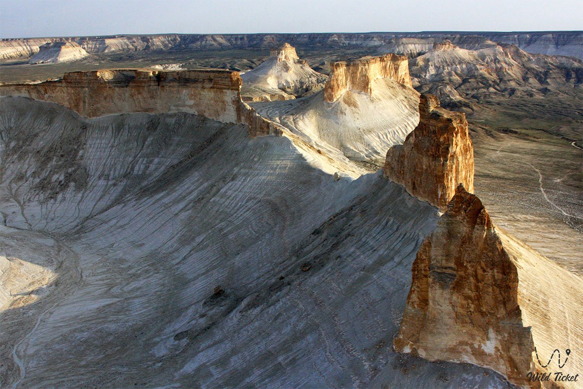
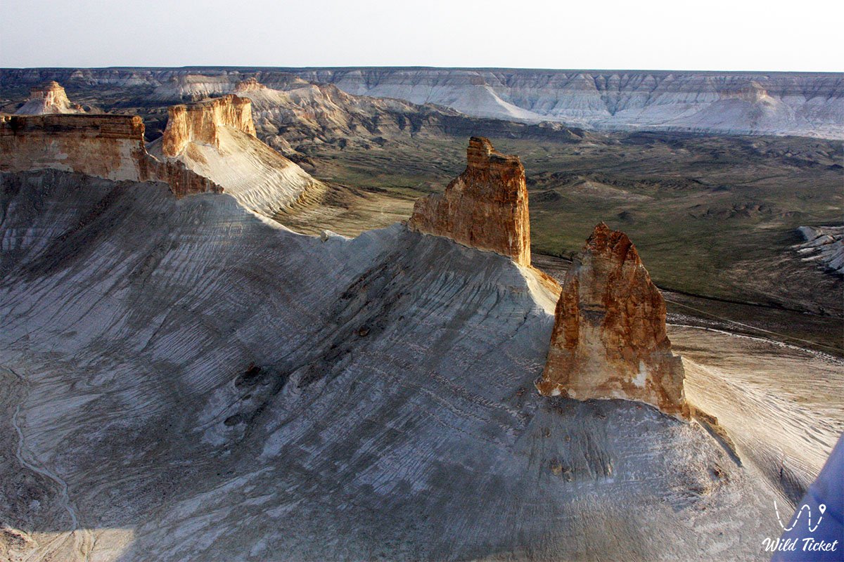
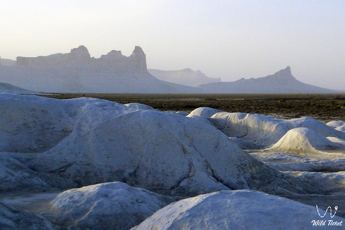
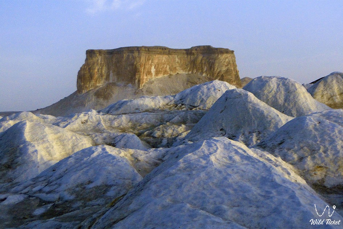
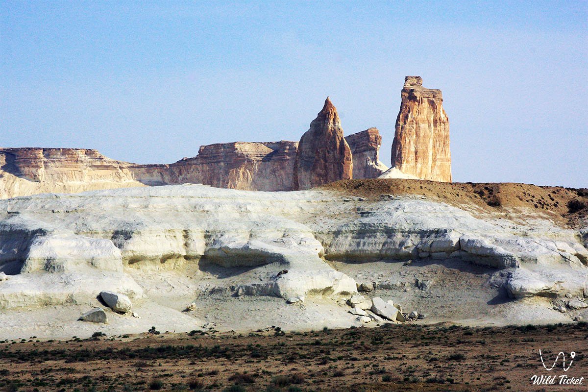
The relief of Bozzhira was formed at the bottom of the prehistoric Tethys Ocean, which separated the supercontinents of Laurasia and Gondwana during the Mesozoic Era. Amidst dazzlingly white plains composed of chalk and limestone layers up to 250 meters thick, colossal remnant mountains of whimsical morphology soar into the sky: pyramidal towers, formations resembling yurts, spires, and surfacing submarines. The primary visual landmark and symbol of the canyon are two limestone remnant outliers – "The Fangs" (Kaz. Azu tisteri), rising from the valley floor to a height of about 200 meters.
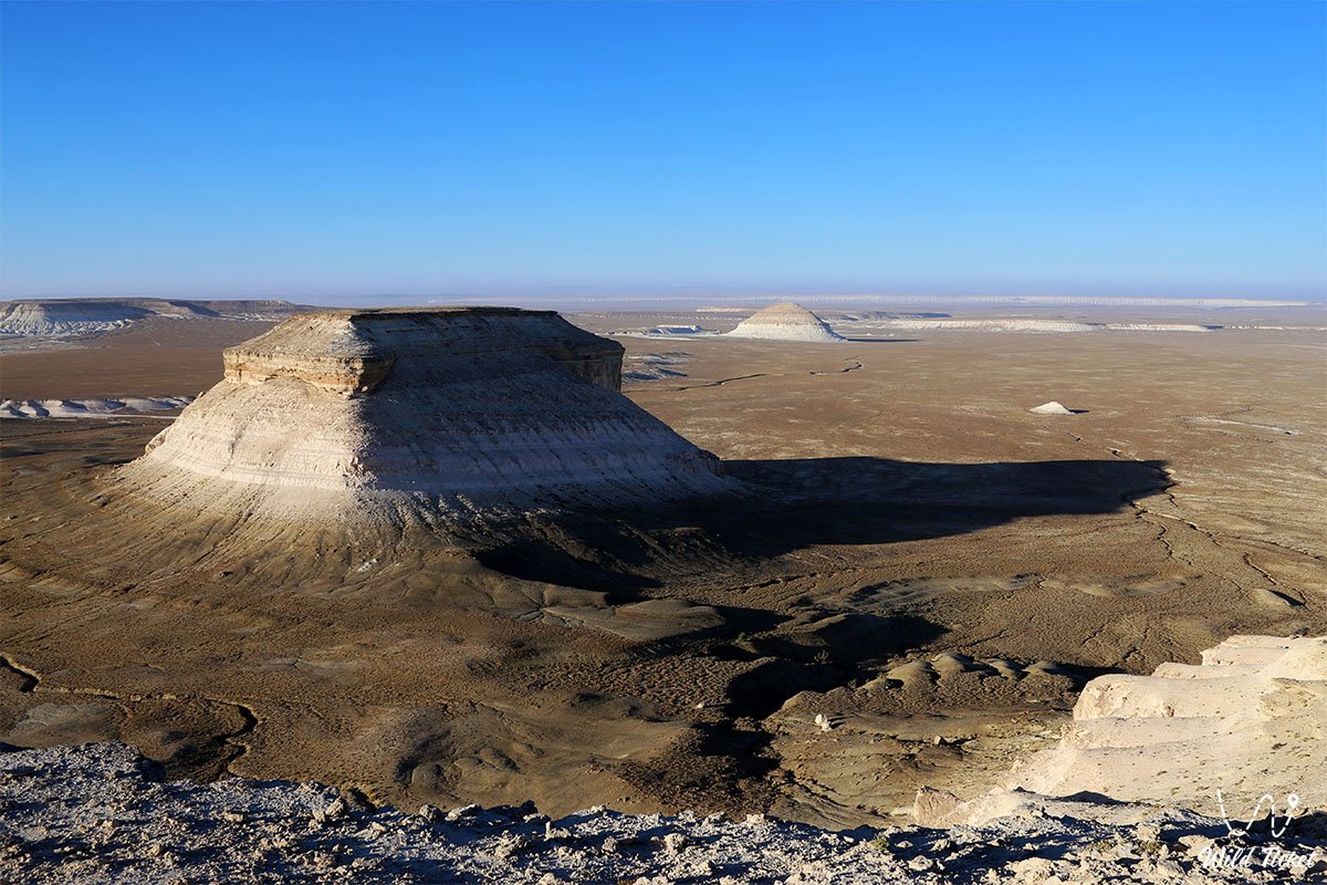
Several panoramic viewpoints of Bozzhira also exist in this area, offering stunning vistas of the tract (panorama No. 1, panorama No. 2, panorama No. 3, panorama No. 4, panorama No. 5, panorama No. 6).
The color palette of the tract shifts continuously: from blinding white and cream to ochre-yellow, pink, and brown, reflecting climatic epochs of sedimentation and the succession of ancient faunas. The Mangyshlak Upland and its chalk escarpments are painted in crimson tones by the rays of the sun at sunrise and sunset, while under a full moon the white cliffs create the illusion of an alien landscape.
Within the framework of the state program "Sacred Geography of Kazakhstan," the tract has been granted the status of a sacred site of regional significance, uniting the geological chronicle of the planet with the spiritual heritage of nomads. The Bozzhira tract is part of the Ustyurt State Nature Reserve.
In spring, the harsh Bozzhira tract experiences a short yet astonishing transformation. Among blindingly white chalk cliffs and lifeless canyons, the Sogdian tulip breaks through – a rare wild-growing plant that blooms in its natural habitat only in Kazakhstan. This fragile endemic blossoms for just a couple of weeks, tinting the desert landscape with delicate colors and creating a very rare natural contrast. Here you can view the complete list of wild-growing tulips of Kazakhstan.
Today, the Bozzhira tract is recognized as a jewel of ecological and expeditionary tourism in Eurasia, drawing photographers, geologists, scientists, and travelers from all over the world with its pristine grandeur and cosmic energy. The route to Bozzhira seamlessly connects with neighboring shrines and natural monuments: the sacred Beket-Ata Underground Mosque in the Oglandy tract, the layered multi-colored Mount Bokty, and the gigantic Karynzharyk Depression with the "Three Brothers" remnant outliers.
--------------------------------------------
How to get there and visit –
The Bozzhira tract is located 270–300 kilometers east of the city of Aktau, east of the western chink of the Ustyurt Plateau, 16.3 kilometers north and slightly west of the lake and Karashek salt marsh, 21.7 kilometers northeast of the Baysary tract, 18.4 kilometers south and slightly east of the Beket-Ata underground mosque, 23.4 kilometers east and slightly north of Mount Bokty, and 100 kilometers east and slightly north of the city of Zhanaozen in the Karakiyan district in the southeastern part of the Mangystau region, Republic of Kazakhstan.
GPS geographical coordinates: 43°27'05"N 54°04'19"E
The route from Aktau usually runs along a paved highway south through the city of Zhanaozen to Senek village or towards the Beket-Ata underground mosque. Beyond the asphalt, stony graded tracks, sandy sections, and field steppe ruts begin, traversing the Ustyurt Plateau towards the lower and upper plateaus of the tract.
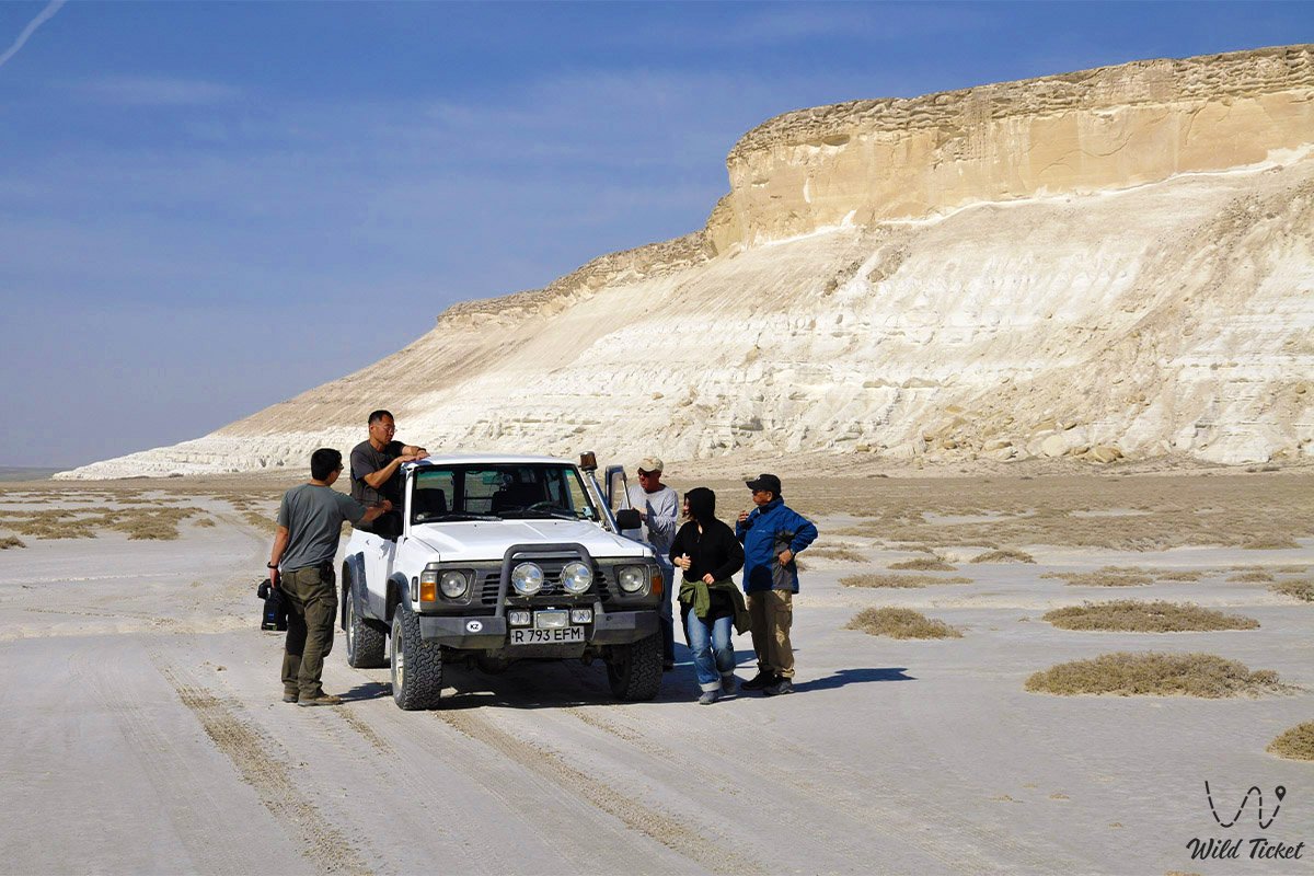
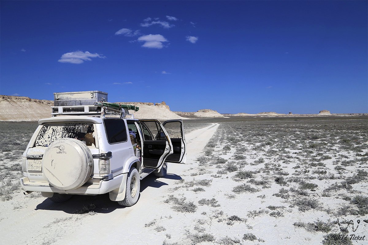
A trip to Bozzhira requires an exclusively reliable, fully operational four-wheel-drive off-road vehicle (4x4) with high ground clearance, sturdy all-terrain or mud-terrain tires (AT/MT), and crankcase armor protection. Sharp flint chips and stones of the chink create a high risk of tire punctures, making it mandatory to have at least two full-size spare wheels, an air compressor, a high-lift jack, a tire repair kit, and a dynamic tow strap.
For safety reasons, independent trips into the heart of Ustyurt must be carried out in a convoy of at least two vehicles. Cellular reception in the tract is virtually absent, so an expedition must carry a satellite phone, autonomous GPS trackers with offline maps, a fuel reserve calculated for an autonomous driving range of 600–700 kilometers, and a drinking water supply of no less than 5 liters per person per day.
The best time to travel is spring (from late April to early June), when the steppe comes alive, turns green, and is free of exhausting heat, as well as warm autumn (September – October). In summer, daytime temperatures at the bottom of the canyon consistently exceed +40...+45 °C, the incandescent chalk reflects sun rays, and there is no shade in open spaces. In winter, piercing gale-force winds blow, and following precipitation the white clays turn into a slippery, impassable mire.
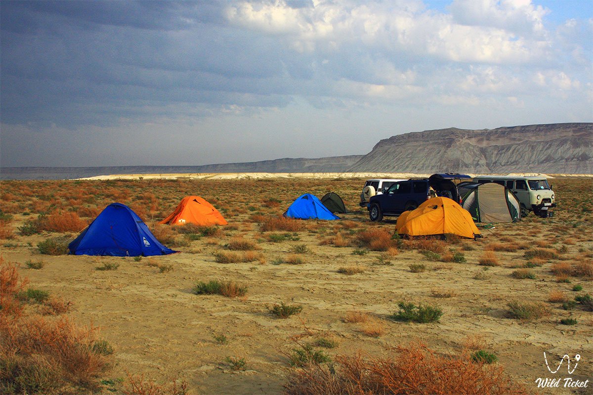
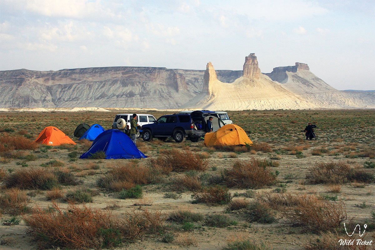
Any tourist infrastructure directly in the tract is absent: there are no hotels, cafes, gas stations, or equipped parking lots here. Overnight stays are possible only in personal tents on safe level grounds away from overhanging cliff cornices or in guest houses of the Beket-Ata pilgrimage center (30 km from the tract).
--------------------------------------------
History
The geological chronicle of the Bozzhira tract is rooted in the Mesozoic Era. For hundreds of millions of years, this territory was the bottom of the gigantic Tethys Ocean, which separated the ancient supercontinents. Under the pressure of water masses, a continuous accumulation of limestone, chalk, and marl sediments occurred, forming strata over 250 meters thick.
About 40–60 million years ago, tectonic movements uplifted the floor, creating the Ustyurt Plateau, while the Caspian, Black, and Mediterranean seas became remnants of Tethys. The final retreat of water about 5 million years ago opened vast expanses to erosion: torrential water streams, steppe winds, and temperature extremes carved soft rocks for millions of years, forming sheer cliff-chinks and remnant outliers. Scientists have determined that in ancient times the canyon represented a savanna inhabited by ancestors of wild horses, saber-toothed cats, leopards, and cheetahs. Erosion continues to this day: in several millennia, the appearance of Bozzhira will change beyond recognition.
Humans have inhabited these lands since the Paleolithic era. On the plateau, archaeologists find Stone Age flint tools and enigmatic stone arrow-shaped alignments ("arrows of Ustyurt") for corral hunting of saiga antelopes and argali sheep. In the Middle Ages, branches of the Great Silk Road to the ports of the Caspian and Khwarazm ran along the chinks. Later, the austere canyons served as sacred refuges for Sufi hermits, among whom a key role was played by the 18th-century thinker Beket-Ata, who founded an underground hermitage in the neighboring Oglandy tract.
In the 20th century, the plateau was explored by geological and cartographical expeditions of the USSR Academy of Sciences. To protect fragile ecosystems, the Ustyurt State Nature Reserve was established in 1984. In the early 21st century, Bozzhira received global recognition as a natural phenomenon and was included in the "Sacred Geography of Kazakhstan" project.
Information
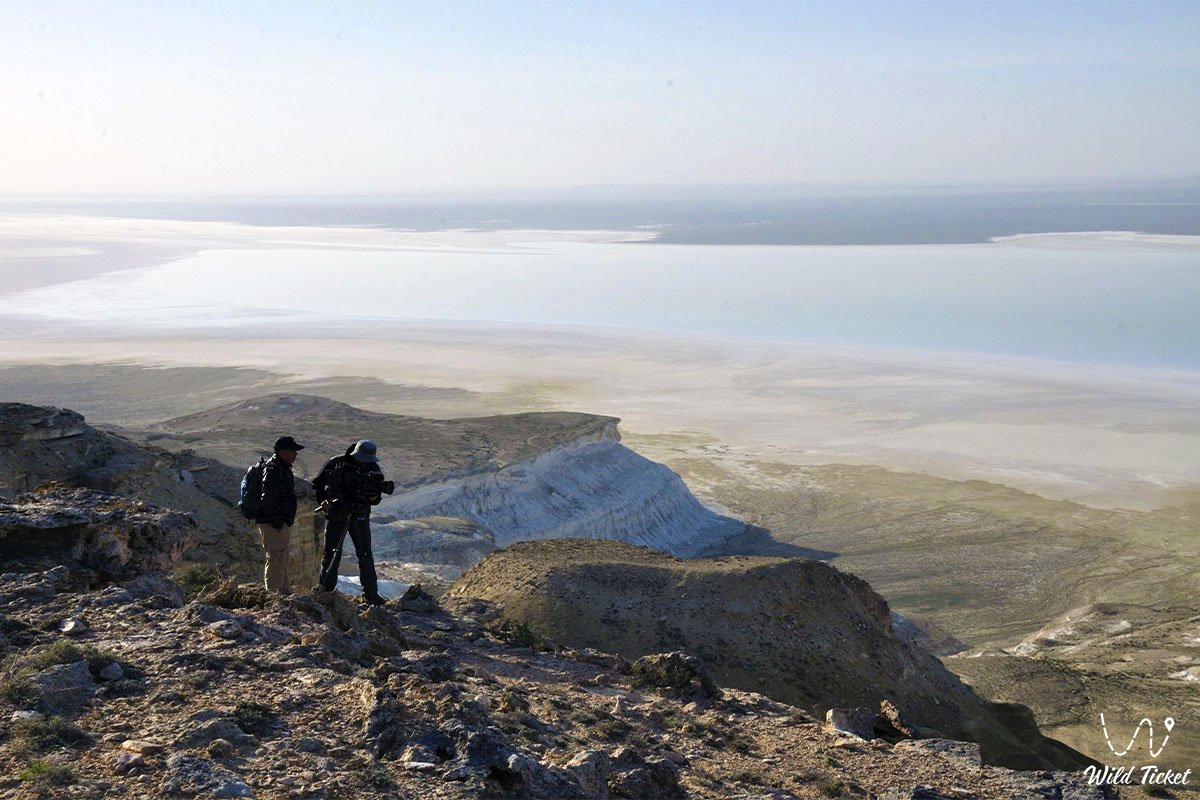
Geomorphologically, Bozzhira represents a system of erosional cirques and chinks on the western scarp of the Ustyurt Plateau with elevation drops of up to 200–250 meters. The rock strata are composed of white and grey marls, Paleogene clays, and an upper armor cap of dense coquina limestone that protects mountain tops from destruction.
The territory possesses immense paleontological value. In screes at the foot of the remnant peaks, fossils of the ancient Tethys Ocean fauna are found everywhere: fossil shark teeth, mollusk shells, ammonites, belemnite rostra, sea urchins, and fragments of petrified algae.
The climate of the tract is extra-continental and sharply arid. Annual precipitation does not exceed 100–140 mm. The air is exceptionally transparent, and the total absence of light pollution opens up a brilliant dome of the Milky Way. Strong winds frequently blow across the plateau, turning into dust storms in summer.
Ecologically, the territory is vulnerable: soft chalk slopes are easily damaged by vehicle wheels and take decades to recover. Driving is strictly permitted along established tracks, and all domestic waste must be taken back with you.
Detailed description of the venue
The landscape complex of the Bozzhira tract includes recognized observation decks and rock monuments:
• Oynak Bozzhira – a chalk plateau, an open flat surface, the lower plateau in the Bozzhira tract. This is where travelers usually stop for the night during journeys across Bozzhira and set up a base tent camp with a field kitchen.
• Zhogarly Bozzhira – the great and ancient Tethys Ocean once lapped on the site of this plateau. Remains of ancient mammals can still be found here. Teeth of ancient sharks of various sizes can be discovered here in large quantities; fairly large specimens measuring the size of an average human palm are encountered.
• Chalk Outliers "Fangs of Bozzhira" (Azu tisteri) – two vertical limestone peaks about 200 meters high at the entrance to the canyon, which have become the symbol of the tract.
• Mount "Yurt" – a massive remnant mountain with a dome-shaped summit that echoes the shape of a traditional nomadic Kazakh dwelling.
• Mangyshlak Peninsula – an open-air museum of pristine nature tucked away in western Kazakhstan along the shores of the Caspian Sea. Millions of years ago, the waters of the prehistoric Tethys Ocean surged here, whereas today surreal deserts, blinding salt marshes, and Martian canyons stretch across the land.
Flora and fauna
The vegetation cover of Bozzhira is typical of the stony and clay deserts of the Turan province. The flora is represented by drought-resistant xerophytes, halophytes, and rupicolous petrophytes. In ravines and on plains grow grey-soil and Turanian wormwood, salt-marsh biyurgun, boyalych, itsegek, bean caper, as well as bushes of black and white saxaul, tamarisk, and Atraphaxis. In spring, the stony steppe turns green with ephemerals: wild Sogdian tulips, wild onions, and desert irises bloom, withering away by early summer.
The fauna of the tract includes rare species adapted to life among sheer cliffs and a deficit of fresh water. The primary inhabitant of the chinks is the Ustyurt mountain sheep (mouflon), listed in the Red Book of Kazakhstan, which moves confidently along steep escarpments. Goitered gazelles and saiga antelopes occur on the plains.
Predators include the corsac fox, steppe wolf, badger, marbled polecat, sand cat, and the rare desert lynx – caracal. The world of rodents and reptiles is represented by jerboas, gerbils, Central Asian tortoise, Ustyurt gecko, toad-headed agama, whipsnakes, and the arrow snake.
Large predatory birds soar in the sky above the canyon: golden eagle, steppe eagle, long-legged buzzard, saker falcon, Egyptian vulture, and eagle owl. Pallas's sandgrouse, black-bellied sandgrouse, and the houbara bustard inhabit semi-desert plots.
Legend
A Kazakh tale about the stone guardians of the steppe is associated with the Bozzhira tract. The legend tells that after the ocean waters receded, giant batyrs rose to defend nomadic encampments. When countless enemy hordes approached the chink, two mighty warriors blocked the narrow passage, holding back the foes. Unable to break the batyrs in battle, enemy sorcerers turned them into limestone rocks. Ever since, the petrified giants – the "Fangs of Bozzhira - Azu Tisteri" – continue their eternal vigil over the steppe.
Another lore is associated with the Sufi saint Beket-Ata. It is said that the holy elder frequently climbed the inaccessible ledges of Bozzhira for multi-day prayers and solitude. The purity of his prayer was so profound that drops of moisture seeped from the crevices of the white stones, giving drink to wild argali sheep, while ferocious storms subsided at the foot of the cliffs. Local residents believe that the tract cleanses the traveler's soul, relieving anxieties beneath the dome of the night sky.
Conclusion
The Bozzhira tract is a majestic monument of Earth's geological history, uniting chalk strata of the ancient Tethys Ocean, monumental limestone towers, and the austere silence of the Ustyurt Plateau. Preserving its pristine appearance, the tract is deservedly recognized as one of Kazakhstan's most expressive natural wonders.
A journey to Bozzhira unlocks the romance of self-sufficient expeditions, granting unforgettable sunrises among white cliffs and the stillness of the boundless steppe. The night skies here are filled with stars, completely free of city light; bring a telescope along to discover the vast expanses of the universe.
Interesting sights nearby:
• Karynzharyk Depression;
• Karagiye Depression;
• Mount Borly-Tau;
• Mount Otpan-Tau and Aday-Ata Monument;
• Shomanay Mountains;
• Akespe Tract on Mangyshlak;
• Mount Sherkala;
• Shatkal Canyon;
• Mount Shokytau;
• Utebay Cave;
• Balayuk Cave;
• Silicon Valley in Mangistau;
• Mount Ushkirtaw;
• Utebay Tract;
• Kokala Tract;
• Kenderli Steppe Salt Marsh.
Photogallery: