Tours and excursions to Mangishlak peninsula -
Mangyshlak Peninsula is a peninsula on the east coast of the Caspian Sea in Kazakhstan. The same name is given to the plateau adjacent to the peninsula, east to the Ustyurt plateau. In the northern part of Mangyshlak, the Buzachi Peninsula stands out, washed by the waters of the Mangyshlak Bay, as well as the Dead Kultuk and Kaydak bays. In the west, the Tub-Karagan Peninsula extends into the Caspian Sea; south of Mangyshlak is the Kazakh Bay. On the territory of the peninsula is the Mangistau region of Kazakhstan.
In pre-revolutionary Russia and the USSR, this region was called Mangyshlak. In modern Kazakhstan, the name Mangistau has been used since the early 1990s.
Origin of name
There are several versions of the origin of the name of the peninsula: “Mangyshlak” - translated from Turkmen means “Thousand villages”, for the Kazakhs, this area is called “Mynkystau” - a thousand winter huts. Historically, this area often passed from Turkmens to Kazakhs, and vice versa, which is confirmed by cemeteries interspersed with Kazakh and Turkmen burials.
In the Geographical and Statistical Dictionary of the Russian Empire it is explained as follows: "Mangyshlak is the winter nomad of menkih or nogai." “Menk” (ming) is the name of a tribe of Mongolian descent, which became part of the Nogaev and other Turkic peoples. According to modern ideas, the name may also be associated with the Mangyt yurt, in the Turkmen form Mangyt-Dag - Mangyt mountains.
Turkmen scientist K. Annaniyazov believes that "Mangyshlak" means a large village, since "man" is translated as large, "gyshlak" is a village.
History
Mangyshlak has a rich history. Archaeologists have found numerous Paleolithic monuments on the coast of Sarytash Bay, on the Tyubkaragan Peninsula and in the valleys of the Shahbagata and Kumakape rivers. The industry of the Shahbagat site (proteolevallois-ashel) on the territory of the Fort Shevchenkovsk city administration is similar to the tools of the Olduvai culture, the industry of the site of Shahbagat (levallois-ashel I) corresponds to the average ashel.
The Koscuduk I site on the Caspian Sea belongs to the Neolithic / Eneolithic era (late V - first half of the 4th millennium BC), the industry of which has both archaic types of tools of the Oyuklinsky culture and materials of the Shebirsky type of the Khvalyn culture. The human burial of the Eneolithic at the site of Koskuduk I is the oldest in Kazakhstan. In the V millennium BC. e. Oyuklinskaya culture was replaced by Tuluz culture.
On Mangyshlak there are sacred places of the necropolis of more than 362 Sufis, missionaries. Most of them are distributors of Islam in Central Asia from the Khodz Kaz family. clan Jozha. In the Middle Ages, Mangyshlak and Ustyurt served as the gateway to trade and economic ties between East and West. In ancient times, part of the Pecheneg tribes left the northern territories between the Aral and Caspian seas and came to Mangyshlak. Later, the Pechenegs on Mangyshlak were replaced by Oguzes. In some documents they are called Turkmens. Now the Adaevites live in these places.
It is believed that Adaevites descend from the Adai-ata. According to legend, after the weakening of the central khanate in Turkestan, he decided to find a new homeland. He had with him a horse and a saber. Then the dzhigit gathered daredevils longing for freedom and truth, and took them to the edge of the steppe, to Mangyshlak. And a new tribe of proud Adaevites was formed there - warlike and united, where all the oppressed tribes found protection and shelter. Some of the former Turkmen tribes, dependent on the Khiva khan, became part of the Adays, another part of the Trukhmen moved to the modern Stavropol Territory.
In the early 40s of the XIX century, Mangyshlak was the only point that through the Caspian Sea the Russians had relations with the Bukhara Emirate and mainly the Khiva Khanate
Mangyshlak district was formerly part of the Trans-Caspian region, then alternately subordinated to Astrakhan, Ashkhabad, Orenburg, was part of the West Kazakhstan region, Guryev region. Later, the Mangyshlak region was formed.
Mangystau rebellion
In 1870, in connection with the introduction of new administrative reforms there, the Manystauskoye or Adaevskoy uprising broke out, which was suppressed the same year.
Nature
The climate is sharply continental, extremely dry. There are no rivers with a constant stream. Mangyshlak is a unique nature reserve. Here, “as in a reserved casket, the entire arsenal of the most diverse manifestations of the nature of deserts has been collected,” writes Professor B. A. Fedorovich.
Mangyshlak is a promising oil region: oil fields are being developed in Uzen, in Zhetybay, in Kalamkas. Copper, manganese, phosphorites, rock crystal, rare ores have also been discovered on the peninsula. It was here that the world's first industrial fast neutron reactor was launched. At present, the reactor has worked out its life, but the results of the research are still very important. Unique desalination plants that provide water were built, which made it possible to build the city of Shevchenko (now Aktau) on Mangyshlak.
Fauna
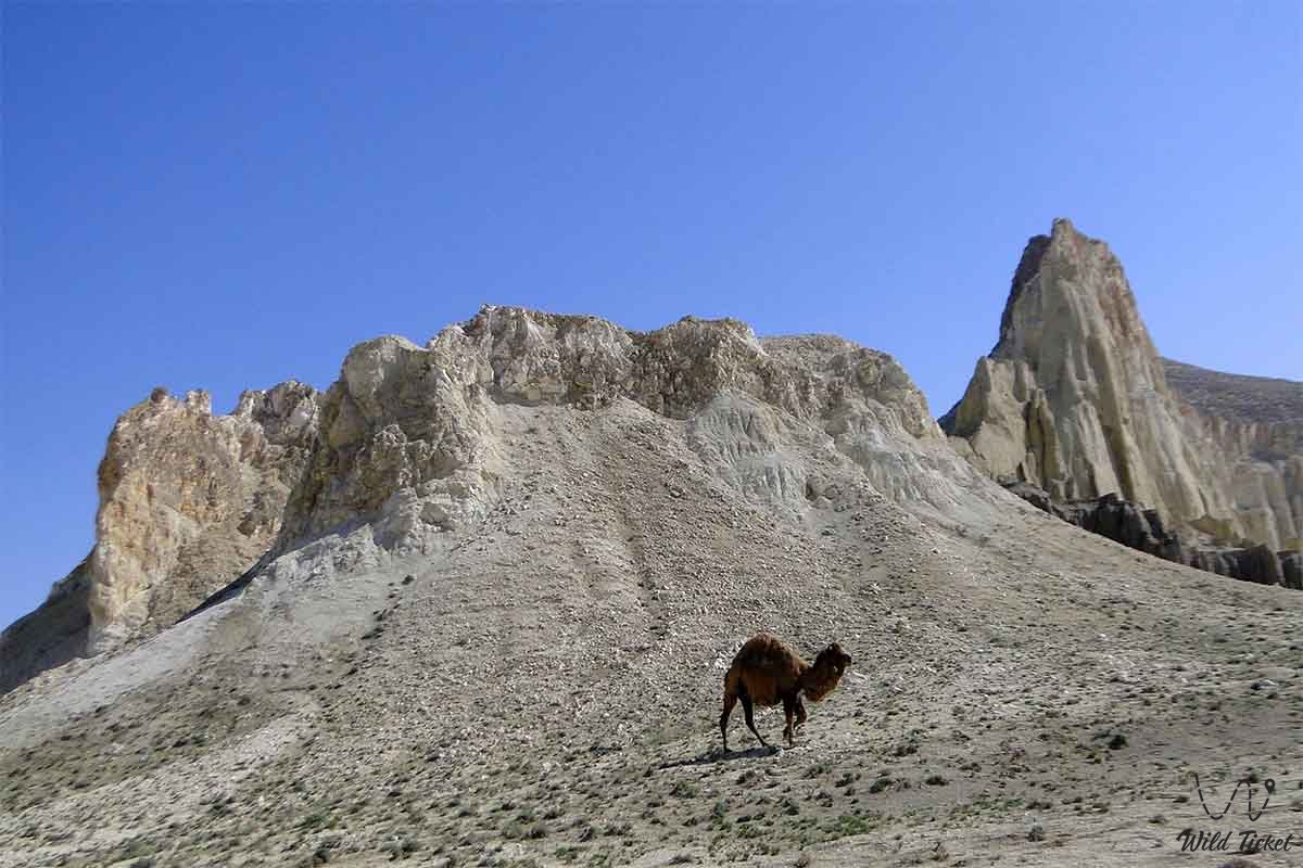
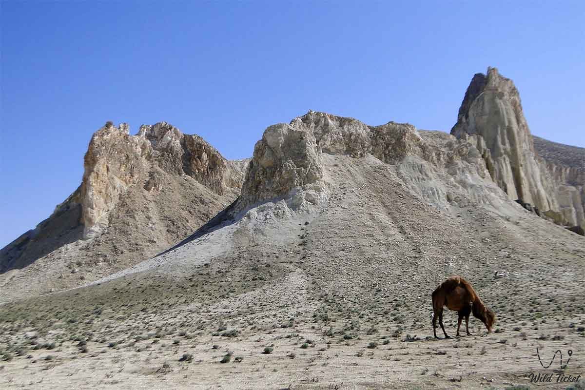
On the territory of the Mangistau region there are all types of landscape. The diversity of the soil determines the formation of a kind of flora. About 263 plant species and many animal species are found. The amphibian class is represented by only one species - the green toad. The reptile class here includes 22 species. On the peninsula live 45 representatives of the class of mammals. There are many birds - as many as 111 species, including migratory ones. Of these, flamingos, saker, peregrine falcon, vulture, steppe eagle, golden eagle, eagle owl, jack, serpent eater, black-bellied sandgrouse, and loaf are listed in the Red Book.
Nine mammals - the Redbooks - need more care: the Ustyurt mouflon, gazelle, caracal, manul, dressing, sand dune cat, honey badger, white-bellied arrow arrow, cheetah. Perhaps the most famous symbol of Aktau is the Caspian seal. Phoca (Pusa) caspica is the smallest seal in the world, endemic to the Caspian Sea. It is found in the entire sea - from the coastal regions of the North Caspian to the shores of Iran. In winter, early spring and late autumn, the bulk of the population is concentrated in the Northern Caspian. In autumn, it enters the mouths of the Volga and the Urals. In late spring, summer and early autumn, the seal is found in the Middle and South Caspian.
Caspian seal differs from other seals in the world in body structure, nutrition, lifestyle, and many morphological features. This unique species is on the verge of extinction: over the past 100 years, its population has declined by 90%. If at the beginning of the 20th century the number of Caspian seals reached 1 million individuals, then, according to aerial photographs, the number of animals in 1989 was about 400 thousand individuals, in 2005 - 111 thousand individuals, and in 2008-2009 no more than 100 thousand individuals.
Healing waters
Mangyshlak has many healing springs: bromine, chloride, sodium and others. There are sources similar to the Matsesta and Feodosia. The peninsula has opened a rich set of healing springs, up to thermal springs, approaching unique Kamchatka ones in temperature.
Why are there so many different sources in such an arid place like Mangyshlak? The reason for this is the sands of Sengirkum, Bostankum and Tuyesu, stretching from north to south for hundreds of kilometers. Sands play the role of a kind of sponge, which absorbs the few rainfall that falls on the peninsula. Hydrogeologists-scouts found clean fresh water at the bottom of huge bowls filled with sand. But this water is still not enough. Therefore, desalination plants were built on the peninsula, supplying the city and the region with water: fresh, technical and hot.
Unique places
Once the Mangyshlak Peninsula was called dead. “The desert, completely without any vegetation, sand and stone; even if there is a tree, there is nothing ... ”wrote the Ukrainian poet T. G. Shevchenko. The climatic conditions of the region are severe. In the summer, heat sears it, dust storms visit, and winters are cold and blizzard.
Blue bay
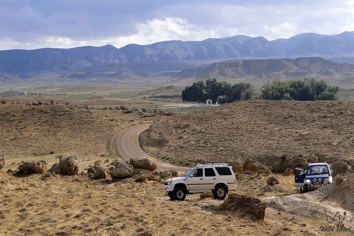
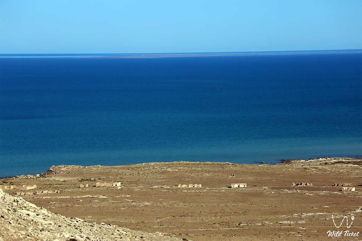
The Mangyshlak Peninsula is hundreds of kilometers of rocky Caspian coast, countless kilometers of desert, but other than that there are golden sandy beaches. One of them is Blue Bay.
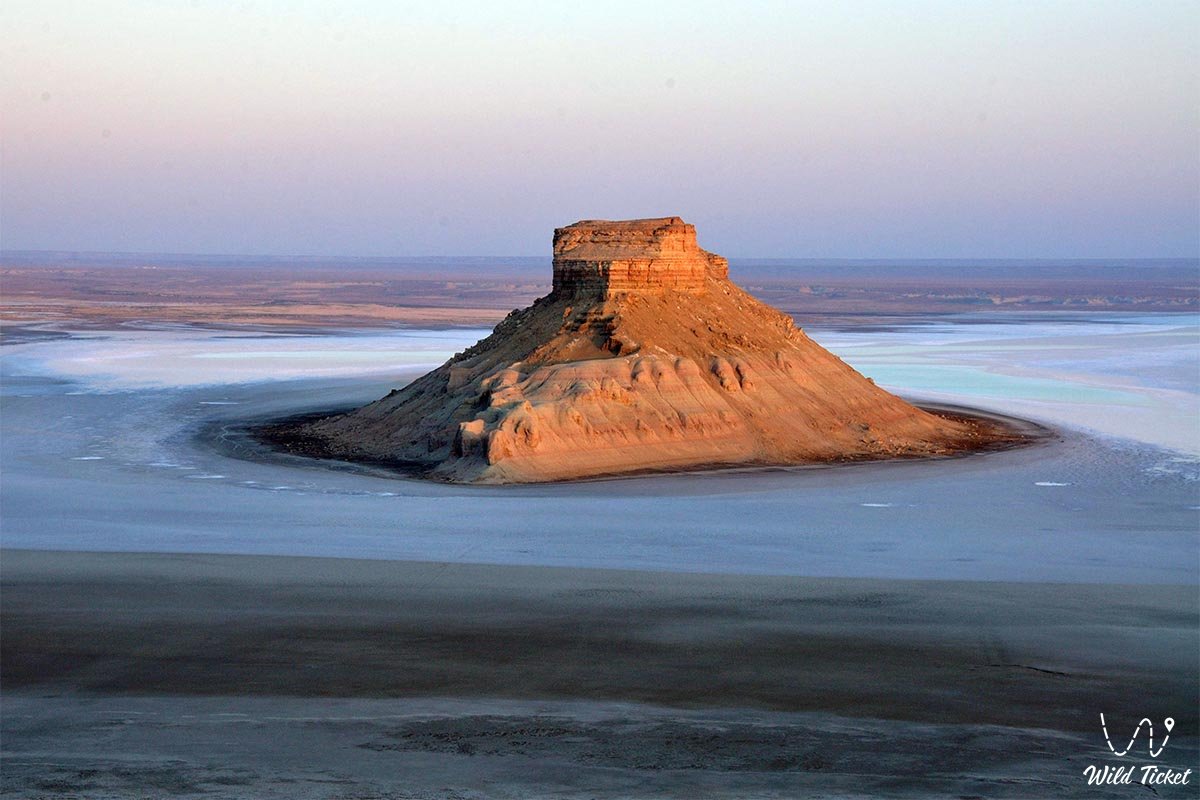
Zhigylgan
The giant basin of Zhigylgan is Fallen Earth, the edge of which is almost a regular circle with a diameter of at least 10 kilometers. Most likely, karst phenomena associated with the dissolution of natural rocks (gypsum, rock salt and others) are the cause of the formation of the basin.
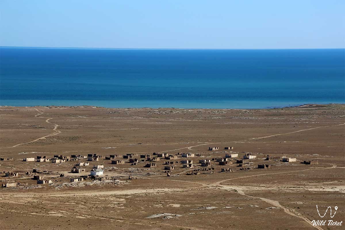
Necropolis of Sultan-epe Mangishlak peninsula.
Sultan-epe - saint, Suffi. According to legend, once upon a time a father called his sons to him. The youngest son did not come immediately, but after a few days. Sultan-epe said that he was in the distant Caspian, where he helped fishermen in distress.
Ancient necropolis of Kent Baba
The ancient necropolis of Kent-Bab, where the memorials of the XV — XX centuries. On the territory of the necropolis is a steppe mosque. A prayer stone points to the east, stones are laid in a protective circle. In this circle, the traveler will feel safe at any time of the year; at night and during the day he will be protected by the saint. We consider the drawings on the walls of the necropolis: horses, camels, plant patterns are depicted here, and here the triangle is one of the protective symbols, a talisman.
Beket Ata Necropolis - The underground mosque of Beket-ata
The Beket Ata Necropolis is a spiritual, historical and architectural monument. Beket-Ata is known as a fortuneteller, lived, according to legend, in the second half of the XVIII century. Born near the village of Kulsary, Atyrau region, and at the age of 14 he came to bow to the ashes of the sage Sopan-Ata, revered by him, to receive a blessing. On the third night, Shopan-Ata ordered the young man to study. The young man went to distant Khiva, there, in a madrasah, he comprehended science. Having reached the age of 40, he became a Sufi and began to teach children to read and write.
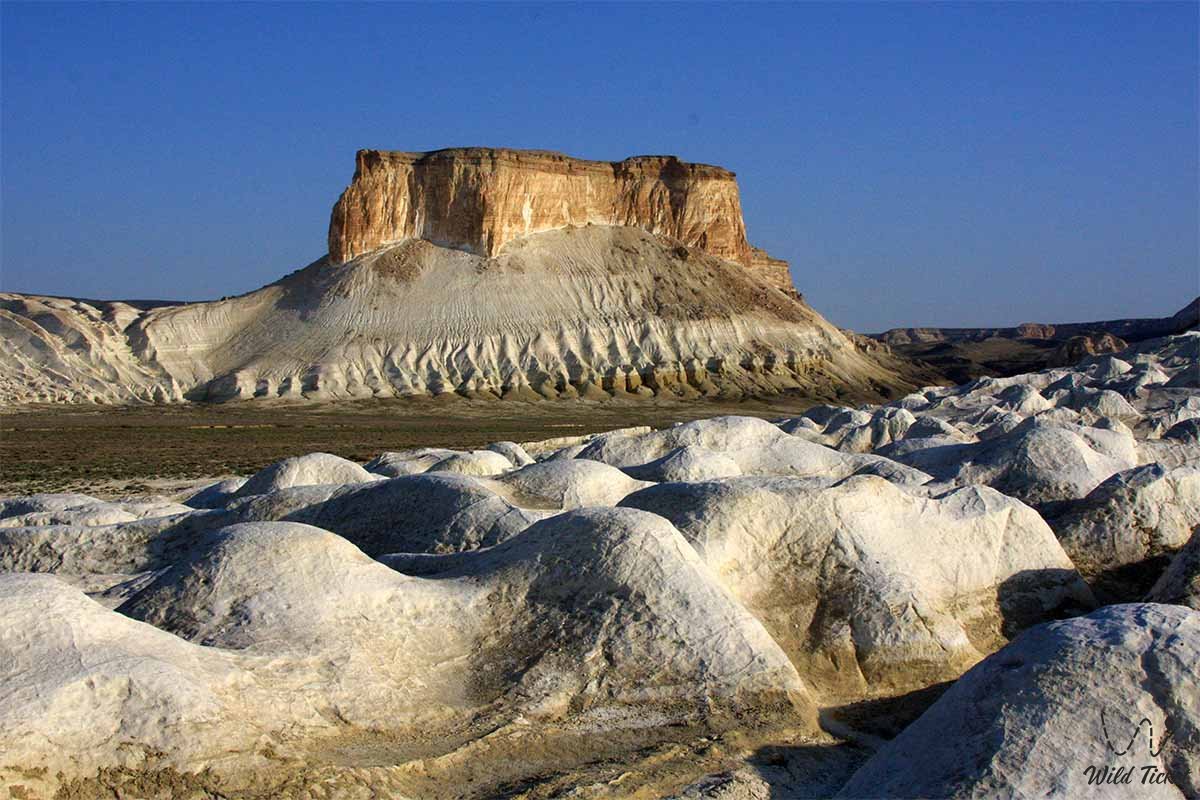
Depression of Karagie
In the eastern part of the Mangyshlak plateau, about 50 km from the city of Aktau, one of the deepest depressions in the world extends from northwest to southeast with a mark of −132 m below the ocean level. The formation of a depression is associated with the leaching of salty rocks, with subsidence and karst processes that took place on the coast of the Caspian Sea.
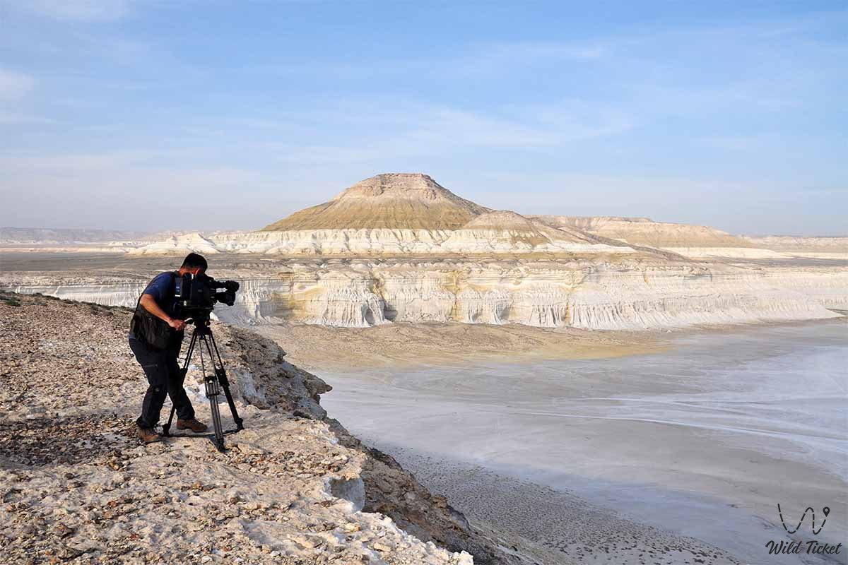
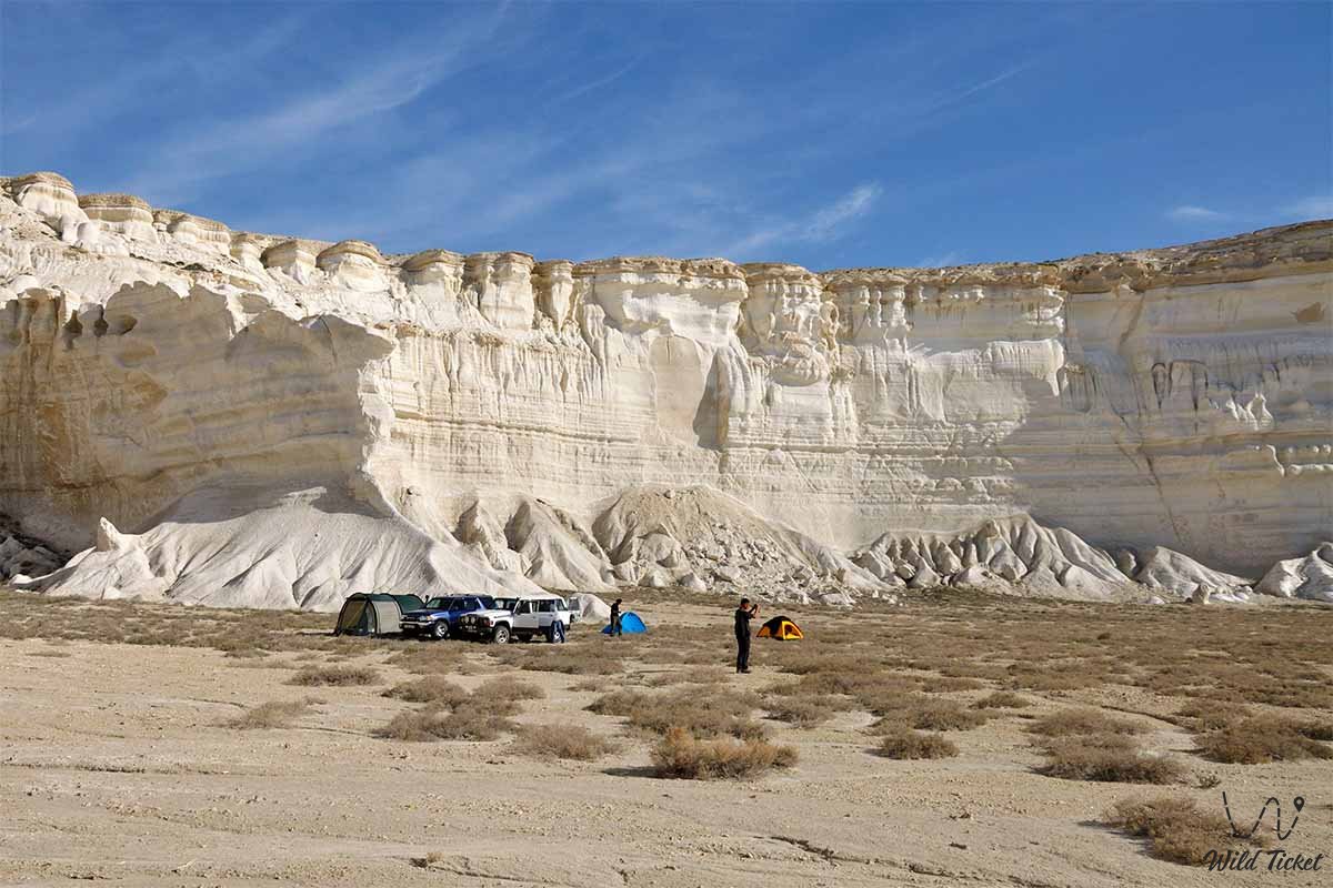
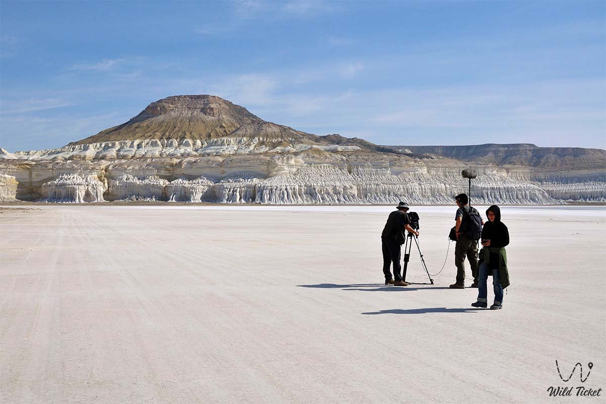
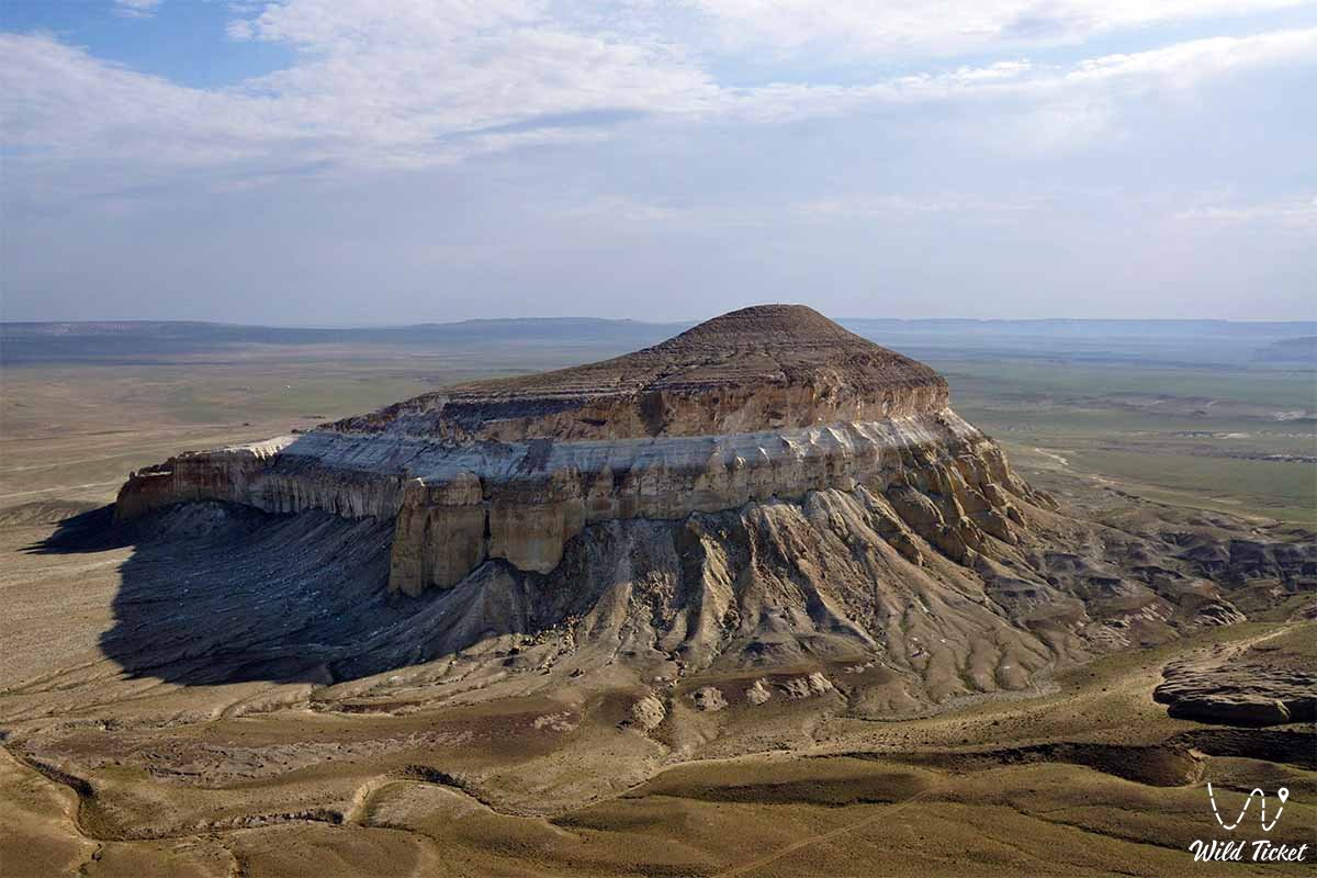
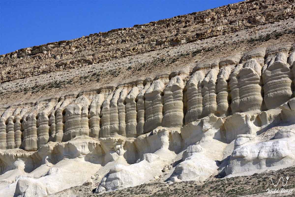
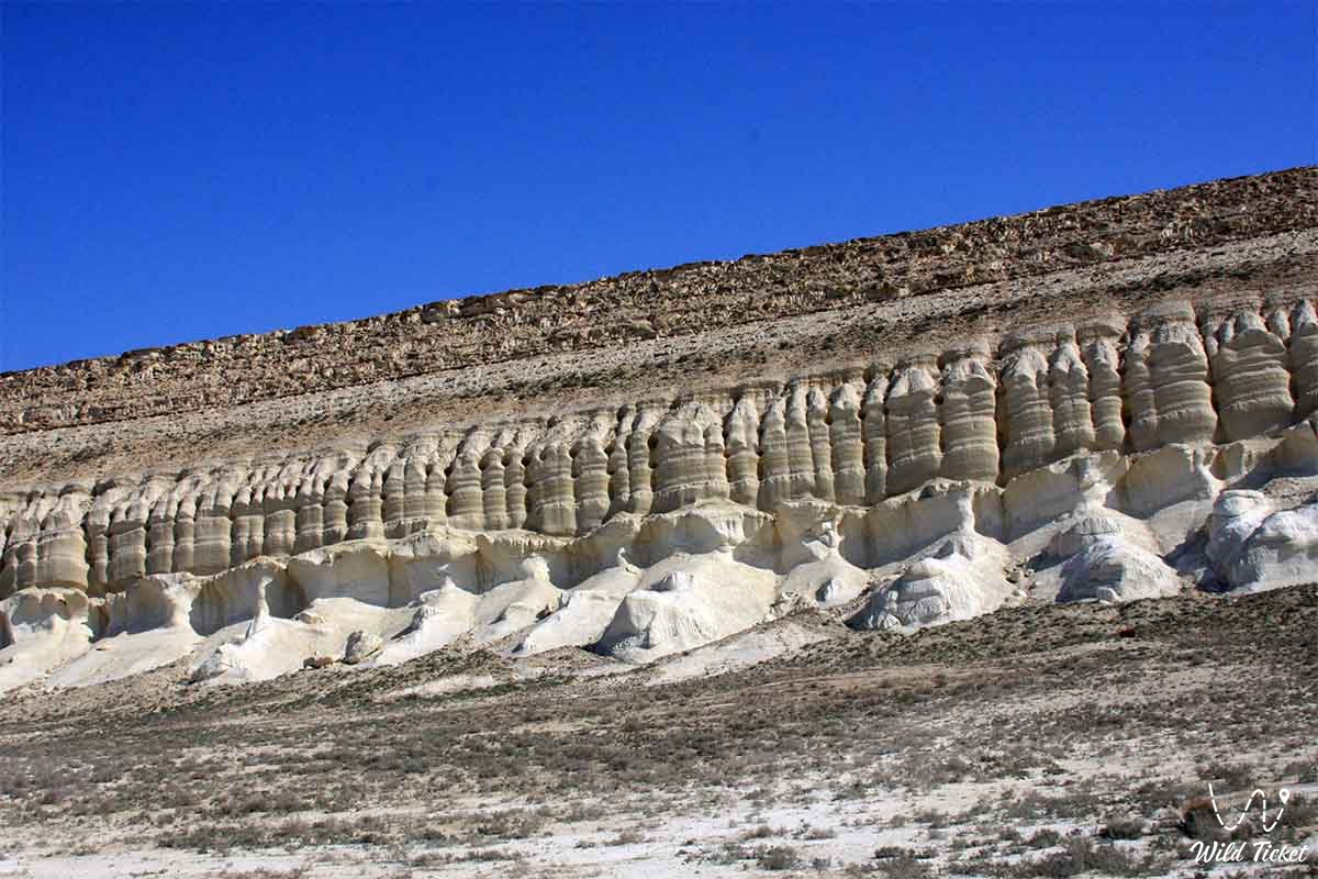
Northern Aktau
Northern Aktau (white cliffs 111 km of road to Kalamkas and Karazhanbas) can be defined as the "Chalk Mountains". The mountains are composed of limestones, marls and white clays.
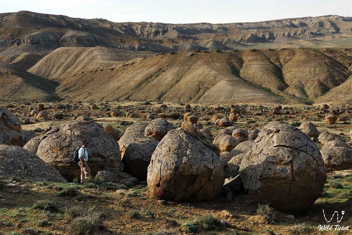
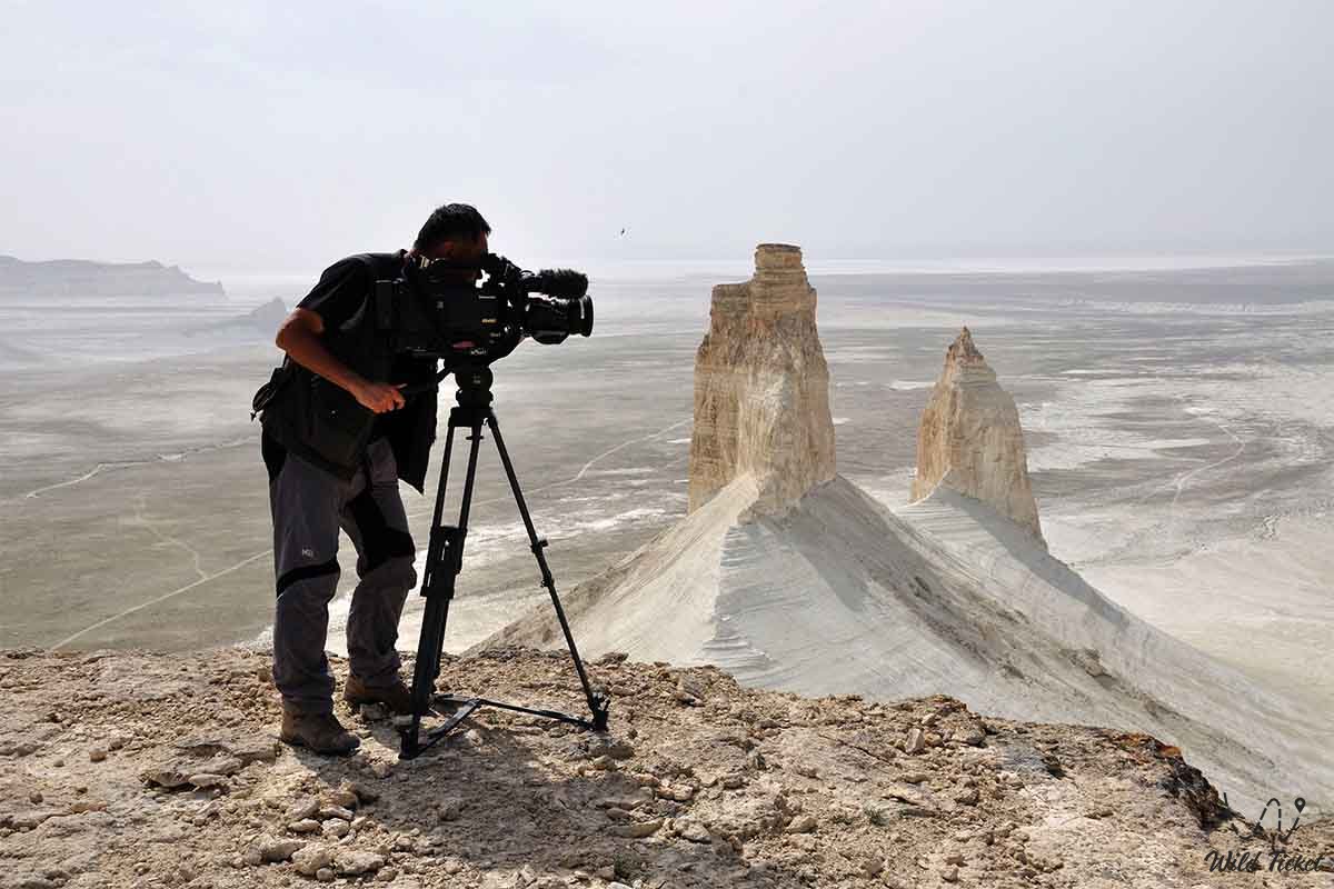
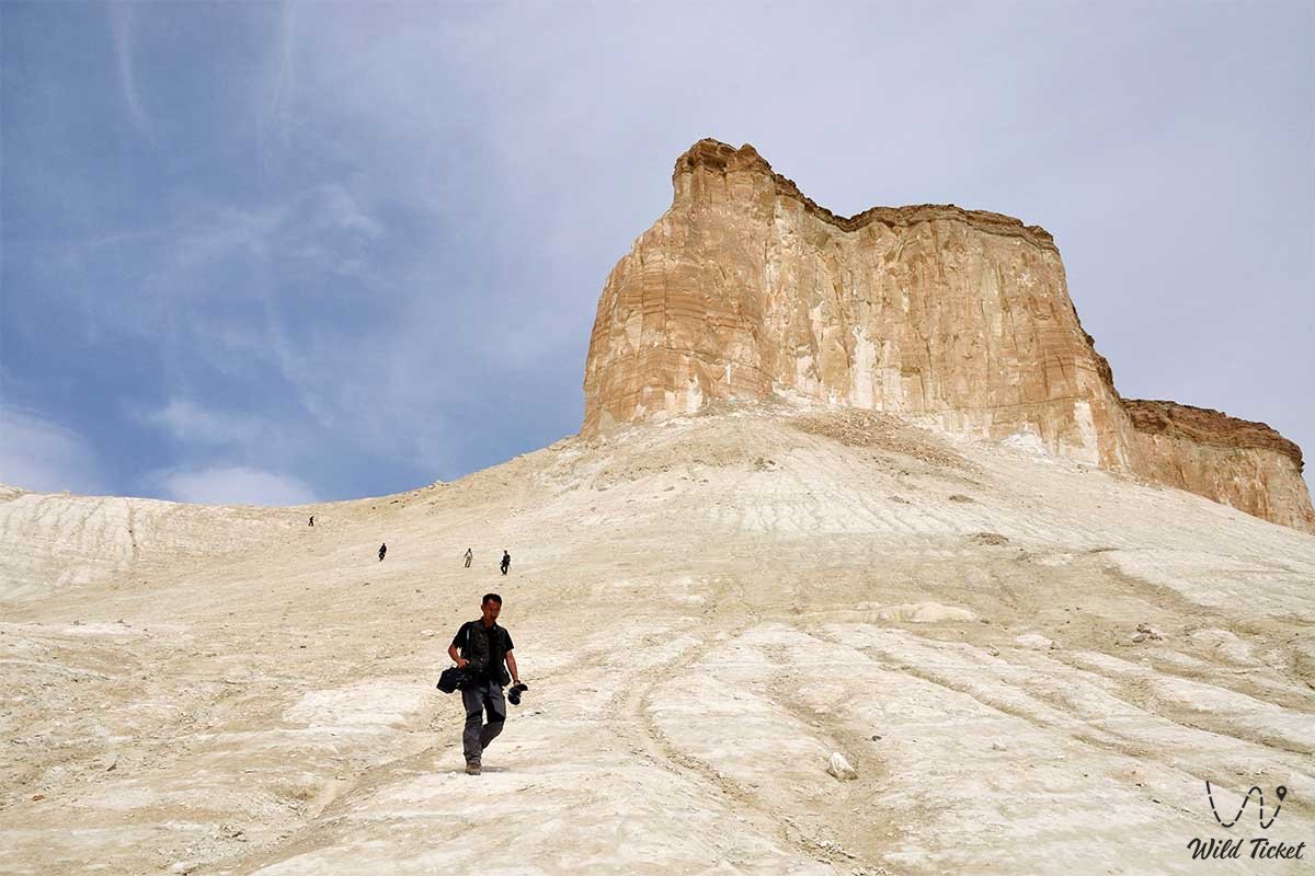
Sherkala mount
Shergala (Sherkala) is a lonely mountain of unusual shape, about 170 kilometers from the city of Aktau, near Shetpe. On the one hand, the mountain resembles a huge white yurt, on the other, it resembles a sleeping lion with its head resting on its paws. Shergala translated from Turkmen means “Lion Mountain” or “Lion Mountain”.
Around Shergaly there is a scattering of spherical boulders - nodules of various sizes. Many cracked by the wind. Other small nodules are broken. Inside is a trace of a shell or fish. Not far from Chergaly there is a green oasis: a spring and a small river Akmysh.
Large settlements Mangishlak peninsula.
Aktau (Shevchenko)
Beineu
Uzen
Mangyshlak
Zhetybai
Fort Shevchenko
Shetpe
Eralievo
Tauchik
Bautino
Akshukur
Sayotes
Boranculus
Industry
It was previously believed that the main wealth of the peninsula is oil (and you can often find oil rigs in the steppes - mainly oil is produced on the Buzachi Peninsula and the New Uzen area. In Soviet times, there was an active search for oil, now explored reserves are no less actively sold to foreign concerns).
However, the rapid development of the peninsula began in the 1960s with the discovery of a uranium ore deposit. The city of Shevchenko was created as a city of workers of the Caspian Mining and Metallurgical Combine. In 1972, a physical, and in 1973, energy start-up of the world's first industrial fast neutron nuclear reactor, BN-350, was carried out (it has now been stopped and is preparing for conservation).
Also, giants of the chemical industry were created under the USSR: ATZ, KHMZ, ZPM. All these huge factories are located in the industrial zone.
Photogallery: