Travel to Emba river in Kazakhstan -
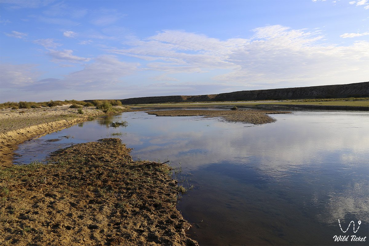
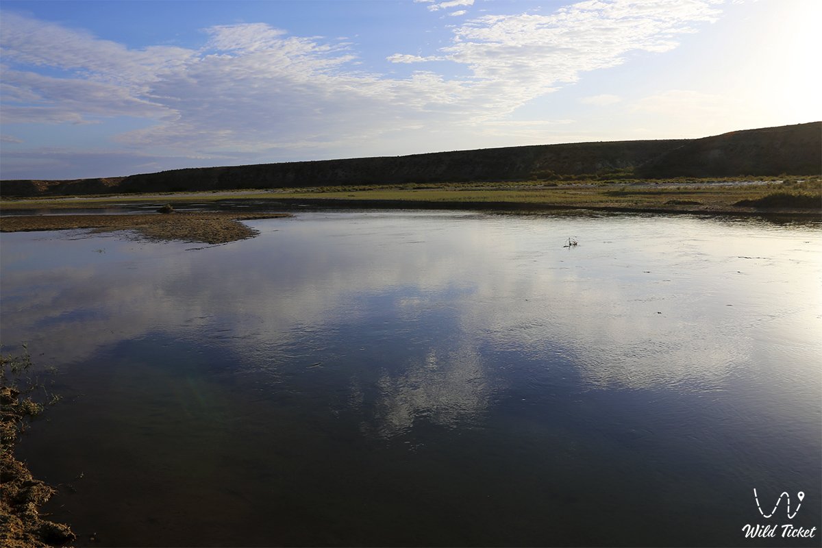
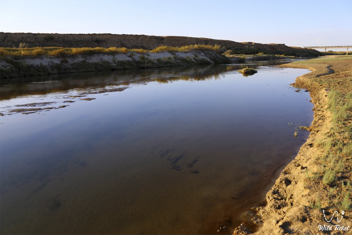
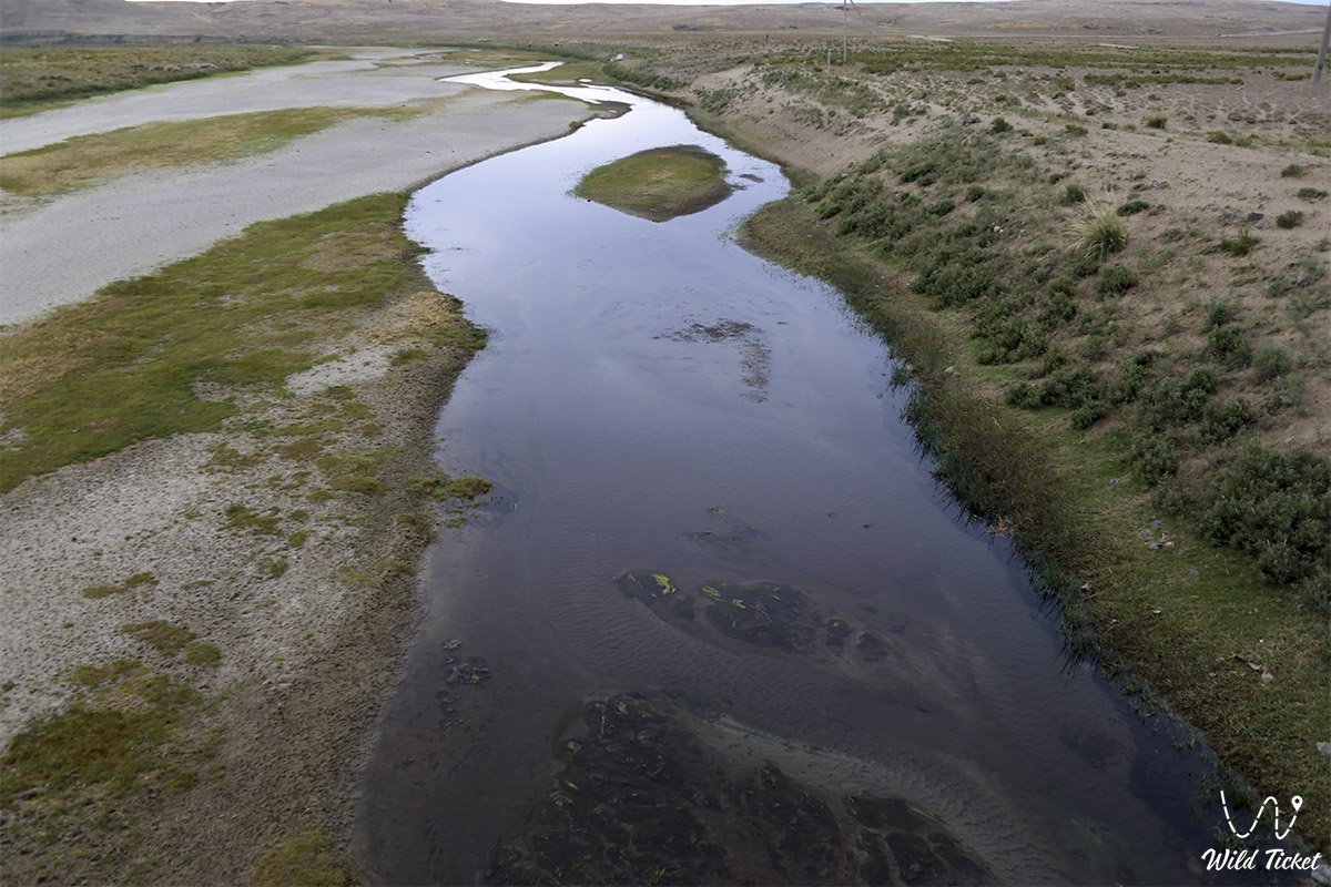
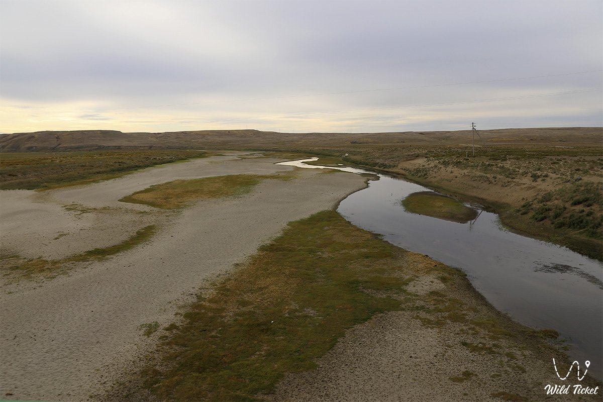
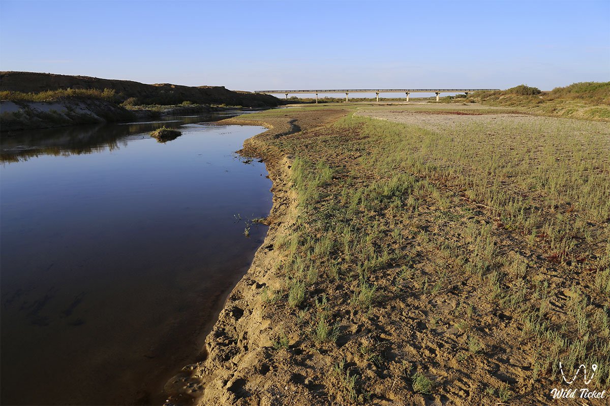
Emba is a river in the Aktobe and Atyrau regions of Kazakhstan, dividing the European and Asian parts of the country. The length is 712 km (in flood), the basin area is 40,400 km². The origins on the western slopes of Mugodzhar, flows along the Podural plateau and the Caspian lowland. It is lost among the salty coastal swamps (litter), in the full-flowing years it reaches the Caspian Sea. The food is mostly snow. The main runoff in April - May, during the rest of the year it often dries up, breaking into separate reaches.
Water is highly mineralized: in the upper reaches from 150-200 mg / l in spring to 800 mg / l in summer; in the lower reaches, 1500-2000 mg / l in the spring and 3000-5000 mg / l in the summer. The main tributaries, the course of which is also seasonal: Temir (right) and Atsaksy (left).
Oil and gas are produced in the middle and lower reaches of the Emba (North Emba oil and gas region, South Emba oil and gas region, East Emba oil and gas region).
It is believed that the conditional border between Europe and Asia passes along the river (there are other interpretations).
Information
The Emba basin is located in the steppes and semi-deserts. In its upper part, it represents a Cretaceous plateau dissected by erosion, in the lower - the river flows in the Caspian lowland, which has a barely noticeable deviation to the sea. About 20 km from the sea, the river forms a delta with three main branches: Kara-Uzyak, Kiyan and Kulok. Emba is extremely poor in water. Its nutrition occurs almost exclusively due to melting snow. In the spring it is full of water, and in the summer it represents a number of disconnected stretches of forest with stagnant water. Emba waters in spring contain a large mount of sediment. After rains, the river carries muddy, dirty-milky-colored water.
Origin of name
In the Kazakh language, Emba has two variants of the name, kaz. Embi and Kaz. The press. The first is official, but of little use, the second is used locally more often. Embi comes from the Turkmen (Oguz, whose tribes roamed in the region until the XVII-XVIII centuries) Yem boyı (Ýem boýy) literally translates as a valley of food or a valley of health. In Kazakh, this word fell both with the reduction of vowels (y) embi (the initial e is pronounced as diphthong ye), and in the form of a translation of Jem with the meaning of nutrition.
From the name of the river comes the name of the Nogai-Dzemboyluks, who had previously wandered on the banks of the river and, under the pressure of the Kalmyk invasion, resettled in the Kuban and the Northern Black Sea region in 1728.
Algemba railway and oil pipeline on Emba river
In January 1920, construction began on the Algemba railway and oil pipeline (based on the first letters of the words Aleksandrov Gai and Emba), which was supposed to connect the Aleksandrov Gai station (Saratov region) with the North Emba oil and gas region located at the mouth of the Emba river near the village of Makat. Work on the construction of the road and the pipeline was discontinued in August 1921, it was not commissioned. According to some reports, a large number of people died during the construction of the road from hunger, thirst and epidemics.
The border between Europe and Asia
Preliminary results of the expedition of the Russian Geographical Society in Kazakhstan in April - May 2010 showed that the border of Europe and Asia along the Ural River, as well as along the Emba, does not have sufficient grounds. South of Zlatoust, the Ural ridge loses its axis and breaks up into several parts. Then the mountains gradually disappear, that is, the main landmark disappears during the border. The Ural and Emba rivers do not divide anything, since the terrain they cross is identical.
The conclusion of the expedition is as follows: the southern part of the border runs from the Ural Mountains to their continuation on the territory of Kazakhstan to the Mugodzhary Mountains (Aktobe region), then along the edge of the Caspian Lowland, where the East European Plain ends. The Caspian lowland was formed millions of years ago when the Caspian Sea washed over the western ledges of the Ustyurt plateau. Therefore, most likely, the border between Europe and Asia should be considered the edge of this geological formation.
Photogallery: