Photo tour of Turgai geoglyphs -
Take a photo of Turgai geoglyphs from a quadcopter (drone) -
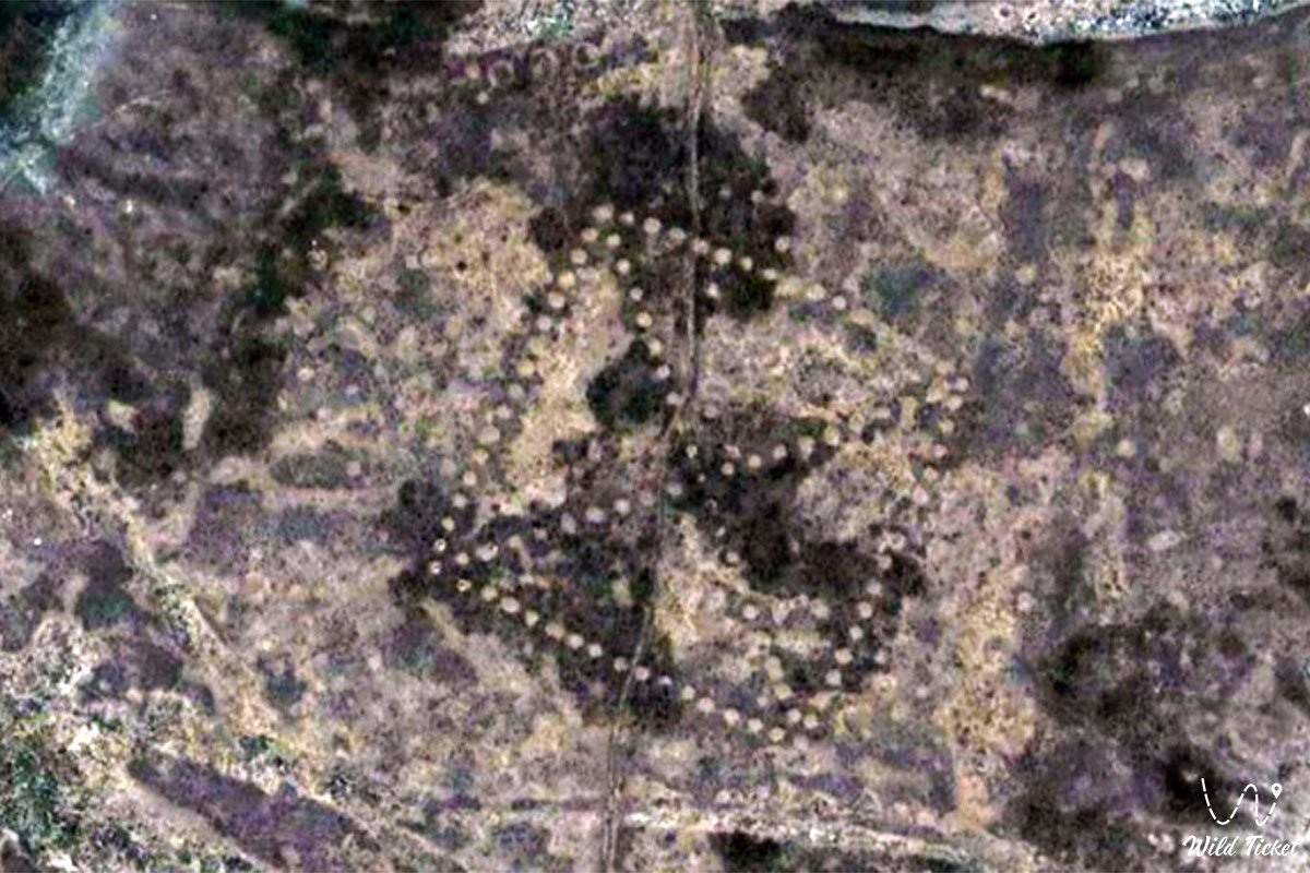
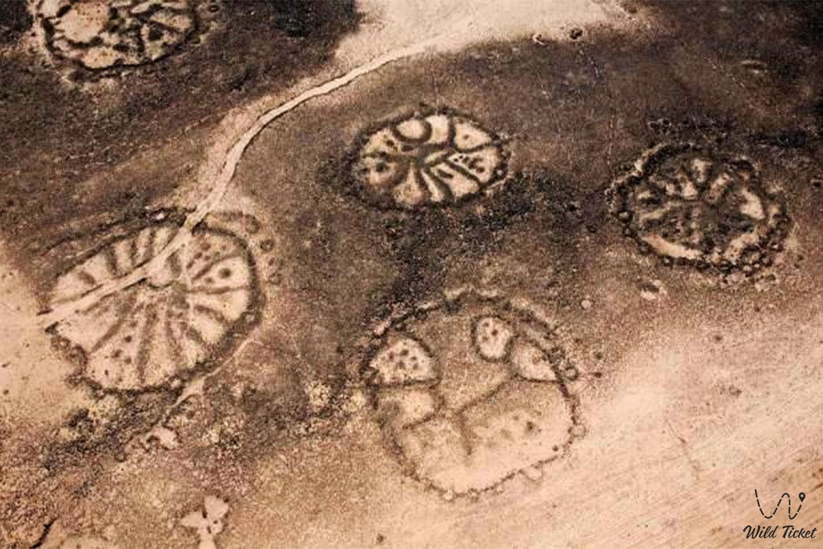
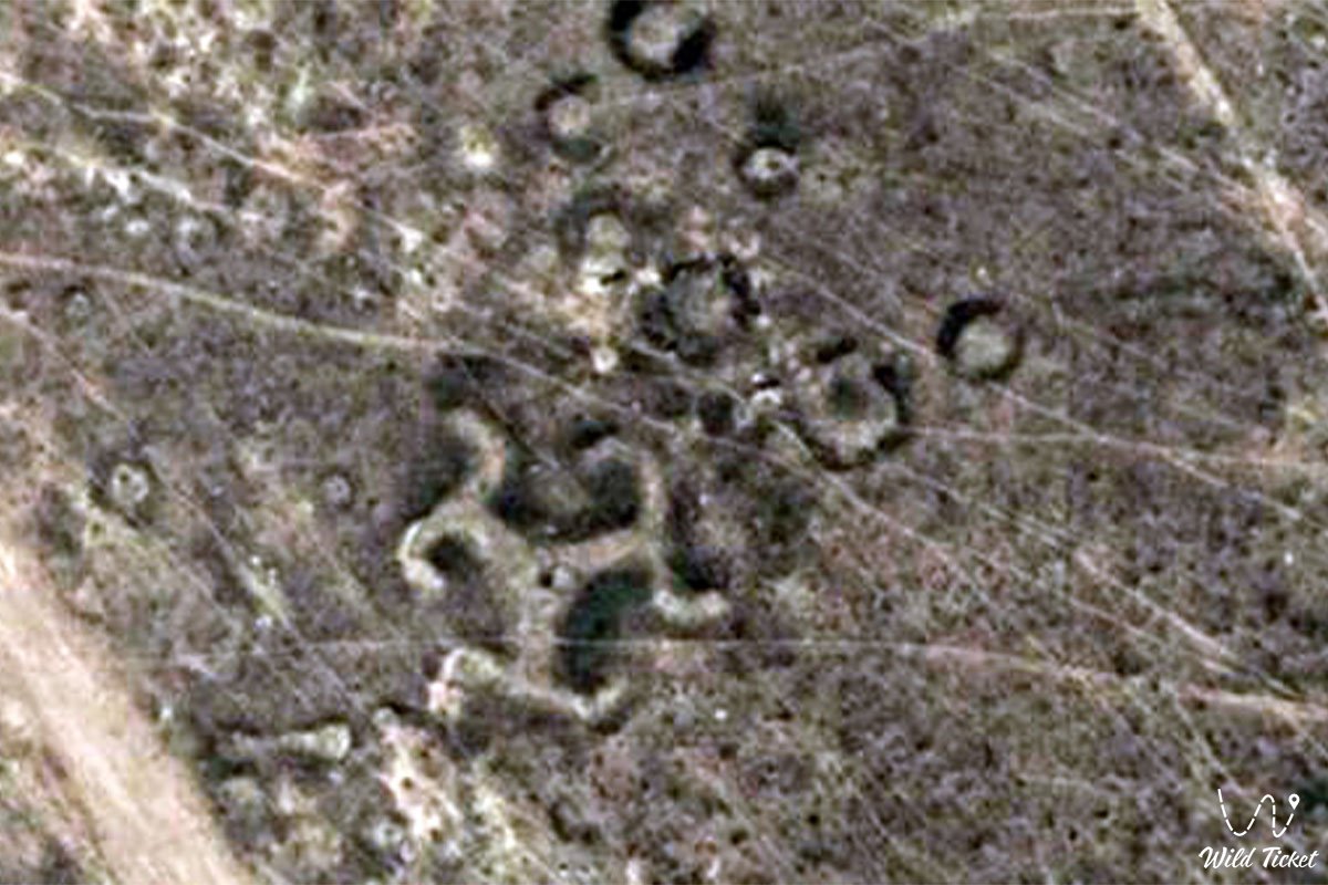
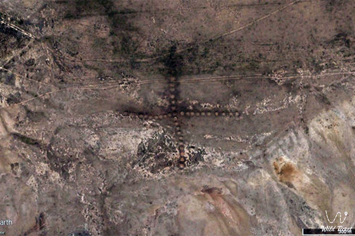
Turgai geoglyphs-also known as steppe geoglyphs, are geometrically rather large figures in various frequent plateaus of Turgai, Northern Kazakhstan. Geoglyphs are made in the form of lines, squares, crosses, circles. In total, there are about 260 different kinds of geoglyphs, the most interesting and well-preserved are the "Turgai Swastika", "Shili square" and "Ushtogai square". These geoglyphs were studied, and aerial photographs of the geoglyphs were taken. If desired, you can use the exact coordinates to see what these geoglyphs look like in the Google Earth program.
---------------------------------------------
How to get there, see -
Turgai geoglyphs are located in Northern Kazakhstan, Turgai plateau, Kostanay region, Republic of Kazakhstan.
GPS coordinates: 50.832933°N 65.326276°E (Ushtogai square)
---------------------------------------------
Information
Turgai geoglyphs consist of or are made of small mounds, mounds of stones, or furrows left on the ground. The sizes of the geoglyphs range from 90 meters to 400 meters or more. Geoglyphs were first discovered in 2007 by researcher and enthusiast Dmitry Day, initially he was looking for traces of pyramids in Kazakhstan, but discovered these geoglyphs and began to study them thoroughly. There is no exact dating of these geoglyphs, Dmitry made assumptions that the geoglyphs were made from 1 to 8 thousand years ago and belong to the ancient Mahanjar culture.
Photogallery:


Comments 2