Travel on the Caspian Sea – Photo tour to the Caspian Sea -
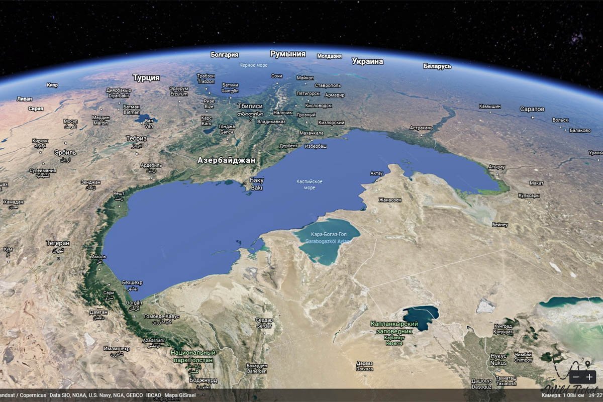
The Caspian Sea, the Russian Caspian Sea, the Persian Darya-Heather, the world's largest inland body of water. It is located east of the Caucasus Mountains and west of the vast steppe of Central Asia. The name of the sea comes from the ancient peoples of the Caspian Sea, who once lived in Transcaucasia in the west. Among its other historical names, Khazarsk and Khvalynsk come from the former peoples of the region, and Hyrkansk comes from Hyrkanos, "The Land of Wolves."
How to get there and visit -
The elongated sea stretches from north to south for almost 750 miles (1,200 km), although its average width is only 200 miles (320 km). The sea covers an area of about 149,200 square miles (386,400 square kilometers) - larger than the area of Japan - and its surface is about 90 feet (27 meters) below sea level. The maximum depth in the south is 3,360 feet (1,025 meters) below the sea surface. The sea is washed by Kazakhstan in the northeast, Turkmenistan in the southeast, Iran in the south, Azerbaijan in the southwest, and Russia in the northwest.
Tourist Information
The Caspian Sea is the largest salt lake in the world, but this has not always been the case. Scientific studies have shown that until relatively recent geological times, about 11 million years ago, it was connected through the Azov, Black and Mediterranean Seas with the World Ocean. The Caspian Sea is of exceptional scientific interest because its history - especially previous fluctuations in both area and depth - provides clues to the complex geological and climatic evolution of the region.
Anthropogenic changes, especially those resulting from the construction of dams, reservoirs, and canals in the vast Volga River system (which flows into the Caspian Sea from the north), have affected the modern hydrological balance. Caspian shipping and fishing play an important role in the region's economy, as do oil and natural gas production in the Caspian basin. The magnificent sandy beaches of the sea also serve as resorts for recreation and recreation.
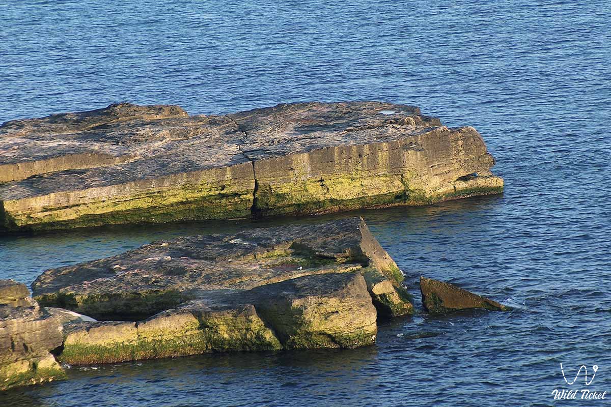
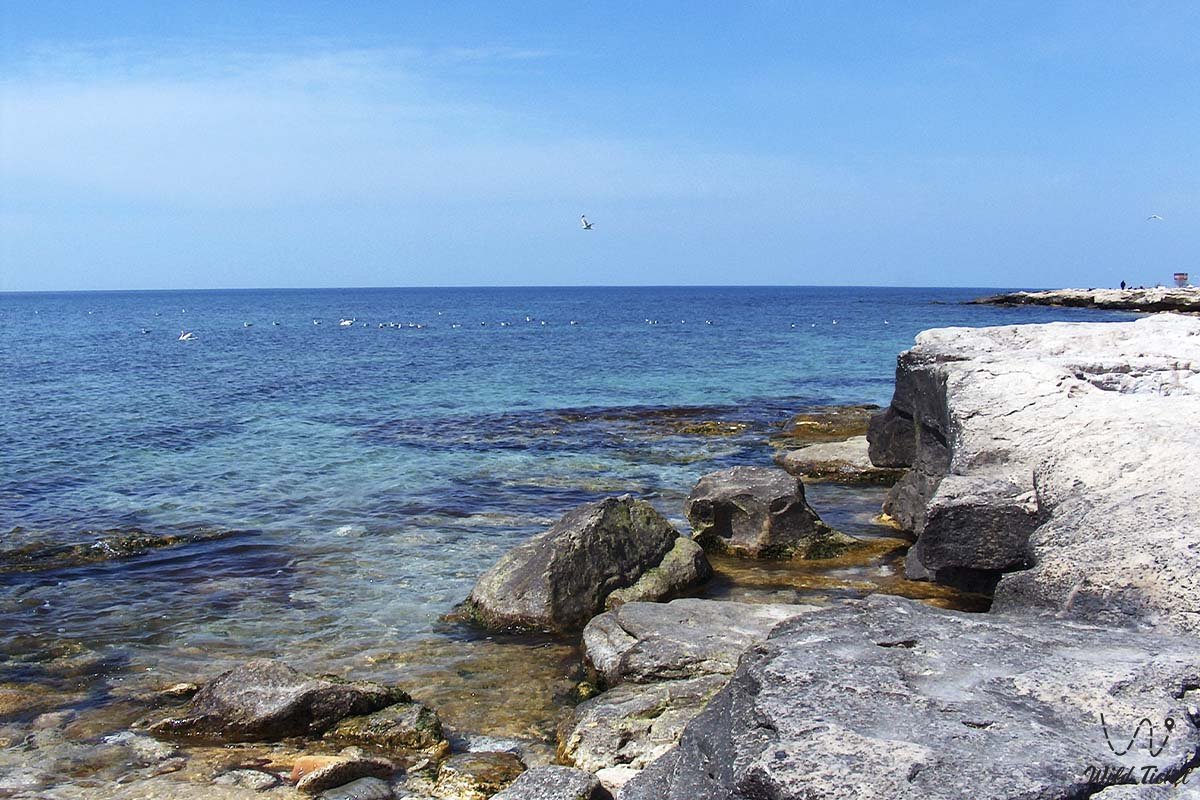
Islands of the Caspian Sea
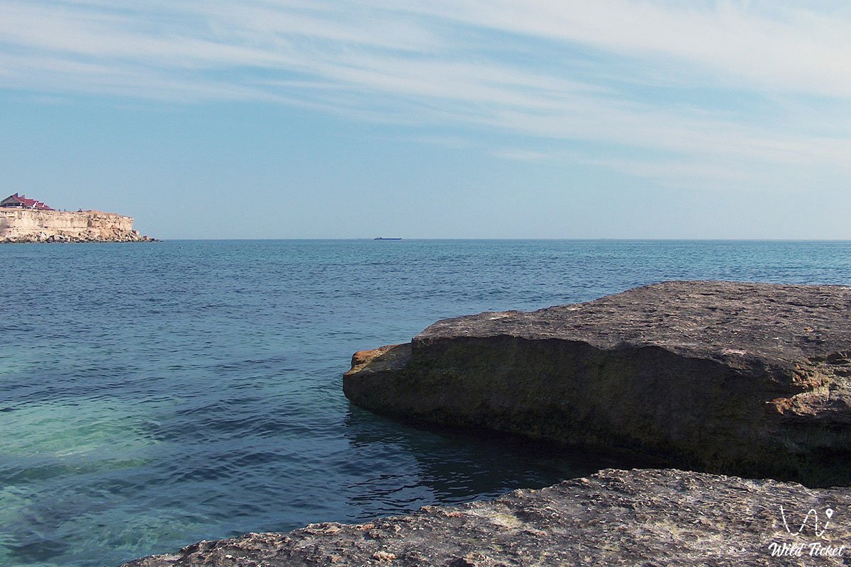
The Caspian basin as a whole is usually divided into the northern, middle and southern Caspian, based partly on the underwater relief, and partly on hydrological characteristics. There are about 50 islands in the sea, most of which are small. The largest ones are Chechensky, Tyulensky, Morskoy, Kulalny, Zhily, Ogurchinsky.
Coastline Features
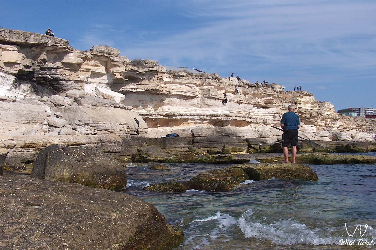
The shores of the Northern Caspian Sea are low and reflect a large accumulation of alluvial material washed away by the Ural, Terek and, above all, Volga rivers, whose deltas are extensive. The western coast of the Middle Caspian is hilly. The foothills of the Greater Caucasus loom close, but are separated from the coast by a narrow sea plain. The Absheron Peninsula, on which Baku is located, juts into the sea here, and to the south of it the floodplain of the Kura and Araks rivers forms the Kura-Araks lowland along the western coast of the southern Caspian Sea.
The southwestern and southern shores of the Caspian Sea are formed by deposits of the Lankaran and Gilan-Mazanderan lowlands, with high peaks of the Talysh and Elburz ranges rising inland. The eastern coast of the Southern Caspian Sea is low, partly formed by sediments formed as a result of the erosion of rocks along the sea. The coastline here is sharply indented by the low hilly peninsulas of Cheleken and Turkmenbashi.
To the north, beyond the eastern shore of the middle Caspian Sea, is Kara Bogaz Gol (Garabogazkel), formerly a shallow bay of the Caspian Sea, but now a large lagoon bay separated from the sea by a man-made embankment. The eastern coast of the Middle Caspian Sea is mostly steep, the sea destroys the outskirts of the limestone plateaus Tyupkaragan and Kendyrli-Kayasansk.
The main rivers - Volga, Ural and Terek - flow into the northern Caspian Sea, and their combined annual discharge accounts for about 88 percent of all river water entering the sea. The Sulak, Samur, Kura and a number of smaller rivers flow into the western coast of the middle and southern Caspian, providing about 7 percent of the total flow into the sea. The rest comes from the rivers of the southern Iranian coast. In addition to the Atrak River in southern Turkmenistan, the arid eastern coast of the sea is characterized by a complete absence of permanent watercourses.
Geology and relief
The relief of the Caspian Sea reflects its complex geological structure. The bottom of the northern Caspian Sea is extremely old, dating back to Precambrian times or at least about 541 million years ago. The bottom of the Northern and Middle Caspian Sea has a continental-type crustal structure. The northern part is part of a tectonic depression in the north of the Caspian Sea, a vast trough in a large ancient structural block known as the Russian Platform. Mangyshlak connects the Tyupkaragan mountain peninsula in the east with the western coastal structures lying below it.; These are the remnants of a distant structural uplift of the Hercynian mountain formation, which occurred about 300 million years ago.
It has been suggested that the Middle Caspian depression arose as a result of the deflection of the edges of those ancient structures that occurred in the Late Paleozoic, approximately 252 million years ago. The bottom of the Middle Caspian is very complex. In the west, the underwater shelf is part of the deflection of the Greater Caucasus geosyncline (deflection of the Earth's crust), while the flooded Turanian platform in the east rises in a shape known as the Kara-Bogazsky (Garabogazsky) shaft.
The features of the Absheron Peninsula region, along with the folded structures on the western side of the southern part of the Caspian Basin, originate from the processes of Alpine mountain formation and folding (dating back to about 26-10 million years ago), which created the Caucasian Ridges. In fact, the border between the middle and southern Caspian is still undergoing folding. The entire southern Caspian Sea rests on a very ancient structure of suboceanic basalt crust, although in the south this rock is covered with huge accumulations of sedimentary layers many miles thick.
Until the beginning of the Late Miocene epoch (about 13.8 million years ago), the Caspian Sea basin was connected to the Black Sea through a structural depression known as the Manych Trench (or Kuma-Manych Depression). After uplifting at the end of the Miocene, the Caspian Sea turned into a closed body, with oceanic underwater characteristics preserved today only in the southern Caspian. Communication with the ocean was temporarily restored in the Early Pleistocene epoch (about 2.6 million years ago), and there may also have been a connection to the north through the Russian Plain with the Barents Sea of the Arctic Ocean.
About 2 million years ago, glaciers advanced and retreated across the Russian Plain, and the Caspian Sea itself-in successive phases known as Baku, Khazar, and Khvalyn-alternately contracted and expanded. This process has left a legacy in the form of peripheral terraces that mark old coastlines and can also be traced back to geologically recent underlying sedimentary layers.
The bottom of the Caspian Sea is now covered with recent sediments, fine-grained in shallow waters in the north, but with shell deposits and oolitic sand reflecting the high lime content in the waters of the Caspian Sea, widespread in other coastal areas. Calcium carbonate also affects the composition of deeper bottom layers.
Climate
The northern Caspian Sea is located in the zone of temperate continental climate, and the middle (and most of the southern) The Caspian Sea is located in a warm continental zone. The southwest is influenced by the subtropics, and this remarkable diversity is complemented by the desert climate prevailing on the eastern shore. The atmospheric circulation in winter is dominated by the cold, clean air of the Asian anticyclone, while in summer it is influenced by the high-pressure spurs of the Azores Islands and the South Asian low-pressure centers.
The cyclonic disturbances coming from the west and the tendency of the Caucasus Mountains to block them are complicating factors. As a result of these factors, the northern and north-western (almost one third of cases) and south-eastern (more than one third) directions of circulation prevail. Fierce storms are associated with northerly and southeasterly winds.
Summer air temperatures are fairly evenly distributed - the average values from July to August range from 75 to 79 °F (24 and 26 °C), with a maximum of 111 ° F (44 °C) on the sun-scorched eastern shore, but the average monthly winter temperature ranges from 14 °F (-10 ° C) in the north to 50 ° F (10 °C) in the south. The average annual precipitation, which falls mainly in winter and spring, ranges from 8 to 67 inches (200 to 1,700 mm) above the sea, with the lowest rainfall in the east and the highest in the southwest. Evaporation from the sea surface is high, reaching 40 inches (1015 mm) per year. Ice formation affects the northern Caspian Sea, which usually freezes completely by January, and in exceptionally cold years, the ice floating along the western coast reaches south to the Absheron Peninsula.
Hydrology
Short-term fluctuations in sea level caused by wind can reach 7 feet (2 meters), although they average about 2 feet (60 cm). Seiches (free or standing fluctuations of the sea surface, mainly caused by winds and local changes in atmospheric pressure) are usually less pronounced. Tidal changes are only a few inches (or centimeters), and seasonal rises caused by high levels of spring water in rivers are not much more.
One of the most fascinating aspects of exploring the Caspian Sea is the reconstruction of long-term fluctuations over the centuries based on archaeological, geological and historical data. It seems that since the 1st century BC, the water level in the Caspian Sea has fluctuated by at least 23 feet (7 meters). The main causes of long-term fluctuations are climatic changes, which determine the balance between water inflow (river inflow and precipitation) and losses (evaporation). During the first three decades of the 20th century, the Caspian Sea level was close to 86 feet (26 meters) below sea level, but in 1977 it dropped to 96 feet (29 meters), the lowest level recorded in the last 400 to 500 years.
The rapid rise in water levels began in 1978 - in the mid-1990s, sea level was 87 feet (26.5 meters) below sea level - but after 1995, sea levels dropped slightly, and in the early 21st century rose again. The decline that took place between 1929 and 1977 was due to climate change, which increased evaporation and reduced river inflows, which was reinforced by the construction of a reservoir on the Volga to supply river water for irrigation and industry.
The rise in water levels after 1978 was also the result of climate change, which caused an increase in inflows from the Volga River, which in some years was significantly higher than average. An increase in precipitation over the sea and a decrease in evaporation also contributed to this phenomenon. In 1980, Soviet hydrologists stopped the outflow to Kara Bogaz Gol by building sand barricades between the Caspian Sea and the lagoon. The planners paid serious attention to the feasibility of other measures to stabilize the water level in the Caspian Sea.
In summer, the average surface temperature of the Caspian Sea ranges from 75 to 79 °F (24 to 26 °C), while in the south it is slightly warmer. However, there are significant winter contrasts: from 32 to 45 °F (from 0 to 7° C) in the north to 46-50 ° F (8 to 10 °C) in the south. Deep-sea upwellings off the eastern shore - the result of prevailing wind activity - can also lead to a noticeable decrease in temperatures in summer.
The salinity in the Caspian Sea averages about 12.8 parts per thousand, but this figure hides fluctuations from only 1 part per thousand at the mouth of the Volga to a high 200 parts per thousand in Kara Bogaz Gol, where intense evaporation occurs. . In the open sea, the salinity distribution is noticeably uniform; from the surface to the bottom, it increases by only 0.1–0.2 parts per thousand. The Caspian waters differ from the oceans in their high content of sulfates, calcium and magnesium carbonate and, as a result of the influx of rivers, in their lower content of chlorides.
The circulation of water masses occurs mainly counterclockwise (from north to south along the western shore), with a complex pattern developing further south, where several side movements are observed. Currents can increase where they coincide with strong winds, and the sea surface is often heaved by waves. The maximum storm surges occurring near the Absheron Peninsula were measured at an altitude of over 30 feet (9 meters).
Marine life of the Caspian Sea.
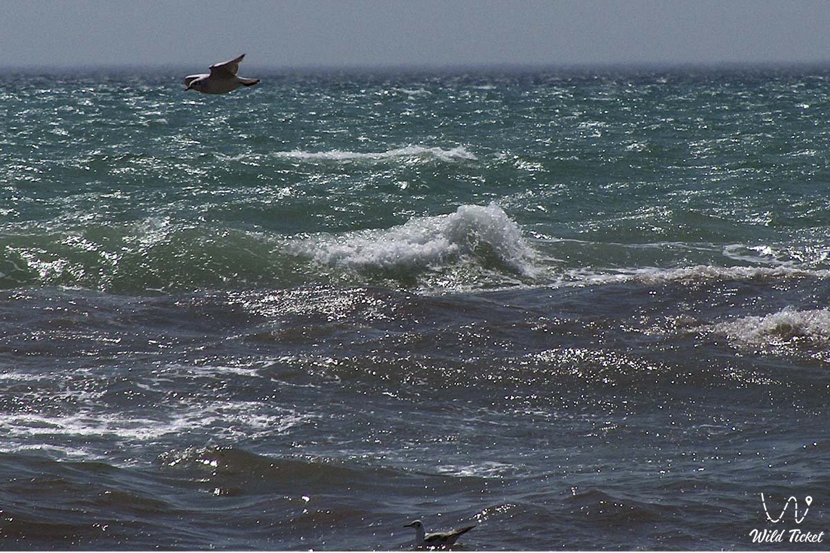
The Caspian Sea is home to about 850 species of animals and more than 500 species of plants. Although the number of species is relatively small for a body of water of this size, many of them are endemic (that is, they are found only there). Blue-green algae (cyanobacteria) and diatoms make up the largest concentration of biomass, there are several types of red and brown algae. Wildlife that has been strongly affected by changes in salinity includes fish species such as sturgeon, herring, pike, perch, and sprat; several species of shellfish; and many other organisms, including sponges. About 15 species of Arctic (for example, the Caspian seal) and Mediterranean types complement the main fauna. Some organisms migrated to the Caspian Sea relatively recently: shells, crabs and shellfish, for example, were brought by sea vessels, and mullet was deliberately imported by humans.
Economy
The Caspian Sea has long been famous for sturgeon, which are valued for their caviar, and the sea accounts for most of the world's catch. During a long period (1929-77) of decreasing water levels and the subsequent drying up of the most favorable spawning grounds, the population of sturgeon decreased significantly. A number of measures have been taken to improve the situation, including a ban on fishing for sturgeon on the high seas and the introduction of aquaculture. The seal industry was also developed in the northern regions, mainly from fur.
Oil and natural gas have become the region's most important resources. The operation began in the 1920s, expanded significantly after World War II and continued until the 21st century. Oil from the seabed is extracted using drilling platforms and artificial islands. The most promising reserves are located under the Northeastern Caspian Sea and adjacent shores. Minerals such as sodium sulfate extracted at Kara Bogaz Gol are also of great economic importance.
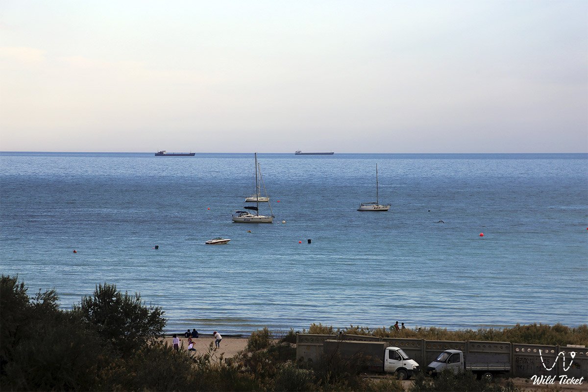
Shipping
The Caspian Sea plays an important role in transportation across the region: oil, timber, grain, cotton, rice, and sulfates are the main cargoes, while Astrakhan and Makhachkala are in Russia, Baku in Azerbaijan, Bandar-e-Anzali in Iran, and Turkmenbashi in Turkmenistan. Aktau is the most important port in Kazakhstan. They are also connected by regular passenger flights, and the train is transported directly, without unloading, between Baku and Turkmenbashi.
In the late 1990s, several Caspian littoral countries entered into agreements with oil companies to build new pipelines to bring oil and natural gas from the region to the market. One of them, the oil pipeline from Baku to Ceyhan, Turkey, on the Mediterranean coast, was opened in 2005. Another project, the trans-Caspian pipeline, will transport Turkmen natural gas under the Caspian Sea to Azerbaijan.
Research
Scientific exploration of the Caspian Sea began in the 18th century on the initiative of Peter the Great. The first report on the sea was published by the Russian Academy of Sciences in 1720. Fyodor I. Soymonov's description of the sea, containing the first navigation instructions, and an atlas of the sea were published in 1731. Hydrographic studies of the Caspian basin were continued by the Russian Navy and were completed mainly in the second half of the 19th century. Important sea level measurements were started in Baku in 1830 and are currently being carried out in more than 20 locations.
The first multidisciplinary studies of the Caspian Sea (hydrological, chemical and biological) were conducted during the expeditions (1904, 1912-13, 1914-15) under the leadership of the Russian zoologist Nikolai Mikhailovich Knipovich. Regular hydrometeorological observations were started in the 20s of the last century. Research at sea is currently coordinated by the Scientific Council of the Caspian Sea. The most important programs are those that study long-term fluctuations in the regime and level of water in the sea, the protection of the marine environment and the preservation of biological productivity of the sea and unique natural features. With the collapse of the Soviet Union and the development of political conflicts in the region, no serious research was conducted during the 1990s. However, by the beginning of the 21st century, scientific research began to solve environmental problems in the region.
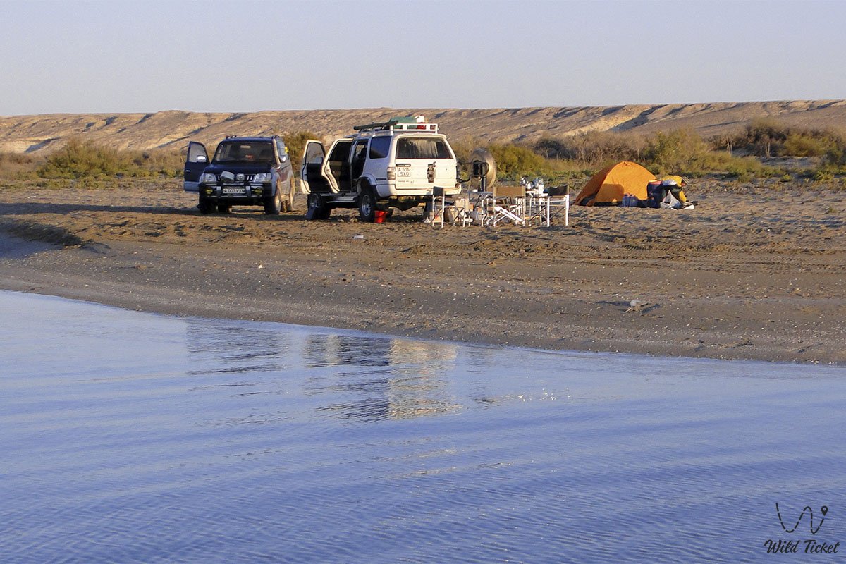
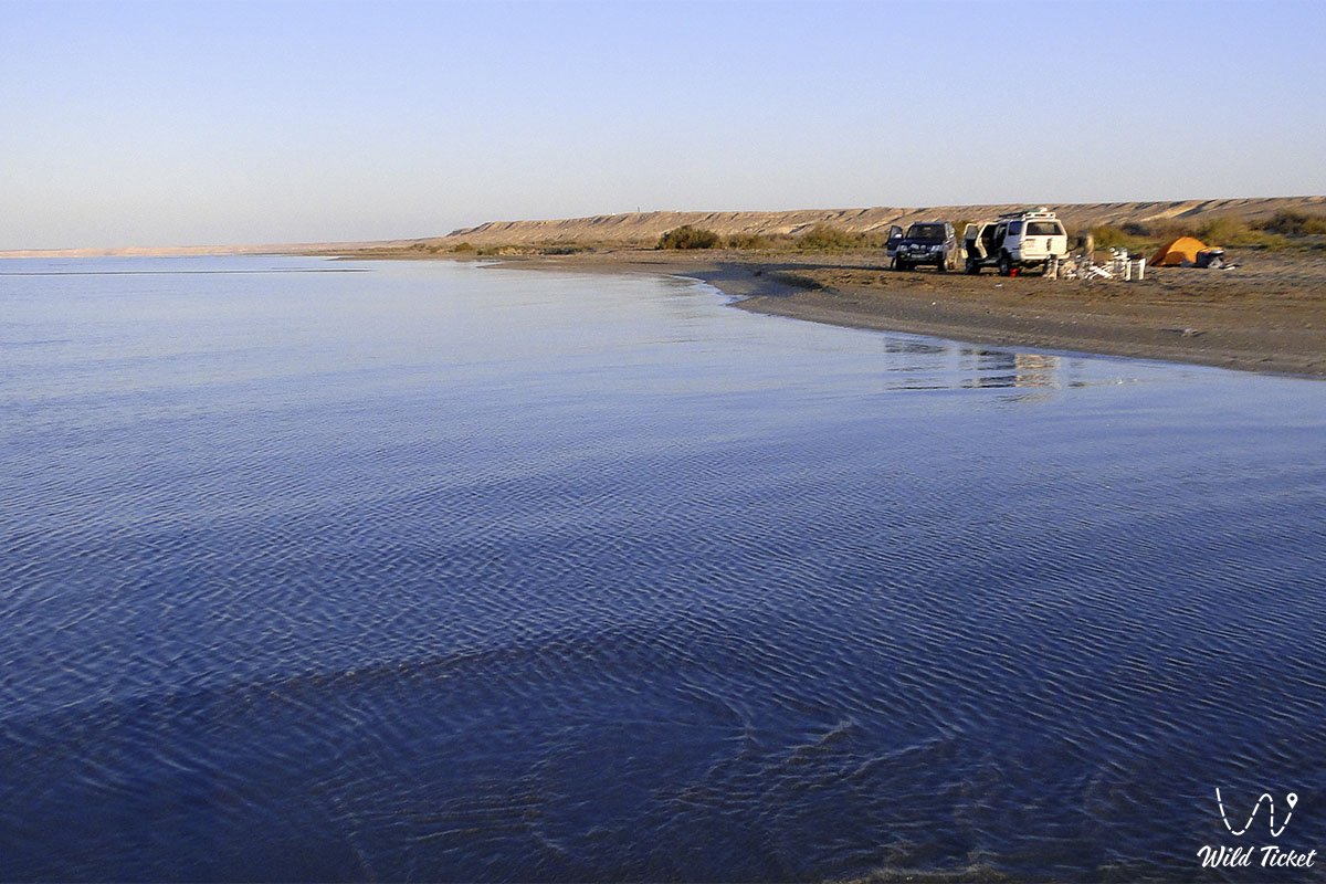
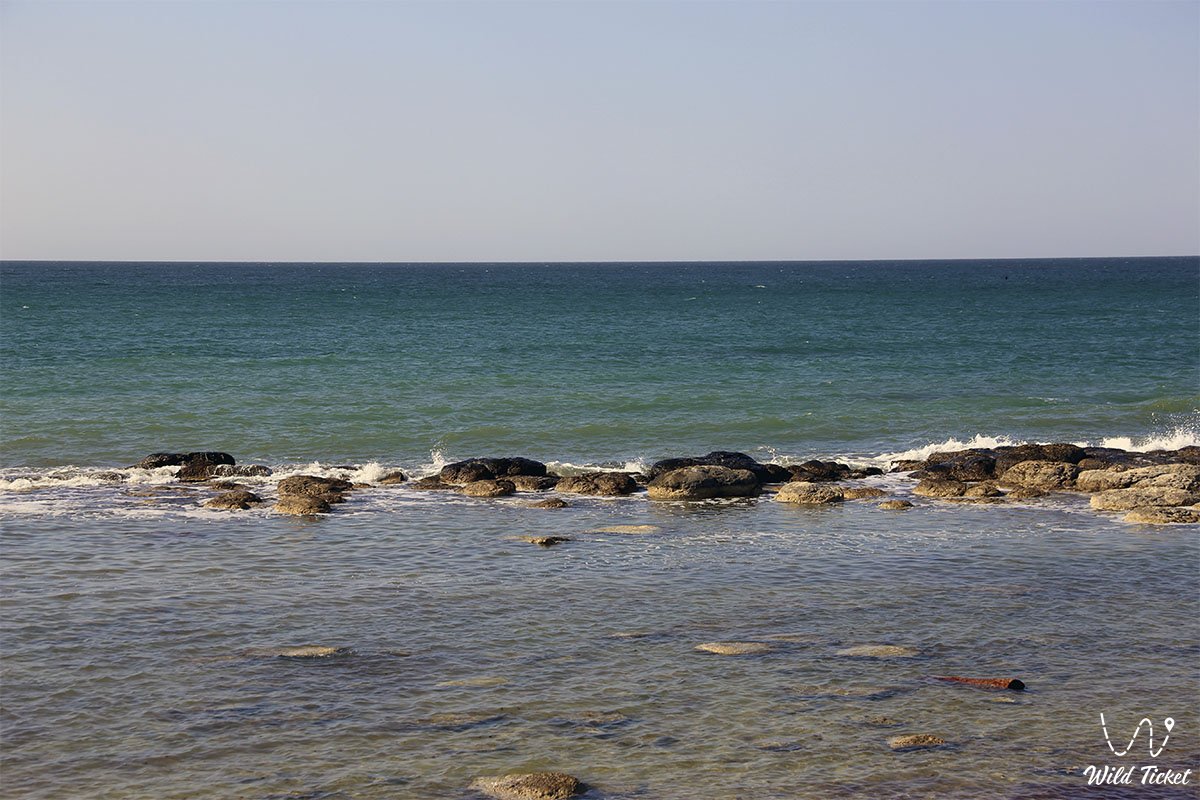
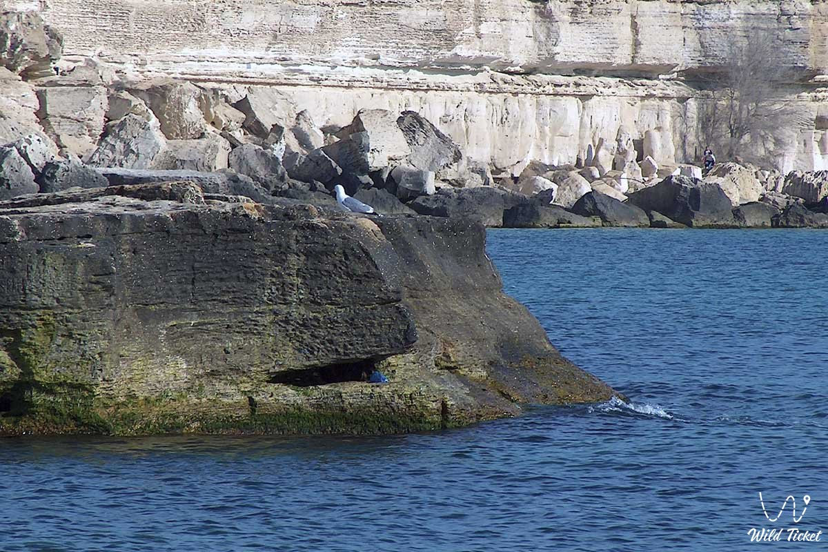
Photogallery: