Unique hydraulic landscape complex of Kazakhstan -
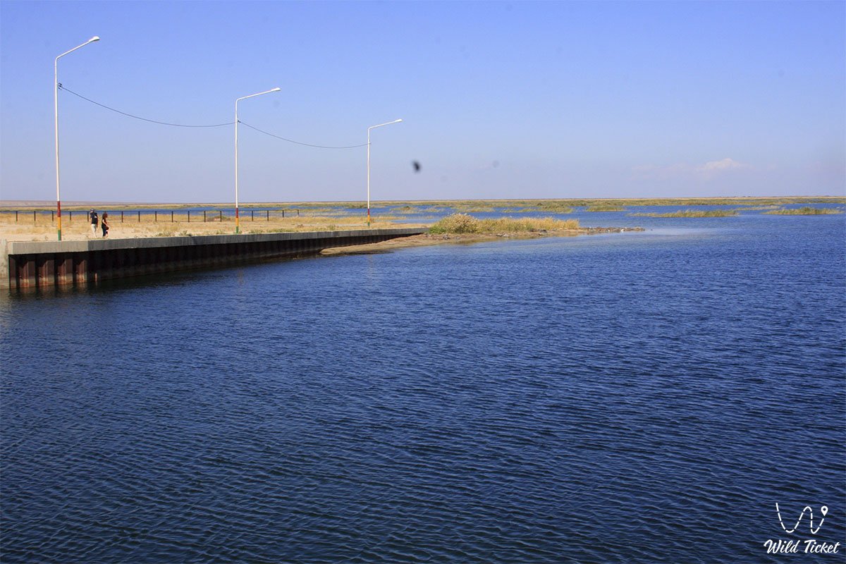
The Kokaral Dam is an original engineering and natural ensemble located in the Aral district of the Kyzylorda region, directly in the Berg Strait. This grandiose hydraulic structure, stretching for more than 13 kilometers, is located 104 kilometers southwest of the city of Aralsk, 25 kilometers from the village of Karateren, and just one and a half kilometers south of the delta of the Syr Darya River.
The major construction of this unique structure, costing more than 85 million US dollars, was fully completed in August 2005 with the financial support of the World Bank and the participation of Russian engineers. This boundary is situated in a key ecological zone of the Aral region, close to such iconic geographical sites as the vast Shevchenko Bay, the deep-water Butakov Bay, the Aklak sluice facility complex, and the Kerderi Mausoleum (ancient settlement).
Today, this dam is considered the primary symbol of the man-made salvation of the Northern (Small) Aral Sea, which stopped the catastrophic outflow of Syr Darya water into the drying Southern Aral. Thanks to the dam, the water level of the Small Sea rapidly rose to the project mark of 42 meters above sea level, the water salinity decreased, the local microclimate recovered, and the distance from Aralsk to the water's edge was reduced from 100 to 25 kilometers, bringing life back to the desert lands.
Via this link you can get acquainted with the list of tours to the Aral Sea.
---------------------------------------------
How to get there and visit -
The Kokaral Dam is located in the Berg Strait, 104 kilometers from the city of Aralsk (between the former Kokaral Peninsula and the Syr Darya River delta), Aral district, Kyzylorda region, Republic of Kazakhstan.
GPS coordinates: 46°06'07"N 60°46'10"E
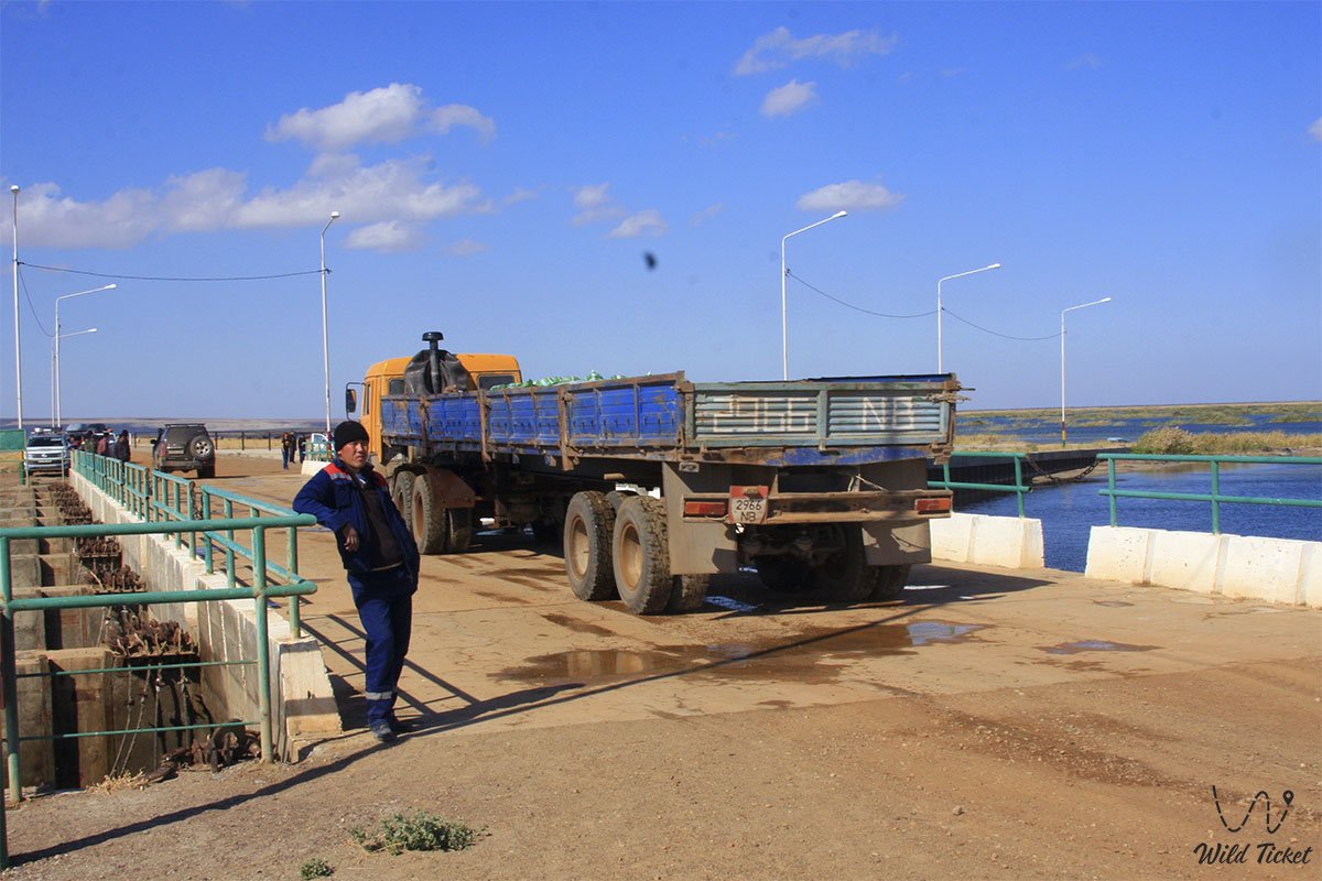
The transport logistics of this wild region completely exclude urban public transport. No regular buses or city taxi services operate here. You can reach the dam exclusively as part of organized expeditions or on your own.
Only a prepared four-wheel-drive SUV is suitable for the trip, as difficult steppe, dirt, and sand roads lead to the structure. Drivers must carry an additional supply of fuel, drinking water, navigators, and satellite communication devices.
Opening hours: The territory of the dam is open for observation around the clock and all year round. Access to the adjacent observation deck is completely free; there are no ticket offices, admission fees, or paid checkpoints here.
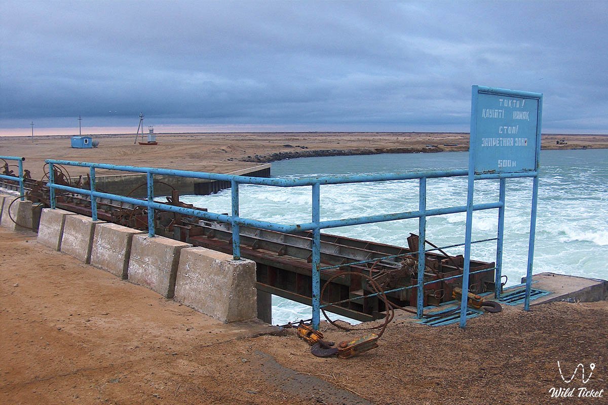
There is also information that recently the entire dam and the Aklak sluice facility have become strategic facilities and are under guard, so document checks and restriction of tourist access to certain areas are possible.
It is recommended to plan a trip to this region for the spring or early autumn period to avoid the extreme summer heat and sandstorms. All tent camps and parking sites are organized by tourists independently under expedition conditions, adhering to safety rules near hydraulic facilities.
Tour - Magic of the Small Aral: Journey to the Heart of the Receded Sea (5 Days).
---------------------------------------------
History
The history of this saving boundary is full of drama and dates back to the late 1980s, when due to critical shallowing, the single Aral Sea definitively divided into two isolated parts, and the fresh flow of the Syr Darya began to empty uselessly into the Big Aral. The real heroes of those years were local construction enterprises and executive bodies, which, in conditions of a lack of funds, made desperate attempts to block the Berg Strait on their own.
The first sand dike was built in 1992, but in the spring of 1993, it was washed away by the rising water. The second sand dam, reinforced with reinforced concrete slabs in 1998, suffered the same fate – in 1999, it was completely destroyed by a severe storm, although even during its short period of existence, it managed to prove its effectiveness: carp, bream, and Aral sturgeon returned to the Small Sea then, replacing the flounder, the only inhabitant that had survived in the brine.
Realizing that the elements could not be restrained by local budgets alone, the government of Kazakhstan appealed for help to the International Bank for Reconstruction and Development in 2001. The construction of a permanent reinforced concrete and earth structure began in 2004 by the Russian JSC "Zarubezhvodstroy" under the strict technical supervision of the British-Turkish company "Mott MacDonald".
After the dam was put into operation in 2005, water volumes in the Small Aral grew to 23-29 cubic kilometers, fully covering the dried-up seabed. A real historical breakthrough is happening right now: the Ministry of Water Resources and Irrigation of the Republic of Kazakhstan, together with the World Bank, has developed and is launching the second phase of a large-scale modernization (SYRNS-2) for the period 2026–2029.
The project provides for a global reconstruction of the Kokaral Dam and an increase in its height, which will make it possible to raise the sea level to 44–46 meters according to the Baltic system, reduce mineralization to an ideal 2.5 grams per liter, and direct the water along a new delta channel straight to the former port of Aralsk.
Information
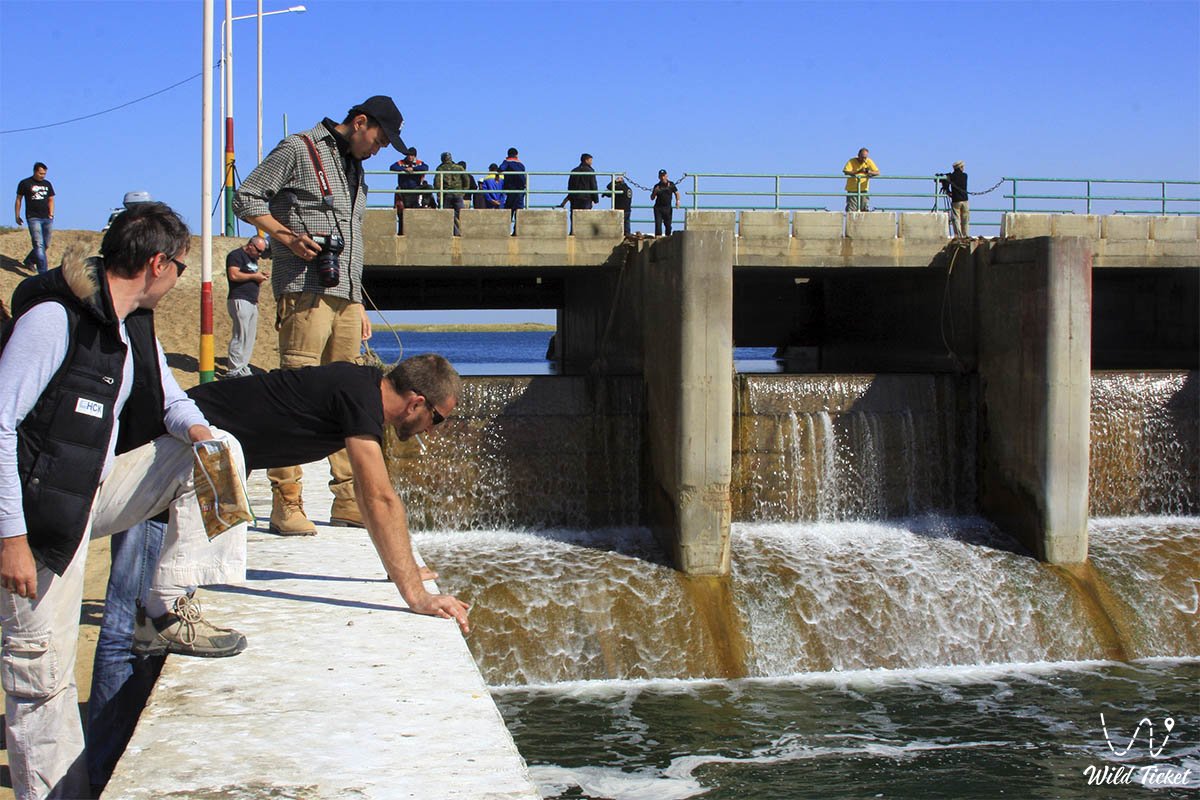
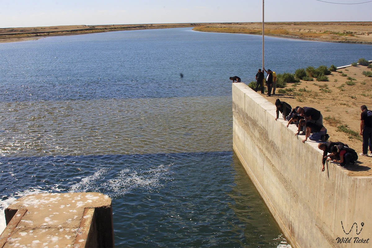
The Kokaral Dam is organized as a highly complex water management complex that includes a powerful combined embankment and a modern concrete spillway structure. To preserve the unique ichthyofauna at the site, employees of the Aral-Syr Darya Basin Fish Inspection regularly carry out land-reclamation fishing of the fish leaving through the sluices: large specimens are sent to the "Kambala Balyk" processing plant in Aralsk, while viable young fish are released back into the delta lakes. The entire surrounding territory is under constant ecological and hydrological control, which records an increase in rain clouds and a beneficial softening of the continental microclimate.
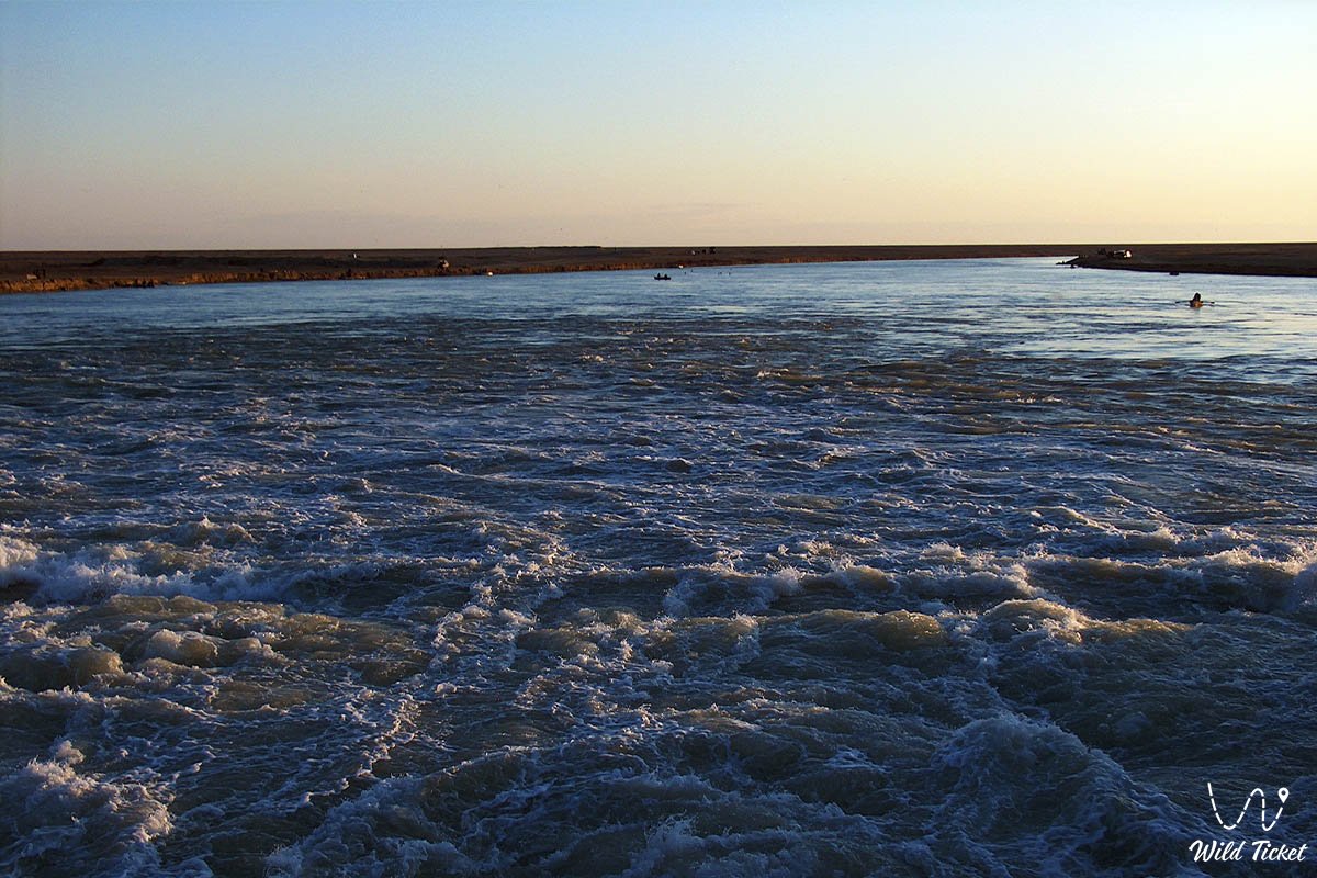
Engineers and patrol services pay special attention to the technical safety of the facility due to the colossal pressure of the water masses. The inflow of the Syr Darya in recent years has exceeded 6 billion cubic meters thanks to tough inter-state agreements between Kazakhstan and Uzbekistan, signed by the specialized minister Nurzhan Nurzhigitov. In this regard, round-the-clock monitoring is carried out at the dam, and tourists are strongly advised not to approach the zones of intensive water discharge and to strictly follow the instructions of guides during the flood period.
Detailed description of the venue
The well-thought-out infrastructure of the dam includes the following original locations and geographical features:
• Boundary line of the Berg Strait – a thirteen-kilometer zone of the hydraulic gate, which connects the mainland shore with the former Kokaral Peninsula, which has now become a land plot.
• Earth body of the embankment – a monumental barrier up to 150 meters wide at the base and 9 meters along the top of the crest, into which more than three million cubic meters of screened sand and gravel have been laid.
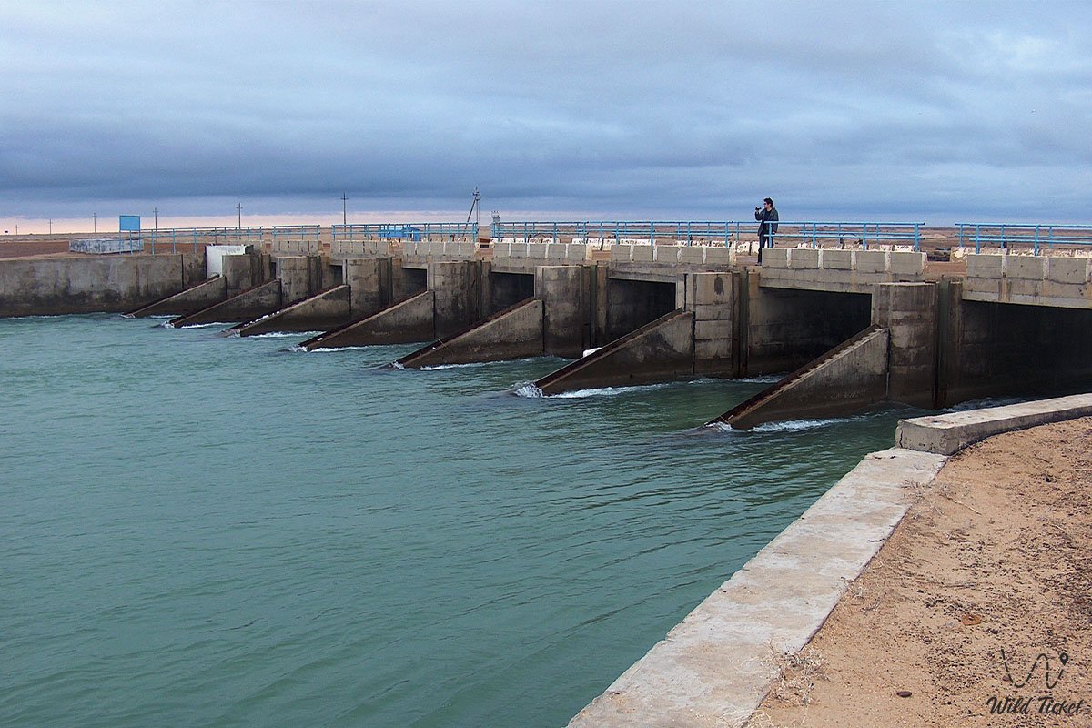
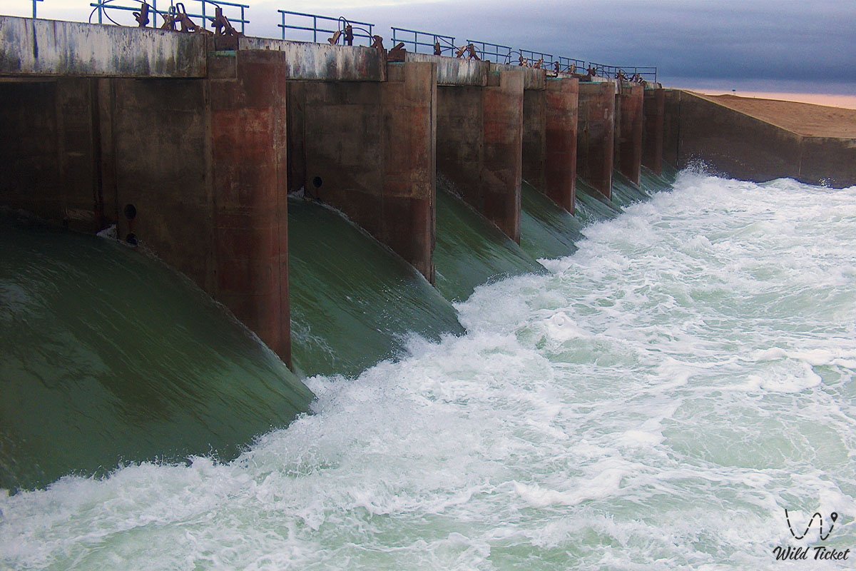
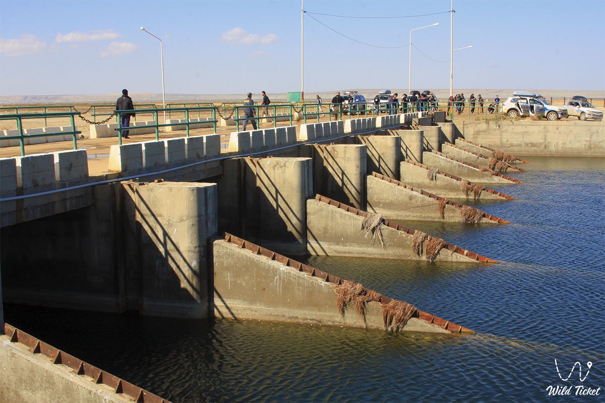
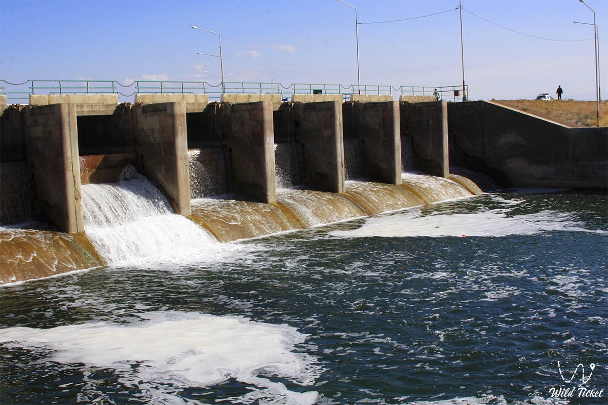
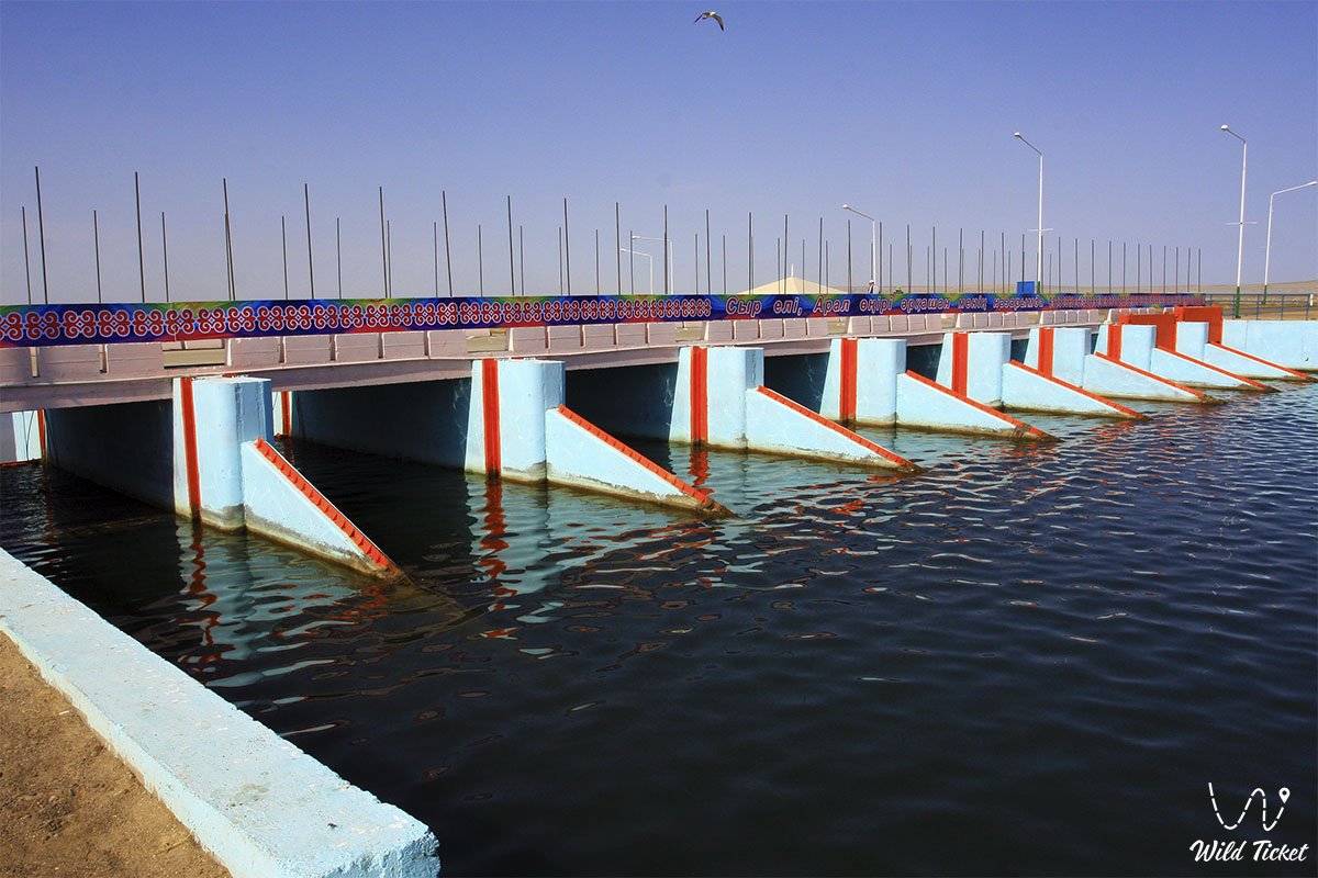
• Nine-bay concrete spillway – the central engineering structure with a capacity of up to 600 cubic meters per second, protecting the body of the dam from destruction during floods.
• Cylindrical bypass sluices – additional drainage openings with a capacity of 46 cubic meters per second, serving for fine-tuning the filling level of the sea basin.
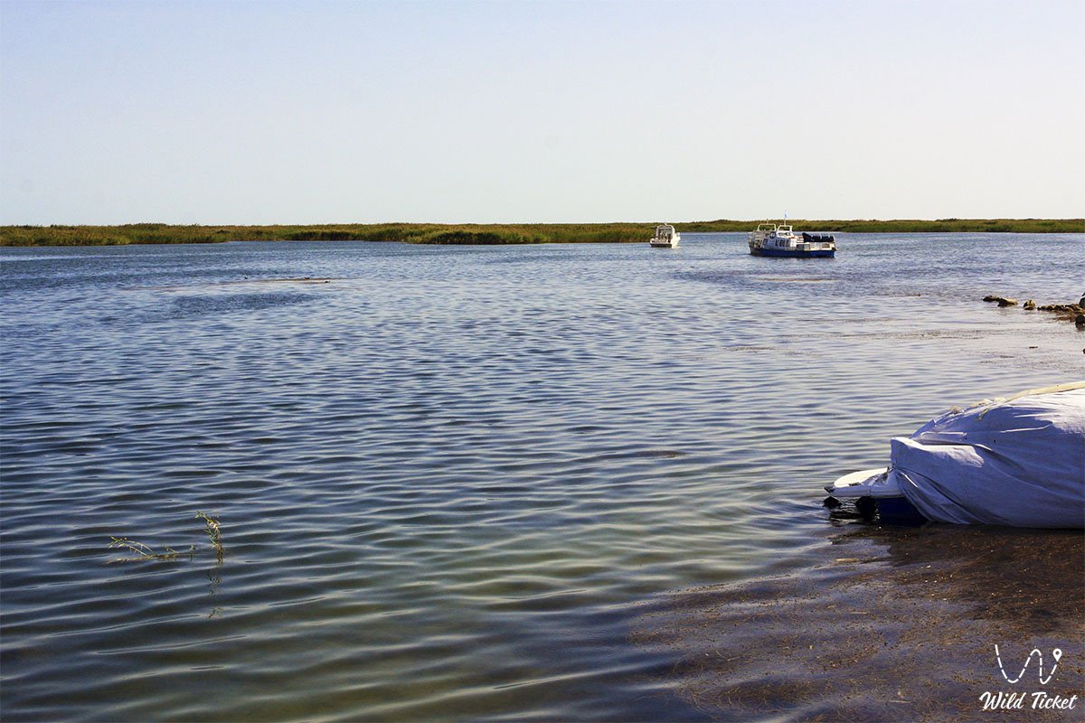
• Downstream of the Syr Darya delta – an adjacent water sector one and a half kilometers to the north, where the river flow is accumulated and distributed through the system of the "Sagimbay" and "Domalak" main channels.
• "Aklak" expedition post – an accompanying sluice facility and protective dikes located 23 kilometers to the southeast, regulating the straightened riverbed.
Architecture
The architectural solution of the dam is based on the principles of industrial minimalism, where aesthetics are fully subordinated to the harsh laws of hydrodynamics. The linear layout of the grandiose thirteen-kilometer embankment smoothly follows the natural contours of the bottom of the former strait, creating a natural visual transition from the steppe massifs to the water surface. The highlight of this landscape engineering is the rhythmic row of massive concrete piers of the central spillway, equipped with lifting gates and sluice mechanisms made of treated high-strength metal. During the construction and reinforcement of the slopes, durable materials were used: reinforced concrete slabs, massive rock fill, and special fractional gravel, reliably protecting the structure from the destructive Aral wave.
Legend
A touching legend lives among the hereditary fishermen of the Aral district about the fragile sand dikes of the 1990s, which people built practically with their bare hands using their own modest savings. It is said that when the storm of 1999 broke through the second dam, the salty sea water seemed to mourn the receding sea, and the flounder rushed to the breach, begging people not to give up.
Old-timers believe that the current concrete sluice facility gained its indestructible strength because the faith of thousands of Aral residents is embedded in its foundation, and if a traveler throws a copper coin into the swirling spillway at dawn, the Aral Sea will surely return to the embankment of the old port.
Another legend is connected with the sound of water passing through the gates of the dam in spring: local residents believe that in this noise one can hear the voices of missing ships, which rejoice at the revival of their native harbor and bless new fishing teams for a rich catch of carp and pike perch.
Conclusion
The Kokaral Dam on the Small Aral is a magnificent man-made bridge connecting advanced ecological thought with the harsh reality of the Aral region. A visit to this landscape and hydraulic giant allows guests of the Kyzylorda region to realize the planetary importance of preserving water resources.
The dam remains the main reference point for scientific, educational, and expedition tourism in the region. Expedition routes definitely include this point in their programs, allowing everyone to see firsthand the border between the revived sea and the endless steppe.
Interesting sights nearby:
• Akbasty village;
• Barsakelmes Nature Reserve,
• Barsakelmes Island;
• Lake Kamystybas;
• Ayteke Bi village;
• Zhankent ancient settlement;
• Beketay Mausoleum;
• Basibek Mausoleum.
Photogallery: