Pointed bastion 368 meters high for panoramic trekking in Central Mangystau –
Mount Shomanai is an isolated table-and-butte peak that belongs to the Shomanai mountain massif of the same name and serves as the primary elevation dominant of the Valley of Castles in the Mangystau district. The massif owes its origin to the prehistoric Tethys Ocean, which once covered the vast expanses of the Turan lowland: marine bottom sediments uplifted by tectonic processes emerged at the surface, and millions of years of subsequent weathering transformed the former seabed into whimsical chalk buttes.
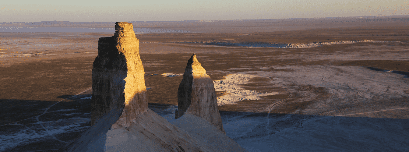
From afar, Mount Shomanai resembles a sharp stone spike and a fairytale castle with towers, colonnades, and fortress walls. The upper slab of silicified limestone protected the central core from complete destruction. The absolute elevation of Mount Shomanai's summit is 368 meters above sea level, making it the highest point of the entire massif (the next highest is neighboring Mount Zhapyrakty at 363.8 m). Its relative elevation above the valley floor reaches 190–200 meters, allowing the peak to be seen from dozens of kilometers away.
A wild, winding trail cut across a steep gravelly scree leads to the summit. The ascent requires caution, but it brings hikers to a narrow rock platform offering a 360-degree panoramic view of the Aktau mountains, the cone of Sherkala, and the labyrinths of chalk castles. On the eastern side, outcrops of perfectly shaped spherical concretions resembling bowling balls border the mountain. In a moist spring, the valley at the foot is blanketed with fragrant Sogdian tulips (Tulipa sogdiana), while cautious Ustyurt mouflons can be found on the inaccessible rock shelves.
--------------------------------------------
How to get there and visit –
Mount Shomanai is located in the southwestern part of the Airakty-Shomanai mountain hub in the Mangystau district of the Mangistau region. The distance from the regional center of Aktau is around 175–185 km, roughly 20–22 km north of the village of Shetpe, 5 km east of the Ktairakty massif, 4 km southeast of the Akmyshtau massif, about 14 km east of Mount Sherkala, and roughly 12 km from the Kogez ethno-village. The Aktau – Beineu railway trunk line runs along the western foot.
GPS geographic coordinates of Mount Shomanai:
44°13'28"N 52°11'06"E
The route from the city of Aktau heads northeast along a paved national highway through Zhetybai to the village of Shetpe (about 160 km). After passing Shetpe, follow the regional paved road Shetpe – Shaiyr north for another 15 km alongside the Aktau – Beineu railway branch. Near the Akmysh tract before the railway crossing, turn right onto an established steppe dirt road heading east into the Airakty basin. After skirting the Akmyshtau massif, the road leads directly to the base of the southern sector of the mountains, where the trail begins at the foot of the pointed Shomanai peak. Travel time from Aktau by car is approximately 2–2.5 hours.
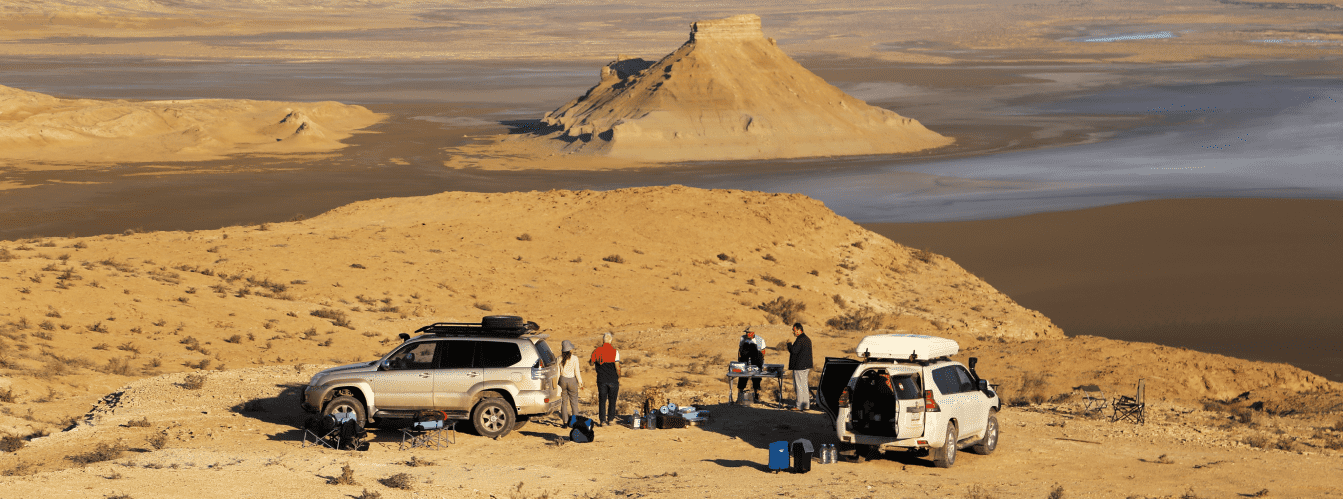
Access roads and vehicle requirements: during the dry season, the staging area at the foot of the mountain can be reached in any passenger car or crossover along firm, well-beaten tracks. However, circling the mountain, reaching the eastern concretion fields over loose sediments, and negotiating deep rain ruts requires a four-wheel-drive 4x4 SUV with ground clearance of at least 200 mm. The vehicle should be equipped with a functional spare wheel, an air compressor, and a tow strap.
ATTENTION: during spring snowmelt and following rainfall, the clay soil at the foot turns slick within minutes. Tire treads pack with sticky mud, causing wheels to slip even on flat terrain. Driving onto clay sections in wet weather is prohibited.
Hiking ascent and safety precautions: the climb to the summit takes between 40 minutes and 1 hour with an elevation gain of around 190 meters. The trail winds along a steep scree slope with an incline of up to 30–35 degrees, composed of loose marl and rubble. Sturdy trekking shoes with stiff soles, deep tread, and ankle support are strictly mandatory for the ascent. Using trekking poles is strongly recommended.
Strong winds blow across the summit crest: approaching the cliff edge is prohibited due to the risk of falling and hidden fissures in the limestone cornice. During warm seasons, venomous reptiles and arachnids (Pallas's coluber, steppe viper, black widow spider, camel spider) inhabit scree slopes and scrub, so watch your step carefully and avoid reaching blindly into rock crevices.
Environmental safety rules:
On Mount Shomanai, it is STRICTLY MANDATORY TO:
– carry out all generated household waste back to the village of Shetpe;
– ascend strictly along the beaten path to prevent rockslides and slope erosion;
– strictly refrain from painting words or carving graffiti on rock faces;
– avoid cracking or hauling away spherical concretions at the eastern foot;
– refrain from throwing stones down from the cliffs;
– avoid picking rare blooming Sogdian tulips or digging up their bulbs;
– refrain from lighting open fires at the base of the cliffs (cook only on portable gas stoves).
Infrastructure: infrastructure is completely absent directly at Mount Shomanai. Overnight stays are held in field base camps in tents. A drinking water supply of at least 4–5 liters per person per day is required. The nearest serviced yurts, showers, and cafe are located at the Kogez ethno-village (12 km), while gas stations, tire repair shops, grocery stores, and pharmacies are found in the village of Shetpe (20 km). 4G mobile coverage is reliable at the summit and across open steppe areas at the base.
The best time for an ascent is spring (from late April through late May), when the steppe turns green and the Sogdian tulip blooms, as well as early autumn (September – early October) with pleasant temperatures around +18...+24 °C. In July and August, ascents should be attempted only at sunrise (before 7:30 AM): by midday, air temperatures exceed +40 °C, and the white rocks heat up intensely, creating a severe risk of heatstroke.
--------------------------------------------
History
The history of Mount Shomanai is intertwined with the military topographic survey records of Mangyshlak, the nomadic traditions of the Aday clans, and the industrial development stages of Central Mangystau.
During the Middle Ages and the Modern era, this dominant height of 368 meters served as an essential observation post for nomadic clans of Mangyshlak. Because the mountain towers nearly two hundred meters above the surrounding plain, steppe patrols monitored caravan trails and passes between the Northern Aktau and Karatau ranges. At the approach of hostile raiding parties or livestock rustlers, sentries lit signal fires on the summit, the smoke of which could be seen by nomadic encampments for dozens of kilometers around.
In the second half of the 19th century, Mount Shomanai was selected by military topographers of the Corps of Military Topographers of the Russian Empire as a first-class triangulation point for compiling the general map of the Mangyshlak upland. Topographic parties erected a stone cairn and a wooden signal at the highest point, linking the peak into a unified geodetic network with the summits of Karatau and the Ustyurt plateau.
In the 1960s, the rocky needle of Shomanai served as a primary landmark for surveyors and construction crews building the Aktau – Beineu railway trunk line laid along the western base of the massif. With the rise of outdoor and hiking tourism in the early 21st century, the path across the southwestern scree slope evolved into the main trekking route for ascending the high viewpoints of the area.
Information
In structural and geomorphological terms, Mount Shomanai is a cuesta-butte peak of conical-tower shape formed within the Upper Cretaceous sedimentary cover.
Morphometric characteristics:
– absolute summit elevation: 368 m above sea level;
– elevation of the neighboring southern peak of Zhapyrakty: 363.8 m above sea level;
– elevation of the plain base: approximately 170–175 m;
– relative elevation of the peak: 193–198 m;
– length of the summit rock crest: about 120 m with a platform width of 3 to 8 m;
– steepness of scree slopes: 28–35 degrees;
– height of the upper sheer limestone ledge: from 12 to 18 m.
The lithological cross-section displays distinct tiering:
1. The basal horizon is composed of soft gray and greenish marls and carbonate clays of the Albian-Cenomanian up to 80 m thick.
2. The middle tier consists of a sequence of yellowish quartz sandstones and dense siltstones with interbeds of ferruginous aggregates.
3. The summit cornice and sharp spire are formed of a durable slab of silicified limestones of the Turonian stage up to 15 m thick. The mechanical strength of these rocks protected the butte from complete erosion.
Wind regime and climate: the region features a sharply continental climate. Average January temperatures are -5...-8 °C, and July averages +28...+32 °C with daytime peaks above +42 °C. Constant updrafts along the ridge produce wind gusts of 12–15 m/s even during calm weather across the plain.
Detailed site description
The morphological complex of Mount Shomanai includes the following key features and viewpoint sectors:
• Rock spire of the summit (368 m) – a pointed limestone pinnacle atop the butte with a triangulation platform offering an unbroken circular panorama of the entire Valley of Castles;
• Upper panoramic balcony – a flat stony shelf roughly 4 meters wide just below the summit, serving as the main vantage point for photographing the distant Aktau ranges;
• Summit limestone wall – a vertical cliff belt up to 15 meters high with wind-carved hollows and vertical fissures that encircles the upper third of the mountain;
• Winding trekking trail – a narrow footpath roughly 700 meters long ascending via switchbacks across the loose talus slopes of the southwestern face;
• Talus cone at the foot – a steep scree apron at the base of the mountain with slopes up to 35 degrees, composed of fine marl, gravel, and sandstone slabs;
• Neighboring table mountain Zhapyrakty (363.8 m) – a flat, trapezoidal butte in the southern sector of the massif, separated by a shallow saddle and complementing the landscape panorama;
• Sub-summit wind cirque – a semicircular erosional niche on the eastern flank below the rock belt where stable wind vortices form.
Flora and fauna
Vegetation on the slopes of Mount Shomanai is sparse due to the steep terrain and continuous rock movement. Plants take root in rock joints and across micro-terraces: species include biyurgun (Anabasis salsa), white wormwood, Lerche's wormwood, gray winterfat, Atraphaxis, and boyalych. In spring, thousands of delicate, fragrant Sogdian tulips, wild onions, yellow star-of-Bethlehem, and small steppe poppies bloom across the moistened marls at the mountain base, withering by early June.
Wildlife consists of species adapted to cliffs and foothill terrains. Pairs of cautious Ustyurt mountain sheep (mouflons) inhabit inaccessible shelves and cornices. Burrows of gerbils, jerboas, and tolai hares are common around the foot. Predatory mammals hunting here include corsac foxes, badgers, and steppe polecats.
Birds of prey nest on the sheer upper cliffs: saker falcons, steppe eagles, long-legged buzzards, and kestrels. Desert wheatears and saxaul jays inhabit rocks near the summit.
Common reptiles on sun-warmed slabs include rapid fringe-toed lizards, toad-headed agamas, and steppe agamas. Venomous snakes hide in rock crevices—the Halys pit viper and steppe viper—alongside camel spiders and black widow spiders.
Legend
An ancient Kazakh legend of the Sentry Batyr and the Stone Spear is associated with Mount Shomanai.
The story tells that when ruthless steppe raiders attacked nomadic pastures across Mangyshlak, the Aday clans entrusted defense of the tract to a young batyr named Shomanai. The batyr possessed exceptional vision and a steadfast heart: he could spot the dust cloud of an enemy detachment a full day's march away.
Shomanai took up a defensive post on the highest rock in the valley, holding a heavy battle spear. When the vanguard of the enemy cavalry entered the gorge, the batyr blew his battle horn to alert peaceful encampments and stood alone to bar the invaders' path on the narrow trail. Enemy arrows could not pierce his armor, while the rocks he cast down sent attackers into retreat.
Realizing the warrior could not be overcome by direct assault, the enemy khan ordered his archers to shower the summit with a volley of poisoned arrows. Mortally wounded, Shomanai drove his spear deep into the center of the rock and prayed to the Creator that his watch would never end. Thunder crashed in that very moment: the hero's body merged with the cliff, and the tip of his spear became a sharp stone pinnacle at the mountain's crest. Ever since, the mountain has borne the name Shomanai, keeping an eternal watch over the Valley of Castles.
Conclusion
Mount Shomanai is the primary observation vantage point and an iconic trekking destination in the Valley of Castles. Ascending its loose slopes requires steady footing, but the panorama from 368 meters over the open terrain of Central Mangystau, the cone of Sherkala, and the white chalk castles leaves an enduring impression of any expedition across the Mangyshlak peninsula.
Nearby attractions:
• Shomanai mountain massif (eastern concretion field);
• Solitary Mount Sherkala ("Lion's Fortress");
• Akmysh tract and oasis;
• Kogez ethno-village;
• Aktau mountain range;
• Karatau mountain range;
• Samal gorge;
• Kokkala tract;
• Village of Shetpe;
• City of Aktau;
• Ktairakty residual mountains;
• Akmyshtau mountain massif.
Pilgrimage and sacred sites in Mangystau:
• Karaman-ata underground mosque;
• Otpan-tau memorial complex;
• Beket-Ata underground mosque (Oglandy);
• Shopan-Ata underground mosque and necropolis;
• Shakpak-Ata underground mosque;
• Sultan-epe underground mosque;
• Masat-Ata underground mosque;
• Kenty-baba necropolis;
• Sisem-ata necropolis;
• Koben mosque;
• Zholaskan mosque;
• Kolbas Ishan mosque;
• Sonabay underground mosque;
• Uytoly-Ata mosque;
• Bayte sanctuary.
Photogallery: