A Trip to the Betpak-Dala Desert from Almaty -
Betpak-Dala is a desert region or desert occupying a vast area in central Kazakhstan.
How to Get There and Visit -
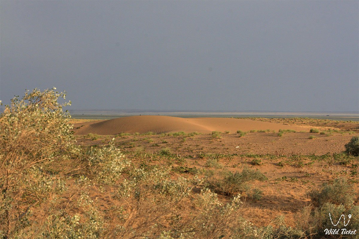
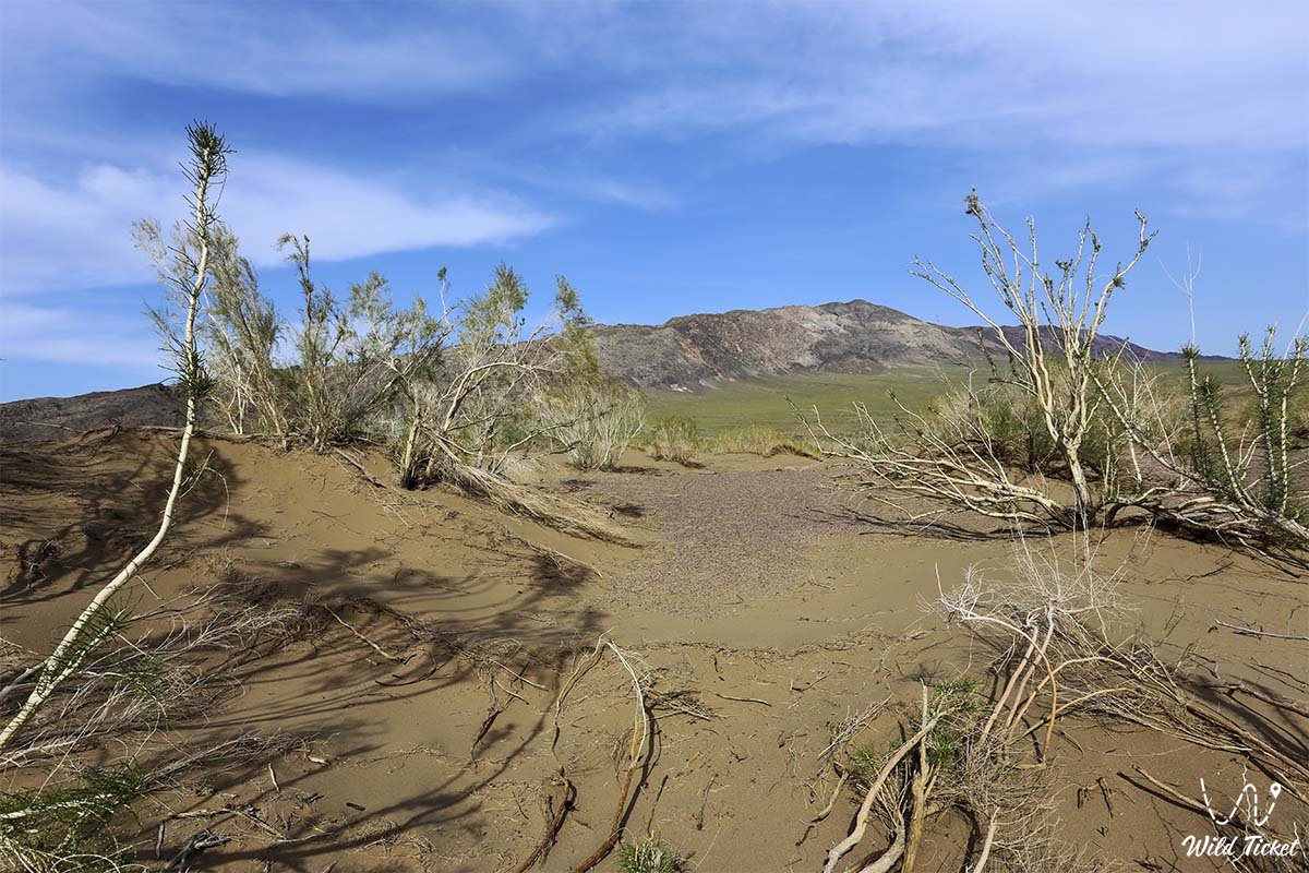
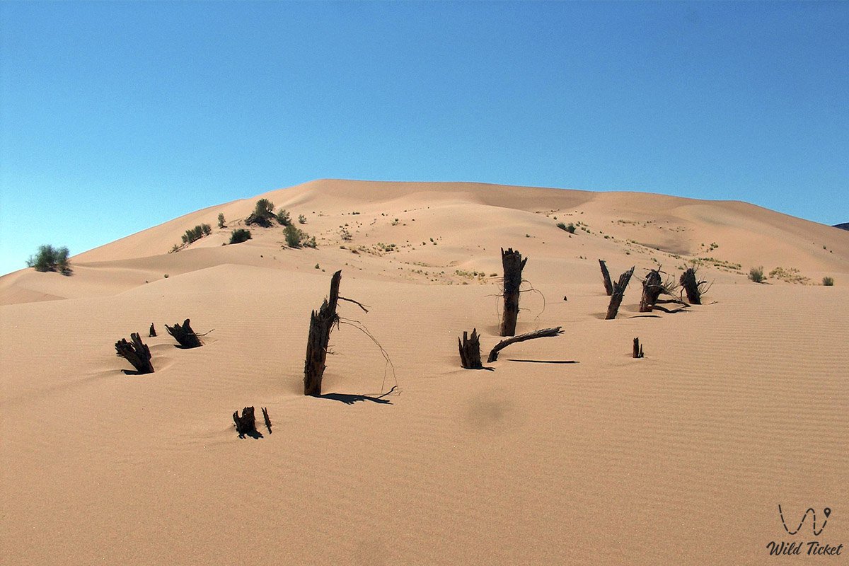
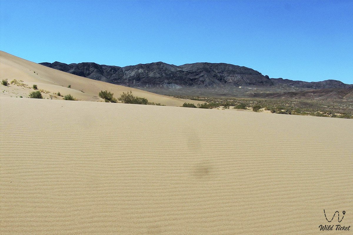
The desert is located in the Karaganda, Zhambyl, and Turkestan regions. It borders the lower reaches of the Sarysu River to the west, Lake Balkhash to the east, the Shu River valley to the south, and Saryarka to the north. It stretches 500 km from west to east and 300 km from north to south. Its area is approximately 75,000 square kilometers. The average absolute elevation of the Betpakdala Plateau desert is 300-350 meters. The southwestern part of the plateau, with an absolute elevation of 200-300 meters, is flat, while the northeastern part, with an absolute elevation of 400-700 meters, is flat.
Information
Paleozoic rocks (granite, porphyry, limestone) are deep, overlain by Mesozoic and Paleogene sedimentary rocks (sandstone, clay, pebbles, sand). The highest point is Mount Zhambyl (974 m). This part is a continuation of the Caledonian structure of Saryarka.
Water Resources
The Betpakdala Plain, cut by ravines, contains brackish, barren, and salt lakes that dry up in the summer. There are small rivers, such as the Karkaraly, Karasu, and Taldyespe, which fill with rainwater in the spring and dry up in the summer.
Climate
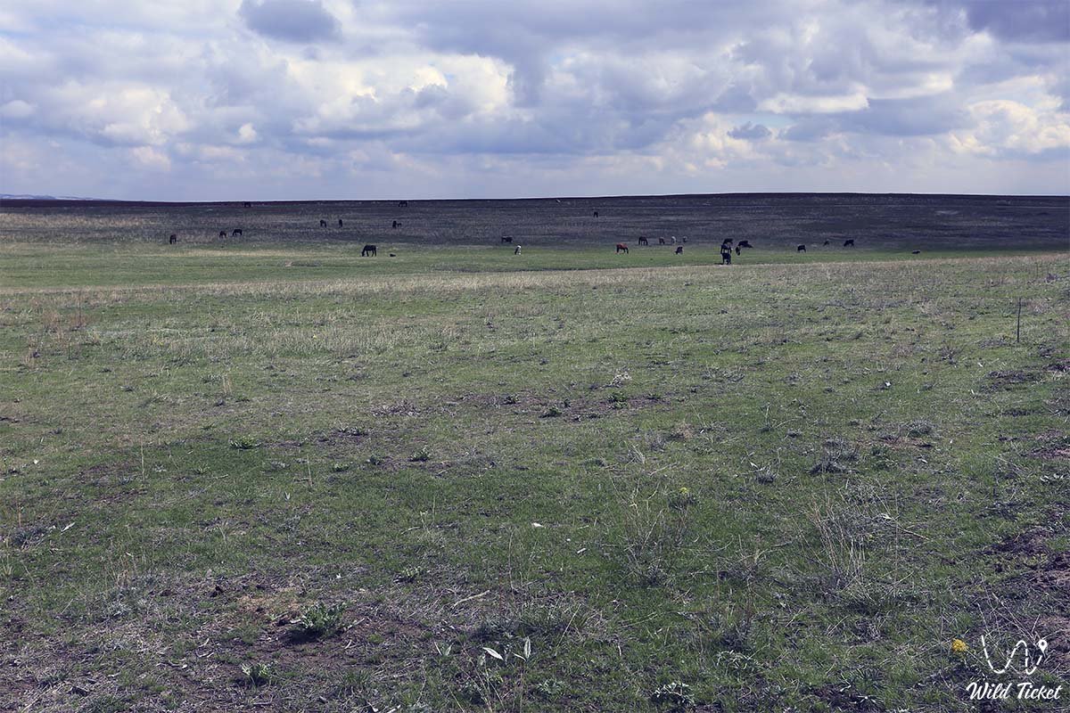
The climate is extremely continental. Summers are hot and dry, and winters are cold. Average January temperatures range from -12°C to -14°C, and July temperatures range from -24°C to -26°C. Annual precipitation is 100-150 mm. Snow depth does not exceed 10-15 cm. Although there are no permanent water sources, groundwater (artesian) is abundant. Pastures are irrigated by artesian wells 10-30 m deep.
Flora and Fauna
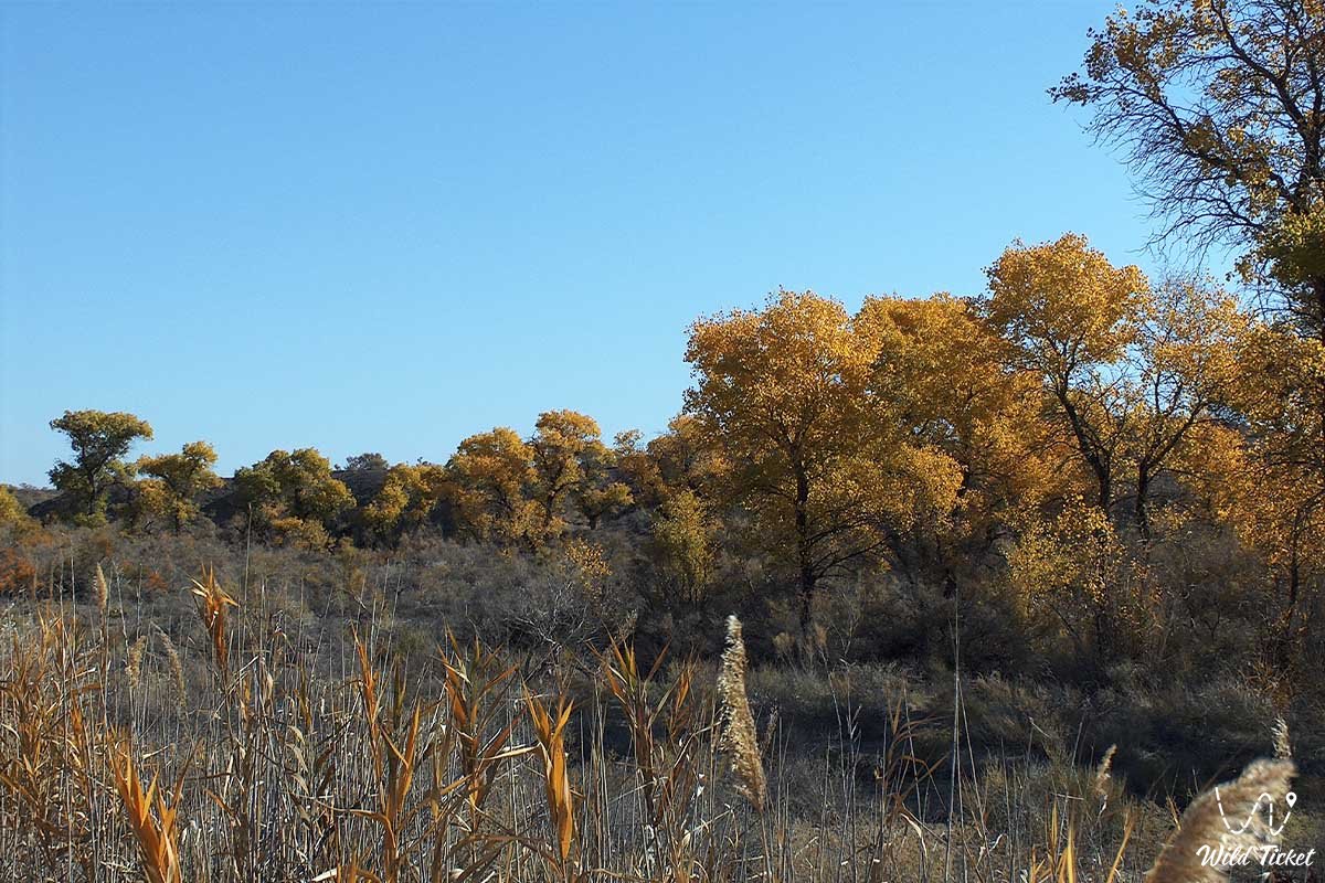
The soils of the Betpakdala Desert are brown and gray-brown. Wormwood predominates in the north, in the rocky deserts of the hills to the east, and wormwood, ephedra, rhubarb, and saxaul, as well as dry channels on sandy hills and ridges near the Shu River to the south. Argali, deer, wolves, and foxes inhabit the northeastern highlands; saiga antelope, squirrels, hawks, snakes, and lizards inhabit the plains. Betpak-dala is a spring-autumn pasture. Wildlife sanctuaries and reserves (Andasai and others) were created to preserve the fauna of the southern Saryarka and Betpak-dala.
History and Meaning of the Name "Betpak-dala"
The mysterious steppe between the Chu River and Saryarka has long been known as the Betpak-dala steppe and desert: it is known that it was called the Betpak steppe, despite its hot summers, harsh winters, and dry nature. There's an ancient Kazakh word, "betpak." It means facelessness. Shameless, faceless people, especially women, are still called "bezlikie" in the village. It stems from two words: "lichko" (face) and "sad" (garden). "Litso" (face) refers to an ordinary face, while "sad" (caring) refers to concern.
The word "lichko" (face) must derive from the concepts of "miserable, disobedient" or "faceless, cold, faceless, hot." However, nomadic people studied the nature in which they lived and used it for economic purposes. At first glance, the Betpak steppe resembles a grassless steppe, but the small bushes that grow there are beneficial for livestock. The meat of the cattle that grazed here and ate the grass was delicious.
Photogallery:


Comments 2