Aral Sea level decline and comprehensive analysis of factors -
The drying up of the Aral Sea represents the largest anthropogenically driven ecological catastrophe in modern history. Prior to the onset of the active regression phase in 1960, the Aral Sea was the world's fourth-largest endorheic lake-sea by surface area. For centuries, the stability of its water area was maintained by a delicate balance between evaporation from the water mirror and river inflow supplied by the region's two main arterial waterways: the Amu Darya (which accounted for two-thirds of the flow) and the Syr Darya River (which provided one-third).
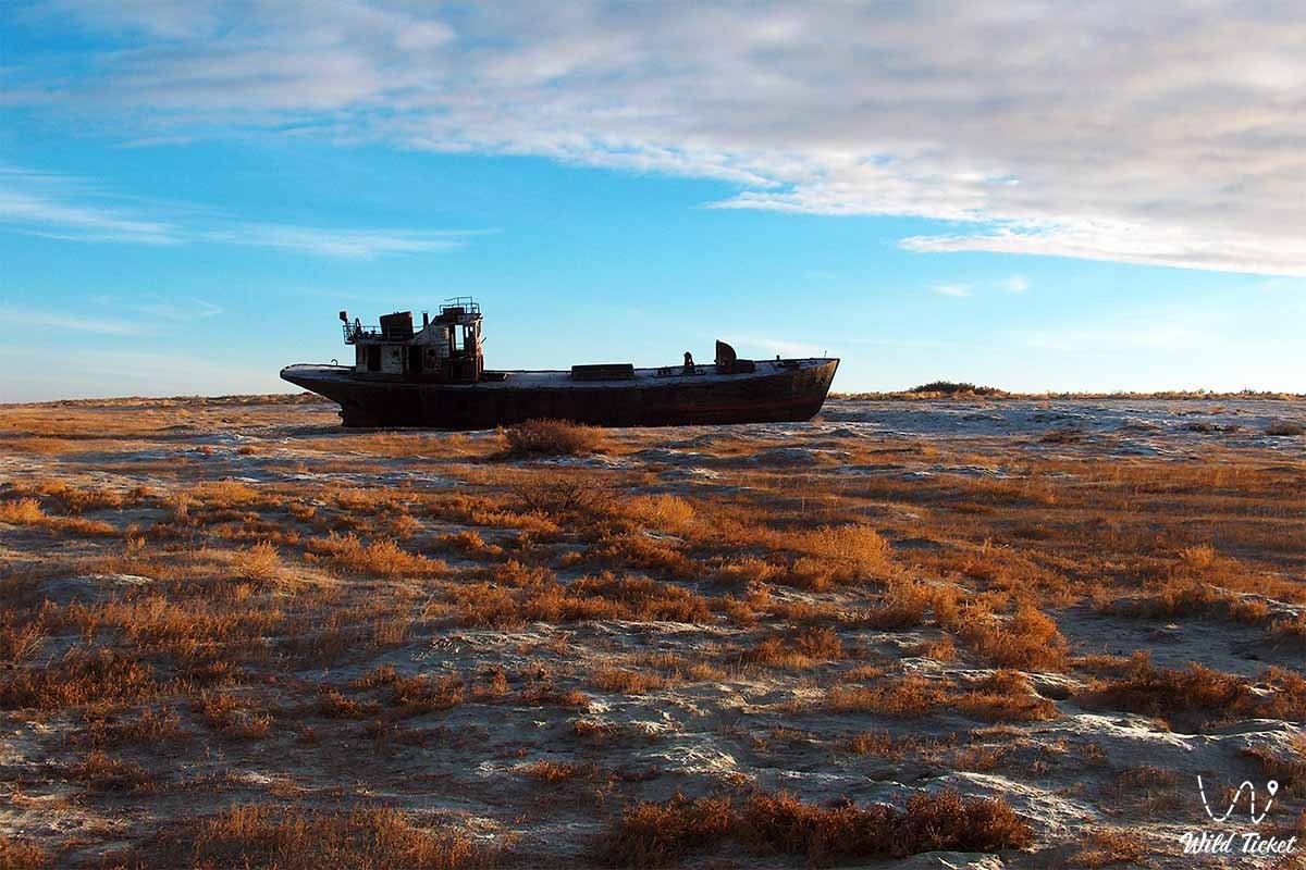
Between 1960 and the 2000s, this natural equilibrium was irreversibly destroyed. According to estimates by hydrologists and climatologists, the contribution of anthropogenic activity to the desiccation of the sea exceeded 70%, whereas climatic cycles and natural water scarcity accounted for less than 30%. The rapid, massive withdrawal of freshwater for irrigated agriculture caused the annual inflow of rivers into the deltas to drop from a natural 56–60 cubic kilometers to virtually zero. As a result, the sea level dropped by more than 20–25 vertical meters, the shoreline retreated by 80–100 kilometers, and the once-unified water body fractured into isolated residual basins.
The root causes of the catastrophe were the aggressive agricultural specialization of the Central Asian republics and Kazakhstan during the Soviet era, the creation of an extensive yet hydraulically flawed irrigation network suffering colossal losses to seepage and evaporation, the disregard of ecological laws to meet state production targets for cotton and rice, and a conceptual mindset that treated landlocked endorheic lakes as a "mistake of nature."
Today, understanding the true drivers of the degradation of the Aral basin is of paramount importance for the modern water policies of Central Asian states, preventing the recurrence of similar crises in other water bodies across the planet, and coordinating joint efforts to preserve the North (Small) Aral Sea. The South (Large) Aral Sea also partially survives, though very little water remains in it.
--------------------------------------------
How to get there and visit -
The journey to sites offering visual evidence of the Aral's desiccation and dried river mouths begins in the city of Aralsk, Kyzylorda region, Kazakhstan.
The city is situated along the "Western Europe – Western China" international highway corridor (M-32) and the Orenburg – Tashkent railway line, 448 kilometers northwest of Kyzylorda and 380 kilometers southeast of Aktobe.
GPS geographical coordinates of the port of Aralsk: 46°47'50"N 61°39'40"E
GPS geographical coordinates of the dried mouth of the Syr Darya: 46°09'20"N 60°58'30"E
GPS geographical coordinates of the Kokaral Dam: 46°05'12"N 60°47'14"E
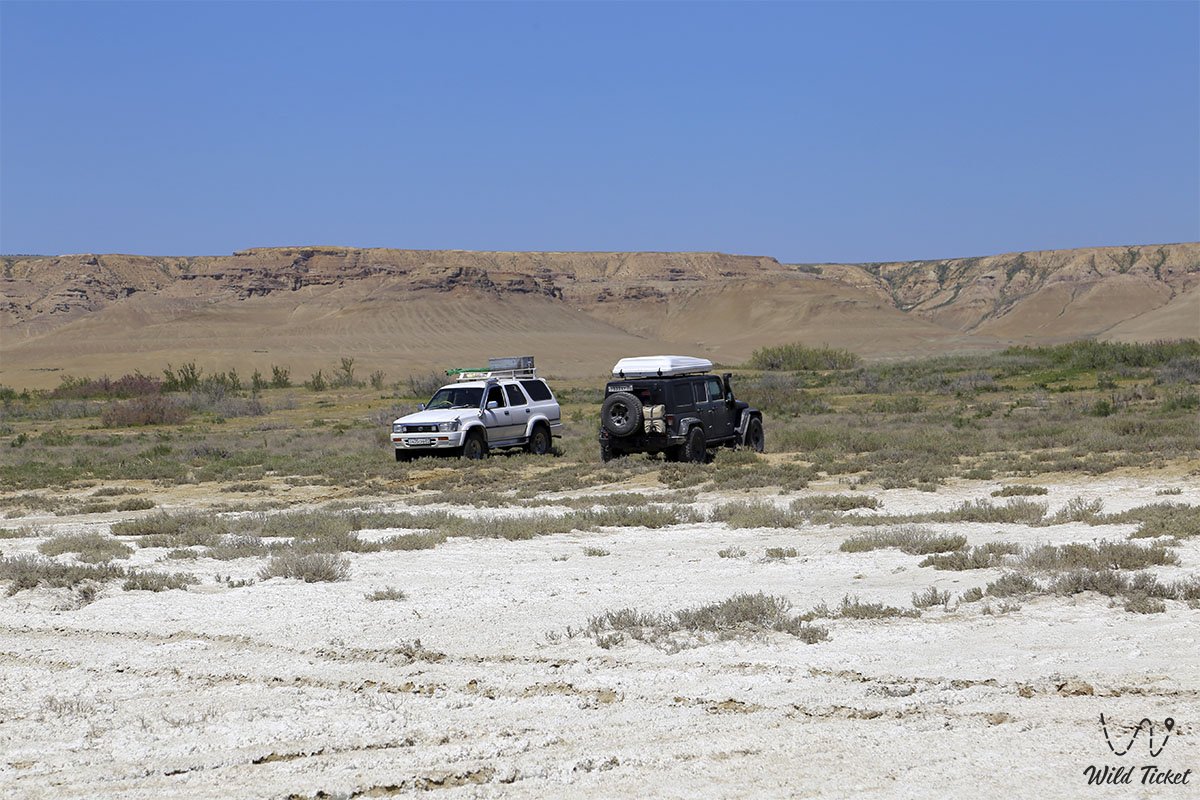
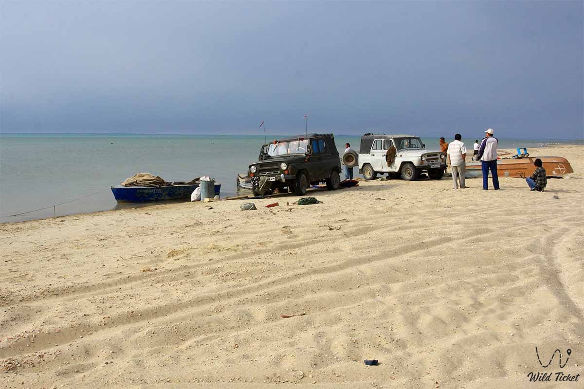
Aralsk can be reached by any passenger vehicle over paved asphalt roads, as well as by scheduled intercity buses or trains. However, expeditionary trips to the dried mouth of the Syr Darya, the Barsakelmes tract, the Kokaral Dam, the dikes of the Aklak hydraulic structure, and deep into the Aralkum Desert are feasible exclusively in prepared, heavy-duty 4x4 off-road vehicles with high ground clearance, reinforced suspension, mud-terrain tires, and winches.
The primary hazard on the drained seabed is posed by batpaks – treacherous salt-marsh quagmires where a deceivingly hard salt crust conceals viscous, liquid mud capable of completely swallowing a vehicle, alongside deep, shifting barchan sands. Driving deep into the desiccated zone is permitted only as part of a convoy of at least two vehicles equipped with GPS trackers, satellite communications, air compressors, high-lift jacks, sand tracks, an autonomous fuel range of 600–700 km, and a drinking water supply of no less than 5 liters per person per day.
The most favorable seasons for a visit are spring (mid-April to late May) and early autumn (September – October). At the height of summer, extreme heat exceeding +40...+44 °C reigns over the exposed seabed alongside severe sand-and-salt storms, while in winter frosts drop to -35 °C amid gale-force winds.
Aralsk features hotels, a local history museum, and a museum of fisheries. In coastal villages (Karateren, Akbasty, Tastubek), travelers can stay in local guest houses or pitch tent camps on safe, solid elevations.
--------------------------------------------
History
Historical and hydrological research demonstrates that the Aral Sea repeatedly altered its contours throughout the Holocene. Over the past ten thousand years, the sea dried up and refilled at least five times. In antiquity (4th–6th centuries BC), oasis agriculture flourished in the lower reaches of the rivers. In the 13th–14th centuries, following the Mongol destruction of Khwarazmian irrigation dams, the Amu Darya diverted along the Uzboy channel into the Caspian Sea, causing the Aral to drop below the 29-meter mark (the settlement of Aral-Asar and the Kerderi mausoleums arose on the exposed floor). In the 17th century, the river turned back into the Aral basin, restoring the reservoir to a stable level of 53 meters, which persisted until 1960.
The historical prerequisites for desiccation were established in the first half of the 20th century. At the turn of the century, geographer Aleksandr Voyeykov posited that the evaporation of colossal volumes of river water over the Aral was economically inefficient and that the reservoir was a "mistake of nature." In the 1920s, the State Planning Committee (Gosplan) of the USSR first conceived projects to intentionally lower the sea level for land reclamation and agricultural plowing of its bed.
A decisive turning point occurred in the 1950s–1960s, when the Soviet leadership formulated a strategic objective: to achieve total cotton independence for the USSR to supply the textile industry, gunpowder manufacturing, munitions, and solid rocket propellants. Uzbekistan, Turkmenistan, and southern Kazakhstan were deemed the ideal geography for these vast plantations.
In 1954, construction began on the gigantic Karakum Canal, which diverted up to 12–13 cubic kilometers of water annually from the channel of the Amu Darya into desert sands. Irrigated land areas expanded from 4.7 million hectares in 1960 to 7.4 million hectares by the late 1980s. Along the river systems, 80 reservoirs and more than 315,000 kilometers of canals were excavated, completely disrupting the natural hydrological equilibrium.
Beginning in the early 1970s, scientists sounded the alarm as sea levels plummeted by 50–67 centimeters annually. State authorities explored ambitious projects to divert a portion of Siberian river runoff to Central Asia, but the plan was definitively canceled in 1986. In 1989, the sea split into the Small and Large Aral. Following the dissolution of the USSR, efforts to salvage the water body passed to the newly independent states of the region, backed by international institutions.
Information
A rigorous scientific inquiry into the causes of the Aral Sea's desiccation identifies a confluence of hydraulic engineering, agronomic, and institutional factors.
The primary driver was excessive, unreturned water withdrawal. The Syr Darya and Amu Darya rivers, which jointly supplied about 56–60 km³ of water per year prior to 1960, were almost entirely exhausted in the sands by the late 1980s. In drought years, the flow of the Syr Darya failed to reach its delta altogether, while the Amu Darya was fully drained in its middle reaches.
The second critical driver was the exceedingly low efficiency of irrigation infrastructure. Canals were constructed as unlined earthen trenches lacking waterproof concrete slabs or geomembrane linings. Seepage into sandy soils and open evaporation resulted in the loss of up to 50% of all diverted water before reaching the fields. Comprehensive canal lining would have cost billions of dollars, conflicting with Soviet budgetary priorities.
The third driver was the monoculture of water-intensive cash crops: cotton and paddy rice. These crops required the continuous flooding of checks and intensive leaching of saline soils. Lacking crop rotation, agricultural fields were treated with heavy applications of synthetic fertilizers, pesticides, and defoliants, which were drained away by collector networks into endorheic desert depressions (such as Sarygamysh and the Arnasay lake system), squandering tens of additional cubic kilometers of diverted water.
The fourth driver was the widespread construction of reservoir cascades. Between 1954 and 1981, 15 major artificial reservoirs with a combined capacity exceeding 53 km³ and an evaporation footprint of around 2,000 km² were established across the river basins, drastically intercepting downstream river inflow.
As the sea level dropped to 31 meters by 2002 and shorelines receded, more than 60,000 km² of seabed emerged to form the Aralkum Desert. Annually, 60 to 100 million tons of salts and agrochemical residues are lifted into the atmosphere, traveling 500–1,000 km and driving a severe surge in respiratory and renal pathologies among the population of Priaralye. Only the construction of the Kokaral Dam by Kazakhstan in 2005 succeeded in stabilizing the Kazakhstani sector – the North Small Aral – restoring its level to 42 meters.
Detailed description of the venue
The geographic arena manifesting the causes and consequences of the Aral regression spans key hydrological focal points:
• Desiccated delta of the Syr Darya River – a network of parched branches, silted channels, and drainage collectors deprived of natural spring flood pulses.
• Karakum Main Canal – the world's longest artificial waterway, exceeding 1,400 km in length, which annually diverts a massive volume of the Amu Darya's discharge.
• Berg Strait – the historic maritime strait between the Kokaral peninsula and the eastern shore, whose desiccation in 1986–1989 fractured the unified sea in two.
• Auzy-Kokaral Strait – a narrow, shallow strait that dried out in the late 1960s, converting Kokaral Island into a peninsula.
• Kokaral Dam – a 13-kilometer hydraulic barrier that severed the Small Aral from the drying Large basin.
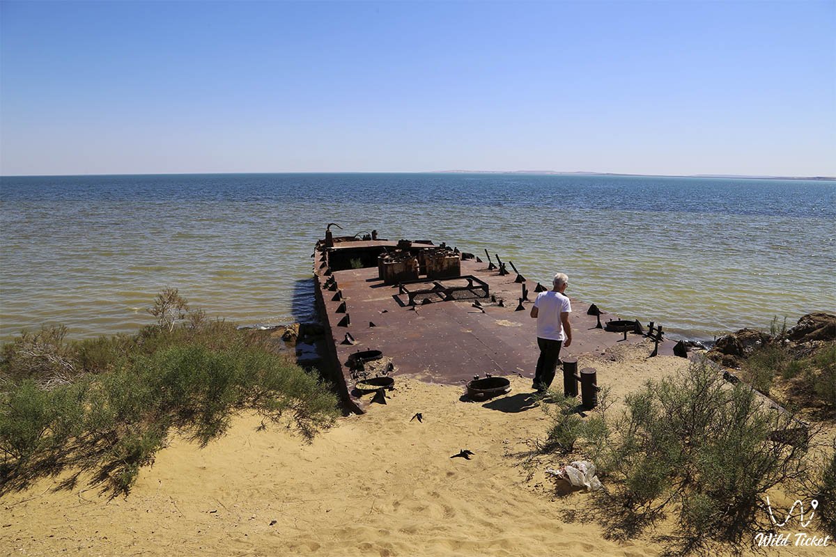
• Bolshoy Sarycheganak Bay – the historic deep-water harbor of the city of Aralsk, where retreating waters left piers and portal cranes stranded on dry land.
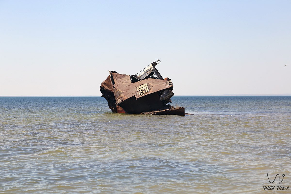
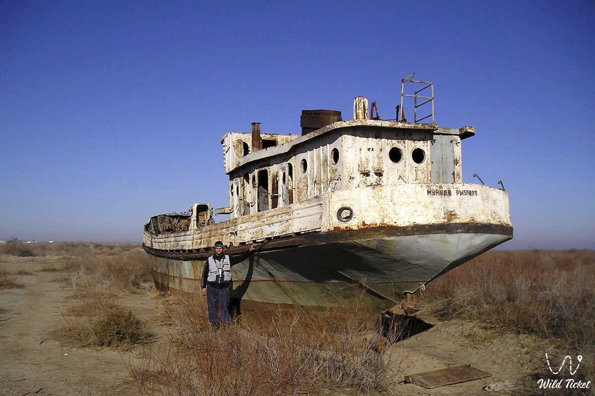
• Zhalanash Bay – the location of the historic ship graveyard, visually illustrating the rate of water regression.
• Endorheic Sarygamysh and Arnasay depressions – vast artificially formed drainage sink lakes that intercepted collector-drainage runoff bypassing the sea.
• Aralkum Desert – a newly formed geological surface covering 6 million hectares with dense concentrations of sulfates, chlorides, and pesticide traces.
• Vozrozhdeniya Island – a formerly isolated island that merged with the mainland in 2001 due to falling water levels.
Flora and fauna
The desiccation of the sea dealt a catastrophic blow to the biodiversity of the entire basin. Of the 32 native fish species, all populations in the Large Aral had gone extinct by the early 2000s: the Aral barbel, carp, bream, pike perch, shemaya, asp, wels catfish, and roach. The Azov-Black Sea flounder-gloss introduced in the 1970s managed to survive longer, but as salinity exceeded 70–100 g/l, it too perished. In the Small Aral, water freshening down to 8–10 g/l enabled the recovery of 16 commercial fish species.
Along the coastal strip and delta plains, falling groundwater tables caused riparian tugai forests and reed beds to shrink from 600,000 hectares to roughly 100,000 hectares. Of 173 terrestrial animal species, only 38 managed to survive. Regional saiga populations plummeted from historical herds of one million head to a few thousand.
The flora of the drained seabed has adapted to extreme salinity: European glasswort, jointed glasswort (sarsazan), Caspian potash-plant, tamarisk, and white saxaul have established themselves across sands and salt pans. To curb toxic salt-and-dust storms, Kazakhstan is conducting an extensive phytomelioration initiative, planting black saxaul (Haloxylon aphyllum) across more than 300,000 hectares of the exposed seabed.
Legend
A philosophical steppe parable titled "The Price of Hubris" is intimately tied to the retreat of the Aral Sea. According to ancient lore, the Syr Darya and Amu Darya were sent by the Creator into the waterless sands of Turan as life-giving arteries to sustain the sacred Blue Sea. Steppe elders passed down an ancestral decree: "Do not shackle the running waters, do not steal the sea's rightful share, for if the water dries, sand shall become your bread, and salt your water."
When 20th-century planners dismissed the wisdom of the elders to turn rivers backward in pursuit of "white gold" (cotton), the spirit of the Aral Sea departed its sanctuary. The legend relates that the sea did not vanish into the sky, but retreated deep beneath the earth through bottomless fissures, waiting to resurface only when humanity learns to revere every drop and atones for its offenses against nature.
Tangible evidence of the Aral's cyclical memory emerged in 2000: the retreating waters exposed the ruins of the medieval city of Aral-Asar and 14th-century Kerderi mausoleums on the seabed. This archaeological discovery proved that the Aral had dried out centuries ago when human diversions altered river channels, later returning to its natural shores in accordance with the eternal cycles of the Earth.
Conclusion
The causes of the Aral Sea's desiccation stand as a sobering planetary warning of the disastrous consequences that ensue when ecological balance is sacrificed for short-term economic gains. The Aral experience demonstrated that vast withdrawals of water resources, made without regard for evaporation, seepage, and the hydrological needs of closed basins, can wipe out unique natural oases in a matter of decades.
Today, reckoning with these historic mistakes is driving the implementation of modern water-saving irrigation technologies, the overhaul of hydraulic engineering systems, and deeper transboundary cooperation among Central Asian nations under the umbrella of the International Fund for Saving the Aral Sea.
Interesting sights nearby:
• Aral Geopark;
• Barsakelmes Island (former);
• Aralkum Desert (dried seabed);
• Ayteke Bi Village;
• Basibek Mausoleum;
• Raim Fort;
• Tolybay Batyr Mausoleum;
• Saraman-Kosa Tower;
• Begim-Ana Tower;
• Bogen Village;
• Lake Kamystybas (Kambash);
• Baikonur Cosmodrome.
Photogallery: