Shale tectonic walls, natural pool with a waterfall, and spring oasis –
Karadayirmen Gorge (Kaz. Qaradiirmen shatqaly) represents a striking rocky canyon of tectonic origin with vertically tilted layers of dark rock in the west of Kazakhstan. This wild geological labyrinth is nestled in an intermontane depression between the northwestern spurs of the Western Karatau ridge and the eastern slopes of the Northern Aktau ridge within the territory of the Mangystau district.
This entire contrasting mountain rift serves as a unique geomorphological natural monument of the Mangystau region, where instead of the familiar white and cream chalk chinks, the traveler's eye meets dark shales and gray sandstones cutting across the stony steppe. Dozens of kilometers to the west, the boundless shores of the peninsula are washed by the azure waters of the Caspian Sea, while the gorge, concealed from steppe winds, offers coolness and shelter among the sun-scorched foothills.
In the tourism and expedition logistics of Central Mangystau, Karadayirmen Canyon serves as a vivid gem of the compact Karatau mountain ring. The gorge is located just 5.6 kilometers east of the village of Shayyr and approximately 150–165 kilometers northeast of the regional center Aktau, from where paved highways lead through the transport hub of the village of Shetpe.
Just a few kilometers away blaze the surreal variegated Jurassic clays of the Kokala tract, while the crests of the gorge open onto a panorama of Mount Zhalgan (331.2 m) and the legendary Mount Sherkala, resembling a sleeping lion or a gigantic yurt.
The unique appearance of the defile is shaped by colossal tectonic folding of the Paleozoic basement and Mesozoic horizons of the ancient Tethys Ocean. From Karadayirmen Gorge and the neighboring clays of Kokala, off-road routes branch west toward the rock-cut Shakpak-Ata mosque, the stony Saura Gorge, and the coast of Koshak Bay, and east toward the celebrated cluster of spherical concretions in the Torysh Valley, the sacred height of Mount Otpan-Tau with the Aday-Ata complex, and the ruins of the caravan settlement of Kyzylkala.
Along the winding floor of the canyon and carpets of peppermint, an inexhaustible stream of pure drinking water babbles cheerfully, plunging into a natural stone pool as a cool waterfall. After resting in the shaded stone corridors of Karadayirmen, expeditions head southeast toward the snow-white chink scarps of the Bozzhira tract, the banded Mount Bokty, the boundless salt flat expanses of the Karynzharyk depression, the gleaming Tuzbair salt flat, and the strict protection cordons of the Ustyurt Reserve.
For road-trippers and travelers, Karadayirmen Gorge serves as an ideal mountain refuge: visitors come here for the refreshing chill of the natural waterfall pool after scorching desert trails, picturesque tent camps beneath towering tectonic crags, and the chance to explore wild labyrinths of dark shales under the peaceful murmuring of the spring brook. Today, Karadayirmen Gorge is recognized as one of the most atmospheric, contrasting, and cinematic natural monuments of Mangyshlak, drawing trekking enthusiasts, photographers, and geologists with its impregnable stone gates, ice-cold pool of revitalizing water, and the primeval energy of ancient tectonic forces.
--------------------------------------------
How to get there and visit –
Karadayirmen Gorge is situated in the central part of the Mangystau district in an intermontane basin between the Karatau and Aktau ridges. The distance from the village of Shayyr is about 5.6–7 km to the east, from Mount Sherkala – 9.3 km to the west, from Mount Zhalgan – 6.6 km to the southwest, from the district center village of Shetpe – about 50–55 km, and from the city of Aktau – roughly 155–165 km.
GPS geographical coordinates of Karadayirmen Gorge:
44°14'26"N 51°53'28"E
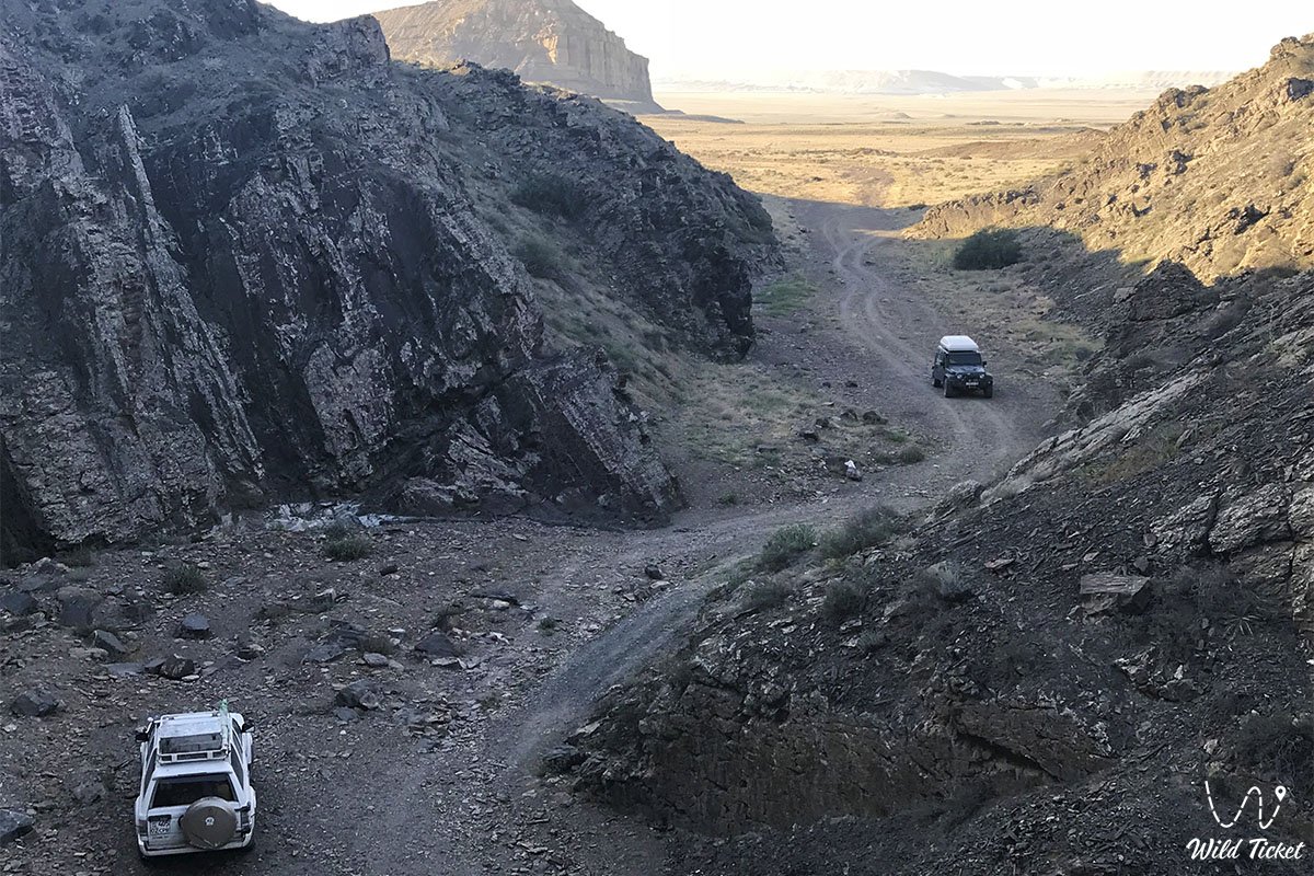
The route from the city of Aktau runs along the high-speed paved highway of republican significance Aktau – Shetpe – Beyneu to the roundabout near the village of Shetpe (about 100–110 km). Next, turn northwest onto a good paved road toward the village of Shayyr (about 45 km). Just before Shayyr or immediately past its eastern edge, turn right onto a well-traveled dirt track skirting the southern slopes of Mount Zhalgan, leading directly to the base of the gorge and the neighboring Kokala tract. Travel time from Aktau by car takes about 2.5 hours.
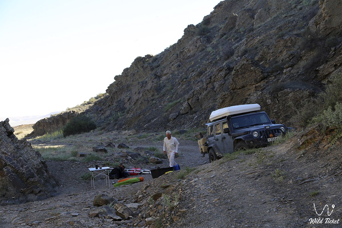
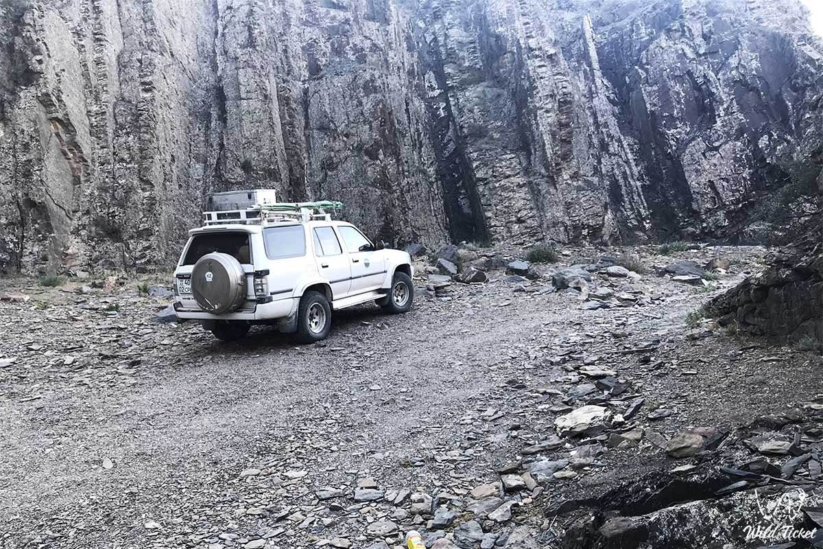
Vehicles can drive only up to the foot of the natural cliff wall – the "stone gates" of the gorge. Driving deeper into the canyon itself is physically impossible for any vehicle due to vertically tilted slabs and cyclopean boulders. For comfortable travel across the unpaved foothill sectors, an all-wheel-drive vehicle (crossover or 4x4 SUV) is strongly recommended, as clay tracks become slick after rare rains, and rocky screes occur on approach to the gorge.
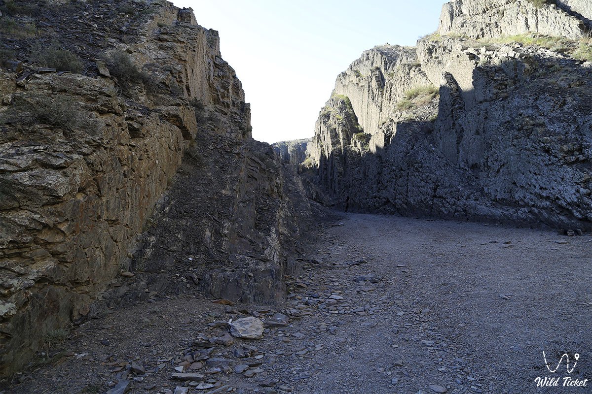
Foot route and safety guidelines: the entrance to the gorge is barred by a natural 10-meter stone wall with a narrow cleft choked with boulders. Entering is possible via two routes: ascending the left ridge and carefully descending to the floor down a steep rocky scree, or scrambling up the rock ledge near the waterfall (basic scrambling caution and grippy footwear required). Sturdy trekking boots with rigid soles are mandatory to protect ankles against sharp shale edges.
Visiting regime: access to the gorge is open, and special permits are not required. It is necessary to carry original identity documents for travel across the roads of the Mangystau region.
Infrastructure on site is completely absent: rugged wilderness reigns here. The spring on the canyon floor provides crystal-clear fresh water suitable for drinking (locals have long considered it therapeutic). In the stone basin beneath the waterfall at the entrance, one can bathe and refresh during summer heat. The nearest shops, pharmacy post, and gas stations are located in the village of Shayyr (7 km) and the village of Shetpe. For wild tent camping at the entrance of the gorge, self-contained camp gear, food provisions, a gas stove, and insect repellent are required. Mobile connectivity is shielded by the canyon cliffs inside, but functions steadily atop the ridges and on open plains before the entrance.
The best time to visit is spring from mid-April to early June, when the surrounding steppe blooms, the stream and waterfall are at their fullest flow, and willow foliage and wild mint fill the air with freshness. Early autumn (September – October) brings mild sunshine, golden autumn foliage, and comfortable conditions for trekking without exhausting heat. In summer (July – August), midday heat on open slopes reaches +36...+40 °C, yet inside the deep shade of the canyon and in the cold water of the waterfall basin, welcome coolness is always preserved.
--------------------------------------------
History
The history of Karadayirmen Gorge reaches deep into antiquity and is intertwined with nomadic culture, caravan routes, and ancient legends of Mangyshlak's Aday clans. The gorge draws its name from the Kazakh words "qara" (black) and "diirmen" (mill, millstone) – literally "Black Millstones".
This toponym stems not only from the visual resemblance of fractured rock slabs to giant millstones of an ancient mill, but also from an authentic craft heritage. In past times, local stonemasons quarried exceptionally durable dark gray siliceous sandstones and shales within the gorge, carving out reliable hand and water millstones for grinding grain, which were prized across Mangyshlak and the Ustyurt Plateau.
Over centuries, Karadayirmen served as a hidden haven along the Great Silk Road. Caravans traveling from Caspian shores to the settlement of Kyzylkala and on to Khiva diverted to the foot of the gorge to replenish waterskins with ice-cold spring water. During feudal clashes and raids, the narrow entrance barred by a ten-meter cliff wall became a natural fortress where a small band of sarbaz warriors could hold off an army while safeguarding women, children, and livestock herds deep within the canyon.
In 1870, during the anti-colonial Aday uprising, the defiles of Karadayirmen, the slopes of Mount Zhalgan, and secluded ravines of Karatau served as secure encampments for rebel detachments led by batyrs Dosan Tazhiuly and Isa Tlenbaev, who leveraged the rugged mountain terrain for guerrilla maneuvers.
During the Soviet era, geologists and topographers surveyed Karadayirmen, mapping outcrops of ancient coal-bearing and shale strata. Today, having preserved its primeval spirit, Karadayirmen Gorge attracts road travelers and researchers as one of the most distinctive and mysterious natural corners of Western Kazakhstan.
Information
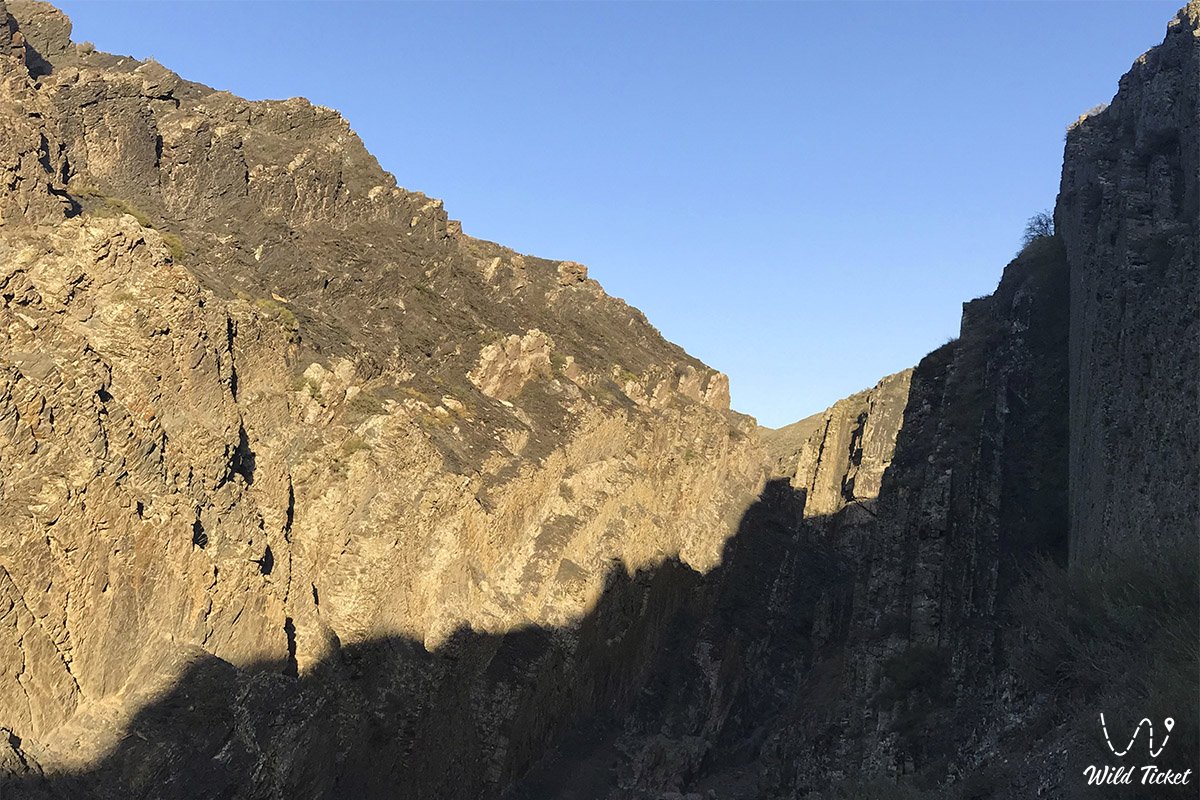
Geomorphologically, Karadayirmen Gorge represents a deep erosional-tectonic canyon spanning roughly 1.8–2 kilometers in length. The canyon winds through the mountain massif, alternately widening to 30–50 meters and compressing into vertical clefts only 3–5 meters across. The height of sheer rock walls reaches 20 to 50 meters, producing the effect of a deep stone chamber. The floor of the gorge lies at elevations around 160–180 meters above sea level, while surrounding Karatau ridges and the summit of nearby Mount Zhalgan soar to 331.2 meters.
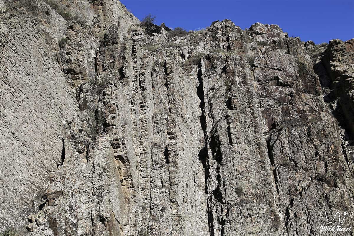
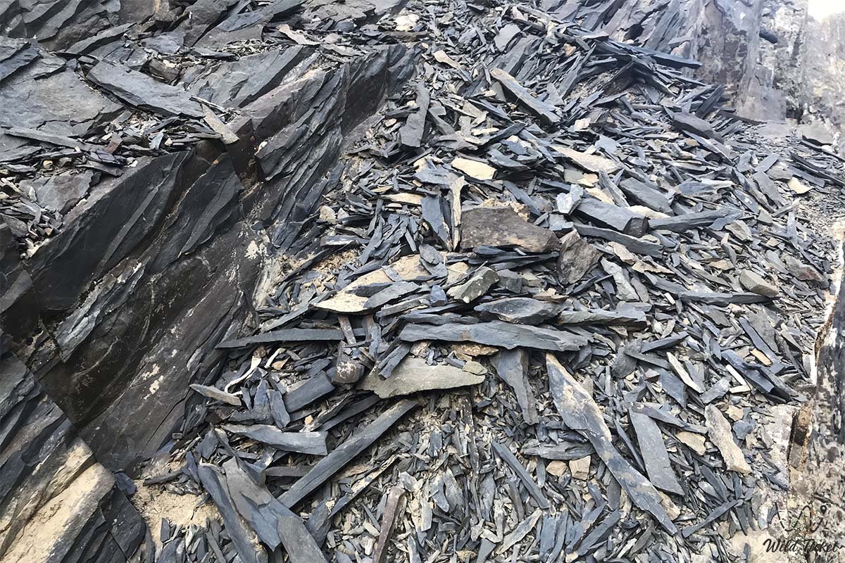
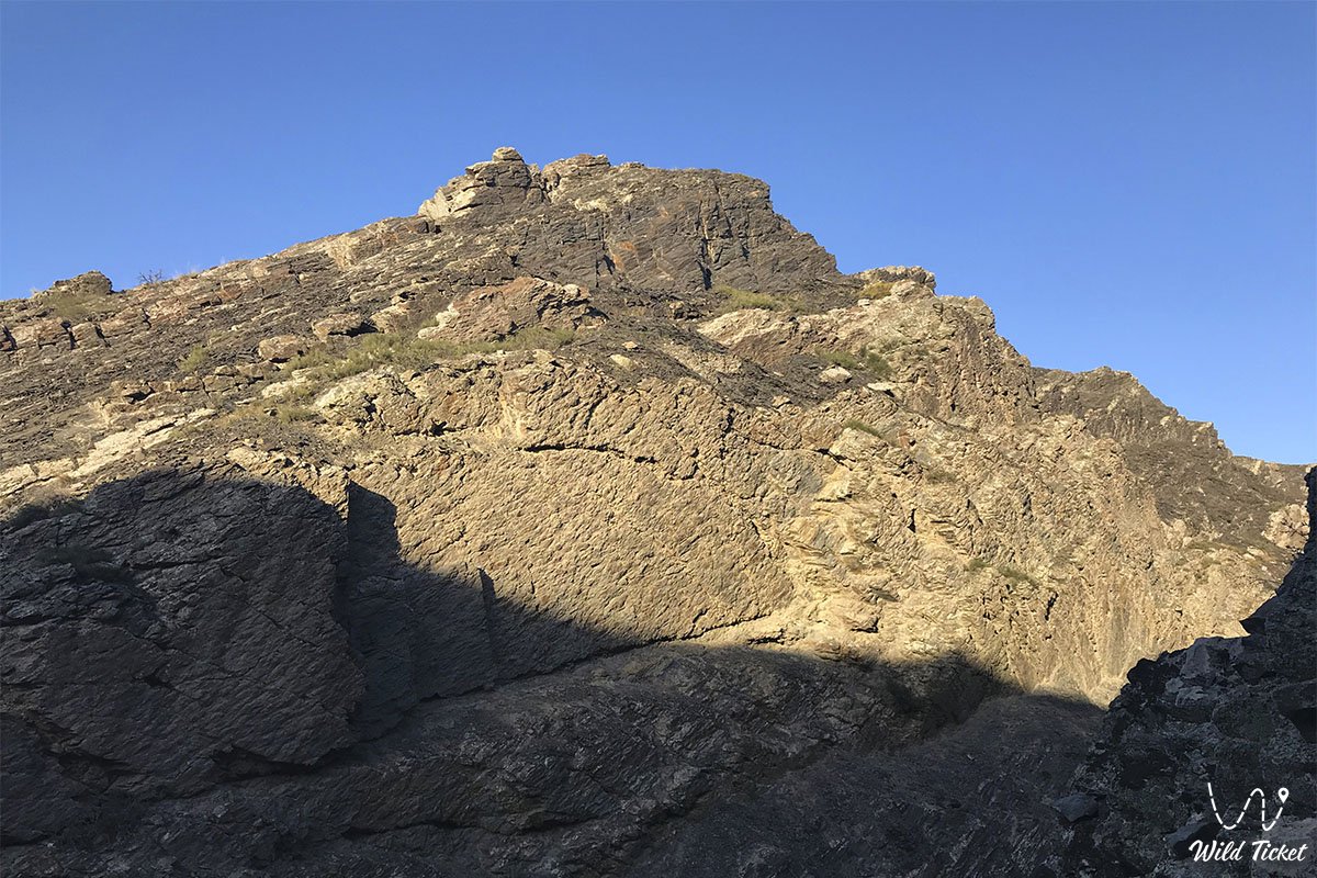
The geological structure of the canyon sets it apart from the rest of Mangystau. While most of the peninsula is mantled by horizontal white and pale limestones of the Neogene Tethys Ocean, Karadayirmen exposes folded, metamorphosed sedimentary strata of the Triassic and Jurassic periods. The cliffs consist of dark quartzitic sandstones, siliceous shales, siltstones, and carbonaceous rocks of black, dark-gray, and graphite shades. Rock beds here have been deformed by colossal tectonic movements, resting nearly vertically at angles of 70–90 degrees and creating the appearance of "book pages" split into millions of sharp slabs.
The hydrological regime is unique: a permanent spring stream of clear bicarbonate water of excellent taste flows along the floor, fed by deep fracture aquifers. Over rock ledges and tectonic steps, the stream forms cascades and flowing rock pools. At the entrance to the gorge, the stream cuts through the 10-meter cliff barrier, creating a waterfall whose basin forms a deep open-air natural pool.
Soil cover is practically absent on rocky ledges, while the gorge floor features moist dark-brown alluvial soils enriched with leaf litter and spring silt.
The climate is sharply continental with arid mountain characteristics. In summer months, air temperatures on open semi-desert slopes exceed +36...+40 °C, yet inside the canyon temperatures remain 6–8 degrees cooler thanks to dense shadow from sheer walls and evaporation from the brook and waterfall. Winters are moderately cold and breezy, with average January temperatures of -5...-8 °C, when frozen waterfalls solidify into icy organ pipes within the gorge.
Detailed description of the venue
The natural landscape ensemble of Karadayirmen Gorge includes the following key morphological sectors, rock barriers, and hydrological features:
• Entrance stone wall ("Gates of the Titans") – a cyclopean ten-meter barrier of vertically tilted black shale beds blocking the canyon entrance like a fortress rampart.
• Spring waterfall and natural plunge pool – a scenic cascade cutting through the stone gate and pouring into a deep monolithic rock basin filled with cool, clear water.
• Winding rock labyrinth – the primary sinuous cleft of the canyon extending 1.8 km with sheer overhanging cornices, revealing new vistas around each sharp turn.
• Cascade of flowing stone pools – a series of stepped rock baths filled with emerald spring water, fringed by wild mint carpets and green moss.
• Green tugay canyon oasis – the floor of the central gorge sector where crowns of relict willow and low-growing hawthorn rustle amid sharp black rocks.
• Upper bypass crest and viewing point – a stony left spur near the entrance serving as a foot route to the canyon floor and opening onto views of Mount Zhalgan, Mount Sherkala, and the colored hills of Kokala.
Flora and fauna
The vegetation of Karadayirmen Gorge forms a green oasis amidst the parched wormwood semi-desert of Karatau. The canyon floor along the stream is carpeted with patches of fragrant peppermint, watercress, plantain, reeds, and moisture-loving ferns and mosses. Amid rock piles rise spreading Dzhungarian willow trees, thickets of wild rose hips, hawthorn, and tamarisk shrubs. On outer dry crests and stony screes cling Lerche's wormwood, boyalych, Anabasis salsa (biyurgun), and dense mats of jointed anabasis. In spring, gravelly foothill slopes burst into bloom with wild Sogdian tulips and delicate irises.
The wildlife is rich thanks to permanent fresh water and the shelter of sheer cliffs. The gorge and surrounding spurs host the cautious Ustyurt mountain sheep (mouflon / urial), listed in the Red Book of Kazakhstan; at dawn, mouflons descend to the stream pools to drink. Shaded shale crevices shelter badgers, corsac foxes, steppe polecats, long-eared hedgehogs, tolai hares, and gerbils.
Avifauna is vocal within the gorge, where echoes amplify bird calls. Chukar partridges, rock doves, turtle doves, rock nuthatches, crag martins, and pied wheatears nest in rock niches and willow crowns. On upper cliff ledges, raptors rear their young: long-legged buzzards, golden eagles, peregrine falcons, lesser kestrels, and Eurasian eagle-owls.
Herpetofauna includes the agile steppe agama, toad-headed agama, Caspian gecko, dione snake, and dice snake inhabiting spring pools. In the evening, the calls of green toads resonate near the waterfall.
Among arthropods on sun-baked black shales, solifuges (camel spiders), tarantulas, and steppe scorpions shelter beneath flat stones during daytime.
Legend
An ancient Mangystau legend tells of the Giant's Stone Millstones and the Gates of Peace in connection with Karadayirmen Gorge.
Tradition recounts that in time immemorial, when the Western Karatau mountains were the domain of ancient titan batyrs, a mighty giant named Dayirmen lived in these reaches. He guarded a magical subterranean spring whose water restored youth and healed mortal wounds.
To prevent evil desert demons and ruthless conquerors from desecrating the life-giving source, Dayirmen shattered the black rock ridges with his bare hands, carved colossal round millstones from them, and erected an impregnable wall with a narrow entrance before the gorge. He piled giant boulders across the opening, commanding the rocks to part only for travelers with pure hearts and peaceful intentions.
When an invading army attempted to breach the way to the water, Dayirmen struck the black slabs with his war club. The crags crashed together, burying the invaders under rockfalls, while the batyr merged forever into the dark ridge, becoming the eternal sentinel of the gorge.
Ever since, Kazakhs have called this sanctuary Karadayirmen – the Giant's Black Millstones. Local elders believe the healing water of the waterfall washes away inner anxiety and bodily sickness, and that whoever enters the canyon with a gentle soul will receive endurance of spirit and the protection of the ancient mountain spirits.
Conclusion
Karadayirmen Gorge is a natural bastion and hidden jewel of mountainous Mangystau, where the dramatic wildness of black shale crags unites with the crystal chime of an ice-cold brook and the rustle of emerald willow groves. An expedition to the gates of Karadayirmen offers road travelers the thrill of traversing rugged terrain, the joy of bathing in a natural waterfall plunge pool, and an encounter with the living geological history of the Earth.
Interesting sights nearby:
• Variegated Jurassic Clays of Kokala Tract;
• Sacred Outlier Mount Sherkala;
• Panoramic summit of Mount Zhalgan (331.2 m);
• Mountain ridges of Western Karatau and Northern Aktau;
• Torysh Valley of Giant Spherical Concretions;
• Airakty-Shomanay Outlier Mountains (Valley of Castles);
• Ruins of Medieval Trading Settlement Kyzylkala;
• Spring oasis and grove of Tushchybek;
• Tamshaly Rocky Gorge with Weeping Rock;
• Grand Zhygylgan Geological Sinkhole with Tracks of Saber-Toothed Cats;
• Saura Canyon with Relict Lake and Turtles;
• Rocky Cape Tyub-Karagan on the Caspian.
Sacred sights and pilgrimage destinations:
• Beket-Ata Underground Mosque in Oglandy Tract;
• Karaman-Ata Underground Mosque;
• Shakpakty-Ata Underground Mosque;
• Sultan-Epe Underground Mosque;
• Otpan Tau Complex on Mount Otpantau;
• Kolbas Ishan Mosque;
• Koben Mosque;
• Zholaskan Mosque;
• Nurbergen Kalyshev Mausoleum;
• Zhaman Sauran Mosque;
• Ishan Khozha Mosque;
• Itolla Mosque;
• Sonabay Underground Mosque;
• Masat Ata Mosque;
• Uytoly Ata Underground Mosque;
• Bayte Sanctuary.
Photogallery: