Lowland clay-sand plains and the austere breath of the Northern Caspian –
The Buzachi Peninsula (Kaz. Bozashy tubegi) represents a vast lowland geographic landmass jutting deeply into the northeastern waters of the Caspian Sea in western Kazakhstan. This desert and semi-desert region occupies the northern sector of the Mangystau district, separated by a narrow isthmus from the stony plateaus of Tupkaragan.
This entire colossal littoral territory serves as an essential geographical and economic component of the Mangystau region, stretching from the salt-crusted shores of Mangyshlak Bay in the west to the cyclopean depressions of Dead Kultuk and Kaydak bays in the east.
In regional tourism and expedition logistics, the Buzachi Peninsula serves as the primary northern gateway to the remote natural landmarks of the Caspian basin. Approximately 180–220 kilometers to the south along paved highways lies the regional administrative center of Aktau, from where roads lead through the steppe railway junction of the village of Shetpe and the settlement of Tushchyqudyq straight to the Karazhanbas and Kalamkas oilfields.
Southwest of the peninsula rise the rocky ridges of Tupkaragan with the grandiose geological Zhygylgan sinkhole preserving fossilized footprints of ancient animals, the secluded stony defile of Tamshaly, the spring-fed Saura Canyon, Cape Tyub-Karagan, and sheltered Koshak Bay.
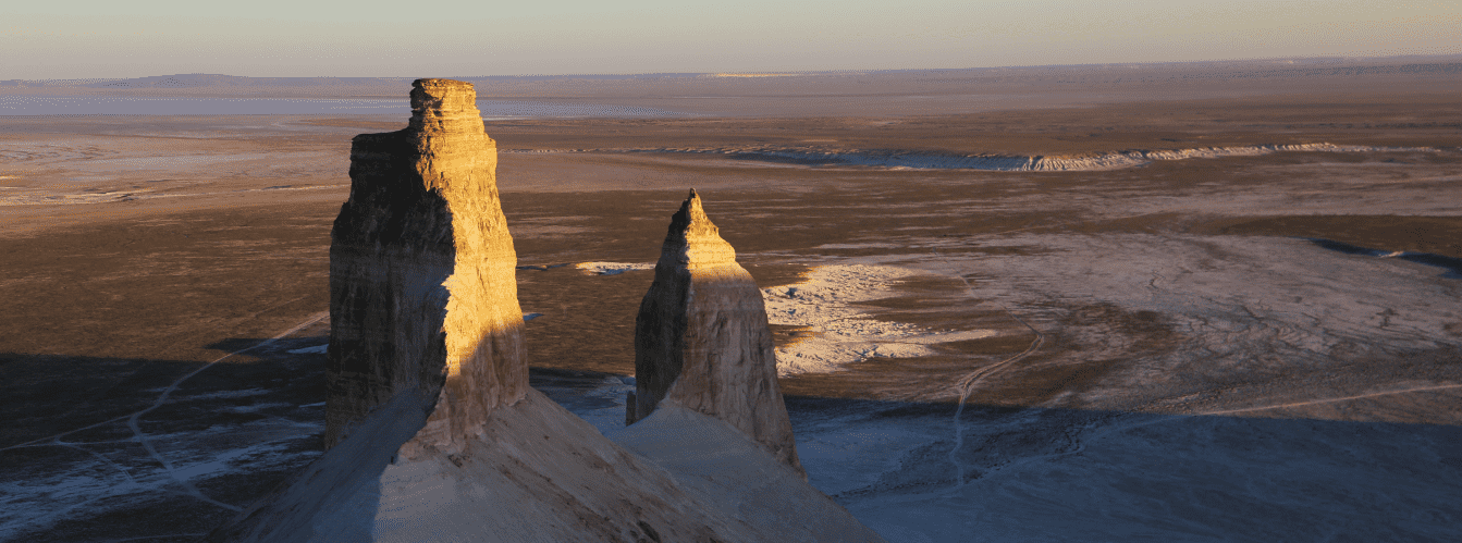
The geomorphological character of the peninsula was forged by continuous Quaternary sea-level fluctuations and centuries of sedimentation from the retreating Tethys Ocean. From the southern borders of Buzachi through the mountain defiles of the Northern and Southern Aktau ridges, routes lead to the renowned Torysh Valley of Stone Concretions, the sacred summit of Mount Otpan-Tau with the Aday-Ata memorial, residual Mount Sherkala, the multicolored Jurassic clays of the Kokala tract, and the narrow slate gorge of Karadayirmen.
The low-lying shores of the peninsula abound in expansive salt marshes, silty shoals, and sand tracts, providing ideal biotopes for hundreds of thousands of migratory waterfowl, the relict Caspian seal, and saiga antelopes. Skirting the peninsula from the east along the chink scarps of the Ustyurt Plateau, off-road convoys journey toward the chalk Tuzbair salt flat, the dizzying chinks of Manata Pass and the Man-Ata mausoleum, the stepped scarps of the Bozzhira tract, Mount Bokty, and the otherworldly expanse of the Karynzharyk depression, granting access to the untouched expanses of the Buzachi Nature Sanctuary and the protected grounds of the Ustyurt Reserve.
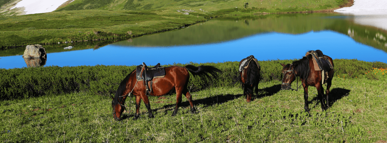
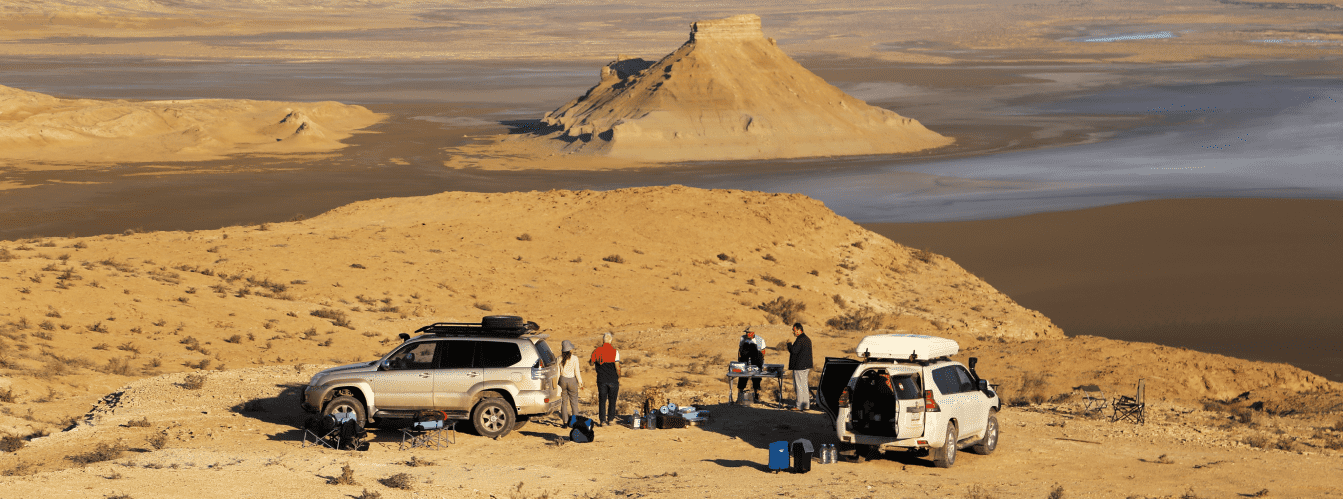
For self-drive travelers and expedition crews, the Buzachi Peninsula serves as an ideal seaside refuge: travelers venture here for exceptional birdwatching along shallow bays, wild camping amidst the silence of sand dunes under sweeping starry skies, and the rare opportunity to encounter Caspian seals along remote spits alongside herds of grazing Aday horses. Today, the Buzachi Peninsula is recognized as an outstanding monument of primeval littoral nature in Eurasia and Mangystau, drawing researchers, overland drivers, and amateur ornithologists with cosmic salt-marsh vistas, herds of grazing camels and horses of the Aday breed, colonies of greater flamingos, and the boundless horizon of the Caspian sky.
--------------------------------------------
How to get there and visit –
The Buzachi Peninsula is situated in the northern part of the Mangystau region within the boundaries of the Mangystau and Tupkaragan districts. The distance from the city of Aktau to the entrance of the peninsula (around the village of Tushchyqudyq or Shebir) is about 170–190 km, to the industrial settlement of Karazhanbas – roughly 210 km, and to the Kalamkas shift camp on the northern coast – approximately 270–290 km.
GPS geographical coordinates of the Buzachi Peninsula:
44°59'17"N 51°59'51"E
The driving route from the city of Aktau leads northeast along the paved highway of republican significance via Akshukur and Tauchik, or via the station of Shetpe with a turn north toward the village of Tushchyqudyq. Farther north, a well-maintained paved industrial highway extends across the entire peninsula, connecting the regional center with the immense Karazhanbas, Northern Buzachi, and Kalamkas oilfields.
Standard passenger cars can travel along the main paved spine highway, but any excursions toward the wild shores of Mangyshlak Bay, the Oliktykol salt marsh, the Buzachi Sanctuary, or Dead Kultuk and Kaydak bays strictly require a prepared four-wheel-drive vehicle (4x4).
Safety precautions and terrain specifics: the primary hazard of the peninsula lies in treacherous coastal salt flats (sors) and unstable clay takyrs. Beneath a thin, dry upper crust often lurks deep, viscous mud capable of instantly trapping a vehicle. Driving off established ruts is strictly discouraged. Vehicles must carry sand ladders, a kinetic snatch strap, a functional jack, an air compressor for deflating and inflating tires, and reserve fuel in jerrycans.
Visiting regime: transit travel along public roads of the peninsula is unrestricted. However, northern and eastern sectors border the frontier zone of the Republic of Kazakhstan on the Caspian Sea and the territory of the Buzachi State Nature Sanctuary. All travelers must carry original national ID cards or passports.
Access to industrial oilfield operational facilities is restricted by security checkpoints.
Infrastructure: in the settlements of Tushchyqudyq and Shebir, as well as at central oilfield support bases, gas stations, grocery stores, tire repair bays, and canteens operate. Along the wild shoreline sectors, infrastructure and freshwater sources are absent. For self-contained camping, travelers must carry at least 5 liters of drinking water per person per day, food provisions, sturdy windproof tents (strong winds sweep the peninsula), and shade canopies. Reliable 4G cellular service covers the main highway and oilfield hubs, but vanishes across remote salt flats and sanctuary grounds.
The best season to visit is the dry shoulder period: late spring (May – early June) and early autumn (September – October). During this window, temperatures are comfortable (+22...+26 °C), scorching heat is absent, and millions of migratory birds gather along coastal shoals. In summer (July – August), blistering heat reaches +40...+42 °C accompanied by dusty, salt-laden dry winds. In early spring and late autumn, prolonged rains and wind-driven surges turn the lowlands into impassable mire.
--------------------------------------------
History
The history of the Buzachi Peninsula is bound to pastoral livestock breeding, ancient nomadic migration trails, and the eventual discovery of massive subterranean mineral wealth in the Caspian basin. In Kazakh toponymy, the peninsula is named "Bozashy" (Buzachi). Most linguists link the root to the light, pale-gray shade of the local wormwood-salt plains ("boz" meaning whitish, gray, virgin, or feather-grass colored). Another folk etymology traces the name to a Turkic clan designation or the word "buzaushy" (calf-herder, tender of young cattle).
Over many centuries, the sweeping pastures of Buzachi served as wintering grounds (kystau) for Kazakh clans of the Junior Zhuz, especially the Aday. Winters here were milder than on the high Ustyurt Plateau, while low shrubs and saltworts provided year-round forage for hundreds of thousands of sheep, Bactrian camels, and hardy Aday horses.
During the Middle Ages, caravan routes traversed the Buzachi isthmus, linking ports on the Tupkaragan Peninsula with the steppes of the Lower Volga and cities of the Golden Horde. Nomads utilized an intricate system of natural freshwater lenses and deep wells (shynyrau) hand-dug into sandy massifs to depths of several dozen meters.
In the 1830s and 1840s, expeditions led by Grigory Karelin explored the peninsula while seeking suitable locations for Russian fortifications on the Caspian. Later, in the late 19th century, cartographers and geologists documented extensive deposits of salts and marls bordering the Buzachi sors.
A radical turning point came in the 1970s, when Soviet geologists struck enormous hydrocarbon reserves on Buzachi. Deposits of heavy, high-viscosity crude were discovered: Karazhanbas (1974), Northern Buzachi (1975), and Kalamkas (1976). Within a short timeframe, industrial oil-production infrastructure, paved roads, and modern shift camps arose amid the salt flats. In 1976, to protect unique wildlife across an area of 132,000 hectares, the Buzachi State Nature Sanctuary was established.
Information
Geographically and geomorphologically, the Buzachi Peninsula is a flat, lowland depositional plain covering an area of more than 11,000 square kilometers. The peninsula is washed by the waters of Mangyshlak Bay to the west and the depressions of Dead Kultuk and Kaydak bays to the north and east. Virtually the entire landmass lies below global sea level (elevations range from -28 meters along the Caspian waterline to -5...-10 meters across the interior).
The geological structure of the basement comprises thick sequences of Paleozoic, Mesozoic, and Cenozoic sedimentary strata. The subsoil of Buzachi holds colossal reserves of oil and gas within Cretaceous and Jurassic beds. The surface is composed of Quaternary marine and alluvial-deltaic deposits: bedded sandstones, loams, shell sands, and gray clays of the ancient Tethys Ocean. Defining features of the terrain include salt marshes (sors), takyrs, and sweeping ridge-hummock tracts of stabilized and semi-stabilized aeolian sands.
The hydrological regime is hyper-arid. Permanent rivers and open freshwater bodies do not exist on the peninsula. The hydrography consists of ephemeral salt lakes and seasonal salt-marsh muds (Oliktykol sor, Zhalpak sor). Along the coast, Caspian wind-driven surges play a major role: fierce northerly winds ("moryanas") can push seawater across coastal plains many kilometers inland. Within sandy massifs, shallow lenses of slightly mineralized groundwater feed ancestral wells.
Soil cover is poorly developed, represented by littoral solonchaks (both crustal and puffy), takyr-like soils, solonetz complexes, and desert sandy soils.
The climate is sharply continental, arid desert. Summers are dry, long, and hot, with average July temperatures of +27...+30 °C and daytime highs exceeding +40 °C. Winters are changeable, with frequent thaws interrupted by sharp gale-force winds; average January temperatures hover around -4...-8 °C (dropping to -25 °C during Siberian cold fronts). Average annual precipitation is meager at 100 to 140 mm, with evaporation exceeding rainfall by 8 to 10 times.
Detailed description of the venue
The natural landscape ensemble of the Buzachi Peninsula includes the following geographic sectors, natural tracts, and operational zones:
• Buzachi State Nature Sanctuary – a vast protected area in the north of the peninsula serving as a wildlife reserve for the preservation of saiga antelopes, goitered gazelles, and waterfowl.
• Coastal Oliktykol salt marsh – a colossal sor depression featuring snow-white salt efflorescence and gypsum crystals, changing in character with marine storm surges.
• Sand hummocks and ridges of central Buzachi – undulating expanses of semi-stabilized desert sands colonized by tamarisk and Calligonum shrubs, where pastoral wells were historically dug.
• Western littoral shore of Mangyshlak Bay – a strip of gently sloping sand-and-shell shoals, shallow coves, and reed-fringed islets rich in fish.
• Industrial oilfield sector (Kalamkas and Karazhanbas) – an engineered hub amid the salt flats featuring pumpjacks, tank farms, and specialized infrastructure.
• Eastern coastal belt of Kaydak Bay – the zone where lowland Buzachi clays transition into treacherous salt-marsh muds at the foot of distant Ustyurt chinks.
Flora and fauna
Vegetation across the Buzachi Peninsula is of a halophytic desert character. Under extreme soil salinity, saltworts dominate: Halocnemum strobilaceum, glasswort, Anabasis salsa (biyurgun), boyalych, itsigek (Anabasis aphylla), and Bassia. Sandy ridges support shrub communities of Calligonum (dzhuzgun), tamarisk (saltcedar), sand acacia, camelthorn (dzhantak), and white wormwood. In low-lying depressions and along coastal spits grow belts of common reed. In spring, the plains are briefly colored by ephemerals, wild tulips, and desert grasses.
Wildlife represents a valuable genetic reservoir of Central Asian arid fauna. The Buzachi Sanctuary preserves the rare Buzachi population of the saiga antelope alongside graceful goitered gazelles, which are listed in the Red Data Book of Kazakhstan.
Carnivores include the wolf, corsac fox, badger, steppe polecat, marbled polecat, and tolai hare. Along coastal shallows and sandy spits haul out Caspian seals, the endemic marine mammals of the sea. Numerous herds of Aday horses and Bactrian camels graze freely across the rangelands.
Avifauna numbers hundreds of species, with the shoals of Buzachi serving as a critical flyway nexus. Thousands of greater flamingos, Dalmatian and great white pelicans, whooper swans, mute swans, grey herons, Eurasian spoonbills, ruddy shelducks, and pied avocets nest and stage along the lagoons and sors. In the open desert dwell MacQueen's bustard (houbara bustard) and the little bustard, while golden eagles, steppe eagles, saker falcons, and long-legged buzzards hunt from the skies.
Herpetofauna is diverse: the rapid fringe-toed lizard, secret toad-headed agama, plate-tailed gecko, four-lined snake, arrow snake, and Central Asian tortoise are widespread.
Legend
An ancient Kazakh legend concerning the White Mare and the Sacred Well is tied to the Buzachi Peninsula.
Tradition tells that in ages past, when an unprecedented seven-year drought struck the land of Mangyshlak, all wells went dry and pastures withered to gray dust. Nomads faced ruin alongside their herds, and even the ancient Caspian receded far from the shore, leaving behind bitter salt.
A poor batyr owned a beloved snow-white mare ("boz biye") of pure Aday blood. Seeing the suffering of the clan, the mare whinnied loudly, turned toward the northern wastes, and galloped into the lifeless salt flats. The batyr and his kin followed in her tracks.
For three days the mare ran across sors and scorching sands. At the close of the third day, in the middle of a flat, pale plain, she halted and struck the earth three times with her silver hoof. Instantly, a powerful fountain of sweet, crystal-clear spring water burst forth with a bell-like chime.
The people watered their animals, excavated a deep well (shynyrau) at the spot, and were saved from peril. The plain around the well was named "Bozashy" in honor of the white savior. Since then, belief holds that the spirit of the White Mare protects the horse-breeders of Buzachi, and that the Aday horses of this land possess untiring stamina, able to travel hundreds of kilometers across desert terrain and locate water beneath parched salt.
Conclusion
The Buzachi Peninsula is an extraordinary and rugged region of Mangystau, where the primordial expanse of salt flats and golden sand dunes coexists with industrial progress and the dazzling waters of the Caspian. An expedition across the boundless plains of Buzachi offers an uncommon sense of freedom, the sight of pink flamingos in flight above sors, herds of free-roaming Aday horses, and an enduring link between centuries-old nomadic traditions and the living nature of the Caspian coast.
Interesting sights nearby:
• Buzachi State Nature Sanctuary;
• Koshak Bay;
• Kaydak Bay;
• Giant Dead Kultuk Bay;
• Zhygylgan Geological Sinkhole;
• Fossilized Tracks of Machairodonts;
• Tamshaly Rocky Gorge;
• Saura Canyon with Relict Pond Turtles;
• Tyub-Karagan Bay;
• Torysh Valley of Spherical Concretions;
• Mount Sherkala Outlier;
• Variegated Clays of the Kokala Tract;
• Expansive Oliktykol Salt Marsh.
Sacred sights and pilgrimage destinations:
• Beket-Ata Underground Mosque in the Oglandy Tract;
• Karaman-Ata Underground Mosque;
• Shakpakty-Ata Underground Mosque;
• Sultan-Epe Underground Mosque;
• Masat Ata Mosque;
• Bayte Sanctuary.
Photogallery: