Tour from Aktau city to Boszhira tract -
Travel from Beineu to the panoramas of Bosjira -
Route according to the program: Aktau city – Karagiye depression – Zhanaozen city – Kyzylsai village – Boszhira tract – Boszhira panoramas – Ulken Mountain-Kem
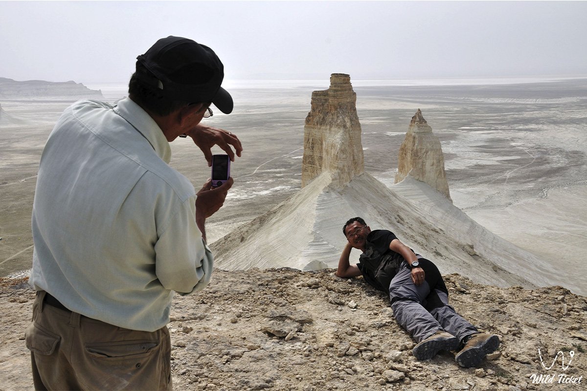
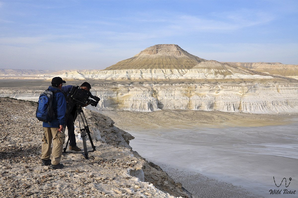
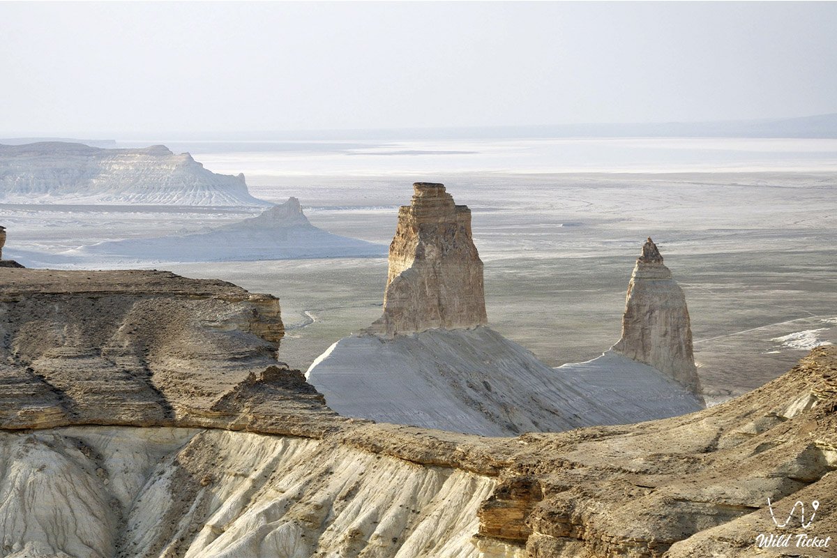
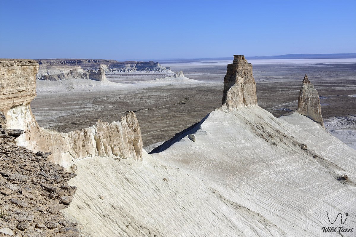
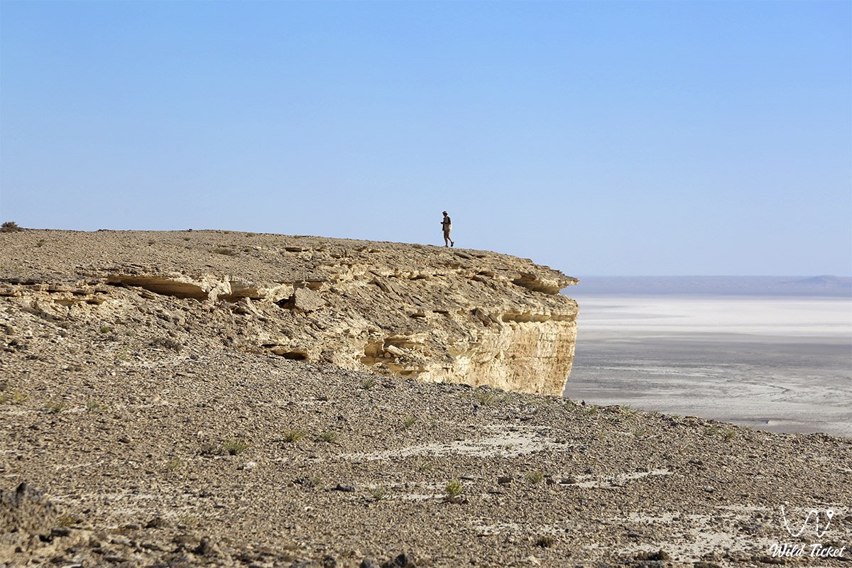
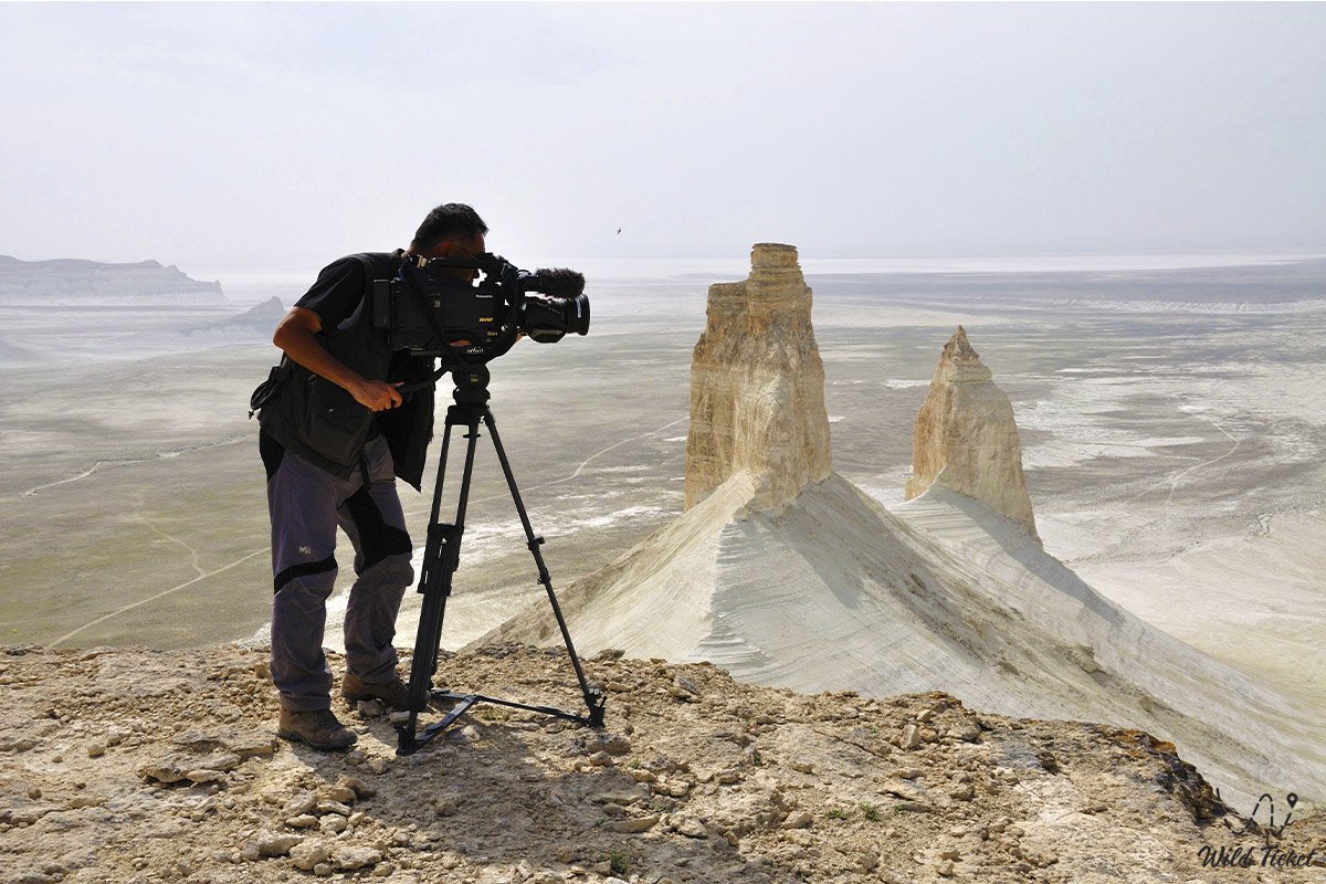
Ulken-Kem mountain is a hill, the ledge is located in the Boszhira tract. The Ulken-Kem hill is a landmark of the tract and is located in the tract itself and the mountain is easily accessible. All high formations, free-standing mountains, hills and ledges have their own names, and the Ulken-Kem hill also got its name. The Ulken-Kem ledge has an elongated shape, protrudes far forward from the main part of the earth and ends with outliers, peaks called Azu-Tisteri.
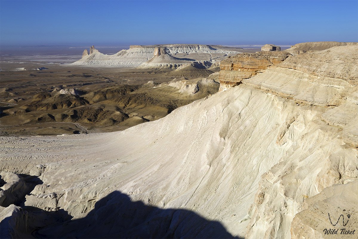
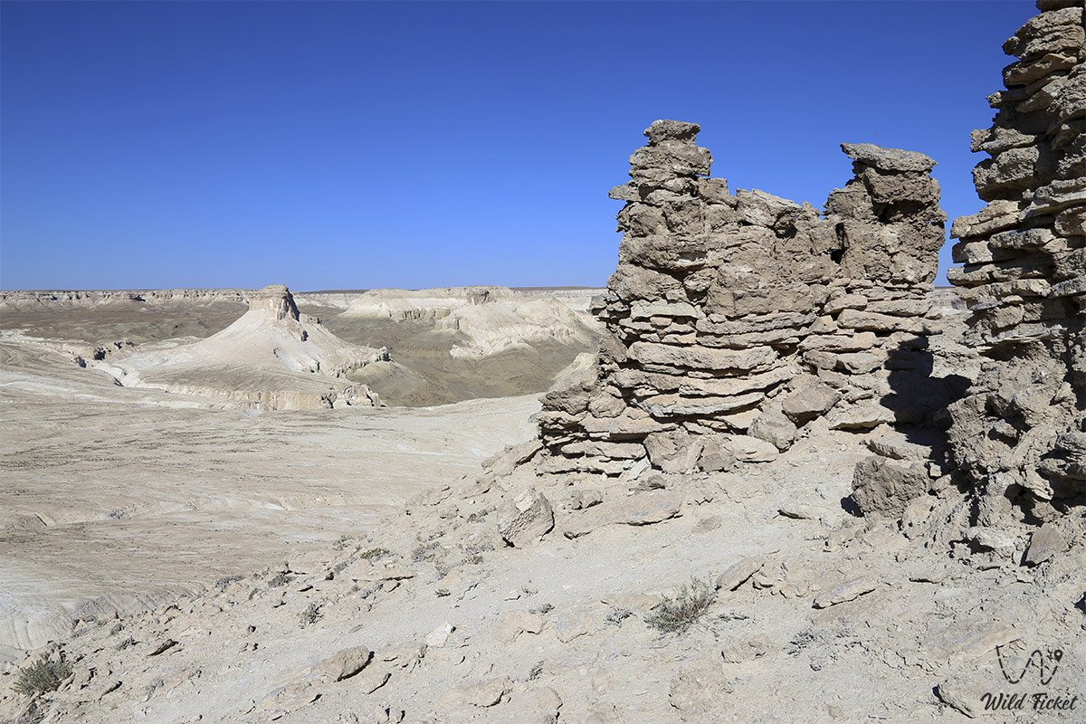
To get to Ulken-Kem Mountain, you will have to walk a little through the local mountains and hills and drive by car before the start of the ascent. It is best to travel here with a guide who knows the local roads and knows the shortest way to Ulken-Kem. The start of the ascent on Ulken-Kem starts from the Ortasha plateau, before the start of the ascent on Ulken-Kem we can leave the car and start the ascent. In some places there is a trail, but in some places it is not, but the path is clearly visible so you will not get lost. The main landmark here is the stone fortress shelter on the road to Ulken-Kem.
GPS coordinates of Mount Ulken-Keme N43°25'24" E54°04'14"
Important, safety precautions on Ulken-Keme: it is necessary to be extremely careful on Ulken-Kem, it is necessary to behave extremely carefully on the top of Ulken-Keme mountain, do not come close to the cliffs, watch out for other members of the group so that they do not approach the cliff, especially look after the children if they go with you to this the journey.
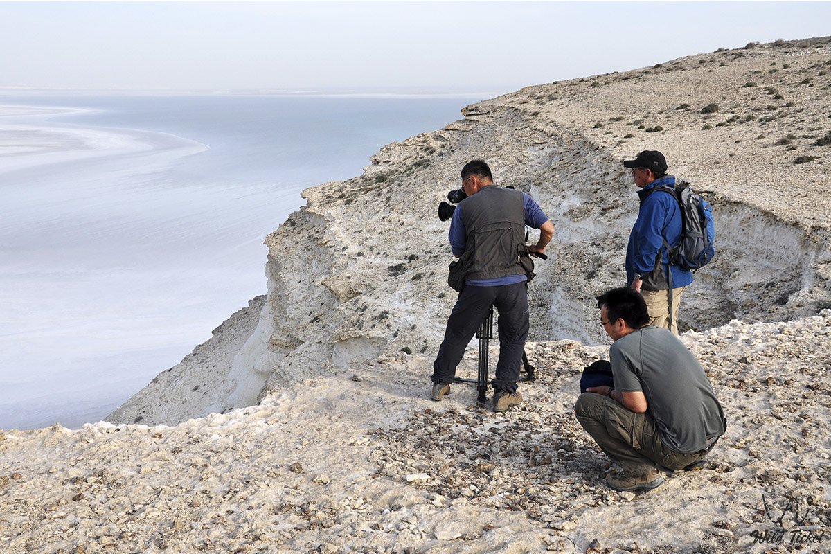
The cliff here exceeds 150 meters. Everyone here likes to take photos against the background of the Azu-Tisteri peaks, to take these photos it is best to lie down in front of the cliff and take these photos, sometimes a strong wind blows on the plateau, so it is also necessary to observe safety precautions here.
Tour itinerary:
Photogallery: