Chalk Mountains Three Brothers
Striped tiger outliers and dazzling mirror of the Kenderli salt marsh –
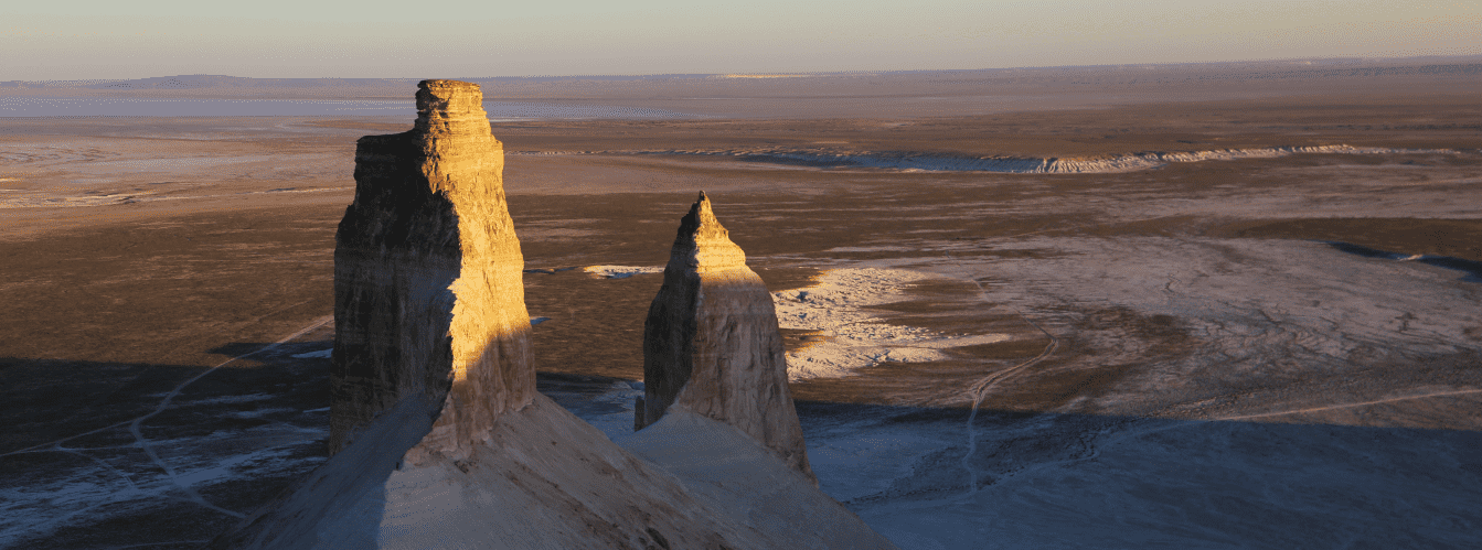
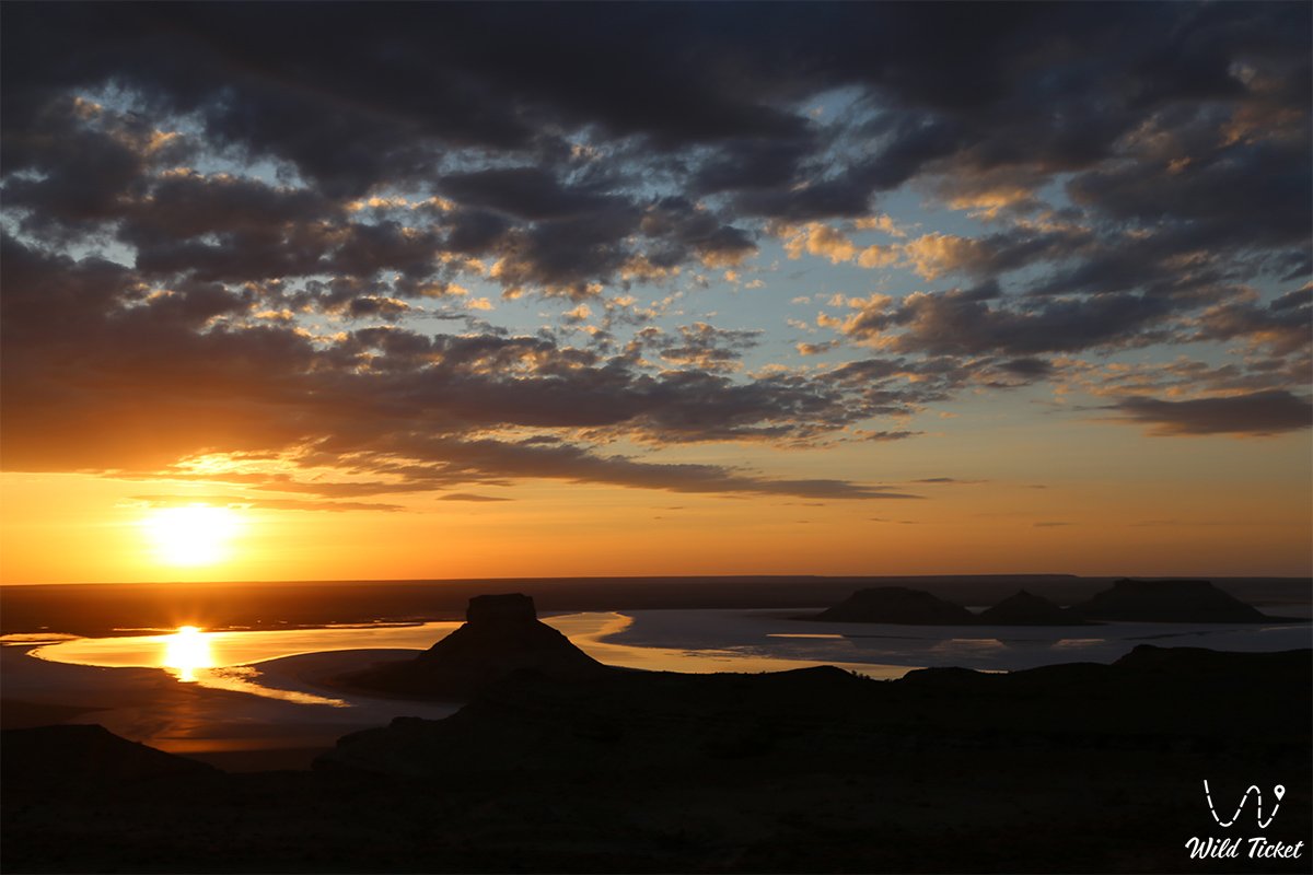
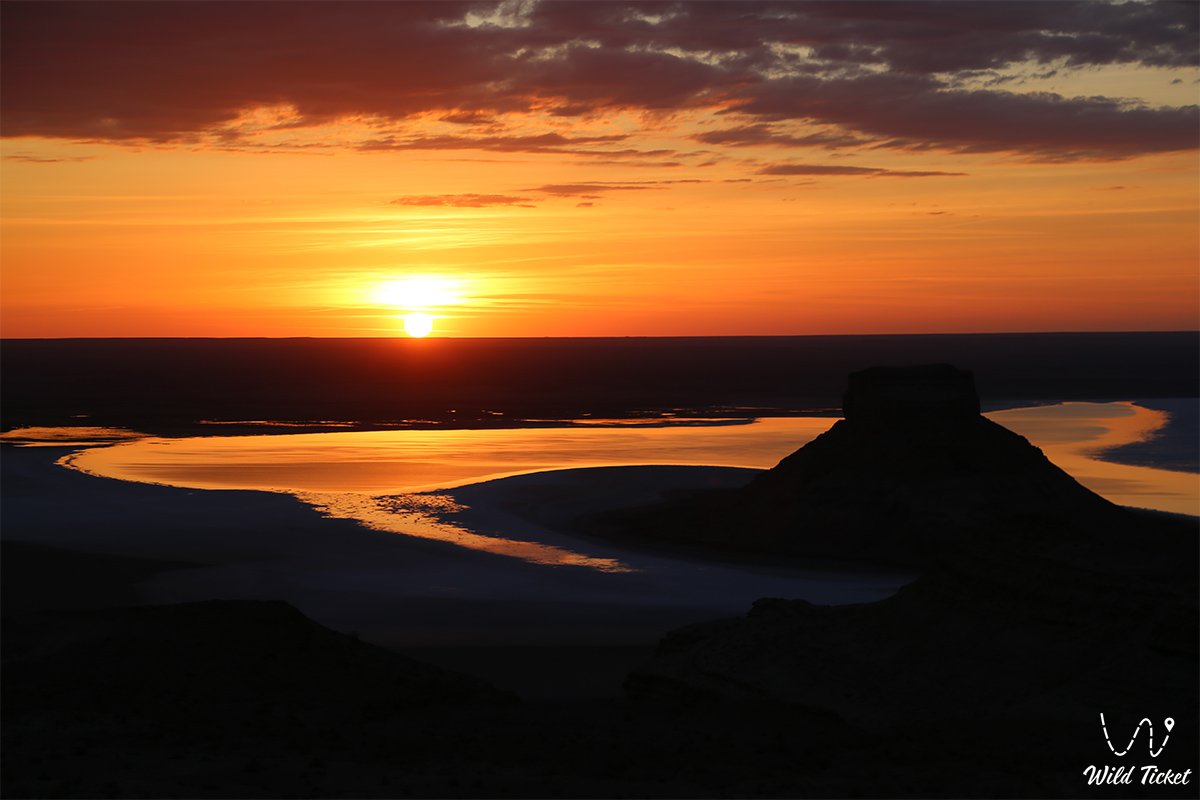
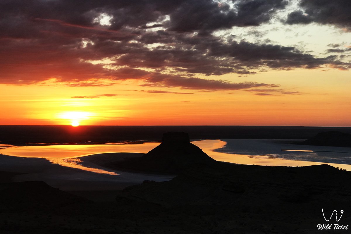
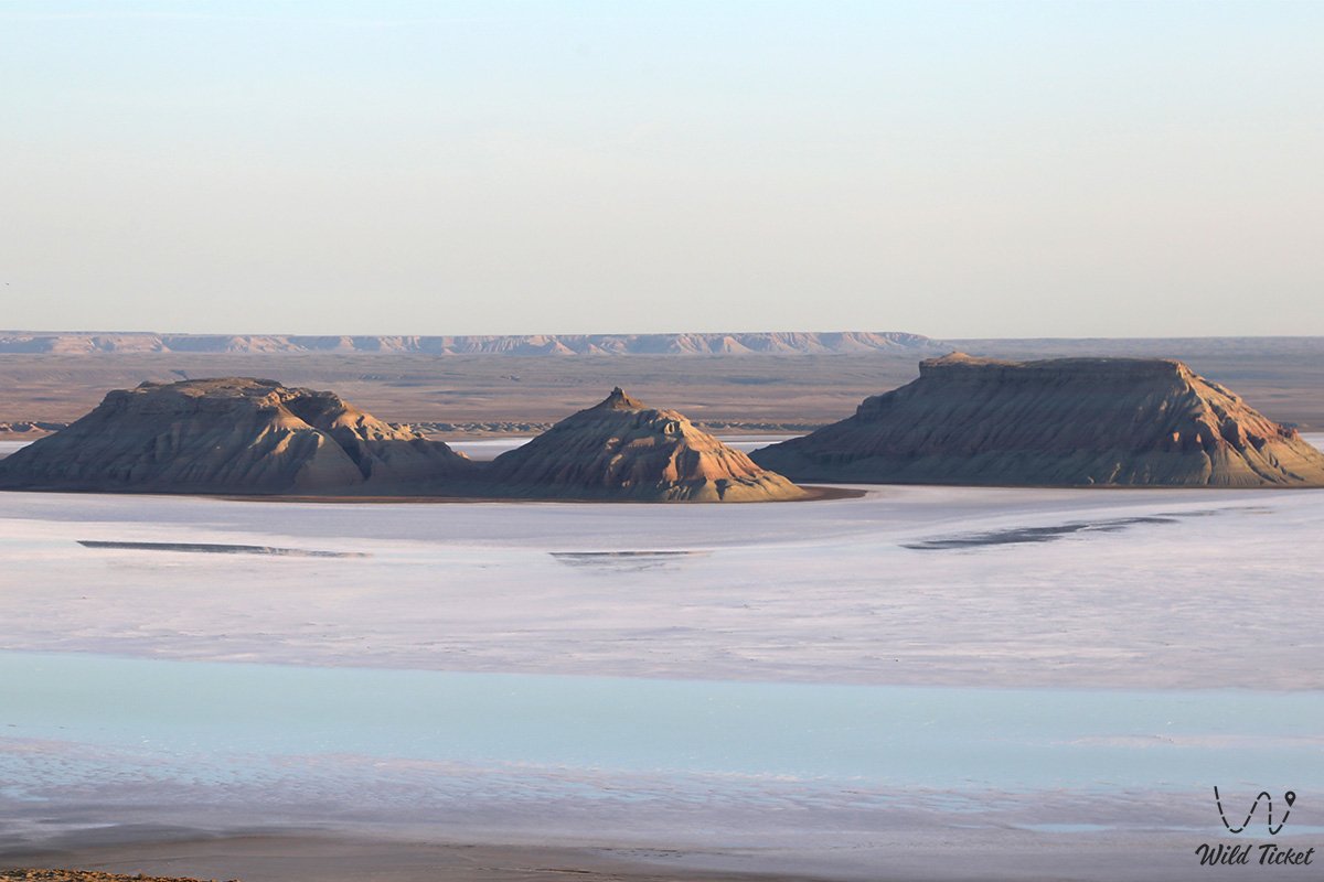
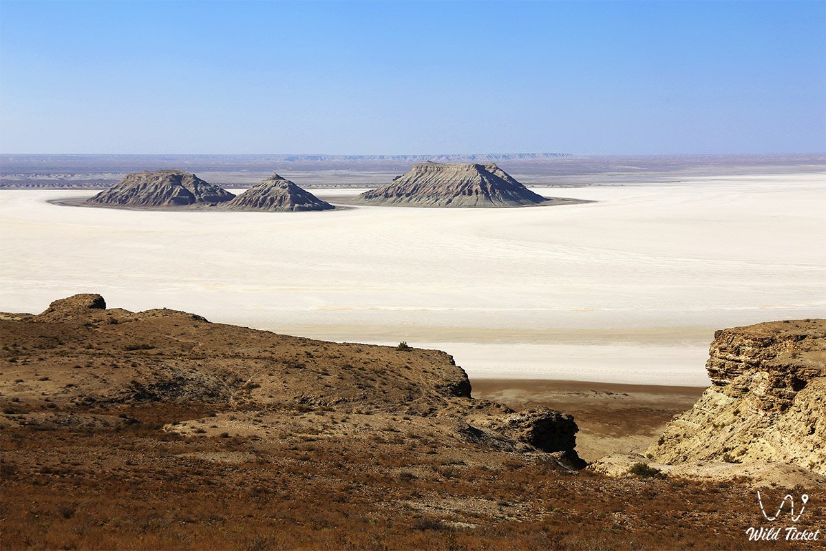
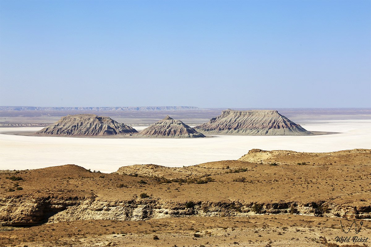
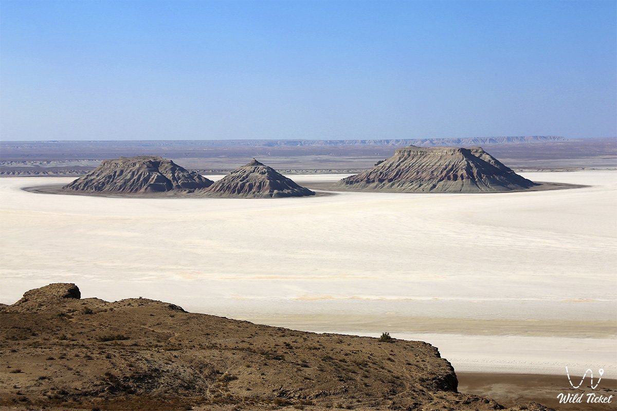
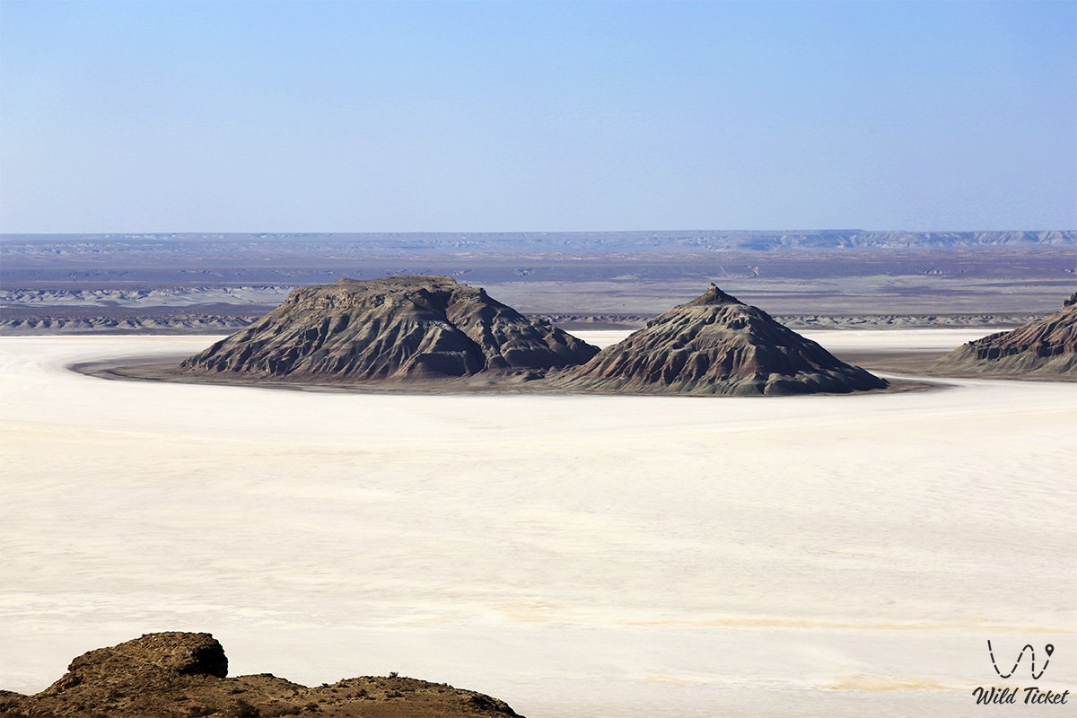
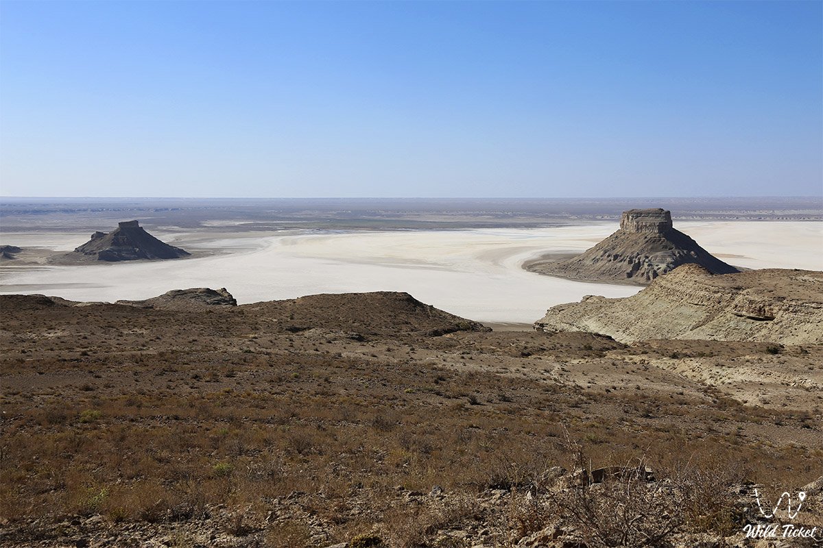
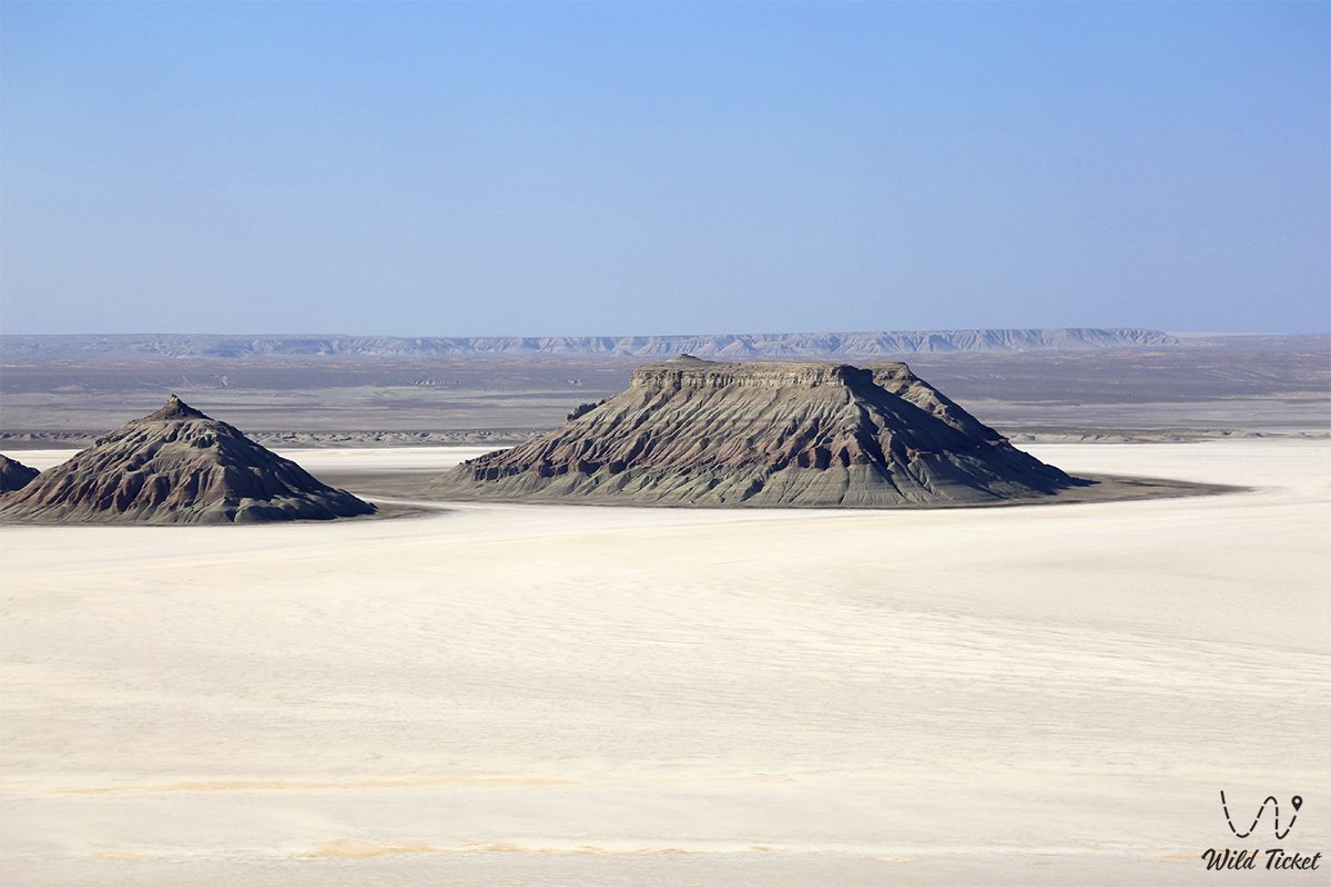
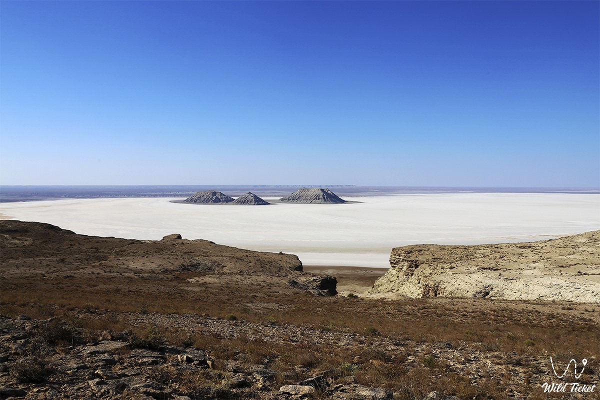
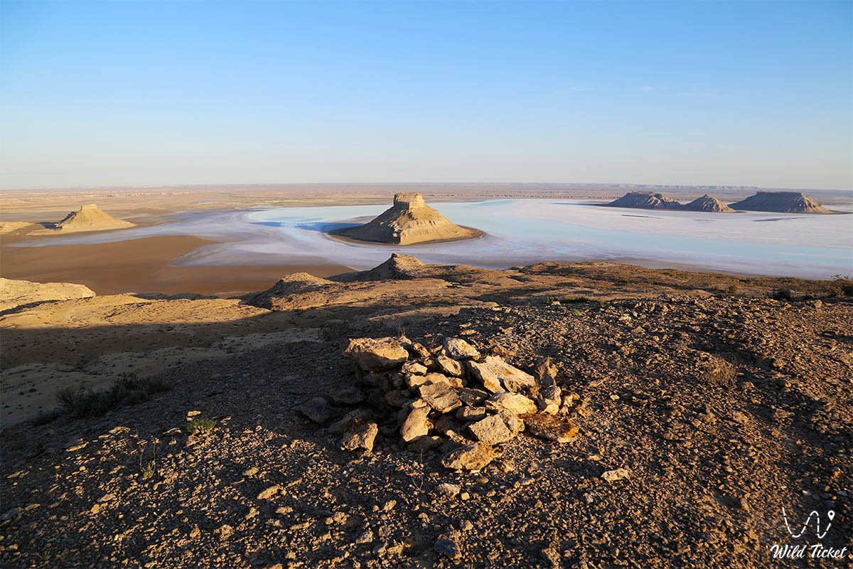
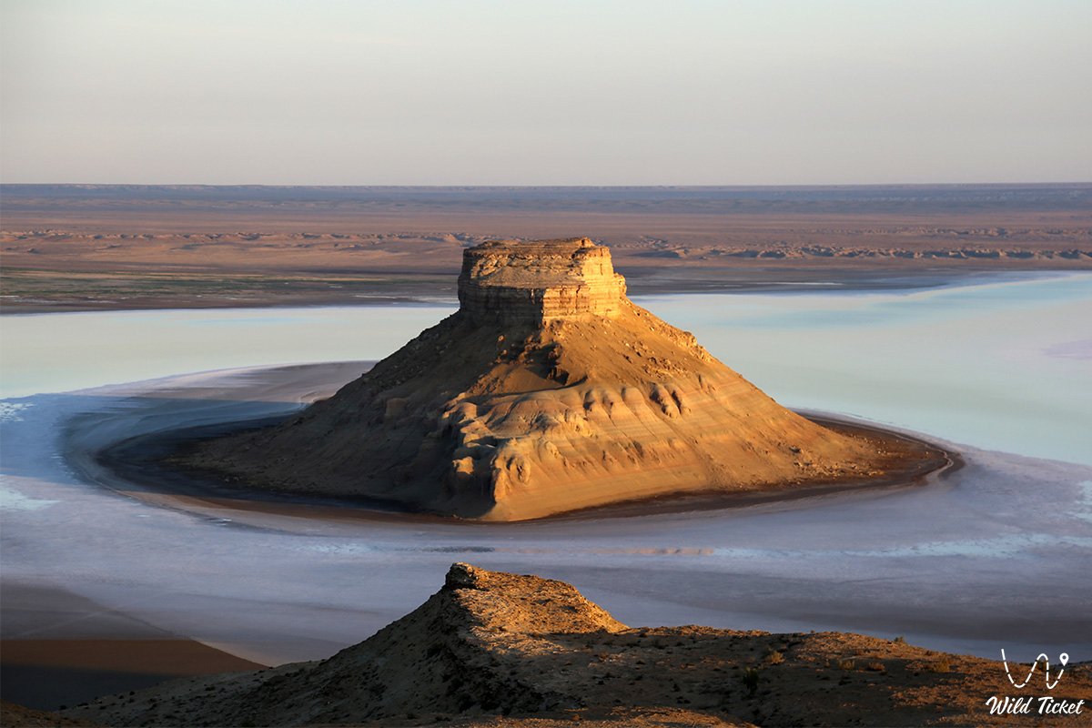
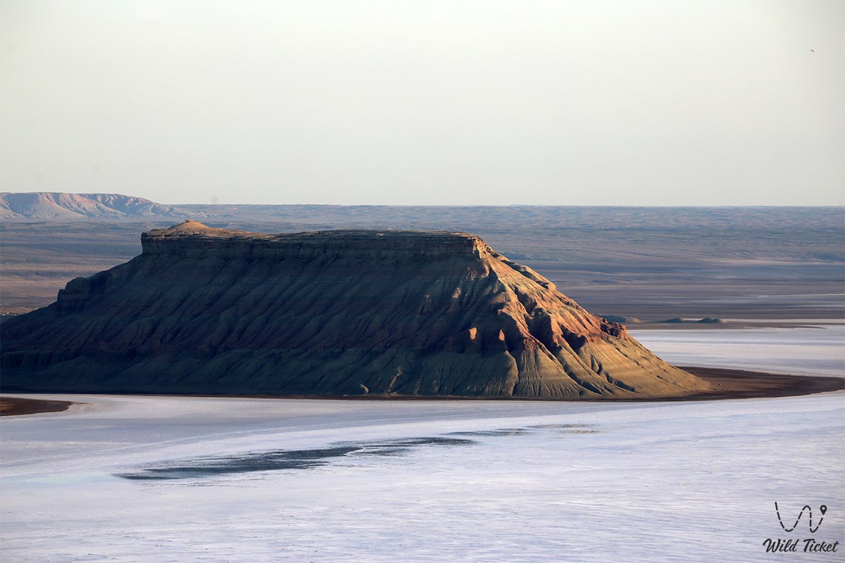
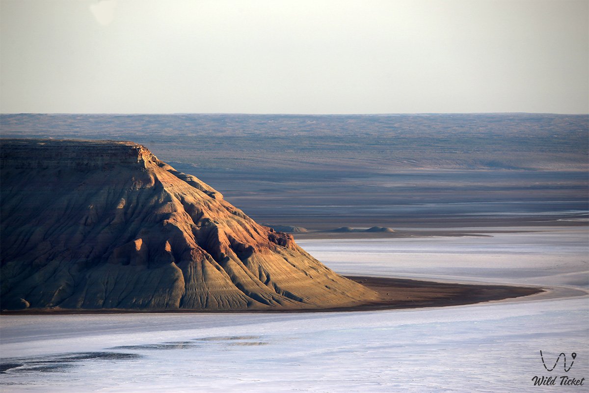
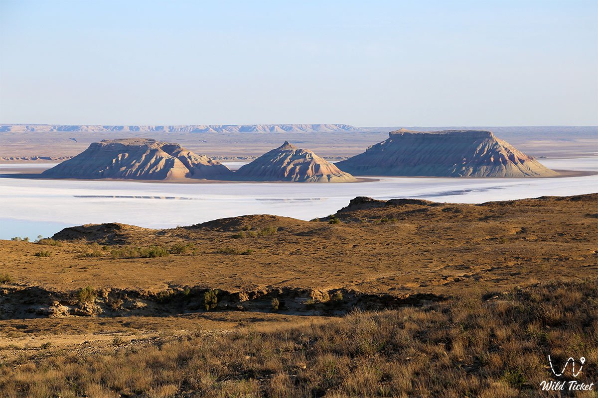
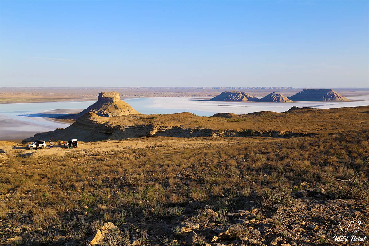
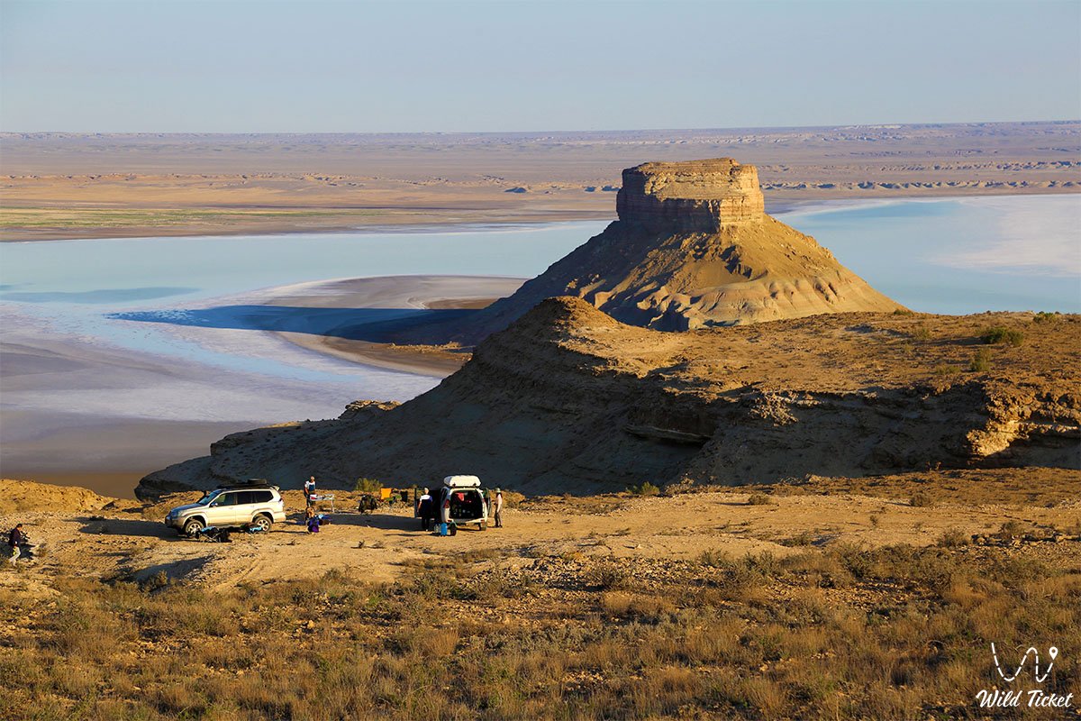
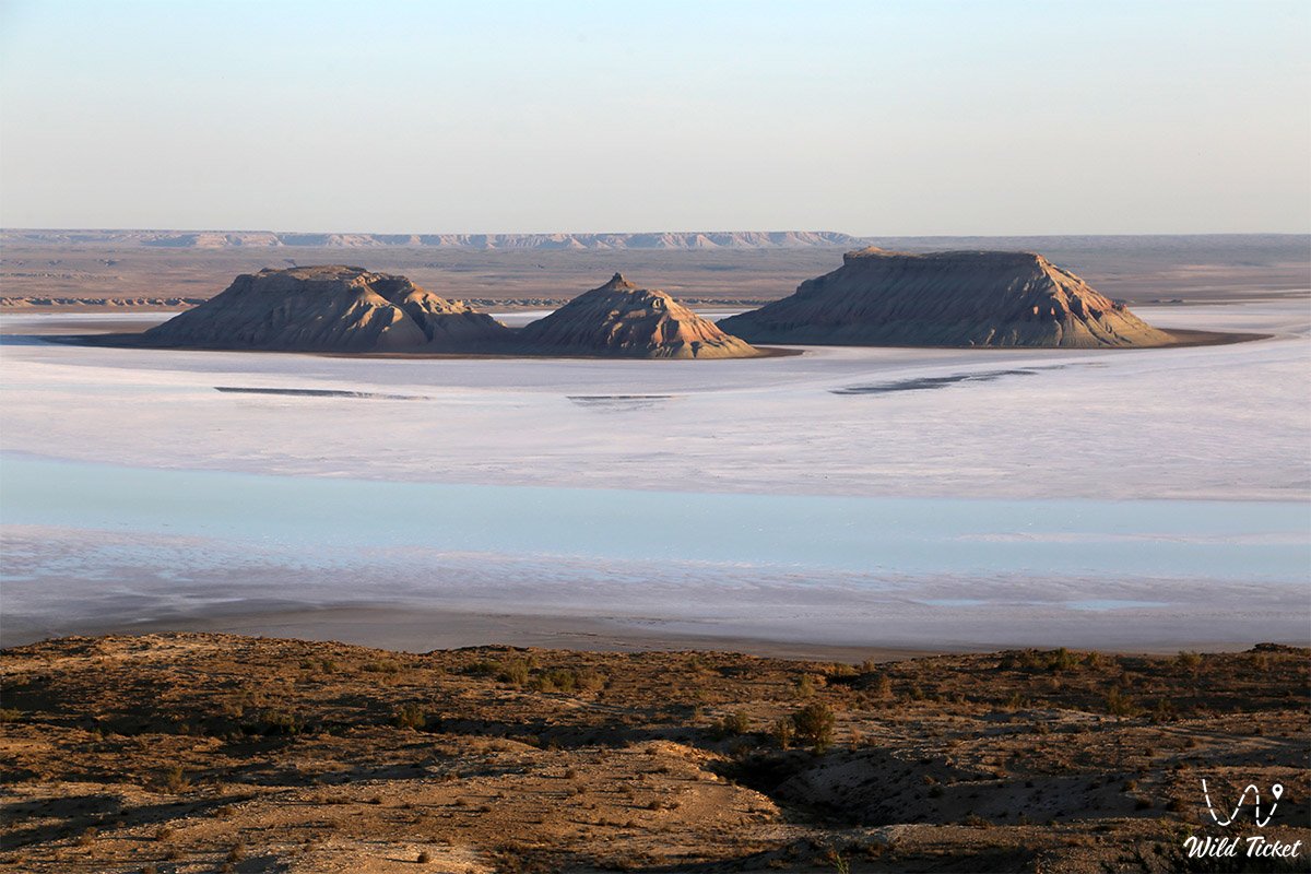
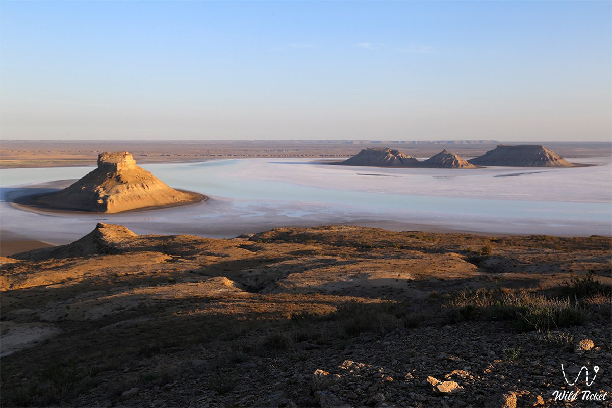
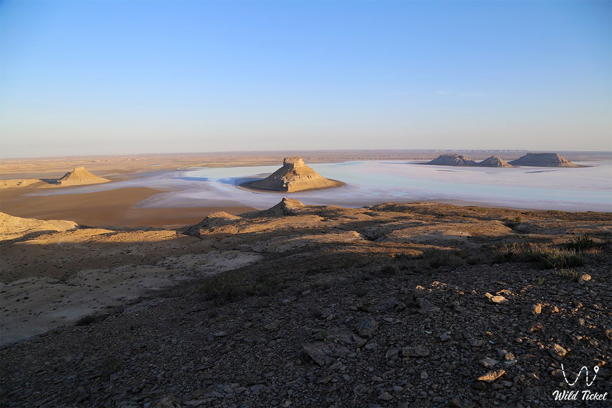
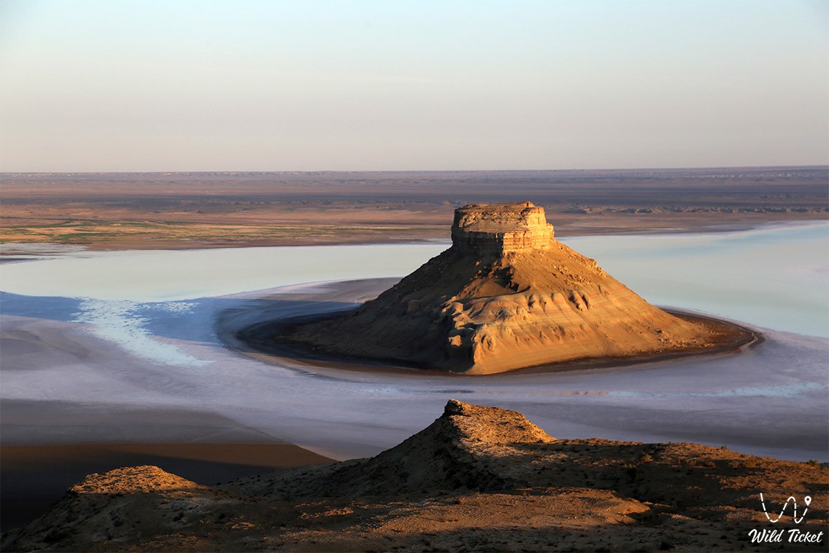
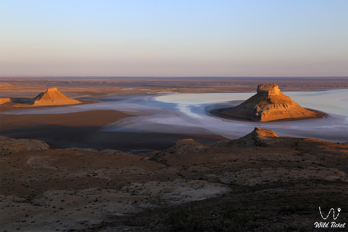
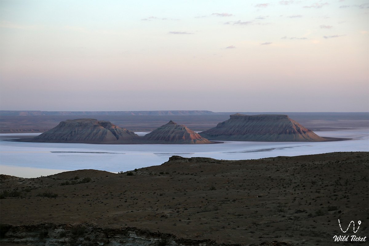
The Chalk Mountains Three Brothers (Kaz. Ush aғaiyndy tauy, also known as Ush batyr) represent three monumental isolated outliers of fanciful shape rising above an absolutely flat surface in the west of Kazakhstan. This striking natural monument is sheltered at the very bottom of the giant tectonic Karynzharyk depression within the boundaries of the Karakiyan district.
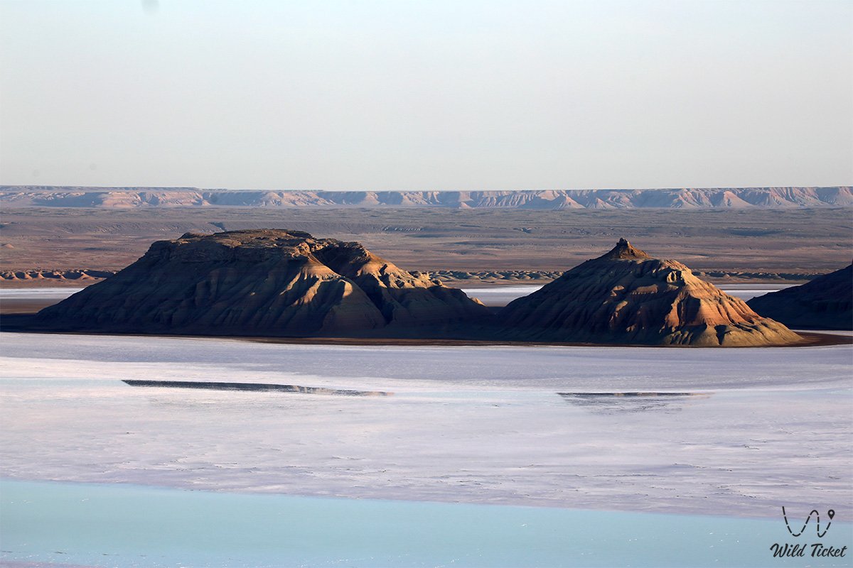
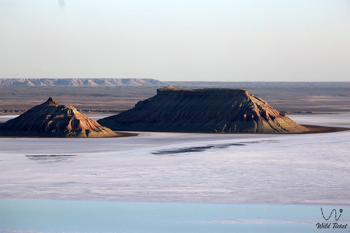
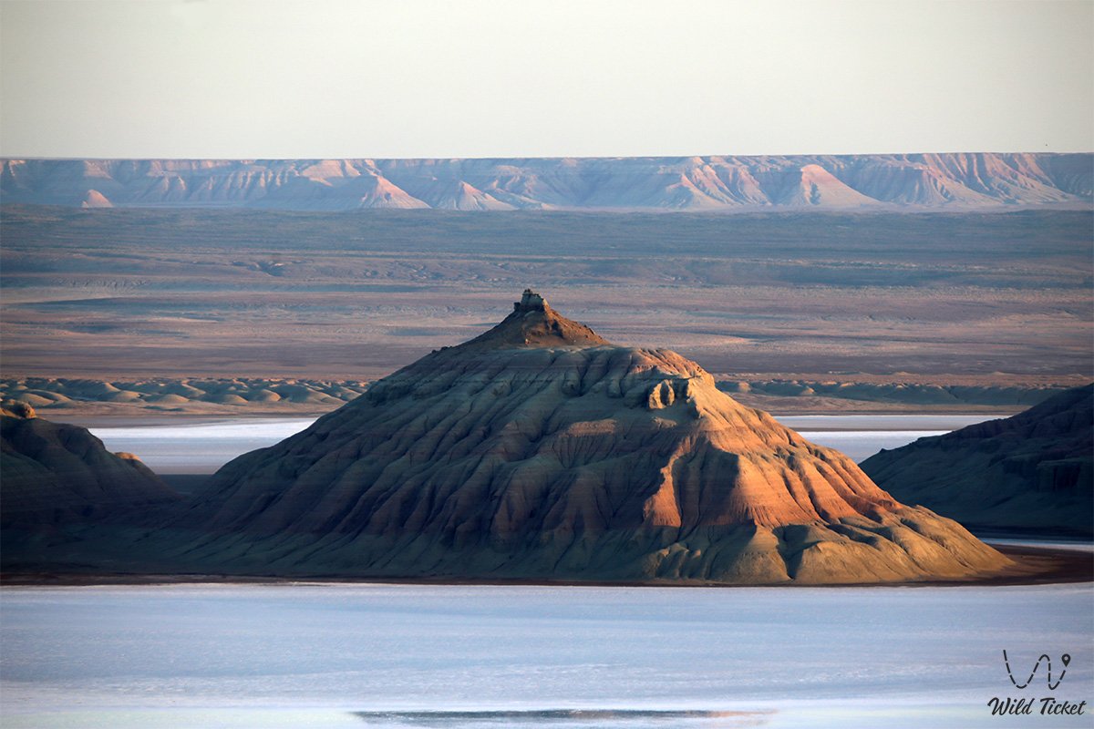
This entire surreal valley serves as one of the most vivid natural gems of the Mangystau region, where amid the blinding white expanse of the Kenderli-sor salt flat soar striped "tiger" peaks composed of contrasting beds of colored clays, gypsum, and chalk. Dozens of kilometers to the west churn the stormy waters of the Caspian Sea, while at the bottom of the endorheic basin cosmic silence reigns, broken only by gusts of hot wind.
In the tourism and expedition logistics of Southern Mangystau, the Three Brothers outliers serve as an iconic waypoint on the most demanding autonomous off-road itineraries. The starting base for travelers is the oil-industry city of Zhanaozen, while the last outpost of civilization before venturing into the depths of the salt flat is the remote village of Akkuduk, located approximately 37 kilometers northwest of the mountains. West of the Karynzharyk tectonic depression along the coast stretch Cape Tokmak, the resort-flanked Kenderli Bay (holiday center), the ferry hub of Port Kuryk, and the colossal tectonic abyss of the Karagiye depression (-132 m) with the Batyr salt marsh.
The unique banded appearance of the outliers is owed to centuries of Meso-Cenozoic sedimentation at the bottom of the vanished prehistoric Tethys Ocean and millions of years of erosional dissection across the Ustyurt Plateau. From the Karynzharyk depression, vehicle ruts lead north and northeast: toward the solitary Mount Bokty, the stepped chalk castles of the Bozzhira tract, the boundless Tuzbair salt flat, the golden sands of the Senek (Tuyesu) massif, and the deep Zhazgurly depression alongside the neighboring Basgurly depression.
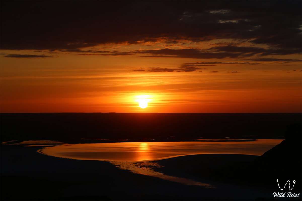
The landscape acquires special enchantment after rare rains, when the dry bed of the Kenderli salt flat becomes veiled with an ultra-thin film of brine, transforming into a gigantic mirror wherein the Three Brothers outliers reflect like fairy-tale islands in a boundless primeval ocean. Morning sunrise and evening sunset also provide prime lighting for photographing the three mountains. From these striped bastions, expedition tracks lead into the very heart of the strictly protected wild landscapes of the Ustyurt State Nature Reserve, which preserves habitats of Asia's rarest ungulates and birds of prey.
Further onward, routes extend to Mount Sherkala and Cape Tyub-Karagan, home to the celebrated tectonic Zhygylgan sinkhole whose floor preserves the fossilized tracks of prehistoric animals.
Today, the Chalk Mountains Three Brothers are recognized as one of the most cinematic and exotic wonders of Eurasian nature, drawing skilled drivers, landscape photographers, and explorers of cosmic panoramas with their inimitable tiger-striped crags and the grandeur of primeval wilderness.
--------------------------------------------
How to get there and visit –
The Chalk Mountains Three Brothers (Three Batyrs) are situated in the south of the Karakiyan district, in the southern part of the deep endorheic Karynzharyk depression upon the bed of the Kenderli salt flat, within the territory of the Ustyurt Reserve. The distance from the village of Akkuduk is about 37 km, from the city of Zhanaozen – roughly 210–230 km, and from the regional administrative center of Aktau – approximately 340–370 km one way.
GPS geographical coordinates of the Three Brothers Mountains (Ush aғaiyndy):
42°38'43"N 54°15'34"E
The driving itinerary from Aktau runs along high-speed paved highway southeast through the Karagiye depression to the city of Zhanaozen (around 150 km). From Zhanaozen, continue south on asphalt past the settlement of Senek to a junction where rough gravel grader and a maze of steppe dirt tracks branch toward remote Akkuduk village. Beyond the settlement, hard-packed ruts run southeast along the eastern chink of Karynzharyk, descending via steep rocky gullies to the edge of the Kenderli salt flat. Total travel time from Aktau one way takes between 6 and 8 hours of concentrated off-road driving.
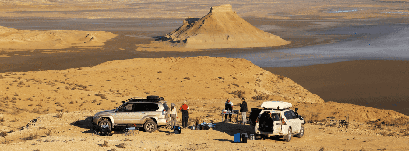
A prepared expedition 4x4 vehicle is strictly necessary (all-wheel drive, low-range gearing, elevated ground clearance, and durable A/T or M/T off-road tires). Driving in a convoy of at least two vehicles is strongly advised.
Driving directly onto the salt crust of the Kenderli sor is STRICTLY FORBIDDEN: beneath the visible layer of dry salt lies a treacherous stratum of saline slime (khaka), capable of instantly bogging a heavy vehicle down to the hubs. Vehicles must carry a high-lift jack, kinetic tow straps, a tire inflator compressor, sand ladders, shovels, and at least two spare wheels per vehicle.
Visiting regime: the mountains are located within the buffer zone of the Ustyurt State Nature Reserve and along the state frontier zone. Entry requires obtaining an official permit in advance from the reserve administration in Zhanaozen and paying the ecological fee. All participants must carry original passports or national ID cards for checks by environmental inspectors and border control officers of the National Security Committee of Kazakhstan.
Infrastructure in the mountain area is completely non-existent: this is an uninhabited, fully autonomous realm. The nearest small grocery store and well are located in Akkuduk village, while comprehensive gas stations, tire shops, pharmacies, and automotive service bays are found only in Zhanaozen. The expedition requires 100% self-reliance: a potable water reserve (at least 6–8 liters per person per day), spare fuel in jerrycans calculated for heavy consumption over sand and mud, rations for several days, a satellite phone or satellite tracker, windproof tents, and warm clothing (desert temperatures drop sharply at night). Cellular reception across the Karynzharyk depression is completely absent.
The best season to visit is the dry shoulder period: spring (May – early June) and early autumn (September – October). During these months, weather conditions remain stable, tracks are dry, and daytime temperatures hover comfortably between +22 and +28 °C. In July and August, travel is hazardous due to extreme heat exceeding +42...+45 °C, when the salt surface acts as a scorching reflector. Late autumn and early spring rains turn clay descents slick and render the depression floor impassable.
--------------------------------------------
History
The history of the Three Brothers Mountains is steeped in nomadic lore and chronicles of the most grueling geographical surveys across the Ustyurt Plateau. Since antiquity, the boundless and unforgiving Karynzharyk depression was considered by Aday nomads to be a sacred and daunting boundary: crossing it without a seasoned guide and knowledge of hidden fordable paths through the sors meant certain death.
The outliers received their Kazakh name "Ush aғaiyndy" (Three Brothers) or "Ush batyr" (Three Batyrs) for their proud, solitary stance: three majestic peaks stand shoulder to shoulder amid white silence like legendary warriors guarding the peace of the sleeping steppe. Their secondary colloquial name, the "Tiger Mountains," took root because of their vivid stratified coloring, where bands of ochre, terracotta, pink gypsum, and brilliant white chalk alternate in rhythmic ribbons.
In the late 19th and early 20th centuries, expeditions of the Imperial Russian Geographical Society and the Military Topographical Corps ventured into the Karynzharyk depression. Explorers plotted these isolated peaks onto strategic maps of the Southern Trans-Caspian region, noting them as unmistakable visual navigation benchmarks against the flat, monotonous salt-flat horizon.
In 1984, with the establishment of the Ustyurt State Nature Reserve, the Kenderli salt flat and the Three Brothers Mountains were placed under strict state protection as a pristine benchmark of arid ecosystems and a refuge for endangered wildlife.
In recent decades, the Three Brothers outliers have become a magnetic destination for international expedition tourism: witnessing the reflection of the tiger batyrs in the water-sheened mirror of the flooded sor is hailed as a hallmark reward for every true explorer of Mangystau.
Information
Morphometrically, the Three Brothers Mountains represent a compact group of three discrete erosional residual massifs of mesa-conical shape. They sit on the floor of the Kenderli salt flat inside the Karynzharyk depression, whose bottom drops to absolute elevations between -50 and -70 meters below global sea level. The relative relief of the outliers above the salt surface reaches 80 to 120 meters, rendering them dominant topographical landmarks for hundreds of square kilometers around.
The geological structure exhibits a classic horizontal marine sedimentary sequence from the Mesozoic and Paleogene strata of the ancient Tethys Ocean. The body of the mountains is composed of alternating dense white writing chalk, pinkish marls, and gypsiferous greenish and chocolate-toned clays, crowned by a protective cap of ferruginous Sarmatian limestone. It is this durable rock shield that preserved the outliers from total denudation, while surrounding strata were leveled by millions of years of wind deflation and slope wash.
The hydrological regime of the basin is hyper-arid. Permanent streams and freshwater springs do not exist on the depression floor. The bottom of the Kenderli salt flat represents a hydromorphic sor with shallow mineralized groundwater. During rare but torrential spring downpours, the depression captures surface runoff from Ustyurt's chinks, forming a thin sheet of brine 2 to 10 centimeters deep that lingers under the sun from several days to a couple of weeks.
Soil cover surrounding the mountains is absent, replaced by sor solonchaks (both puffy and crustal) featuring a salt-gypsum crust several centimeters thick. The scree aprons at the base of the peaks carry thin, primitive gravelly desert soils.
The climate is hyper-continental and ultra-arid. Summers are brutally hot: during July, daytime air temperatures in the basin regularly reach +42...+46 °C, while the white salt crust reflects solar radiation, producing intense heat and blinding glare. Winters are thin on snow, marked by sharp winds and freezes down to -20...-25 °C. Average annual precipitation does not exceed 90–110 mm, while potential evaporation exceeds rainfall by more than 15 times.
Detailed description of the venue
The spatial-natural complex of the Three Brothers tract includes the following key morphological elements, panoramic viewpoints, and landscape zones:
• Main (Northern) Batyr – the most massive and elevated outlier of the triad, featuring a flat mesa top and distinctly rhythmic alternating white-and-pink bands.
• Middle Tiger Outlier – a conical peak sculpted by deep badland erosion rills, whose flanks exhibit the most vivid tiger-stripe coloration of clays.
• Southern Brother – a sharp-crested rocky spire bordered by steep screes at its foot, completing the triad on the southern margin of the salt flat.
• Salt Mirror of the Kenderli Salt Flat – a boundless, dazzlingly white sheet of self-precipitated salt encircling the outliers with a level horizontal floor.
• Steppe Capes of the Eastern Chink of Karynzharyk – elevated observation vantage points along the rim of the Ustyurt Plateau, opening onto a classic panoramic perspective over the Three Brothers from a height of 150 meters.
• Aeolian Canyon Zone at the Base – a miniature maze of clay-gypsum gullies carved around the foot of the peaks by rare flash floods.
Flora and fauna
Vegetation across the bed of the Kenderli salt flat is virtually absent due to extreme salinity. Only along the periphery of the sor and on alluvial fans of ravines do specialized halophytes survive: European glasswort, Halocnemum strobilaceum, Suaeda, Caspian saltwort, and sea lavender. On screes around the base of the Three Brothers cling sparse shrubs of boyalych, Anabasis salsa (biyurgun), white wormwood, and Anabasis aphylla (itsigek). In spring, ephemeral plants and tiny desert tulips briefly appear across clay foot-slopes.
Fauna in the environs of the peaks is remarkable, as the district falls within the core zone of the Ustyurt Reserve. It supports one of the last viable populations of the rare Turkmen kulan (wild ass), successfully re-acclimatized across Karynzharyk. Herds of goitered gazelles course through the clay plains, while steep chink scarps harbor bands of Ustyurt mountain sheep (mouflons / urials).
Carnivores denning along plateau ravines include the wolf, corsac fox, badger, marbled polecat, and sand cat. Encounters with the elusive honey badger and the secretive caracal are also recorded in these reaches.
Avifauna in the depression comes alive during migration seasons. Flocks of greater flamingos, Dalmatian pelicans, swans, and numerous waders rest on the surface of the flooded sor. On sheer clay-chalk scarps of the chinks and rocky shelves of the Three Brothers nest raptors: golden eagle, Egyptian vulture, saker falcon, long-legged buzzard, imperial eagle, and lesser kestrel.
Herpetofauna is represented by the rapid fringe-toed lizard, toad-headed agama, Caspian gecko, sand boa, and Halys pit viper. During nighttime cool, scorpions, solifuges, and tarantulas roam the desert sands.
Legend
An ancient Kazakh legend concerning the Three Batyr Brothers and the Celestial Shield is woven around the Ush aғaiyndy chalk outliers.
Tradition tells that in ages past, a peaceful nomadic clan wandered along the rim of the boundless plateau, its horse herds renowned for their speed and its daughters for their grace. The pride and strength of the clan rested in three batyr brothers, born of one mother in the same blessed hour. They were inseparable, possessed heroic power, and swore an oath to defend their native steppe to the last drop of blood.
Without warning, countless hordes of fierce conquerors marched from the south, ravaging all in their path. The balance of forces was overwhelming: enemy ranks choked the horizon like swarms of black locusts. To safeguard their aul and allow their people to reach the northern chinks, the three brothers stepped forward and stood shoulder to shoulder at the very floor of the endorheic basin.
For seven days and seven nights, a fierce clash raged. The warriors repelled assault after assault; their shields rang under enemy arrows, and the earth beneath their boots turned white-hot. As their strength waned and their quivers emptied, the brothers raised their hands to the Creator, pleading not for their own lives, but that their bodies might become an insurmountable bulwark through which the enemy could never break.
Heaven heard their righteous prayer: the earth trembled, lightning struck, and the three brothers transformed into gigantic stone peaks, while the ground around them became encased in dazzling salt armor, consuming the remnant forces of the enemy. Ever since, these three striped batyrs have kept eternal watch amid the white silence of Karynzharyk, reminding future generations of unbroken brotherhood, self-sacrifice, and sacred devotion to their homeland.
Conclusion
The Chalk Mountains Three Brothers stand as one of the most monumental and breathtaking emblems of primeval Mangystau, where the fanciful geometry of erosion unites with the boundless whiteness of the Kenderli salt flat into a cosmic landscape. An expedition to the Three Batyrs on the floor of Karynzharyk offers road travelers an incomparable journey through rugged desert terrain, awe before the enduring power of geological epochs, and the chance to behold the Earth in its primordial majesty.
Interesting sights nearby:
• Deep Tectonic Karynzharyk Depression;
• Dazzling White Kenderli Salt Flat;
• Solitary Mount Bokty Outlier with Striped Slopes;
• Grand Bozzhira Tract with chalk fang-like castles;
• Dazzling Tuzbair Salt Flat with Snow-White Arches;
• Sand Massif and Barchans of Senek (Tuyesu) Village;
• Relict Tectonic Basgurly Depression;
• Deep Endorheic Zhazgurly Basin;
• Scenic chalk chink of the Manata Pass;
• Rock outliers of the Kenderli-Kayasan Plateau;
• Steppe tract and well of Kugusem;
• Remote desert village of Akkuduk.
Sacred sights and pilgrimage destinations:
• Beket-Ata Underground Mosque in Oglandy Tract;
• Karaman-Ata Underground Mosque;
• Shakpakty-Ata Underground Mosque;
• Sultan-Epe Underground Mosque;
• Otpan Tau Complex on Mount Otpantau;
• Kolbas Ishan Mosque;
• Koben Mosque;
• Zholaskan Mosque;
• Nurbergen Kalyshev Mausoleum;
• Zhaman Sauran Mosque;
• Ishan Khozha Mosque;
• Itolla Mosque;
• Sonabay Underground Mosque;
• Masat Ata Mosque;
• Uytoly Ata Underground Mosque;
• Bayte Sanctuary.
Photogallery: