Sacred valley of springs, mulberry groves, and Sufi silence –
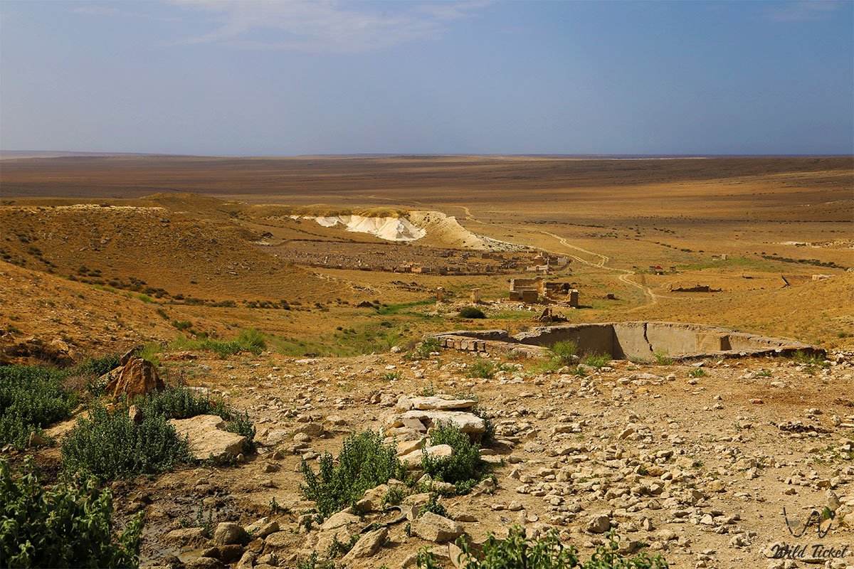
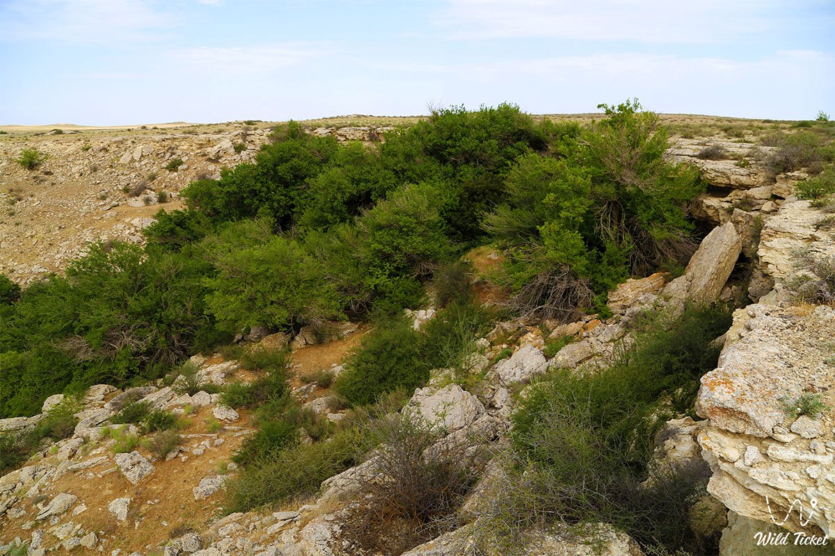
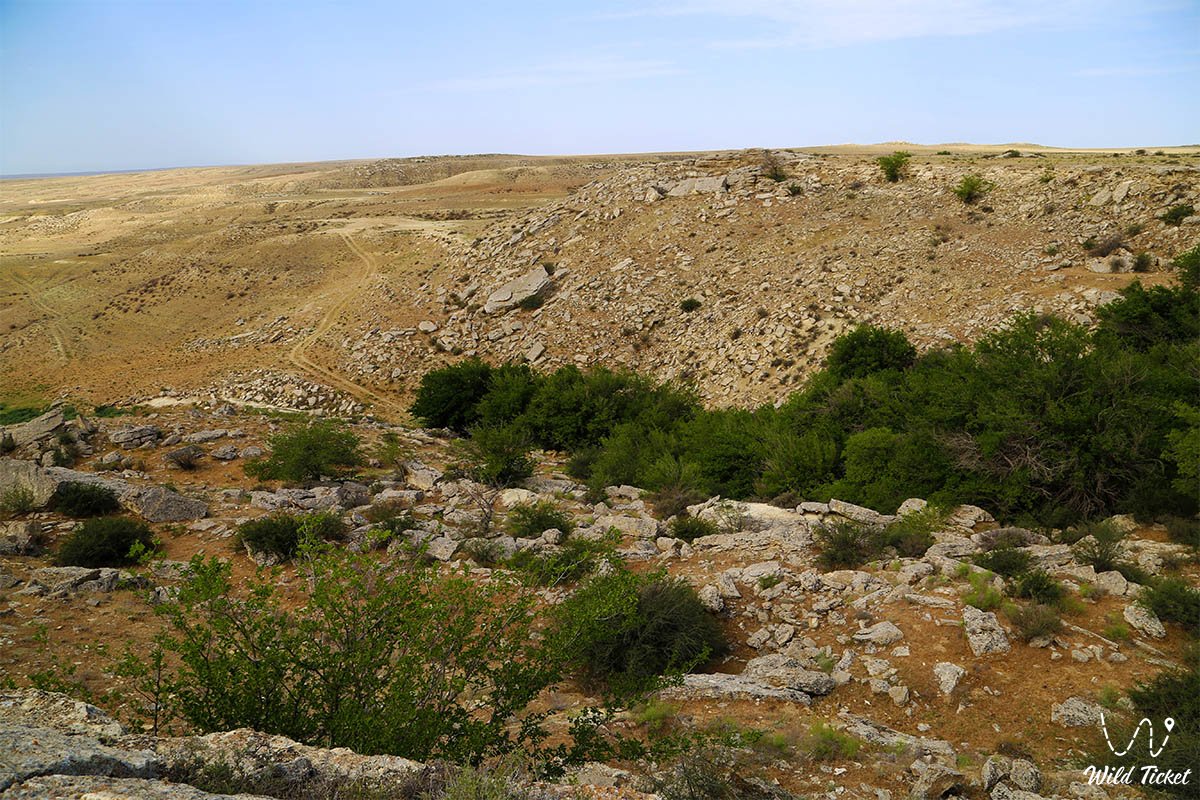
The Khanga Baba Tract (in historical documents and regional lore also Kanga-Baba, Kangy-Baba, Kaz. Khan'ga baba, Qan'ga-Baba) represents a picturesque mountain-steppe valley, a unique relict oasis with freshwater springs, and one of the most prominent historical-architectural memorial complexes of the Tupkaragan district in the Mangystau region.
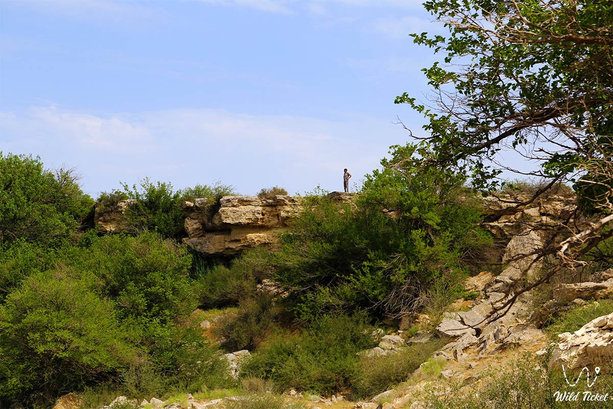
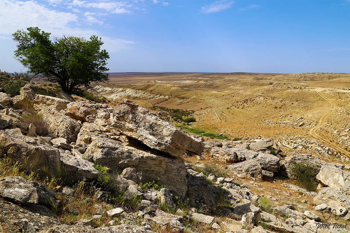
Situated at absolute elevations ranging from 57.6 to 106.9 meters above sea level, the tract sprawls at the foot of the eponymous Khanga (Kanga) ridge, which stretches from east to west for 15 kilometers like a monolithic limestone rampart.
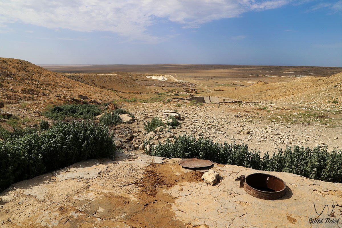
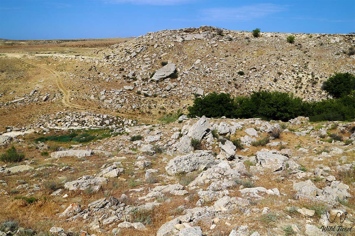
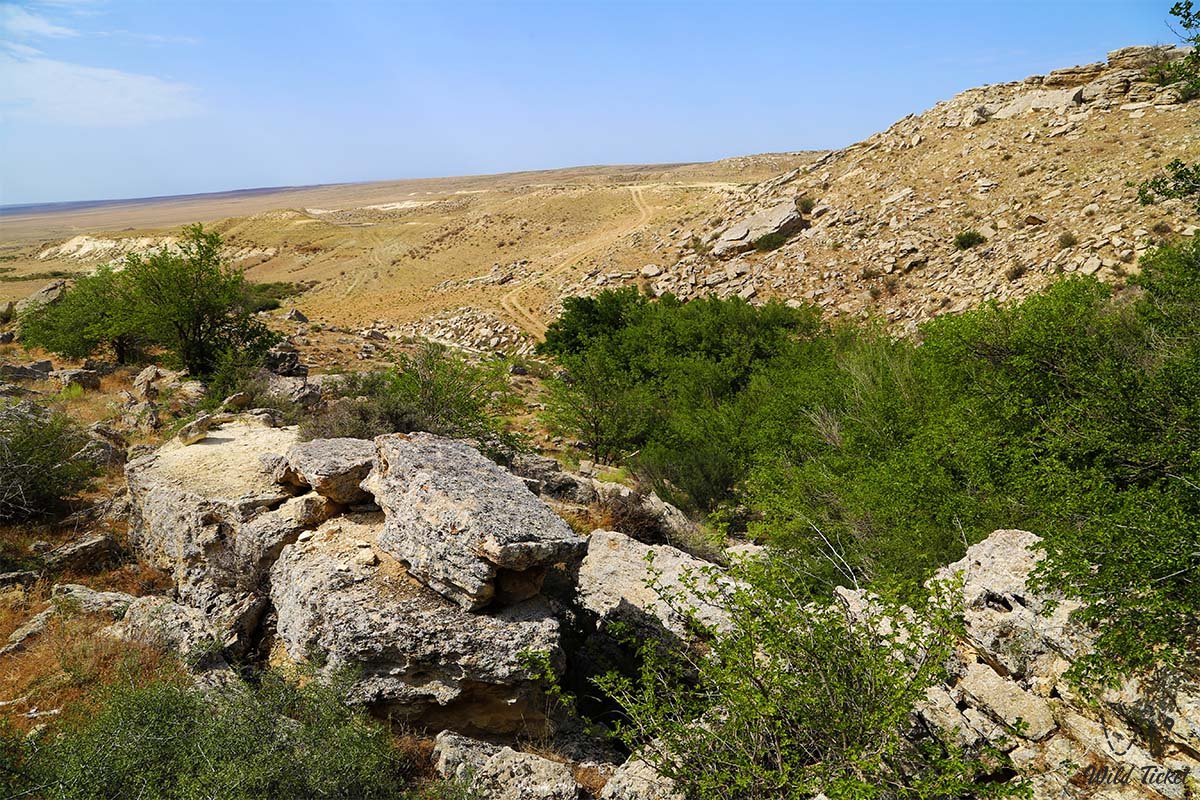
From the north, east, and west, the basin of the tract is reliably enclosed by steep cliff scarps, while to the south it opens toward a flat salt marsh and the Oy tract. The southern facade of the Kanga ridge is dissected by approximately ten deep, steep erosional ravines with an elevation differential of 100 to 120 meters. Originating along the rocky crest, after 500–1,000 meters these ravines branch out extensively, entering the Khanga valley. In their headwaters, numerous freshwater springs seep out from beneath Sarmatian strata, maintaining constant soil moisture and nourishing a chain of miniature oases.
The primary cultural, sacred, and archaeological centerpiece of the valley is the ancient burial ground and necropolis of Khanga Baba, included in the registry of historical and cultural monuments of republican significance in Mangystau. The memorial complex preserves hundreds of stone gravestones reflecting the unbroken succession of nomadic epochs: from campsites and kurgans of the Early Iron Age to medieval Turkmen stone steles bearing curved battle sabres and monumental Kazakh domed mausoleums and carved kulpytases of the Aday clan.
Adjoining the necropolis directly are the ruins of an ancient Turkmen mosque built of flat fieldstone and the remnants of fortress walls that protected caravan tracks.
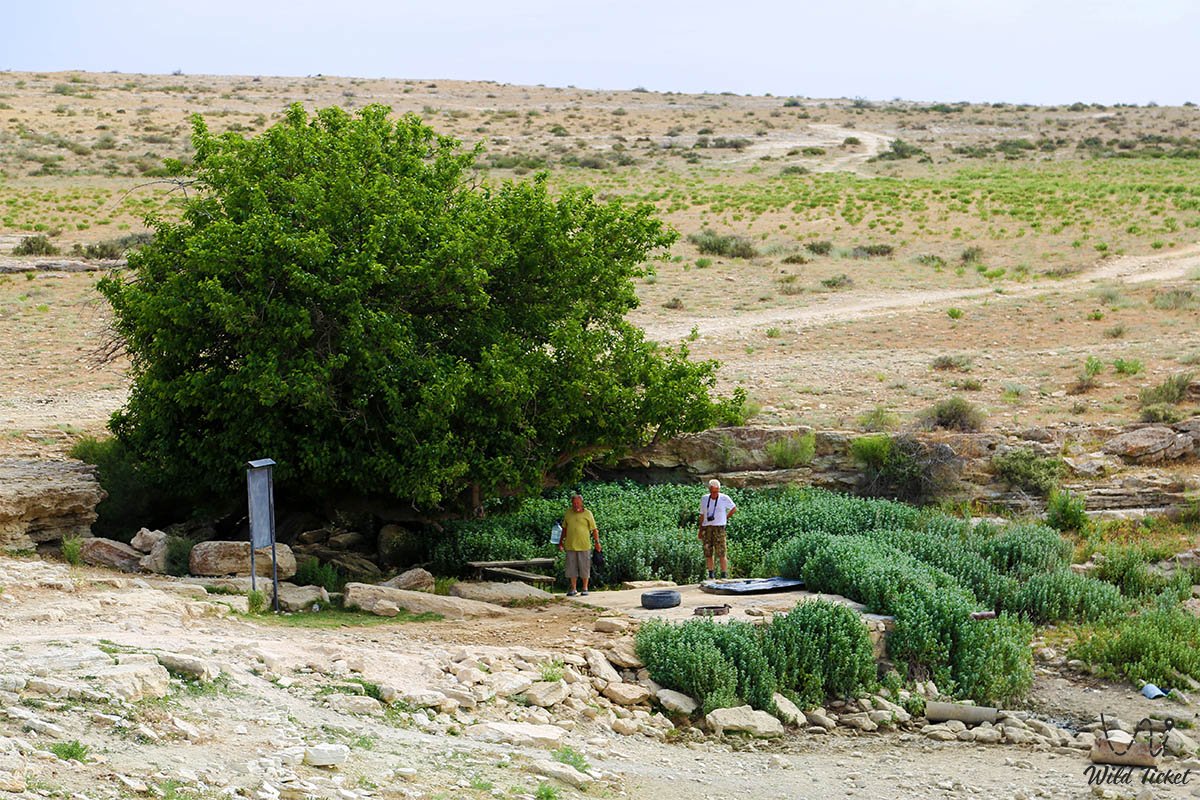
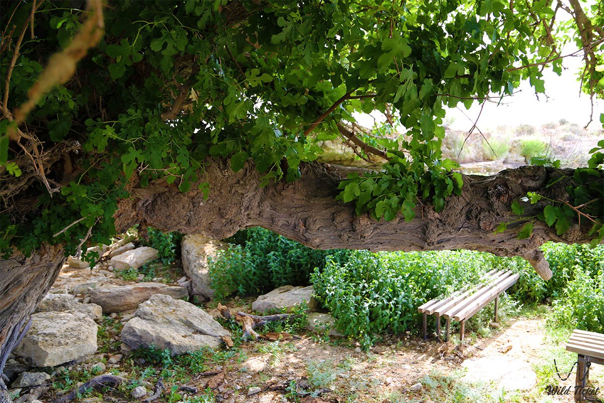
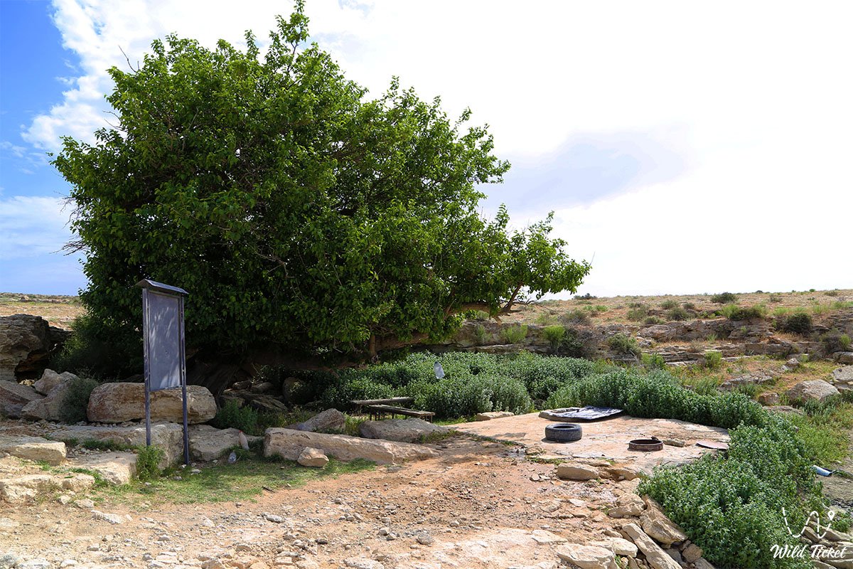
The Khanga Baba Valley was celebrated in plein-air studies by the prominent poet and artist Taras Shevchenko, who documented this oasis in 1851 during the expedition of Lieutenant A. I. Antipov. The expansive mulberry orchards and spreading elm trees (karagach) bestowed particular enchantment upon the locality, beneath whose canopy caravans traveling from the shores of the Caspian Sea across the Ustyurt Plateau to Khwarazm rested for centuries. Located in the immediate vicinity are the famous Cape Tupkaragan and Tupkaragan Bay.
Today, the Khanga Baba tract is an important destination for expedition tourism, pilgrimage, and regional historical exploration on the Tupkaragan Peninsula, attracting travelers with the lifesaving coolness of its springs, the romance of ancient ruins, and the artistic legacy of the exiled kobzar. Located nearby are landmark natural attractions such as the Zhygylgan sinkhole (Fallen Land), on whose floor one can find fossilized footprints of ancient animals of planet Earth.
--------------------------------------------
How to get there and visit –
The Khanga Baba tract and necropolis are situated in the south-central part of the Tupkaragan Peninsula, 26.8–30 km east and slightly south of the town of Fort-Shevchenko, 19 km northeast of the coastal village of Kyzylozen, and approximately 115–125 km northwest of the city of Aktau.
GPS geographical coordinates: 44°27'17"N 50°35'37"E
The primary route from Aktau leads northwest along the paved highway of republican significance Aktau – Fort-Shevchenko. Approximately 27–30 km before reaching Fort-Shevchenko, near the highway fork leading toward the village of Zhyngyldy, a roadside sign indicates the direction to the "Khanga Baba" complex. From the asphalt, the route branches south into the interior of the plateau: after 2.1 km, a compacted steppe dirt track descends directly into the valley toward the grove, springs, and memorial complex.
During the dry season, driving to the entrance of the necropolis and the foot of the grove is possible in a standard passenger sedan or crossover. However, if the journey includes radial excursions along the floors of the ravines, crossing into the Oy tract toward the water well and the Karakoz mausoleum, or ascending the plateau toward Kapamsay canyon, an expedition four-wheel-drive vehicle (4x4) with high ground clearance and durable tires (AT/MT) is necessary, as stony washouts and sandy-clay ruts require reliable cross-country capability.
Field infrastructure within the tract is absent. The nearest gas stations, shops, hotels, tire repair services, and eateries are concentrated in the town of Fort-Shevchenko and the village of Bautino (about 30 km to the west).
Fresh water can be drawn from the springs in the upper reaches of the ravines; however, for drinking without boiling, using a pre-packed bottled supply (no less than 3–4 liters per person per day) is recommended.
IMPORTANT: The Khanga Baba tract is a sacred sanctuary and resting place of ancestors. When visiting the mosque and burial ground, strict rules of respect must be observed: clothing must cover shoulders and knees, making noise is prohibited, and climbing on tombstones or disturbing historical masonry is strictly forbidden.
Pitching camps and setting up tents is permitted exclusively in the lowland of the oasis beneath the trees at a respectful distance from the grave enclosures.
The best time to visit is spring (from late April to early June), when mixed herbs green the floors of the ravines, shrubs bloom, and springs murmur, as well as autumn (September – October) with its mild solar warmth. During summer months, temperatures inside the basin can rise above +38...+40 °C; however, the dense foliage of mulberry trees and elms provides comfortable shade for resting.
--------------------------------------------
History
The history of the tract is closely interwoven with the ethnogenesis of steppe peoples, Eurasian trade arteries, and the defensive system of Khwarazm. According to the prominent Soviet orientalist and archaeologist S. P. Tolstov, the Khanga Baba tract is directly linked to the medieval fortified city of Khanga, which served as the extreme northwestern bastion of the state of the Khwarazmshahs.
Researchers interpret the origin of the toponym in two ways. A participant in the Karatau expedition of 1851, Bronisław Zaleski, recorded a local tradition stating that the valley and cemetery were named after the revered Turkmen Sufi and righteous elder Khanga Baba. Concurrently, modern Kazakhstani scholars and linguists connect the root "Kanga" with the ethnonym "Kangly" (a Pecheneg-Oghuz tribal confederation) that dominated the Aral region and Mangyshlak from the 5th to the 12th centuries.
Following the Mongol devastation in the 13th century, the Kangly integrated into Turkic ethnic groups, giving rise to clans of Teke Turkmens and Kazakhs. In Old Turkic, the word "kanga" also denoted a fortified border, watch outpost, or frontier garrison. Thus, the Khanga valley represented a fortified oasis housing a garrison that guarded caravans along the Khiva route between the bays of the Caspian and the chinks of Ustyurt.
Since ancient times, the valley attracted human settlement through its mild microclimate and abundant fresh water. For centuries, local inhabitants engaged in horticulture, melon farming, and fruit cultivation here. Stone check-dams and weirs that retained floodwaters for terrace irrigation have been preserved in almost every one of the ridge's ten ravines. Sericulture achieved notable prominence: up until the mid-20th century, the ravines and the foot of the ridge were blanketed in dense plantings of mulberry (tut), whose foliage was used to rear silkworms.
A distinctive chapter in the chronicle of the tract is associated with the stay of the exiled Ukrainian poet and artist Taras Shevchenko. In May 1851, as part of the military-scientific expedition of engineer A. I. Antipov, Shevchenko conducted field studies in the Khanga Baba tract. Struck by the contrast between the lifeless semi-desert and the shaded groves, the artist dedicated a suite of graphic sheets and the famous watercolor "Khanga-Baba" (May 1851 – July 1857) to the tract, capturing the centuries-old trees, stone tombstones, and portal mausoleum with documentary fidelity. Shevchenko camped at the mouth of the Karakoz ravine near an ancient well.
In 1870, Colonel N. P. Lomakin compiled a topographic and military-statistical description of the tract during a reconnaissance of the Mangyshlak Peninsula. In 1889, the geological structure of the Khanga Baba ravines was investigated in detail by the eminent geologist N. Barbot de Marny within the framework of the Aral-Caspian expedition.
In 1927, the Department of Public Education of the Adayev district constructed a stone boarding school building in the Karakoz ravine for Kazakh orphan children. Following the Great Patriotic War, with the development of larger boarding schools in the working settlements of Tauchik and Fort-Shevchenko, the school was closed, while its historic stone walls have survived to the present day.
A comprehensive architectural-archaeological survey of the necropolis was completed in 1973 by an expedition led by Professor Malgabar Mendikulov, the founder of Kazakhstan's school of monument restoration, who systematized the typologies of the gravestones and the mosque.
Information
Geomorphologically, the Khanga Baba tract represents a deep erosional-tectonic basin transitioning into a broad valley opening toward the sea. The elevation differential between the flat plain of the valley and the rim of the Kanga ridge spans from 57.6 to 106.9–120 meters.
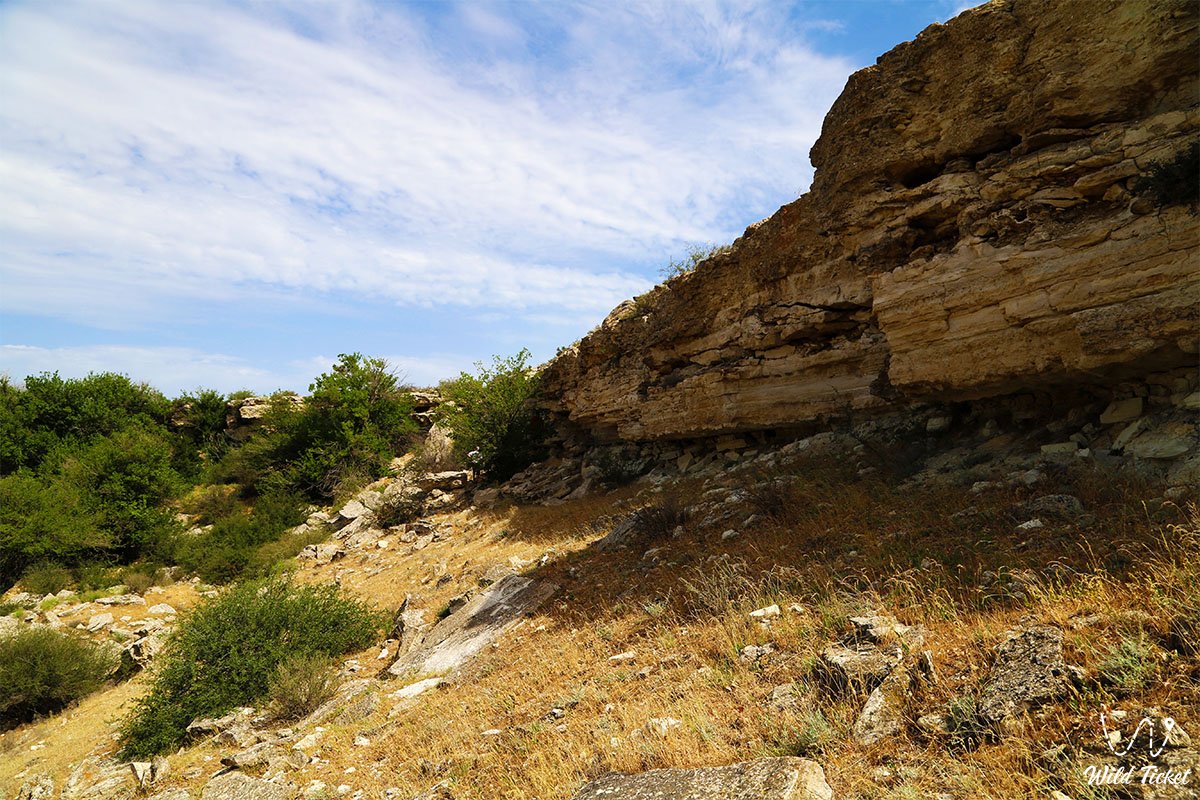
The geological structure of the tract presents a textbook cross-section of Tertiary and Cretaceous sediments of the Tethys Ocean. According to N. Barbot de Marny's documentation, a clear conformable bedding of strata is observable within the ravines:
1. Upper tier – dense and oolitic Sarmatian limestones composed entirely of fossilized shells of ancient mollusks Mactra podolica and Cardium protractum.
2. Underlying them are finely laminated blue-gray marls of foliated texture containing fossil inclusions of Pholas ustjurtensis.
3. Lower down, muddy-green clayey sands outcrop, saturated with plates of selenite gypsum ("Marienglas") and nodules of brown gypsum; fossil teeth and scales of prehistoric fish of the Tethys Ocean are recorded within this horizon.
4. The base of the section consists of dense white writing chalk laced with gypsum veins and native concretions.
The hydrological regime is unique for waterless Mangyshlak. Unconfined groundwater discharges bubble up along the floors of the ten steep ravines from beneath Sarmatian beds. The temperature of the spring water remains at a steady mark of around +14...+17 °C even on sweltering days. Seeping through fissures, the springs moisten the bottoms of the ravines, creating small pools and marshy spots overgrown with weeds and moisture-loving grasses. Upon emerging onto the flat piedmont plain, the streams gradually infiltrate the desiccated sandy-clay sediments, sustaining the root systems of the groves.
The climate of the area is semi-desert and arid, yet moderated by the breath of the Caspian Sea situated 20–25 km to the north and west. The average January temperature is -2...-4 °C, while July averages +26...+28 °C. Inside the enclosed basin of the tract, the microclimate is considerably milder and better protected from harsh desert winds than on the open plateau of Tupkaragan.
Detailed description of the venue
The landscape, memorial, and natural complex of the Khanga Baba tract encompasses the following architectural and natural zones:
• Khanga Baba Necropolis (tripartite structure) – a historical burial ground divided into three clearly demarcated sectors:
1. Eastern and central sectors – mixed burials where medieval Turkmen monuments and later Kazakh memorials of the Aday clan stand side by side.
2. Western sector – an exclusively archaic Turkmen necropolis of the 14th–17th centuries, composed of low, flat stone slab-chests (sandyktas), vertical steles with Arabic Koranic epitaphs, and carved reliefs depicting curved battle sabres, daggers, and protective amulets.
3. Kazakh complex of the 18th–20th centuries – monumental tombstones distinguished by rich polychrome geometric and floral ornamentation, carved kulpytases, sculpted stone boxes (koytas), and open rectangular enclosures (saganatam).
• Ruins of a portal-domed mausoleum – the central structure of the necropolis, recorded in watercolors by Taras Shevchenko. Stone foundations and wall fragments of a monumental portal built of dressed coquina limestone have survived to this day.
• Ruins of an ancient Turkmen mosque – a rectangular stone building constructed from carefully fitted slabs of local sandstone and coquina. The structure included a central prayer hall with a mihrab niche and several adjoining chambers for resting dervishes and pilgrims.
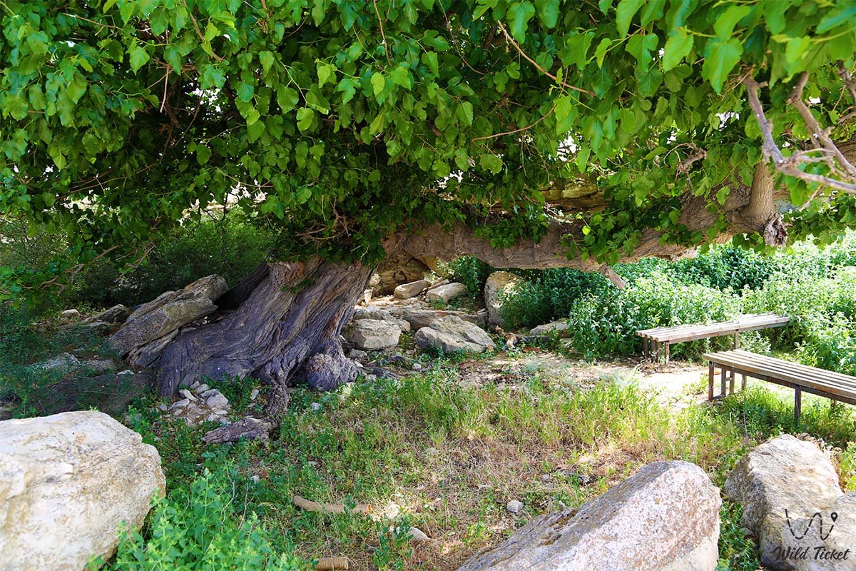
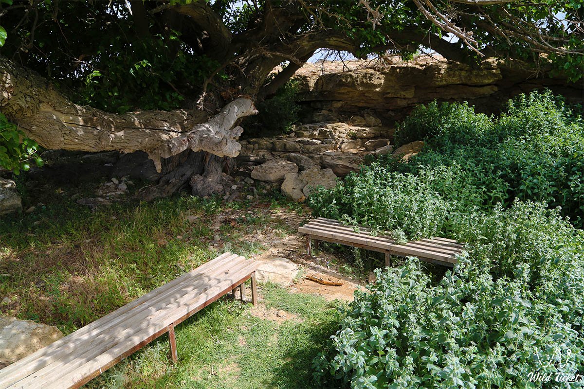
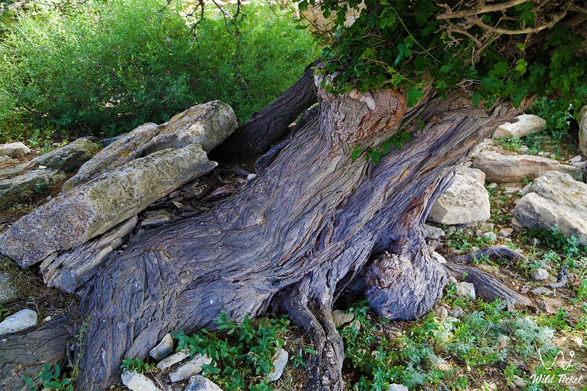
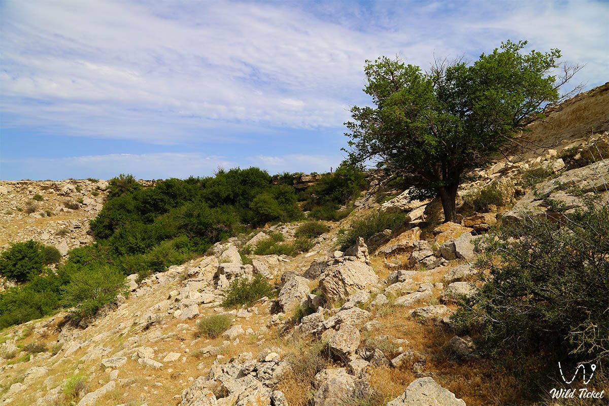
• Relict groves of the oasis – stands of centuries-old elm trees (Ulmus pumila) and mulberry trees (Morus). The gnarled, twisted trunks of these ancient trees create a unique park-like landscape in the middle of the desert.
• Network of ten spring ravines – deep rocky canyons with precipitous 100-meter walls, chalk screes, natural catchment terraces, and antique stone dams built to accumulate snowmelt runoff.
• Historic Karakoz ravine – a tract featuring an ancient well, the field campsite of Antipov's 1851 expedition, and the surviving stone building of the Adayev district orphan boarding school built in 1927.
• Southern salt marsh of the Oy tract – a flat endorheic basin at the outlet of the valley, covered with a salt crust and Halocnemum strobilaceum, terminating the hydrological drainage of the tract.
Flora and fauna
The vegetation cover of the Khanga Baba tract exhibits a striking contrast between the moist ravine floors and the parched steppe plateaus. The tree canopy is represented by centuries-old mulberry trees (black and white mulberry) and elms. The understory of the ravines is densely covered with bushes of tamarisk (saltcedar), wild rose, hawthorn, nitre bush (Nitraria), and Russian olive (Elaeagnus angustifolia).
The herbaceous layer on the ravine floors is dominated by wild mint, licorice, succulent weeds, reeds, and bulrushes near spring-fed pools. The surrounding limestone chinks and stony debris aprons of the ridge support typical arid vegetation: gray-soil wormwood, Lerche's wormwood, biyurgun, boyalych, Caspian saltwort, and camelthorn. Fleshy stems of glasswort and Halocnemum strobilaceum grow on the southern salt flat.
The animal kingdom of the oasis is concentrated around the freshwater sources. Dense tree canopies provide nesting habitat for numerous birds: European bee-eaters, European rollers, turtle doves, Eurasian scops owls, Eurasian tree sparrows, great grey shrikes, and chukar partridges settle here. Birds of prey nest on the sheer ledges of the chalk Kanga ridge: long-legged buzzard, common kestrel, steppe eagle, and Eurasian eagle-owl.
Mammals include the tolai hare, corsac fox, steppe polecat, badger, and long-eared hedgehog. At night, wolves, gerbils, and jerboas emerge from the steppe to drink at the streams. Tracks of the Red Book-listed Ustyurt mountain sheep (argali/mouflon) are occasionally recorded on the surrounding cliffs. Reptiles include the Central Asian tortoise, steppe agama, toad-headed agama, sand boa, and swift arrow snake. The European green toad thrives in the spring-fed pools.
Legend
An ancient Turkmen and Kazakh tradition regarding the spiritual power of a righteous elder and a miraculous spring is linked to the origin of the sacred oasis and burial ground of Khanga Baba. The legend tells that during the Early Middle Ages, the pious Sufi elder Khanga Baba traveled across the waterless expanses of Tupkaragan with his murids. They were walking toward the stormy Caspian, carrying the light of spiritual teaching to nomadic auls. Along the way, a severe drought overtook the caravan: the last water supplies in leather waterskins ran out, pack camels collapsed, and exhausted travelers sank in despair onto scorching stones at the base of the white ridge.
Witnessing the impending demise of his companions, the elder Khanga Baba scaled a rock ledge, turned his face toward Mecca, and offered a fervent prayer for the salvation of innocent souls. Concluding his prayer, the sheikh struck the hard Sarmatian limestone with his heavy staff, declaring: "May the mercy of the Creator rain down upon this parched earth!" In that very instant, the rock shuddered, split open, and a powerful torrent of crystalline ice-cold water surged from the fissure.
Having quenched the thirst of the dying travelers, the holy man drove his travel staff, carved from dry mulberry wood, into the moistened ground, saying: "Let this tree take root and bestow shade, salvation, and nourishment upon every weary wanderer for all time."
The elder's staff immediately sprouted green shoots, turning into a mighty mulberry tree from which the flourishing groves of Khanga Baba expanded.
The elder lived in the valley for many years, healing wounded caravaneers, teaching steppe children to read and write, and reconciling feuding tribes. After his passing, the righteous man's resting place became an inviolable shrine. Ever since, a belief endures among the people: whoever enters beneath the canopy of the oasis with peace, bakes flatbread, and recites a prayer by the ancient graves will obtain the steadfast patron protection of Saint Khanga Baba and a safe journey across the boundless steppe.
Conclusion
The Khanga Baba tract is a rare oasis where nature and history exist in harmony on the Tupkaragan Peninsula, where the cool murmur of springs mingles with the age-old silence of memorial stones. Visiting the tract allows travelers to touch the chronicles of the Silk Road, follow the paths of Taras Shevchenko's expeditions, rest in the shade of relict mulberry groves, and appreciate the enduring value of every sip of living water in the heart of rugged Mangyshlak.
Interesting sights nearby:
• Paleontological Guide to Mangyshlak;
• Town of Fort-Shevchenko and the Taras Shevchenko Monument;
• Seaport and Village of Bautino;
• Tamshaly Canyon and Oasis;
• Saura Canyon and Turtle Lake;
• Kapamsay Canyon;
• Zhygylgan Tectonic Sinkhole;
• Fossilized Animal Footprints in the Zhygylgan Tract;
• Saline Lake Kuzdykary;
• Cape Tyub-Karagan;
• Medieval Settlement of Ketikkala;
• Akmysh Tract and Valley near Mount Sherkala;
• City of Aktau.
Sacred sights and pilgrimage destinations:
• Khanga Baba Necropolis;
• Shakpak-Ata Rock Mosque;
• Sultan-Epe Underground Mosque;
• Kenty-Baba Necropolis-Mausoleum;
• Karaman-Ata Underground Mosque;
• Otpan Memorial Complex on Mount Otpantau;
• Shopan-Ata Underground Mosque;
• Beket-Ata Underground Mosque in the Oglandy Tract;
• Ancient Koshkar-Ata Necropolis;
• Pantheon of Kazakh Batyrs Sisem-Ata Necropolis;
• Uytoly-Ata Underground Mosque;
• Nurbergen Kalyshev Mausoleum in Senek Village.
Photogallery: