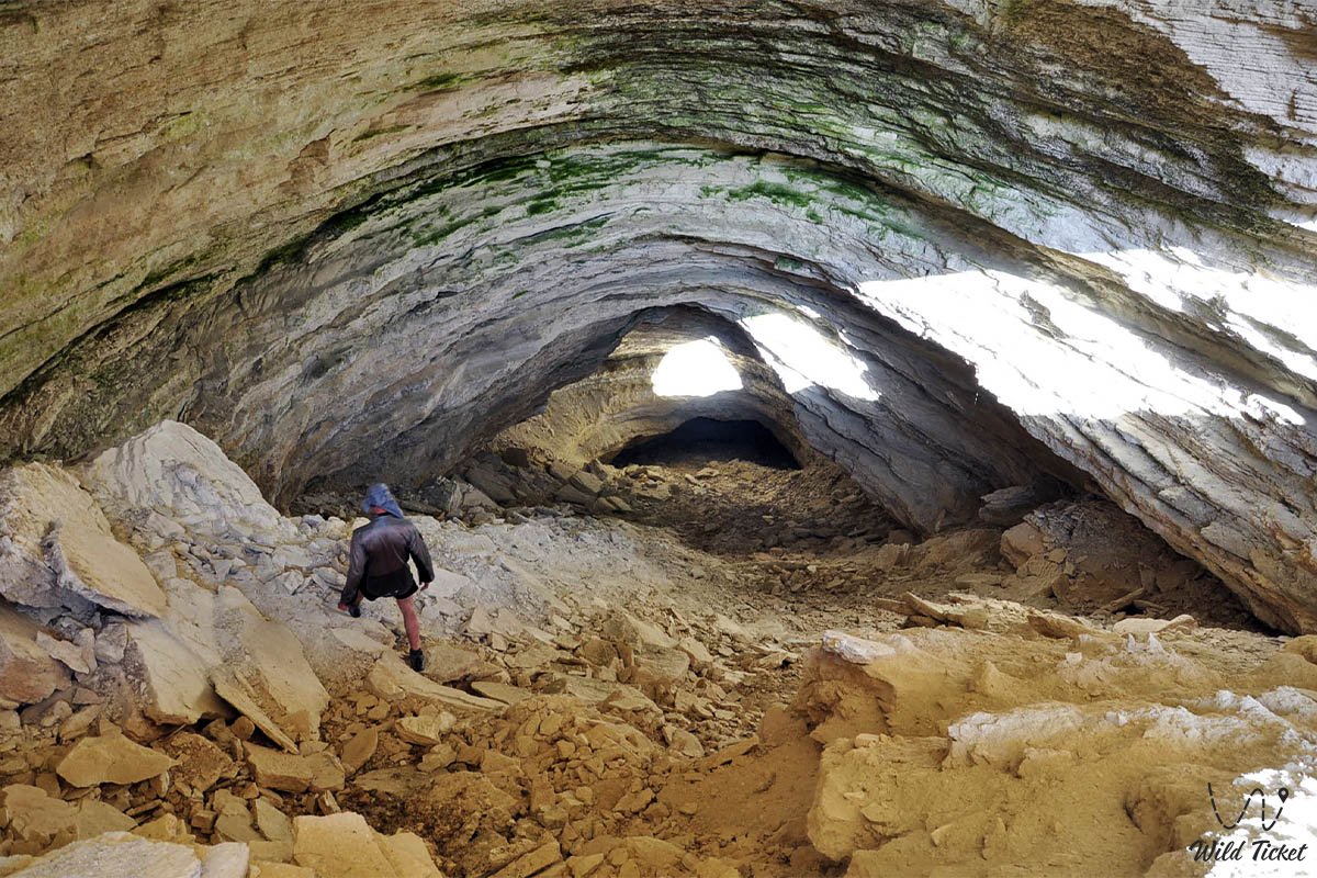
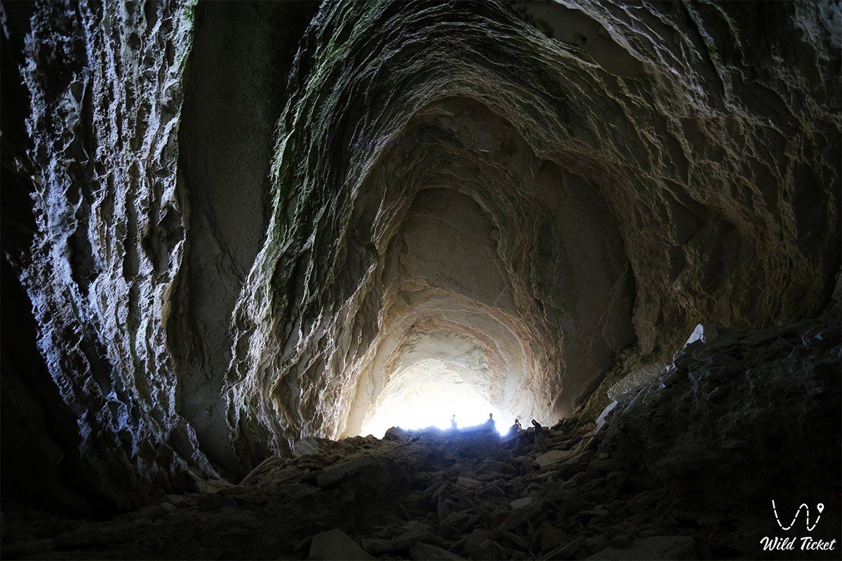
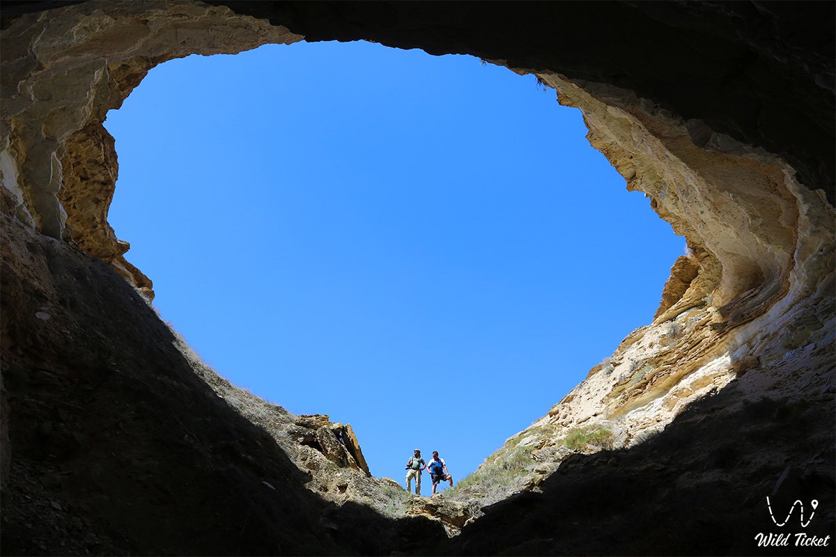
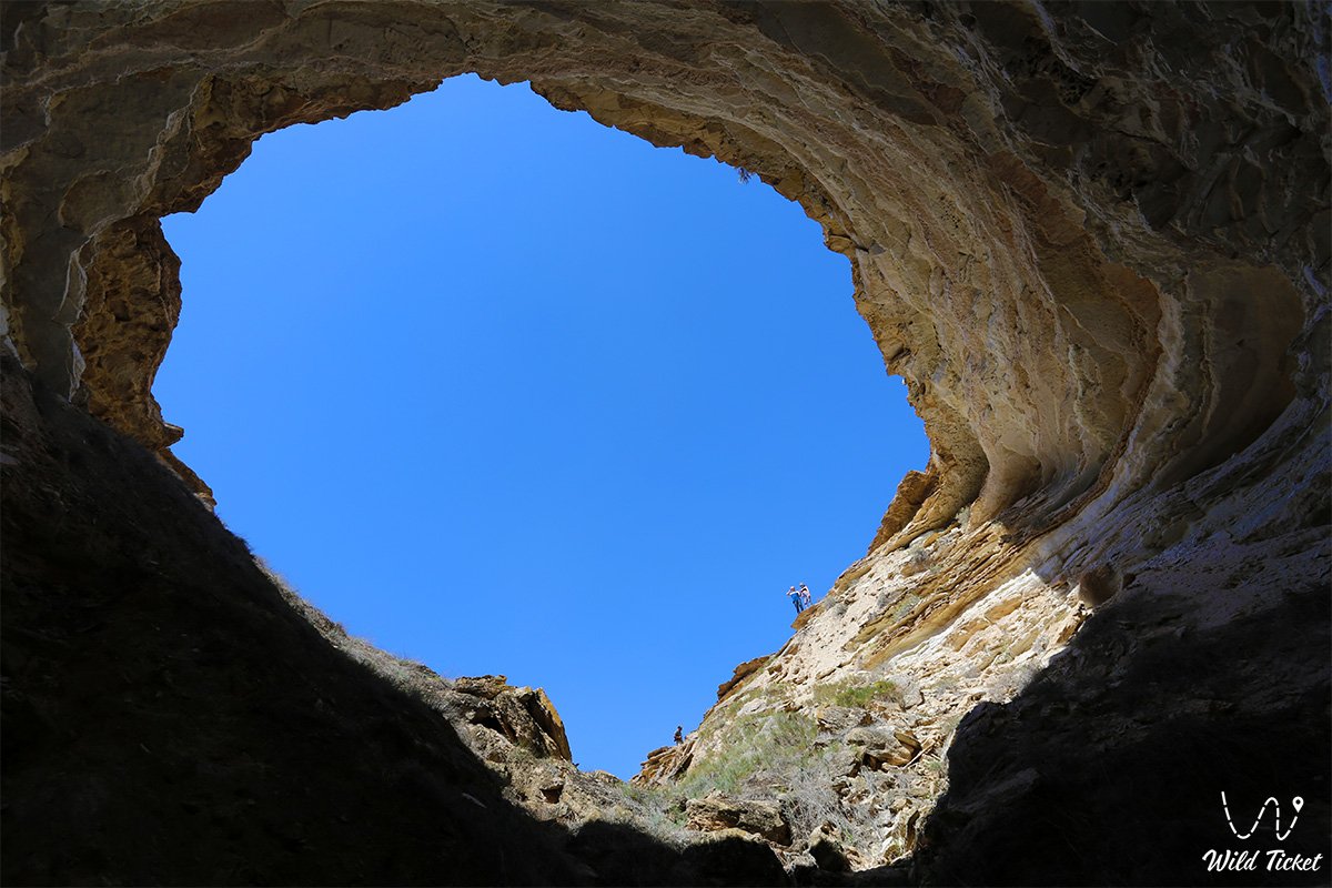
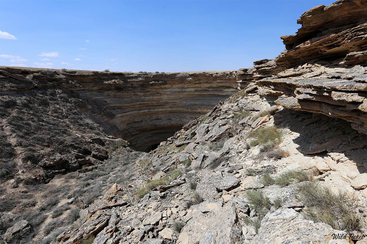
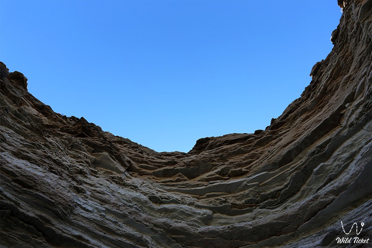
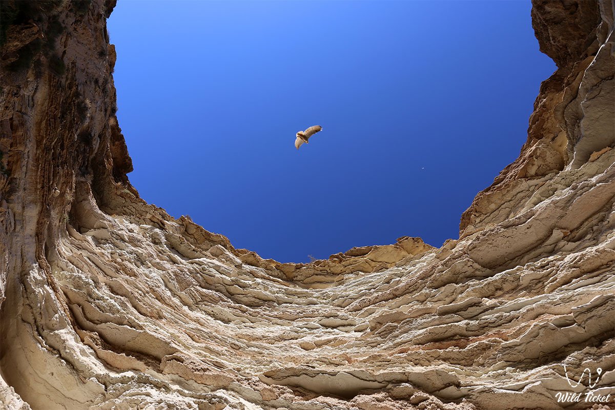
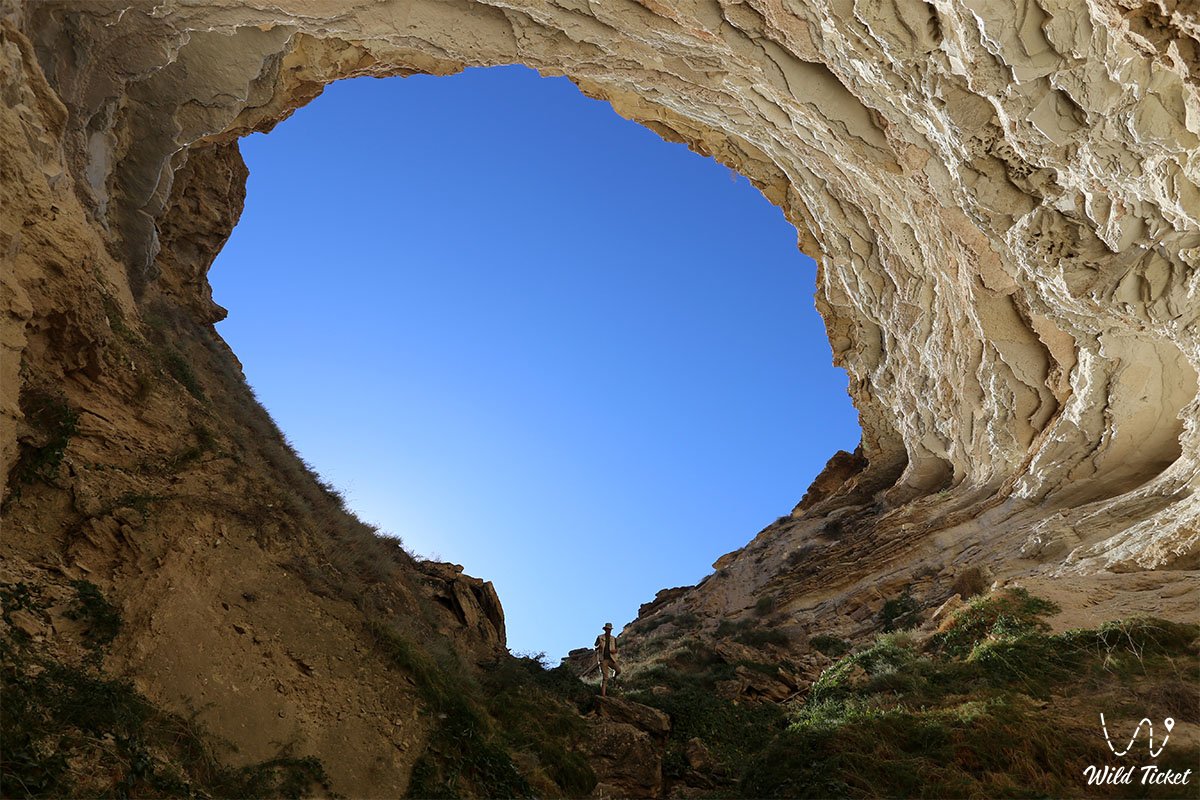
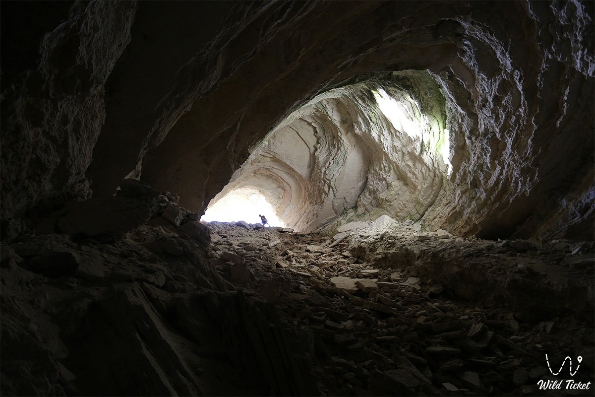
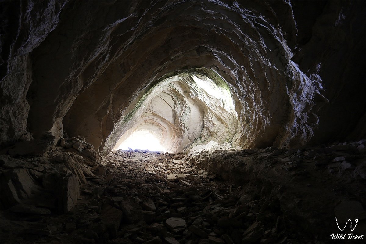
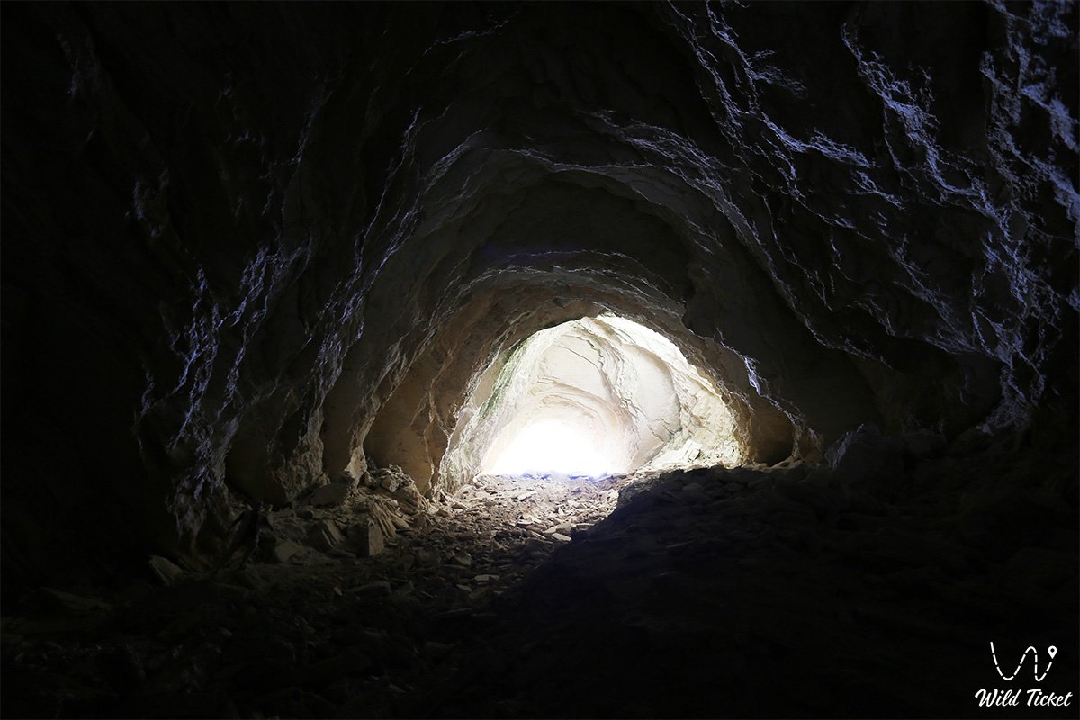
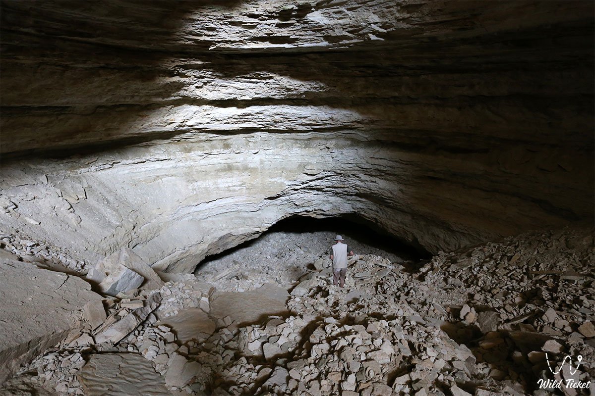
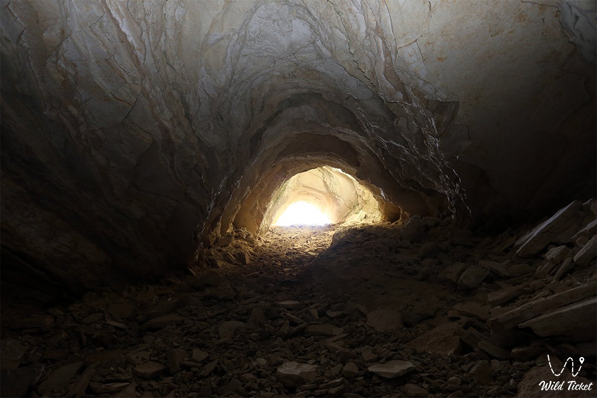
Speleological cavity of Mangyshlak with rock talus and underground galleries –
Utebay karst cave (also known as the Utebay cavity) is an inclined gravitational-collapse karst sinkhole and an extensive subterranean system in the south of the Ustyurt plateau in western Kazakhstan. This underground cavity formed within sedimentary strata in the Karakiyan district, dissecting the vast gypsum plains of the southern portion of Ustyurt.
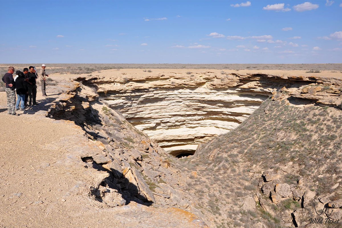
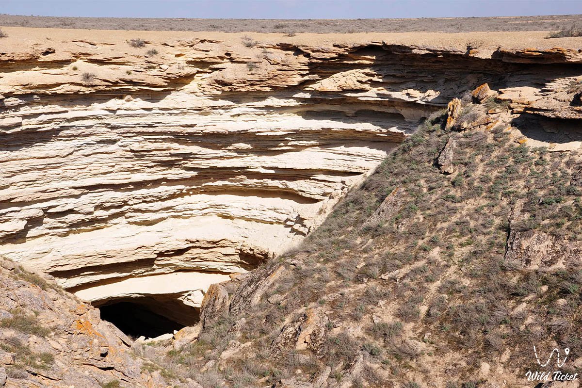
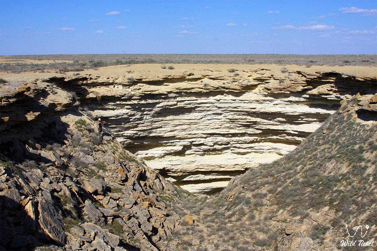
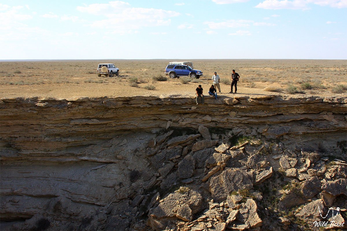
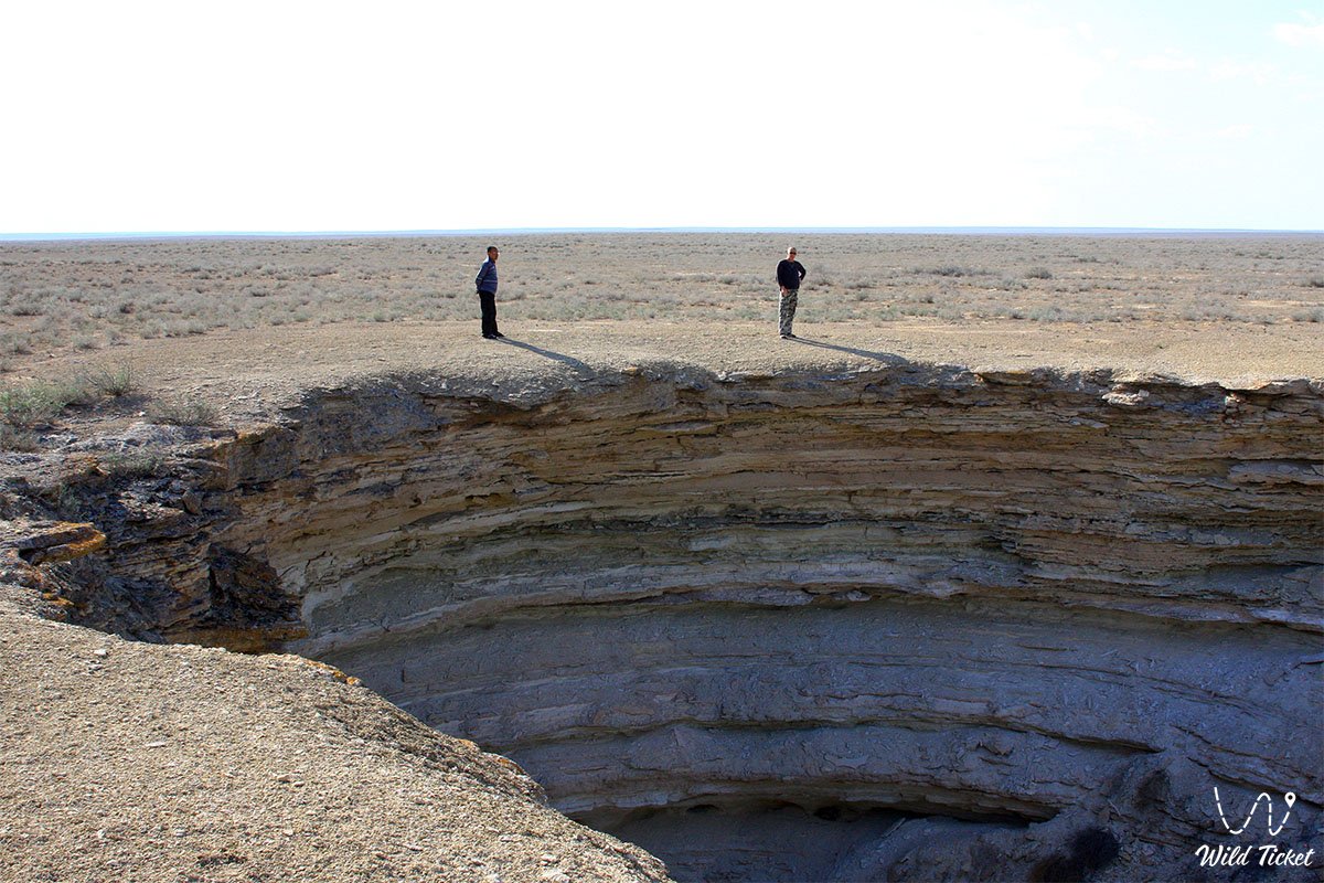
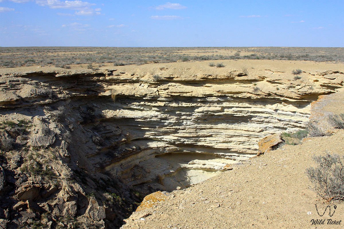
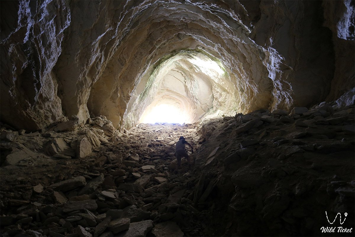
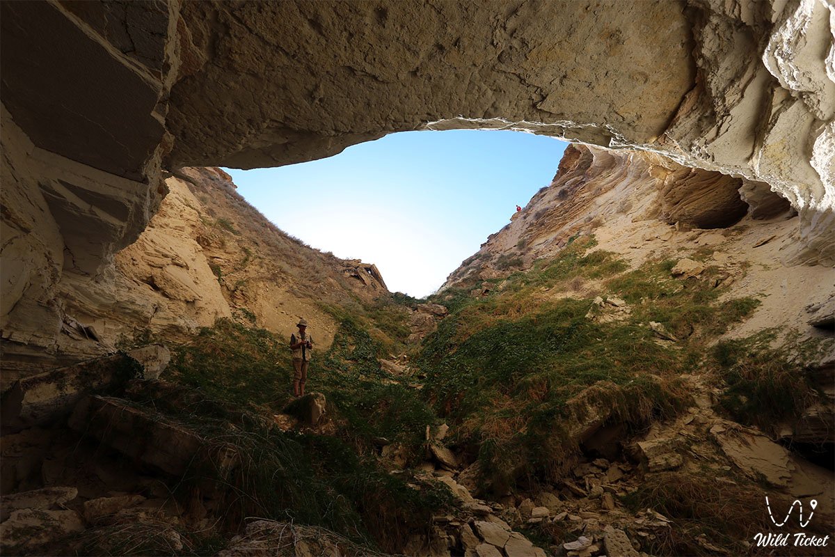
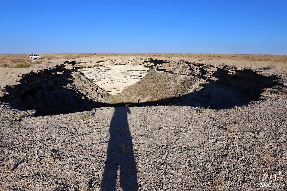
This entire karst zone of Mangystau serves as an essential speleological landmark of the region, opening abruptly across the flat steppe horizon as a massive collapse sinkhole 50 meters long, 30 meters wide, and approximately 20 meters deep at the entrance. The cavity developed through the large-scale gravitational collapse of the roof of an ancient subterranean gallery, triggered by deep-seated rock leaching and seismic activity, which opened direct access into the interior chambers. Just 10–10.5 kilometers north of the sinkhole lies the deepest Balayuk karst cave (Bulyoyyk) with a subterranean lake.
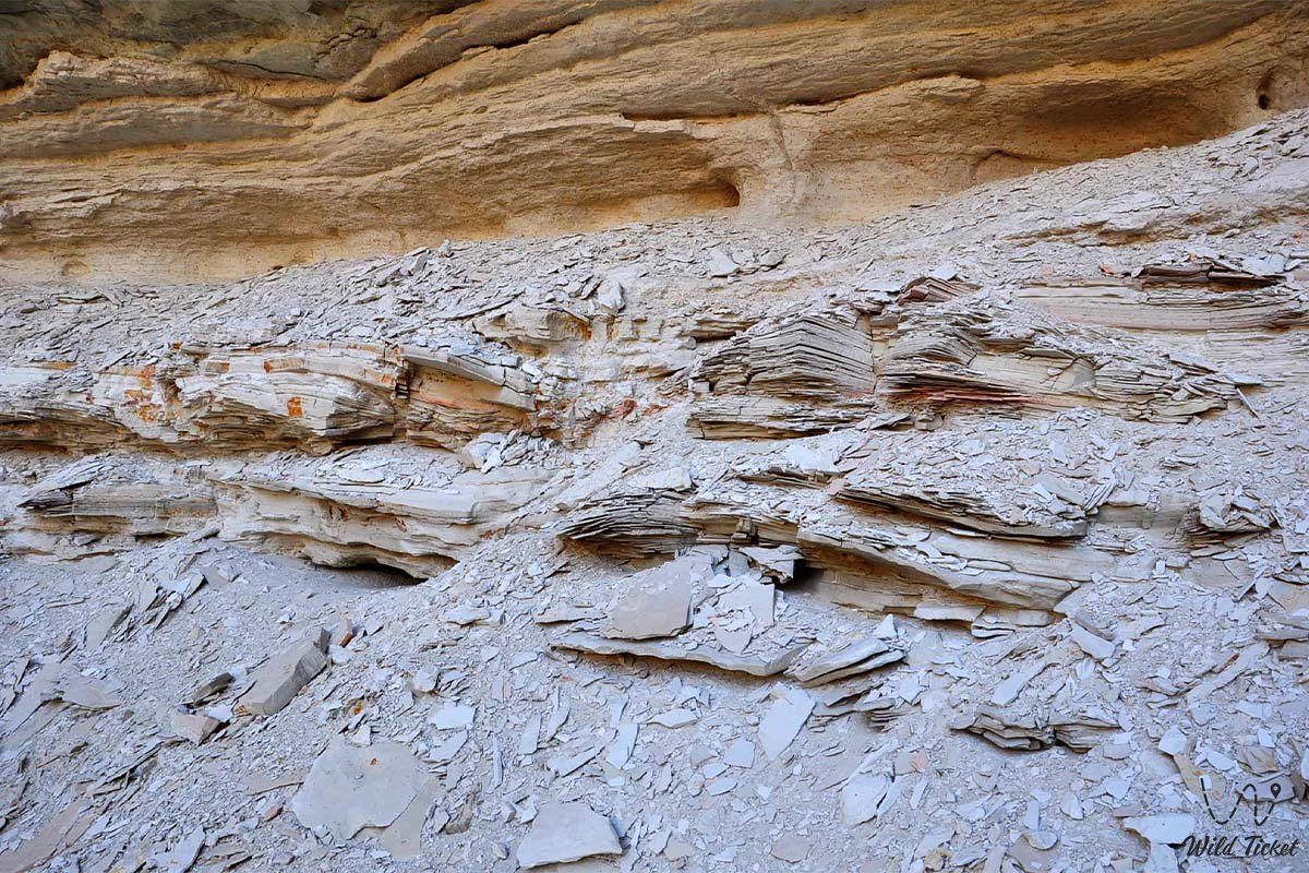
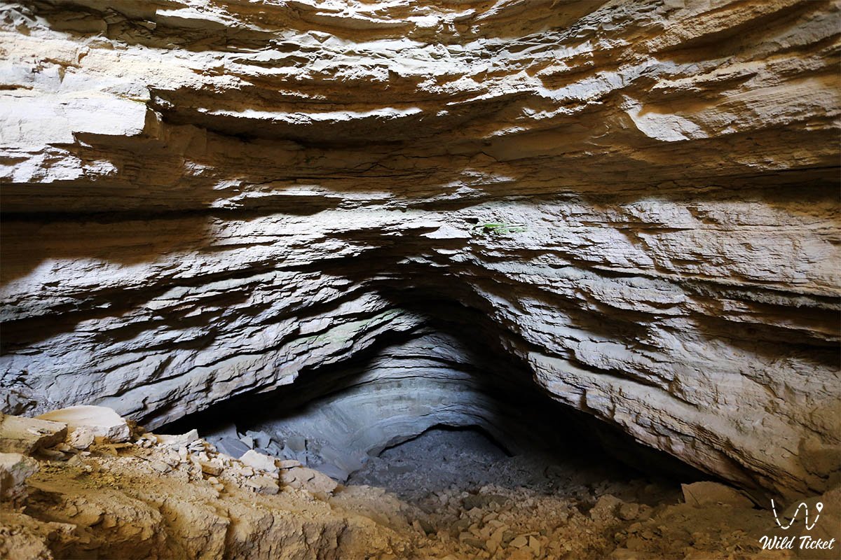
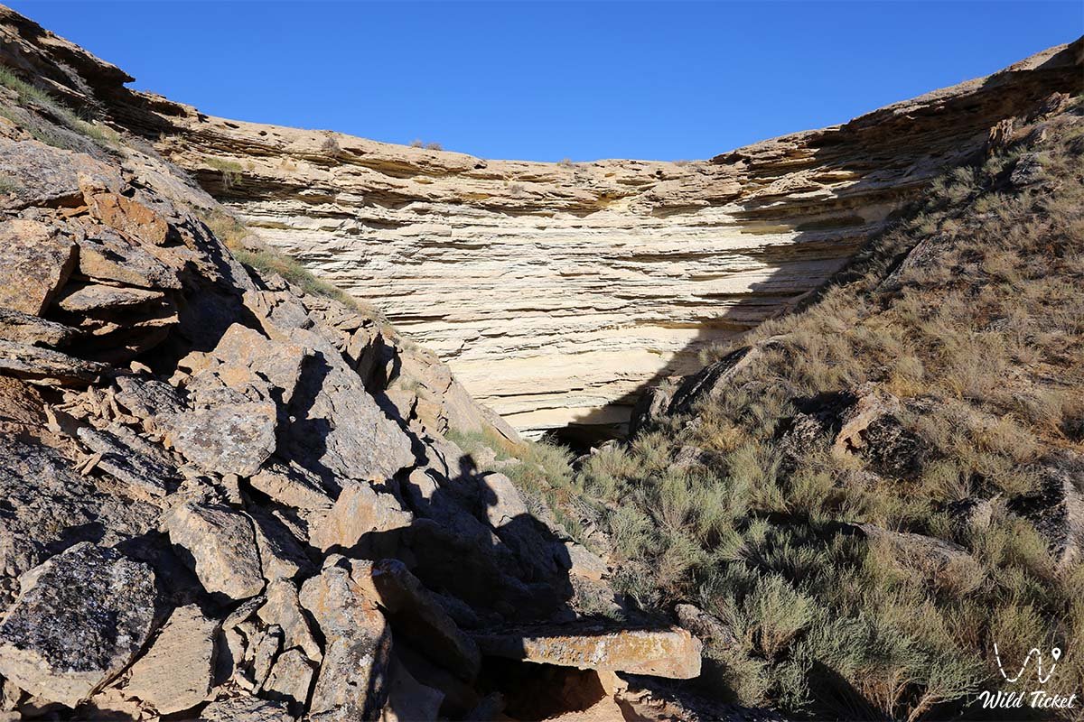
Down to a depth of 60 meters, the geological framework of the cavity is composed of alternating layers of oolitic, shelly, and fine-grained cavernous limestones of the Pontian and Lower Sarmatian stages, intercalated with carbonate clays and marls. Deeper down, thick interbeds of finely crystalline gypsum up to 1.5 meters thick, conglomerates, and quartz sandstones are exposed, formed millions of years ago on the bed of the retreated ancient Tethys Ocean.
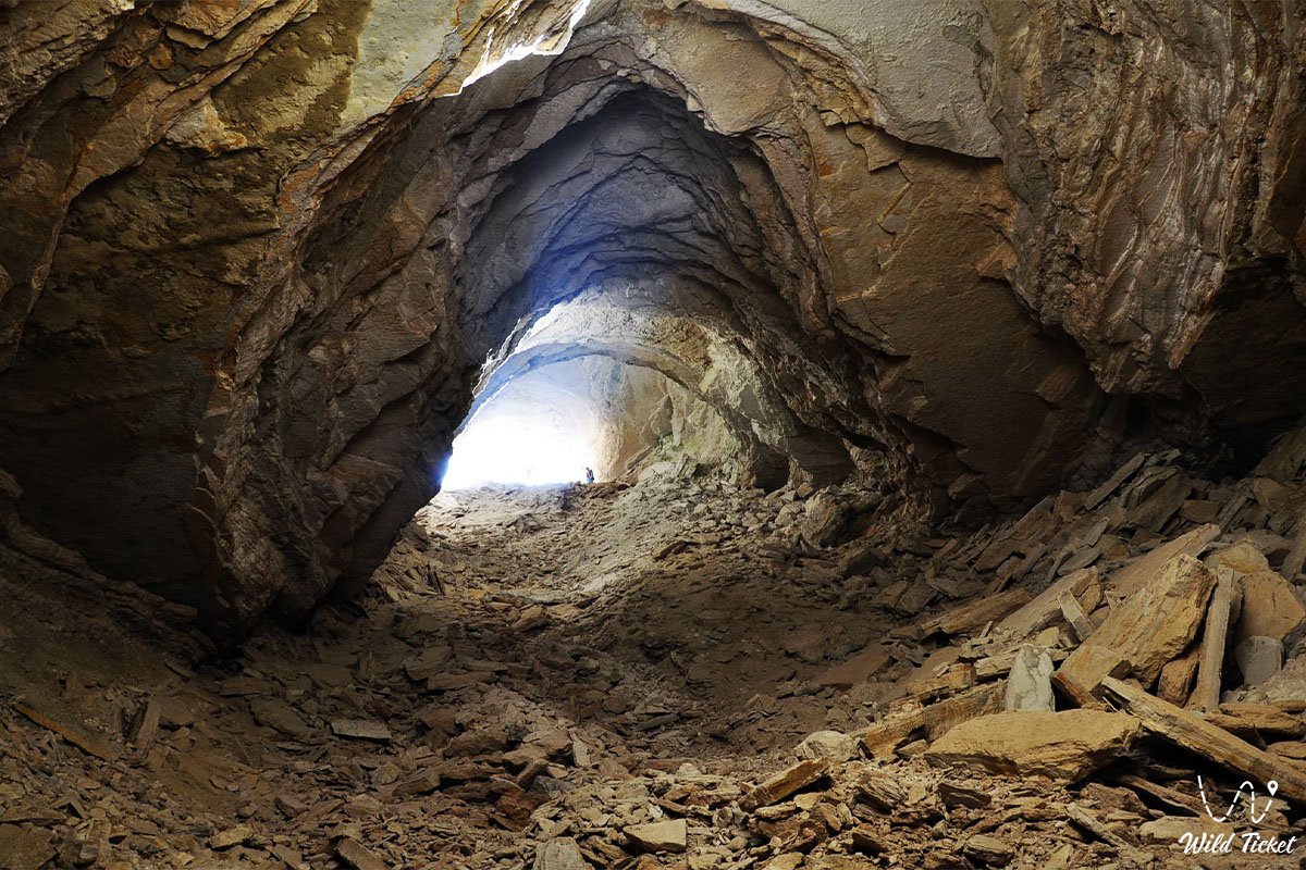
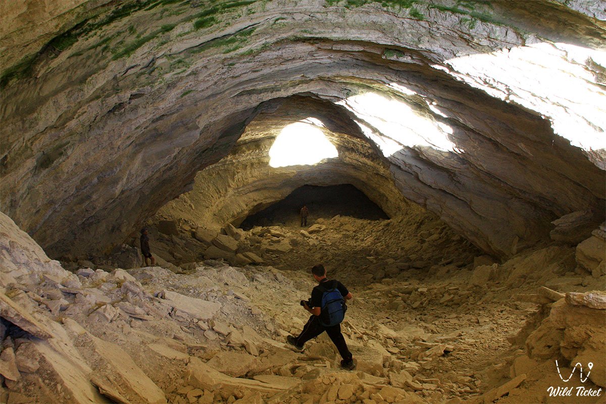
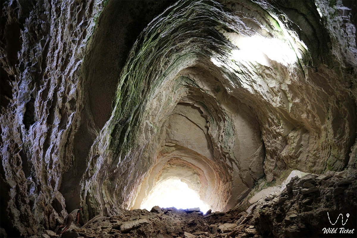
The bedding of the constituent strata is horizontal and conformable. From the entrance sinkhole, the subterranean space branches into two diametrically opposed passages: a steeply inclined northeastern tunnel with a 45-degree slope and a stepped collapsed ceiling 3 to 12 meters high, descending to a depth of 56–70 meters, and a southwestern tunnel measuring 3.5 by 14.6 meters in cross-section.
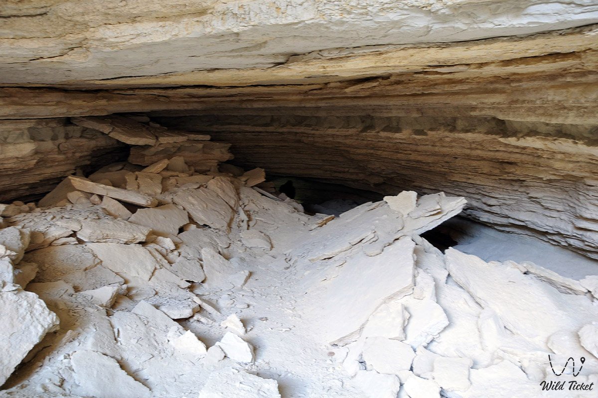
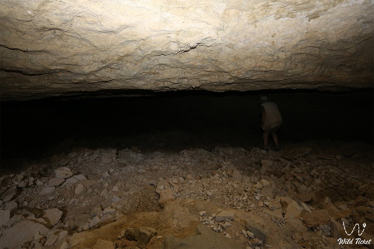
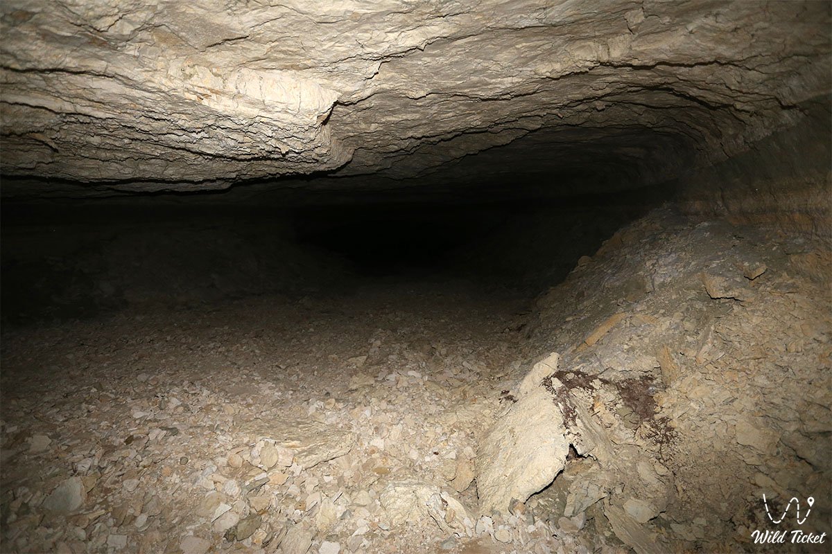
The floors of the chambers are strewn with boulder talus and a thick five-centimeter layer of fine white gypsum dust. During the spring snowmelt, an ephemeral karst pool forms briefly at the bottom, quickly filtering deeper through open ponors.
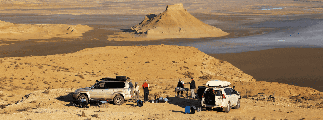
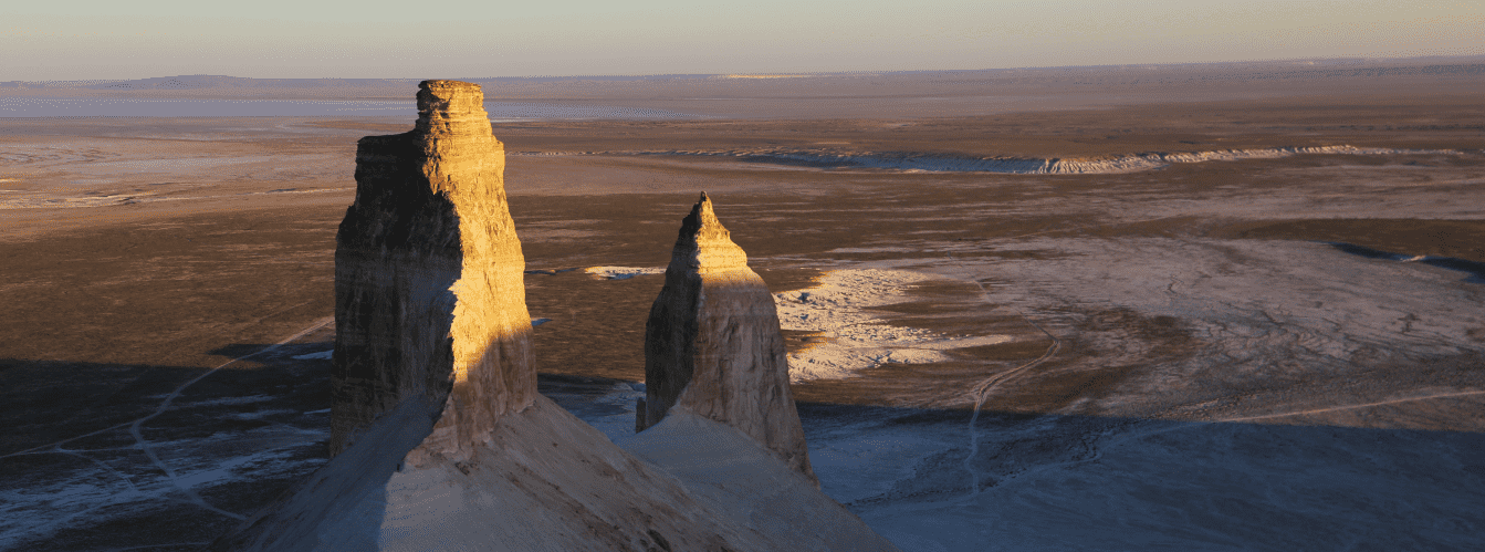
In the expedition and travel geography of Mangyshlak, Utebay cave occupies a strategic position as a key subterranean landmark along remote southern routes. Fifty-five kilometers to the west lies the Onere tract with spring oases in the Ustyurt nature reserve. Within overland expedition range are the gleaming salt flat of the Karynzharyk depression with the "Three Brothers" buttes, the chinks of the Ustyurt plateau, the Bozzhyra tract, mount Bokty, and the border frontiers of Kazakhstan.
Continuing west along steppe tracks, travelers can reach the Basgurly-Zhazgurly depression system, proceed to the Kuandy depression, and reach the coast of the Caspian Sea near Kenderli bay and cape Tokmak.
--------------------------------------------
How to get there and visit –
Utebay cave is located in the southern part of the Ustyurt plateau in the Karakiyan district of the Mangistau region. The distance from the city of Aktau is around 490 km, about 340 km from the town of Zhanaozen, roughly 55 km east of the Onere outpost and tract (Karynzharyk depression), 10.5 km south of Balayuk cave, and 1.6 km south of the Utebay cemetery.
GPS geographic coordinates of Utebay cave:
42°29'05"N 54°38'50"E
The route from Aktau leads southeast along a paved national highway through the town of Zhanaozen (150 km).
From Zhanaozen, the journey proceeds along a rough gravel grader to the Golbonshe hill, after which it transitions into a sandy rutted track to the Ozene outpost and border post. Next is a steep, rocky-loamy ascent onto the Ustyurt plateau scarp along the eastern chink of the Karynzharyk depression toward the Utebay tract. The primary landmark for turning right toward the sinkhole is a geodetic point (tripod benchmark) with a small structure on the left side of the track. The entire steppe drive from Zhanaozen takes between 7 and 10 hours of pure driving time.
Permit requirements and border zone regime: the site is situated in close proximity to the territory of the Ustyurt state nature reserve and within the border zone of the Republic of Kazakhstan. Citizens of Kazakhstan must carry national identification cards and register at the border checkpoint and with reserve rangers at the outpost.
Foreign nationals must obtain a special border zone permit in advance through authorized state agencies, as well as an official entry permit for the reserve territory, issued at the reserve office in Zhanaozen (near the Tenge railway station).
Vehicle requirements: the route is passable solely for prepared 4x4 expedition vehicles with high ground clearance (from 220–250 mm), durable All-Terrain or Mud-Terrain tires, and skid plates. Traveling in a single vehicle is strictly discouraged: the trail crosses uninhabited desert without mobile coverage. Essential gear includes a fuel supply for at least 500–600 km of autonomous driving over difficult ground, two operational spare wheels, an air compressor, tow straps, a hi-lift farm jack, and a tubeless tire repair kit.
ATTENTION: the primary hazard when approaching the cave is the "perfectly flat steppe" effect. The Utebay collapse sinkhole is completely invisible from a distance of even 50–70 meters and appears directly in front of the vehicle as an abrupt 20-meter drop-off. Speed within a two-kilometer radius of the GPS coordinate must be kept to a minimum. The rim of the sinkhole is composed of weathered limestone, with undercut ledges fissured by cracks that continue to collapse regularly: driving closer than 30 meters to the cliff edge is strictly prohibited.
Safety precautions when descending underground: descending to the bottom of the entrance sinkhole is possible on foot down the inclined talus slope; however, penetrating further into the northeastern gallery requires speleological training, safety helmets, primary and backup headlamps, non-slip trekking boots, and safety ropes. The gallery ceiling is stepped, with loose "living" boulders and traces of recent rockfalls throughout. A thick layer of fine gypsum and limestone dust (up to 5 cm) rises into the air with every step, making breathing difficult: using respirators or protective buffs is recommended.
Descending alone is strictly prohibited.
Environmental safety rules:
At Utebay cave and across the plateau, it is STRICTLY MANDATORY TO:
– pack out all generated waste back to civilization;
– refrain from leaving graffiti on limestone ceilings or breaking gypsum speleothems;
– avoid throwing rocks or earth down into the sinkhole, as people may be exploring below;
– refrain from lighting campfires inside grottoes and on the rim of the sinkhole;
– exercise caution regarding wildlife: camel spiders, black widows, and venomous Halys pit vipers occur in rock crevices and dust.
Infrastructure: the area is entirely self-sufficient. Within a 150 km radius, there are no sources of potable water, mobile coverage, shops, lodging, or tire repair shops. Drinking and utility water supplies must be calculated strictly from a minimum of 5 liters per person per day. Camps are pitched using personal tents at a safe distance from the cliff edge on the leeward side.
The best time for expeditions is autumn (September – October), when the extreme summer heat subsides, dirt tracks are dry, and daytime air temperatures are comfortable (+18...+25 °C). In spring (April – May), the steppe comes alive with green cover, but snowmelt can turn clay ascents onto the plateau impassable. In summer, temperatures on the surface of Ustyurt exceed +42...+45 °C in the shade, turning the journey into a severe endurance test.
--------------------------------------------
History
The history of the discovery and exploration of Utebay cave reflects the phases of modern scientific and speleological research in the remote areas of the Ustyurt plateau in the 21st century.
In past centuries, the karst sinkholes of southern Ustyurt were known only to nomadic Aday pastoralists and hunters. Situated 1.6 km north of the sinkhole is the old ancestral Kazakh cemetery of Utebay, after which researchers later named the cavity itself. Herders avoided approaching these "black holes" in the plateau, considering them dwellings of subterranean spirits, while the pit served as a natural trap for wild saigas and goitered gazelles.
During the Soviet period, speleological study of Mangyshlak and Ustyurt developed sporadically. In 1959, researchers S. E. Petrov and A. N. Slyusarev discovered the vast Balayuk cave 10 km to the north, but the Utebay cavity remained absent from official speleological surveys for a long time due to the concealed profile of the sinkhole.
The modern stage of study began in the spring of 2012, when a speleological reconnaissance expedition of Mangystau researchers carried out the first topographic survey and mapping of the Utebay cavity. A follow-up expedition on September 25, 2015, documented significant morphodynamic changes: the southwestern and northeastern passage sections had deepened and settled, revealing new galleries extending 70–100 meters. Field studies in 2022 confirmed the active status of the cavity: hydrological gypsum dissolution and gravitational roof movements continue to shape the subterranean framework before the eyes of researchers.
Information
Genetically, Utebay cave is an inclined gravitational-corrosional-collapse karst cavity developed within horizontally bedded Neogene limestone-sulfate strata.
Morphometric parameters of the cavity:
– surface entrance sinkhole dimensions: length 50 m, width 30 m, depth up to 20 m;
– maximum recorded depth of passages: from 56 to 70 m;
– total length of accessible passages: approximately 100–120 m;
– cross-section of the southwestern passage: width 14.6 m, height up to 3.5 m, length 22.5 m;
– slope of the northeastern passage: from 45 degrees in the upper section to 6 degrees at the lower leveling zone;
– ceiling height in galleries: variable, from 3 to 12 m;
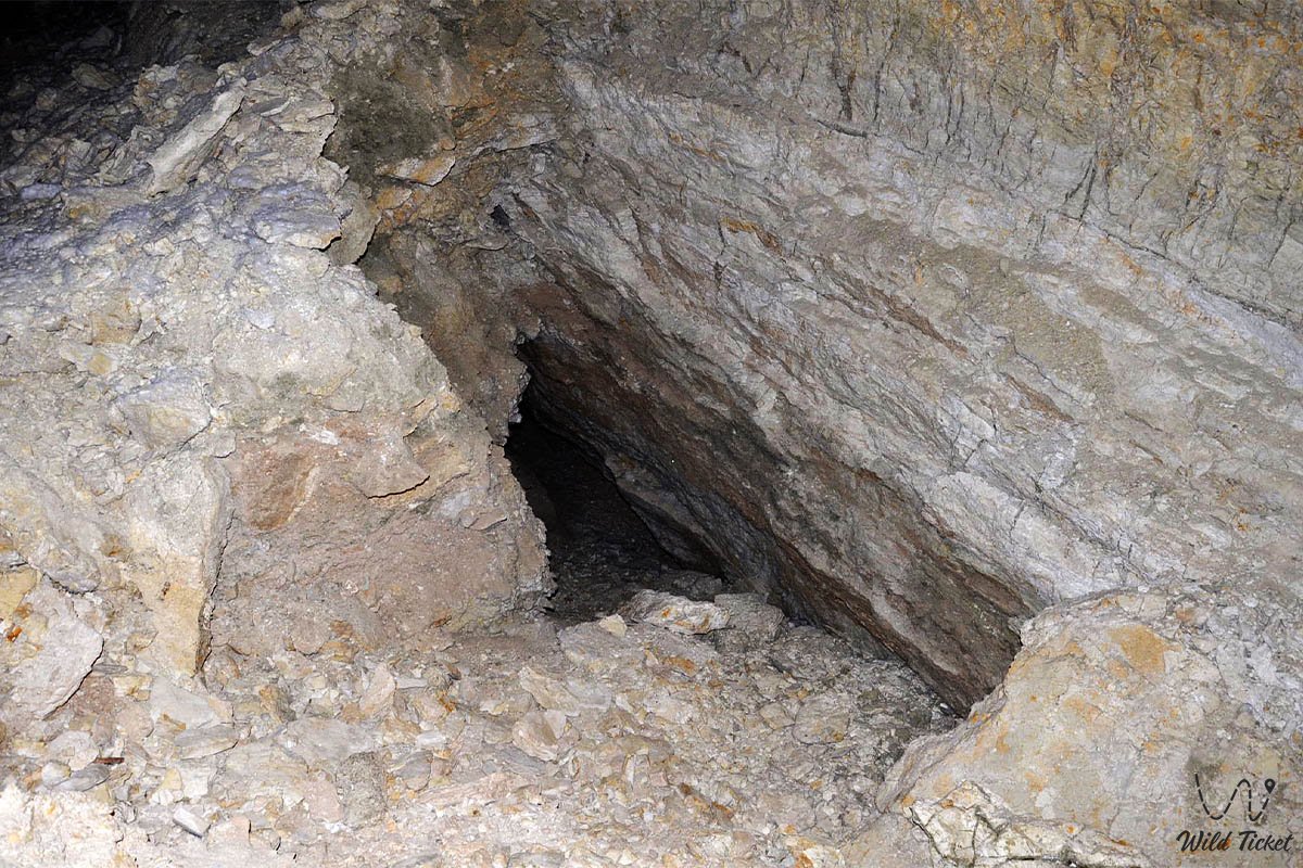
– dimensions of the slotted ponor at the floor: 1.3 by 0.53 m.
Lithological and stratigraphic cross-section:
1. Upper horizon (down to a depth of 20–25 m) is composed of durable organogenic-detrital limestones of the Pontian stage, forming the vertical walls of the entrance collapse.
2. Middle horizon (down to a depth of 60 m) consists of alternating light-pink cavernous oolitic limestones, marls, and dense carbonate clays of the Lower Sarmatian.
3. Lower bottom tier exposes alternating clays, sandstones, and thick beds (up to 1.5 m) of coarsely crystalline and fibrous gypsum (selenite).
Microclimatic indicators:
The cavity belongs to the warm static type. Air temperature at depth remains stable throughout the year at +18 °C. Perceptible air circulation and draft currents are absent. Humidity during dry seasons is moderate, and the floor is carpeted with a layer of dry, powdery gypsum dust up to 5 cm thick. The lack of a permanent water body alongside open ponors indicates that the floor of the cavity has not yet reached the regional aquiclude, with dissolution processes continuing at deeper levels.
Detailed site description
The speleological complex of Utebay cave comprises the following morphological zones and subterranean sectors:
• Collapse daylight amphitheater – an oval collapse sinkhole with sheer white walls that serves as the vestibule to the cave and illuminates the inclined entrances with natural daylight;
• Inclined entrance grotto "Heel" – a spacious vaulted chamber in the southwestern sector of the sinkhole, tapering inward and terminating in a blind wall with an impassable narrow fissure;
• Northeastern inclined tunnel "Toe" – the main gallery of the cave, descending steeply at a 45-degree angle through limestone beds to a depth of over fifty meters;
• Lower leveling chamber – a horizontal 40-meter gallery section at maximum depth where the slope flattens to 6 degrees and the ceiling arches into a rounded vault;
• Boulder talus stream – a massive gravitational accumulation of large limestone and marl boulders covering the floor of the inclined galleries from the entrance down to the deep termini;
• Bottom ponor of the ephemeral lake – a slit-like karst aperture at the base of the far chamber that swallows seasonal floodwaters and sandy-loamy sediment;
• Gypsum cornices and veins – exposures of translucent crystalline gypsum and selenite in the lower walls of the galleries, cutting across pink Sarmatian beds.
Flora and fauna
Vegetation on the plateau surface around the Utebay sinkhole is sparse, consisting of ultra-arid gypsophytes and halophytes: scattered dwarf shrubs of Anabasis salsa (biyurgun), white wormwood, gray saltwort, boyalych, and gray winterfat. Inside the sinkhole itself, higher plant life is absent due to moisture deficit and shifting talus. In spring, films of unicellular algae and sparse patches of crustose lichens form on moist stones along the boundary between light and shade in the entrance crater.
Wildlife in the surrounding area is typical of southern Ustyurt. The plateau plain and the chinks of Karynzharyk support Ustyurt mouflons, goitered gazelles, saigas, corsac foxes, and tolai hares. The sinkhole serves as a hazard for wild and domestic ungulates that lose footing on the steep cliff rims.
Subterranean fauna of the cave remains little studied. Bats (hemprich's long-eared bats, serotine bats) find daytime roosts in deep rock joints and beneath grotto ceilings. Small invertebrates inhabit the gypsum dust across the cave floor: cave harvestmen, darkling beetles, and woodlice carried in from the surface by wind.
Among reptiles on the surface around the sinkhole, toad-headed agamas, steppe agamas, and rapid fringe-toed lizards are common, while venomous snakes—the Halys pit viper and the rare Steppe ribbon racer—alongside camel spiders and black widows, hide in rock fissures near the entrance.
Legend
An ancient Mangystau legend of the Vanished Caravan and the Breath of the Subterranean Khan is told of the Utebay sinkhole.
The story relates that when secret caravan routes crossed Ustyurt from Khiva to the shores of the Caspian, a wealthy caravan belonging to a merchant named Utebay was crossing the plateau. The caravan carried bales of silk, silverware, and precious gemstones. At sunset, the travelers were caught in a violent dust storm—an "akburan"—that blanketed the sky in dense white haze.
Having lost all landmarks on the open plain, the caravaneer traveled blind, relying on the instinct of the camels. Suddenly, a subterranean rumble sounded beneath the caravan's feet: the ground split open, unveiling an immense abyss that nomads considered the portal to the domain of the subterranean lord. In an instant, the caravan, with all its riches and drivers, vanished into the dark mouth of the earth without leaving a trace on the surface.
When the storm cleared, kinfolk found only a colossal sinkhole, from whose depths rose a white gypsum haze resembling smoke. Since then, the karst sinkhole has borne the name of Utebay, and folk tradition holds that on calm, windless nights on the edge of the drop-off, one can hear the faint ringing of bells from the lost camels wandering through the subterranean labyrinths of Ustyurt.
Conclusion
Utebay karst cave is a speleological feature and a rugged monument of the Ustyurt plateau wilderness. The combination of a colossal collapse sinkhole, inclined passages plunging to depths of 70 meters, stark white limestone ceilings, and thick gypsum strata leaves a memorable impression on travelers willing to traverse hundreds of kilometers of desert off-road terrain.
Nearby attractions:
• Balayuk karst cave (Bulyoyyk);
• Karynzharyk depression;
• Kenderli salt flat;
• "Three Brothers" butte mountains (Batyrs);
• Onere tract spring;
• Ustyurt state nature reserve;
• Ustyurt plateau;
• Bozzhyra tract;
• Basgurly depression;
• Zhazgurly depression;
• Bokty butte mountain;
• Senek village;
• Town of Zhanaozen;
• City of Aktau;
• Karynzharyk sand massif;
• Ozene border post;
• Golbonshe hill;
• Ancient ancestral Utebay cemetery.
Pilgrimage sites along Mangystau routes:
• Beket-Ata underground mosque (Oglandy);
• Shopan-Ata underground mosque and necropolis;
• Karaman-ata necropolis and underground mosque;
• Shakpak-Ata rock-cut mosque;
• Sultan-epe underground mosque;
• Otpan-tau memorial complex.
Photogallery: