Desert outpost of Tyubkaragan with ruins of stone houses and crystal-clear lagoons –
Cape Bagarzhik is a hard-to-reach coastal rock massif, a distinctive natural site, and the location of the abandoned fishing village of Kanga on the northern coast of the Tupkaragan peninsula in the Tupkaragan district in Kazakhstan. Hundreds of millions of years ago, this entire northern edge of land was the shelf floor of the prehistoric Tethys Ocean. In the shallow bays of the Mesozoic and Cenozoic eras, millions of generations of mollusks, crustaceans, and plankton formed stratified horizons of Sarmatian coquina limestones and marls.
Following the regression of the ancient ocean and the opening of the Caspian basin, powerful wave impacts and dry winds sculpted stepped terraces, rocky screes, and natural scour basins into the coastal scarp. Today, the secluded stony-sandy spits of the cape are washed by the crystal-clear waters of the Caspian, creating a sharp contrast with the waterless, clayey-gravelly plateau.
The main defining features of cape Bagarzhik are the atmospheric ruins of a deserted Soviet fishing settlement built from local coquina stone, and an extraordinary concentration of snakes (dice snakes and whip snakes) that have made their home among the coastal rocky ridges and shallows. The cape also features the long sandy Kanga spit, where one can walk out into the sea. Complete isolation from civilization, a total absence of tourist crowds, untouched wild beaches, and fantastic sea sunsets draw experienced road travelers and explorers of pristine corners of the Northern Caspian here.
In the travel and expedition logistics of Mangyshlak, cape Bagarzhik serves as an important scenic point along the northern off-road route across Tyubkaragan. Just 5.5 km south of the cape lies the famous canyon and spring oasis of Tamshaly with its overhanging weeping cornice and freshwater lake. Continuing east along the coast, travelers reach the grand geological sinkhole of Zhygylgan with its stone labyrinth of slabs and fossilized tracks of Neogene machairodont cats. Located nearby are the medieval ruins of the Karagan fortification, the ancient Aktam and Shiaulie necropolises, as well as Sultan-epe canyon and the underground Sultan-epe mosque, inscribed on the UNESCO World Heritage Tentative List.
--------------------------------------------
How to get there and visit –
Cape Bagarzhik is situated on the northwestern face of the Tupkaragan peninsula in the Tupkaragan district of the Mangistau region, on the coast of the Caspian Sea. The distance from the museum town of Fort-Shevchenko is about 30–35 km along steppe tracks, 5.5 km north from Tamshaly canyon, roughly 18–20 km west from the Zhygylgan sinkhole, and about 165–170 km from the regional center of the city of Aktau.
GPS geographic coordinates of cape Bagarzhik (abandoned village):
44°37'12"N 50°35'12"E
The route from the city of Aktau leads northwest along a regional paved highway through Akshukur village to Fort-Shevchenko (around 135–140 km of good highway). From Fort-Shevchenko, head northeast toward Tamshaly canyon (around 25–28 km along a well-traveled steppe grader). Past the Tamshaly tract, continue north along a beaten dirt track toward the coastal cliffs of the Caspian (another 5.5 km). The road descends gently from the plateau chink to the edge of the sea, leading straight to the stone house frames of the abandoned village. Total travel time from Aktau by 4x4 SUV takes about 2.5–3 hours, and around 40–50 minutes from Fort-Shevchenko.
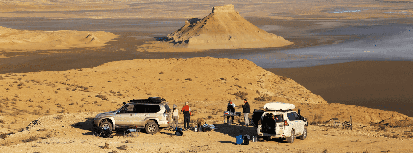
Access tracks and vehicle requirements: scheduled public transport to the cape is non-existent. Reaching Fort-Shevchenko is possible in any passenger car, but driving across the stony steppe roads of the Tyubkaragan plateau and negotiating the rocky-sandy descent to cape Bagarzhik requires a reliable four-wheel-drive 4x4 vehicle with ground clearance of at least 200–220 mm.
The primary hazards are sharp fracture edges of coquina limestone slabs, deep rain ruts, and stretches of loose sand along the shoreline. Vehicles must be equipped with All-Terrain (AT) or Mud-Terrain (MT) tires with reinforced sidewalls, an operational spare wheel, a compressor, a dynamic recovery strap, and a shovel.
Walking excursions and safety precautions (herpetological factor): exploring the deserted fishing village and coastal terraces is done on foot. The settlement is semi-ruined: stone ceilings and weathered coquina walls are unstable, so entering inside buildings is not recommended to prevent accidents from collapses.
ATTENTION: cape Bagarzhik is known for an immense concentration of snakes, especially along the coastal strip, on wet stones at the surf line, and in the water. The overwhelming majority are dice snakes (Natrix tessellata) and patterned whip snakes, which lack venom glands and do not show aggression toward humans unless provoked. However, venomous Halys pit vipers and steppe vipers also inhabit the coastal screes and rocks.
Walking through grass and over coastal rocks barefoot or in open sandals, handling snakes, or attempting to catch or tease them is strictly prohibited. Sturdy closed-toe hiking footwear or thick boots are mandatory. Before entering the water on wild beaches, carefully check the bottom. Swimming in the Caspian Sea is possible—the water here is transparent and clean—but enter smoothly, avoiding sudden movements near clusters of coastal algae and submerged boulders.
Environmental safety rules: the coast of cape Bagarzhik is an untouched corner of Mangyshlak wilderness.
Within the limits of the cape, it is STRICTLY MANDATORY TO:
– pack out all household waste (plastics, canned goods, glass) to permanent dumpsters in populated areas;
– avoid harming snakes and other coastal wildlife, showing care toward local fauna;
– leave the historic stone masonry of abandoned houses and ancient grave monuments undisturbed;
– refrain from driving wheeled vehicles onto the beach sands within the water protection zone;
– avoid lighting open campfires from scarce driftwood and coastal shrubs in strong winds (cook meals strictly on portable gas stoves).
Infrastructure: tourist infrastructure is entirely absent around cape Bagarzhik. The abandoned village has no permanent inhabitants, electricity, cellular reception, or sources of fresh drinking water. Journeys are conducted in complete self-sufficiency.
For field camping, bring a drinking water supply of at least 3 liters per person per day, food provisions, durable wind-resistant tents with storm stakes (strong Caspian winds blow across the cape), and an expanded field first-aid kit with antihistamines.
The nearest stores, gas stations, tire repair shops, and medical facilities are in Fort-Shevchenko (30–35 km).
The best time to visit is the summer and early autumn period (from June through late September). In summer, the sea warms to a comfortable +23...+26 °C, allowing swimming on wild beaches, while a constant sea breeze tempers the daytime heat (+28...+32 °C). May and early June are ideal for viewing the blooming steppe, but reptile activity peaks during this period.
--------------------------------------------
History
The history of cape Bagarzhik links the formation of land at the bottom of the Tethys Ocean, medieval fortifications of Tyubkaragan seafarers, and the daily work of the 20th-century Caspian fishing industry.
Over hundreds of millions of years, the Mesozoic Tethys Ocean deposited thick beds of organogenic limestones here. The tectonic uplift of the Turan plate transformed the seabed into an abrupt plateau, while subsequent Caspian transgressions carved an intricate coastline with protruding capes and sheltered shallow bays.
In the Middle Ages, cape Bagarzhik and the neighboring tracts of Tamshaly and Karagan served as strongpoints along the northern branch of the Great Silk Road. Caravans heading from the Khiva oasis to Caspian moorings to load goods onto vessels bound for the Volga and the mouth of the Ural utilized the sheltered anchorages off the cape. The presence of a permanent freshwater source in Tamshaly canyon, just a few kilometers to the south, secured safe staging areas. Nearby on high plateau ground, ruins of the medieval Karagan caravanserai and fortress, as well as the ancient Aktam and Shiaulie ancestral necropolises with carved kulpytases by Turkmen and Kazakh masters, still survive.
In the early and mid-20th century, a permanent fishing settlement (fishing camp) was established at cape Bagarzhik. During the Soviet period, a commercial fishing crew was based here, harvesting valuable sturgeon and freshwater-tolerant species (grey mullet, pike-perch, Caspian roach) in the northern waters of the Caspian basin. From easily worked local coquina limestone, fishermen built sturdy single-story houses, net-repair workshops, salting sheds, ice cellars for catch storage, and mooring structures. Life bustled in the settlement for decades: fish were regularly transported by sea and steppe roads to fish-processing plants in Bautino and Fort-Shevchenko.
In the latter half of the 20th century, due to depleted commercial fish stocks, centralization of fisheries in major ports, and shoreline shifts, the settlement was closed. Residents abandoned their homes, taking their belongings. Time, salty Caspian winds, and rains transformed the fishing outpost into an atmospheric ghost village. Roofless stone walls, abandoned piers, and deserted beaches became a natural sanctuary for wildlife, turning cape Bagarzhik into one of the most distinctive destinations on the travel map of Mangistau.
Information
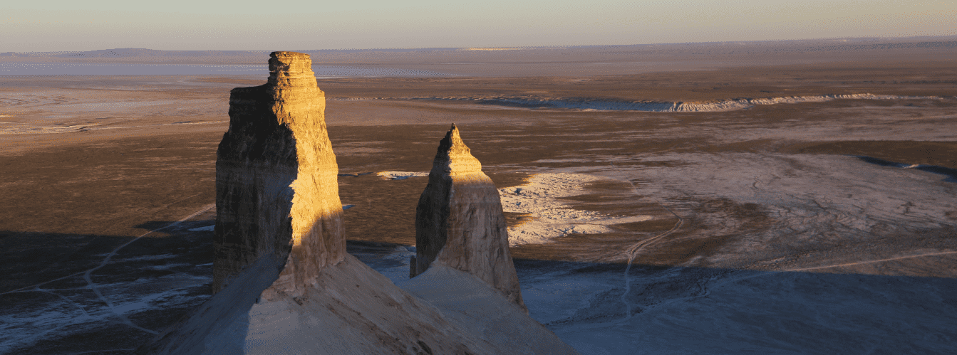
Geologically and geomorphologically, cape Bagarzhik is an abrasional-accumulative rocky headland composed of gently dipping strata of Neogene (Sarmatian and Pontian) coquina limestones formed in the shallow basins of the Tethys Ocean.
The coastal profile of the cape is stepped: the structural Tyubkaragan plateau drops toward the sea through a series of scarps 10 to 25 m high, transitioning into a gentle shoreline strip. The surface consists of alternating dense coquinas, marls, and carbonate clays. In the wave zone, storm abrasion has formed extensive benches—horizontal stone platforms etched with natural pools, fractures, and wave-cut niches.
The beaches of cape Bagarzhik consist of coarse golden quartz-carbonate sand and finely crushed, water-rounded shells. Nearshore bottom ground is mostly hard rock with scattered sand patches, resulting in clear and transparent water (visibility reaches 5–8 m in calm conditions).
The hydrological regime of the northern Caspian features wind surges and ebbs: during onshore winds, the water level rises and floods the lower rock terraces, whereas dry winds blowing from the steppe push the sea back dozens of meters, uncovering submerged rocky ridges carpeted with stonewort algae.
The climate of the area is dry, desert-maritime, with mild, windy winters (average January temperature -2...-4 °C) and prolonged, moderately hot summers. The average daytime July temperature is +27...+30 °C, though a continuous sea breeze moderates the heat. Annual precipitation is minimal, around 120–140 mm.
Detailed site description
The natural-historical complex of cape Bagarzhik includes the following key elements:
• Rocky cape Bagarzhik – a distinct headland of the Tyubkaragan plateau formed of Tethys Ocean coquina limestone, projecting into the waters of the Northern Caspian;
• Abandoned fishing village of Kanga – ruins of mid-20th-century stone houses, outbuildings, and salting warehouses constructed from rough-cut coquina blocks;
• Coastal rocky ridges and wave-cut benches – flat rock platforms with natural pools that serve as the main habitat for the local snake population;
• Wild shell-and-sand beaches – isolated coves with golden sand and a gentle gradient into the sea, suitable for secluded swimming;
• Pier frames and ice-cellar remnants – dilapidated structures of Soviet fishery infrastructure along the shoreline edge;
• Viewpoint on the plateau chink – an elevated ledge above the cape offering an open circular panorama of the marine horizon.
Flora and fauna
The plant cover of cape Bagarzhik is typical of stony and sandy maritime semi-deserts of Tyubkaragan. Salt-tolerant psammophytes grow on coastal sand accumulations: sand wildrye, desert acacia, Schober's nitrebush, and camelthorn (alhagi). The rocky plateau is dominated by communities of Turanian wormwood, boyalych (tree-like saltwort), biyurgun, and scattered tamarisk shrubs. In spring, the steppe around the cape comes alive: slopes are blanketed with flowering ephemerals, wild onions, and tulips, whereas by mid-summer the vegetation dries under the sun, scenting the coast with bitter wormwood.
The animal life of the area is notable for its high reptile density. Hundreds of dice snakes (Natrix tessellata) inhabit sun-warmed coastal boulders, crevices in ruins, and shoreline algae beds. These snakes swim, dive, and hunt small gobies directly in seawater. Alongside them live patterned whip snakes, rapid fringe-toed lizards, desert lidless skinks, gray geckos, and Central Asian tortoises. Venomous species—the Halys pit viper and steppe viper—are occasionally observed among the rocky ledges of the plateau.
Mammals include typical inhabitants of steppe Mangyshlak: corsac foxes, tolai hares, marbled polecats, steppe polecats, and long-eared hedgehogs. Bat colonies roost inside the abandoned village buildings. At dawn, wild saigas and horses from local herds may approach the sea.
Birdlife along the coast is rich due to abundant fish and minimal human disturbance. Caspian gulls, great black-headed gulls, Caspian terns, and great cormorants rest and forage on the rocks and sandbars. During seasonal migrations, flocks of mute swans, common shelducks, and mallards rest in the lagoons. Raptors nest on the ledges of coastal cliffs, including saker falcons, kestrels, long-legged buzzards, and steppe eagles. In nearshore waters off the cape, hunting endemic Caspian seals are often seen.
Legend
An ancient Kazakh legend of the Snake King and the Fisherman's Vow is told about cape Bagarzhik.
The story goes that when the first fishermen arrived on the Tyubkaragan coast, this place was known as the Cape of Golden Nets. Fish were so plentiful that boats returned filled to the gunwales with silver mullet and sturgeon. But one day, the head of the fishing crew, driven by greed, decided to cordon off the bay with fine-meshed nets, catching even tiny fry and leaving nothing for the sea.
Then, from the deep onto the coastal stones of cape Bagarzhik crawled the giant Snake King—guardian of the underwater depths of the ancient Tethys Ocean. His scales gleamed like polished coquina stone, and his eyes burned with green fire. The King spoke to the fishermen in a human tongue, warning that the sea does not tolerate greed, and ordered the fry released back into the waves, demanding an oath that they take only as much fish as needed to feed their families.
The head fisherman was frightened, swore the oath, and kept his word. In gratitude, the Snake King commanded his legion of snakes never to harm humans, to guard the peace of the cape, and to keep the shores free of evil spirits. Decades later, however, new arrivals broke the ancient pact and cast destructive nets. As tradition tells, that very day fish abandoned the shallows, well water turned bitter, and people fled their stone houses in haste. The settlement emptied into ruins, and the snake host emerged from the deep to occupy the deserted shores, keeping watch over the remains of the village and reminding mortals of the sacred laws of nature.
Conclusion
Cape Bagarzhik is an intriguing corner of wild Northern Mangystau, where the character of a deserted fishing village meets the limestone formations of the ancient Tethys Ocean and the clear azure of the Caspian Sea. Its distinct natural setting with water snake colonies, isolated sandy beaches, and quiet surf leaves a lasting impression on anyone exploring the landscapes of the Tupkaragan peninsula.
Interesting attractions nearby:
• Tamshaly canyon and oasis;
• Zhygylgan geological sinkhole;
• Ruins of the Karagan fortification;
• Ancient Aktam necropolis;
• Ancient Shiaulie necropolis;
• Sultan-epe canyon and Sultan-epe underground mosque;
• Kokbulaksay canyon;
• Kapamsay canyon;
• Fort-Shevchenko museum town;
• Sarytash bay;
• Cape Tyub-Karagan;
• Golubaya bay;
• Cape Sagyndyk;
• City of Aktau.
Pilgrimage sites in Mangystau:
• Sultan-epe underground mosque;
• Shakpak-Ata underground mosque;
• Kenty-baba necropolis;
• Beket-Ata underground mosque (Oglandy);
• Shopan-Ata underground mosque;
• Karaman-ata underground mosque;
• Bayte sanctuary.
Photogallery: