Little-known memorial complex of the 11th–19th centuries with archaic headstones of the Abdal clan in the Mangystau district –
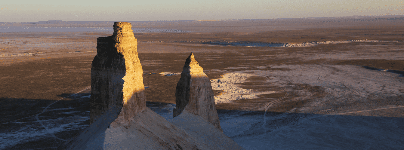
Temir-Abdal necropolis (also known in local travel routes as Sherkala necropolis or the Temir-Abdal-aulie cemetery) is a historic memorial and sacred complex dating from the 11th to 19th centuries, situated in the Mangystau district of western Kazakhstan. The site lies across the eastern section of the Akmysh tract, just 1.2 km west of the foot of the renowned Sherkala residual butte and 20 km northwest of the district center of Shetpe settlement.
Just 222 meters northwest of the necropolis boundary, within a five-meter terrace cliff along a dry watercourse, lies the marl-hewn Temir-Abdal underground mosque (Danisman-mulla-aulie cave), captured in an 1851 watercolor by Taras Shevchenko. The valley surrounding the necropolis is also renowned for singular clusters of spherical concretions – enigmatic round stone formations measuring up to several meters in diameter.
In spatial and historical terms, the necropolis developed along an ancient caravan branch of the Northern Silk Road, which skirted the natural mountain stronghold of Sherkala and the medieval fortified town of Kyzylkala. The name of the sanctuary traces back to the preacher Temir of the Turkmen Abdal clan, who lived and spiritually guided nomads in these lands.
Unlike the monumental Aday pantheons of Ustyurt, the oldest section of the Temir-Abdal necropolis is distinguished by primitive modesty: it preserves archaic burials marked by stone clusters and simple vertical marker-pillars of rough, unworked limestone and marl.
The growth of the necropolis spans multiple cultural strata of Mangyshlak: from early medieval Oghuz-Kipchak interments to burials of the Kazakh Aday clan dating from the second half of the 18th to the early 20th century.
The eastern sector of the complex displays developed minor architectural forms of Kazakh memorial craftsmanship: rectangular roofless carved saganatams, three-dimensional zoomorphic koytas headstones, and slender vertical kulpytas stelae detailed with ornamental carvings and ancestral tamgas.
--------------------------------------------
How to get there and visit –
Temir-Abdal (Sherkala) necropolis is located in the central part of the Mangyshlak peninsula within the Mangystau district of the Mangistau Region. The distance from the city of Aktau is approximately 170–175 km to the northeast; about 20 km northwest of the district center of Shetpe settlement; around 14 km east of Shair village; about 1 km north of the Akmysh-say oasis; 6 km northwest of the Kogez ethno-village; and roughly 1.2 km west of the base of Mount Sherkala.
GPS geographic coordinates of Temir-Abdal necropolis:
44°15'22"N 51°59'36"E
44.256111, 51.993333
Route from Aktau: departure from the city proceeds along the paved national highway A-33 through Zhetybai to Shetpe settlement (about 155 km of solid asphalt). From Shetpe, drive northwest along the paved road toward Shair village until reaching the turnoff for the Akmysh tract and Mount Sherkala. From the asphalt, an established dirt country track (about 3–4 km) runs toward the western slope of Sherkala along the dry Akmysh stream bed directly past the necropolis. Travel time from Aktau takes approximately 2–2.5 hours.
Access conditions: during dry periods, the country road along Sherkala is passable for all types of motor vehicles, including passenger cars driven with care. However, due to sand drifts, rocky sections, and clay patches that soften after precipitation, the most comfortable choice for visiting the valley is a crossover or a four-wheel-drive 4x4 vehicle.
Visiting rules and sacred etiquette:
Temir-Abdal necropolis is a sacred historical burial ground of ancestors:
– visitor attire should be modest (covered shoulders and knees; women are advised to wear a headscarf);
– walking on burial mounds, displacing stones of grave clusters, or sitting on headstones is prohibited;
– leaning on fragile weathered kulpytas stelae and climbing the walls of saganatams are strictly forbidden;
– silence must be observed across the necropolis grounds; loud shouts, laughter, and smoking are prohibited;
– disturbing argali horns and ritual offerings at sacred graves is forbidden;
– all personal waste must be carried away.
Infrastructure: the necropolis is set in a natural wilderness environment. Modern rest facilities, overnight lodging in traditional yurts, dining, and drinking water replenishment are available at the year-round Kogez ethno-village (6 km southeast). Comprehensive town amenities (fuel stations, supermarkets, pharmacies, auto repair shops, railway station) are located in Shetpe settlement (20 km). Cellular coverage near the necropolis and Mount Sherkala remains reliable.
Seasonality: visits are open throughout the year. The best seasons are spring (April – May), when the valley is cloaked in green grasses and wildflowers, and mild autumn (September – October). During July and August, temperatures near the base of the white marl scarps can exceed +40 °C; therefore, exploring the historical monuments is best planned for morning or pre-sunset hours.
--------------------------------------------
History
The development of the Temir-Abdal necropolis encompasses a multi-century span from the 11th to the 19th century, serving as a visible chronicle of successive nomadic peoples at the foot of one of the foremost natural citadels of Mangystau.
During the High Middle Ages (11th–13th centuries), Mount Sherkala functioned as a vital nomadic fortress, while the substantial trading city of Kyzylkala flourished at its base. Plentiful spring water in the Akmysh tract and a strategic location along the caravan route fostered the appearance of the earliest Oghuz-Kipchak burials across the eastern part of the dry valley. Burials of this horizon were distinguished by extreme asceticism: nomads marked graves with simple enclosures of rough-hewn stone and vertically positioned flat slabs.
Between the 14th and 18th centuries, the tract was inhabited by Turkmen clans, among whom the Abdal lineage played a prominent role. According to oral tradition, the devout Sufi teacher Temir lived here during this era. His selfless service, piety, and solitary prayers within a carved rock cell earned deep reverence among surrounding nomads. Following his passing, the hill near his dwelling grew into a revered burial ground – Temir-Abdal-aulie – where Muslims across the district sought eternal rest.
From the late 18th century through the 19th and early 20th centuries, the valley of Sherkala served as regular winter quarters and pastoral routes for Kazakh clans of the Aday tribe. Aday stonemasons introduced monumental carving traditions: the eastern sector of the cemetery saw the rise of carved stone saganatams, kulpytas stelae bearing fine Old Kazakh inscriptions, and sculptural koytases.
In July 1851, during a military and scientific expedition through Karatau, the Ukrainian poet and artist Taras Shevchenko explored these locations. Struck by the sacred silence of the tract and the antiquity of its modest stone pillars, Shevchenko documented this memorial landscape in his travel journals and drawings.
Information
In spatial and typological structure, the Temir-Abdal necropolis is a compact open-air memorial complex situated at an elevation of approximately 115 meters above sea level on the gentle slope of the dry Akmysh stream bed.
Morphometric characteristics:
– period of formation: 11th–19th centuries;
– elevation above sea level: 115 m;
– distance to Temir-Abdal underground mosque: 222 m northwest;
– distance to the foot of Mount Sherkala: 1.2 km east;
– monument construction materials: local grey and pale marl, sandstone, and coquina limestone.
Architectural and typological monument groups:
The territory of the necropolis comprises two distinct historical and architectural sectors:
– archaic sector: early burials featuring stone mounds, primitive oval and rectangular stone enclosures, and single or paired flat vertical stelae made of unworked stone slabs;
– eastern Kazakh sector: memorial structures of the 19th to early 20th centuries, including rectangular saganatams of sawn coquina, zoomorphic koytas tombstones with stylized ram horns, and vertical kulpytas stelae adorned with carved patterns and ancestral tamgas of Aday lineages.
Natural phenomenon of the valley:
The surroundings of the necropolis feature remarkable geomorphological landmarks: along the country road at the foot of Sherkala lie the famous Mangystau spherical concretions – rounded mineral formations created on the floor of the ancient Tethys Ocean.
Detailed site description
The memorial complex of the Temir-Abdal (Sherkala) necropolis encompasses the following key architectural zones, tomb types, and natural landmarks:
• Archaic burial sector of the 11th–15th centuries – the oldest section of the cemetery, featuring modest stone clusters, primitive enclosures, and flat upright slabs of unworked rock.
• Eastern sector of Kazakh saganatams – rectangular stone enclosures by 19th-century Aday craftsmen, displaying contoured relief carving and traditional architectural cornices.
• Colony of sculptural koytases – carved limestone headstones stylized as resting rams, symbolizing pastoral prosperity and ancestral abundance.
• Carved kulpytas stelae – upright stone markers bearing engraved floral patterns, clan tamgas, and Arabic-script epitaphs.
• Venerated tomb of Danisman-mulla-aulie – the sacred grave of the spiritual mentor before the rock scarp, traditionally adorned with argali horns and poles.
• Temir-Abdal underground rock-cut mosque – a cave sanctuary carved into the marl cliff 222 meters to the northwest.
• Field of spherical concretions in the Sherkala valley – a geological zone of giant stone spheres along the access road leading to the necropolis.
• Panoramic view of Mount Sherkala – an imposing chalk residual butte rising as a natural monument above the ancient necropolis.
Legends
Oral traditions surrounding faith, endurance, and ancestral memory are tied to the Temir-Abdal necropolis and Mount Sherkala.
The Legend of the Sufi Temir of the Abdal Clan:
Oral lore recounts that in ancient days, when nomads of the Turkmen Abdal clan pastured livestock beneath the stronghold of Sherkala, the elder Temir lived among them. Relinquishing worldly gains, he established a prayer cell inside a ravine and prayed continuously for the wellbeing of the people. Nomads believed that his pure intentions protected herds from disease and predatory raids. Before passing away, Temir asked to be laid to rest on the slope of the dry valley, founding a sacred cemetery that became an enduring spiritual shelter for travelers.
The Tale of the Wise Danisman-Mulla:
Another narrative tells of the wise preacher Danisman-mulla ("danishpan" meaning sage), who healed bodily and spiritual afflictions of the local nomads. It is said that even after his passing, prayers at his resting place brought healing to the infirm and restored harmony to households. Since then, pilgrims tied white ribbons of hope to the sacred poles and offered prayers for their aspirations.
The Legend of Mount Sherkala ("Lion Fortress"):
Steppe storytellers connect the silence of the necropolis with the heroic defense of Mount Sherkala. According to legend, the defenders of the mountain citadel fought like lions against overwhelming opposing forces. The fallen warriors were laid to rest across the valley at the foot of the fortress. Local inhabitants believe that the spirits of the batyrs (aruakhs) resting in the Temir-Abdal tract continue to watch over the tranquility of the ancient lion-mountain.
--------------------------------------------
Conclusion
Temir-Abdal (Sherkala) necropolis is a precious element of the spiritual and funerary heritage of Mangystau, where the restrained forms of early medieval headstones exist alongside the expressive stonecraft of Kazakh saganatams. Framed by monumental Mount Sherkala and the relict Akmysh oasis, the necropolis invites travelers into the meditative quiet of centuries, revealing the cultural continuities of nomadic Eurasia.
Nearby attractions:
• Temir-Abdal underground rock-cut mosque;
• Legendary Mount Sherkala residual butte;
• Field of giant spherical concretions in the Sherkala valley;
• Relict oasis of the Akmysh tract;
• Medieval fortified town of Kyzylkala (10th–13th centuries);
• Kogez ethno-village with traditional yurts;
• Airakty-Shomanai mountains (Valley of Castles);
• Samal rock canyon with a freshwater spring;
• Otpan-Tau historical and cultural complex with the Aday-Ata memorial;
• Karaman-Ata underground mosque;
• Karaman-Ata necropolis;
• Zhaman-Sauran underground mosque;
• Shetpe settlement;
• City of Aktau;
• Caspian Sea;
• Shair village.
List of other necropolises in Mangyshlak and Mangystau:
• Shopan-Ata necropolis;
• Karaman-Ata necropolis;
• Shakpak-Ata necropolis;
• Masat-Ata necropolis;
• Kenty-Baba necropolis;
• Koshkar-Ata necropolis;
• Yesen-Ata necropolis.
Photogallery: