Land of white Martian canyons, sacred Sufi shrines, and the fossilized Tethys Ocean –
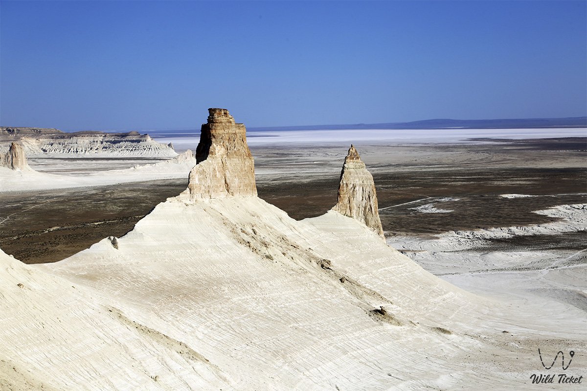
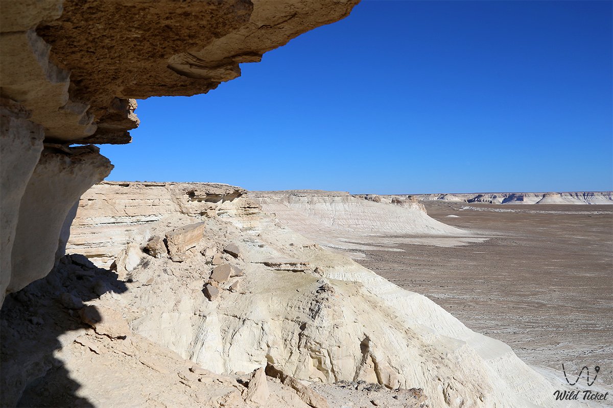
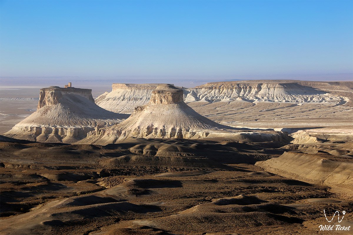
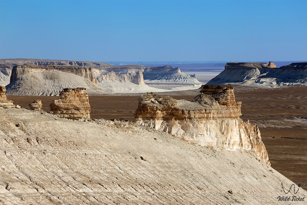
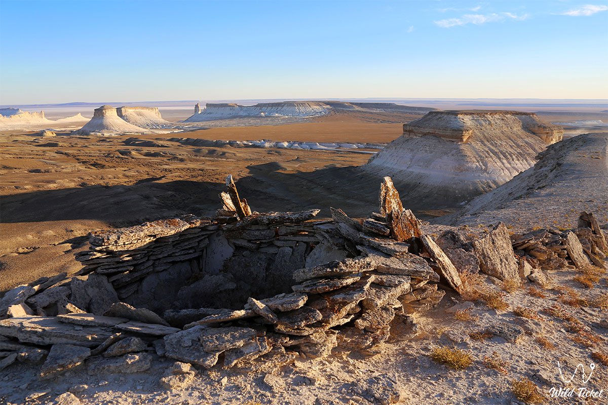
Mangystau (Kaz. Mangystau, historically the Mangyshlak Peninsula) represents a grandiose desert region of the Mangystau region in the southwest of the Republic of Kazakhstan, washed by the azure waters of the Caspian Sea and extending eastward to the monumental chinks of the Ustyurt Plateau. It is a colossal open-air natural museum spread across the bed of the prehistoric Tethys Ocean, whose receding waters laid bare dazzling white chalk cliffs, deep tectonic depressions, karst sinkholes, and isolated table-topped remnant mountains.
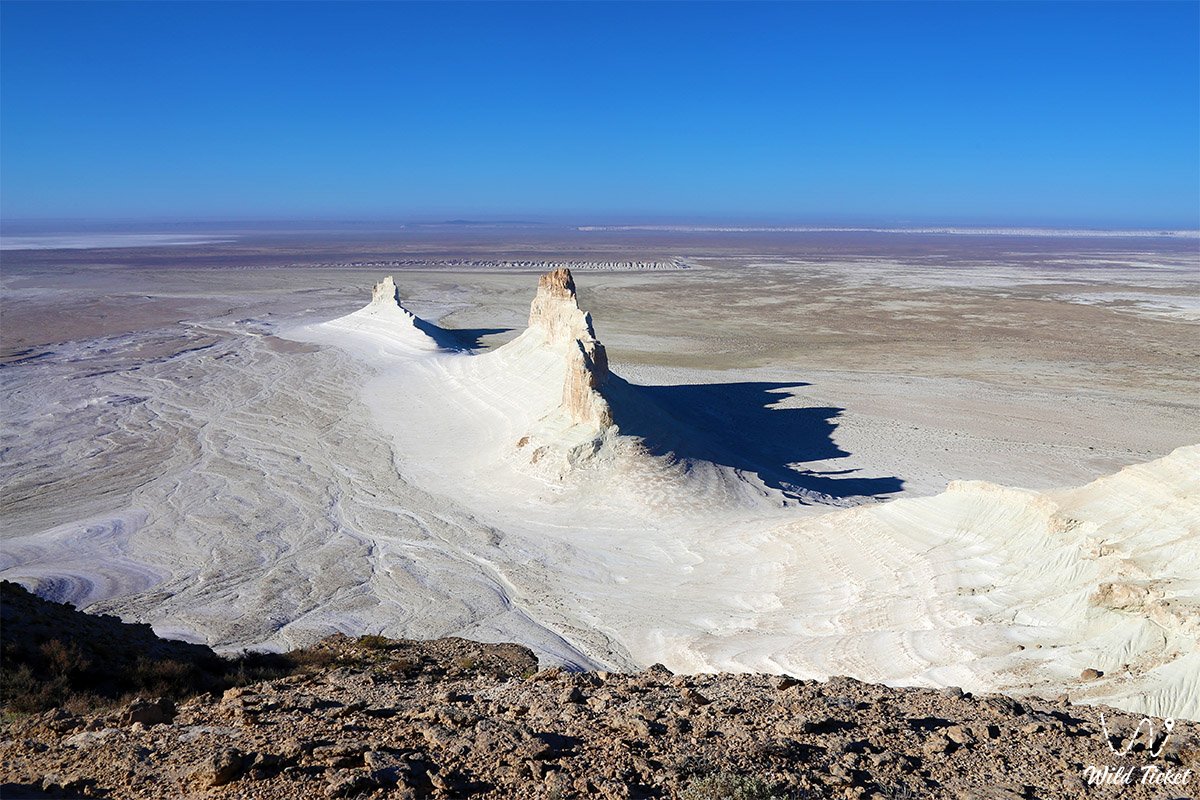
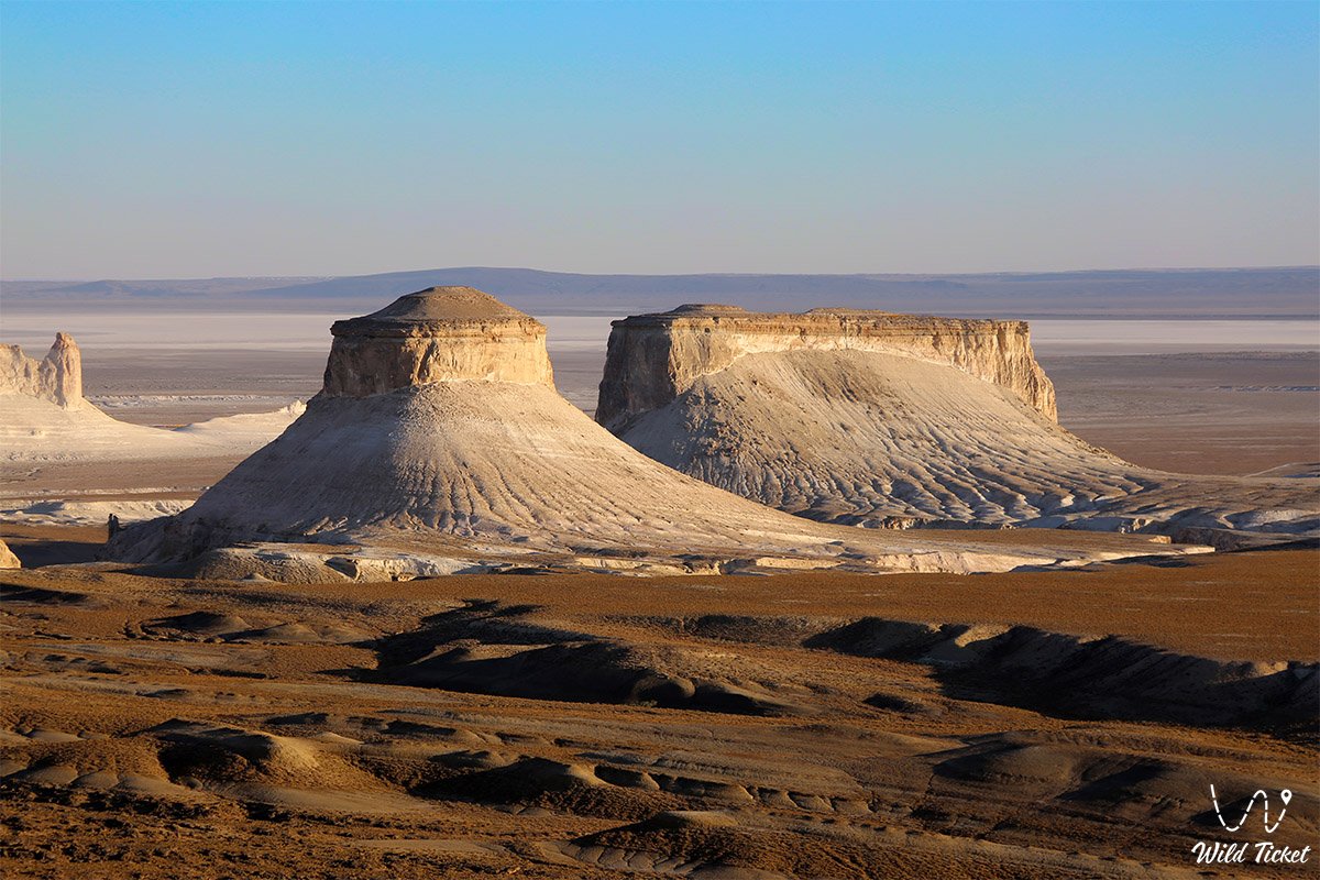
The uninhabited local landscapes are frequently compared to Martian scenery; however, the local "Mars" is not red, but predominantly dazzling white, creamy, and ash-gray, creating the complete sensation of landing on a distant, lifeless planet. The administrative, transportation, and cultural center of the region is the white-stone city of Aktau – the country's primary maritime gateway on the eastern shore of the Caspian.
A special place in the culture and geography of the land is occupied by its profound symbolism. The prominent Kazakh writer and thinker Abish Kekilbayev, a native of these parts, poetically likened Mangystau to the "Sleeping Beauty": the contours of the peninsula's coastline in satellite images indeed bear a striking resemblance to the delicate profile of a young woman.
The origin of the name "Mangystau" itself carries multiple interpretations. According to one, it represents a blessed nomadic expanse meaning "a thousand wintering grounds" ("myng qystau") or "a thousand roads." Other researchers translate the toponym as "dragon's home," "mountain of the great dragon," or "the place where the formidable dragon dwells," associating it with the cyclopean curves of the mountain ridges and ancient myths.
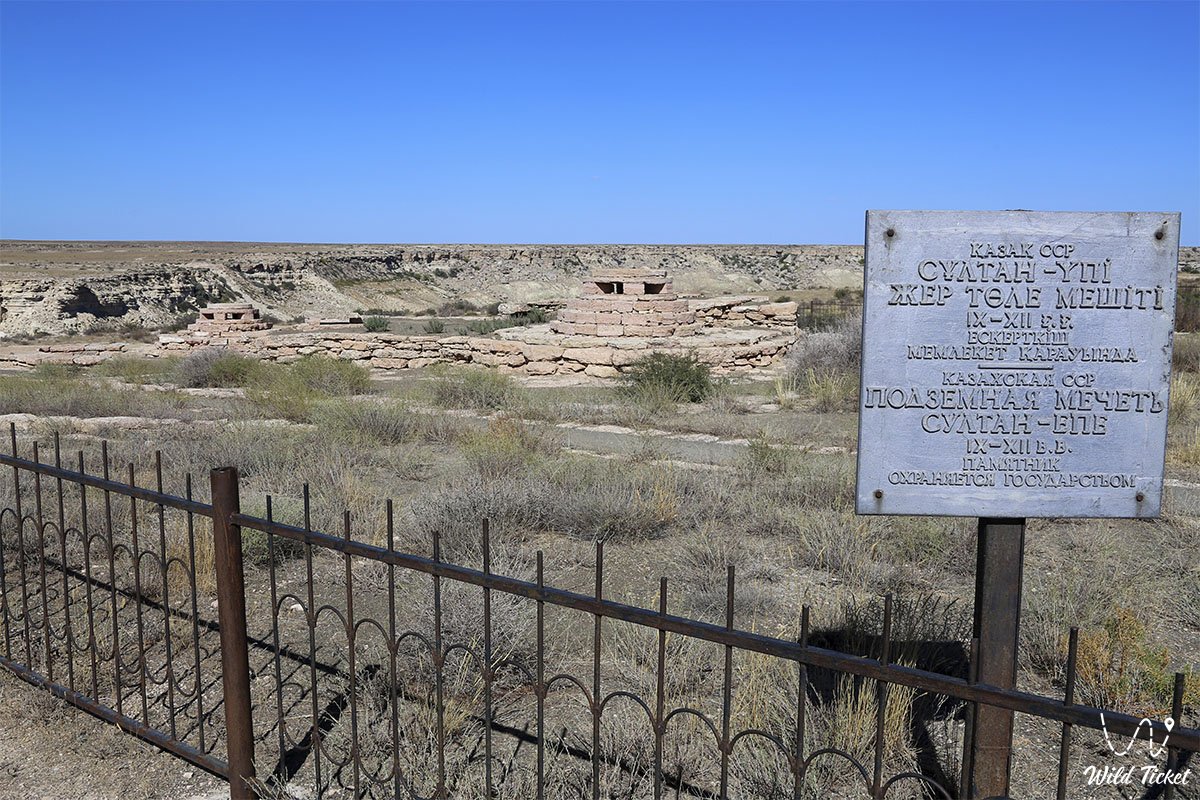
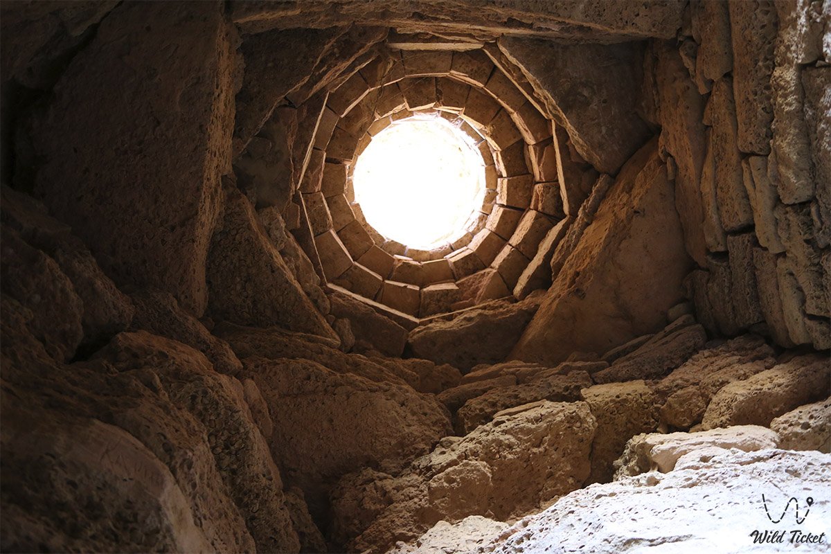
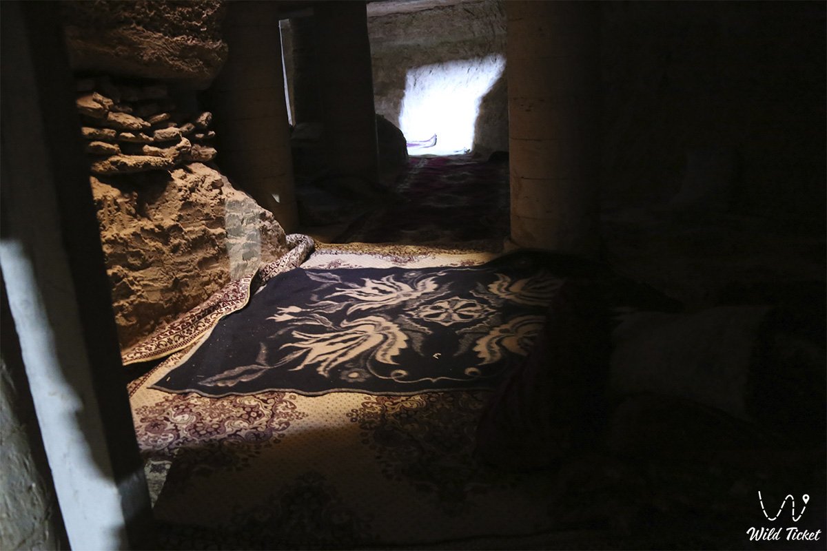
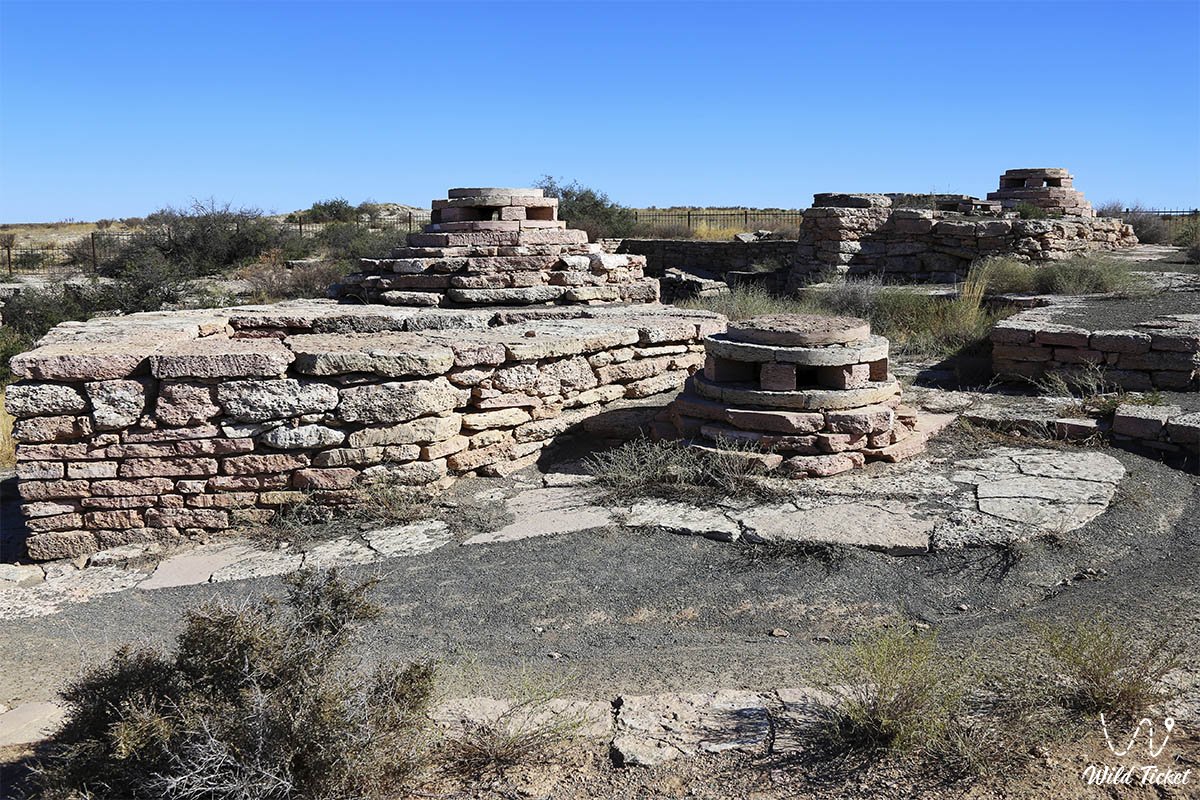
The primary wealth of Mangystau is an unprecedented concentration of natural and sacred phenomena of global stature. The region has long been revered as the "land of 362 saints": over centuries, a distinctive Sufi spiritual tradition developed here, and wandering dervishes carved underground temples and hermitages into the chalk cliffs – the Beket-Ata underground mosque – the Sultan-Epe underground mosque – the Shopan-Ata mosque – the Shakpak-Ata underground mosque.
These shrines attract thousands of pilgrims and researchers, and these ancient rock-hewn mosques of the peninsula, along with their associated sacred necropolises, are officially inscribed on the UNESCO World Heritage list.
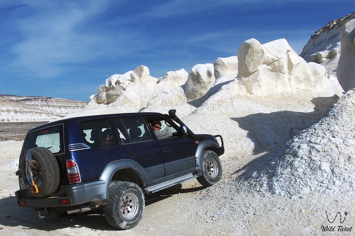
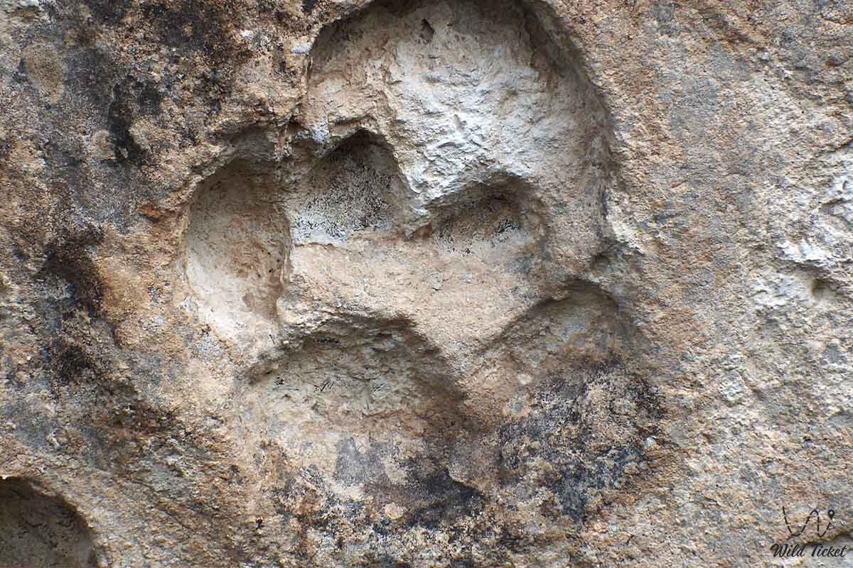
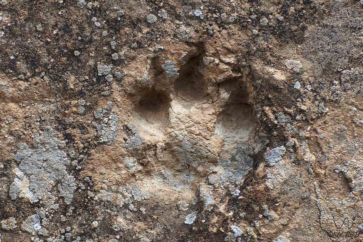
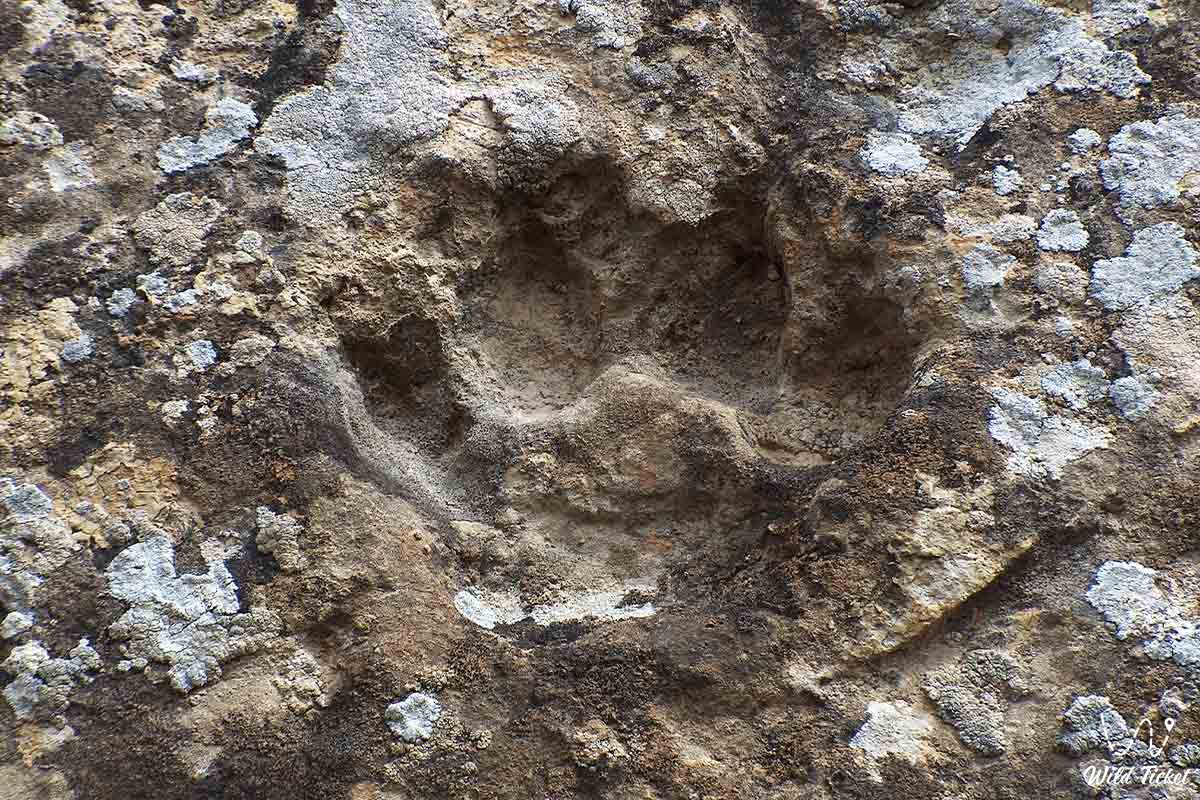
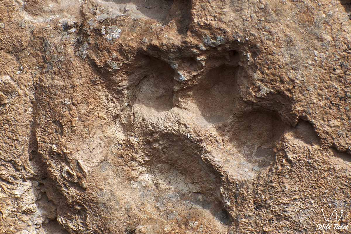
Today, Mangystau is recognized as the premier hub for expedition off-road tourism, geological research, ecological photo tours, and pilgrimage in Central Asia. Travelers come here to discover the teeth of prehistoric sharks, ammonite shells, and corals, navigate the labyrinths of filigree canyons, view petrified footprints of saber-toothed cats, and experience the absolute silence of the primeval desert.
--------------------------------------------
How to get there and visit –
Mangystau is situated in the remote southwestern part of Kazakhstan. The primary transportation hub and departure point for all expeditions is the coastal city of Aktau. Aktau International Airport (SCO), located 25 km from the city, operates daily domestic flights from Astana, Almaty, Shymkent, and Atyrau, alongside regular direct international flights from London, Istanbul, Moscow, Baku, Tbilisi, and Kutaisi. This makes Mangystau a convenient connecting hub within grand combined journeys across Central Asia and the Caucasus.
GPS geographical coordinates of the central part of the region: 43°28'21"N 52°52'47"E
Reaching Aktau is also possible overland: passenger trains and intercity buses run here from various regions of Kazakhstan, and an international train route linking Nukus and Aktau has been launched, making it possible to pair an expedition to the Aral Sea and Ustyurt in Uzbekistan with an extended journey across Mangyshlak.
The Aktau International Sea Commercial Port serves as Kazakhstan's principal maritime terminal on the Caspian; however, regular passenger ferry connections with Baku and Atyrau are currently absent.
Tour durations across the region range from short trips of 1–4 days (covering key highlights such as Bozzhira, Sherkala, and Torysh) to comprehensive 10–14-day expeditions spanning over 1,000–1,500 kilometers across remote steppes, deserts, and salt flats.
--------------------------------------------
Transport, logistics, and safety
Exploring the natural sites of Mangystau requires reliable equipment and competent expedition preparation. Hundreds of kilometers of modern paved highways cross the region, connecting Aktau with the towns of Zhanaozen and Fort-Shevchenko, the ports of Bautino and Kuryk, and the settlements of Shetpe, Beyneu, Tauchik, and Senek.
For many attractions, 80–90% of the drive proceeds along excellent asphalt, with only the final 5–15 km running across compacted dirt tracks. In dry weather, certain individual sites (the panoramic viewpoint of the Karagiye depression, the Kogez ethno-village, the Akmysh oasis) can be carefully accessed in a passenger sedan or urban crossover.
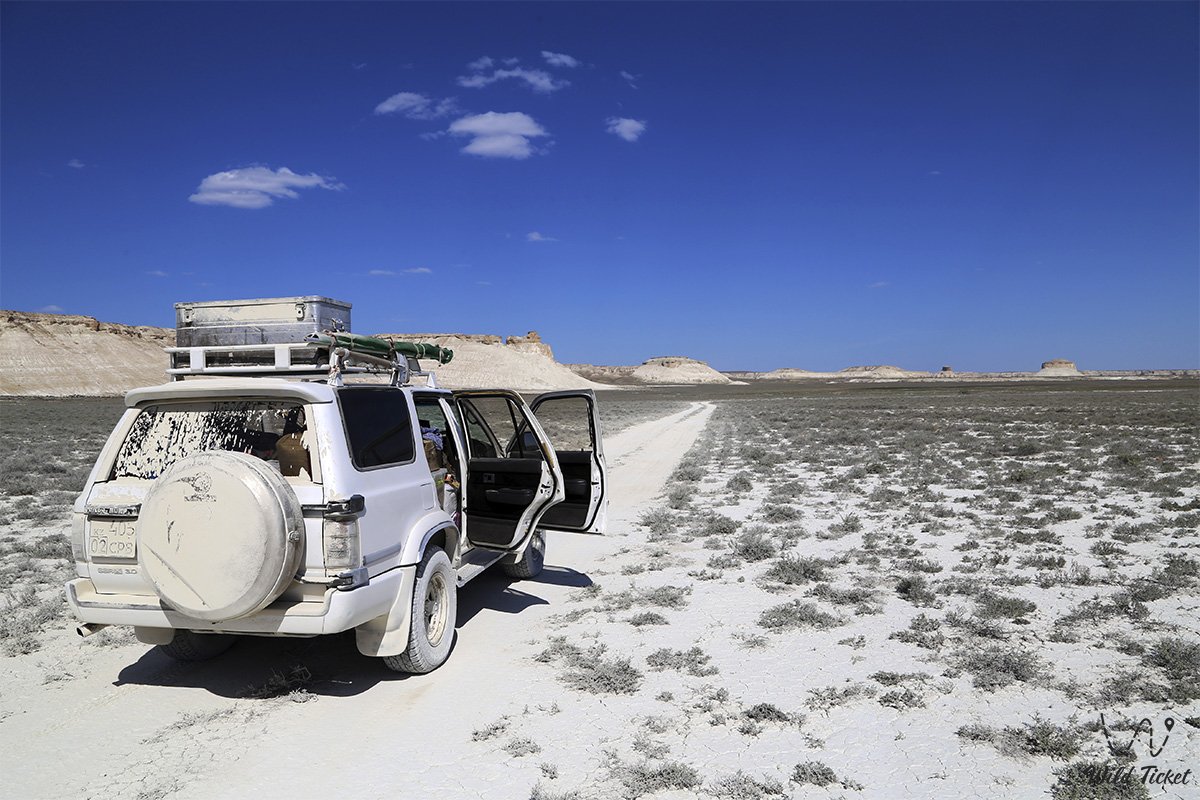
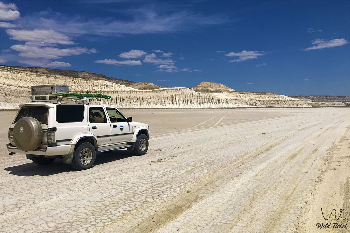
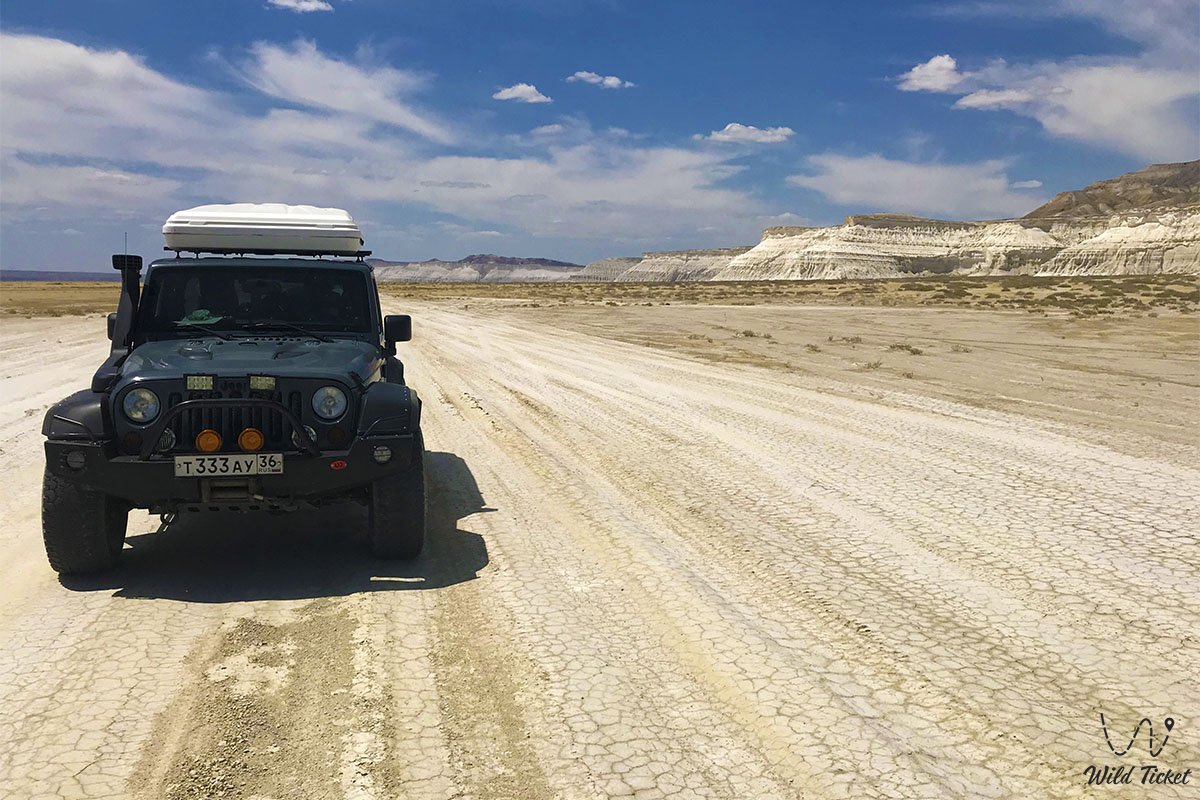
However, a full-scale exploration of Mangystau necessitates a body-on-frame four-wheel-drive vehicle (4x4) with high ground clearance, heavy-duty suspension, skid plates, and durable All-Terrain (AT) or Mud-Terrain (MT) tires.
Traveling across steppe tracks in two-wheel-drive vehicles (2x2) is exceedingly risky: clay soils turn into viscous porridge immediately after rains, while steep descents, stony washouts, and deep dust-filled ruts pose a constant hazard of high-centering or tearing off bumpers.
Routes to destinations such as the Tuzbair salt flat and the Karynzharyk depression require navigating dozens of kilometers across secluded stony-sandy steppe where even prepared off-road vehicles can encounter difficulties.
Key safety rules for autonomous expeditions across Mangystau:
Convoy configuration: venturing into remote areas in a single vehicle is categorically discouraged. The safety standard is a minimum of 2–3 crews in prepared 4x4 vehicles ready to assist in the event of a breakdown or bogging down.
Technical outfitting: every vehicle must carry spare wheels (preferably two), a dependable jack, a tire compressor, a repair kit, a kinetic tow strap, shackles, and a reserve fuel supply in canisters calculated for an autonomous range of at least 400–600 km.
Communications and navigation: mobile network coverage is entirely absent outside of towns. Autonomous GPS navigators loaded with pre-saved offline tracks and a satellite phone or satellite tracker for emergency calls are mandatory.
Self-sufficiency and field camp: multi-day expeditions require a clean drinking water supply of no less than 3–5 liters per person per day (plus an adequate volume of utility water), a camp kitchen, dependable tents, and warm sleeping bags.
Steppe camping rules: pitching tents beneath overhanging chalk ledges is prohibited due to the hazard of sudden rockfalls, as is camping at the bottom of dry ravines and watercourses that can be instantly inundated by flash flood mudflows. Food items must be hermetically sealed to avoid attracting wild animals. Footwear must be kept inside the tent overnight (scorpions, solifuges, and venomous spiders are encountered among stones and sands during warm seasons).
When to go
The climate of Mangystau is extra-continental and sharply arid. The average January temperature ranges from -3 to -5 °C; however, steppe winds blowing from the sea intensify the sensation of cold. Summer is long and scorching: the average July temperature stays between +27 and +32 °C, while at midday the air inside enclosed basins bakes to extreme highs of +40...+47 °C. Annual precipitation is minimal (100–160 mm), with most rains falling in spring and evaporating rapidly under the blazing sun. Characteristic features of the region include persistent winds that subside only toward sunset, alongside periodic dust storms.
• Spring (mid-April – late May) – the golden window for expeditions. The desert transforms for several weeks, covered in a lush carpet of emerald grasses and blooming wild tulips. The air is fresh and free of exhausting heat, making it ideal for extended trekking.
• Autumn (September – October) – a magnificent velvet season. Summer heat subsides, comfortable daytime temperatures set in (+20...+25 °C), Caspian seawater retains its warmth, and the sky offers crystalline clarity.
• Summer (July – August) – a challenge for seasoned adventurers. Vegetation burns away entirely, and the sun bakes the white limestone. Journeys remain possible, but demand strict hydration management, sun protection, and shifting activities to morning and evening hours.
• Winter – a season for hardy adventure travelers. Winter Mangystau possesses a distinct monumental appeal: snow upon white chinks creates fantastic contrasts, though camping in sub-zero temperatures and gale-force winds requires professional winter gear.
History and paleontology
The history of Mangystau spans hundreds of millions of years of geological cataclysms and more than half a million years of human culture. During the Mesozoic and Cenozoic eras (250–40 million years ago), this land was the floor of the Tethys Ocean, which separated the ancient supercontinents of Laurasia and Gondwana. Around 25 million years ago, powerful tectonic displacements uplifted the seabed into dry land. The receding waters left behind immense strata of limestones, marls, writing chalk, and colored clays. Wind, rain, and time eroded the soft layers, sculpting precipitous chinks, castle-like outliers, and deep canyons.
The region is abundant in paleontological artifacts. In screes at the base of chalk mountains, travelers find spiral shells of extinct ammonites, belemnite rostra ("devil's fingers"), fossilized sea urchin tests, and sharp triangular teeth of prehistoric lamniform sharks. On limestone slabs in the Zhygylgan tract (Fallen Land), rare trackways of fossilized paw prints of saber-toothed cats (Machairodus) and hoofprints of three-toed horse ancestors (Hipparion) from the Miocene epoch have been preserved.
In the Kokkala tract, petrified strata of ancient wood and charcoal dating back 170–200 million years are exposed, remaining from burned Jurassic forests through which dinosaurs once roamed.
Humans settled these arid lands in deep antiquity. Archaeologists have discovered Early Paleolithic sites in the valleys of Shakhbagata and Kumakape. On the Caspian shore, the Eneolithic settlement of Koskuduk I was excavated, containing the oldest human burial in Kazakhstan. Owing to the absence of permanent rivers, the region remained on the periphery of major empires, yet a northern branch of the Great Silk Road crossed the Ustyurt Plateau. Merchant caravans from Baghdad and Khiva traveled through the Shetpe Gates toward the marine roadsteads of Sarytash Bay and Bautino Bay.
In the 12th–13th centuries, Khwarazmshah Atsiz founded the fortified city of Kyzyl-Kala near Mount Sherkala, defending the caravan artery until the Mongol invasion. In the 14th century, during the Golden Horde era, the major seaport of Ketikkala emerged along the coast, uniting maritime trade routes of the Caspian basin.
A distinctive chapter in Mangyshlak's chronicle is the arrival of wandering Sufis. In the 10th–13th centuries, teachers of mystical Islam, disciples of Khoja Ahmed Yasawi, reached the peninsula. They carved underground mosques out of monolithic rock, which served concurrently as prayer halls, madrasahs, and refuges. In the mid-19th century, Ukrainian poet Taras Shevchenko served his military exile at Cape Tyub-Karagan, capturing the rugged beauty of the region in a series of watercolors. From the mid-20th century onward, Mangystau grew into a core center of Kazakhstan's oil, gas, and uranium industries, giving rise to modern coastal Aktau.
Detailed description of the main attractions
The natural and historical heritage of Mangystau comprises outstanding landmarks, each possessing an unmistakable character:
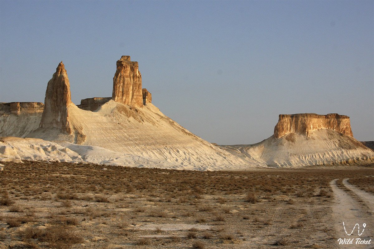
• Bozzhira Tract ("Dragons of Bozzhira") – a grandiose erosional canyon of the Ustyurt Plateau, stunning the imagination with vast white clay plains and limestone remnant outliers rising over 200 meters high. The main visual calling card is the vertical chalk pillars of the "Fangs of Bozzhira". Six key panoramic viewpoints are arranged on the plateau, revealing sweeping vistas of receding canyons reminiscent of lunar or Martian surfaces.
• Kyzylkup Tract ("Tiramisu Cake") – a picturesque massif of gentle layered hills popularly dubbed "Tiramisu" due to the alternation of multicolored sedimentary strata. White layers consist of pure chalk, while red, pink, and crimson hues stem from iron compounds. The canyon's coloration shifts throughout the day: appearing dazzling white under direct midday sun, warming to creamy tones toward evening, and turning violet-pink at sunset. A signature feature of Kyzylkup is the "Sphinx" outlier – a rock projection resembling the contours of a human head.
• Airakty-Shomanay Tract ("Valley of Castles") – a system of table remnant mountains in the foothills of Karatau, made world-famous by Taras Shevchenko's drawings. From afar, the outliers with sheer walls and spires resemble a fantastical medieval city with fortress towers and battlements. Climbing to the flat summit platform rewards travelers with a 360-degree panorama of the Aktau Mountains. Semi-feral herds of steppe horses graze in the ravines of Airakty, Ustyurt mouflons are encountered, while Central Asian tortoises and scorpions inhabit the foothills.
• Ybykty-Say (Kabyrga) Canyon-Tract – a fantastical porous canyon 3 to 6 meters deep, composed of limestone rocks with a unique texture. The gorge walls resemble bubbly chocolate, honeycombs, sea corals, or delicate openwork lace. In the deepest part of the canyon, the fissure narrows to just one meter, creating a dizzying contrast between vertigo and delight. The canyon transforms its appearance depending on the angle of sunlight penetrating through the overhead crevice.
• Zhygylgan Sinkhole ("Fallen Land") – a cyclopean elliptical tectonic landslide at the tip of the Tupkaragan Peninsula. An immense basin with a 12 km perimeter, roughly 4 km diameter, and depths up to 200 meters is strewn with giant limestone monoliths the size of multi-story buildings. Scientists attribute the collapse to tectonic fault displacement or marine leaching of subterranean karst voids. Preserved on the floor of the sinkhole are fossilized footprints of saber-toothed cats (Machairodus) and Hipparions over 10 million years old.
• Lake Kuzdykary (Kozdykara) – a relict lake near the Caspian coast within the bowl of the Zhygylgan sinkhole. Viewed from higher vantage points, the lake forms a flawless heart shape. Its hyper-saline water matches the Dead Sea in density and easily keeps a person afloat. Local lore holds that the lake's depths connect to the Caspian Sea through subterranean conduits. A freshwater spring bubbles beside the salt lake, where stone cave shelters of early 20th-century fishermen have been preserved.
• Tuzbair Salt Flat – a giant endorheic salt marsh at the base of sheer terraced Ustyurt chinks. In spring, the surface of the salt flat is covered by a thin sheet of snowmelt water up to half a meter deep, transforming into a grandiose mirror that reflects clouds and chalk cliffs. In summer, the brine evaporates, leaving a firm salt crust that can be walked upon (in spots, feet sink 10–15 cm into the mud, requiring boots). Attempting to drive onto the salt flat is life-threatening: treacherous silty bogs lurk beneath the crust.
• Mount Sherkala ("Lion's Fortress") – a majestic solitary outlier rising 322–332 meters in the Karatau basin. The mountain possesses remarkable optical variability: from one angle it resembles a gigantic white yurt or an inverted bowl, while from another it appears like a crouching lion resting its head on paws before springing. The northern flank is eroded by gullies and caves, whereas the southern cliffs remain sheer vertical walls. In antiquity, the Khwarazmian city of Kyzyl-Kala thrived at its foot, guarding the caravan route.
• Mount Bokty Table Mountain – a solitary outlier of regular form rising above the steppe like an immense table. From one perspective, the mountain resembles a giant overturned boat with a white-and-ochre hull; from another, a stepped pyramid. Because of its distinct colored sedimentary strata, Mount Bokty became a symbol of Mangystau and was featured on Kazakhstan's 1,000-tenge banknote.
• Kokkala Tract – a geological monument 9.5 km west of Sherkala, serving as a natural tunnel into the Jurassic period. Folding movements exposed strata of variegated colored clays 170–200 million years old. Water erosion carved the clay slopes into whimsical pillars, mushrooms, pyramids, and mini-canyons. The primary highlight of the tract is the opportunity to touch beds of petrified wood and charcoal from ancient dinosaur-era forests.
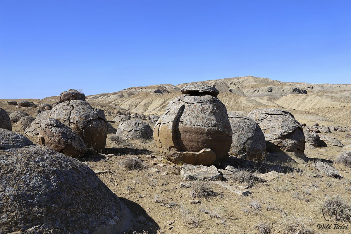
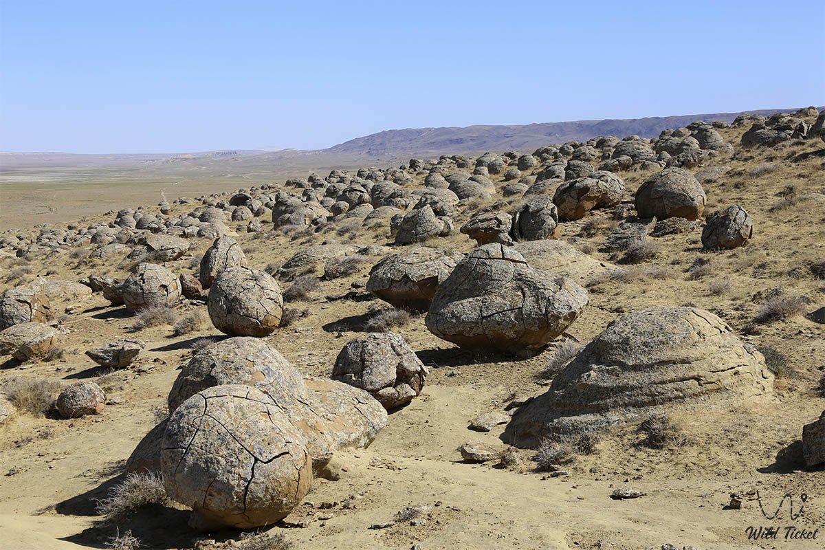
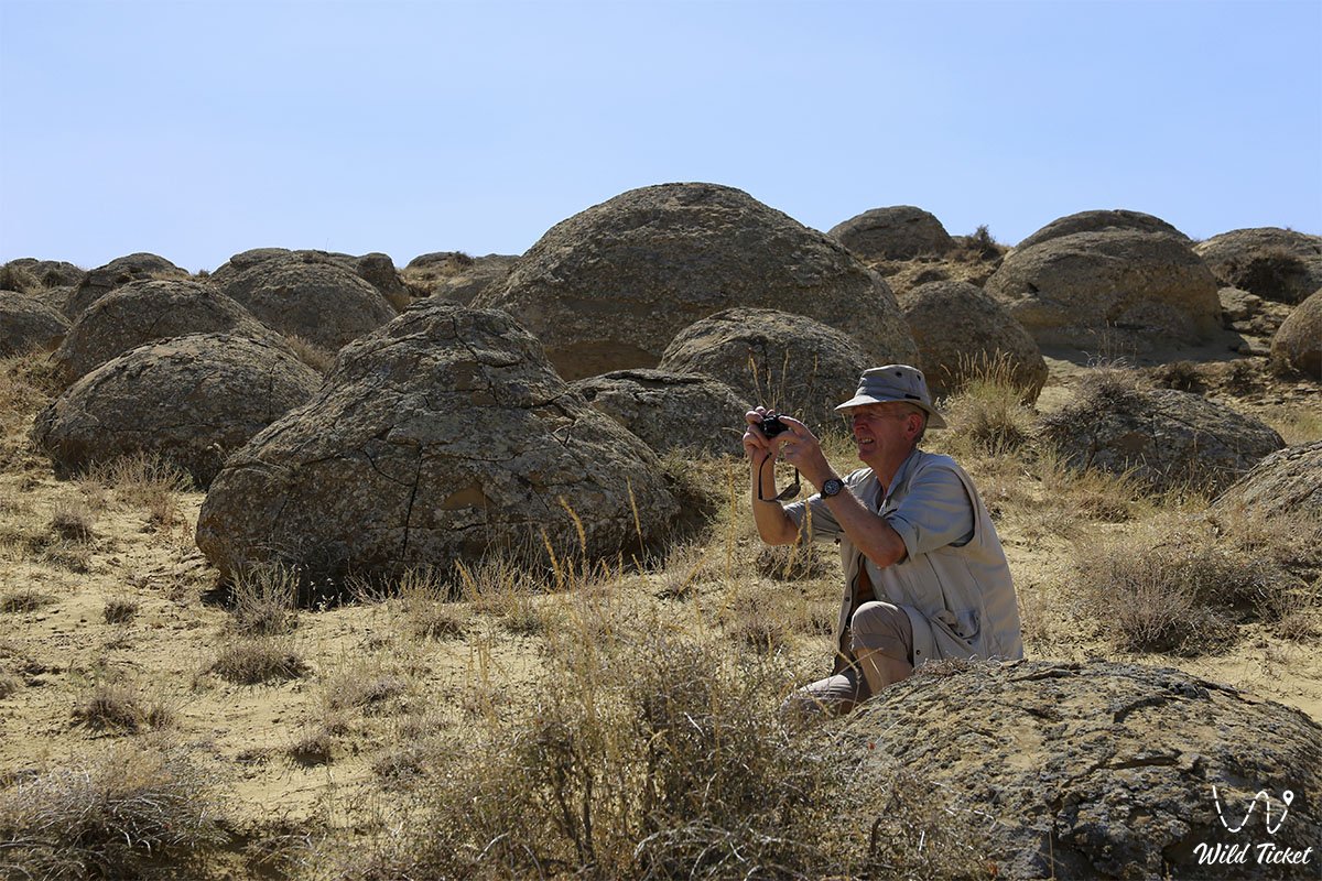
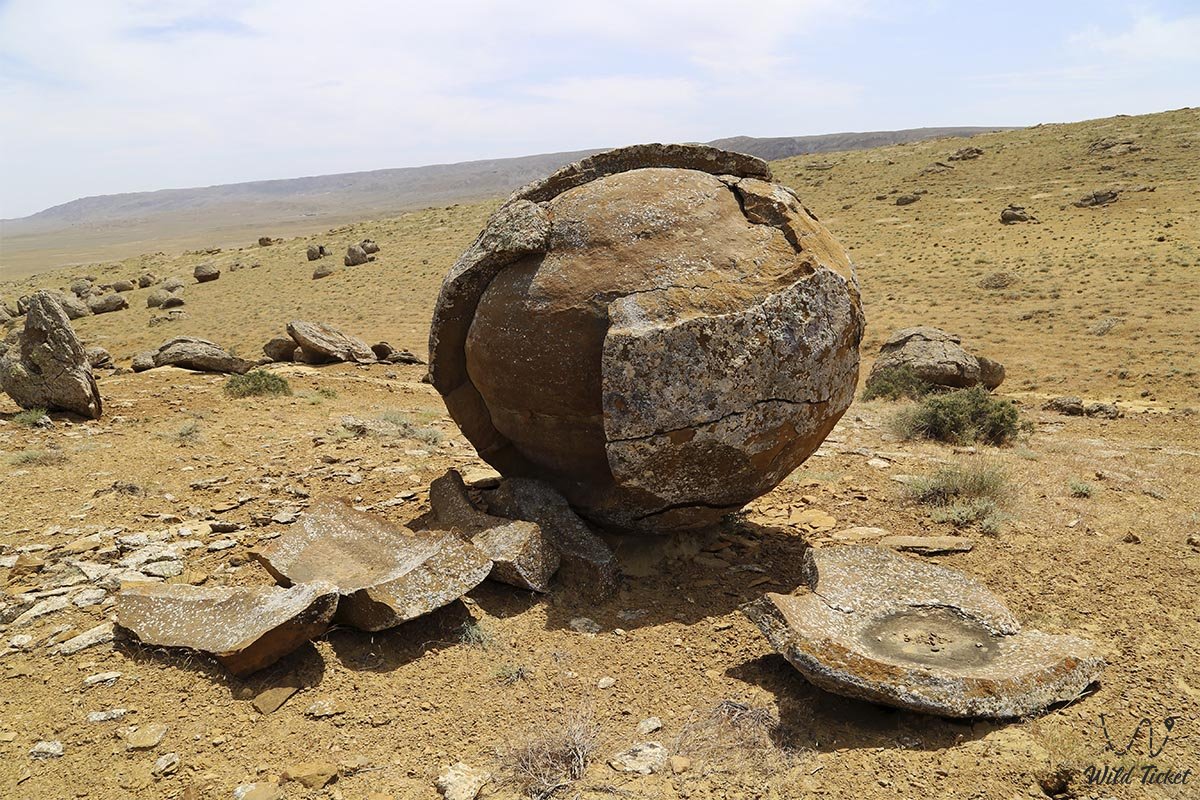
• Torysh Tract ("Valley of Stone Concretions") – a mystical steppe tract strewn with thousands of spherical mineral concretions ranging from 15 cm to 3–4 meters in diameter. The stone spheres crack under sun and frost, peeling away in layers like an onion. According to one hypothesis, the concretions grew concentrically around plankton and shells on the floor of the Tethys Ocean 120–180 million years ago; another suggests they formed in tectonic fault zones through ancient electrical discharges and rock sintering.
• Karynzharyk Depression – a deep tectonic depression 85 km long in the south of the region within the Karakiyan district (the floor sinks to -75 meters below sea level). The main highlight of the depression is the brilliant white Kenderli salt flat, above which rise the isolated "Three Brothers" remnant mountains (Onere). In the north of the valley stands the Karamaya mountain-ridge (210 m) – the product of an ancient volcanic eruption roughly 70 million years ago. The depression forms part of the Ustyurt Biosphere Reserve and shelters rare Red Book-listed animals.
• Karagiye Depression ("Black Jaws") – a colossal endorheic basin 85 km long and up to 25 km wide, situated 50 km from Aktau. The floor of the depression drops to -132 meters below world sea level, ranking as the 5th deepest dry depression on Earth and 1st in Kazakhstan. The seasonal Lake Batyr (Karakol) and clusters of whimsical chalk outliers lie on the basin floor.
Sacred underground mosques of Mangystau
The subterranean rock complexes of Mangyshlak represent a unique phenomenon in Islamic architecture. The emergence of cave temples within Muslim tradition is linked to the cross-pollination of nomadic cultures, Christian cave hermitage traditions, and Sufi reclusion:
• Beket-Ata Underground Mosque in the Oglandy Tract – the primary shrine of Western Kazakhstan, hewn into the chalk cliff of a deep canyon on the Ustyurt Plateau. Beket-Ata (1750–1813) is revered as an outstanding Sufi, educator, philosopher, batyr, and healer who graduated from the Shergazi-Khan Madrasah in Khiva. The saint's tomb rests directly within the carved rock mosque. A prepared stairway stretching roughly two kilometers leads down to the temple. Pilgrims believe that prayer in Oglandy bestows spiritual cleansing and healing.
• Shakpak-Ata Underground Mosque (10th–13th centuries) – a unique monument in the northeast of the Tupkaragan Peninsula on the slope of Mount Ungazy. Unlike other mosques, the sanctuary has a distinct cruciform layout with a central hall and four vaulted wings, pointing to its construction in the pre-Islamic era.
Archaeologists have identified traces of Stone and Bronze Age cultures here, as well as a sanctuary of Zoroastrian fire-worshipers. To this day, pilgrims light ritual lamps (shirak) filled with mutton fat. The walls of the mosque are adorned with refined epigraphy and depictions of open palms, wolves, and horses. The entrance to the mosque is open until sunset.
• Shopan-Ata Underground Mosque – the oldest cave complex on Mangyshlak, carved into a soft limestone massif. According to legend, Shopan-Ata was one of the senior disciples of Khoja Ahmed Yasawi. The complex encompasses prayer halls, cells, and a sacred well. It was to the tomb of Shopan-Ata that the young Beket-Ata traveled in his youth to seek blessings.
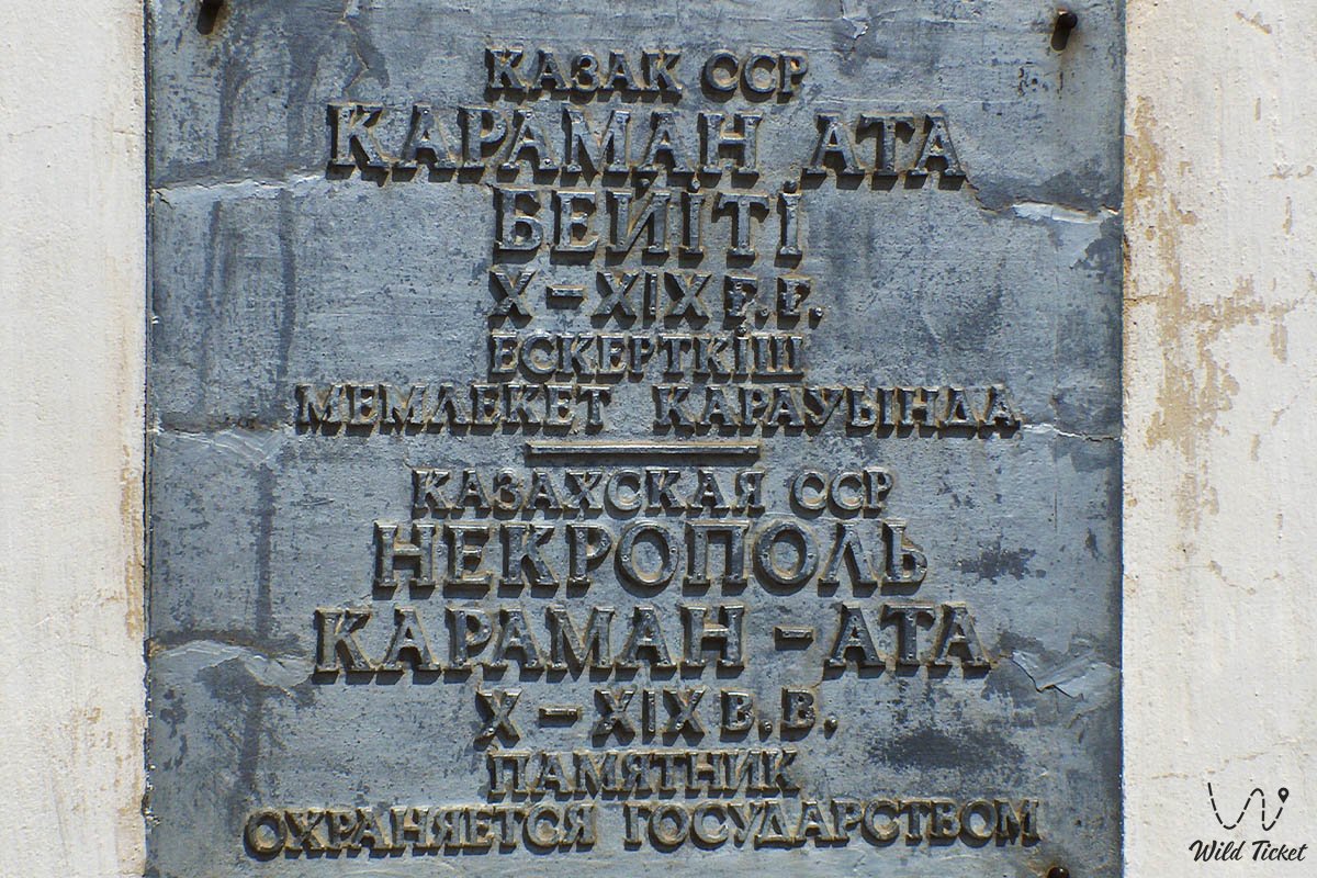
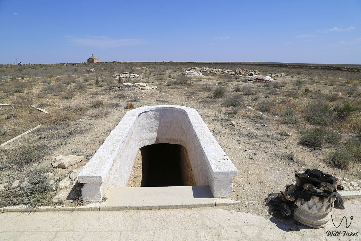
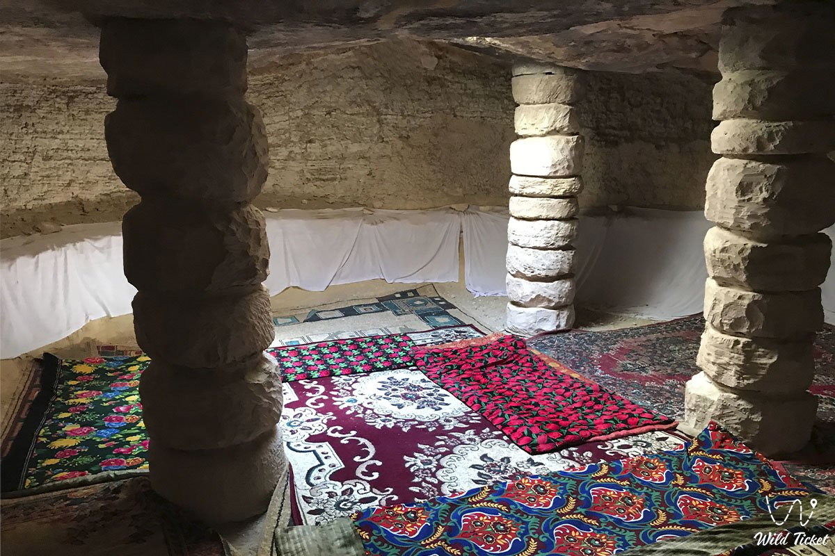
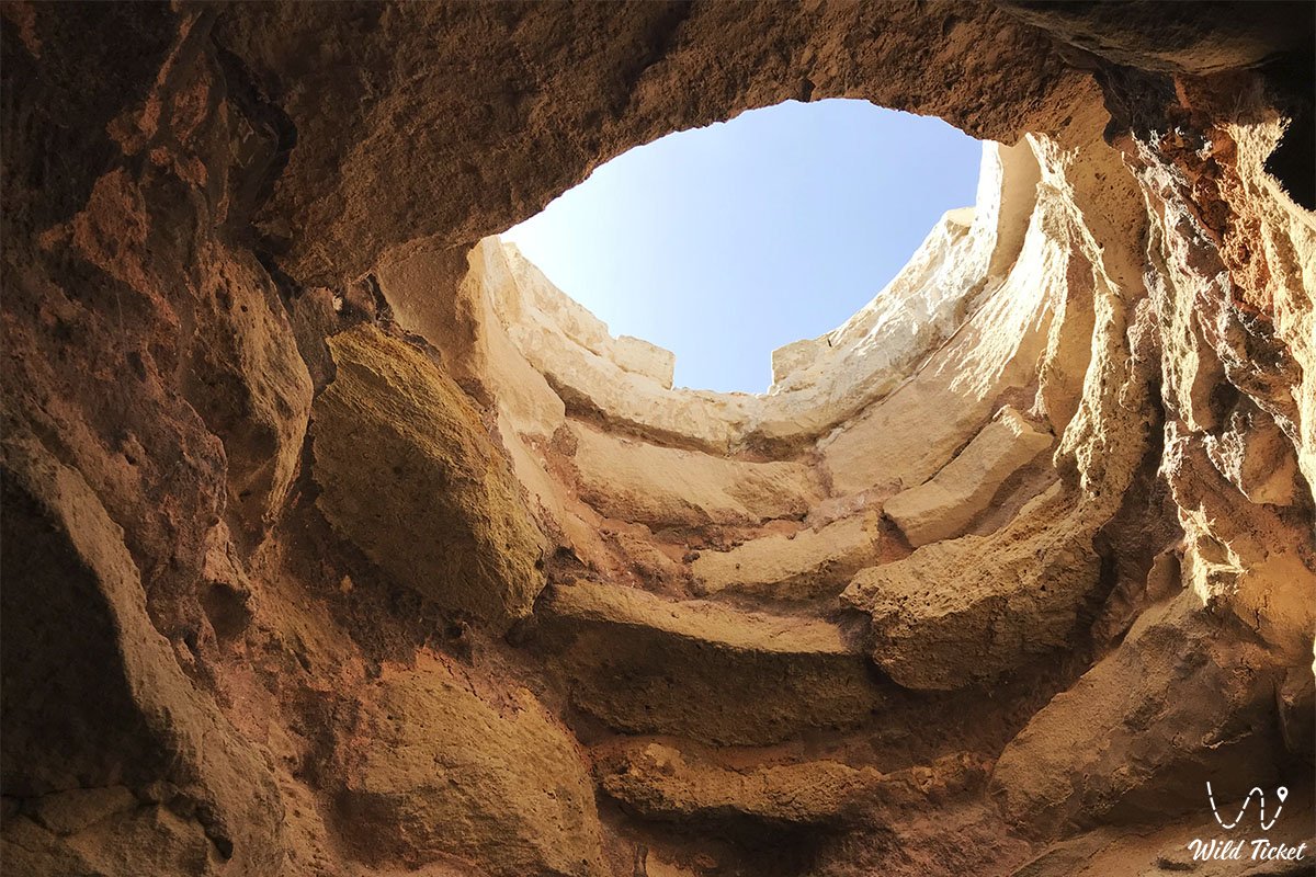
• Karaman-Ata Underground Mosque and Necropolis – an ancient Sufi sanctuary located deep within the peninsula. The mosque was hewn into the slope of a gentle knoll and served as a site where nomads took sacred oaths over the saint's tomb.
• Khanga-Baba Oasis and Khanga-Baba Necropolis – a picturesque tract in a Tupkaragan gorge featuring a grove of centuries-old elms, a mosque, an ancient cemetery of Turkmen and Kazakh clans, and a healing spring.
Flora and fauna
The ecosystem of Mangystau is distinguished by rich diversity and high endemism. Gray-soil wormwood, biyurgun, itsegek, Caspian saltwort, and black saxaul dominate the stony plains. Shrubs of kandym (Calligonum) and sand acacia stabilize sandy massifs. Relict oases with groves of black poplar, willow, mulberry, wild mint, and thickets of blackberry have formed in spring-fed canyon ravines (Tamshaly, Saura, Akmysh). In spring, the steppe is briefly carpeted with blooming poppies and wild tulips.
The wildlife includes dozens of species listed in the Red Book of Kazakhstan. The Ustyurt mountain sheep (mouflon) inhabits the sheer chinks of Ustyurt and the cliffs of Tupkaragan. Goitered gazelles, saiga antelopes, sand cats, Pallas's cats (manuls), caracals, honey badgers, marbled polecats, corsac foxes, and wolves roam the steppes and salt flats. Common reptiles include the steppe agama, toad-headed agama, sand boa, desert monitor, scorpions, and solifuges, while an isolated population of European pond turtles survives in the freshwater pools of Saura Canyon.
The avifauna numbers over 110 bird species. Golden eagles, saker falcons, steppe eagles, peregrine falcons, long-legged buzzards, Egyptian vultures, and eagle owls nest on the cliff chinks. Thousands-strong flocks of greater flamingos, pelicans, mute swans, and great egrets stop over on salt flats and lakes (Karakol, Kenderli sor). The endemic marine mammal – the Caspian seal – inhabits the waters of the Caspian Sea, while fish stocks include sturgeon species, mullet, pike perch, and Caspian roach.
Legends of Mangystau
An ancient Sufi legend concerning Khoja Ahmed Yasawi is tied to the sacred status of the region. Nearing the end of his earthly days in Turkestan, the great mentor gathered 360 (according to other accounts, 362) devoted disciples. The sheikh cast his sacred staff of wisdom toward Mangyshlak and bade his murids draw their bowstrings and shoot arrows through the upper ring of the yurt – the shanyrak.
Setting out in search of their teacher's blessing, Yasawi's followers crossed waterless steppes and reached the shores of the Caspian. Where the master's staff landed, a sacred tree took root in the parched earth, while the arrows struck the white limestone cliffs. The dervishes carved underground mosques into the rock, brought forth healing springs, and imparted teachings of virtue, compassion, and justice to the nomads. Ever since, the people of Mangyshlak hold faith that this land is protected by the spiritual power of holy patrons who safeguard every traveler of pure heart.
Conclusion
Mangystau in Kazakhstan is a rare synthesis of primeval tectonic power, the breath of the ancient Tethys Ocean, the maritime energy of the Caspian, and the profound spiritual memory of ancestors. A journey across the expanses of the peninsula provides an incomparable encounter with Martian landscapes, the silence of chalk chinks, and the majesty of ancient Kazakh soil.
Recommended sights of the region:
• Chalk Outliers "Fangs of Bozzhira";
• Kyzylkup Tract;
• Valley of Castles Airakty-Shomanay;
• Porous Canyon Kabyrga (Ybykty-Say);
• Mount Sherkala ("Lion's Fortress");
• Mount Bokty Table Mountain;
• Torysh Tract ("Valley of Spherical Concretions");
• Zhygylgan Sinkhole;
• Traces of Ancient Animals in the Zhygylgan Tract;
• Heart-Shaped Lake Kuzdykary;
• Tuzbair Salt Flat;
• Kokkala Tract;
• Karynzharyk Depression;
• Chalk Outliers "Three Brothers";
• Deepest Karagiye Depression;
• Canyons of Kapamsay, Tamshaly, and Saura;
• Lake Karakol;
• Kyzyl-Kala Settlement and Akmysh Oasis-Tract;
• Tyub-Karagan Bay, Bautino Village-Port, and Fort-Shevchenko;
• Tupkaragan Peninsula;
• Ustyurt State Nature Biosphere Reserve;
• Karagiye-Karakol Nature Sanctuary.
Shrines of Mangystau – underground mosques and pilgrimage sites:
• Otpantau Complex on Mount Otpantau;
• Kolbas Ishan Mosque;
• Koben Mosque;
• Zholaskan Mosque;
• Great Tulep Necropolis;
• Seydi Islam Ata Necropolis;
• Nurbergen Kalyshev Mausoleum;
• Zhaman Sauran Mosque;
• Ishan Khozha Mosque;
• Itolla Mosque;
• Akshora Mausoleum;
• Sonabay Underground Mosque;
• Masat-Ata Mosque;
• Uytoly-Ata Underground Mosque;
• Sanctuary of Bayte;
• Khanga Baba Necropolis;
• Sherkala Necropolis near Mount Sherkala.
Photogallery: