Tour to Boszhira panorama 4 days
Boszhira, a chalk valley, is located in the Mangistau region, the Mangistau peninsula. Panoramas of Boszhira is a local attraction, there is no tourist infrastructure, therefore, it is necessary to travel here with all the necessary equipment for spending the night in the field, in the wild, as well as cars for movement here you need to use only 4x4 jeeps.
- Distance of the route:
620 km
- Season time:
May – September all season
- Best time:
July - September
- Group size:
not more 12 person
- Days & nights:
4 days - 3 nights
Tour itinerary:
Aktau city – Panoramic platform on the Karagie depression – Zhanaozen city – Shopan Ata necropolis – sor Zhamanauliye (210 km).
We leave the city of Aktau along the paved road to the Karagie depression, which is the deepest dry depression in Kazakhstan, and is located thirty kilometers from Aktau. Our road through the depression will reach -119 meters below sea level. After fifty kilometers, we turn right onto a country road that will lead us to a place with a picturesque view of the Karagie Depression.
After reaching the place, we take pictures, walk, and then there is a simple descent to the radon spring, where you can swim. Then we drive back to the paved road that will lead us to the small town of Zhanaozen. We have a snack at a local cafe and go to the necropolis of Shopan Ata (75 km). This necropolis is the largest in the Mangystau region, and it also houses an underground mosque.
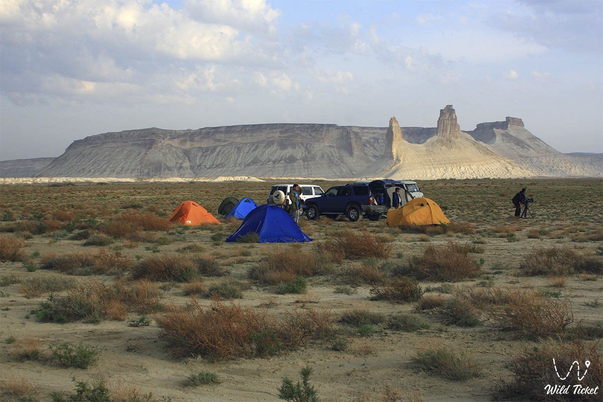
We reach the place and inspect the architecture, then we will have a traditional tea party with the pilgrims who regularly visit this place. After tea, we leave for the village of Zhamanauli, after reaching the place, we walk along the bottom of the salt lake, then we set up a tent camp, have dinner and relax.
Sor Zhamanauliye – Mount Bokty – Kamysty tract – Baysary colonnade – Bosjira tract (100 km).
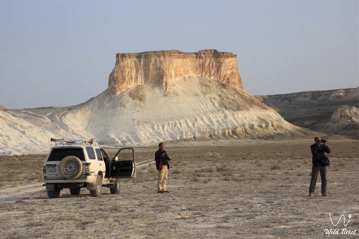
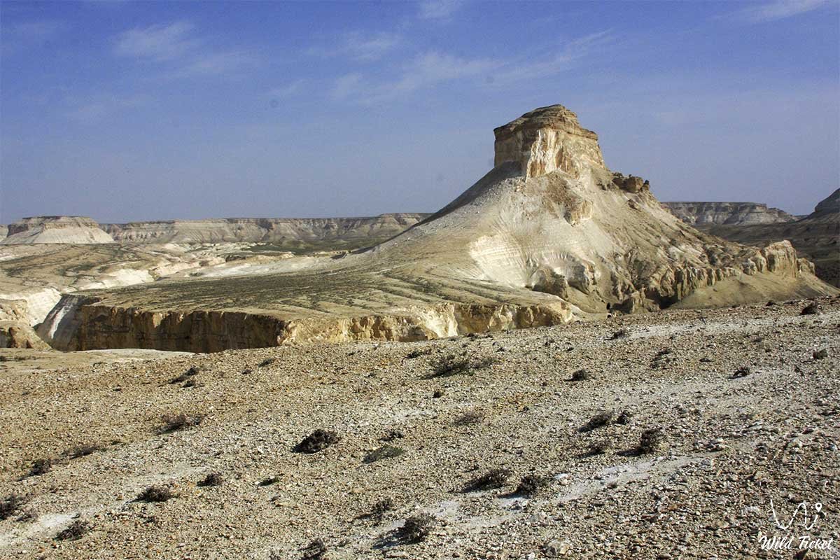
After breakfast, we pack up our camp and leave for the Bokty remnant mountain. If you approach it from the right angle, it will look like a pyramid.
After reaching the place, we walk in the nearby area and take pictures, we can try to find the remains of aquatic mammals. After Mount Bokty, our path will lie along the beautiful chalk ledge of Kamysty to the Baysary colonnade. We'll have lunch on the way. When we reach the colonnade in the ledge of the Baysary formation, we walk and take pictures.
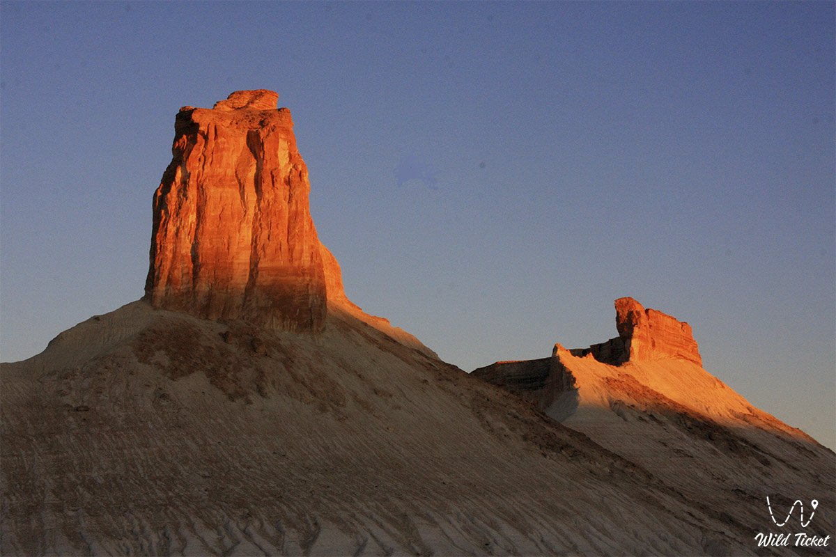
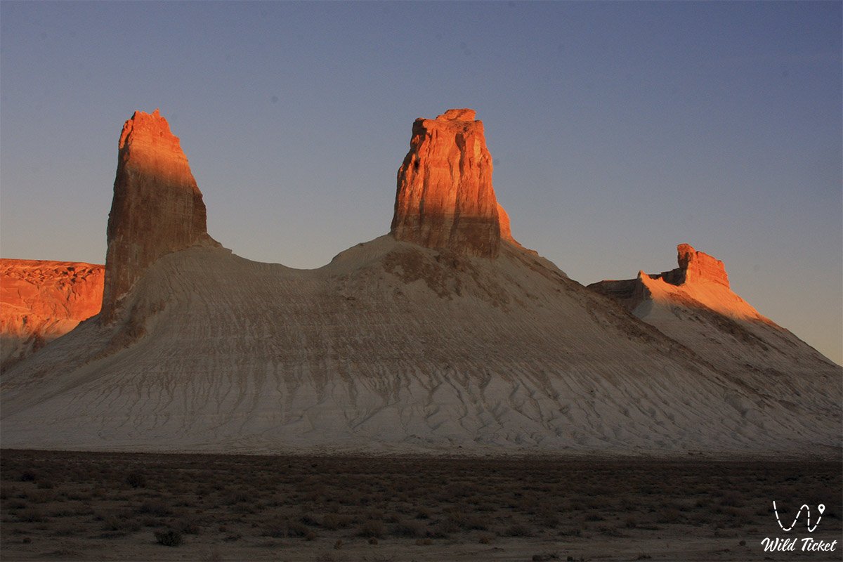
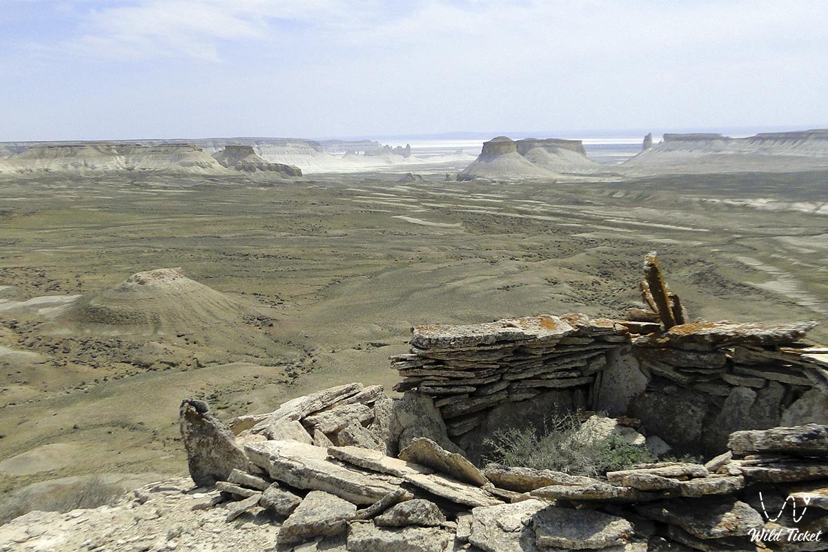
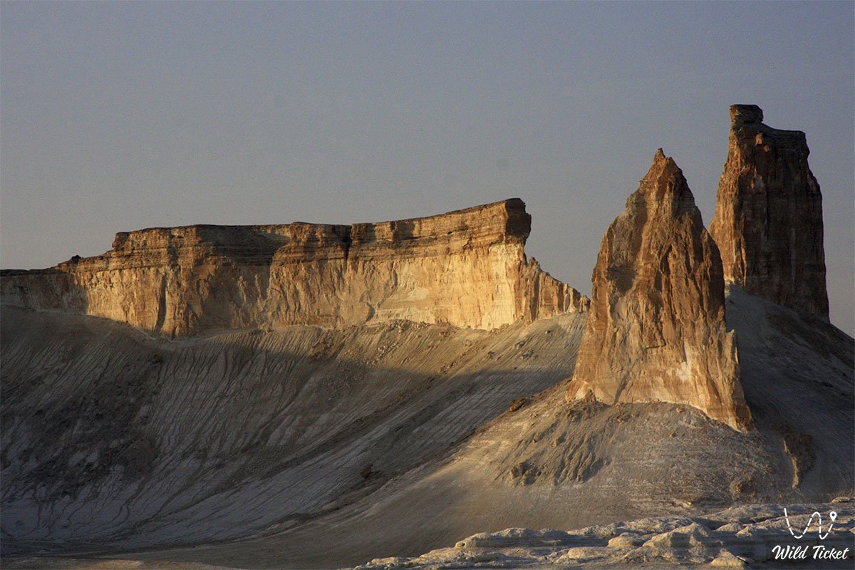
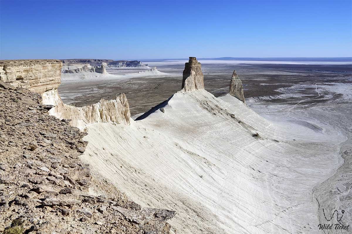
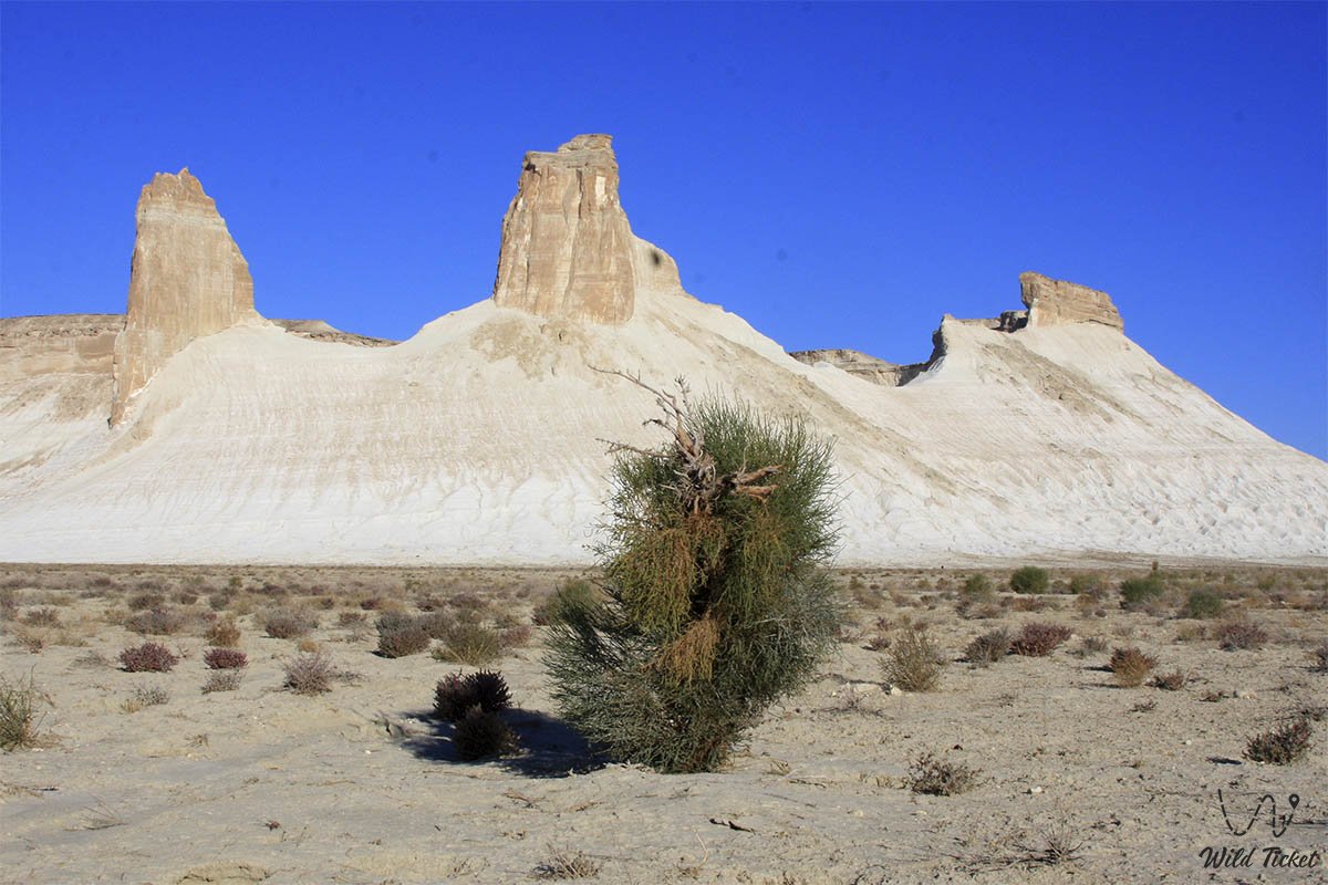
Next, we move to the Bosjira tract. This landscape is difficult to describe in words, in the depths of a huge canyon made of cretaceous plateau rocks, there are unusual-looking mountains, whose height reaches two hundred meters. We will have a car ride along the Ustyurt plateau, and we will also stop to take a walk and take photos among the bizarre landscapes and marine fossils. After finishing our walk, we set up a tent camp, have dinner and relax.
Bozzhira tract – Boszhira panoramas – Mount Nayzatau (60 km).
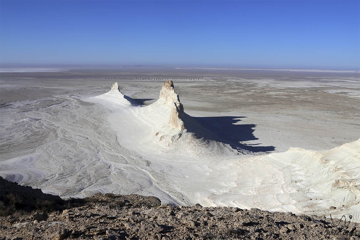
After a hearty breakfast, we will go for a walk to one of the observation decks, which offers a picturesque view of the canyon. The walk will be 6 kilometers, we will climb to an altitude of 270 meters above sea level. We take pictures and take a break from climbing.
After returning to the camp, we have lunch, pack up the camp and go to the panoramas of Bosjir. Our way will lie on the Ustyurt plateau through a rise called Zhusaly. There we will visit three points from which a picturesque panorama of Bosjira opens. We take photos and drive to Mount Nayzatau.
After reaching the mountain, we will be able to explore the arans – pens for wild animals, which were built by hunters in ancient times. We set up a tent camp, have dinner and relax.
Mount Nayzatau – panoramas of Kyzylkup – necropolis of Shopan Ata – Zhanaozen city – Aktau city (250 km).
After breakfast, we will go for a walk in the field of large spherical nodules, which will include a simple ascent to the ledge of a plateau 270 meters above sea level. We take pictures there, maybe we'll be lucky to see mountain sheep.
We have lunch and return to the camp. Having assembled the camp, we leave for the Kyzylkup observation deck. This is a blurred chalk layer containing a layer of red chalk. Taking pictures. Now our way lies back to Aktau, passing by the city of Zhanaozen on the way.
Aktau city – Zhana-Ozen city – 150 km
Zhanaozen city – Shopan Ata necropolis – 85 km
Shopan ata – sor Zhamanauli Necropolis – 15 km
Sor Zhaman-auliye – Mount Bokty – 30 km
Mount Bokty – Bozzhira tract – 70 km
Bozzhira – Naizatau – 60 km
Mount Nayzatau – Kyzylkup – 25 km
Kyzylkup panorama – Shopan Ata necropolis – 50 km
Necropolis of Shopan Ata – Aktau – 235 km
Crossings by Toyota and Nissan Patrol jeeps. UAZ vehicles, used for transportation of luggage, equipment and cargo. The route is classified as extreme (high heat, chalk dust) with full autonomous living in the desert field conditions.
The optimal number of tourists for the tour is no more than 12 people.
Two days of travel and all overnight stays take place in waterless places, water consumption is calculated at the rate of 5 liters of water per day per person, taking into account the sanitary use of water.
Outdoor toilets.
The tourist's personal equipment includes a sleeping bag, a sleeping mat, and a flashlight. Recommended clothing and shoes: hard-soled sneakers, mountain boots, cap or panama hat, sunglasses.
Accommodation in tents - 2 people each.
Shoes: hard-soled sneakers, mountain boots, cap or panama hat, sunglasses.
In the springs, the water is used for cooking and technical needs.
Photogallery: