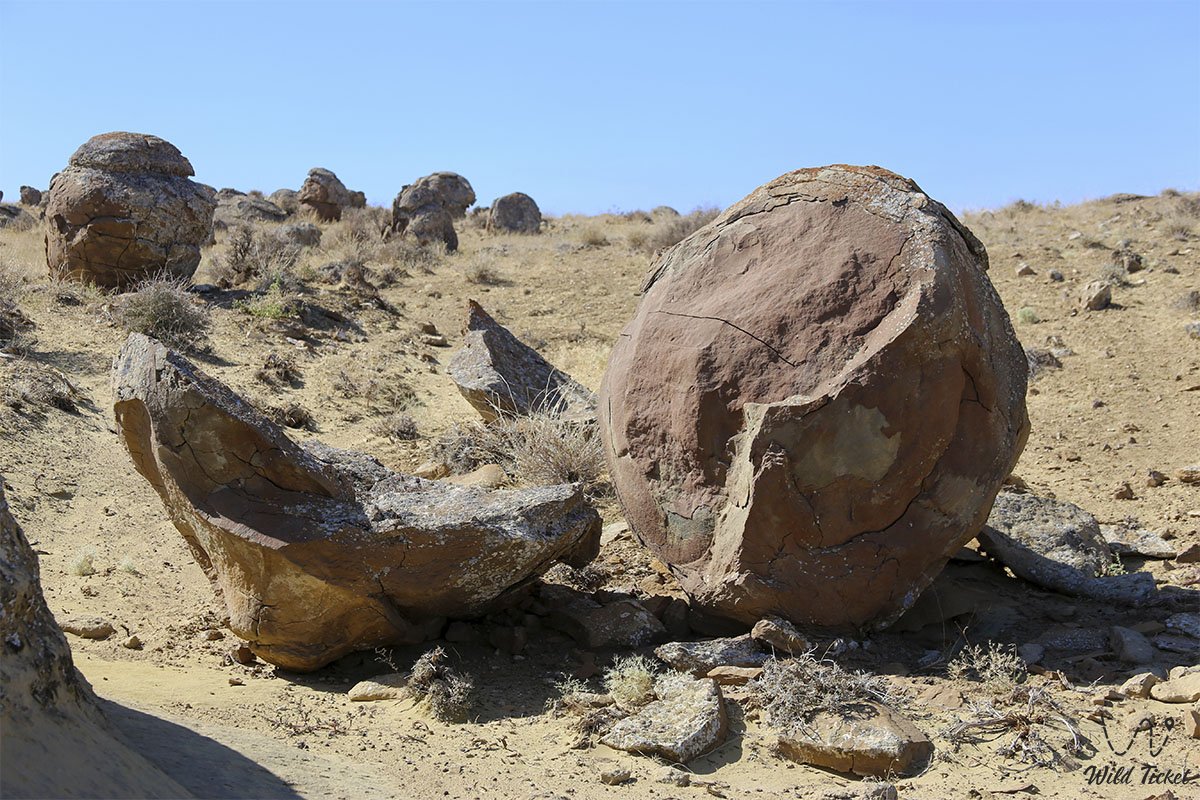
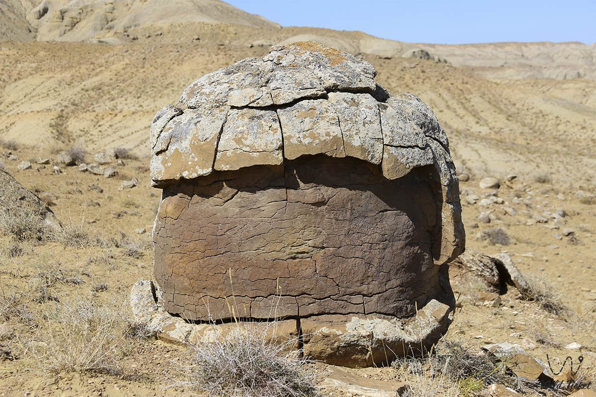
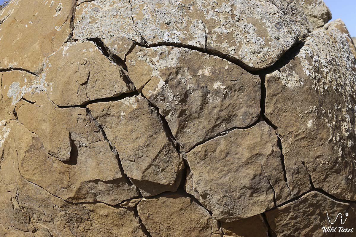
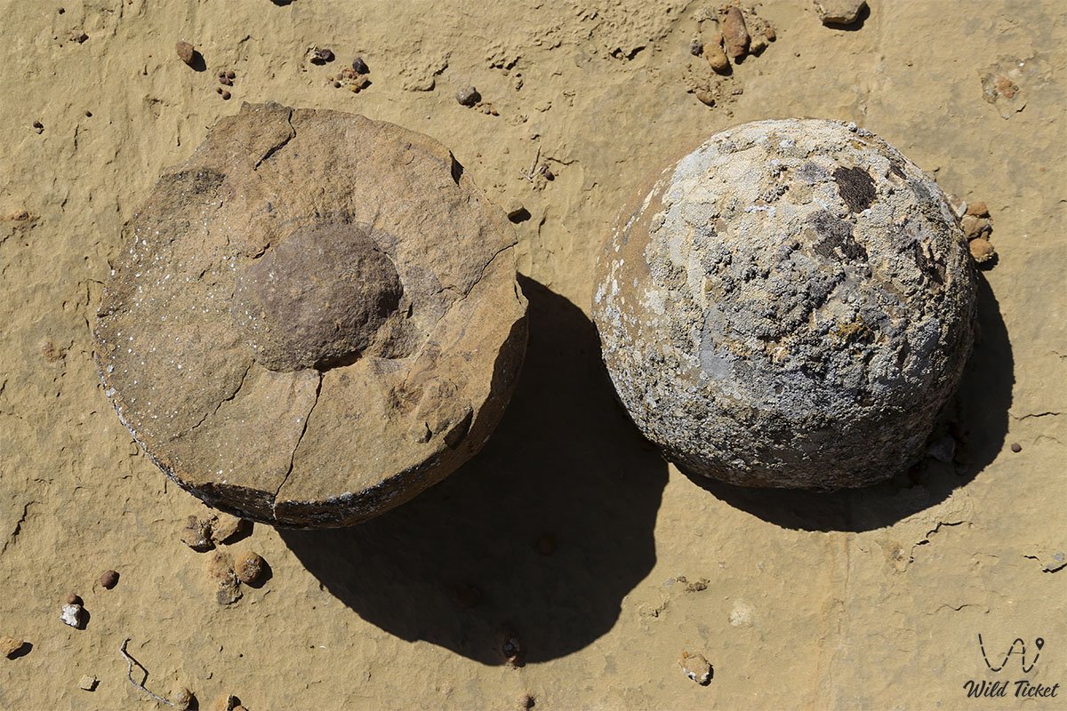
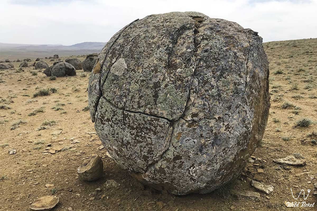
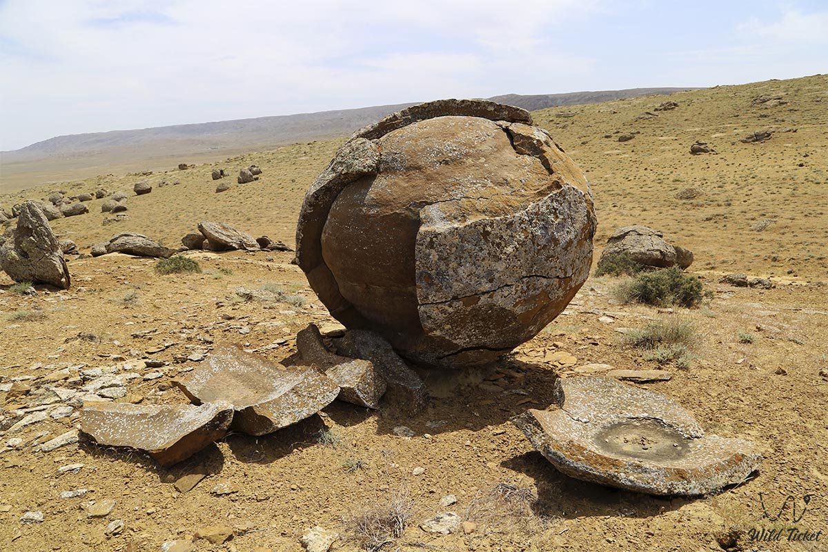
Tour to Torysh-Tuzbair and exploration of stone concretions
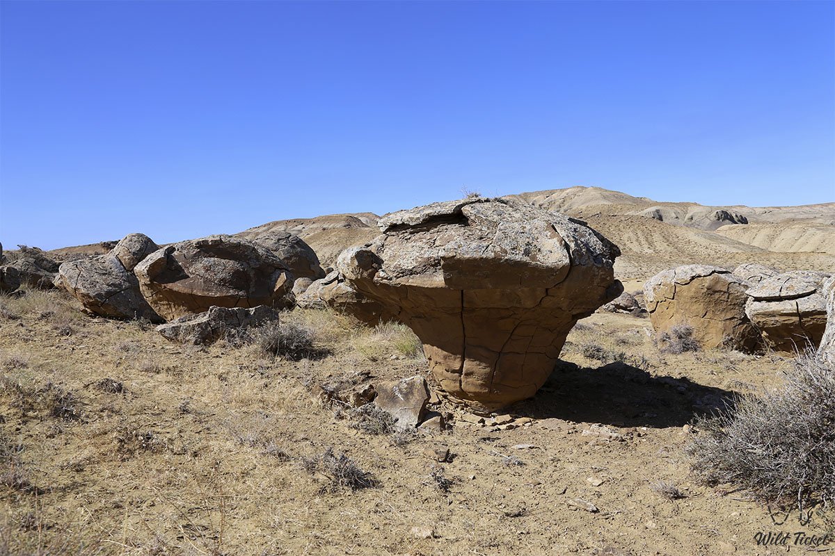
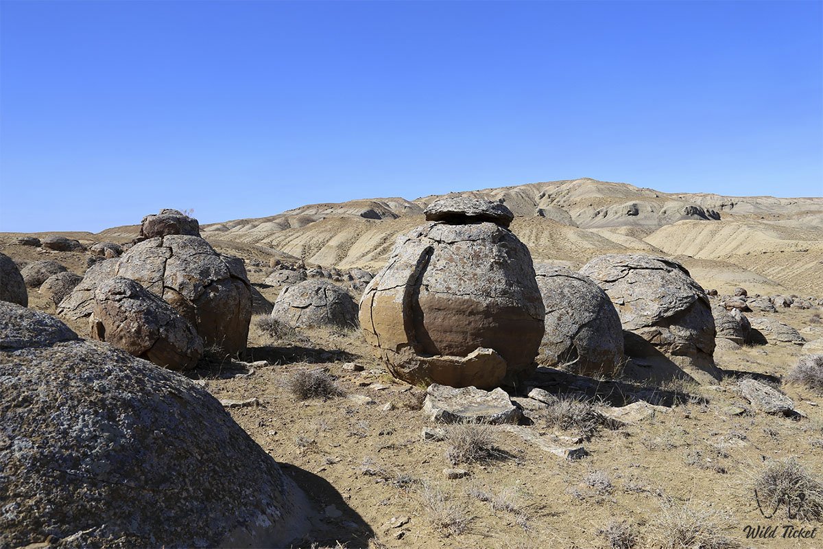
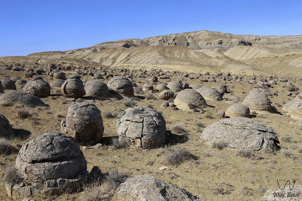
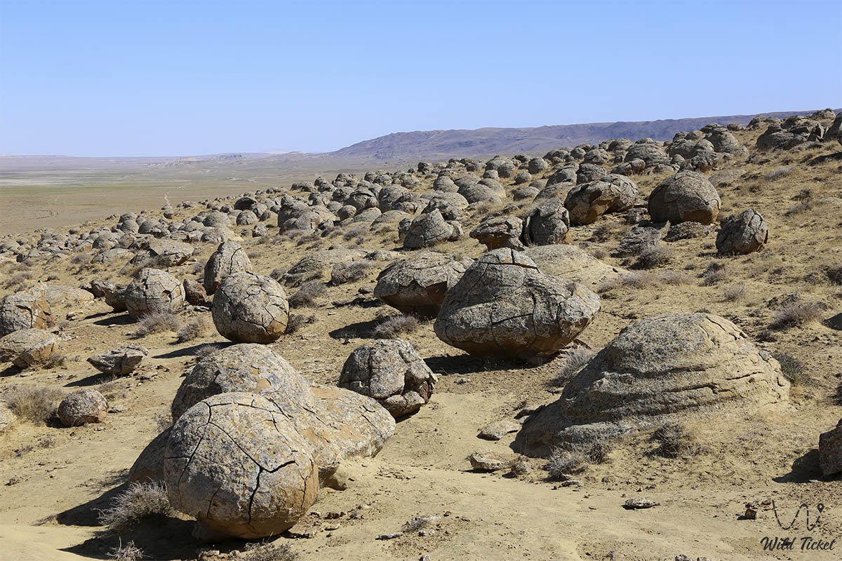
According to one of the legends, the Valley of Balls is a war that came to Mangystau to conquer this territory and defeat the local population. According to legend, the wars did not succeed in doing this, the local residents had friends, local gods who guarded these places. When the enemy came, the gods bestowed strength on the local inhabitants of the nomads, and the nomads, together with the gods, turned the enemies into round stones that are strewn with the Tuzbair plateau. So the enemy was defeated, and the locals continued to live in peace and tranquility.
- Distance of the route:
840 km
- Season time:
May – September all season
- Best time:
July - September
- Group size:
not more 12 person
- Days & nights:
5 days - 4 nights
Tour itinerary:
Aktau city – Shakpakty Canyon – Shakpak ata underground mosque – Kapamsai Canyon – Torysh spherical nodule field (160 km).
We are leaving the city of Aktau. Our first stop will be 27 kilometers from Aktau, we will visit the Turkmen-Kazakh necropolis. After that, we will go to photograph the beautiful panoramas of Shaklakty Canyon. Next, we go to the underground mosque of the fourteenth century, called Shakpak Ata. We'll reach it in twenty kilometers.
After visiting the mosque, we will go to the Kalmasai chalk canyon. Upon arrival, we stroll through the canyon and take photos. Then we will take the road to the spherical stone field, on the way to it we will have lunch, as well as take a panorama of the Kalamsai Canyon. When we reach the Torysh tract, we set up a tent camp. After setting up the camp, we walk around the nearby area of the field of spherical nodules, taking pictures. We return to the camp, have dinner and relax.
Torysh tract – multicolored clays of the Jurassic era Kokala – Mount Sherkala – Zhylshy Cretaceous gorge (60 km).
After breakfast, we break up our camp and go for a walk through a field of spherical stones, no more than two kilometers. We photograph the nodules and drive to the Kokala tract. In this area, clay is full of its variety of colors. The route to Kokala will be thirty kilometers.
When we reach the place, we take pictures, relax by the spring. After lunch, we will go to the ostancevaya mountain of Sherkala. This is a lonely mountain with an interesting shape, which resembles a very large white yurt, and on the other side of the Rock it looks like a sleeping lion that has put its huge head on its front paws.
After reaching the mountain, we will walk around the nearby area. After a walk, we go to the chalk gorge of Zhylshy, which is located 15 kilometers away. Upon arrival, we stroll through the gorge and take photos. After returning from a walk, we set up a tent camp, have dinner and relax.
Zhylshy gorge – Airakty mountain valley-Shomanai – Shetpe village – Aktau city – Karashymrau tract (200 km).
After breakfast, we pack a camp and drive to the valley of the Airakty-Shomanai mountains. When we reach the valley, we walk and take pictures.
We will climb the mountain, which offers a beautiful and picturesque view of the valley next door. Climbing and descending will not require any special training from you. We take pictures and move into an oasis called Akmysh. We will also take a walk through the excavations of the ancient settlement of Kyzylkala. We'll have lunch on the way.
Next, we will find a road through the village of Shetpe, in a gorge in which there is a small lake with fresh water. When we get to the lake, we set up a tent camp, after which we go swimming in the lake. We have dinner and relax.
Karashymrau tract – Tuzbair – sor Tuzbair panoramas (160 km).
After breakfast, we pack up the camp and head to the first observation deck at Tuzbair Mountain. Photographing the Western chink of the Ustyurt plateau. Next, we will have a second observation deck, after which we will climb the Manat on the Ustyurt plateau. We are taking pictures, and we will also be able to explore the aran pens for wild animals, which were built by hunters in ancient times.
We have lunch on the way along the Ustyurt plateau, and descend through the Syndy area to the Tuzbair mountain, a majestic creation of the natural elements. At this point, the chink (cliff) of the Ustyurt plateau ends abruptly with a cascade of clay-limestone steps, at the base of which lies an extensive salt marsh, called a litter in these parts.
After reaching the bottom of the lake, we set up a tent camp. After setting up the camp, you will enjoy free walks in the surrounding area. After returning from a walk, we have dinner and relax.
Sor Tuzbair – Shetpe village – Aktau city (270 km).
After breakfast, we go for a walk through the litter, which is covered with a small layer of water. It will be possible to take pictures in mirror images. Upon returning to the camp, we have lunch, pack up the camp and leave for Aktau, passing the village of Shetpe on the way. Part of the road will be a country road, the other part will be paved, with a total length of 270 kilometers.
Aktau city – Shetpe village – 155 km
Aktau city - Shakpak Ata Underground Mosque – 120 km
Shakpak Ata Underground Mosque – Torysh tract - 63 km
Torysh tract – Mount Sherkala – 45 km
Mount Sherkala – Shetpe village – 20 km
Shetpe village – Manat rise – 100 km
Sor Tuzbair – Shetpe village - 135 km
Crossings by Toyota and Nissan Patrol jeeps. UAZ vehicles, used to transport luggage, equipment, and cargo. The route is classified as extreme (high heat, chalk dust) with full autonomous living in the desert field conditions.
The optimal number of tourists for the tour is no more than 12 people.
Two days of travel and all overnight stays take place in waterless places, water consumption is calculated at the rate of 5 liters of water per day per person, taking into account the sanitary use of water. Outdoor toilet.
The tourist's personal equipment includes a sleeping bag, a sleeping mat, and a flashlight. Recommended clothing and shoes: hard-soled sneakers, mountain boots, cap or panama hat, sunglasses.
Accommodation in tents - 2 people each.
Shoes: hard-soled sneakers, mountain boots, cap or panama hat, sunglasses.
In the springs, the water is used for cooking and technical needs.
Photogallery: