Tour from Kazakhstan to Kyrgyzstan and on to China
We invite you to visit three countries: Kazakhstan, Kyrgyzstan, and China. This multi-day tour covers three countries. This tour can be combined, for example, by adding days or visiting only Kazakhstan and Kyrgyzstan. During this tour, we will visit the most famous natural and architectural landmarks of both countries.
This tour is primarily a promotional one, so organizing it will take time. Therefore, applications must be submitted at least a week in advance. This tour can be traveled in all directions, from China to Kazakhstan and then on to Kyrgyzstan, as well as in the opposite direction. It is also possible to arrive in Kazakhstan and then on to China, depending on the traveler's pre-planned itinerary.
- Distance of the route:
2 183 km
- Season time:
May – September all season
- Best time:
July - September
- Group size:
not more 12 person
- Days & nights:
14 days - 13 nights
Tour itinerary:
In the evening upon arrival, we will meet at the airport. Transfer to the hotel, check in, have dinner and relax.
After we have breakfast, we will have a guided tour that starts at nine in the morning. First of all, we will visit the "Green Bazaar", where you can feel the atmosphere of the east and enjoy the aromas of various spices. Next, we will go to the Rakhat confectionery factory, the best in Kazakhstan. As you approach the factory, you will already feel the delicious aroma of chocolate.
After visiting the Rahat brand store, we will walk to the 28 Panfilovtsev Park, where we will visit the eternal flame and the memorial of Glory, on which the words are carved: "Russia is great, but there is nowhere to retreat, Moscow is behind!" Also, we will visit the cathedral and the museum of musical instruments located in the same park.
Then we will have an excursion to the National Historical Museum, which houses the "golden" room of the Sakas. This museum contains the gold found during the excavations of the Golden Man in the Issyk mounds.
After lunch at the national cuisine restaurant, we drive to the Kok-Tobe cable car station, located on Dostyk Avenue near the Palace of the Republic. We take the funicular up to the top of Kok-Tobe Mountain (1130 m), the ascent takes 5 minutes (1.7 km). On the mountain we visit the mini zoo, where you can see birds of prey, pheasants and peacocks, as well as deer and llamas, then walk to the monument dedicated to the band "The Beatles", after that we will go to the souvenir shop and art gallery.
After walking along Kok-Tobe Mountain, we go down to the bus station and drive to the Medeu tract, the road takes 30 minutes and is 20 km long. We take a 15-minute cable car ride from Medeo to the Cimbulac Ski Resort. The length of the lift is 4.6 km, which makes this the third cable car in the world.
During the funicular ride, you can enjoy a beautiful view of the mountains of the Northern Tien Shan, as well as mountain peaks such as Shkolnik Peak - 3800 m, Amangeldy peak — 4000 m, Abai Peak — 4010 m, Nursultan Peak (formerly Komsomol Peak) — 4376 m. Annual ascents are held at Nursultan Peak as part of the mountaineering Olympiad. And if you look down, you can see the Medeo, the world's largest alpine winter sports complex, located at an altitude of 1,691 meters above sea level.
Arriving at the resort of Cimbulak, we will walk to the observation deck with a beautiful view of the mountains, and then switch to the third cable car (it consists of two parts, with a total length of 3.2 km, the ascent takes 30 minutes), and climb to the Talgar pass (3200 m). After reaching the pass, we walk along its slopes and enjoy the panorama of the city of Almaty, the mountains of the Trans-Ili Alatau and the Malo-Almaty gorge. Then we will have a picnic with champagne. After an active holiday, we return to the city. After dinner at the national cuisine restaurant, we return to the hotel for a rest.
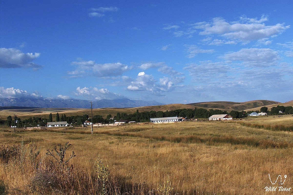
Almaty city – Altyn-Emel National Park (290 km).
After breakfast and departure from Almaty, we set off along the Ili highway, which was first started in 1855, to the Altyn-Emel National Park. On the way to it, we will drive along the dam on the Ili River, past the Kapchagai reservoir, after which our road will lie in the south-eastern direction, along the Ili river on the right side.
After passing through the village of Chengeldy, we reach the border of the national park. After passing through the nuances of admission to the park, we leave for the Terekty gorge, where the Tanbalytas petroglyphs are located. When we reach the gorge, we walk, inspect the rock carvings, which are images of wild animals and the process of hunting them.
The next stop is waiting for us in the Kyzylauys tract. After eighteen kilometers, we reach the place and have lunch in a beautiful gorge. Next, we will have a trip to the Beshatyr mounds. Upon reaching the place, we will climb the main of the mounds, the Beshatyr, which offers a picturesque view of the Ili River and a number of mounds stretching towards the river. We look around and take pictures.
After descending from the mound, we head to the Singing Dune, which is located 43 kilometers away. When we get to the dune, we walk around the nearby area, then climb the dune itself, take pictures. On the way back, we will visit the Shokan Valikhanov spring. After visiting the spring, we will go to the stone steles of Oshakatas.
After eight kilometers, when we reach the stone steles, we walk and take pictures. As is known from the legend, Genghis Khan stayed here with his army. From Oshaktas, we drive to the Mynbulak cordon, where we will visit a pond inhabited by several species of fish. We walk, take pictures against the background of ancient willows by the pond. Next, our way lies to the village of Basshi. After 37 kilometers, having reached the village, we check into a hotel, have dinner and relax.
Basshi village – Aktau mountains (153 km).
After we have breakfast, we will go to the Aktau mountains. Along the way, we will pass through two villages called Nurum and Aktobe. The 71-kilometer-long road will run along the slopes of the Katu-Tau and Aktau mountains. After reaching the colored mountains of Aktau, we walk along the gorge.
After the walk, we will go to the Katu-Tau rock massif. After 26 kilometers, we reach the place, stroll through the nearby rocky terrain and have lunch. After visiting the Katu-Tau massif, we go to the Kosbastau cordon. The highlight of this cordon is that there is a 700-year-old willow tree. Upon arrival, we take a walk, inspect the ancient willows and return to the village of Basshi. We have dinner and rest at the hotel.
Basshi village – Charyn Canyon (342 km).
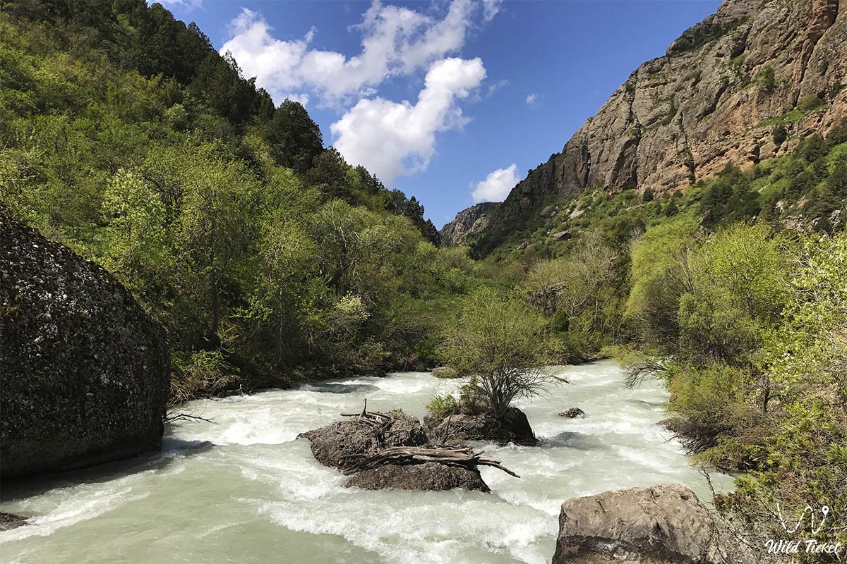
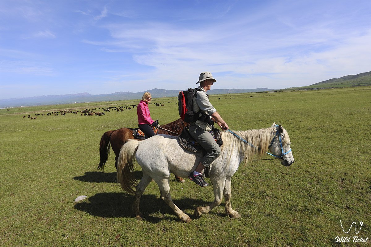
Having had breakfast early in the morning, we leave for the Chilik River, along which we will raft to the village of Malybai. On the way to the river, we will pass several villages, such as Koktal, Chunja, Kokpek. Before we get there, we will travel through the tunnel of the Bartogai dam, built in 1985. After 266 kilometers, having reached the Chilik River, we are preparing for rafting.
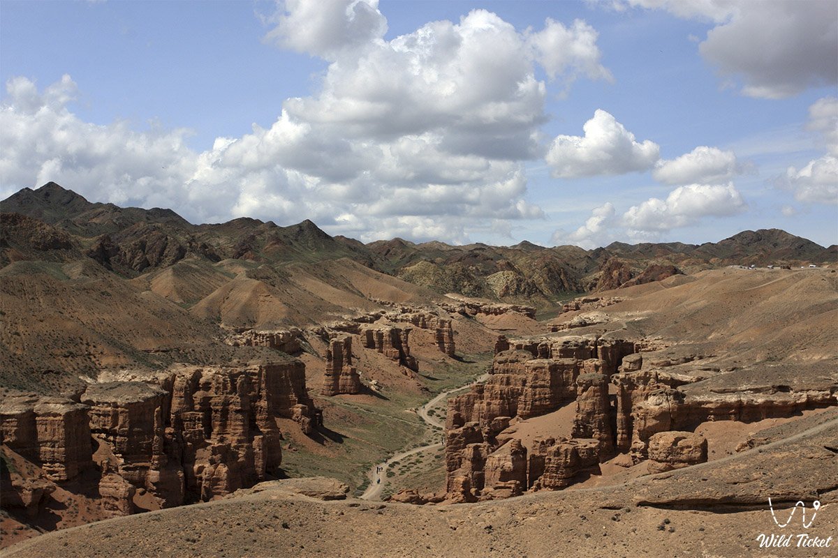
Rafting on the Chilik River will be 12 kilometers long and will take an hour of our time. After finishing our rafting trip in the Malybai area, we have lunch. After lunch, we leave for Charyn Canyon, 52 kilometers away. When we reach the place, we go down the slope and stroll along the canyon to the Charyn River, taking pictures of the bizarre shapes.
The rich variety of landscapes of the Charyn Canyon logically implies an extensive number of different flora and fauna. More than one and a half thousand plant species grow in the canyon, seventeen of them are listed in the Red Book of Kazakhstan.
After finishing our walk, we will go to the panoramic platform above the Charyn River, where we will set up a tent camp. We will also have a Scythian sauna, after which we will have dinner and relax in the camp.
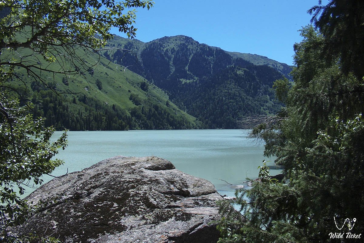
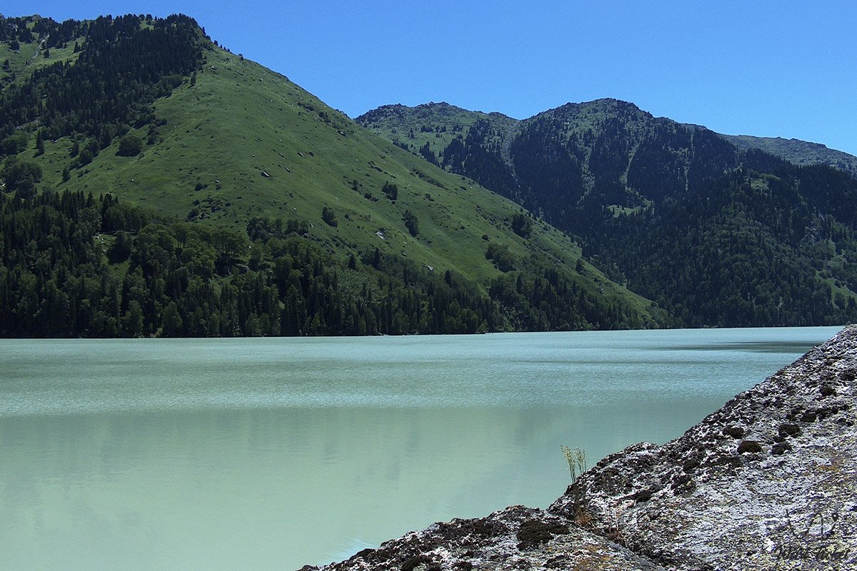
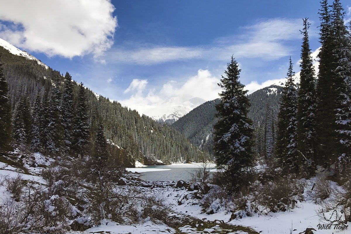
Charyn River – Kaindy Lake – Kolsai Lake (the first) (133 km).
After we have breakfast, we walk around the neighborhood and take pictures. Returning to the camp, we will find our way to Kaindy Lake through the village of Zhalanash. After 97 kilometers we reach the lake, we walk along the coast and have lunch.
After finishing lunch, we drive to the first Kolsai lake, passing the village of Saty. After 26 kilometers of travel, we reach the lake, and we stay in a guest house on the lake shore. We walk along the coast, after which we return for dinner and rest.
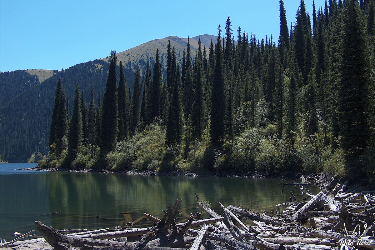
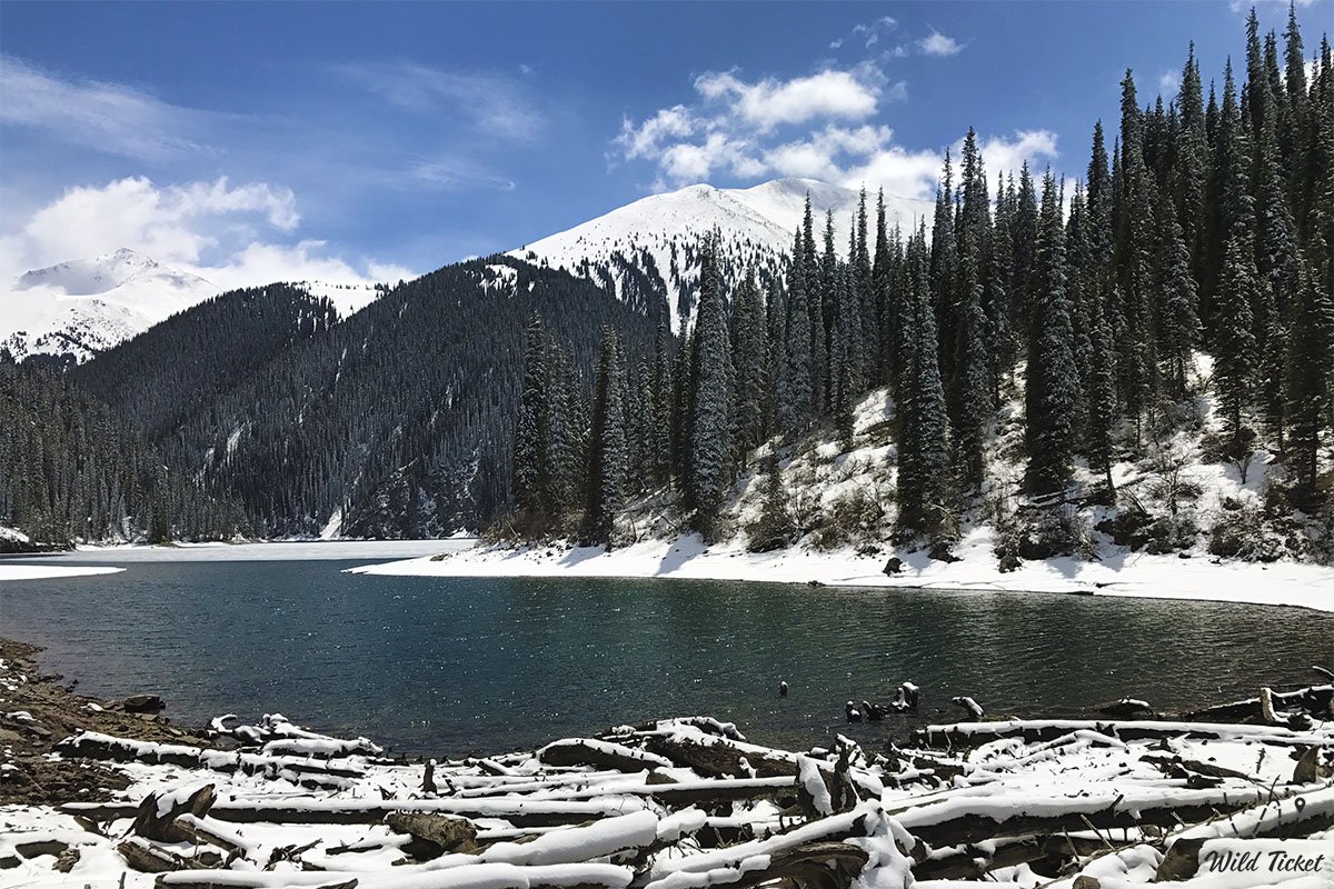
Lake Kolsai (first) – Lake Kolsai (second) (18 km).
After breakfast, we will go to the second Kolsai lake, which is located at an altitude of 2252 meters above sea level. The second Kolsai lake is located 9 kilometers from the first. The trail will run along the left shore of the lake, from it we will have beautiful and picturesque views of the Kolsai lakes and nearby mountains.
The depth of the first Kolsai lake reaches 80 meters, which allows the king trout to live there. After lunch at the second Kolsai lake, we go down to the first, to the guest house. We have dinner and relax.
Kolsai Lake – Kegen village – Kegen checkpoint – Karakol city (289 km).
After we have breakfast, we will pass the village of Kegen and go to the checkpoint "Kegen" – this is the Kazakh-Kyrgyz border. When we get to the checkpoint, we will pass through border control between Kazakhstan and Kyrgyzstan. From the checkpoint, our way lies to the San Tash pass. The road will last 21 kilometers, upon arrival at the pass, we will walk in the nearby area of the stone mountain San Tash, where we will also visit a memorial sign dedicated to Shokan Valikhanov.
After that, we pass the village of Tyup and head to Lake Issyk-Kul for an excursion to the Przhevalsky Museum. The museum is located 12 km north of the city of Karakol, and we will visit the grave of Nikolai Przhevalsky, a monument, and a museum dedicated to the great traveler of the 19th Century. After completing the tour, we leave for Karakol. When we get to the city, we check into a hotel, have dinner and relax.
Karakol city – Jety-Oguz gorge – Tamga village (175 km).
After finishing breakfast, we will visit the Holy Trinity Orthodox Church, the Dungan mosque and the local bazaar. After that, we will find a road to the Jety-Oguz gorge, in the "Sem Bulls" tract. There we will rise to an altitude of 2200 meters above sea level. After reaching the place after 36 kilometers, we will walk to the observation deck with a magnificent view of the Seven Bulls tract.
Our one-kilometer walk will last no more than one hour. Next, we will take a walk to the Jety-Oguz River and the Broken Heart rock. From the "Seven Bulls" tract, we will head to the Kok-Zhaiyk tract. We walk around the nearby area, take photos and have lunch in the yurt. After lunch, we leave the Kok-Zhaiyk tract and head to the canyon called Skazka. After 114 kilometers, we reach the gorge, where an hour and a half walk awaits us.
Due to the soft sandy rocks, the surface of the mountains is very pliable, and therefore minor changes in weather and wind can change the appearance of this gorge. We walk, take pictures of bizarre shapes. After finishing our walk through the gorge, we go to the village of Tamga, 17 kilometers away from us. After reaching the place, we check into a guest house, have dinner and relax.
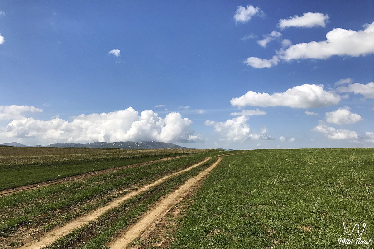
Tamga village – Song-Kul Lake (329 km).
After breakfast, we drive to Song Kul Lake. Our route will lie along the southern shore of Lake Issyk-Kul, thanks to this, we will be able to see the entire southern part of the lake with a length of more than 200 kilometers. After passing Issyk-Kul Lake, we will reach the Orto-Tokoy reservoir. Then we will head to the village of Kochkor, where we will visit a craft workshop and a museum of applied arts.
From the village, our path will continue to the pass with a height of 3446 meters above sea level, which is called Kalmak-Ashuu. After the pass, after 130 kilometers, we reach Song-Kul Lake, which is located at an altitude of 3106 meters above sea level. We stay in the yurts, have dinner and relax.
Song Kul Lake – Tash Rabat caravanserai (174 km).
After finishing breakfast, we will go to the Moldo-Ashuu pass, which is located 22 kilometers away. Our way will be along a mountain road, from which we will observe beautiful and picturesque views of the passes and mountain valleys of the mountains of Kyrgyzstan. We will make a stop at the yurts of Kyrgyz shepherds, who will treat us to their national drinks.
After reaching the pass, we stroll through the surrounding area, take photos and enjoy the view of the Jacket Gorge. After descending from the pass, we will visit two mausoleums Atantai-Batyr and Tailyuk-Batyr. Let's take a walk and take photos. Next, we go to the Tash-Rabat caravanserai through the village of Baetovo.
After 121 kilometers, we reach Tash Rabat, visit a caravanserai and stroll in the surrounding area. After finishing the walk, we will find the road to the beginning of the gorge, where there is a yurt camp, which offers a magnificent view of the ridge, about three thousand meters high. When we get to the camp, we settle down, have dinner and relax.
Tash-Rabat tract – Torugart checkpoint – Kashgar city (280 km).
After having breakfast early in the morning, we will go to the Torugart checkpoint. Our road will pass through two passes Ak-Bayit, with a height of 3281 meters and Tyuz-Belle, with a height of 3574 meters above sea level. Next, we take the Bishkek –Torugart highway, along which we reach the checkpoint. We are going through the customs and border formalities of the Kyrgyz border.
Next, we reach the Chinese checkpoint. We are meeting with our Chinese colleagues there, and we are going to the city of Kashgar. After 170 kilometers, we are in the city. We check into the hotel, after which we will have a city tour. We return to the hotel, have dinner and relax.
After breakfast, we will first visit the old town. Then we will go to the Buddhist monument, located thirty kilometers from the city. After that, we will go to the city of Turfan. We check into the hotel, have dinner and relax.
After finishing breakfast, we will go on a tour of the city of Turfan. After the tour, the road to Urumqi awaits us. Upon arrival, we check into the hotel, have dinner and relax.
After we finish breakfast, we will have a final tour of the city of Urumqi.
The length of the rafting is 12 km.
Difficulty category – III with elements of difficulty category IV - when water is discharged through locks from the Bartogai reservoir, 60-80 cubic meters of water per second.
Difficulty category IV with elements of difficulty category V - when water is discharged through locks from the Bartogai reservoir, 100 – 120 cubic meters of water per second.
The slope of the river is 7-8 m per 1 km. Within 30-35 minutes after the start of the rafting, the river is relatively calm, with periodic shivers and powerful waves.
Threshold No. 1 consists of swells of more than 1 meter with a sharp turn of the river to the right and pressing against the right-bank rock, then the river smoothly levels out. There are two powerful drains and one barrel in the threshold, it is very important to enter the threshold correctly.
There are 2-3 pouring stones in the riverbed to the left of the main stream. Threshold No. 1 with a characteristic water slope of up to 3 meters by 30 meters. The rapid begins 40-50 minutes after the start of the rafting, the length of the rapid is more than 100 meters, after the rapid No. 1 the river is a continuous shiver with powerful shafts more than 1 meter high. The signs of the threshold are the slope of the water with a sharp turn of the river to the right.
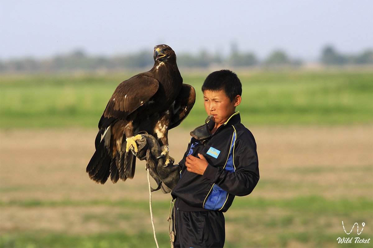
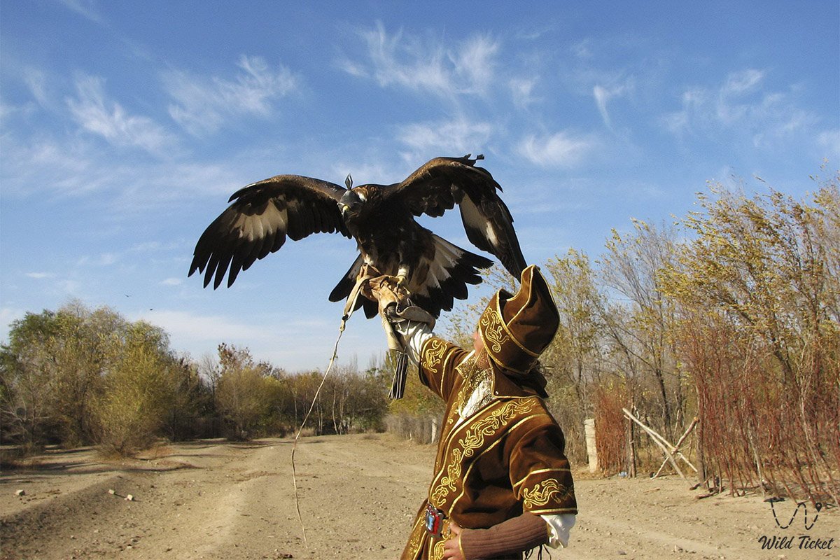
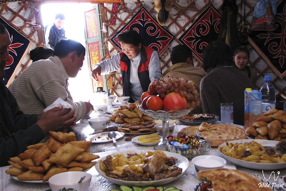
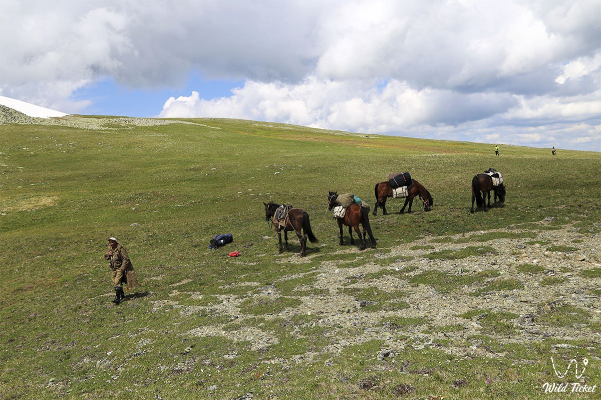
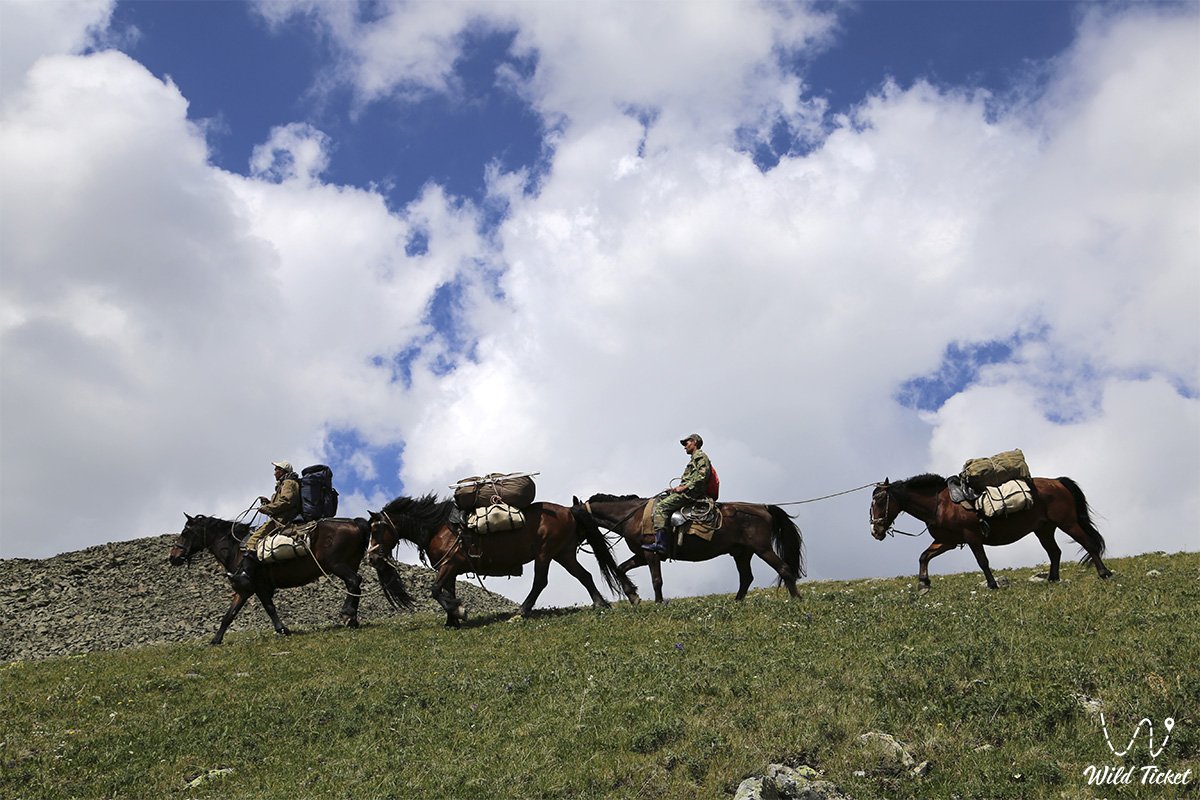
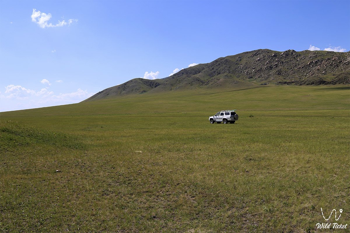
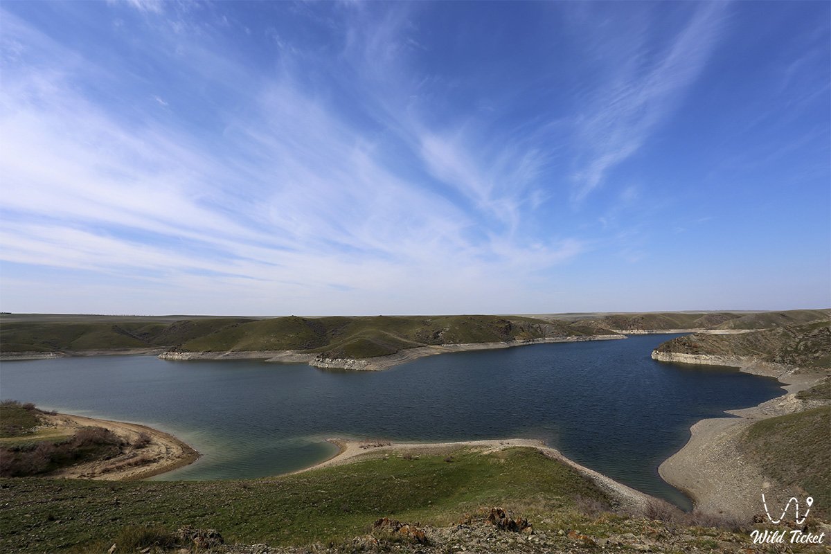
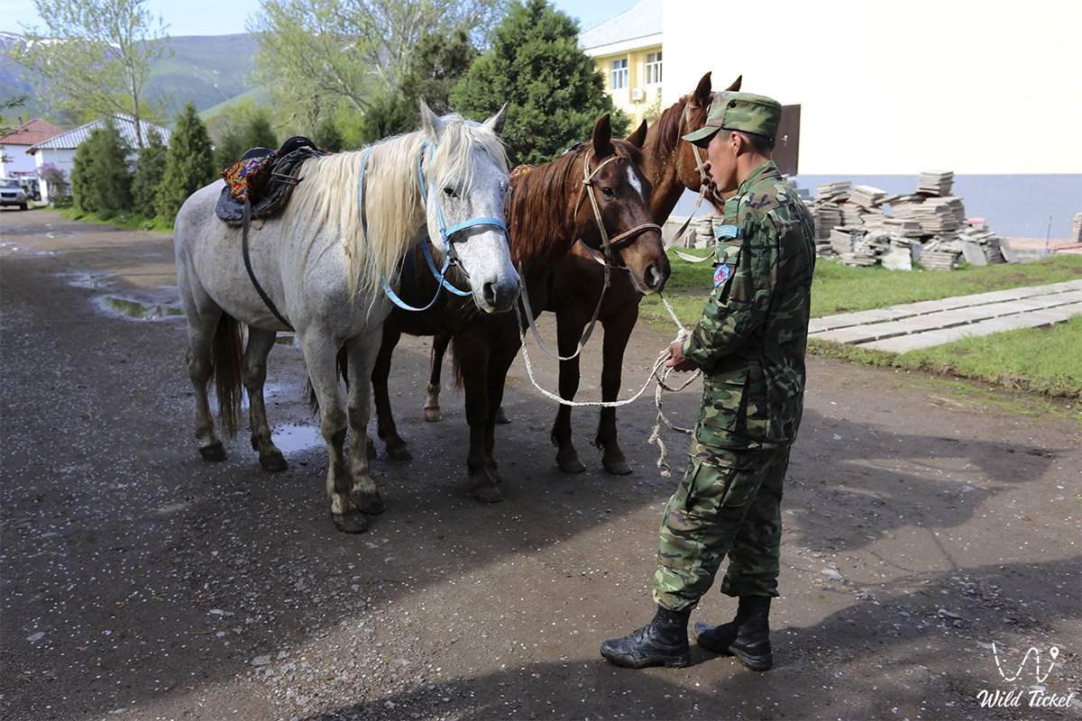
Photogallery: