Tour to the Assy plateau and the mountain valley of the Chilik river
We invite you on a journey to the Assy Plateau, Turgen Gorge, Turgen River Valley, and Chilik River Valley. This trip will take you 8-10 days, during which time you'll visit most of the sights in the Almaty region.
We'll see the Assy Plateau, Turgen River Valley, and Turgen Gorge, where we'll visit the high-altitude astronomical observatory on the Assy Plateau and observe the stars. We'll stay in tents and guesthouses. We'll also go horseback riding in the Chon Uryukty ravine.
This tour is a special event and requires time to organize. Requests must be submitted at least one week in advance.
- Distance of the route:
502 km
- Season time:
July – September 3 months
- Best time:
July - August
- Group size:
not more 6 person
- Days & nights:
11 days - 10 nights
Tour itinerary:
Upon arrival in Almaty, we meet at the airport, followed by a transfer to the hotel, check in, relax from the road and have breakfast.
Immediately after breakfast we leave for a city tour. First of all, we will stop at the park in honor of the 28 Panfilov brothers, there is also a cathedral in it, there is also a museum of musical instruments next to the park, where we will also look, and then we will go to the National Museum of Kazakhstan.
After visiting the museum, we will go to the Medeo tract, which houses the largest alpine skating rink "Medeo", on the way back from the mountains, we will stop at Republic Square. Then we return to the hotel, have dinner and relax.
Almaty city – Issyk city – Turgen village – Turgen gorge – Batan forestry – Assi plateau – Assi pass – Assi Observatory – Amanzhol tract (106 km).
After breakfast, we drive out of the city along the Kuldzhinsky highway, and follow it to the village of Avat, after which we turn right, and after six kilometers we reach the Issyk Kurgans. After reaching the mounds, we will visit the museum of the history of the Golden Man, we will also visit the excavations of the great Issyk kurgan and the gallery, which includes more than ten mounds.
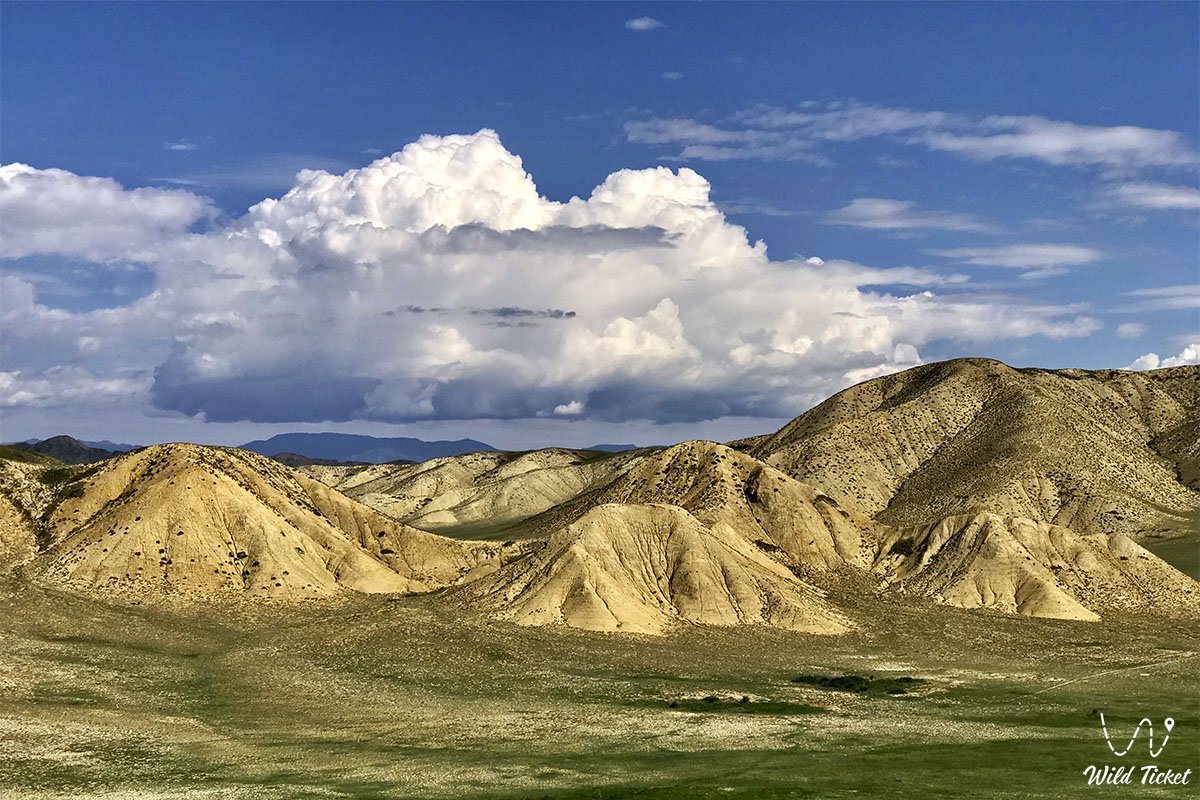
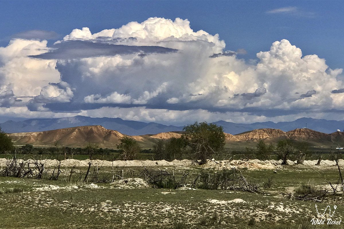
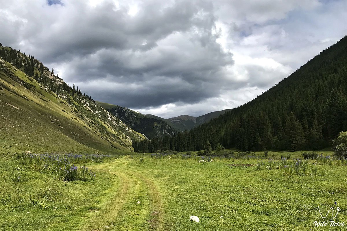
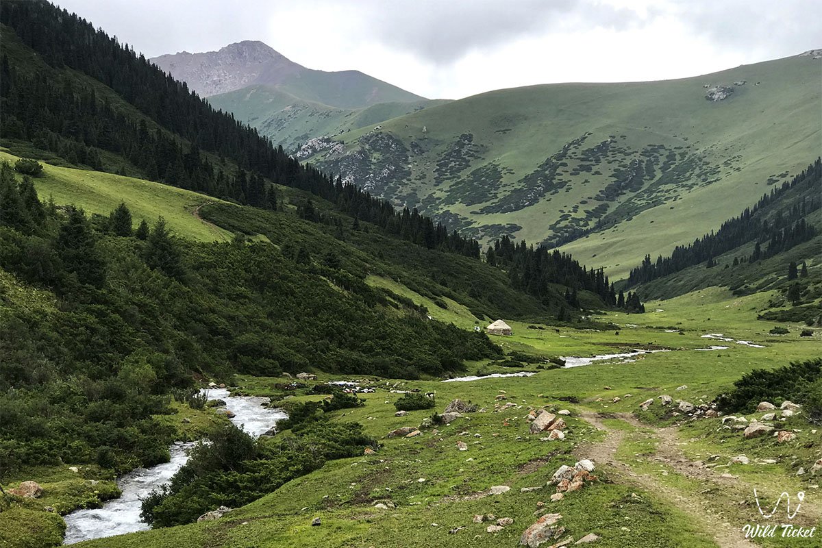
Then we will go to the Turgen gorge, passing the village of Issyk. In the Turgen gorge, we pass the eco-post and continue along the blue mountain river with the same name Turgen. Along the way, we see beautiful landscapes with green lawns and beautiful mountain slopes. After leaving the Turgen gorge, we get to the beginning of the Assi plateau. We walk to the cliff, which offers a picturesque view of the Turgen gorge from the other side.
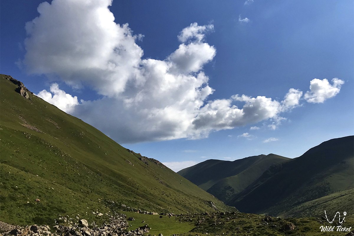
Next, we climb the Assi pass, 2,510 meters above sea level. After arriving at the pass, we walk along it, take pictures of the beautiful panorama, below lies the valley of Assi, and at its edges it is surrounded by the mountains of the Trans-Ili Alatau. There is also an observatory here, which is popularly called Chupa-Chups. Three kilometers later, when we reach the Amanzhol tract, we set up a tent camp.
Then we get acquainted with the groom, who prepared the horses for us and go for a ride. After completing the walk, we return to the camp, have dinner and relax.
Amanzhol tract – Amanzhol pass (10 km).
After breakfast, we set off on horseback along the old road, which was made by cars, and stretches along the Kyzylbulak river on the left bank. After ten kilometers, we reach the Amanzhol pass and set up a tent camp. We have dinner and relax.
Amanzhol Pass – Akkia Pass (2,948 meters) – Chilik River – mouth of the Karakye River (14 km).
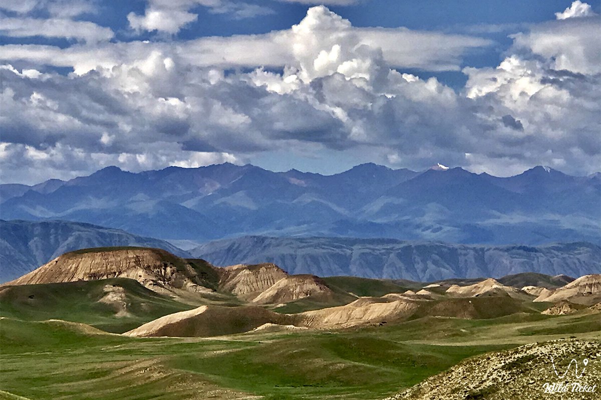
After breakfast, we climb the pass on horseback. Climbing the pass, 3515 meters above sea level, you can enjoy a picturesque view of the Chilik River, which flows in a winding line deep into the gorge.
The descent from the pass follows the coast of the Amanzhol river of the same name to the mouth of another river called Karakye. Here, at an altitude of 2,043 meters above sea level, we set up a tent camp, have dinner and relax.
Mouth of the Karakye River – Chilik River – upper reaches of the Karasai River (13 km).
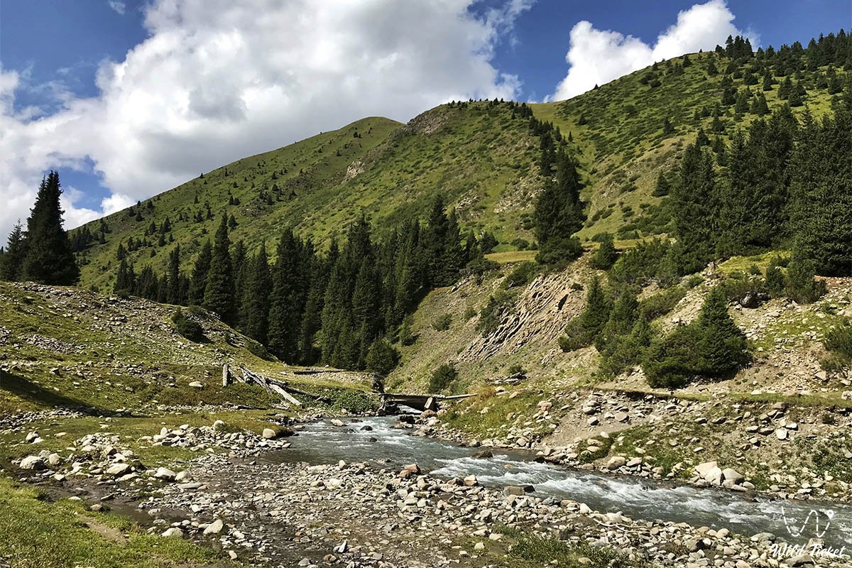
After finishing breakfast, we set off on horseback to the upper reaches of the Karasai River. After leaving the parking lot, we drive along the left side of the Chilik River, and we will get to the right bank via an old suspension bridge, just beyond which are the remains of an ancient cemetery.
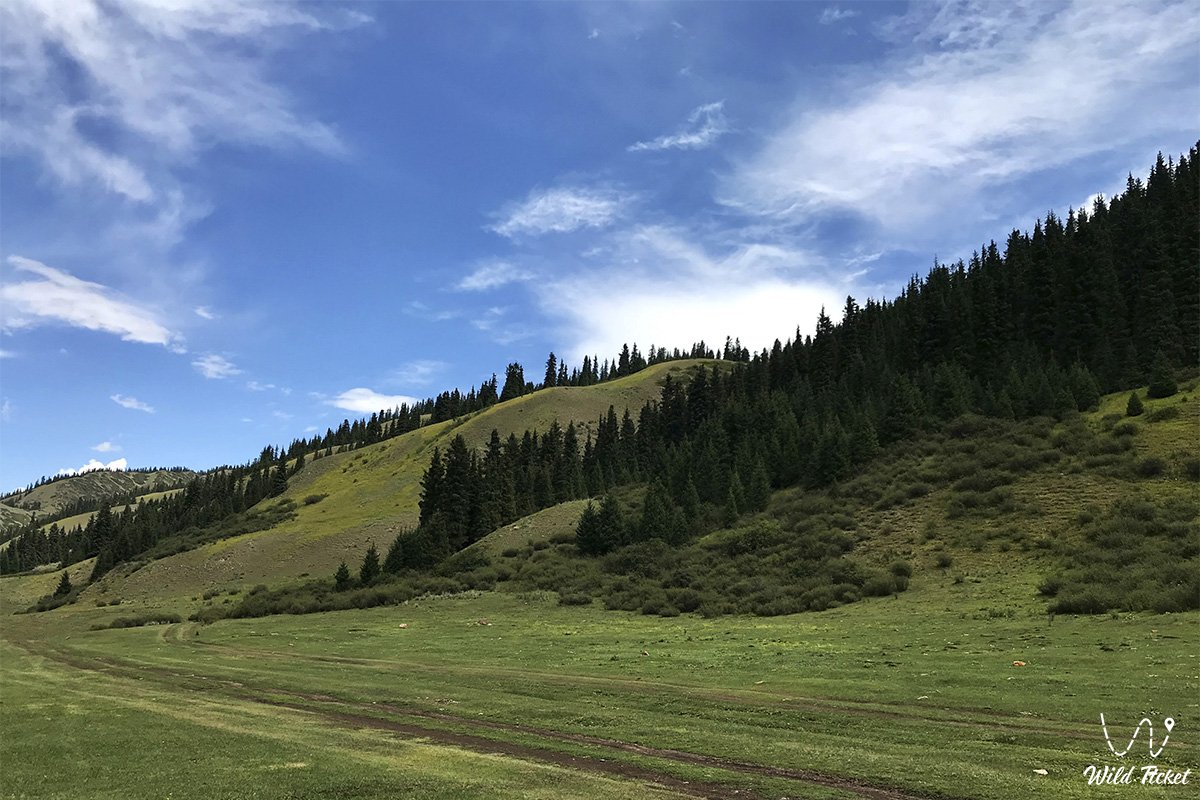
Then, our way lies through a spruce forest, passing through which we get to the Karasai River. Moving along its right coast, we slowly ascend to its upper reaches. After thirteen kilometers, reaching the upper reaches, we set up camp at an altitude of 2202 meters above sea level, have dinner and relax.
Karasai River – Mynzhilki plateau – Karakshi River – Uryukty plateau – Bolshye Uryukty River (16 km).
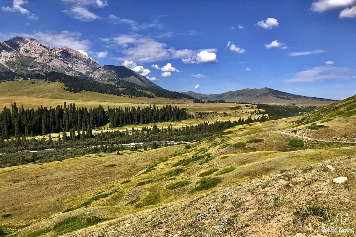
After breakfast, we will have a ride to the Bolshye Uryukty River. We leave the campsite on horseback and move to the Mynzhilki plateau parallel to the right side of the Karasai River. The Mynzhilki plateau is located at an altitude of 2,780 meters above sea level, it is a vast green jailau, where cattle graze regularly. It is brought here by shepherds because of the abundance of fresh and juicy grass.
After crossing the plateau, we will descend to the Karakshi River, located at an altitude of 2300 meters above sea level. After lunch, we will climb to the next plateau, called Uryukty, located at an altitude of 2,720 meters above sea level. From this plateau we can see Talgar Peak, the highest in the Northern Tien Shan. Its height is 5,017 meters above sea level.
After passing the Uryukty plateau, we descend into the valley of the Bolshye Uryukty River. We set up a tent camp at an altitude of 2279 meters above sea level, have dinner and relax.
Horseback riding to Lake Chon-Uryukty (18 km).
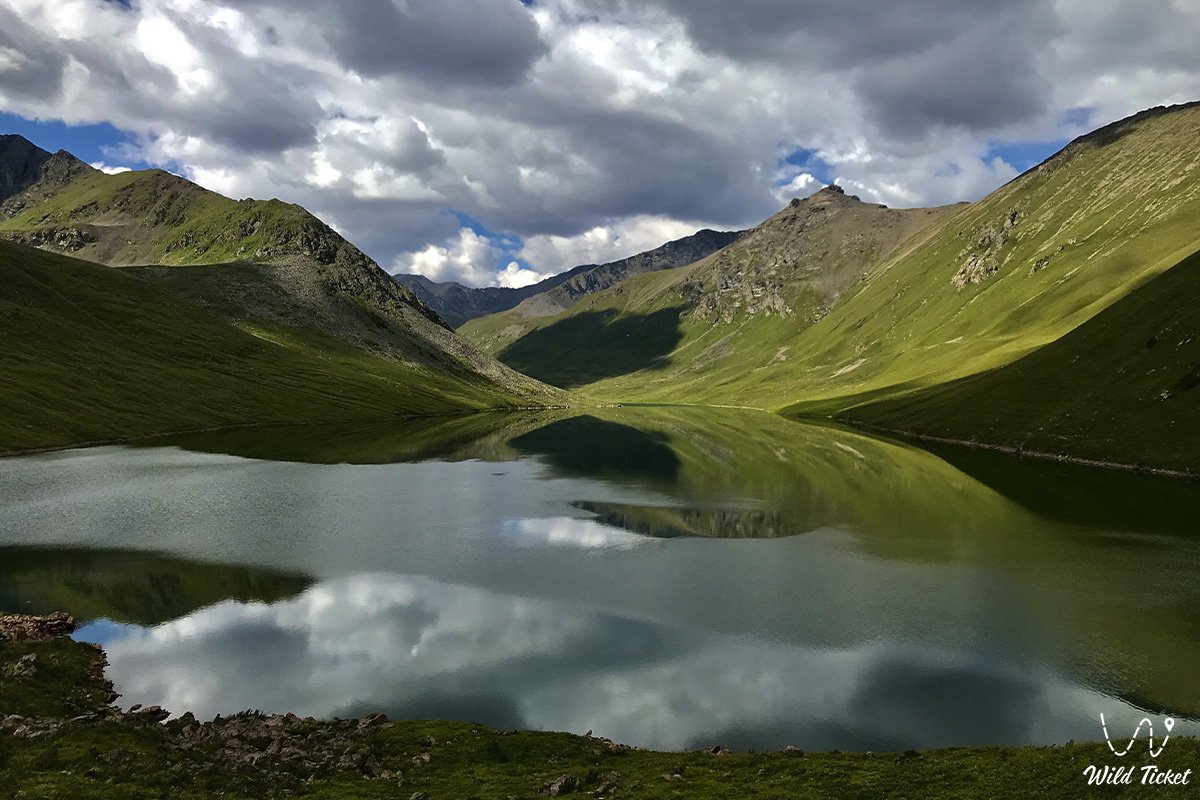
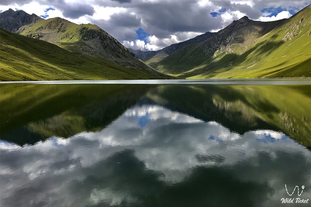
After finishing breakfast, we will ride to Lake Chon-Uryukty. The upcoming road will cross the river several times. As we move forward, we climb higher and higher to the lake, the forests remain behind, and the vegetation around us changes its appearance. After reaching the top, the road leads us to the moraine of the lake.
After driving a little more, we reach Lake Chon-Uryukty, which is located at an altitude of 3640 meters above sea level. It is located in a stone depression, where many streams flow from glaciers. We walk around the lake and take pictures. Then, we return to our tent camp on the Bolshye Uryukty River. We have dinner and relax.
Bolshye Uryukty River – Malye Uryukty River – Sarykerege tract – mouth of the Kutyrgan River (15 km).
After breakfast, we assemble the camp and ride horses along the right side of the Chilik River. Ahead of us lies the crossing of the Malye Uryukty River on horseback. The river is located at an altitude of 2007 meters above sea level.
After reaching the Sarykerege tract, located at an altitude of 1,788 meters above sea level, we descend to the Kutyrgan River. We set up camp at an altitude of 1,761 meters above sea level and stroll through the surrounding area. After the walk, we have dinner and relax.
The mouth of the Kutyrgan River – the Bota Moynok pass – the Taldy River (1,635 meters above sea level) – the village of Kurmenty (20 km).
After breakfast, we ride to the village of Kurmenty. We will move through the forest area, which is located on the right bank of the Chilik River. Soon the trail turns into a country road that goes to the village of Kurmenty. This is where we end our horseback riding trip. We set up a tent camp, have dinner and relax.
Kurmenty village – Saty village (1,429 meters above sea level) – Zhalanash village – Chilik village – Almaty city (300 km).
After breakfast, we leave for Almaty, passing the villages of Saty, Zhalanash and Chilik on the way. When we get to the city, we check into a hotel. You will have free time to walk around the city on your own. We have dinner and rest at the hotel.
Transfer from the hotel to the airport. Departure.
When traveling on horseback, tourists can give away 15 kilograms of their personal belongings for transportation, which are transported on service horses.
Photogallery: