Tour from Almaty to Bestyubinskoye Reservoir -
Sights of Almaty region -
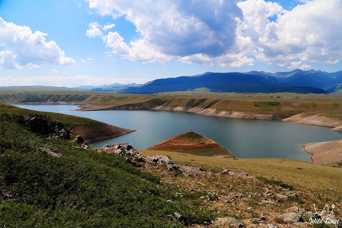
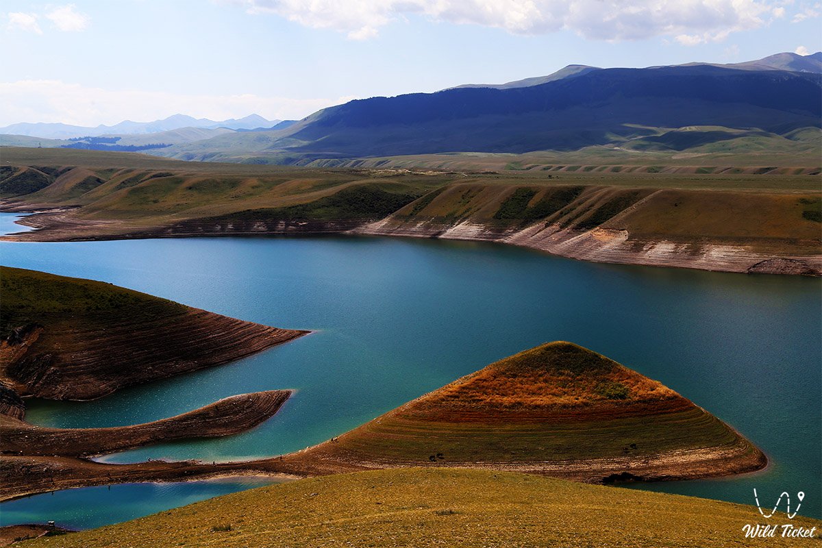
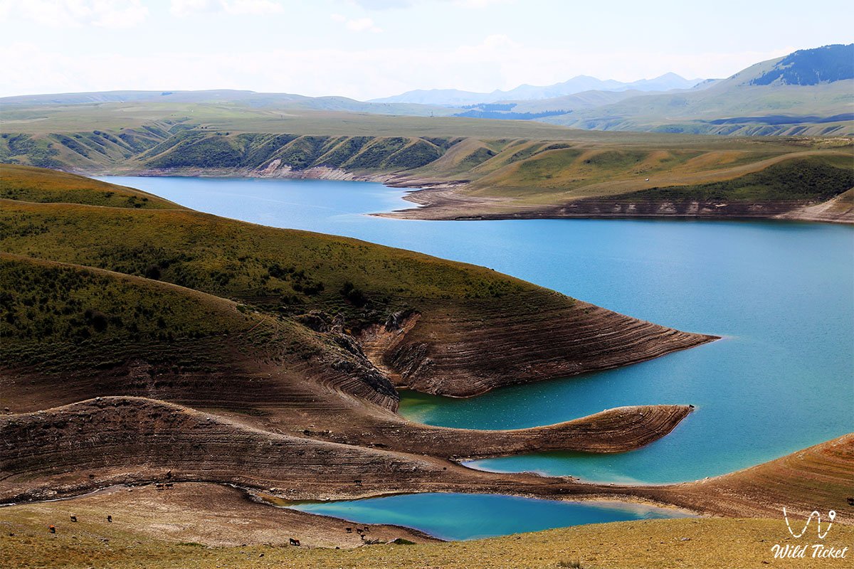
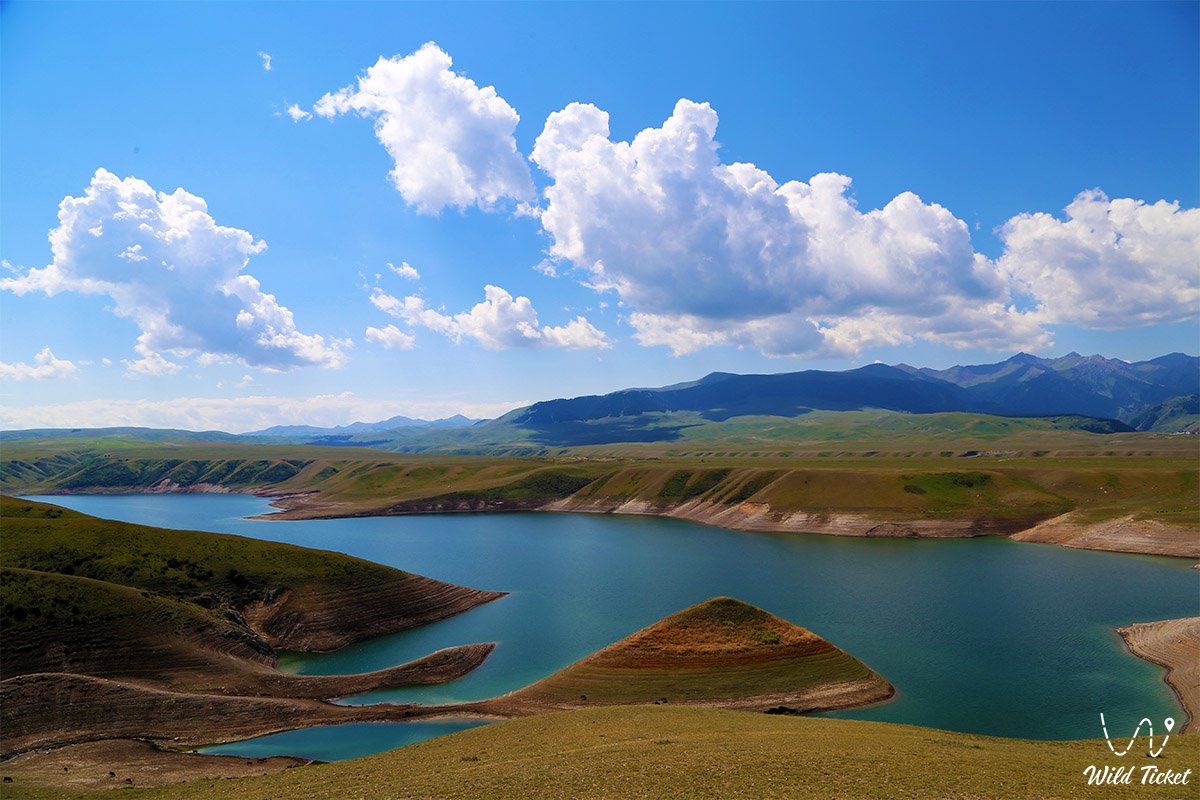
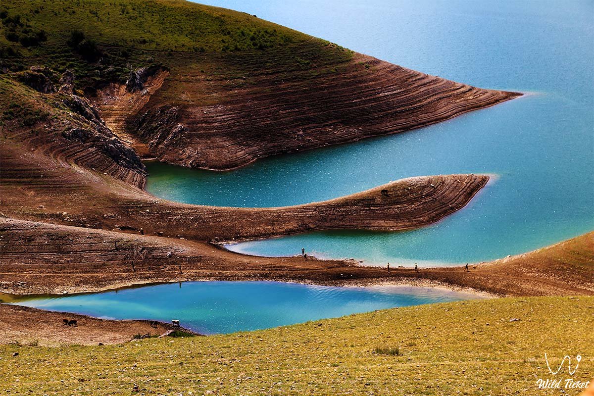
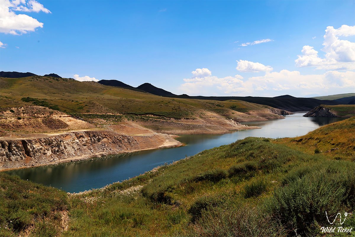
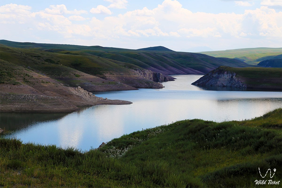
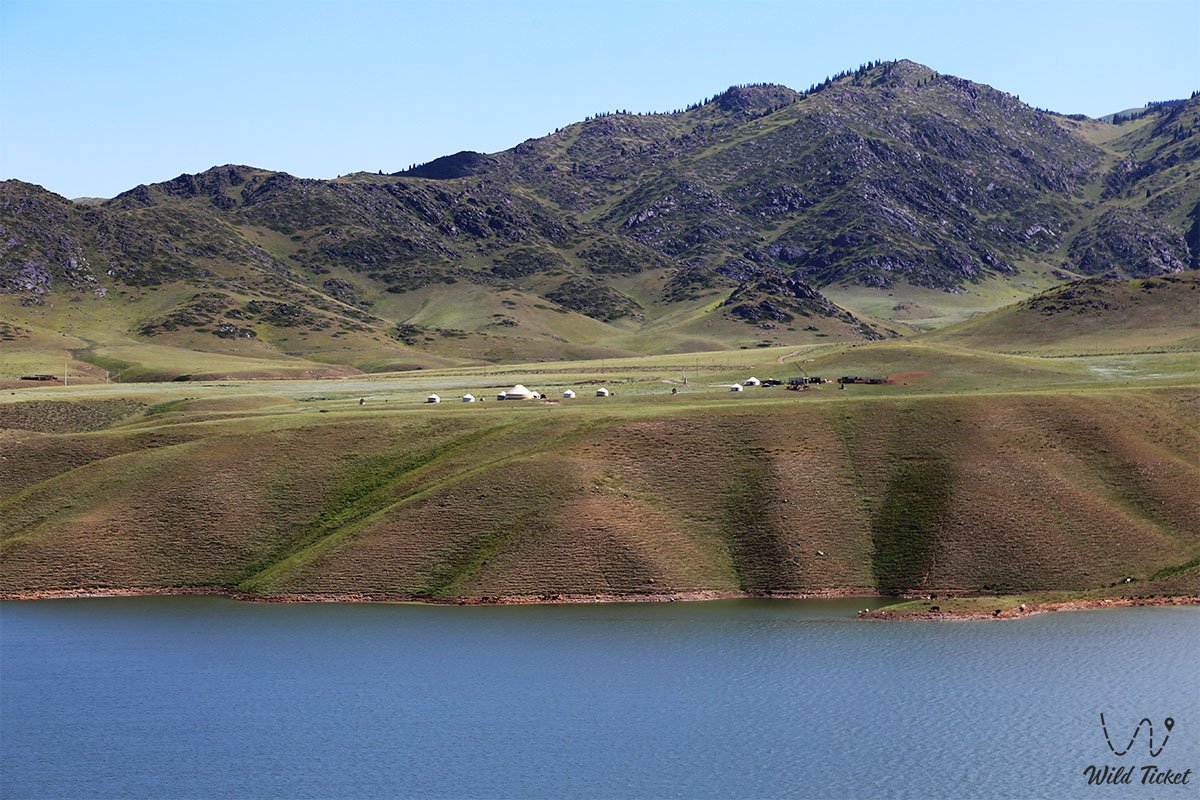
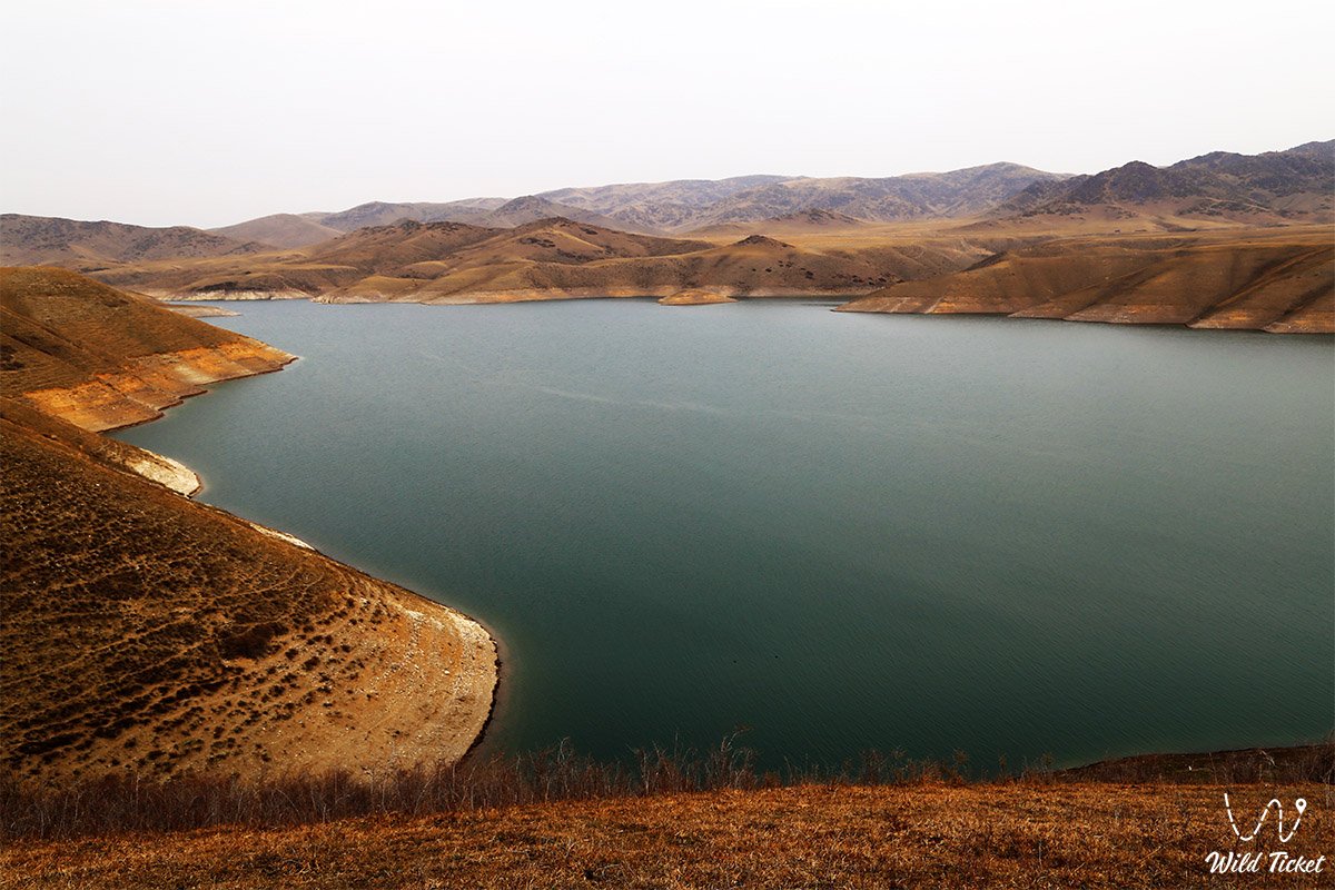
Bestubinskoye Reservoir is not just an artificial reservoir on the map of southeastern Kazakhstan, but a real window into another world, where the wildness of nature meets the engineering power of man, and silence replaces the bustle of cities. Situated at an altitude of about 1700 meters above sea level on the Kegen River, among hills and mountain ranges, this reservoir looks as if it was accidentally forgotten somewhere in the vastness of Iceland or Scandinavia. But it is here, in Kazakhstan, and this is its special magic.
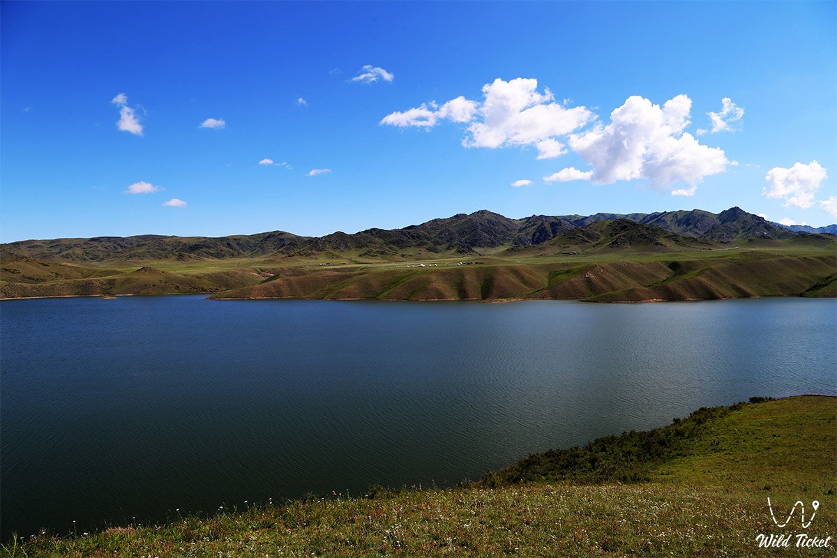
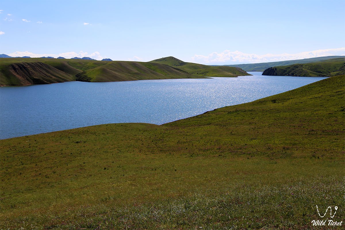
In the morning, the water here is mirror-like, reflecting every fold of the surrounding mountains. By midday, it comes to life, shimmering with all shades of turquoise – from delicate aquamarine near the shores to deep sapphire in the center. And at sunset, real magic happens - the surface turns into liquid gold, over which the last sunbeams glide. In quiet bays hidden between rocky capes, the water takes on an almost unreal azure color.
Local fishermen know: if you catch the moment when the wind dies down, you can see the shadows of large carp flickering in the depths. Eagles nest somewhere on the steep cliffs - their guttural cries echo over the water, mixing with the splash of the waves.
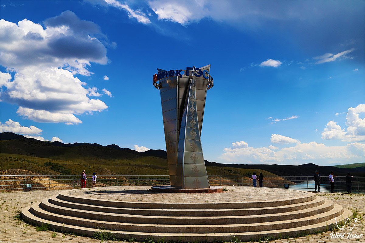
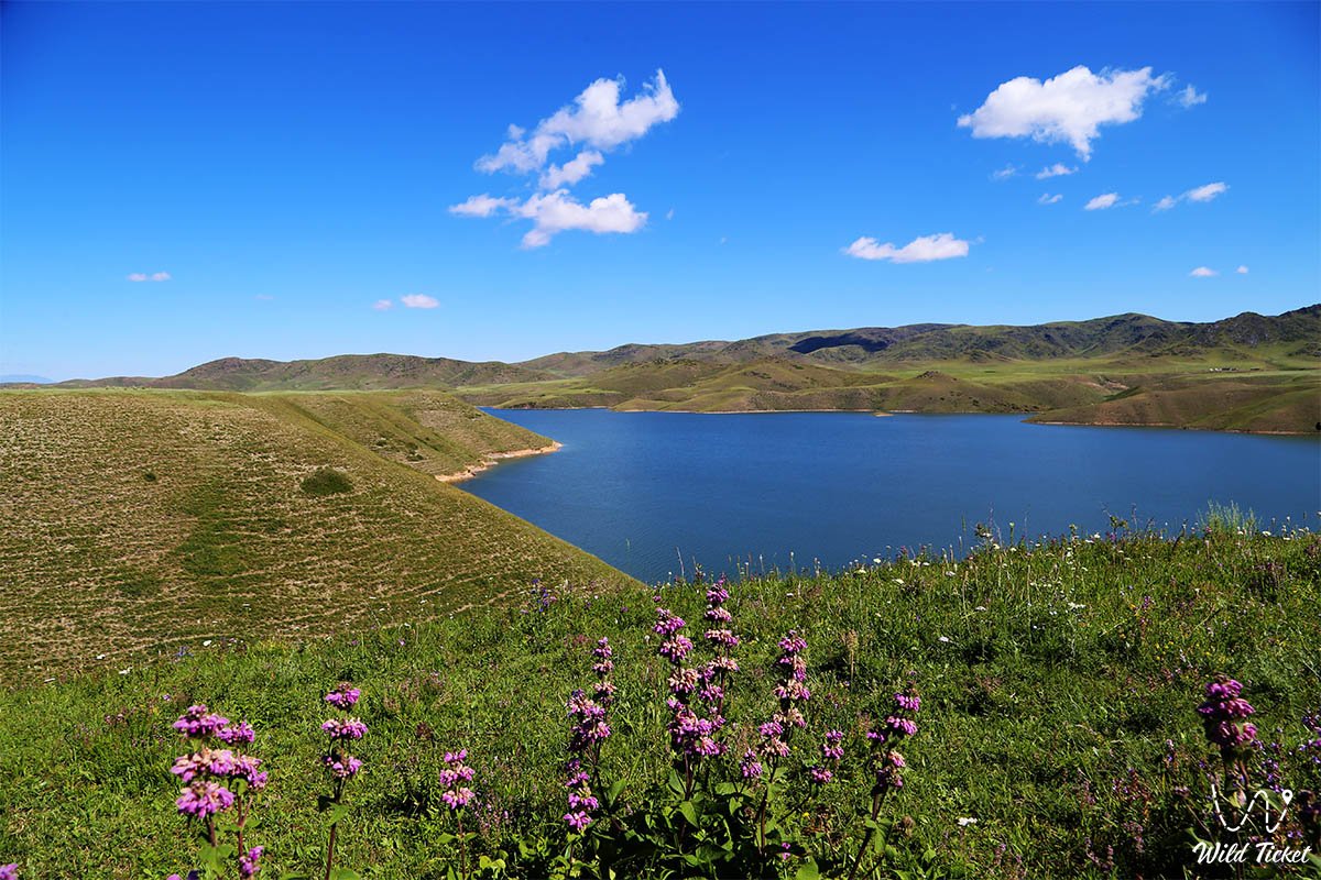
The reservoir was formed as a result of the construction of the Moinak hydroelectric power station (hydroelectric power station) on the Kegen River. The reservoir is very beautiful and picturesque, especially beautiful here in the spring and early summer, at this time the nature of the region is filled with the colors of flowering. Wild tulips also bloom on the reservoir in the spring.
---------------------------------------------
How to get there and visit -
Bestubinskoye Reservoir is located 31 kilometers from the village of Kegen, 2.5 kilometers from the village of Kensu, 17 kilometers from the village of Zhalanash, Kegen district, Almaty region, Republic of Kazakhstan.
GPS coordinates: 43°00'40"N 78°51'54"E
---------------------------------------------
Information -
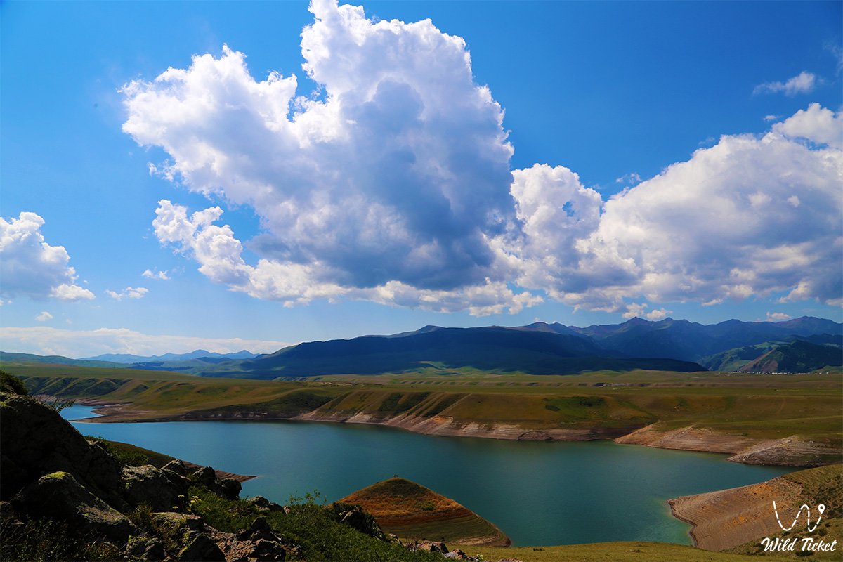
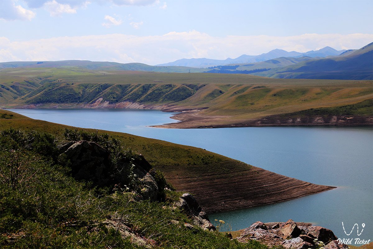
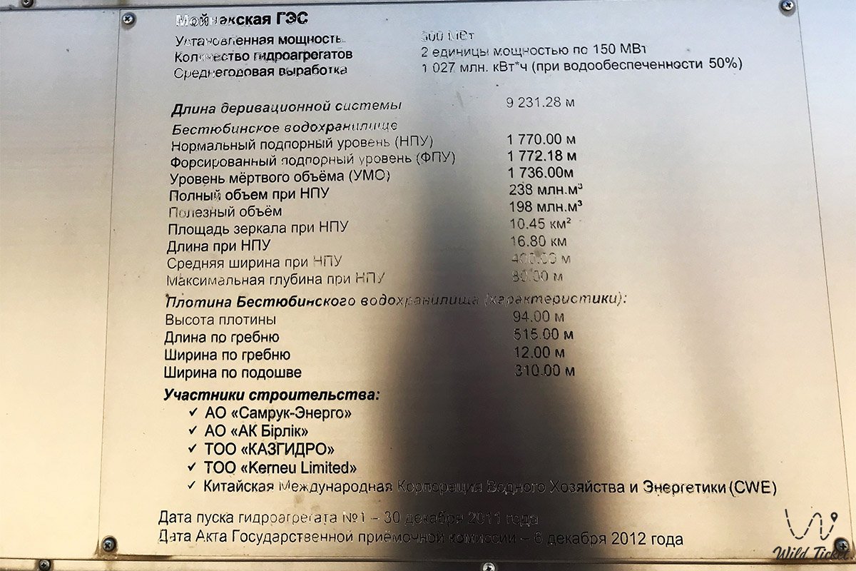
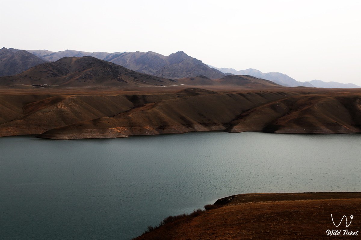
The height of the earthen rampart of the dam on the Bestyubinskoye Reservoir is 94 meters, the length is 4.5 kilometers, the width is 400 meters. The landscape around is as if painted by the brush of wind and time. The surrounding mountains of Kungei Alatau and Kulyktau rise, as if guarding the peace of the reservoir. The slopes are covered with steppe grass, and in spring and early summer - a carpet of wild flowers. From bright yellow dandelions to delicate purple cornflowers, from wild mint to wormwood with its sharp aroma, everything lives and breathes here. Grazing horses can be seen on the horizon, and golden eagles often circle in the sky, watching everything that happens below.
The climate in this zone is sharply continental. In summer it is warm, but not sultry - the coolness from the mountains and altitude is felt even on the sunniest days. At night, the temperature can drop sharply, especially closer to autumn, when frost appears over the mountains. In winter, the reservoir is frozen, and complete silence reigns around, broken only by the crunch of snow and the occasional sounds of the wind.
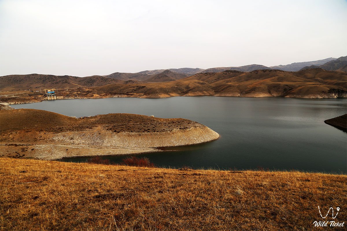
The reservoir was created as a result of the construction of the Moinak hydroelectric power station on the Kegen River - a tributary of the Charyn. The history of the construction itself is an epic. It was started back in 1985, then frozen in the early 90s, and finished in 2011. And since then, this reservoir has become the most important energy facility in the region, but at the same time - a new place of attraction for those who are looking for something more than just "outdoor recreation". There are no cafes, recreation centers, hotels or tourist points here. Just you, a tent, the rustle of a fire and an endless starry sky. It's time to turn off your phone and listen to yourself.
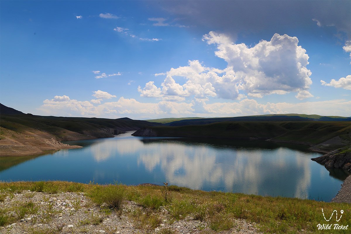
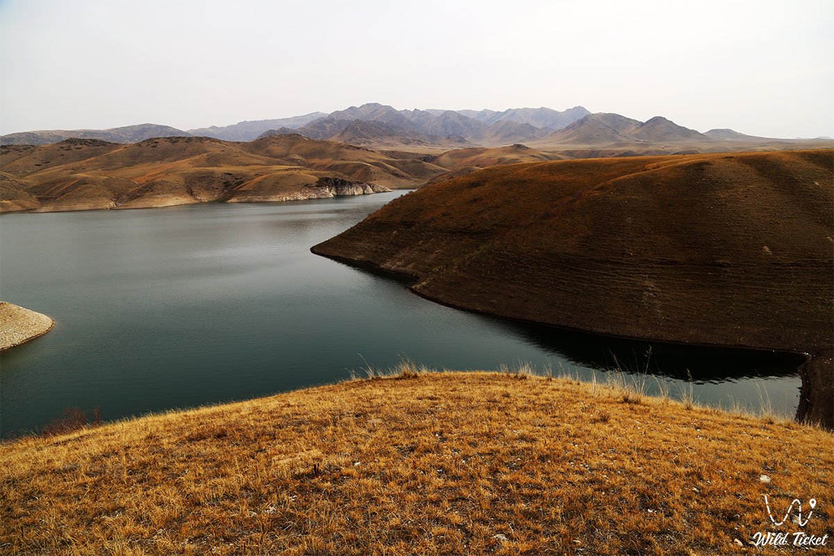
The journey here is also part of the adventure. From Almaty, you need to cover about 240 kilometers along the A-351 highway, then turn onto a gravel road and move towards the village of Kensu. The last kilometers are especially picturesque. The car climbs higher and higher, and new views open up around each turn - gorges, apiaries, streams, and finally, the sparkle of water against the backdrop of gray-blue mountains. Many people come here not only for privacy, but also to feel the power of nature, to be in silence, to walk along the hills, to take pictures that would not be embarrassing to show in any blog in the world.
The Bestyubinskoye Reservoir attracts fishermen, photographers, singles, travelers in SUVs, lovers looking for a moment of silence. Here they fish, meet the sunrises, warm themselves by the fire, write poetry. The whole area around seems to be imbued with the spirit of a large space, where a person does not rule, but is a guest. Where you can’t demand anything, but you can get a lot - if you come with respect.
Photogallery:


Comments 3