A trip to the West Altai Nature Reserve -
Altai Mountains, Russian Altai, Mongolian Altai, Chinese (Pinyin) Altai Shan, a complex mountain system of Central Asia extending for about 1,200 miles (2,000 km) in a southeasterly-northwesterly direction from the Gobi (Desert) to the West Siberian Plain, through China, Mongolia, Russia and Kazakhstan. The jagged mountain ranges got their name from the Turkic-Mongolian altan, which means "golden".
Information
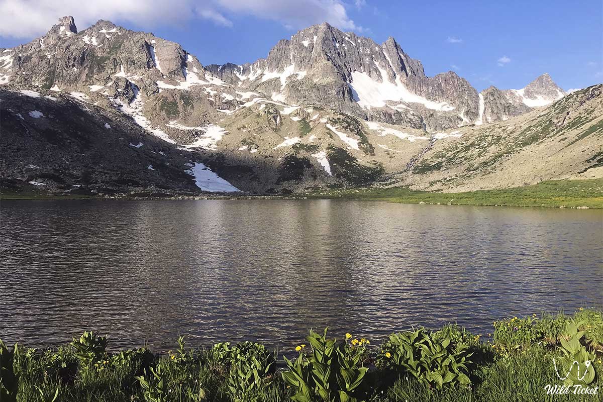
The system consists of three main parts: Altai (formerly known as Soviet Altai) and Mongolian and Gobi Altai. The peak in Altai, Belukha, is at an altitude of 14,783 feet (4,506 meters) - is the highest point of the range. In the past, these mountains were remote and sparsely populated; but in the 20th century, they were opened to extensive resource exploitation, and the ancient way of life of the local peoples was quickly transformed.
---------------------------------------------
How to get there and visit -
Altai proper is located in the Altai Republic of the Asian part of Russia, in the far east of Kazakhstan and in the northern tip of the Xinjiang region of China.
The belt of the northern foothills separates Altai from the West Siberian Plain, and in the northeast Altai borders on the Western Sayanami. From Nairamadlin Peak (Huyten), rising at an altitude of 14,350 feet (4,374 meters), near the intersection of the borders of Russia, Mongolia and China, the Mongolian Altai (Mongol Altayna Nuruu) extends to the southeast and then to the east, the Western Mongolian Altai is part of the border between Mongolia and China. Altai Gobi (Govĭ Altayn Nuruu) begins about 300 miles (500 km) southwest of Ulaanbaatar, the capital of Mongolia, and dominates the southern parts of the country, towering over the Gobi expanses.
---------------------------------------------
Geology
Altai was formed during the great orogenic (mountain-forming) uplifts that occurred between 500 and 300 million years ago, and was worn down during geological time into a peneplain (a gentle plateau with usually corresponding heights). Since the Quaternary period (during the last 2.6 million years), new shocks have raised magnificent peaks of considerable size. Earthquakes are still common in the region along the fault zone in the earth's crust; one of the most recent earthquakes was the one that occurred near Lake Zaisan in 1990.
As a result of these differential geological forces, the highest ridges in modern Altai are especially Katun, Severny (North) Chu and Yuzhny (Southern) Chu - rise to an altitude of over 13,000 feet (4,000 meters) Tabyn-Bogdo-Ola (Mongolian: Tavan Bogd Uul), Menkh Khairkhan Uul and other western ranges of the Mongolian Altai are somewhat lower. The highest peaks are much steeper and more rocky than their Alpine equivalents, but the ridges and massifs of the middle Altai, to the north and west, have ridges of about 8,200 ft (2,500 m), whose softer outlines betray their origin as ancient, smoothed surfaces.
The valleys, however, are jagged and gorge-like. The ridges are separated by structural depressions (especially Chu, Kurai, Uimon and Kansk), which are filled with unconsolidated sediments forming steppe landscapes. The altitude above sea level varies from 1,600 to 6,600 feet (500 to 2,000 meters).
Climate
The climate of the region is sharply continental: due to the influence of the great Asian anticyclone or high pressure area, winters are long and very cold. January temperatures range from 7 °F (-14 °C) in the foothills to -26 °F (-32 °C) in sheltered depressions in the east, while in the steppes of Chu, temperatures can drop to -76 °F. (-60 °C). There are isolated areas of permafrost (soil with temperatures below freezing for two or more years) that cover large areas of northern Siberia.
July temperatures are warm and even hot - daytime highs often reach 75°F (24 °C), sometimes up to 104°F (40°C) on the lower slopes, but summers are higher at short and cooler altitudes. In the west, especially at altitudes from 5,000 to 6,500 feet (1,500 to 2,000 meters), heavy rainfall occurs: 20 to 40 inches (approximately 500 to 1,000 mm) and up to 80 inches (2,000 mm) may fall during the year.
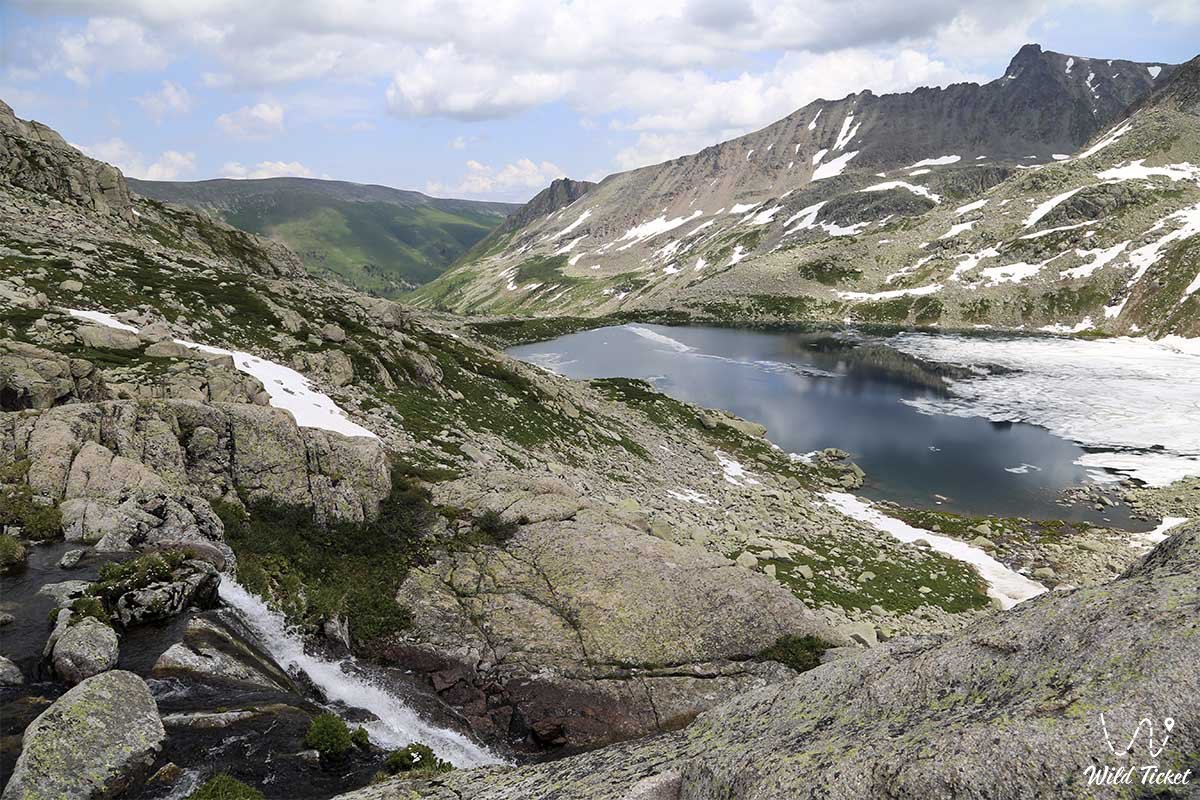
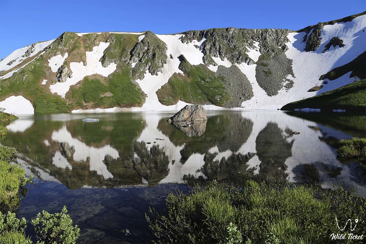
The total amount decreases by one-third to the east, and in some areas there is no snow at all. Glaciers cover the slopes of the highest peaks; about 1,500 people, they cover an area of about 250 square miles (650 square kilometers).
Rivers
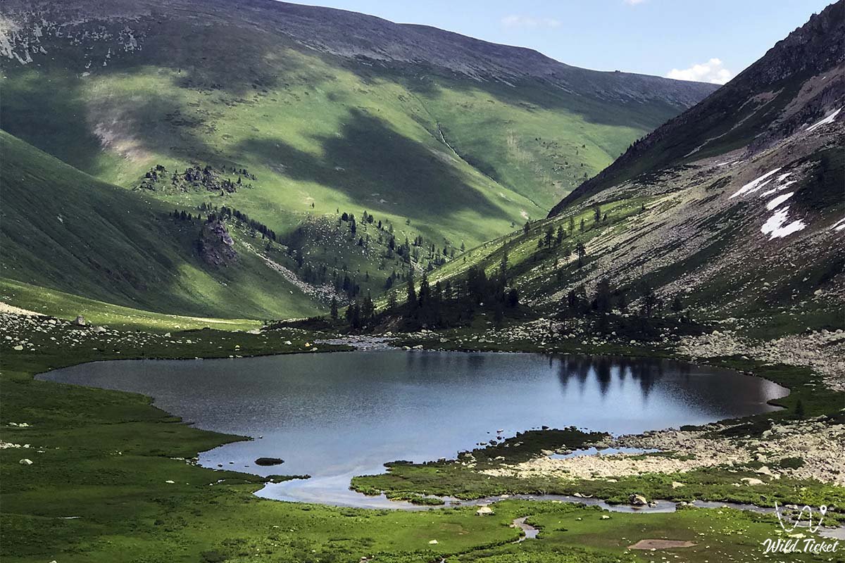
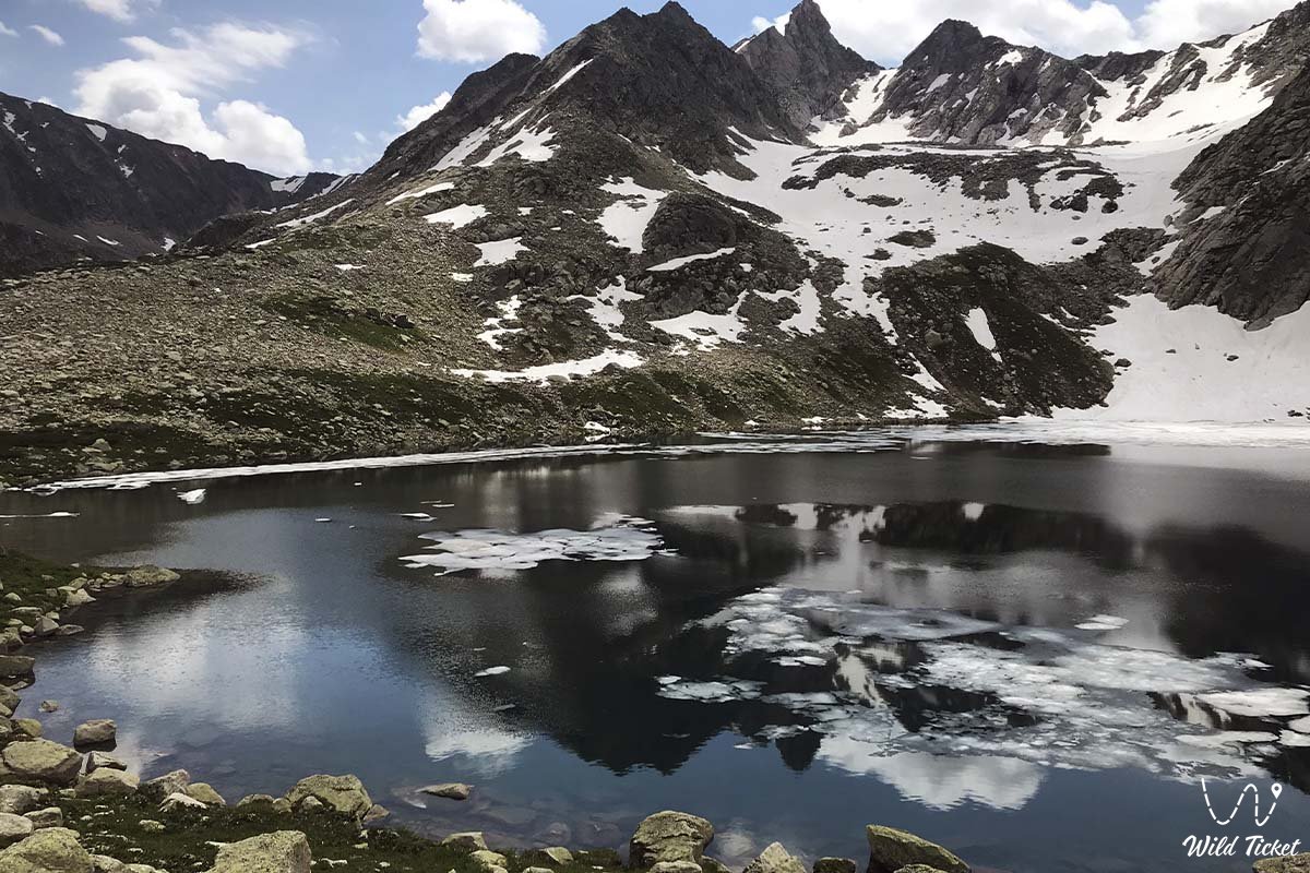
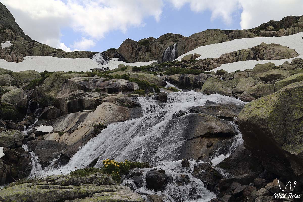
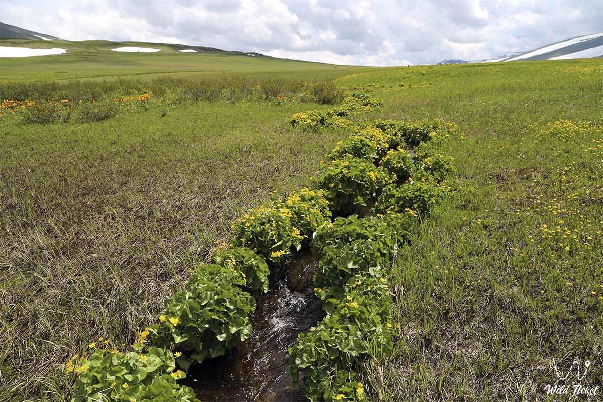
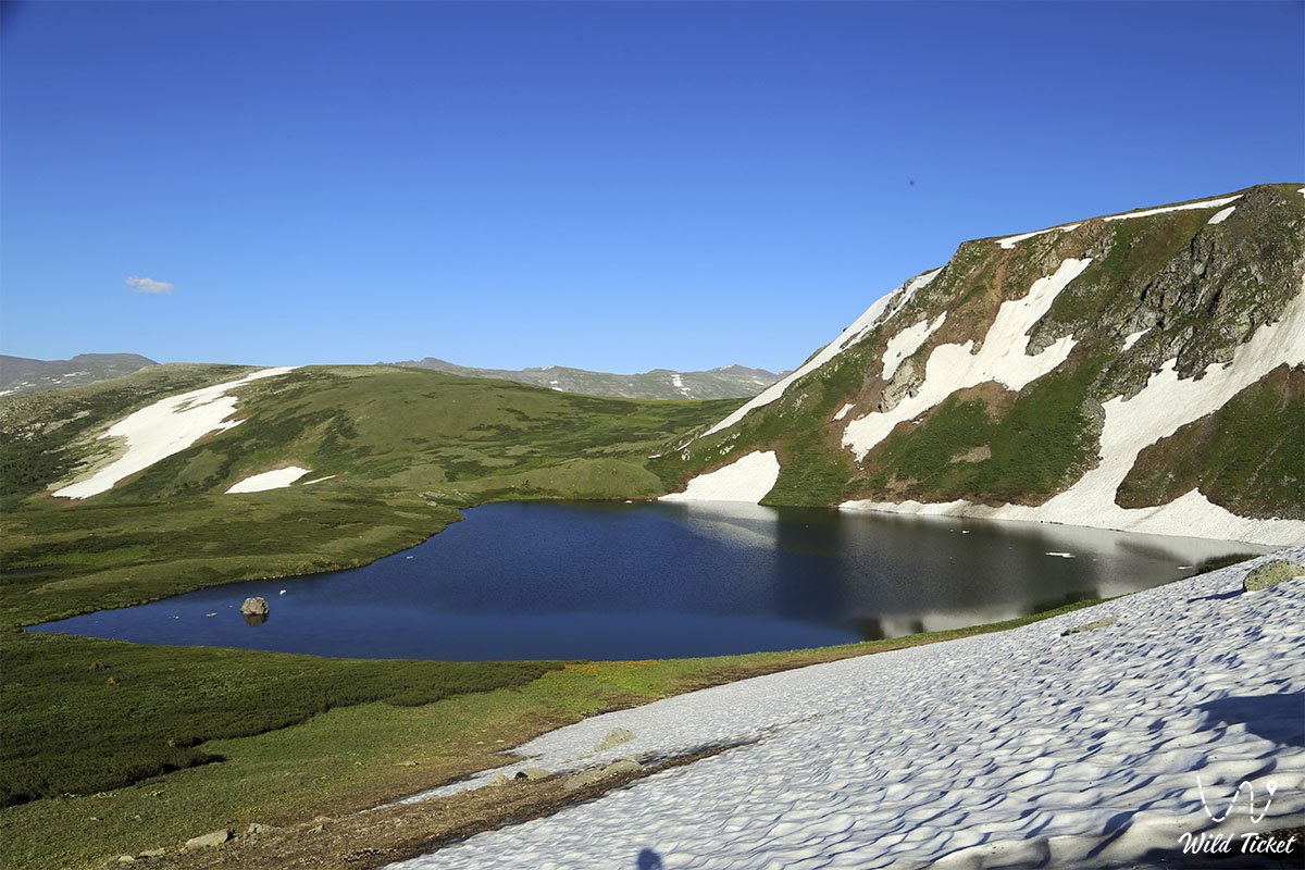
Altai and the Mongolian Altai are crossed by a network of stormy, fast-flowing rivers, fed mainly by melted snow and summer rains, which cause spring and summer floods. The Katun, Bukhtarma, and Biya are all tributaries of the Ob River, and they are among the largest. The Altai Gobi rivers are shorter, flatter, and often freeze in winter and dry in summer. There are more than 3,500 lakes here, most of which are of structural or glacial origin. Those from Gobi Altai are often bitterly salty.
Vegetation cover
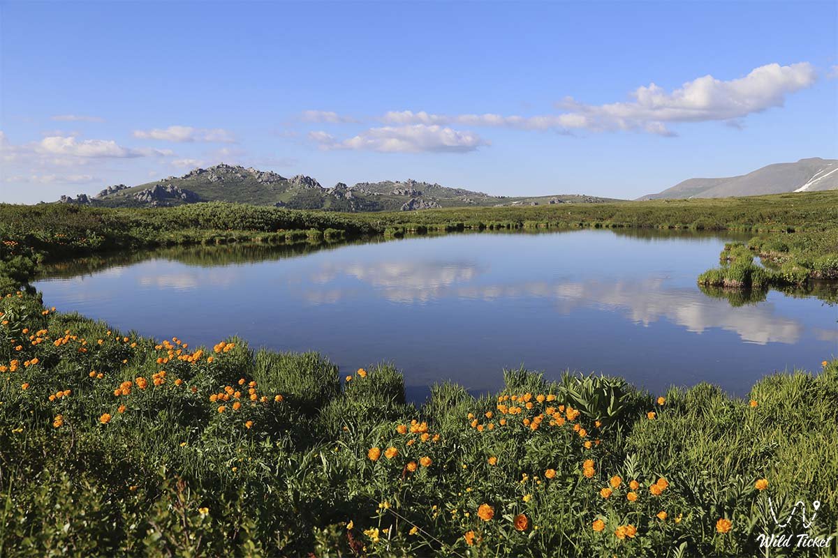
There are four fairly distinct vegetation zones in Altai: the mountain sub-desert, the mountain steppe, the mountain forest, and the alpine regions. The first one, found on lower slopes and in the basins of the Mongolian and Gobi Altai, reflects high summer temperatures and low precipitation: rare life includes xerophytic (drought-resistant) and halophytic (salt-tolerant) plants.
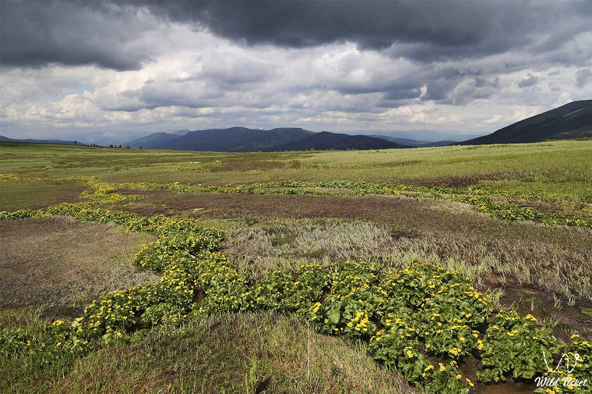
The steppe mountain zone rises to 600 feet (600 meters) in the north and to 6,600 feet (2,000 meters) in the south and east. Meadows and steppes with mixed grasses are characterized by turf grasses, forbidden species, and steppe shrubs. The mountain forest zone is most characteristic of Altai itself; it covers about seven tenths of the territory, mainly in low and medium mountainous regions. Forests reach heights of 6,600 feet (2,000 meters), but rise to 8,000 feet (2,400 meters) on the drier slopes of central and eastern Altai. The most common coniferous species are larches, firs and pines (including Siberian cedar), but there are also large areas covered with secondary birch and aspen forests.
The forest belt is practically absent in the Mongolian and Gobi Altai, but separate valleys of coniferous trees grow in river valleys. Alpine vegetation - subalpine shrubs giving way to meadows, widely used for summer grazing, and then mosses, bare rocks, and ice - is found only on the highest ridges.
Flora and Fauna
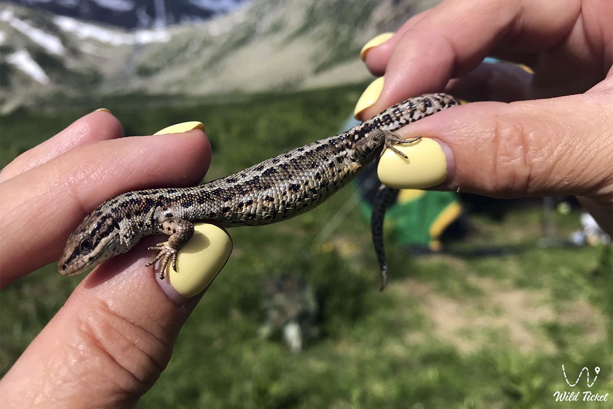
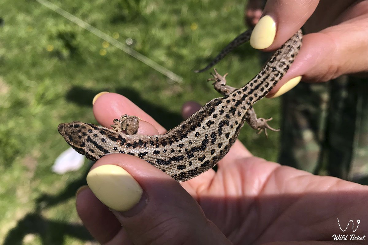
The mountainous semi-deserts and steppes are home to various rodents, as well as birds such as eagles, hawks and kestrels. Most of the species are of Asian origin - for example, marmot, jerboa (jumping rodent) and antelope. Siberian mammals (bears, lynxes, deer, and squirrels) and birds (grouse and woodpeckers) often inhabit moist coniferous forests. Alpine animal life includes mountain goat, snow leopard and mountain sheep.
Population
Altai proper is inhabited by Russian and Altaic-speaking peoples such as Kazakhs. The indigenous Altai peoples (such as the Altai-Kizhi) make up a significant proportion of the population in the Altai Republic. Their main occupation is animal husbandry, including the breeding of cattle, sheep and horses. Russians and Kazakhs are mainly engaged in agriculture, animal husbandry or mining. Large mines and metallurgical plants (for copper, lead and zinc) are concentrated in Rudny ("Rudny") Altai in Kazakhstan and the Altai Republic. Their energy needs are provided by Oskemenskaya and Bukhtarma HPPs.
The Altai Republic has a well-developed forestry and woodworking industries, as well as light industry, including food. The Mongolian and Gobi Altai are inhabited by Khalkha, Mongols and Kazakhs. Horse breeding is widespread in the region. In the north, cattle and yaks are a mainstay, while the drier south is better suited for sheep, goats and camels. Southern pastoralists must make extensive trips to compensate for the lack of water and feed. These nomadic herders erect temporary shelters called yurts or gervais - circular structures consisting of felt and hides tied to lattice frames - in their destinations.
Scientific research of the Altai Mountains dates back only to the 18th century, but it gained momentum after the gold strikes of 1828. Russian geologists and geographers were the first to start collecting data. During the Soviet period, joint research of the earth and its resources was conducted by the US Academy of Sciences and its Mongolian counterpart, as well as universities, meteorological services and planning departments of both countries.
Since the collapse of the Soviet Union and the democratization of Mongolia in the early 1990s, Western scientists have undertaken a series of research projects on the geology, geomorphology, and environmental history of the region. All these activities have led to the creation of detailed topographic and geological maps, new discoveries of rich mineral deposits, and a better understanding of climate patterns affecting water resources and pastures. An extensive Altai nature reserve was created.
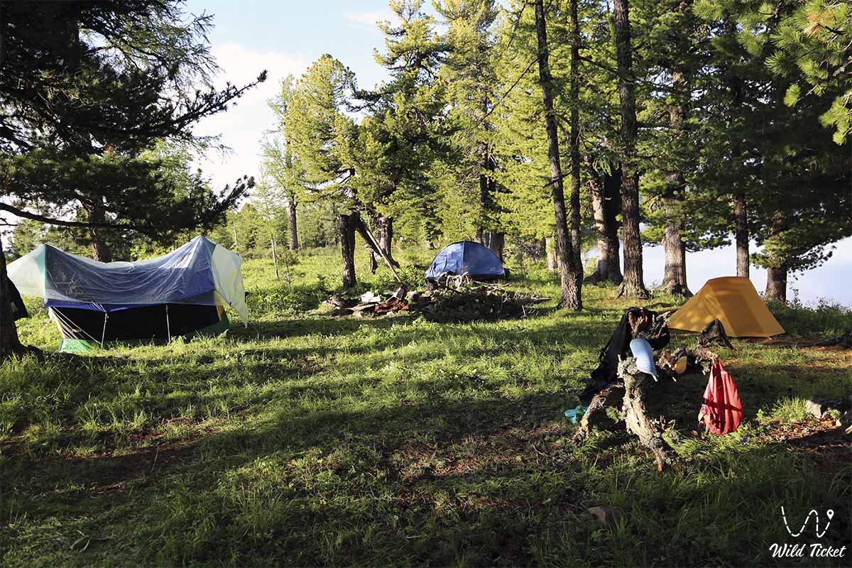
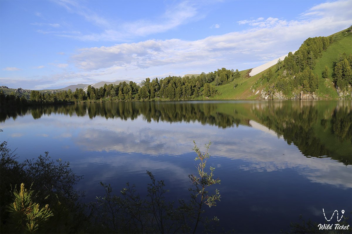
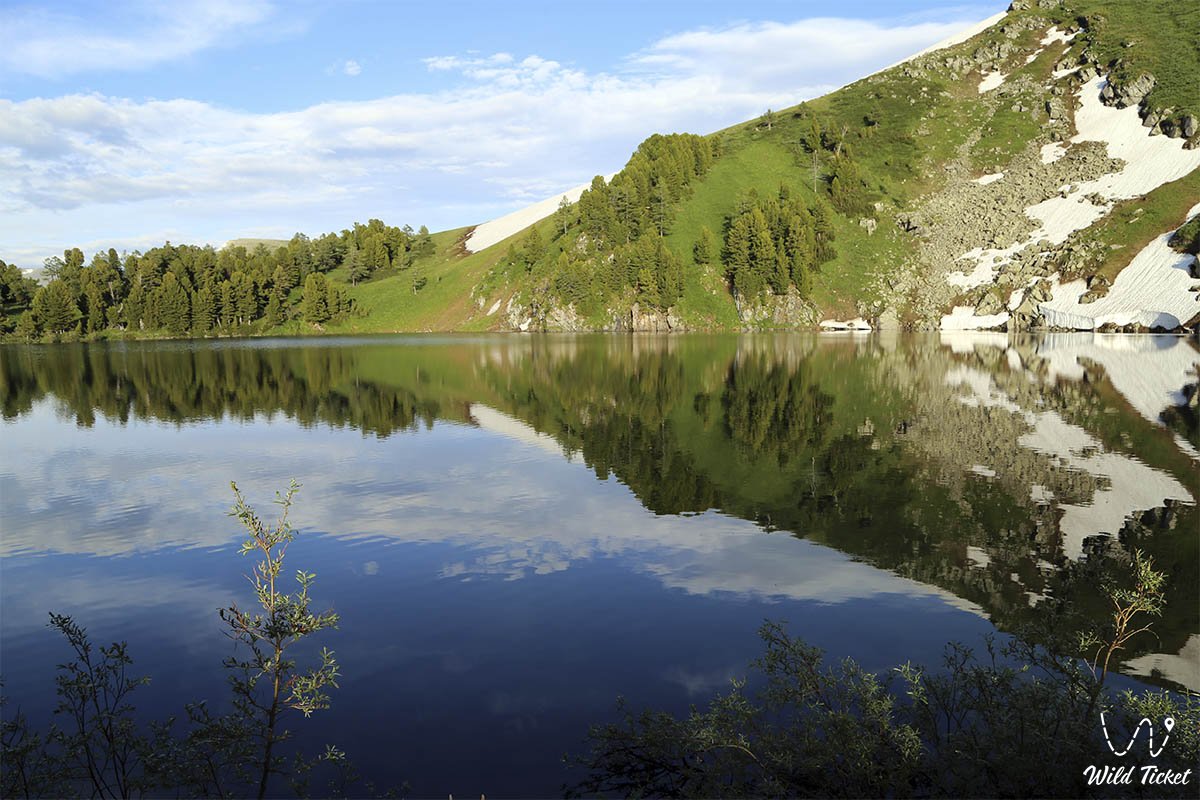
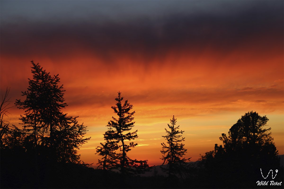
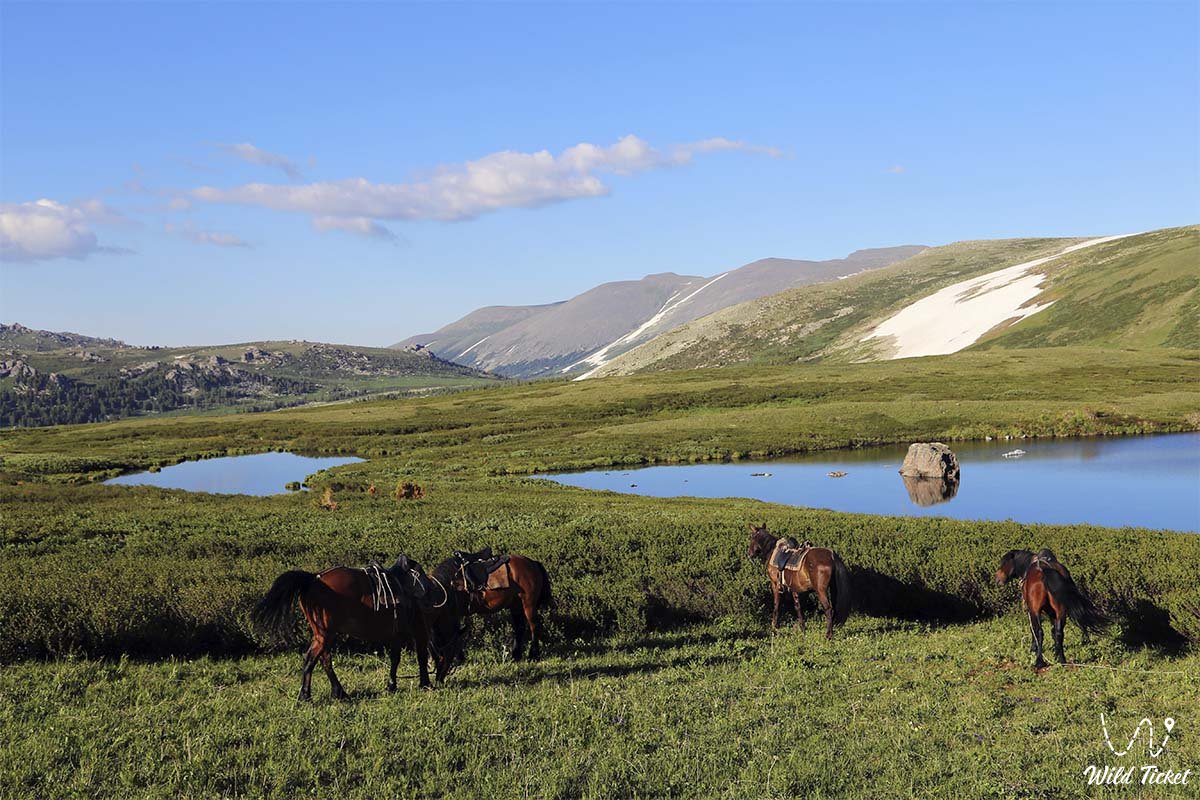
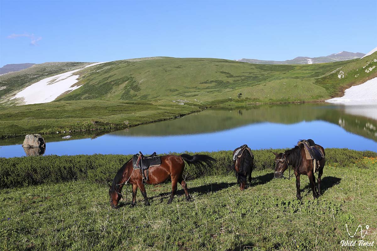
Photogallery: