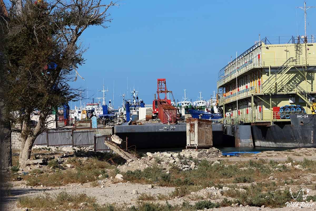
Historical harbor on Tyubkaragan founded in the mid-19th century –
Bautino village (Kaz. Bautino) represents a historic seaside settlement and vital port hub in the Tupkaragan district of the Mangystau region in western Kazakhstan. Situated at the tip of the Tyubkaragan Peninsula on the shores of the natural deep-water Bautino Bay, the settlement is located just 3–4 kilometers northwest of the district center – the city of Fort-Shevchenko, forming with it a unified historical, geographical, and economic agglomeration.
The seaport of Bautino is the oldest operating sea harbor of Kazakhstan on the Caspian Sea, tracing its continuous history from the middle of the 19th century.
The calling card of Bautino is a unique blend of industrial maritime romance and deep historical heritage. Sheltered by the long sandy Tyubkaragan Spit, the bay does not freeze over completely even during severe winters, which made it a natural refuge for vessels of the Caspian Flotilla, a base for fishermen, and in modern times – a key offshore support base for oil and gas operations at the giant Kashagan field.
A visit to Bautino fits harmoniously into popular travel routes across the Mangyshlak Peninsula, being located in immediate proximity to historic Fort-Shevchenko with the Taras Shevchenko Memorial Museum, Cape Tyub-Karagan, the picturesque chalk cliffs and canyons of the Zhygylgan tract ("Fallen Land"), the sacred Sultan-Epe Underground Mosque, the Shakpak-Ata Gorge (Shakpaktysay), the Kapamsay chalk canyon, and the snow-white Sarytash Bay.
Today, Bautino attracts travelers with the vibrant atmosphere of a seaport with ships and tugboats, lighthouses, fishing traditions, and the salty breeze of the Caspian, revealing the maritime facet of Mangystau. The settlement is surrounded by beautiful sandy beaches where one can relax and swim in the sea.
--------------------------------------------
How to get there and visit –
The village and seaport of Bautino are located approximately 140–145 kilometers northwest of the regional center – the city of Aktau. Reaching this area is significantly easier than traveling to the interior districts of the Ustyurt Plateau: the entire route from Aktau to Fort-Shevchenko and Bautino follows a high-quality modern paved highway, taking about two hours in any passenger car.
A straight paved road only about 4 kilometers long is laid from the center of Fort-Shevchenko to the piers of Bautino.
GPS geographical coordinates: 44°32'18"N 50°15'14"E
A specialized off-road vehicle is not required for a trip to Bautino village and Fort-Shevchenko – the route is accessible to any sedan or tour minibus year-round. However, if travelers plan to continue their journey along unpaved gravel tracks toward the cliffs of Zhygylgan or the Sultan-Epe canyon, a four-wheel-drive vehicle (4x4) with high ground clearance is preferable.
Bautino village possesses a well-developed infrastructure: hotels, guest houses for offshore marine and petroleum specialists, cafes, grocery stores, gas stations, and ATMs operate here. Cellular reception and mobile internet work reliably.
The territory of the cargo seaport and fleet support bases is a secured strategic zone with strict access control; however, vessels, port cranes, the harbor, and arriving tugboats can be observed from vantage points along the Tyubkaragan Spit and coastal bluffs.
The optimal time to visit is from May to October. In summer, the sea breeze moderates the midday heat, and the water temperature in the sheltered shallow bay allows for comfortable swimming.
--------------------------------------------
History
The history of the settlement is inextricably linked with the Novo-Petrovskoye fortification (later Fort-Aleksandrovsky, now Fort-Shevchenko), founded in 1846 by a Russian military expedition led by Staff Captain M. I. Ivanin at Cape Tyub-Karagan. A natural sheltered harbor was required for the secure anchorage of Caspian Flotilla warships, a role fulfilled by Bautino Bay, protected by a sand spit from open sea storm winds.
In 1847, a Russian fishing settlement named Nikolayevskaya Stanitsa (later Nikolayevsky settlement) arose on the shores of the bay. Cossack families, retired soldiers, and independent frontiersmen settled here, establishing the largest center for fishing and hunting marine mammals (the Caspian seal) on the eastern shore of the Caspian.
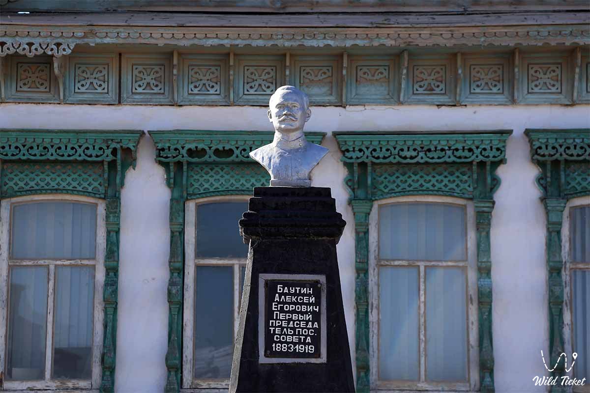
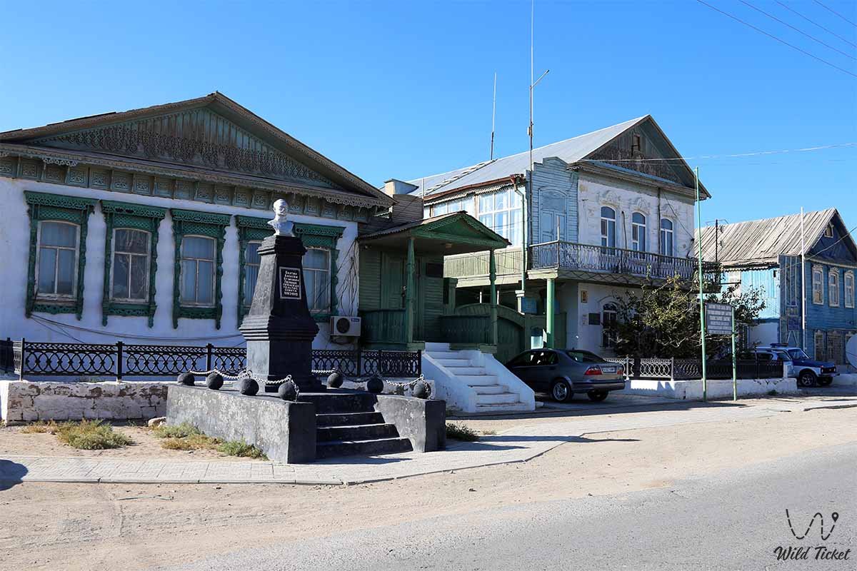
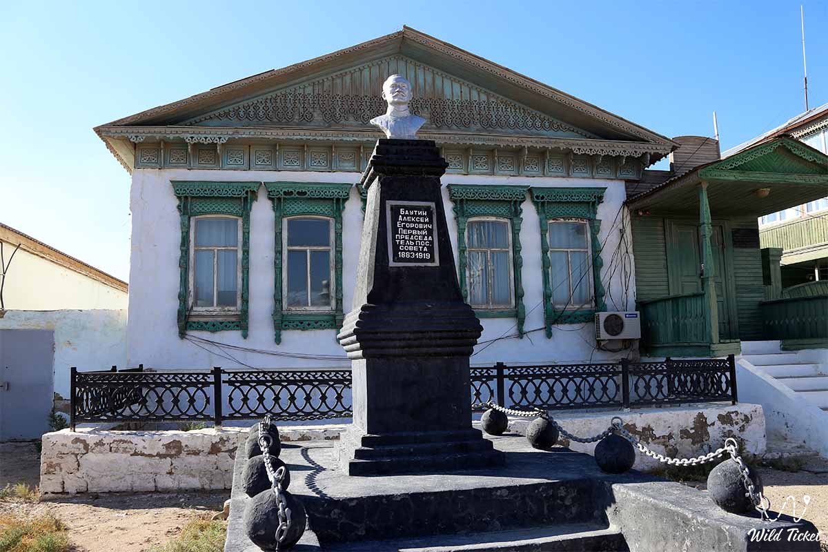
During the Civil War, the settlement and port became an arena of fierce fighting for control of the Caspian. In March 1919, a Red expeditionary detachment commanded by the Bolshevik Alexei Bautin landed here. As a result of a counter-revolutionary mutiny, Bautin and his comrades perished. Following the establishment of Soviet power, Nikolayevskaya Stanitsa was renamed Bautino village in memory of the fallen commissar.
In the Soviet era, the settlement evolved into a major center of the fishing industry of the Kazakh SSR. The Bautino fish cannery was built here, operating alongside a large fishing fleet, berths for seiners, and ship repair yards.
The port received a new wave of development at the turn of the 21st century with the onset of offshore hydrocarbon exploration in the Northern Caspian. Bautino became the primary logistics base of the North Caspian Operating Company (NCOC) consortium supporting drilling rigs and artificial islands at the Kashagan field. Large-scale dredging works were carried out, and modern quays, helipads, and warehouses were erected.
Information
Bautino village is part of the Tupkaragan district and directly borders the northwestern coast of the Caspian Sea. The population of the settlement is about 4,000 people.
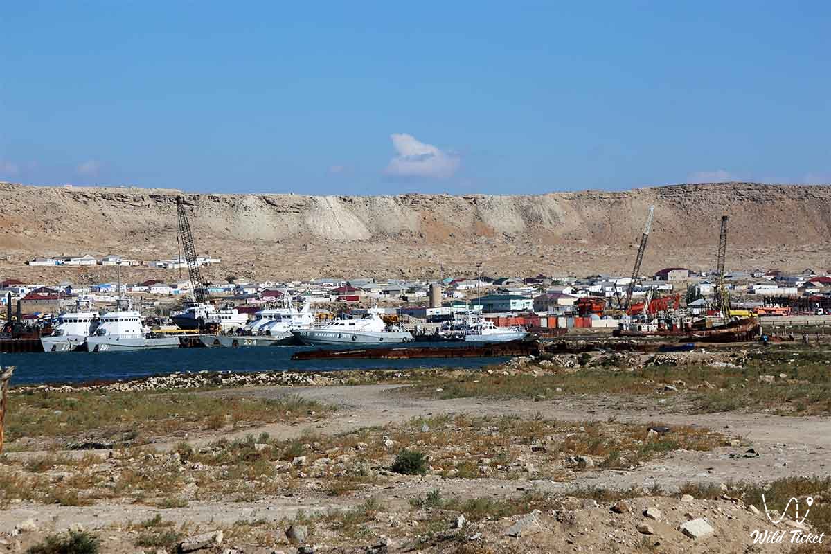
The seaport of Bautino is a specialized port complex situated deep within Bautino Bay. The water area of the port is reliably protected from open sea waves by the narrow Tyubkaragan Spit, ensuring year-round navigation and safe vessel berthing. The quayside extends for several hundred meters with depths alongside berths reaching 4–5 meters, accommodating sea-river vessels, self-propelled barges, tugboats, and supply boats.
The port specializes in the transshipment of general cargo, pipes, cement, industrial equipment, fuel, and rock material used for constructing artificial islands offshore. The port infrastructure includes logistics supply bases, a ship repair yard, fuel and lubricant storage facilities, and oil spill response (OSR) bases.
The climate of Bautino is arid and maritime moderately continental. The proximity of the Caspian Sea makes winter noticeably milder here than on the Ustyurt Plateau (average January temperature is around 0...-3 °C), while summer is less scorching thanks to steady breezes, with an average July temperature of around +26...+30 °C. Precipitation is sparse (around 140–160 mm per year).
Detailed description of the venue
The coastal port complex of Bautino village comprises several key functional and historical zones:
• Waters of Bautino Bay – a natural deep-water marine inlet with a sandy-silty seabed, serving as a harbor for dozens of service vessels, icebreaking tugs, and launches.
• Tyubkaragan Sand Spit – an elongated narrow arc of sand and shell coquina shielding the bay from the open Caspian and serving as a scenic platform for observing the sea.
• Cargo and Service Berths of the Port – berthing complexes equipped with portal cranes, terminals, and specialized areas for handling Kashagan project cargo.
• Bautino Ship Repair Yard – a historic facility for the maintenance of small-craft, fishing, and utility fleets of the Caspian.
• Historical Residential Architecture – old stone houses built from white coquina limestone dating from the 19th to early 20th centuries, preserving the atmosphere of a Cossack stanitsa and fishing settlement.
• Embankment and Anchorages – a shoreline strip where colorful fishing boats, mooring lines, and nets belonging to local residents can be seen.
Flora and fauna
The vegetation cover around Bautino village has a pronounced semi-desert and maritime character. Halophytes and psammophytes thrive on the rocky-sandy coastal soils: Caspian saltwort, Lerche's wormwood, gray-soil wormwood, biyurgun, itsegek, sea lavender (limonium), and camelthorn (dzhantak). Thickets of glasswort and coastal reed are found along shallow sections of the spit.
The animal kingdom is closely tied to the Caspian Sea. The waters of the bay serve as a habitat for valuable fish species: common carp, pike perch, Caspian roach (vobla), mullet, bream, and relict sturgeon species – beluga, stellate sturgeon, and Russian sturgeon.
During winter and early spring, the Caspian seal – the only marine mammal of the Caspian Sea, listed in the Red Book of Kazakhstan – can be observed around Cape Tyub-Karagan and on sandy shoals.
The avifauna of the area is exceptionally rich due to its location along major migratory routes. Caspian gulls, terns, cormorants, sandpipers, grey herons, mute swans, and greater flamingos nest and stop for rest on the Bautino Spit and coastal shallows. Toad-headed agamas, patterned runners, and desert larks inhabit coastal steppe sections.
Legend
An ancient maritime legend about the magical Bay of Salvation is linked to the founding of the settlement on the Tyubkaragan Spit. Lore tells that in centuries past, a fierce autumn storm on the Caspian caught a caravan of merchant vessels returning from Persian lands. The sky merged with black waters, masts broke, and giant waves threatened to smash the wooden boats against the impenetrable cliffs of Cape Tyub-Karagan.
When hope was nearly extinguished, the leader of the merchants offered a sincere prayer to the holy guardians of the seas. At that very moment, a mysterious silvery beam pierced the fog, showing a passage behind a narrow sand ridge. The ships entered the tranquil, wind-sheltered waters of the bay, where the sea was as calm as the bowl of a spring.
Ever since, sailors believed that Bautino Bay rests under the invisible blessing of sea spirits that protect every mariner seeking refuge from fierce Caspian storms.
Conclusion
The village and seaport of Bautino is a unique intersection of maritime history, industrial power, and coastal nature in the Mangystau region. Here, the aged legends of 19th-century fishermen and pioneers coexist harmoniously with a modern maritime fleet, creating the unmistakable flavor of Kazakhstan's westernmost port.
A visit to Bautino broadens one's perspective of Mangyshlak, showcasing not only its desert canyons but also the romantic maritime soul of the ancient Caspian coast.
Interesting sights nearby:
• Karagiye Depression;
• Ustyurt Plateau;
• Kuandy Depression;
• Aktau Mountains (White);
• Sultan-Epe Canyon;
• Basgurly-Zhazgurly Depression;
• Meretsay Canyon;
• Ashchysor Depression;
• Kapamsay Canyon;
• Khanga Baba Tract;
• Zhygylgan Collapse and Ancient Animal Footprints.
Photogallery: