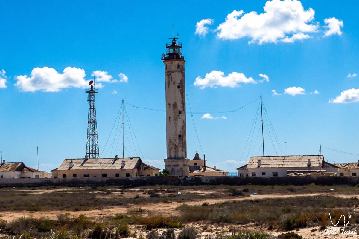
A solitary navigational bastion among coastal dunes and sea surf –
Peschany Lighthouse represents a historical and active navigational tower on the eastern coast of the Caspian Sea in western Republic of Kazakhstan. This unique hydrographic object is situated on the projection of Cape Peschany, which forms the distinctive coastal outline of the Mangyshlak Peninsula approximately 70 kilometers south of the regional center of the city of Aktau.
Territorially, the coastal zone adjoins the borders of the Munaily district and the Karakiya district, serving as a strategic landmark for vessels navigating along the eastern shores of the Caspian in international waters and heading toward the international Port of Kuryk.
The waters of the Caspian Sea in the vicinity of the cape feature a dynamic hydrological regime, where open sea winds generate powerful surf waves that deposit extensive sand bodies and barrier bars. From the southern side of Cape Peschany, the Aleksandr Bekovich-Cherkassky Bay indents deeply into the land, where ships have historically sought reliable natural shelter during stormy weather. For kilometers around the tower stretch wild steppe expanses and golden coastal dunes, creating a sharp visual contrast between the azure surface of the sea and the sun-baked semi-desert.
Within the navigational system of the Mangystau region, Peschany Lighthouse ranks among the top five historical lighthouses of the area, alongside the legendary "Melovoy" Lighthouse in Aktau, the "Upper Tyub-Karagan" and "Lower Tyub-Karagan" lighthouses in the Tupkaragan district, and the "Kyzylozen" Lighthouse. Each features a distinct light signature and flash characteristic. The signal of Peschany Lighthouse reaches up to 19 nautical miles into the open sea, ensuring safe vessel guidance during nighttime and low-visibility conditions.
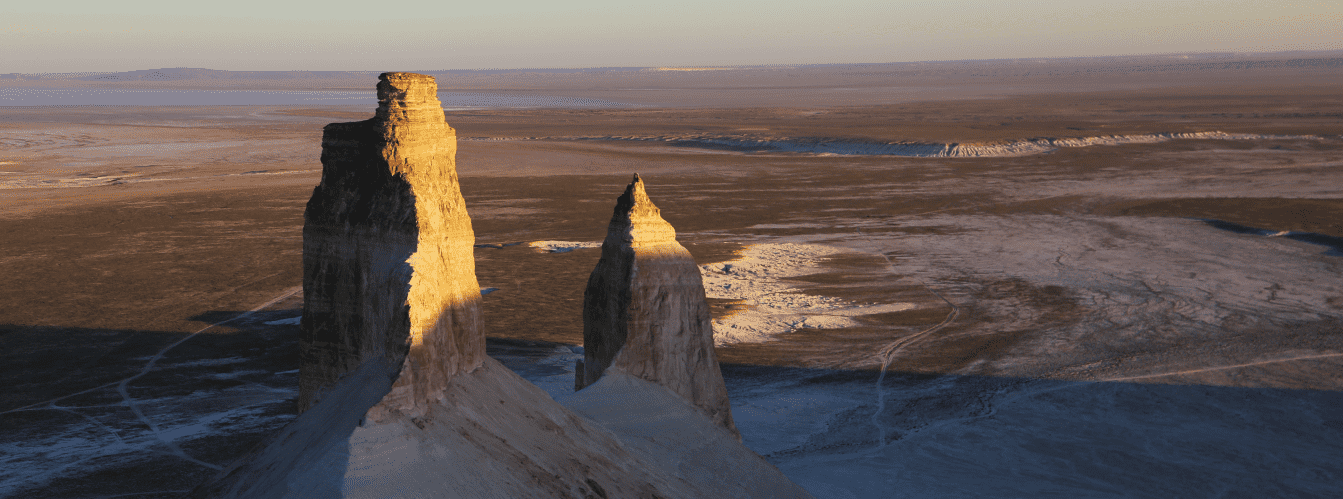
The geological framework of the coast is composed of thick Quaternary marine and eolian deposits overlying Neogene coquina limestone and clays. Steppe gravel tracks lead inland from the coast toward the famous "Three Poplars" (Sadja) landmark, after which trails head east toward the massive Karagiye Depression, the Ashhysor Depression, and the major industrial center of Zhanaozen, near which the Uzen Oil Field is developed.
The primary characteristic of the area surrounding the lighthouse is its absolute silence, broken only by constant sea winds, the rustle of shifting dunes, and the sound of Caspian waves. At night, flashes of the navigational light cut through the gloom over the deserted shore, illuminating the contours of the tower and creating the majestic atmosphere of a remote maritime outpost.
Following inspection of the lighthouse and sand spits, expedition routes head south toward Cape Tokmak, the Kenderli resort zone, and the waters of Kazakh Bay, or turn north toward the port of Kuryk and the monuments of Tupkaragan, including Tamshaly Canyon, the Zhygylgan Sinkhole, and Cape Tyub-Karagan.
Today, Peschany Lighthouse is listed among the historical and cultural heritage sites of the region and remains under professional supervision, serving as one of the most compelling and remote maritime history landmarks of Mangystau during the visiting season from May to October.
--------------------------------------------
How to get there and visit –
Peschany Lighthouse is located on the eastern coast of the Caspian Sea at Cape Peschany within the Mangystau region, Republic of Kazakhstan. The distance from the city of Aktau to the lighthouse is approximately 70–80 km in a southerly direction.
GPS geographical coordinates of Peschany Lighthouse:
43°11'24"N 51°17'06"E
The distance from the facility to the international maritime ferry terminal of the Port of Kuryk is about 30 km northeast, while to the major industrial hub of the city of Zhanaozen it is roughly 130–140 km east via regional highways and steppe graders. Near Zhanaozen operates the major oil and gas asset of the Uzen Oil Field, with the Zhetybay Field situated further north.
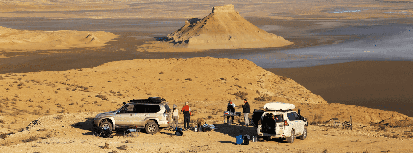
The route from Aktau starts along a paved highway heading south toward the Kuryk ferry complex. After roughly 50–60 kilometers, the route branches right onto packed steppe tracks leading across semi-desert terrain past the "Three Poplars" (Sadja) landmark directly to the coastline and coastal dunes.
Traveling to the lighthouse involves specific technical challenges: the final kilometers before the cape and the coastal approaches cross loose barkhans, wind-drifted sand patches, and shallow saline depressions. Driving a standard passenger vehicle is strongly discouraged due to high risk of bottoming out.
Overcoming this route requires a prepared four-wheel-drive vehicle (4x4) with high ground clearance, low-range gearing, and the capability to deflate tires to 0.8–1.0 atm for traction across shifting sand. The vehicle must be equipped with an onboard compressor, a wide shovel, sand boards, and a durable snatch strap.
Visiting regulations: the sandy coastline, wild beaches, and dunes around the cape are open natural areas accessible for camping and angling. The lighthouse itself functions as a strategic navigational security installation and historical monument, meaning free access inside technical buildings and climbing the tower is strictly restricted; exterior viewing only is permitted.
Infrastructure at Cape Peschany is entirely absent: there are no hotels, shops, fuel stations, or catering facilities. The nearest fuel stations, pharmacies, and repair shops are located in Kuryk village or on the outskirts of Aktau. Mobile reception near the lighthouse and behind the dunes is erratic.
Each crew must carry an autonomous supply of drinking water (at least 5 liters per person daily), reserve motor fuel in metal canisters, a portable gas stove, and gear to secure camp against gusty winds.
Best time to visit: late spring (May – early June), when air temperatures remain comfortable, as well as early autumn (September – October), when summer heat subsides, the sea remains warm, and clear, dry weather settles over the coast.
--------------------------------------------
History
The history of navigational structures on Cape Peschany is tied to the expansion of shipping across the eastern Caspian Sea, hydrographic surveys, and naval presence along the Caspian borders. Sandy shoals and shifting winds across this part of the Mangyshlak Peninsula posed serious navigational hazards for merchant convoys and fishing barks for centuries.
As early as the early 18th century, in 1715–1717, Prince Aleksandr Bekovich-Cherkassky explored these waters during his hydrographic expedition, charting the southern harbor of the cape, which still bears the name Aleksandr Bekovich-Cherkassky Bay. Captains of trading vessels traditionally sought shelter here during severe autumn gales, waiting out foul weather in calm waters.
The permanent navigational tower of Peschany Lighthouse was erected between 1954 and 1956 during a period of infrastructure expansion on the Caspian. Construction was overseen by Great Patriotic War veteran Esenbay Suleimenov. A residential building was constructed near the lighthouse, where Esenbay settled with his family, founding a dynasty of lighthouse keepers. During the Soviet era, the facility operated under the hydrographic service, passing to defense ministry management in the post-Soviet period to ensure vessel safety across Caspian waters.
For decades, the lighthouse was maintained through the dedication of the keeper family who guarded the tower and its optical equipment through challenging economic times. Subsequently, Peschany Lighthouse was officially designated as an object of historical and cultural heritage of the Mangystau region and placed under state authority for comprehensive restoration and preservation.
Information
Peschany Lighthouse is a coastal tower-type navigational structure. The main body consists of a white octagonal reinforced-concrete cylindrical tower equipped with a gallery and an upper lantern room. The height of the tower from its base is approximately 30 meters (about 98 feet), providing visibility of the optical landmark from both sea and shore.
The lighting and optical apparatus of the lighthouse stands at a significant elevation above sea level. The operational range of the navigational light reaches up to 19 nautical miles (around 35 kilometers), signaling vessels moving along international shipping lanes and neutral Caspian waters.
The climate of the cape area is sharply continental and arid, tempered by direct maritime air masses. Winters are relatively mild but very windy, with average January temperatures ranging from -3 to -6 °C. Summers are long, hot, and dry, with July maximum daytime air temperatures reaching +38...+40 °C. Coastal seawater warms to +25...+27 °C during peak season.
The geomorphological landscape is shaped by active wind action and marine wave sedimentation. The coastal strip features active eolian landforms, stabilized and shifting barkhans, and dry saline depressions within inter-ridge hollows.
Detailed description of the venue
The natural and architectural complex of Peschany Lighthouse includes the following features:
• Octagonal reinforced-concrete lighthouse tower – a 30-meter white hydrographic structure with an upper lantern room and viewing gallery.
• Cove and Bay of Aleksandr Bekovich-Cherkassky – a natural marine harbor on the southern side of the cape serving as a historic refuge for ships during storms.
• Coastal barkhans and sand dunes – scenic golden eolian dunes framing the cape down to the surf line.
• "Three Poplars" (Sadja) steppe landmark – a geographic reference point and vegetation oasis along overland approaches from the steppe.
• Historic keeper compound – residential and utility buildings of the hydrographic post linked to the family of builder Esenbay Suleimenov.
• Coastal salt flats and takyrs – saline clay sections of the semi-desert bordering the sand ridges on the eastern side.
Flora and fauna
The ecosystem around Cape Peschany has formed under extreme aridity, high soil salinity, and constant marine winds.
Vegetation (flora): sand ridges are stabilized by specialized psammophytes, dominated by juzgun (Calligonum), desert saxaul, sandy acacia, nitraria, and camelthorn. Dense salt flats support saltworts, biyurgun, sarsazan, and wormwood. In spring, given adequate moisture, desert sedges and early ephemerals appear briefly.
Wildlife (fauna): wildlife consists of inhabitants of sandy and stony semi-deserts. Common animals include gerbils, jerboas, long-eared hedgehogs, tolai hares, corsac foxes, and wolves. Reptiles include toad-headed agamas, rapid fringe-toed lizards, sand boas, and pit vipers. The shoreline hosts migratory birds—yellow-legged gulls, waders, Pallas's gulls, and cormorants—while Caspian seals occasionally appear in coastal waters.
Legend
Among Caspian mariners and old-timers of the steppe, a legend persists concerning the Unquenchable Star of Cape Peschany.
Lore recounts that long before the concrete tower was built in the wild sands of the cape, a solitary elder lived there, keeping memory of sailors lost in the stormy Caspian waters. On the darkest, most violent nights of storms, the elder would climb to the crest of the highest barkhan and light an oil lamp, shielding the flame from fierce gales with his hands. Sailors on distressed vessels would spot that solitary golden point and steer their rudders into the calm waters of Bekovich-Cherkassky Bay, escaping certain death on shallow reefs.
It is believed that when Soviet hydrographers erected the modern high lighthouse on this spot, the beam of its powerful projector absorbed a fragment of that ancient flame, continuing to carry out an eternal watch of life-saving service amidst the stern sea and silent sands.
Conclusion
Peschany Lighthouse is a landmark of maritime history, engineering design, and coastal beauty in Mangystau. The combination of the 30-meter tower, the golden dunes of the "Kazakh Emirates," and the azure waters of the Caspian Sea makes this location an essential stop during off-road expeditions across western Kazakhstan.
Interesting sights nearby:
• Cape Peschany;
• "Three Poplars" (Sadja) tract and landmark;
• Rakushechny Cape;
• Aleksandr Bekovich-Cherkassky Bay;
• Port of Kuryk;
• Kuryk Village;
• Cape Tokmak;
• Kazakh Bay;
• Kenderli Bay;
• Karagiye Depression;
• Lake Karakol;
• Karagiye-Karakol State Nature Sanctuary;
• Ashhysor Depression;
• Uzen Oil Field;
• Zhetybay Oil Field;
• City of Zhanaozen;
• "Melovoy" Lighthouse in Aktau;
• Upper Tyub-Karagan Lighthouse;
• Lower Tyub-Karagan Lighthouse;
• Kyzylozen Lighthouse;
• City of Aktau.
Sacred sights and pilgrimage destinations:
• Sisem-Ata Necropolis;
• Koshkar-Ata Necropolis;
• Ancestral burial grounds of Munaily and Karakiya districts;
• Beket-Ata Underground Mosque in Oglandy;
• Shopan-Ata Underground Mosque;
• Karaman-Ata Underground Mosque;
• Senek Necropolis;
• Tolegen Aulie Mosque;
• Sultan-Epe Underground Mosque;
• Masat-Ata Underground Mosque;
• Temir Abdal Underground Mosque;
• Old Beyneu Mosque.
Photogallery: