Natural attractions of the Turkestan region -
Architectural sights of the Turkestan region -
Turkestan region is a land where the past breathes in every stone, where nature meets antiquity, and the steppe meets the mountains. It lies in the south of Kazakhstan, at the foot of the Tien Shan Mountains, and is considered one of the most ancient cultural centers of Central Asia. Everything is intertwined here: the history of prophets and poets, traces of the caravans of the Silk Road, buzzing bazaars, ancient mausoleums, inaccessible mountains and quiet deserts.
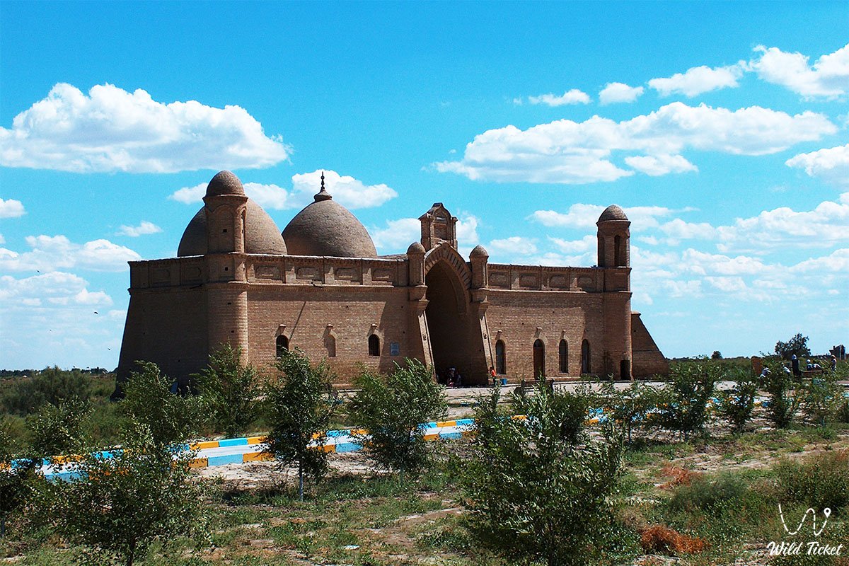
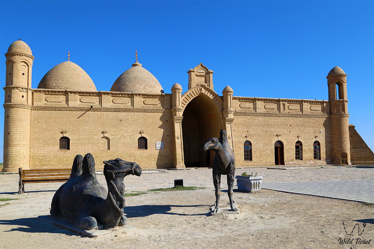
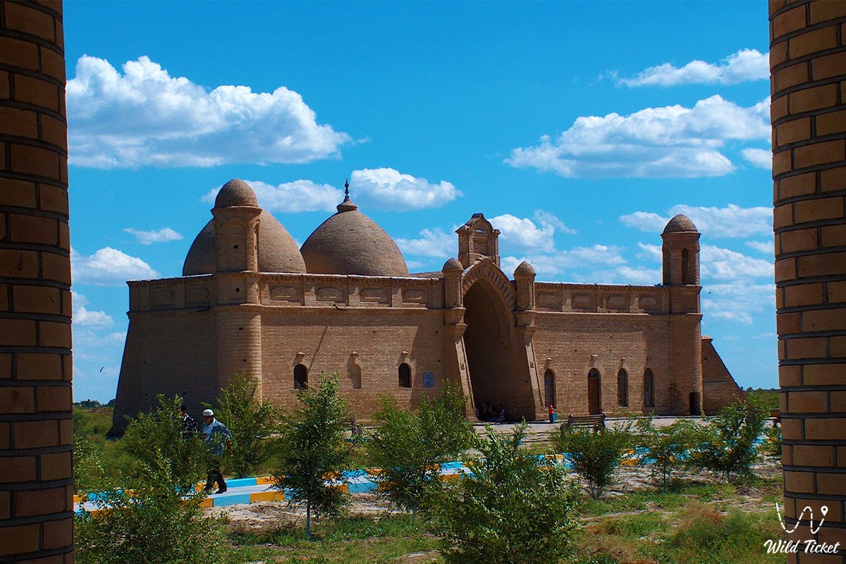
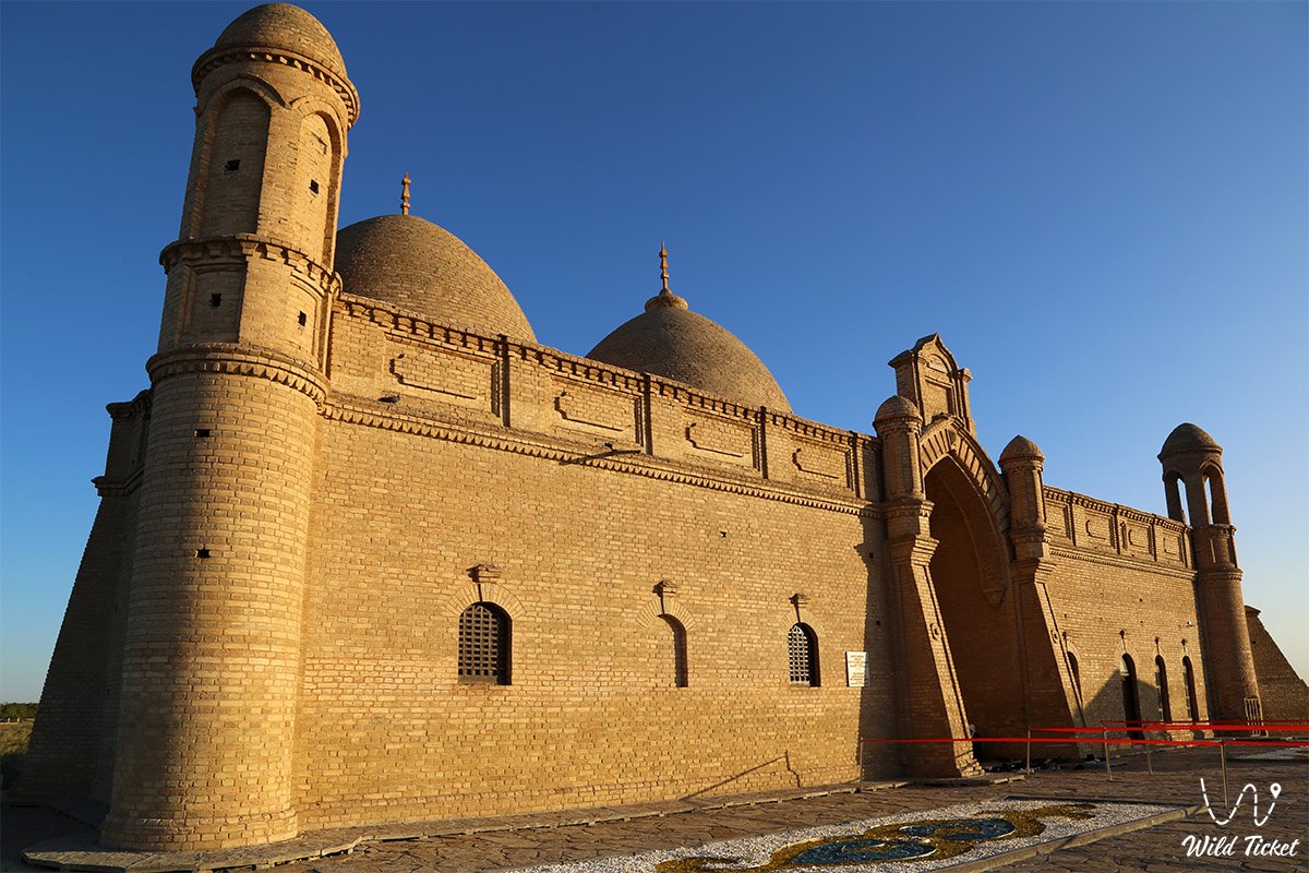
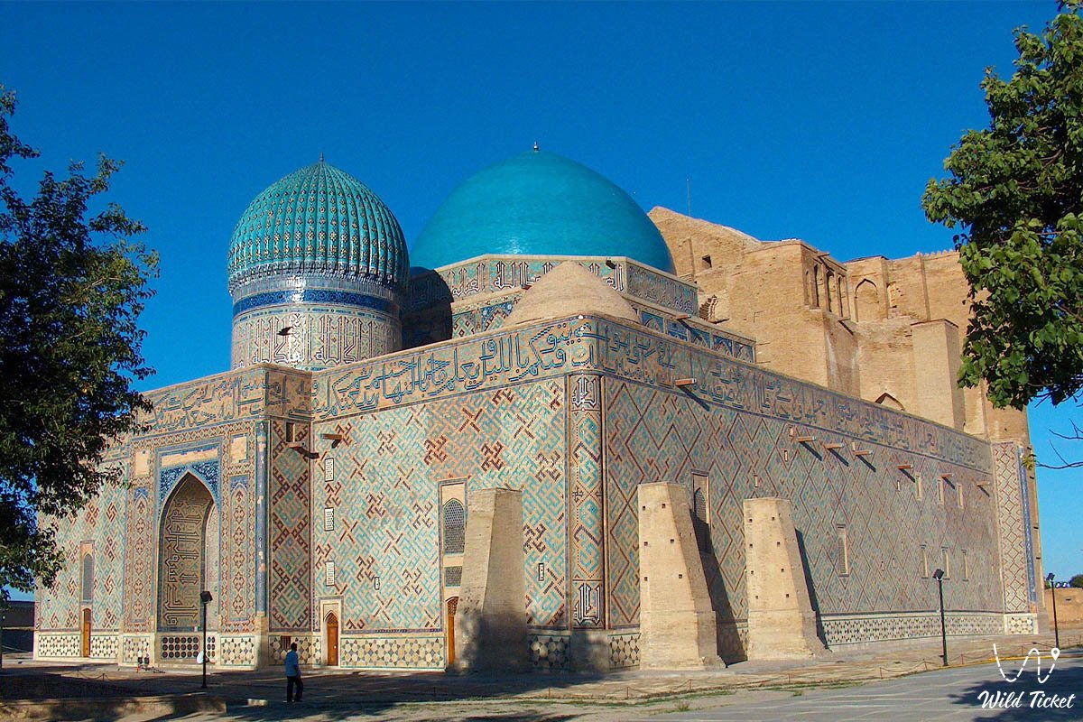
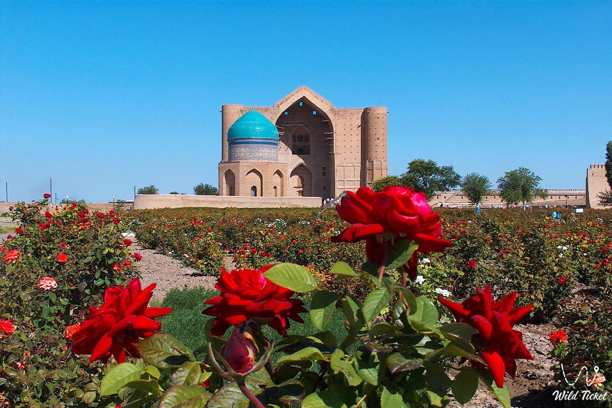
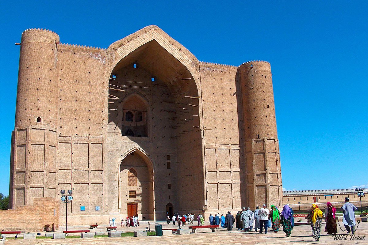
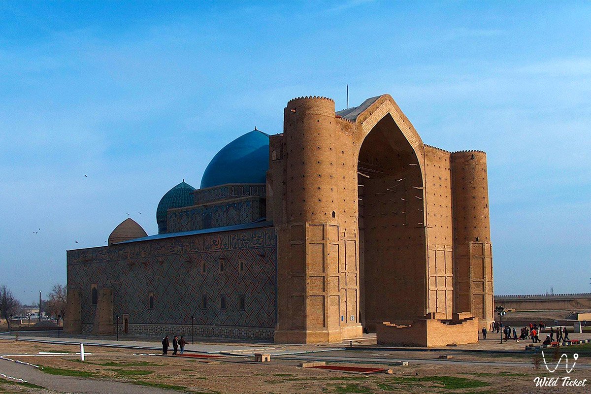
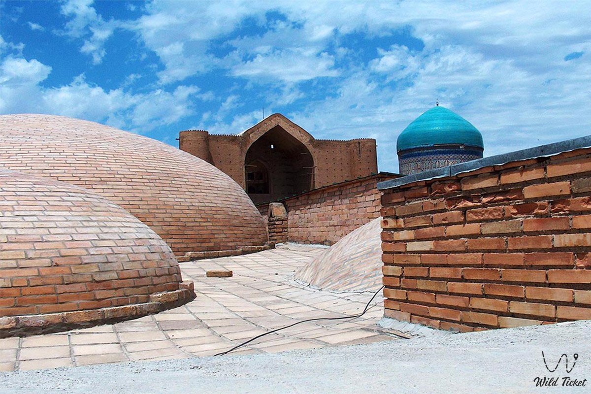
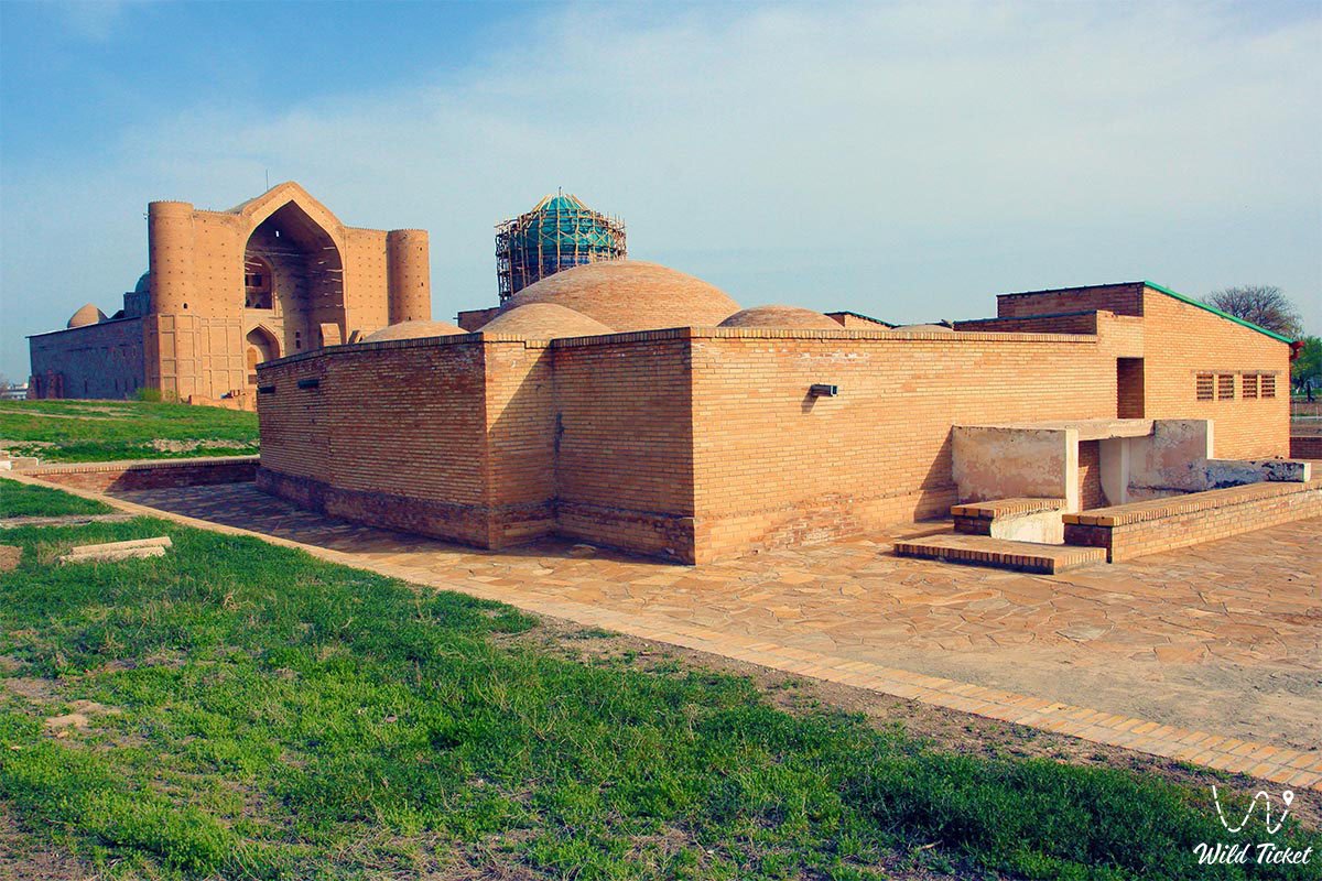
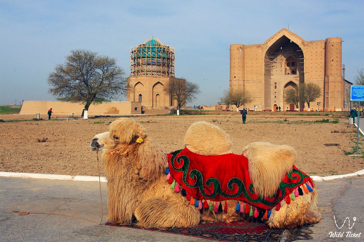
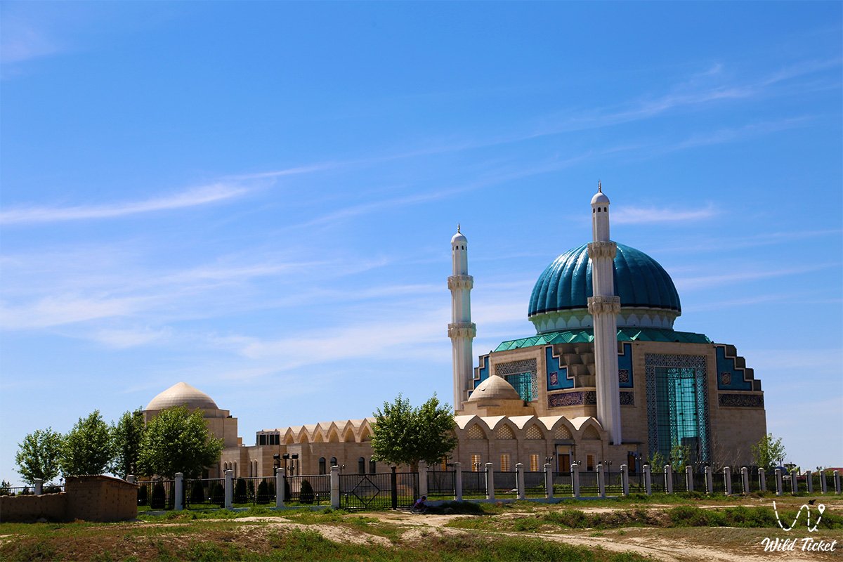
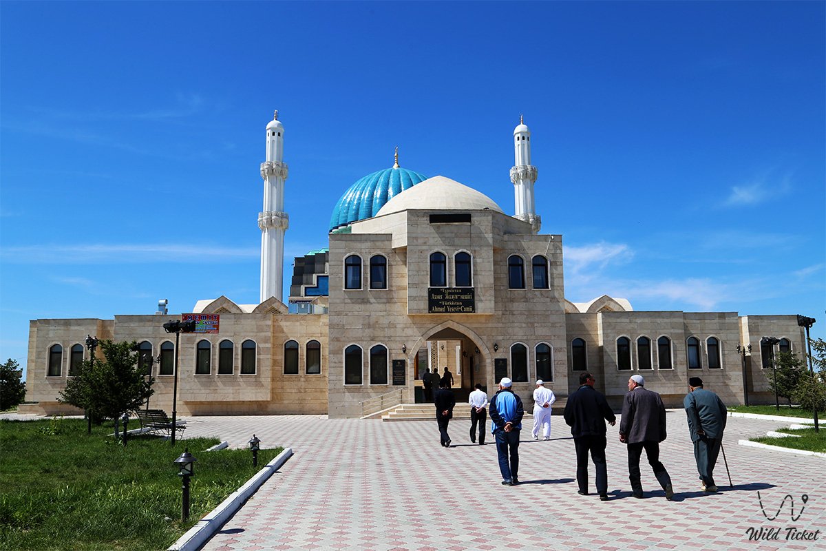
The heart of the region is the ancient city of Turkestan, a sacred city that has been a center of attraction for pilgrims, sages, Turkic khans and travelers for centuries. The mausoleum of Khoja Ahmed Yasawi is the main spiritual symbol not only of the region, but also of the whole country, protected by UNESCO. The walls of the mausoleum, lined with glazed bricks, shine in the sun, like the keepers of a thousand-year-old wisdom.
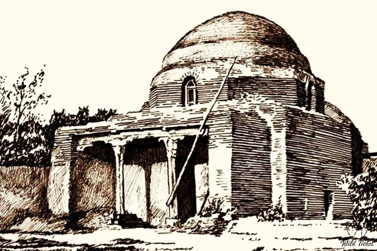
The famous mausoleum of Arystanbaba is located here in the region, which is very popular among pilgrims in the region. Ishaq Baba Mausoleum is also interesting for its size, architecture and interior decoration. The famous ruined city of Sauran is also located in the region and is its hallmark.
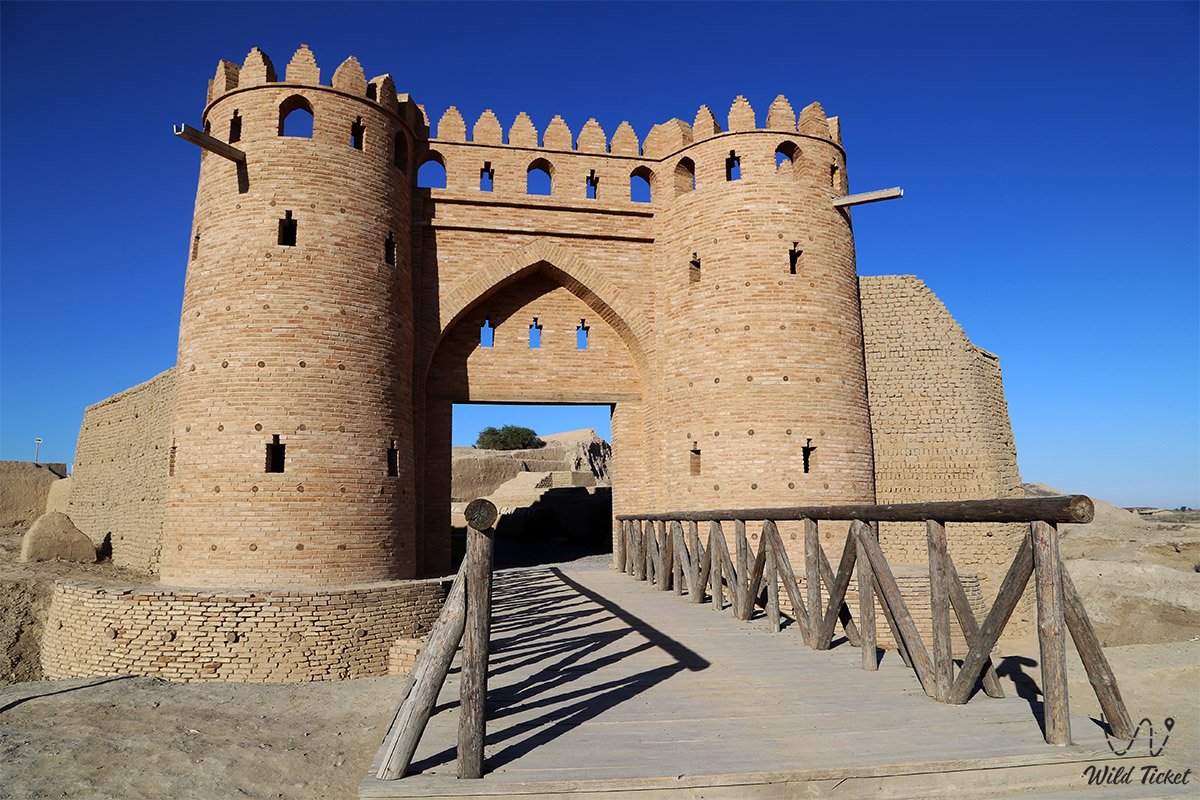
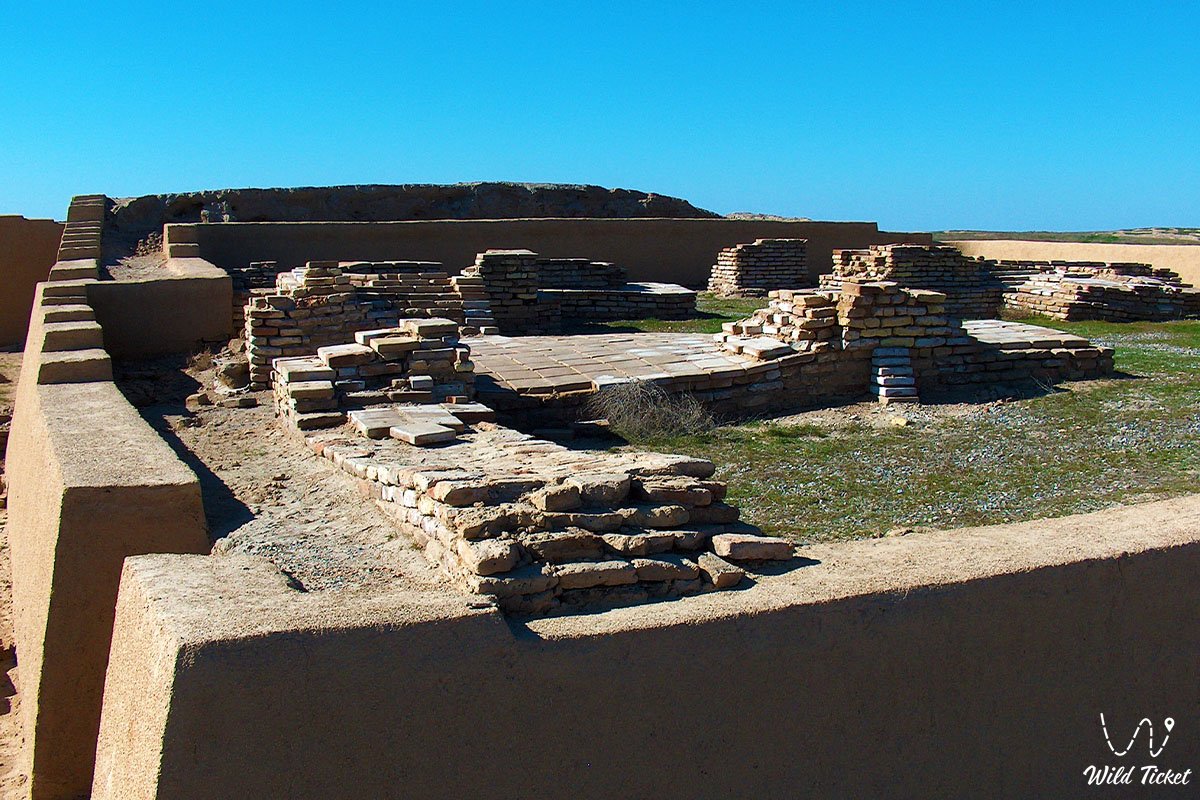
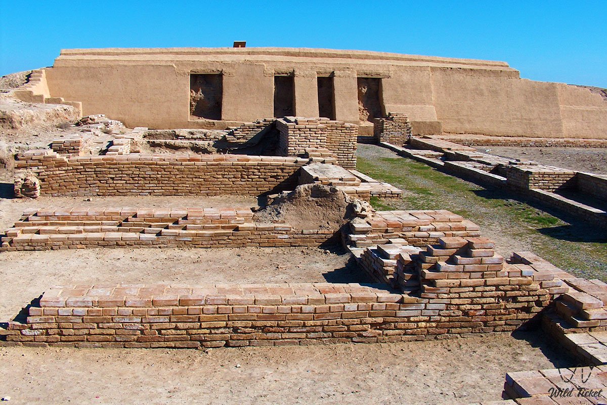
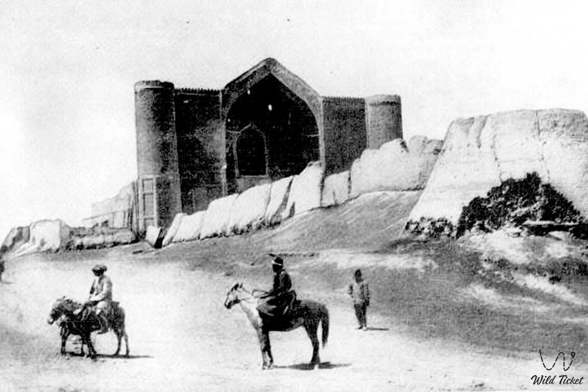
The ancient settlement of Otrar is also one of the architectural attractions of the Turkestan region, an ancient city has been preserved here, which is now partially restored. Here you can see firsthand what the ancient cities of Kazakhstan were like, how they were built, etc. See the full list of architectural attractions of the Turkestan region.
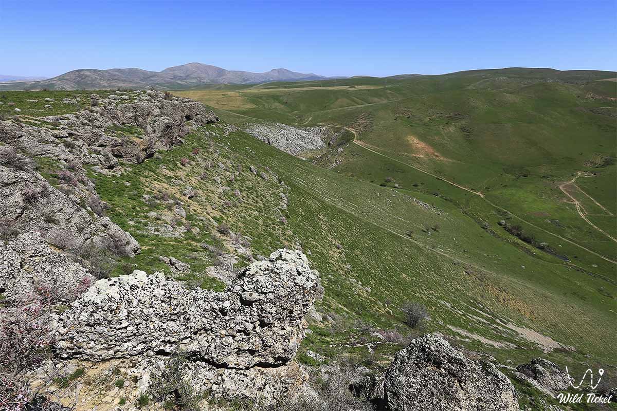
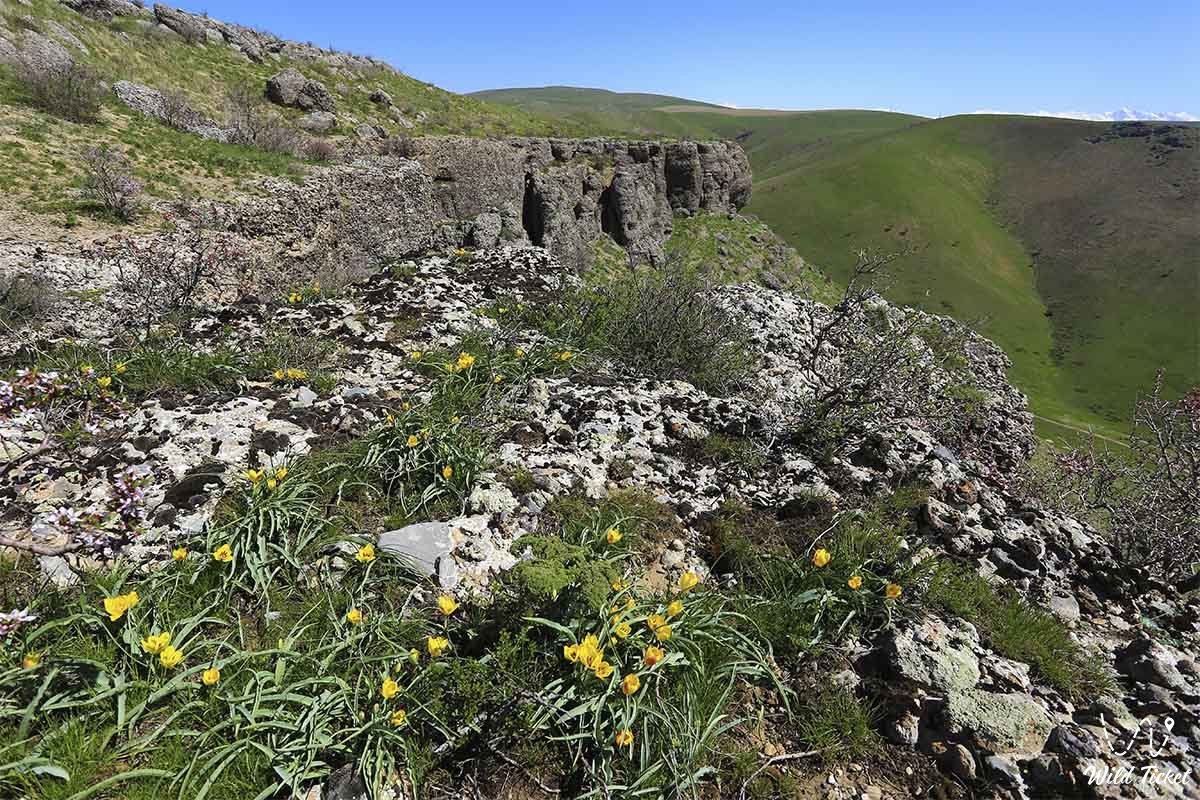
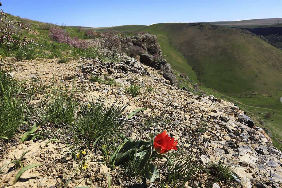
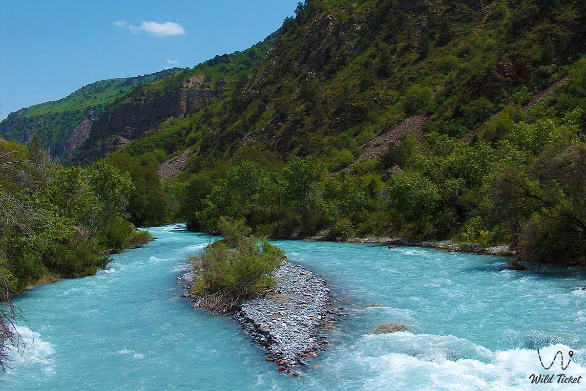
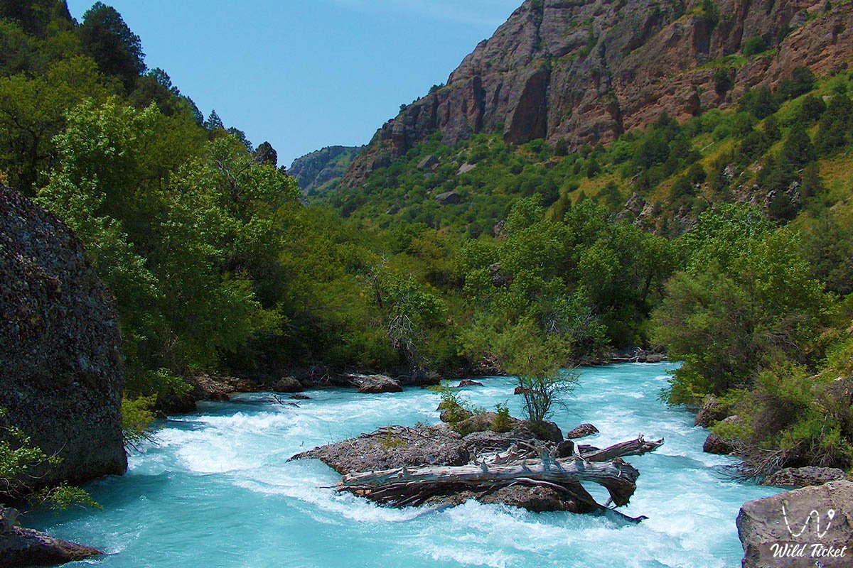
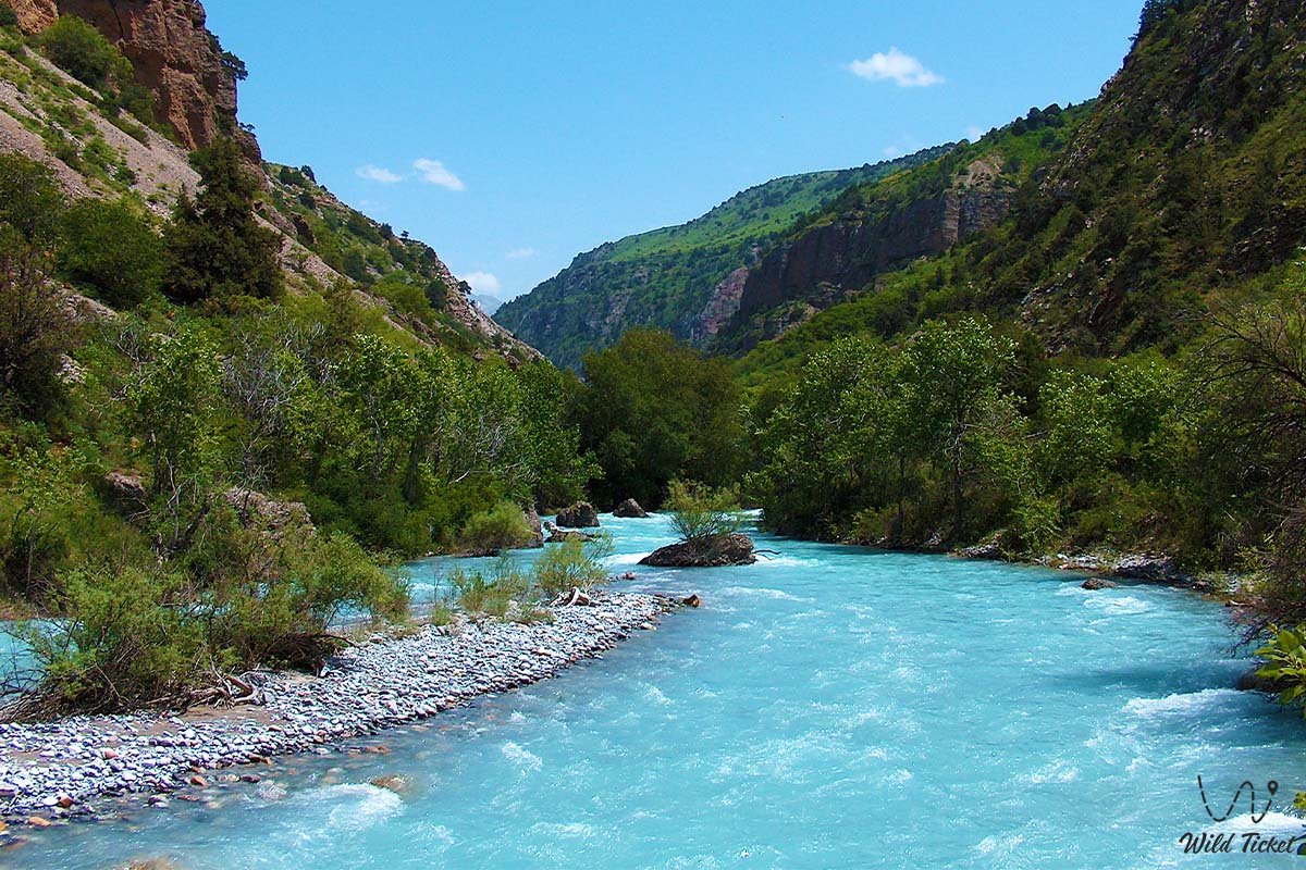
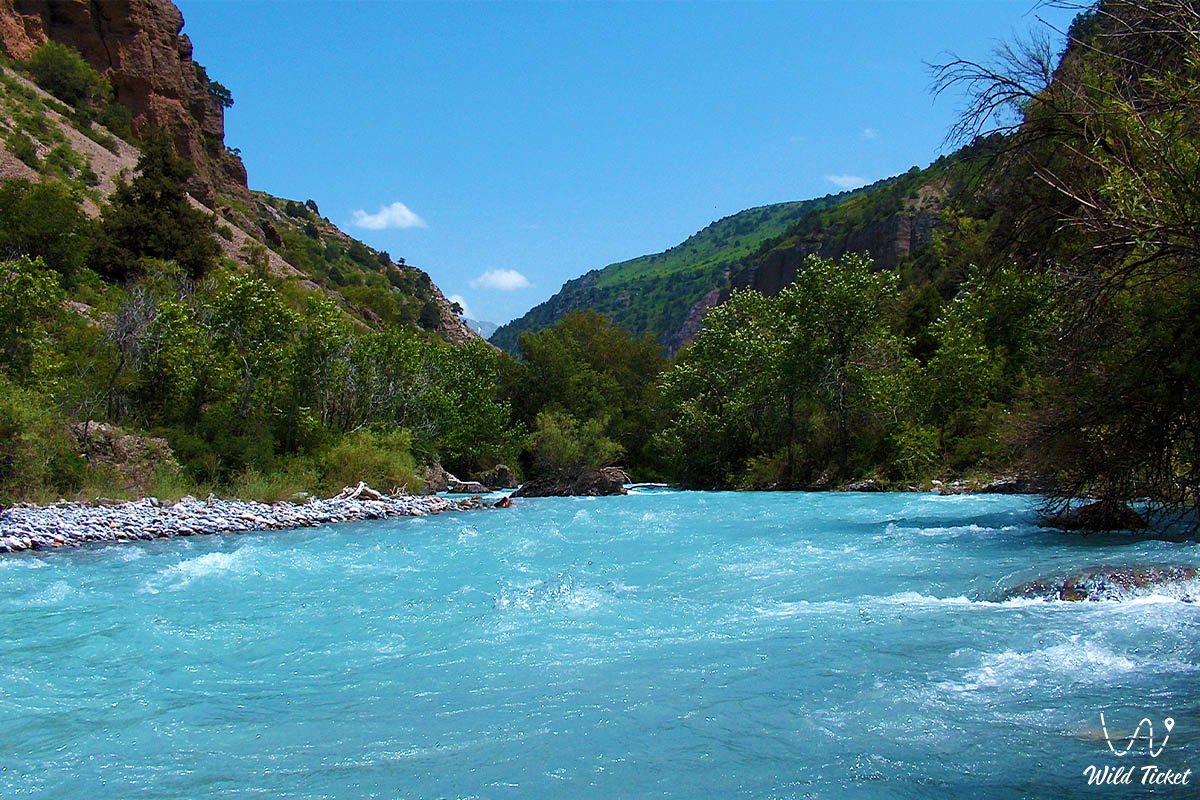
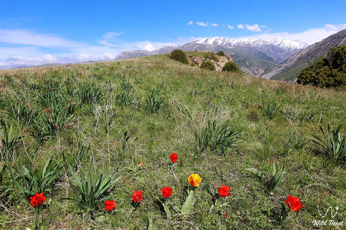
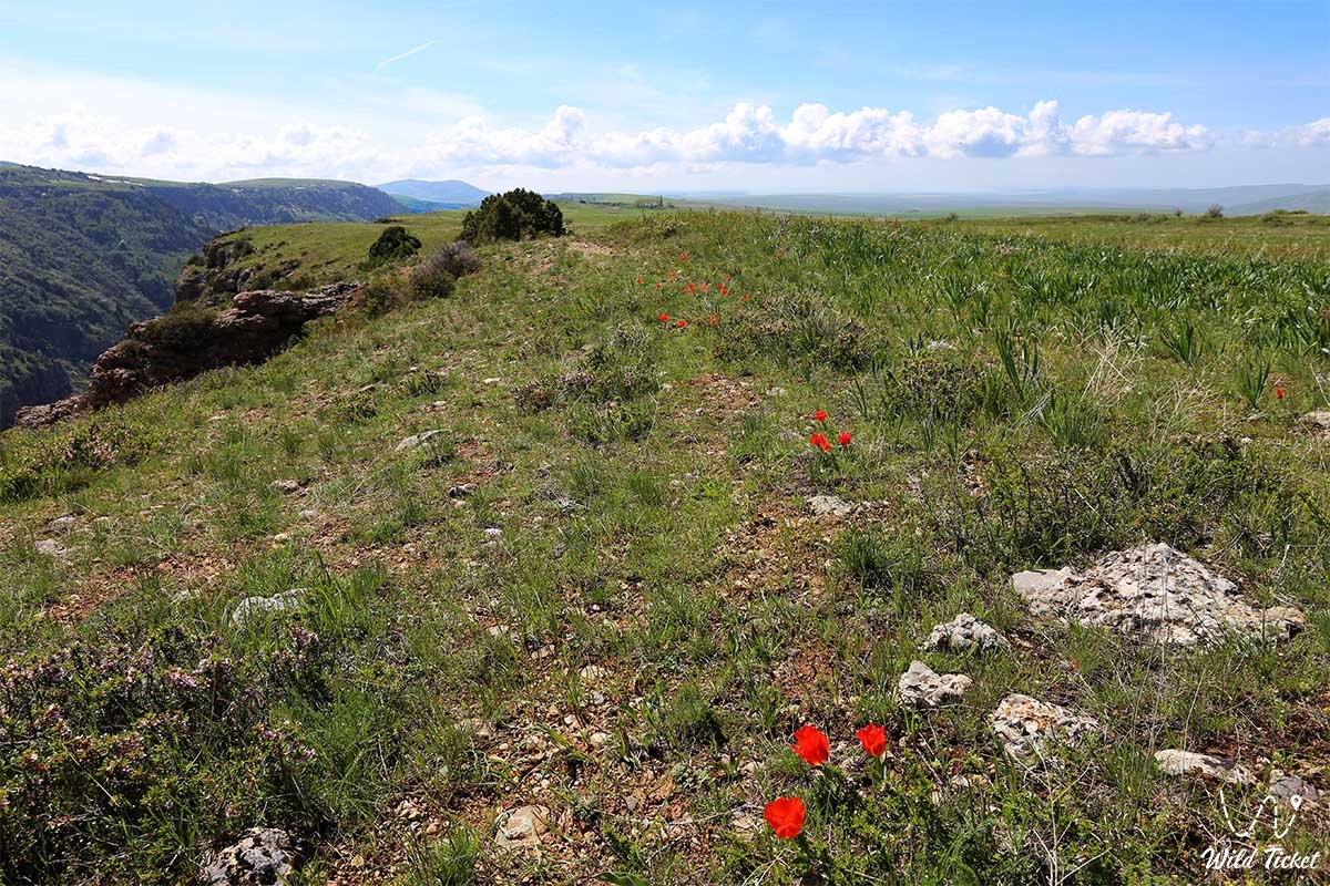
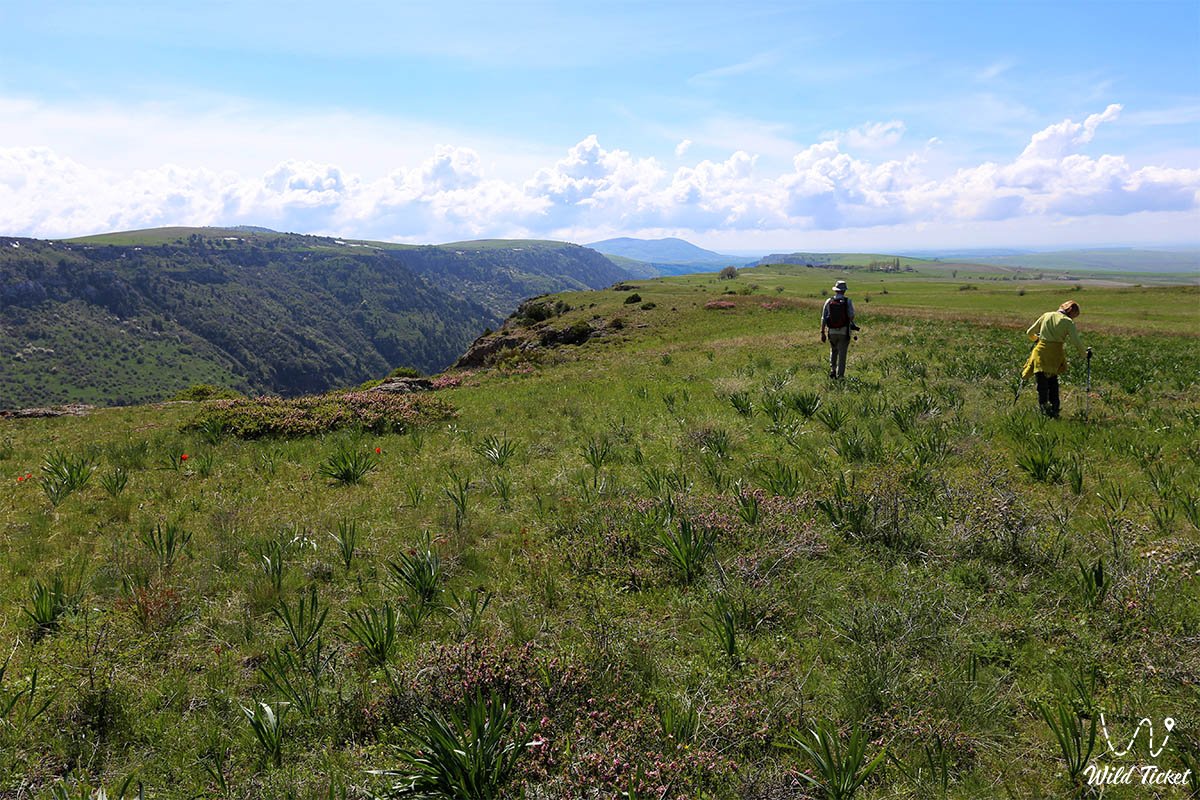
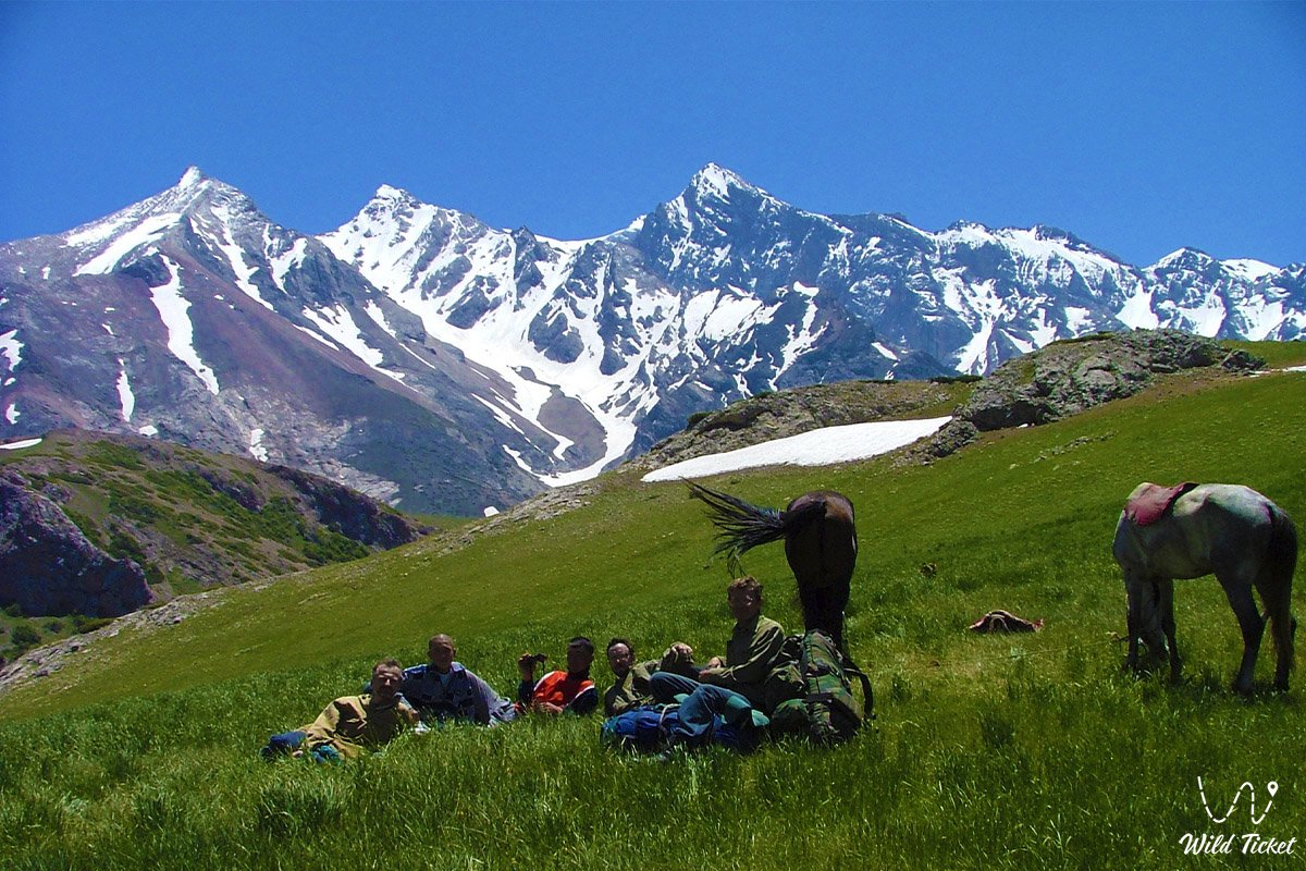
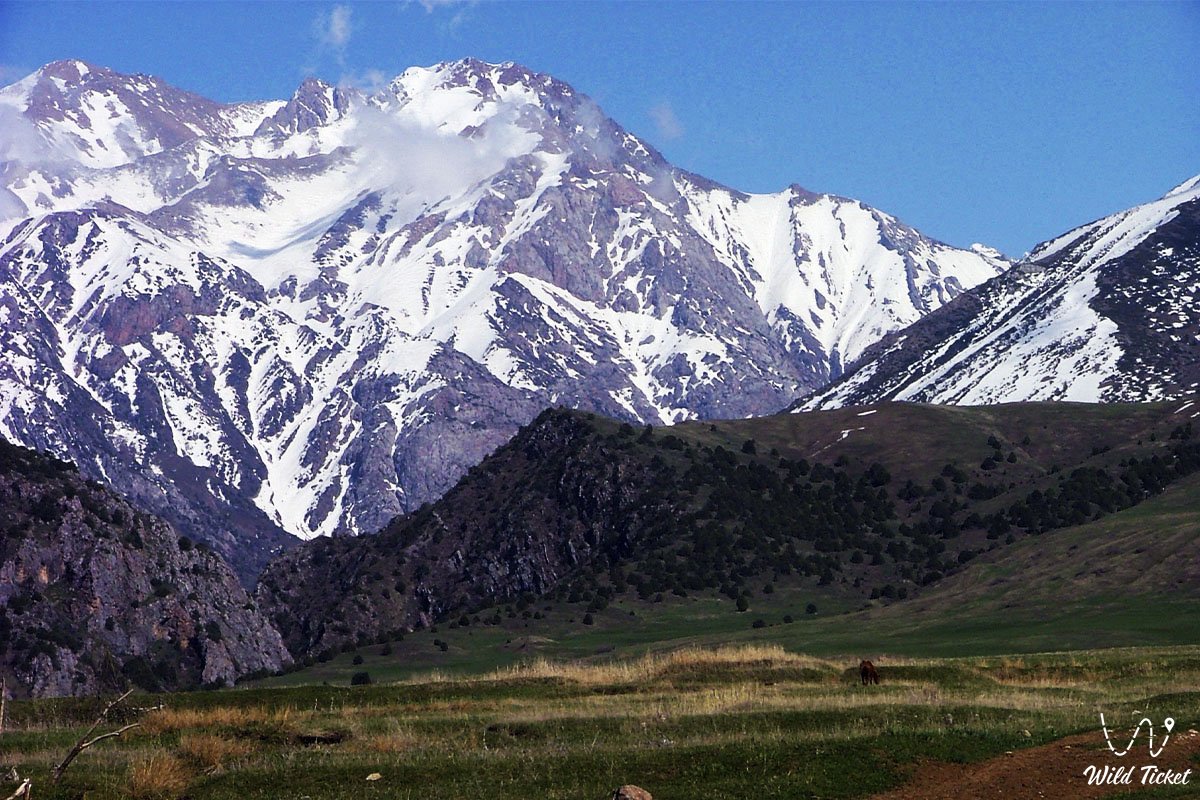
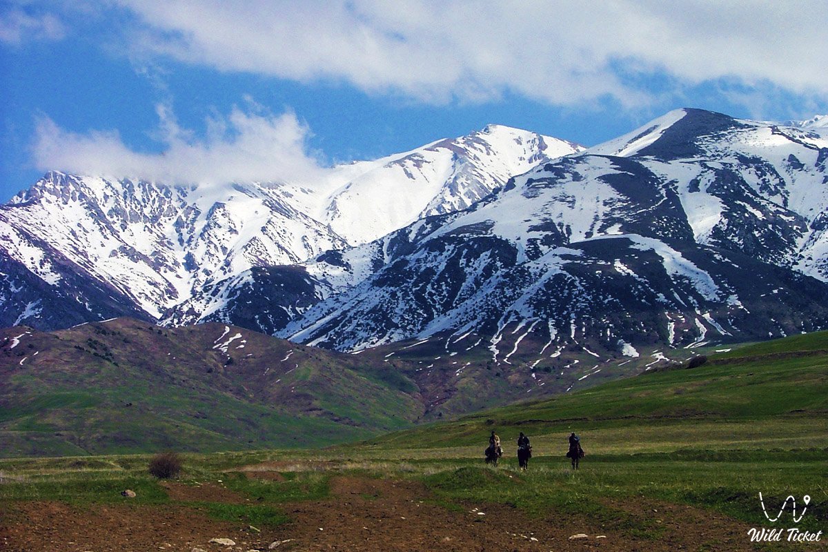
But the Turkestan region is not only about history and architecture, sacred and sacred places, but it is also about the most beautiful, pristine nature and natural attractions that take your breath away. The legendary Aksu-Zhabagly Nature Reserve is located here, the oldest in Central Asia, where waterfalls, caves, glaciers, gorges, flowering fields and snow peaks combine in wild harmony. In spring, wild tulips of Kazakhstan bloom here, just as they were before the beginning of time – wild, proud, native and incredibly beautiful.
It is the birthplace of the snow leopard, the bear, the golden eagle, the archie, the alpine meadows and the Tien Shan coniferous forest. To the south, there are desert and semi—desert expanses - they also have their own strength. See the full list of attractions of the Aksu-Zhabagli Nature Reserve.
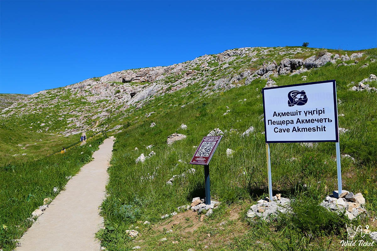
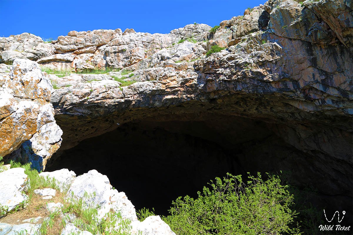
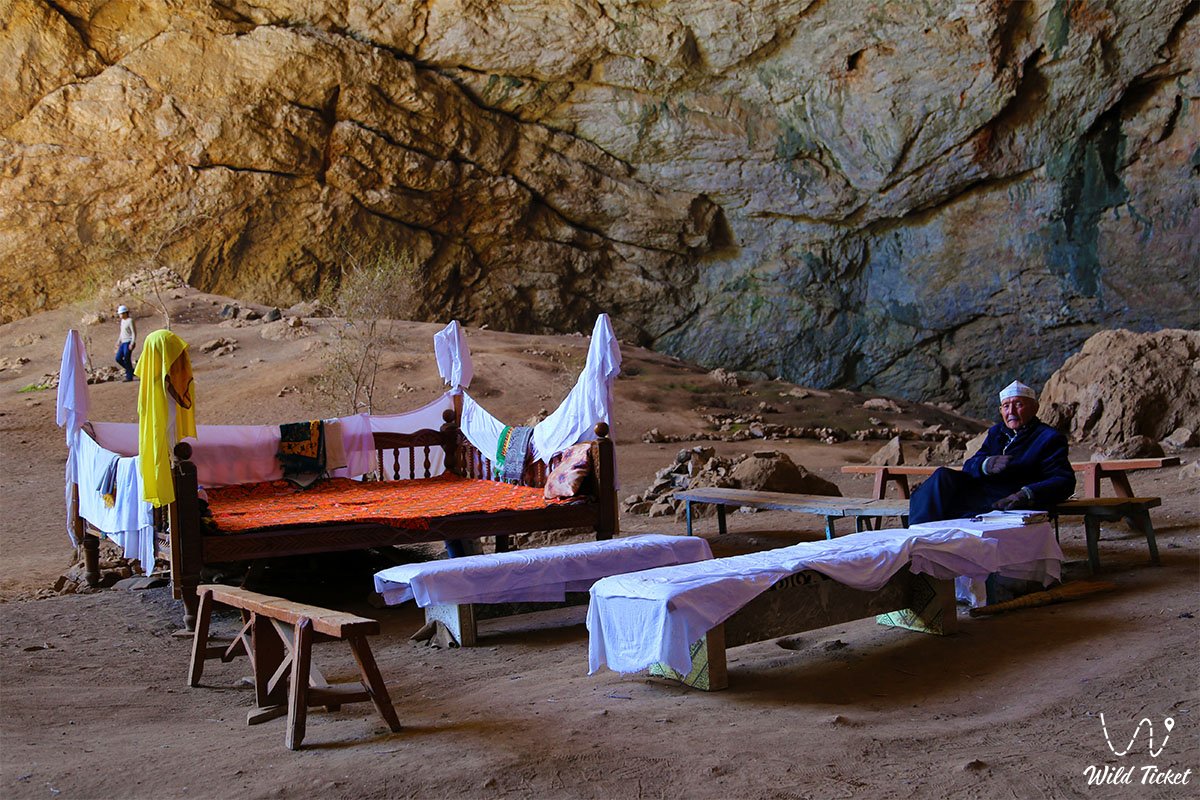
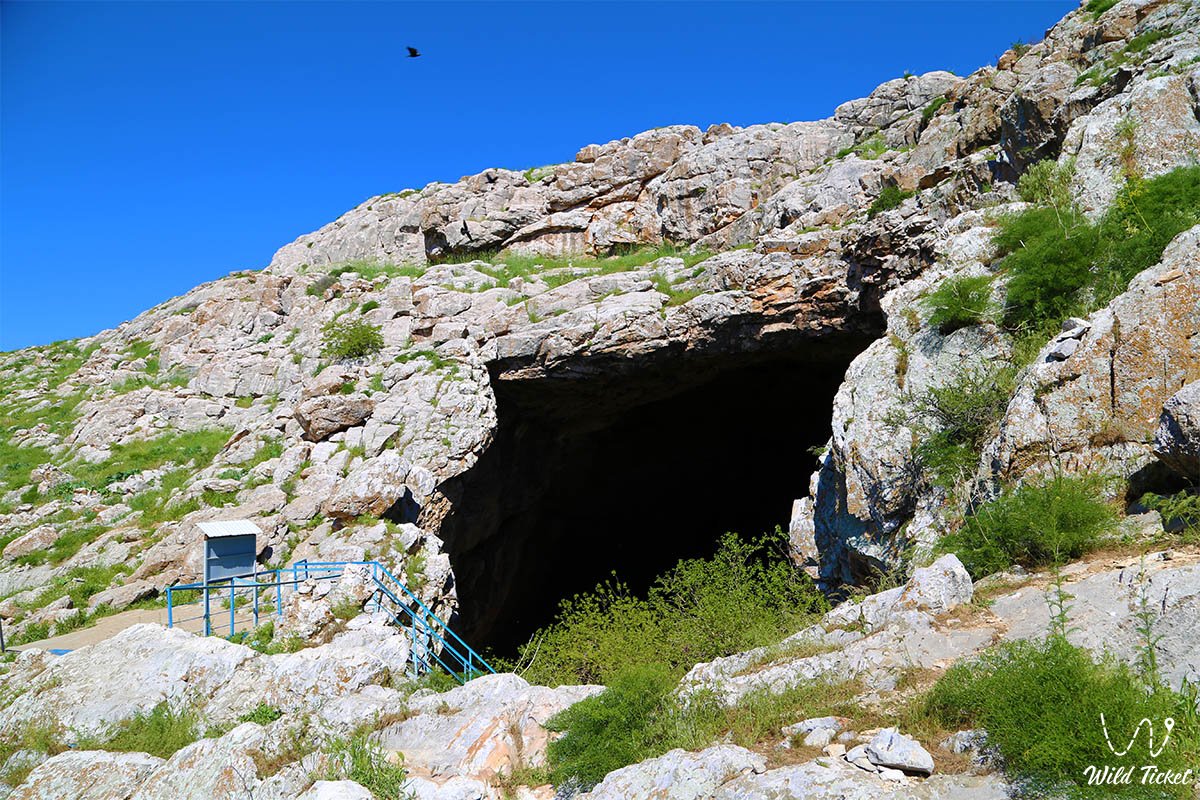
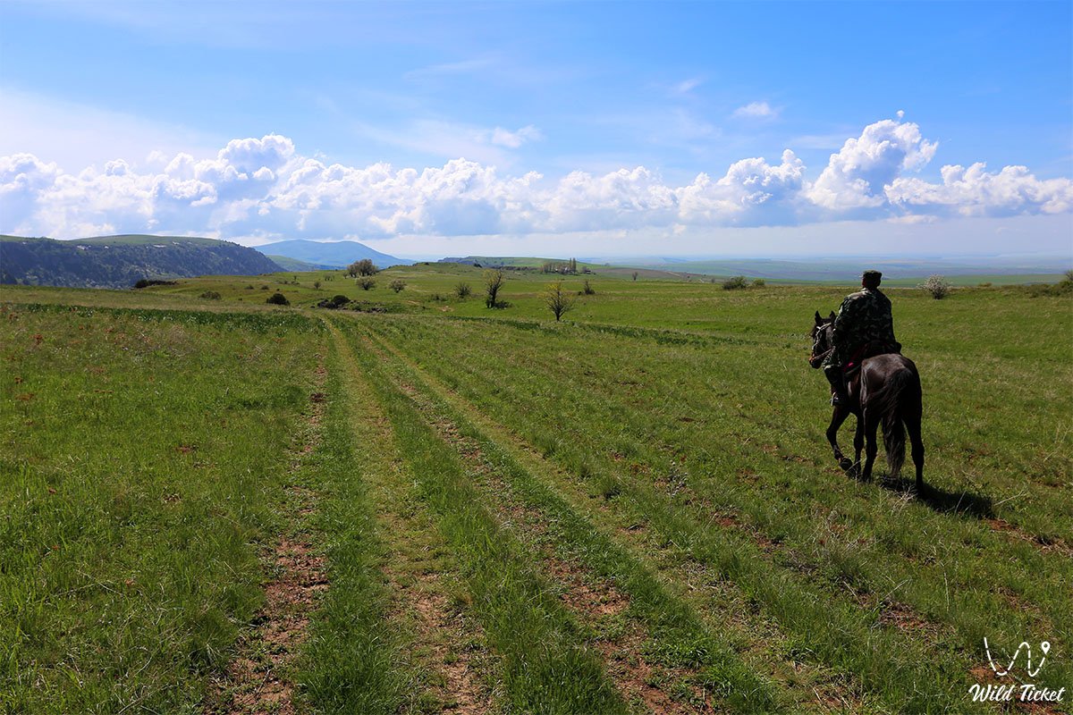
Turkestan region is a land of contrasts. Lakes with reeds, tumbleweeds, cries of herons and cranes, ancient Saka mounds and caves – all this lives like the eternally pulsating heart of this earth. There is the famous Ak-Mosque Cave, a sacred cave where pilgrims gather and say prayers. The other Karaungir cave is just as sacred and is waiting for its pilgrims, they say people are healing in this cave.
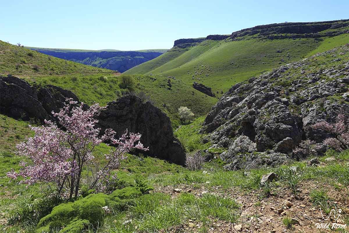
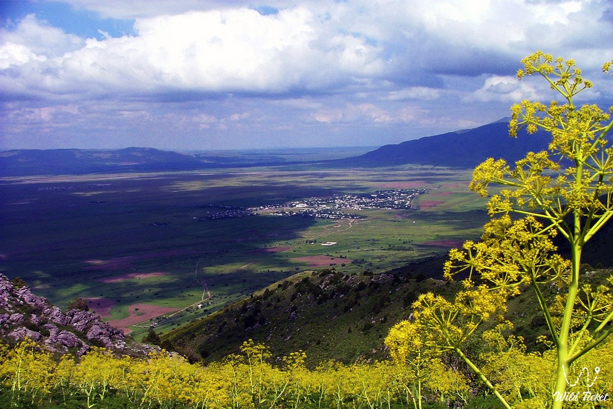
The Kelinshektau mountain range invites lovers of space landscapes and lovers of traveling by jeep. Boralday gorge will show you what beautiful mountains can be in the Turkestan region. Mashat Canyon is a place where residents of the region go on their way out and relax in the shade of its trees.
In the Turkestan region, you can be in the mountains with icy water and pine trees in the morning, and in the evening wander through ancient cities, feeling the millennial dust of caravans under your feet. A real Kazakh soul lives here: they sing kui in the village, cook kumis, and greet the traveler as if they were their own. Then you can hear the voice of the steppe and the roar of the waterfall. Click and see the full list of natural attractions of the Turkestan region.
---------------------------------------------
How to get there and visit -
Turkestan region is located in southern Kazakhstan, a district of the city of Turkestan, a district of the city of Shymkent, Republic of Kazakhstan.
GPS coordinates: 43°10'04"N 68°12'26"E
---------------------------------------------
History and information
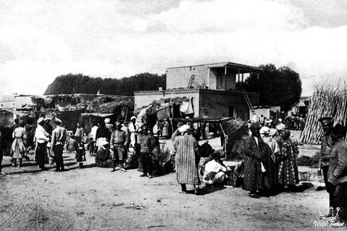
The history of the Turkestan region is a chronicle written by the steppe wind, the sand of ancient cities and the rumble of caravans passing along the Great Silk Road. These lands were inhabited back in the Bronze Age, long before the advent of writing. Tribes were born here, peoples united, cultures were formed, the first kuis on dombra sounded and the first lines of the future Kazakh soul were written. Since ancient times, the Turkestan land has been part of a great trade network connecting the East with the West. Caravans from China traveled through these steppes to Persia, Syria, and Byzantium. Real oases of civilization appeared here: the cities of Otyrar, Sauran, Isfijab and Taraz. These cities were not just parking lots – they were centers of craft, trade, philosophy and science.
Otyrar was especially famous – it was here in the 10th century that the outstanding scientist Abu Nasir Al-Farabi was born, who would later be called the Second Teacher after Aristotle. In the 13th century, Otyrar became the scene of a heroic battle with the troops of Genghis Khan. The city fell, but went down in history as a symbol of resilience and dignity.
In the 16th century, when the formation of the Kazakh Khanate began, Turkestan became not just a major center, but the spiritual and political capital of the Kazakh people. It is here that stands the mausoleum of Khoja Akhmet Yasawi, a saint, Sufi poet and mentor, whose teachings spread throughout the Turkic world. This mausoleum was built at the end of the 14th century by order of the great commander and patron of art Amir Timur. It not only impresses with its architecture, but has also become a symbol of spiritual unity. Turkestan has become a place of pilgrimage, equated in importance to Mecca. It was said: "three hajj trips to Turkestan are like one to Mecca," and Kazakhs have been striving here for centuries to worship the shrine and be buried in the sacred land.
In different eras, the Turkestan land was part of various states: the Kangyuev state, the Karakhanids, the Kokand Khanate, the Russian Empire, and later the Soviet Union. Each stage left its mark: in architecture, in everyday life, in the memory of the people. Even in Soviet times, Turkestan did not lose its importance – the spirit of independence was preserved here, traditions continued to be passed on here, despite ideological prohibitions.
Today's Turkestan region is a continuation of a great history. This is a land where centuries have lived side by side. Here you can touch the wall, built a thousand years ago, and feel the beat of time. This is not just a region of Kazakhstan – it is its source, its foundation, its spiritual center.
Photogallery: