The Big Almaty Round-the-World Trip Route
Multi-day mountain hike in the Almaty mountains -
Trekking along the Big and Small Almaty gorges -
The Big Almaty Round-the-World Trip is a beautiful 4-day mountain route that passes through picturesque places in the Trans-Ili Alatau Mountains. This route is very popular among fans of active recreation and hiking in the mountains, the difficulty category of the route is suitable even for novice travelers.
The route begins at the Big Talgar mountain pass, which can be reached by the Medeo-Chimbulak cable car from the Medeo tract. Then the route passes through the Left Talgar gorge, along which the picturesque mountain river Left Talgar flows. There is a trail along the river that will take you to such picturesque meadows as "Krasnaya Polyana", and then to the meadow "Alpine Rose", after the route will take you to "Solnechnaya Polyana" and then to "Polyana of Fools".
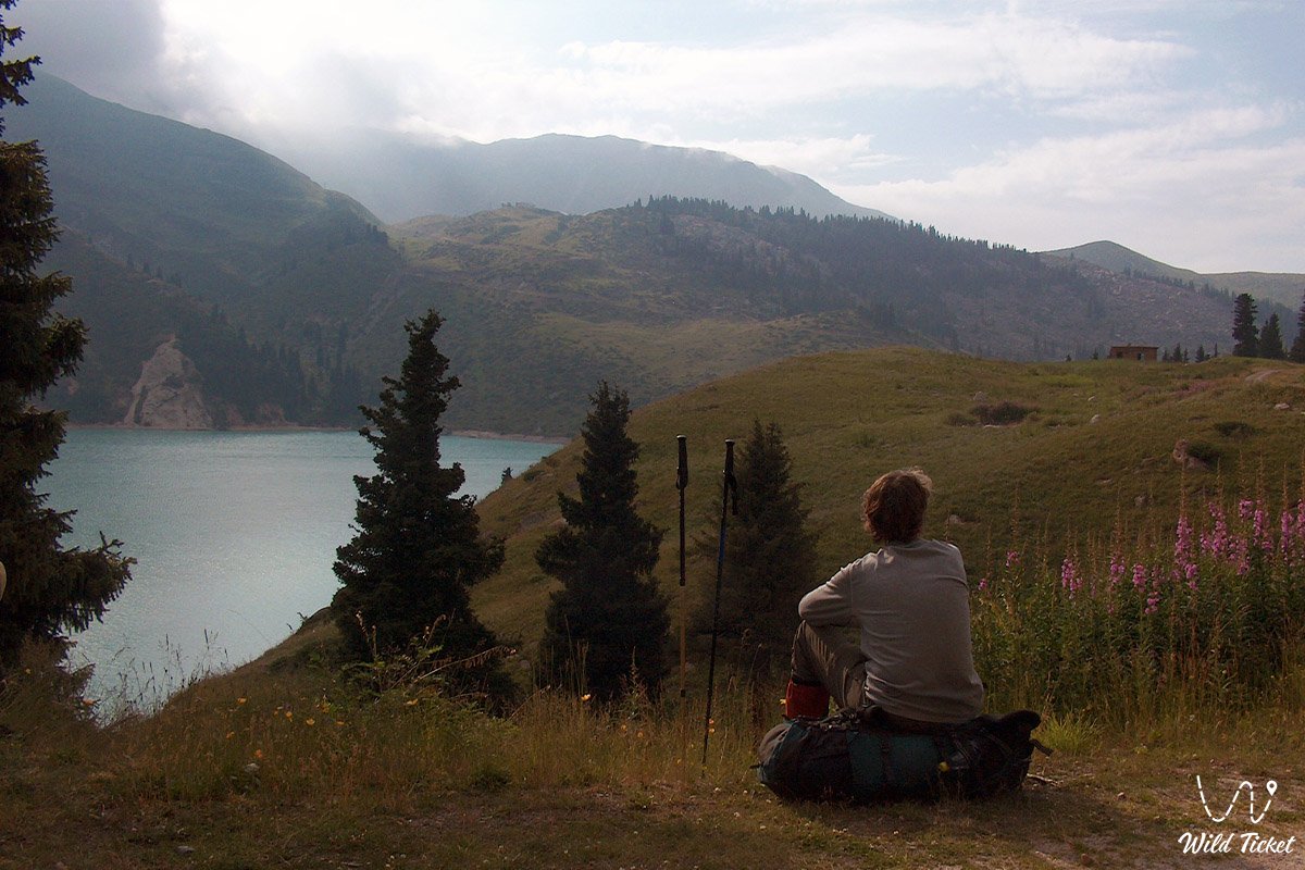
Next, you will need to climb the Tourists Pass and then descend into the Big Almaty gorge through the Kyzylsay gorge. Here you will see the Soviet peak, the Ozerny peak and will descend along the road between these two peaks along the Ozernaya River. On the same day, you will reach the Big Almaty Lake, from where you will need to go down to the city of Almaty by car. This route is also available in the opposite direction, and it is a little easier than the first option.
This route also includes climbing mountain peaks that are on your way, for example, the Molodaya Gvardiya peak and the Sovetskikh Alpinistov peak (Soviet Climbers). For this, you will need additional days and time. Please note that this area is adjacent to the state border between Kazakhstan and Kyrgyzstan, so you must have identification documents with you, as there are border guards in this area who can check you.
---------------------------------------------
How to get there and visit -
The route "Big Almaty Around the World" goes through the mountains of the Ile-Alatau Mountain Park in the mountains adjacent to the city of Almaty, along the Big Almaty Gorge, along the Left Talgar Gorge, Talgar District, Medeu District, Almaty Region, Republic of Kazakhstan.
GPS coordinates: 43°01'37"N 77°05'03"E
---------------------------------------------
Information
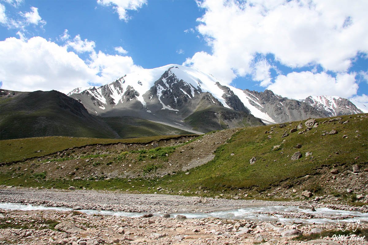
Big Almaty Around the World is one of the most popular and exciting multi-day tourist routes in the Zailiysky Alatau. This circular route, about 40 kilometers long, passes through picturesque gorges, passes, alpine meadows and glaciers, opening up stunning views of mountain peaks and valleys. Krugosvetka has long been a cult route for tourists, climbers and nature lovers who want to test themselves and enjoy the beauty of the mountains.
This route appeared in the middle of the 20th century as a route for training climbers and tourists. Over time, it became popular among mountain tourism enthusiasts due to its accessibility, variety of landscapes and the opportunity to see some of the most beautiful places of the Zailiysky Alatau. The name "Krugosvetka" is due to the fact that the route goes in a ring, returning tourists to the starting point - the city of Almaty.
This is a route of medium difficulty, which requires good physical fitness and basic mountain tourism skills. Along the way there are steep climbs, passes with an altitude of more than 3,500 meters, as well as areas with rocky paths and snowfields. The average time to complete the route is 5 - 7 days.
The Big Almaty Round-the-World Tour is not just a route, but a real adventure that will leave unforgettable impressions. It is suitable for those who love the mountains, appreciate the beauty of nature and are ready to challenge themselves. Regardless of whether you are an experienced tourist or just starting your journey, the Round-the-World Tour will give you a sense of freedom, the joy of discovery and inspiration for new hikes.
photo: Sergey Mikhalkov
Tour itinerary:
Initial section of Route No.1 – cable car station – Shymbulak – Big Talgar Pass
The start takes place without physical exertion and immediately leads into the high mountains. You need to reach the cable car station in the Small Almaty Gorge, slightly below Medeo. Then you purchase a ticket, and the cable car ascent quickly gains altitude up to the Big Talgar Pass at about 3200 meters.
Main section of Route No.2 – Big Talgar Pass – Small Talgar – Left Talgar gorge
From this point the hiking part of the route begins. There is still mobile connection here, so you can inform your relatives in advance about the upcoming lack of network.
Further on, the path goes downward without a typical long ascent. The descent follows the slope along the chairlift line, along the section that is used as a ski slope in winter. At the bottom, near the station, on the right side there is a fence — it is easy to bypass, after which the trail begins.
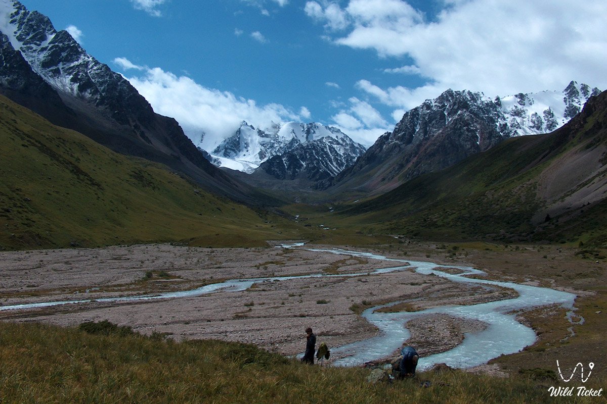
Along the way there is a small lake of unusual shape. Further movement continues along the right slope of the gorge. After about 1–1.5 hours you reach the Small Talgar Pass — a viewpoint from which the Left Talgar gorge is clearly visible.
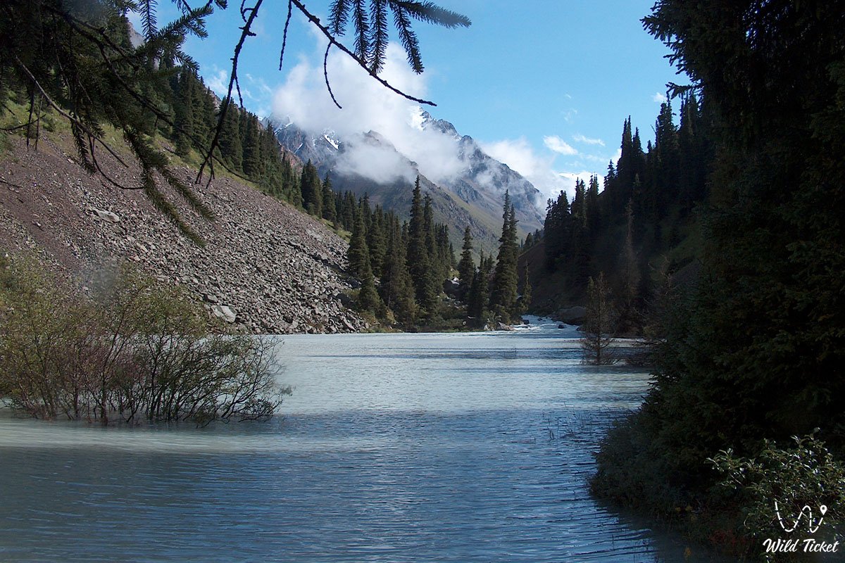
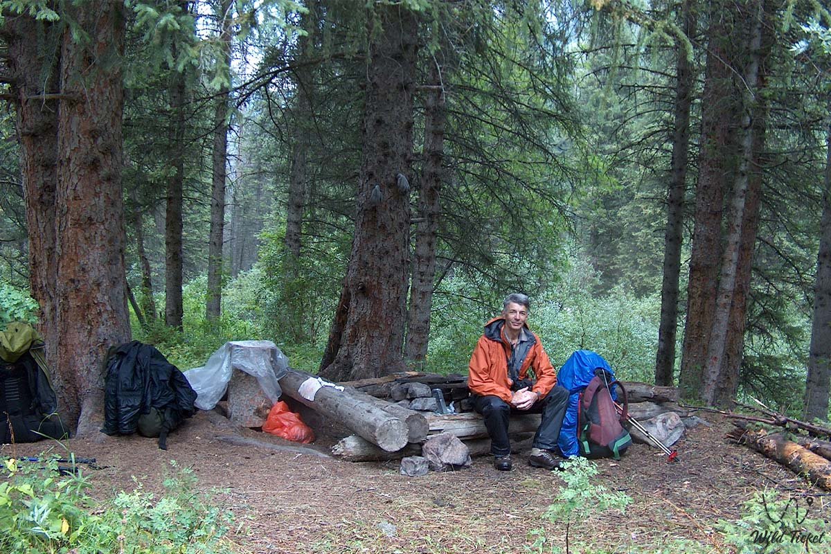
Then the descent begins along the right side. The trail passes over scree areas and can be unstable in places, so careful movement is required. After 1–1.5 hours a forest zone appears near the Left Talgar River, where the first camping spots are available. The river does not need to be crossed — the route follows along it. If necessary, you can stop here, but if desired the route can be continued further, as there are enough campsites ahead.
Final section of Route No.3 – upper part of Left Talgar gorge and Krasnaya Polyana
Further movement continues along the right slope of the gorge with a gradual ascent. On this section the trail is partly lost, with few orientation points, so careful navigation is required.
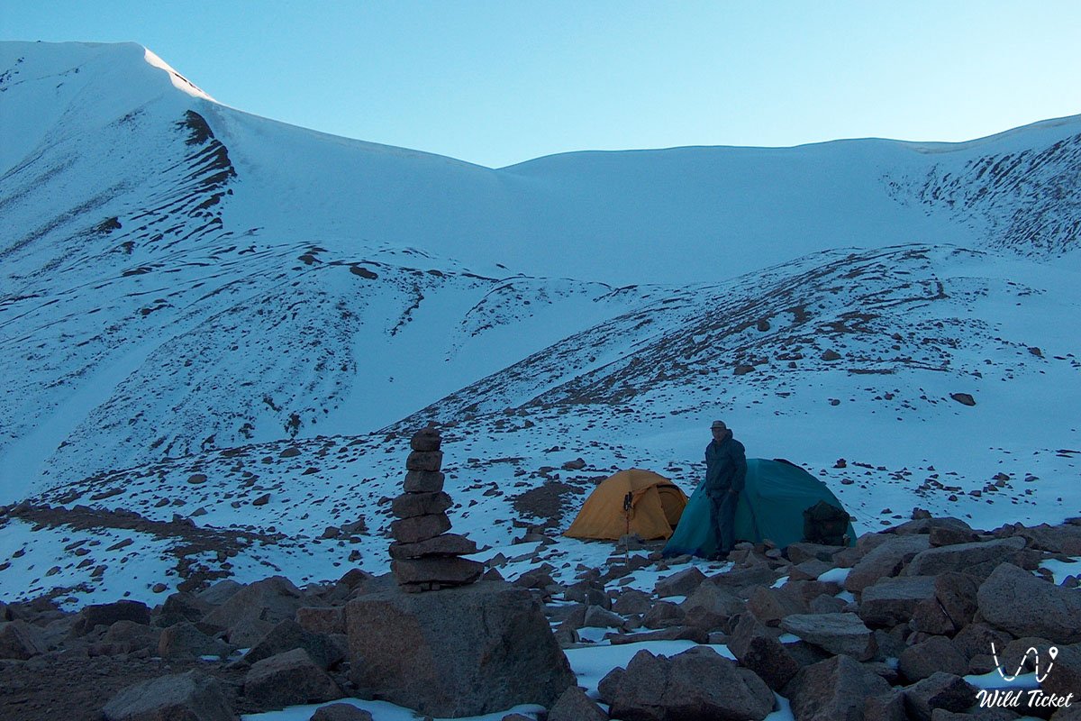
After about 1.5–2 hours of walking, Krasnaya Polyana opens up. This is an equipped rest and camping area: a stream with a small reservoir, a wooden bridge, tables, benches, fire pits, and flat tent sites.
Initial section of Route No.1 – Alpine Rose meadow – mudflow deposits
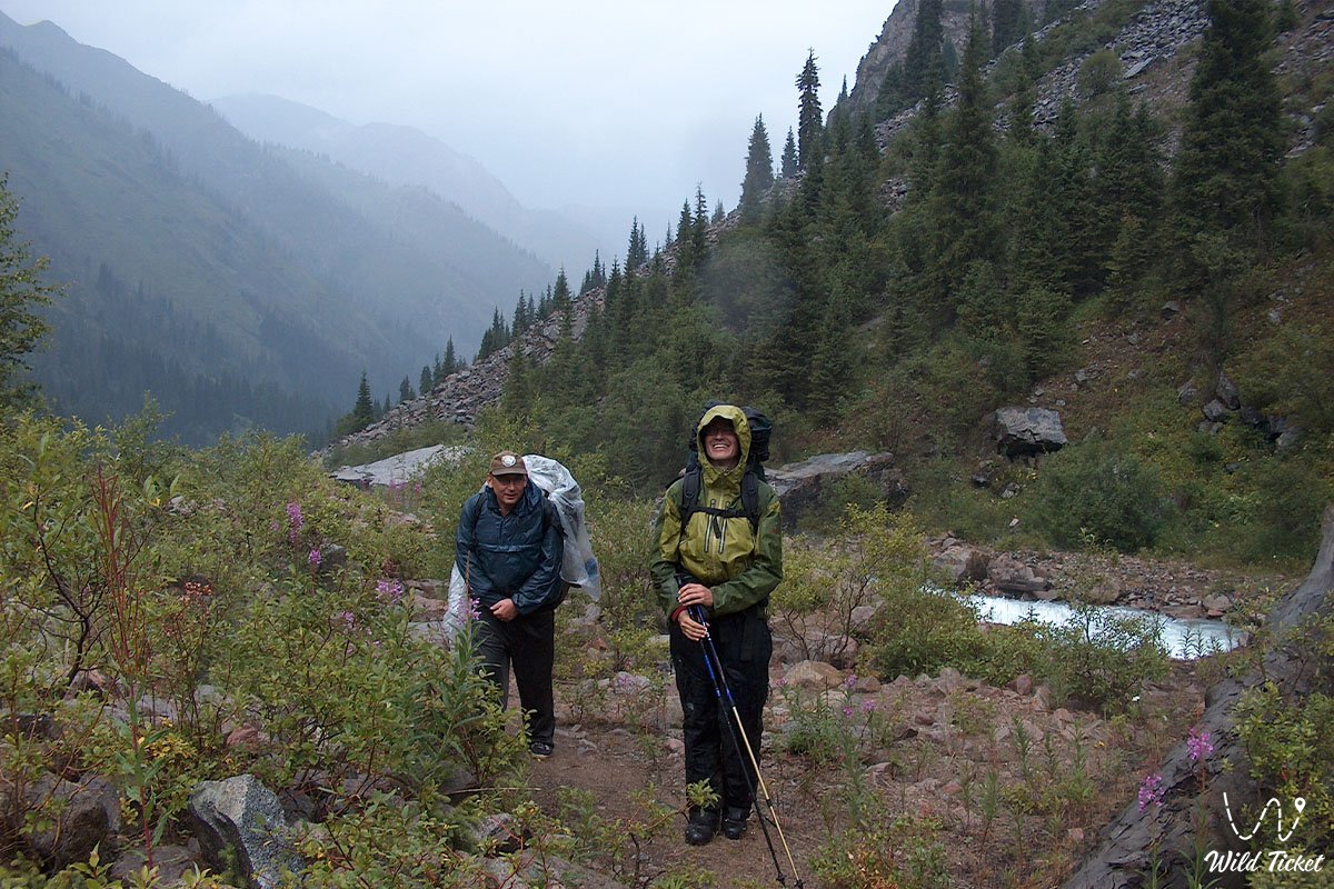
The second day starts early: wake up, breakfast, packing, and departure onto the trail. The first kilometers pass through a forest zone where the path is clearly readable and easy to follow.
Along the way there are several potential camping spots, but the most notable point is Alpine Rose meadow. This is an open area with sandy patches and thin streams. Slightly above there are large boulders resembling a natural stone garden. On one of the stones there is a memorial plaque dedicated to deceased climbers.
Further on, the forest gradually thins out, and the route leads into an area of old mudflow deposits of the Left Talgar River. Here it is important to maintain a direction roughly between the riverbed and the right mountain slope, using stone cairns as navigation. This section is long and takes about 1 to 2 hours.
Before entering the forest mass, the route approaches a green zone, but there is no need to go into dense thickets — the old forest trail is abandoned and blocked by fallen trees. The main path goes higher through bushes, gradually forming an ascent that leads to the open meadows of Sunny Meadow area.
Here the trail becomes more visible. In places there are convenient rest and camping spots. After crossing the gentle section, another ascent begins through sparse forest, after which alpine meadows open up.
Main section of Route No.2 – Sunny meadow – Fools’ Meadow – confluence of Tourist River and Left Talgar River
After exiting the forest, the route reaches a large moraine ridge. It must be crossed traversing it, without descending toward the river cliff and without climbing too high on the slope. Movement here requires caution: loose rocks are present. After the rocky section, there is a zone of bushes and tall grass, after which a readable trail appears again.
Further on, after a short ascent, Fools’ Meadow opens up. It is easily recognized by numerous stone inscriptions and markings on boulders — names, dates, and phrases left by hikers. There are also suitable camping areas here.
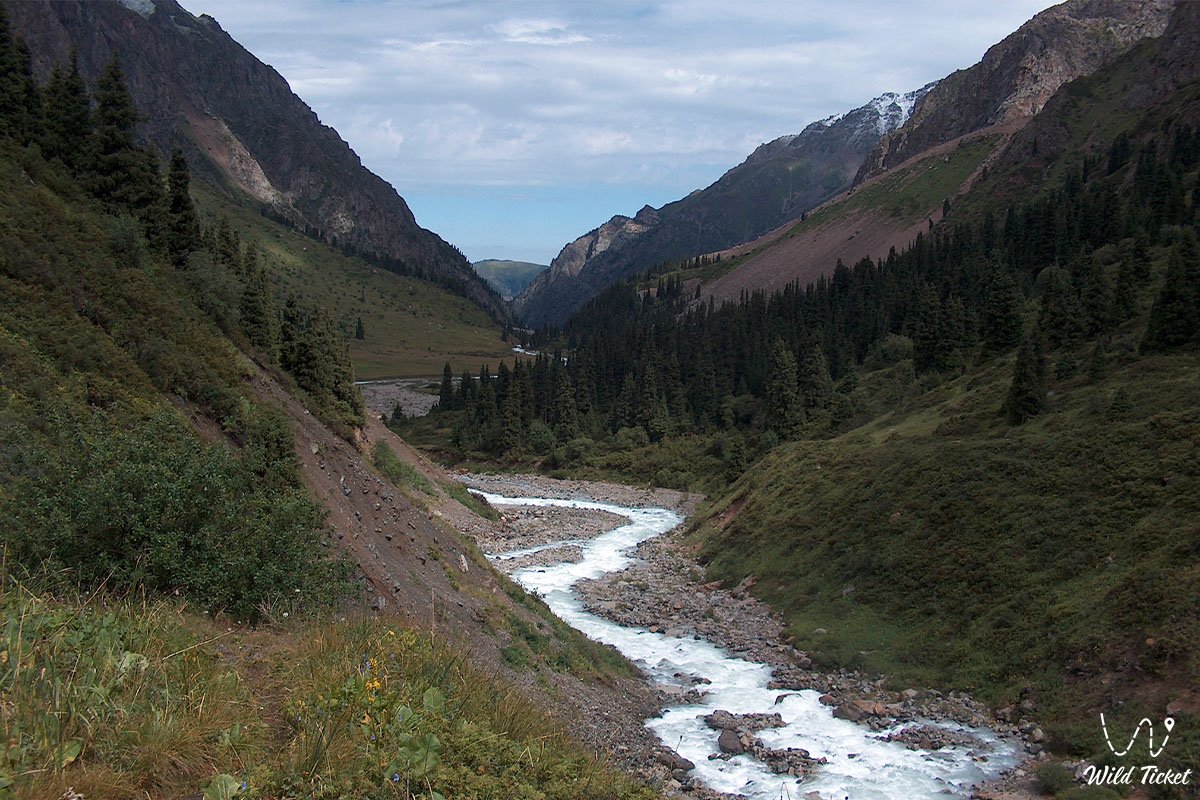
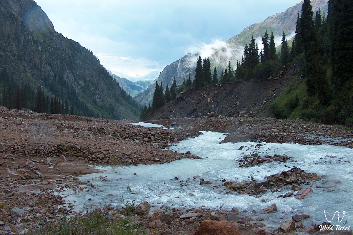
After the meadow, the route gradually climbs along a well-defined trail. Along the way there are water sections and convenient rest spots. Gradually the ascent leads to the confluence of the Tourist River and the Left Talgar River — an important landmark of the route and a place where the scale of the gorge becomes clear.
Final section of Route No.3 – Stone Meadow
Further movement continues along the right side. Among sparse vegetation, a large split boulder appears — from it the trail turns right and upward toward the Tourist Gorge. This begins the most difficult section of the day with a long ascent, especially noticeable after a long trek.
Along the way there are natural stone shelters that can be used for protection from bad weather. Closer to the final point, the gorge becomes narrower and the terrain more pronounced.
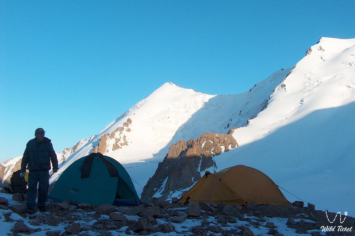
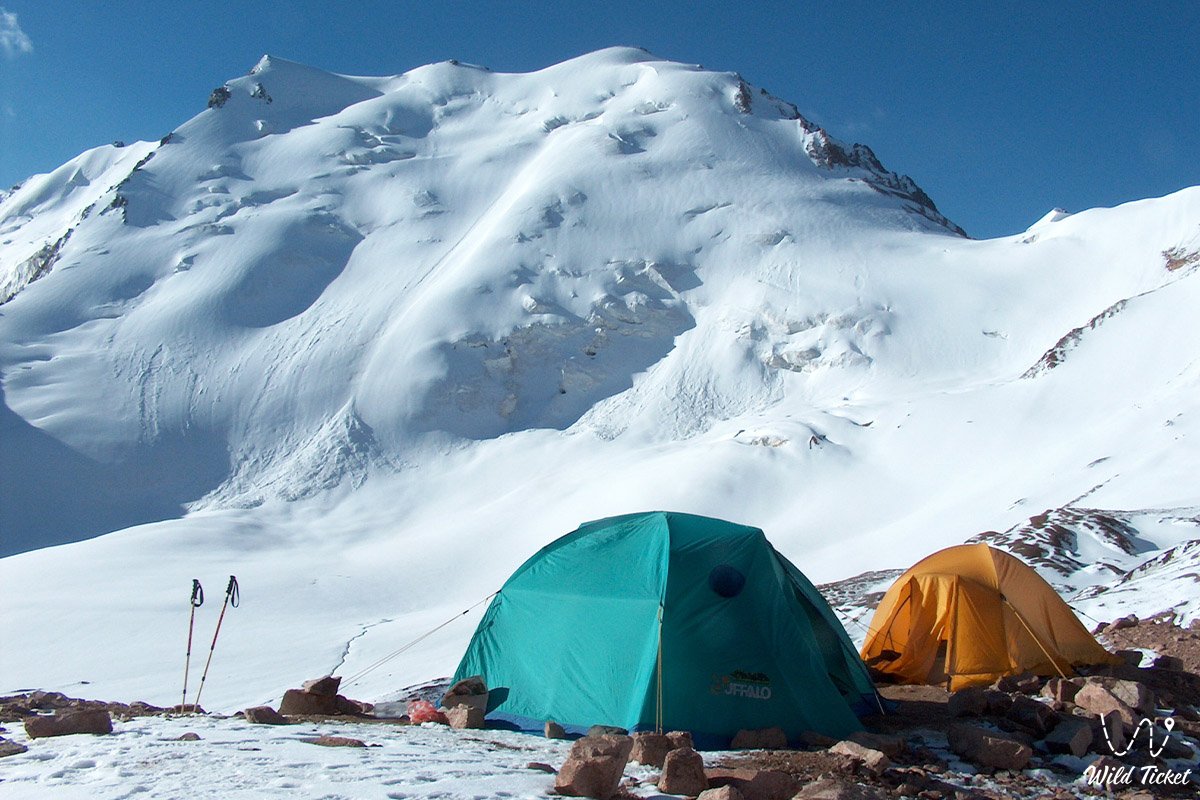
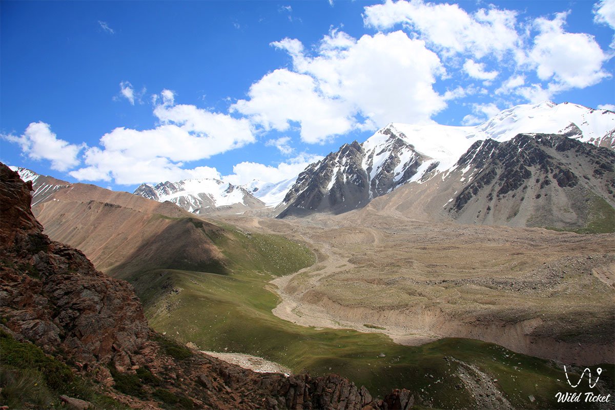
At the end of the ascent, the route leads to the spacious Stone Meadow. On the left there are rock formations, above is the glacier line, straight ahead a moraine ridge, and on the right an open grassy slope with rocky areas. The second overnight camp is organized here.
Initial section of Route No.1 – Stone Meadow – approach to Tourist Glacier
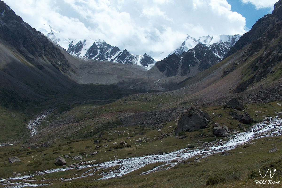
The early morning starts with departure from Stone Meadow. After packing, the camp is left and the route goes upward along the right grassy slope. This is one of the longest transitions of the day — about 3–3.5 hours to the glacier zone.
The trail is not always clearly visible, so the main task is to carefully follow direction using stone cairns. Movement should be along the right side of the gorge, avoiding the edge where unstable scree begins. At the same time, do not move too far left, as there is a difficult exit toward a lake area and an inconvenient approach to the glacier.
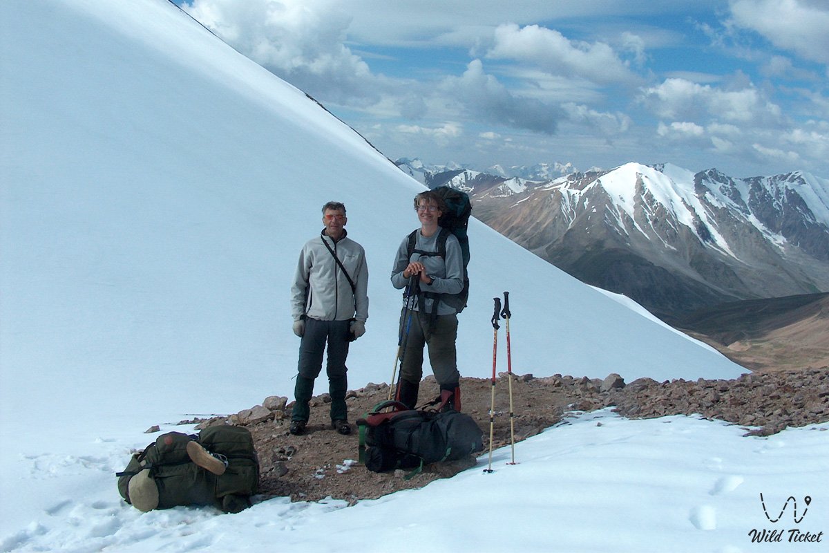
Main section of Route No.2 – Tourist Pass
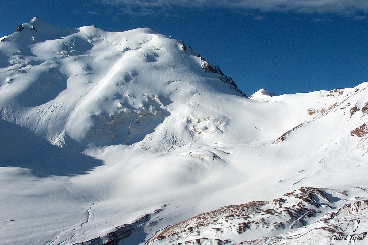
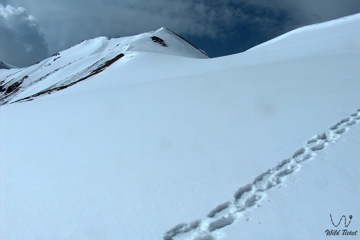
At the foot of the glacier there is a short rest stop, after which the main ascent begins. Movement goes directly over the glacier. First the route goes straight up, then roughly from the middle it traverses left toward the pass.
In summer, the glacier is covered with a layer of fine scree and melts unevenly, so there are natural footholds in places. With proper mountaineering footwear, movement remains stable. For additional safety, trekking crampons are recommended.
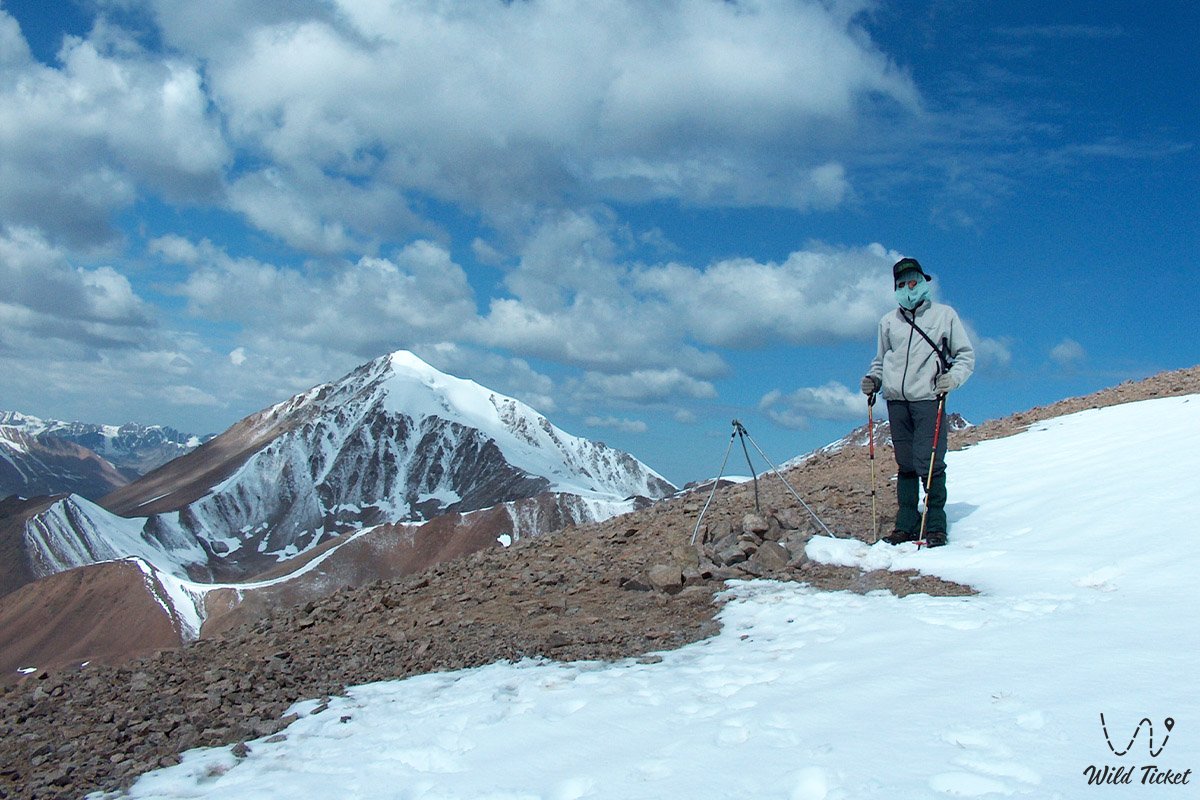
At the pass there is a tripod structure where you can leave a note if desired. This is the highest point of the route — about 4000 meters above sea level.
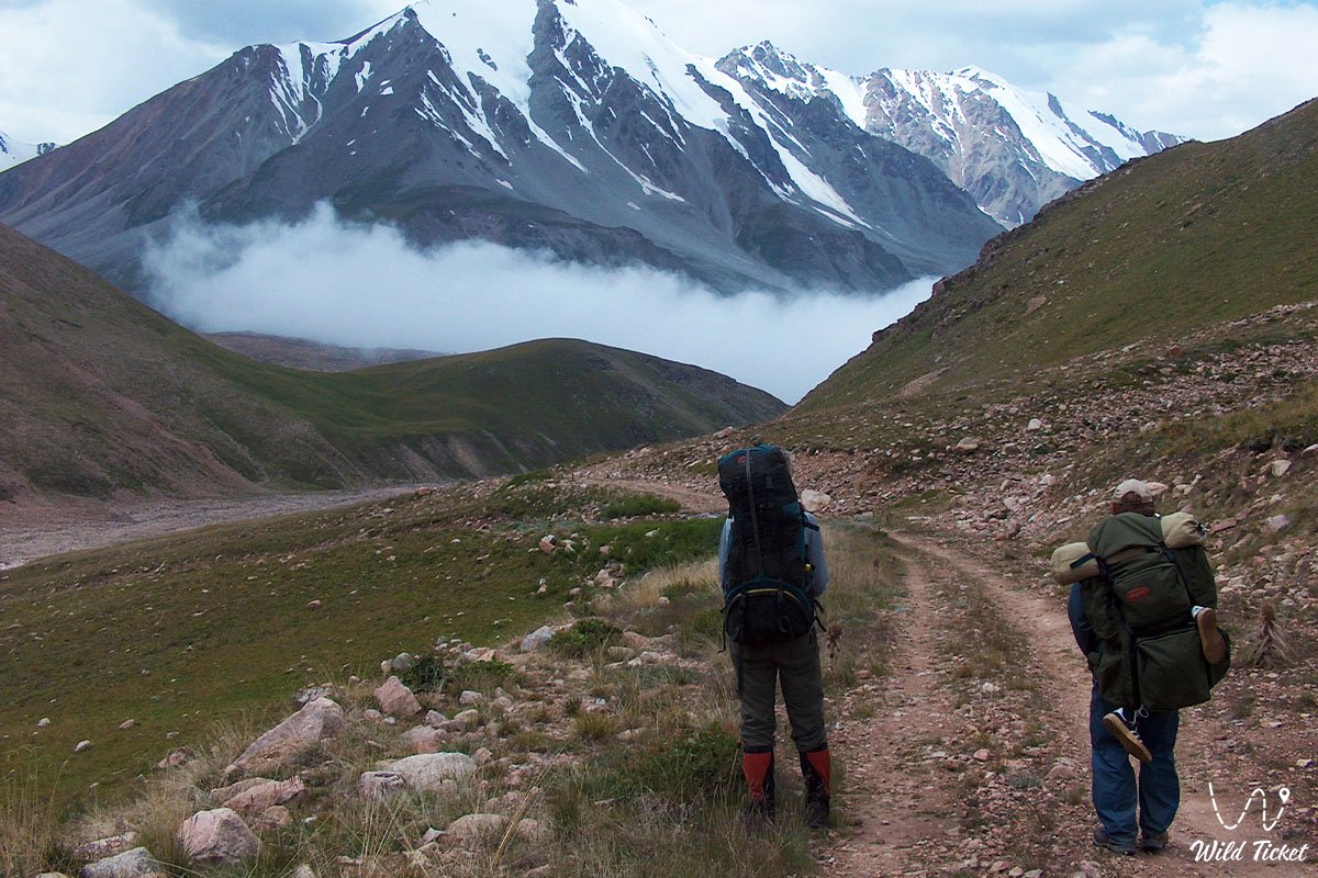
Final section of Route No.3 – descent to the foot of Sovetov Peak
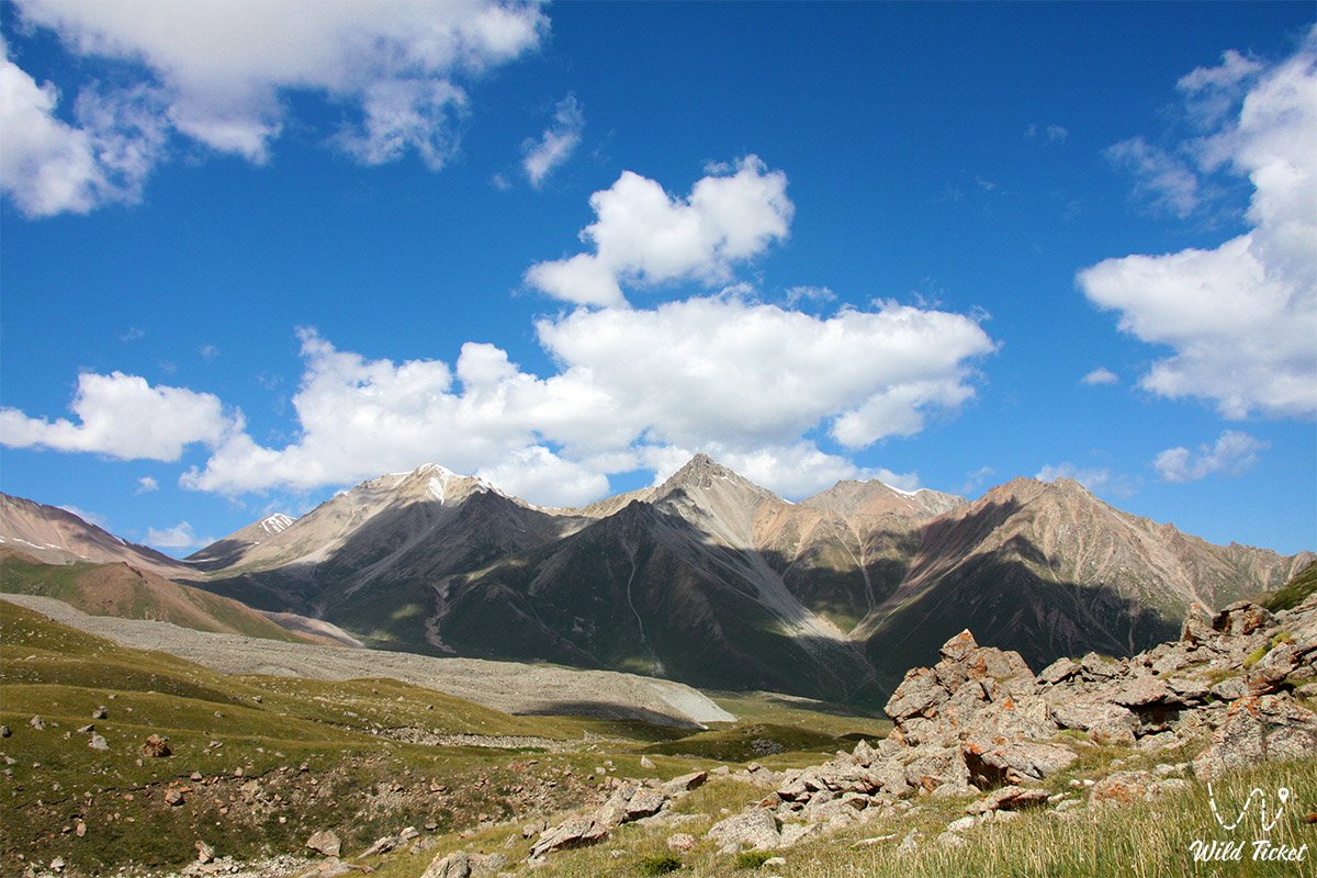
The descent begins along a scree slope located to the right of the glacier. In the upper part the trail is weakly defined, but as elevation decreases it becomes more readable and gradually turns into a gravel surface.
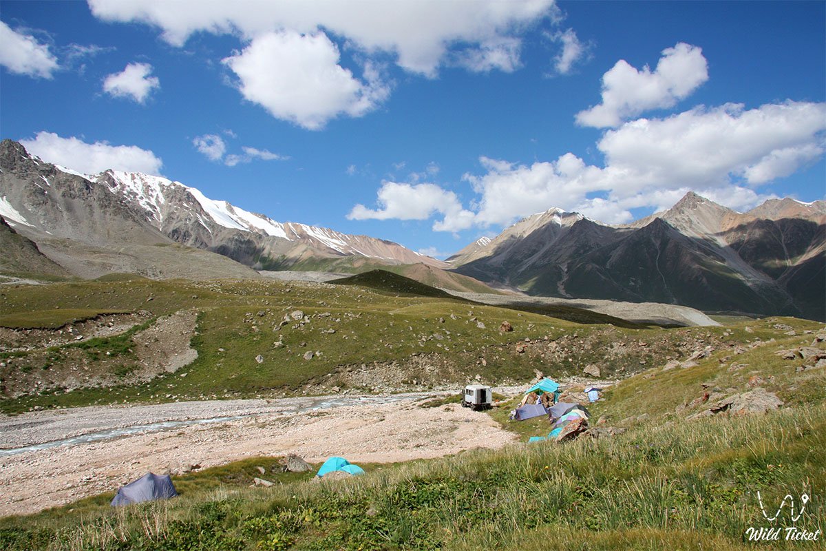
Along the way there are convenient camping spots. One of the most comfortable is located in an area with tall green grass near the confluence of the Kyzyl-Sai River and the Ozernaya River.
If there is time and energy, it is possible to continue the descent all the way to Big Almaty Lake and finish the route by returning to the city.
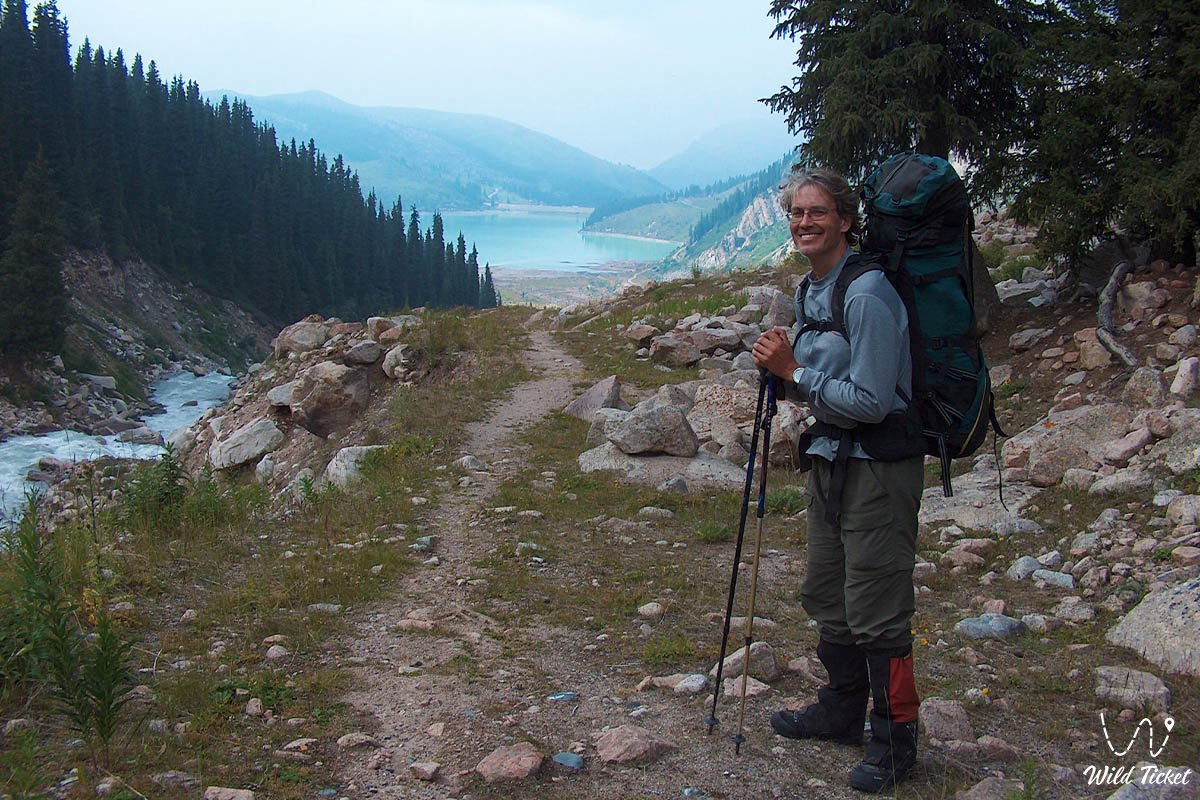
Final section of Route No.1 – Big Almaty Lake – descent to the city
The final day is calm, without rush or heavy load. After breakfast, the camp is packed up and the descent toward the city begins.
The route follows the river, which remains on the left side — it does not need to be crossed. Movement continues strictly along the right bank, where it is important not to lose the trail. It sometimes passes through grassy sections, crosses rocky fields, and uneven terrain. In one section the trail runs above a cliff, so special attention is required. Further on, it gradually turns into a gravel road.
As you approach Big Almaty Lake, mobile connection appears. Near the lake there is a junction: one road goes right and upward — a longer detour via gravel road, the other goes down through forest and ravines. The main route goes downward, where the road gradually turns into a trail and then reconnects with a wider road network.
Further movement continues until reaching the asphalt section, where the urban area begins.
It is also important to note that this section is located in a border zone. During the route, document checks may occur. Citizens of Kazakhstan must carry an ID card or passport, foreign tourists must have a passport and migration card.
Photogallery: