Unique archaeological monument of the Oghuz tribes -
Kesken-kuyuk-kala ancient settlement (also known in handwritten sources as the city of Khuvara) is an outstanding monument of archaeology and one of the largest fortified settlements of the early Middle Ages in the Aral region. Located in the Kyzylorda region on the natural elevation of Keskenkuyukkala at an altitude of 66 meters above sea level, this ancient protuberance of urban culture surpasses even the famous Oghuz capital Zhankent in its scale.
Thanks to many years of research by scientists, the chronological framework of the city's life has been precisely established: it arose in the 5th century AD on the basis of the monuments of the Dzhetyasar culture and ceased to exist in the 11th–12th centuries.
The unique complex belongs to the type of so-called "marsh settlements" – a term introduced by the outstanding archaeologist Sergei Tolstov, who discovered this site in 1946. The city was built on silty soils and dried islands of the ancient delta, on the southern bank of the now dry, overgrown branch of the Kuandarya River (a tributary of the Syr Darya), which fed the oasis with water.
Kesken-kuyuk-kala developed at the junction of three cultures: Dzhetyasar, Zhetysu, and Khorezmian, successively surviving the eras of the Kangars, Pechenegs, early Oghuz, and Karakhanids. The decline and final abandonment of the settlement were caused by a catastrophic change in the riverbed, depriving artisans and farmers of their main vital resource.
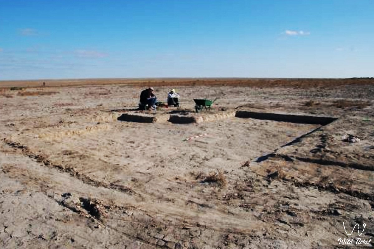
Today, Kesken-kuyuk-kala serves as a key point for international scientific and research tourism. Excavations here are actively conducted by the A. Margulan Institute of Archaeology, the archaeological expedition of Azilkhan Tazhikeyev, and international groups within the framework of the "Central Asian Archaeological Landscapes" program with the assistance of University College London.
The monument is of colossal interest to travelers wishing to see genuine traces of the mixed pastoral-agricultural economy of the ancient Turkic tribes that formed the core of the future Seljuk Empire.
---------------------------------------------
How to get there and visit -
Kesken-kuyuk-kala ancient settlement is located 22.8 kilometers west (slightly north) of the Bozkol village, 30 kilometers south of the Bekarystan Bi village, and 65.1 kilometers southwest of the district center of Ayteke Bi, Kazaly district, Kyzylorda region, Republic of Kazakhstan.
GPS coordinates: 45°31'06"N 61°27'32"E
The transport logistics of this secluded archaeological area completely exclude urban public transport. No regular passenger buses or suburban fixed-route taxis operate to the ancient ruins. You can reach the historical monument from the Bozkol village or the district center exclusively along well-trodden steppe tracks and dirt roads.
Only a prepared four-wheel-drive SUV is necessary for a trip to the settlement, since the paths pass through a flat low-lying plain and former marshy zones of the Syr Darya delta, which can become impassable after spring floods or covered with sand. Drivers must carry satellite navigators, a supply of fuel, communication devices, and a sufficient volume of drinking water.
Opening hours: The territory of the archaeological complex is open for visits by travelers around the clock and all year round. Access to the adjacent territory is completely free; no ticket offices, paid checkpoints, tickets, or excursion fees are provided here.
Trips to this region are highly recommended to be planned for the spring period (April – May) or for September to avoid extreme summer temperatures and exhausting dust storms. All tent camps are organized by expedition groups independently in wild conditions, with mandatory adherence to the rules of respectful behavior on the territory of ancient monuments.
---------------------------------------------
History
The history of the ancient city of Khuvara (Kesken-kuyuk-kala) spans more than six centuries of continuous development. Arising in the 5th century as a small fortification of settled farmers, by the 7th–9th centuries the city reached its highest prosperity, turning into a powerful fortification and trade-craft hub on the Great Silk Road.
In the late 1950s and early 1960s, large-scale studies of the site were continued by Russian scientists Vladimir Smirin and Bella Vainberg, and during the years of Kazakhstan's independence, reconnaissance was continued by a detachment under the leadership of Zholdasbek Kurmankulov.
Over the long centuries of oblivion, the structures made of raw brick underwent intensive erosion and weathering under the influence of the harsh Aral climate and the wet soil of the delta. The walls of the houses turned into washed-out earthen hills, and metal objects became heavily rusted.
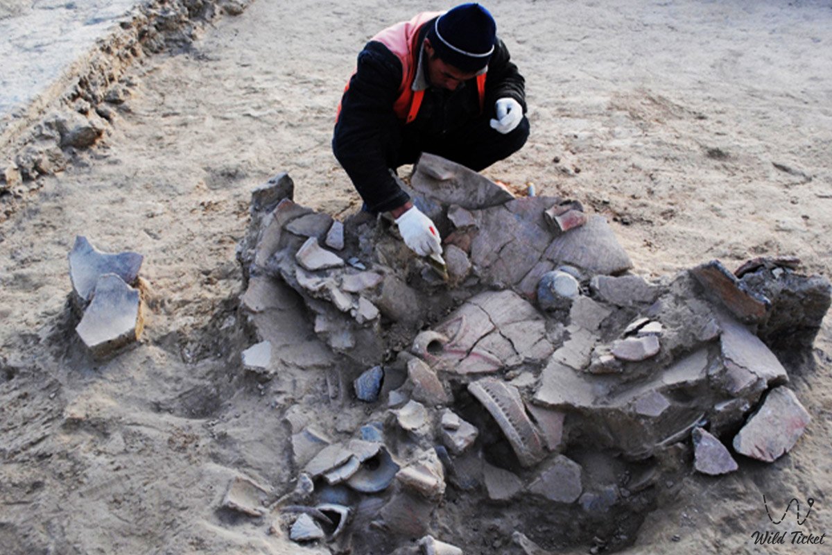
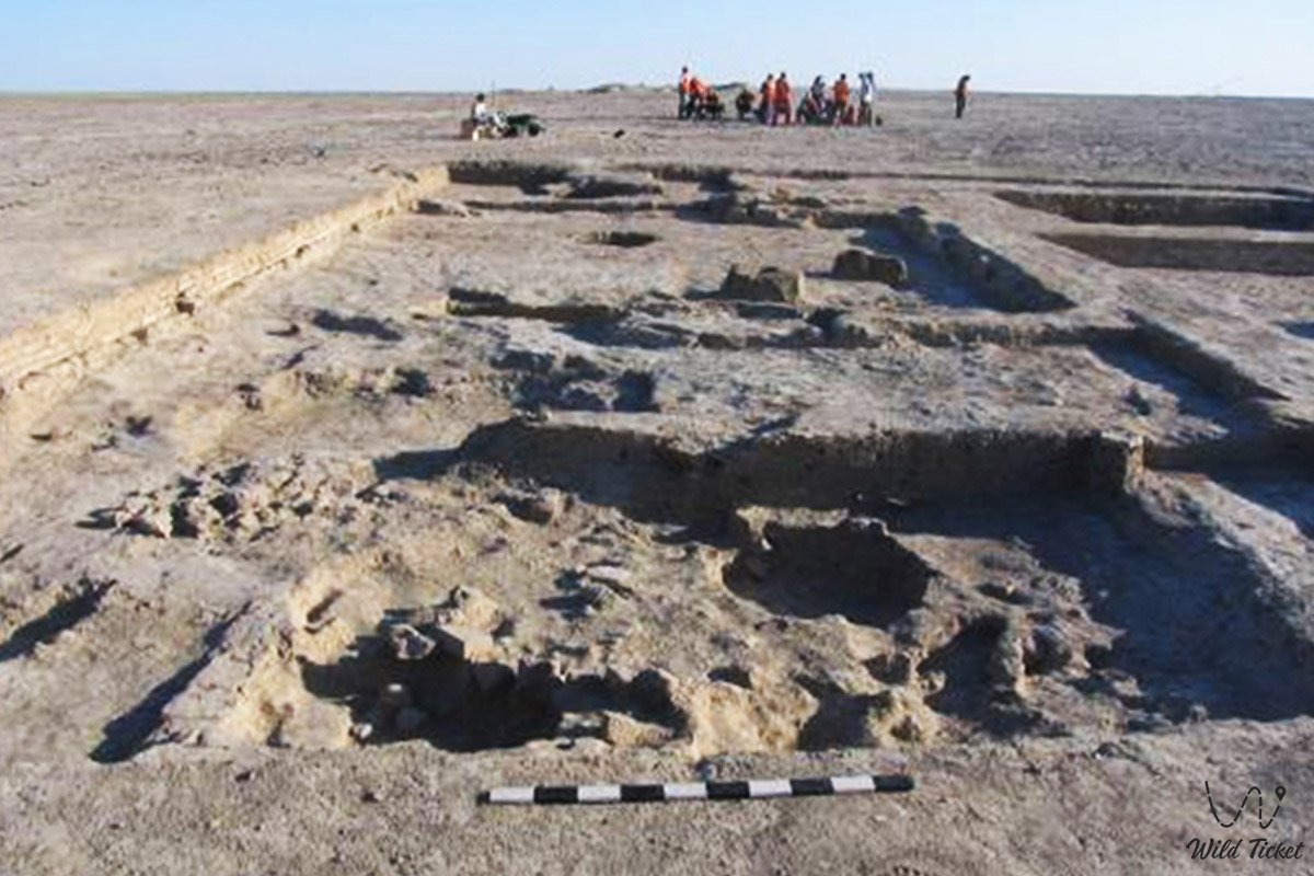
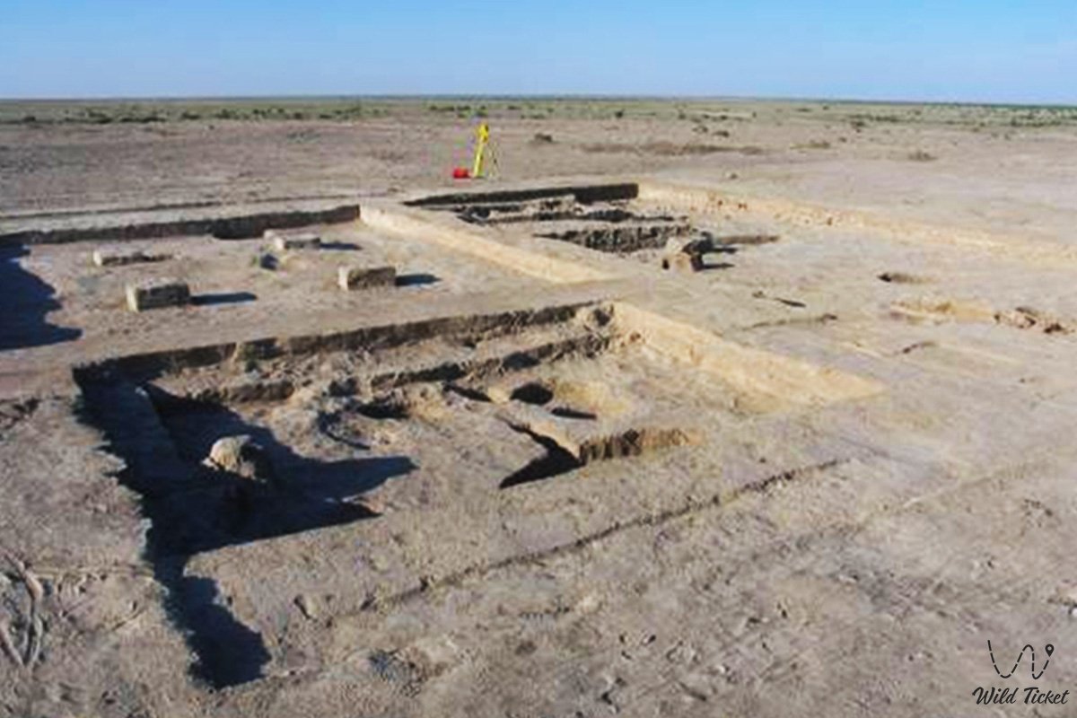
Modern international excavations organized by "Rutrum" LLP under the leadership of M. Gurulev and other institutes allowed the discovery in the citadel of a well-preserved wall 1.6 meters high with several layers of plaster. This discovery helped reconstruct in detail the stages of changing architectural styles from the Kangar era to the Karakhanid period.
Information
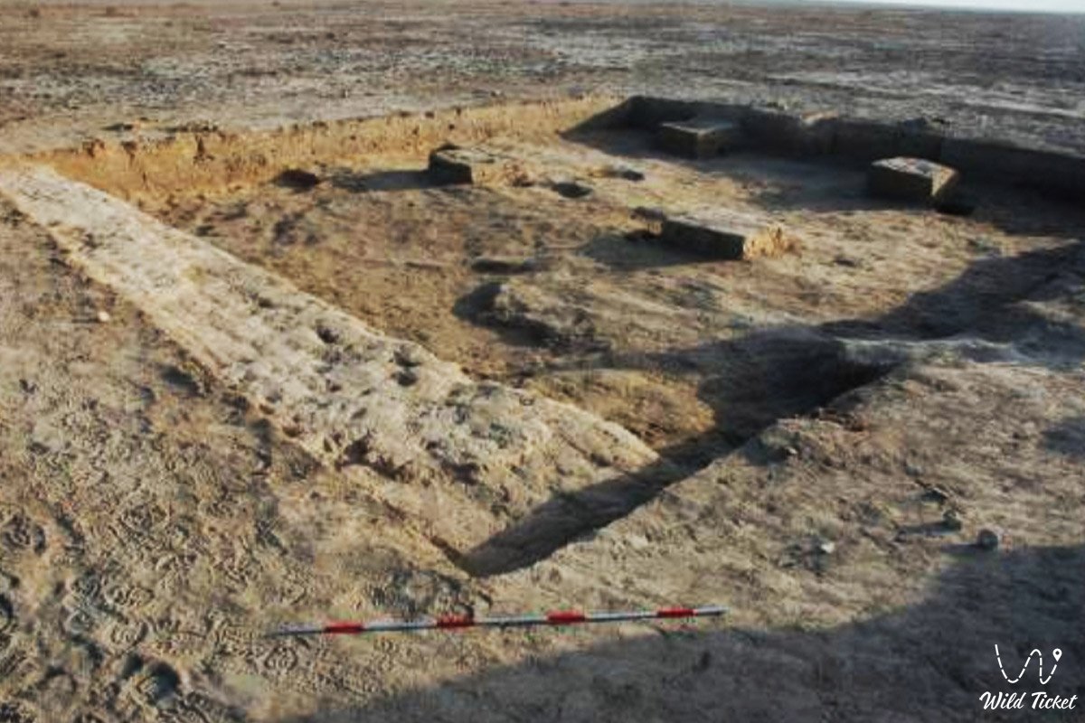
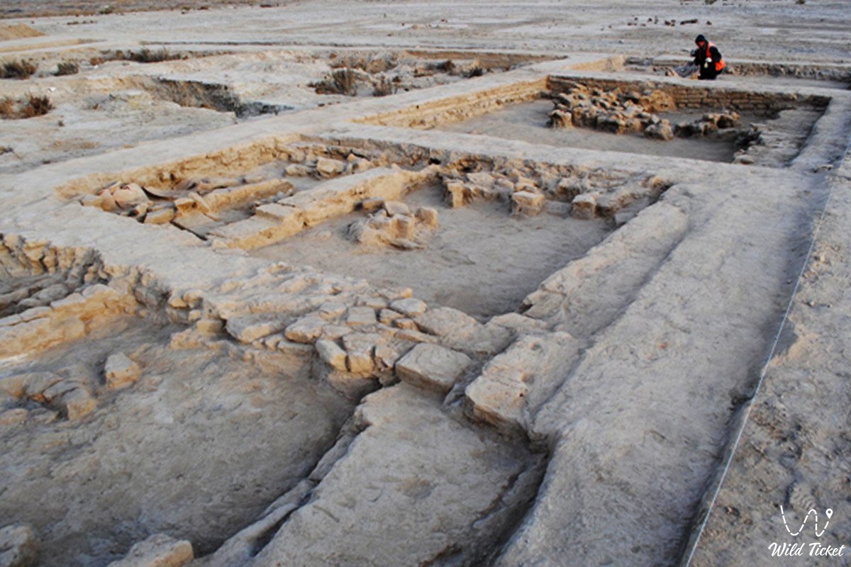
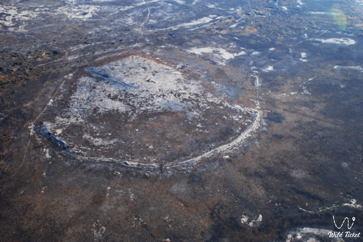
Kesken-kuyuk-kala ancient settlement is organized as a giant urbanized settlement of an irregular rounded shape, the general dimensions of which, according to topographic drawings and aerial photography, range from 560x700 to 830x710 meters. The structure of the monument completely complies with the canons of medieval town planning: an extensive outer territory (rabat), the inner city (shahristan), and a powerful "heart" of the complex – an isolated citadel. The area of the settlement is surrounded by an ancient wall that has turned into a defensive rampart about 2 meters high.
In the northeastern part of the shahristan, on a natural elevation, there is a huge mound of a square-shaped citadel measuring 210x210 meters, rising 3 meters above the general level of the city and 5 meters above the surrounding steppe.
Tour organizers and archaeologists recommend that tourists move around the site exclusively on foot, strictly forbid collecting fragments of surface material independently, and urge them to treat ancient structures exposed by excavations with care.
Detailed description of the venue
The well-thought-out infrastructure of the historical complex includes the following original locations and geographical features:
• Massive square citadel – the place of residence of the city nobility, built up with regular buildings divided by internal walls two bricks thick into rooms ranging in size from 4x4 to 23x23 meters.
• Encircling corridor of the citadel – a special fortification bypass corridor about 1.5 meters wide, running along the entire perimeter of the central square.
• Main radial street – a three-meter central artery passing obliquely closer to the eastern edge of the citadel, from which curved alleys branch off at different angles.
• Shahristan and caravanserais – an extensive residential zone of merchants and artisans with traces of dense building.
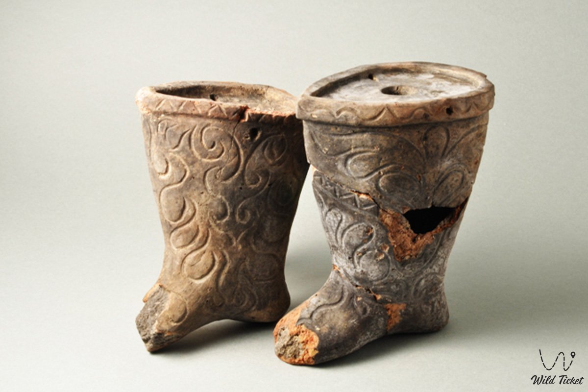
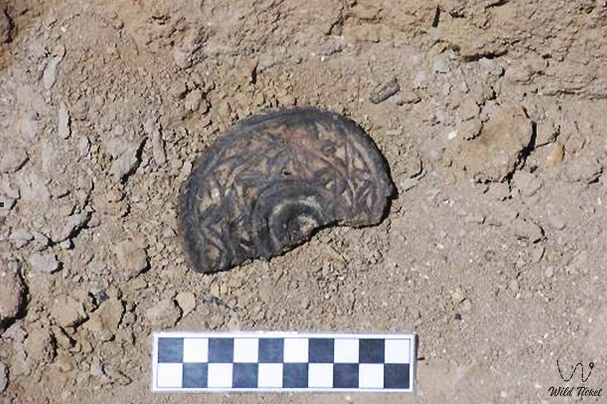
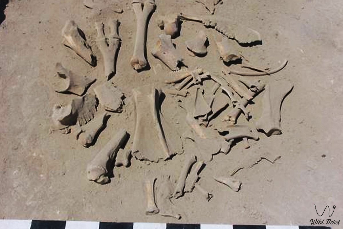
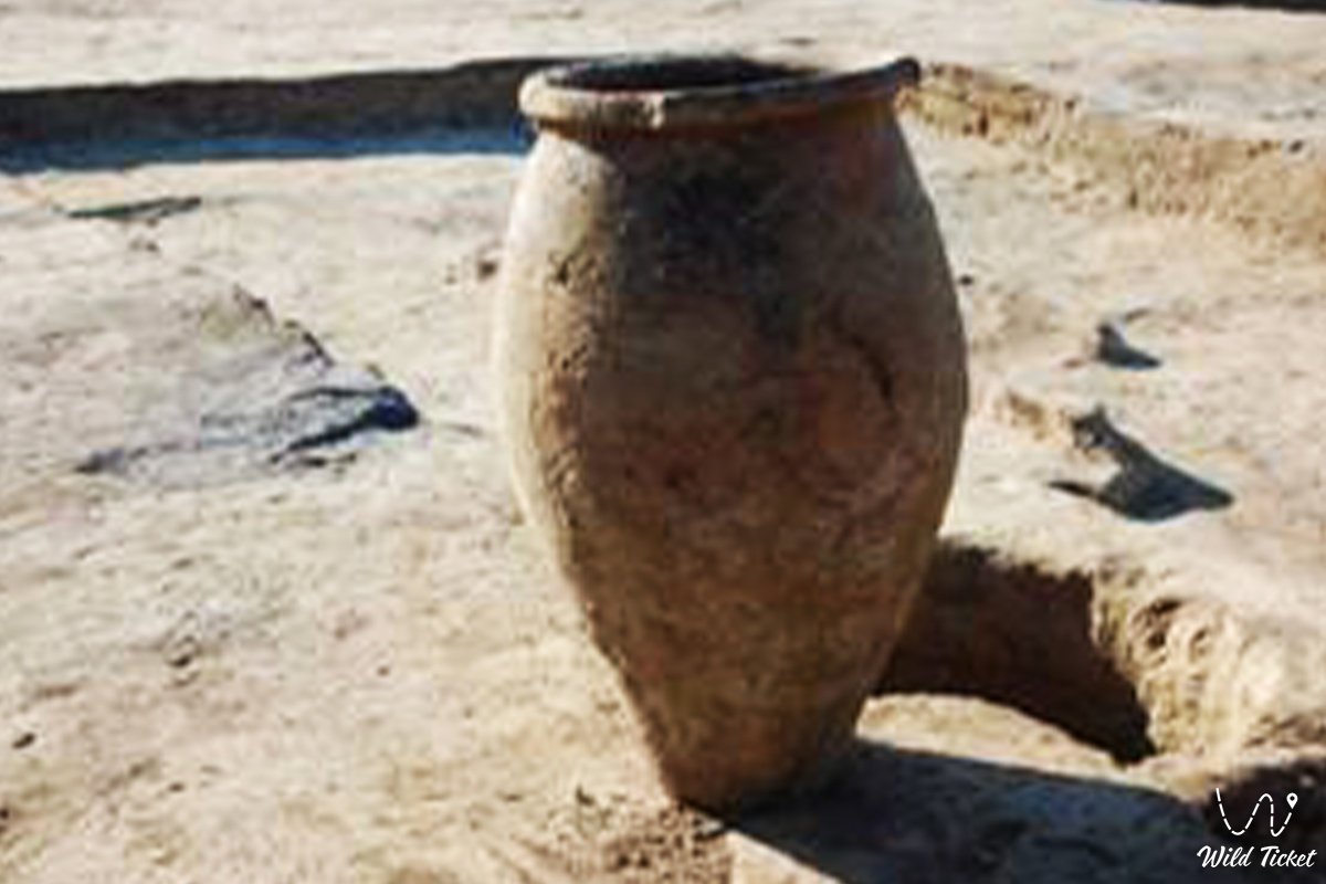
• Craft rabat – the peripheral sectors of the city where unique artifacts were discovered: fragments of spindles, bronze cast asyks for games, and details of women's jewelry (glass beads, rings, and earrings).
• Ritual sector of the Oghuz – a cult zone inside the premises, where archaeologists discovered a grandiose altar measuring 2.2x1.4 meters and a domed stove-fireplace of a rounded vault.
Architecture
The architectural solution of Kesken-kuyuk-kala reflects the strong influence of the Khorezmian school of architecture of the Afrigid period. The powerful fortress and residential walls are laid from square raw mudbrick, the dimensions of which vary from 28x28 to 40x40 cm (the prevailing standards are 33x33 and 35x35 cm, typical for early medieval Khorezm).
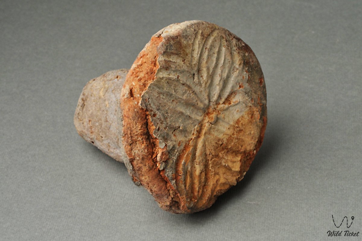
The highlight of the local engineering was a developed irrigation system: traces of cultivated fields and main canals have been recorded in the vicinity of the city. A mass of remains of cultural plants (wheat, millet, rice, seeds of the lagenaria pumpkin) was found, which proves a high level of settled agriculture among the nomads. The abundance of molded local ceramics decorated with rich herringbone, geometric, and floral relief ornaments links the architectural and decorative style of the settlement with the Turkic monuments of Semirechye and Mongolia.
Legend
A poetic legend about the death of this great marsh city exists among the old-timers of the Kazaly district. It is said that in the era of its prosperity, it was ruled by a proud and cruel khan who owned deep wells and caravan routes. He refused to give his only daughter in marriage to a noble but poor steppe batyr. The young man, going into exile, predicted to the ruler that his pride would dry up the stone hearts and the very walls of the city.
Shortly after that, due to tectonic shifts, the capricious Kuandarya River changed its course forever, leaving the blooming pumpkin fields and gardens without a drop of moisture. The water left within a few weeks, and the residents were forced to hastily leave their homes, leaving the khan in an empty citadel.
It is believed that the bronze asyks and rich jewelry found in the rabat were abandoned by the citizens as a tribute to the spirits of the steppe. The old men claim that if you come to the settlement during a full moon, you can hear the quiet whisper of the wind, reminding that even the most powerful walls are powerless before the laws of nature and justice.
Conclusion
Kesken-kuyuk-kala ancient settlement is a magnificent historical bridge linking the complex ethnocultural processes of transformation of the nomadic tribes of Eurasia with the modern tourist and educational potential of Kazakhstan. The monument allows one to clearly appreciate the scale of urbanization in the lower reaches of the Syr Darya and the depth of trade and economic ties of the ancient Oghuz with Maveraunnahr.
The settlement remains a highly valuable site for adventure and archaeological tourism in the Kyzylorda region. Research routes invariably include this large-scale elevation in their catalogs, allowing guests of the Aral region to touch the secrets of the city of Khuvara lost in the sands.
Interesting sights nearby:
• Tolybay Batyr Mausoleum;
• Begim-Ana Tower;
• Saraman-Kosa Tower;
• Kuttybai Mausoleum;
• Zhankent ancient settlement (Yangikent).
Photogallery: