Medieval Atlantis of the dried seabed -
Aral-Asar ancient settlement represents one of the most sensational and exciting archaeological monuments on the territory of Kazakhstan. Located on the exposed bottom of the Aral Sea in the Aral district of the Kyzylorda region, this medieval city of the Golden Horde era has become an essential scientific discovery that overturned ideas about the historical geography of the region.
The discovery of Aral-Asar visually proved that during the Middle Ages (10th–14th centuries), the Aral Sea had already experienced large-scale cycles of low water, giving way to a developed urban culture, oasis agriculture, and caravan routes. The unique basin, surrounded on all sides by deserts, repeatedly changed its contours: at one time there was a wasteland here, at another the sea waves roared, because of which the outstanding researcher Sergei Tolstov gave this land an accurate name – the "Aral node of ethnogenesis." It is best to start your journey to the site from the city of Aralsk or the village of Ayteke Bi.
The history of the discovery of the settlement began after the finds extracted from the dried bottom in 2000–2001 created a real sensation among the local population and the scientific community. An expedition organized by scientists and students of the Korkyt Ata Kyzylorda State University under the leadership of Azilkhan Tazhekeyev discovered the monumental Kerderi Mausoleum on the bottom, which had receded by 100–120 kilometers. Following this, in 2004, the medieval settlement itself was opened.
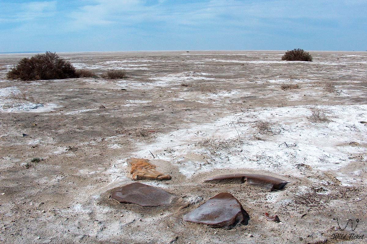
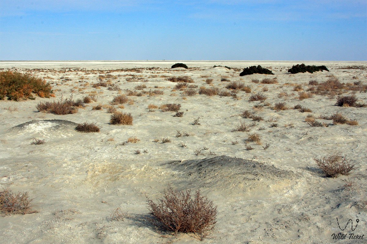
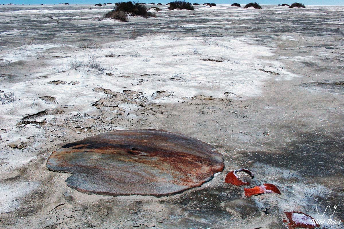
The city spread out at an altitude of about 35–35.3 meters from the Baltic zero, occupying a total area of about 6 hectares (dimensions approximately 300×200 meters). During several centuries of its existence, neither defensive walls nor protective structures were built in it – Aral-Asar represents a large open settlement ("a large village"), which for the subsequent 500–600 years rested underwater at a depth of up to 20–30 meters.
Today, the Aral-Asar settlement is recognized as a key object of the Aral Geopark, which seeks to join the UNESCO Global Geoparks Network, and as an essential platform for studying the interaction between society and the natural environment. This city, flooded in antiquity, attracts scientists and tourists with its tragic history.
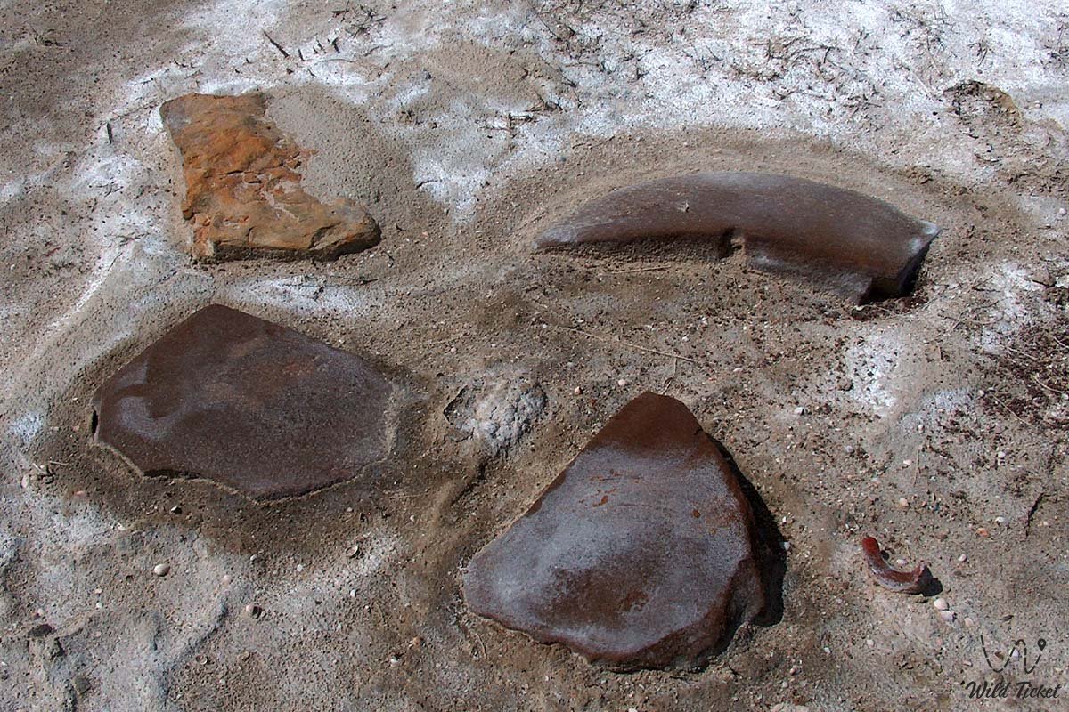
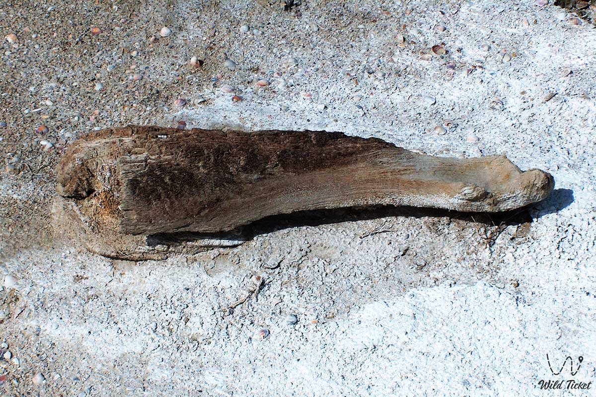
According to researchers, at the end of the 14th century, the troops of Emir Timur destroyed the irrigation systems of Khorezm, because of which the Amu Darya River rushed into the Sarykamysh depression, drying up the Aral. A prosperous village grew on the exposed fertile bottom, but already in the 15th–16th centuries, the direction of the river flow was restored, and the unstable waters of the Aral rapidly returned. The flood came so unexpectedly that the residents barely managed to collect light belongings, leaving heavy millstones and valuable tools in place, which plunged into silty deposits for centuries.
---------------------------------------------
How to get there and visit -
Aral-Asar ancient settlement is located on the former bottom of the Aral Sea in the Aral district of the Kyzylorda region, Republic of Kazakhstan.
The monument is located almost halfway between the Kokaral and Barsakelmes peninsulas, southwest of the confluence of the Syr Darya River into the Saryshyganak bay.
The city stands 4.5 kilometers southeast of the Kerderi Mausoleum, 64.7–70 kilometers southwest of the Karateren village (which previously stood on the shore, but is now removed from the water by 120 km), 123 kilometers northwest of the Kaukey village, and 92.4 kilometers west of the Zhanatalap village.
GPS geographical coordinates: 45°42'32"N 60°18'57"E
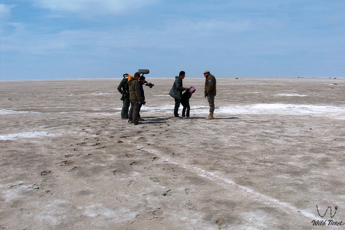
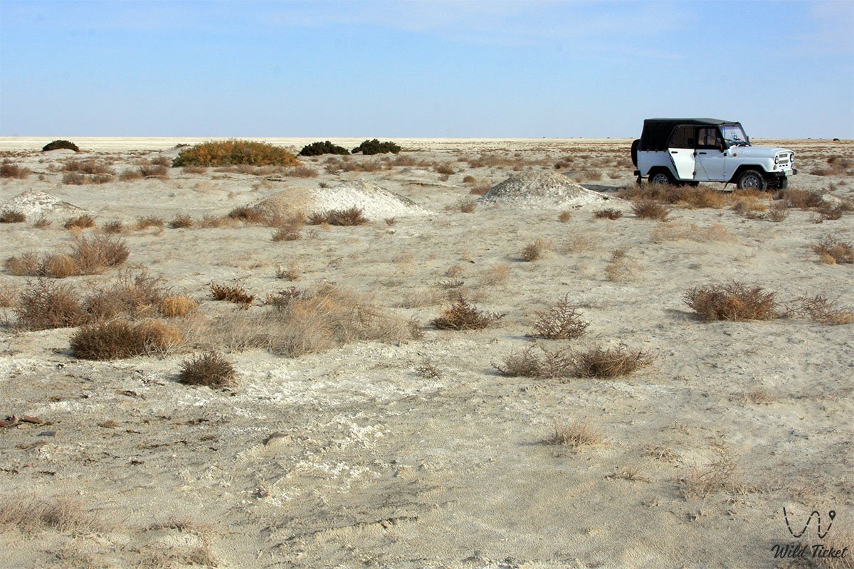
The transport logistics of this difficult-to-reach desert area completely exclude public transport – there are no highways to the settlement on the seabed. Visiting the site is possible exclusively within specialized expeditionary jeep tours from the city of Aralsk.
The route of the first day of a standard three-day tour runs from Aralsk to the northwest through the Zhalanash village (63 km along a grader, past the picturesque cliffs of the Saryshoky tract — the Eastern chink of the Ustyurt plateau) to the Tastubek village on the Koktyrnak peninsula. After that, SUVs descend to the dried seabed, pass the Kaltybay mountains, the Shoshkaly tract, and move along the bottom along the northern shore of Butakov Bay past the half-dismantled rusty hulls of old ships and barges.
Only a prepared four-wheel-drive SUV (4x4 jeep) with high cross-country capability is suitable for a trip to the site. Moving along the salt-marsh bottom of the Aral Sea involves high risk: the surface of the settlement is covered with a white salt crust, covered with fine-grained gray sand, and strewn with seashells. Unstable takyrs and silty deposits hide under this drift, which turn into an impassable trap after rare precipitation.
It is categorically forbidden to head to Aral-Asar alone in a single car – there must be at least two vehicles in the expedition for mutual assistance. Drivers are required to carry satellite navigators, reliable shovels, dynamic ropes, spare fuel canisters, and a large supply of drinking water.
Opening hours: the territory of the ancient settlement is open for visits around the clock and all year round. Access is completely free; no paid checkpoints, tickets, or environmental fees exist here. Artifacts found at the site of the ancient city are now officially stored in the Museum of Fishermen in the city of Aral.
The trip is recommended to be planned for the spring period (April – May) or early autumn (September – October). In summer, extreme heat reigns in the desert (the average temperature in July is 32°C), and in winter, severe freezing winds down to -10°C and blizzards blow. All tent camps are organized by tourists independently in wild conditions (popular camping sites are the Kaltybay mountains or the Kelmes tract near the Akbasty village). Replanting supplies of fresh artesian water and finding overnight stays in guesthouses is possible in nearby fishing villages.
---------------------------------------------
History
The history of the Aral-Asar settlement dates back to the Middle Ages and the heyday of the Golden Horde (late 13th – 14th centuries). In antiquity, Oghuz tribes, considered the ancestors of Turkmens and Azerbaijanis, were gradually displaced from these areas by the Kipchak tribal nobility. Presumably, the core of the population of Aral-Asar was formed by ethnic descendants of mixed Oghuz-Kipchak communities who did not leave the inhabited places. The oasis flourished due to the fact that the delta branches of the Syr Darya and Amu Darya provided the region with fresh water.
The residents built a developed agricultural and production zone, turning the city into a powerful hub for supplying flour and grain for export along the caravan routes of the Great Silk Road. Aral-Asar was located isolated from other major centers (the ancient cities of Kesken-Kuyuk-Kala and Dzhend were more than 200 kilometers away). At the end of the 14th century, due to a change in the hydrological regime, the rivers left, and the sea began to return. Water rushed into the hollow, completely flooding Aral-Asar. The city turned into a silent Atlantis, hidden under a 20-meter thickness of water for almost 500 years, until the ecological crisis of the late 20th century and the anthropogenic diversion of river waters for cotton and rice exposed the ancient ruins again.
Information
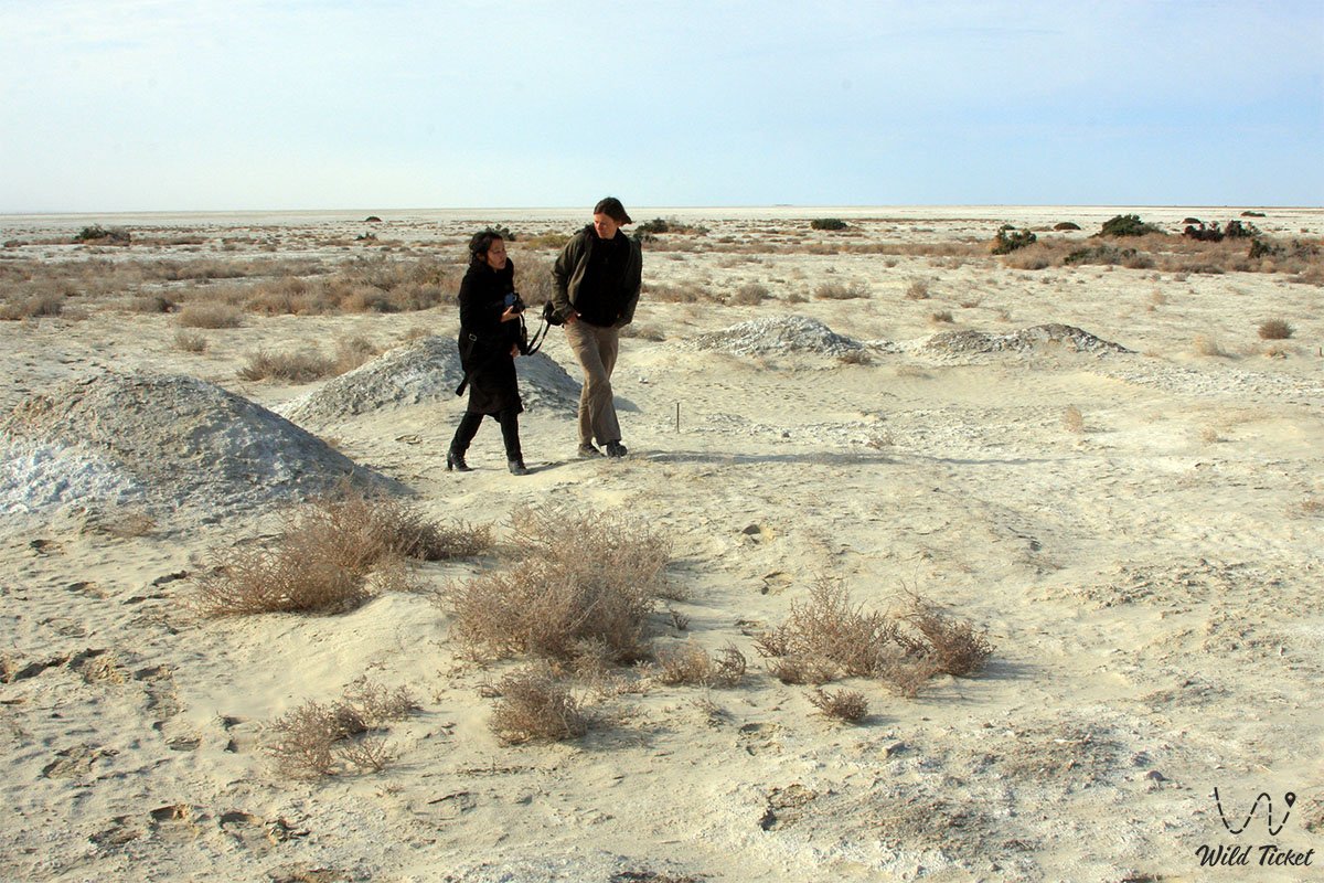
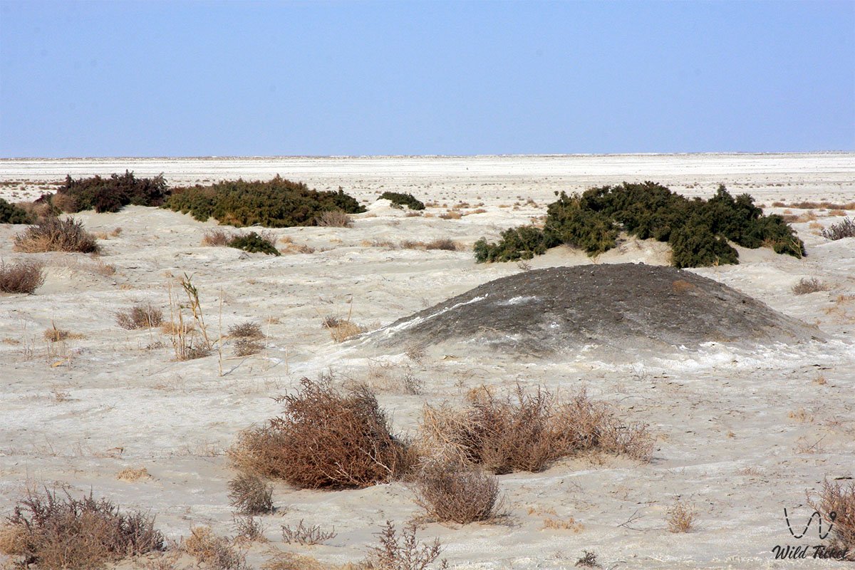
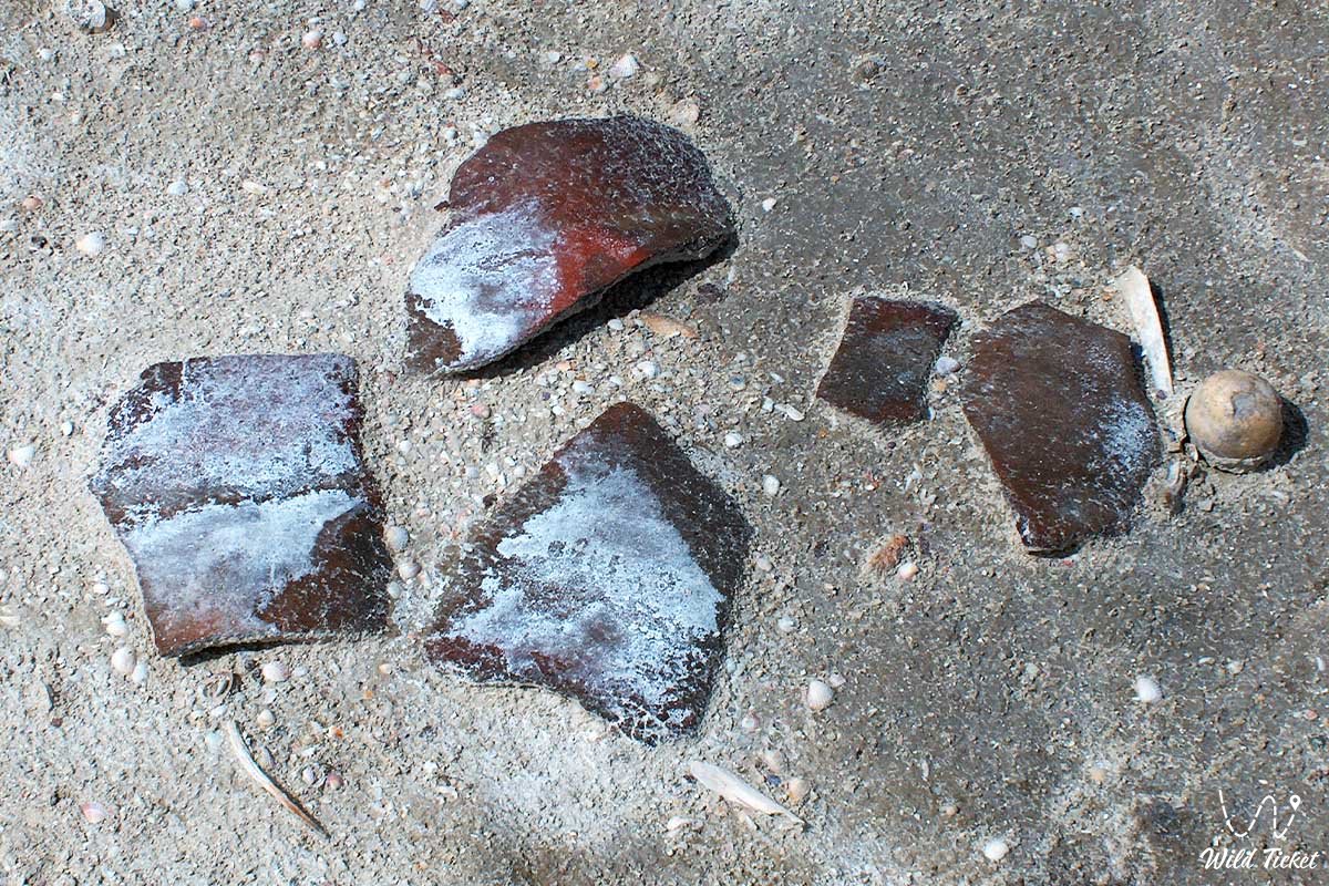
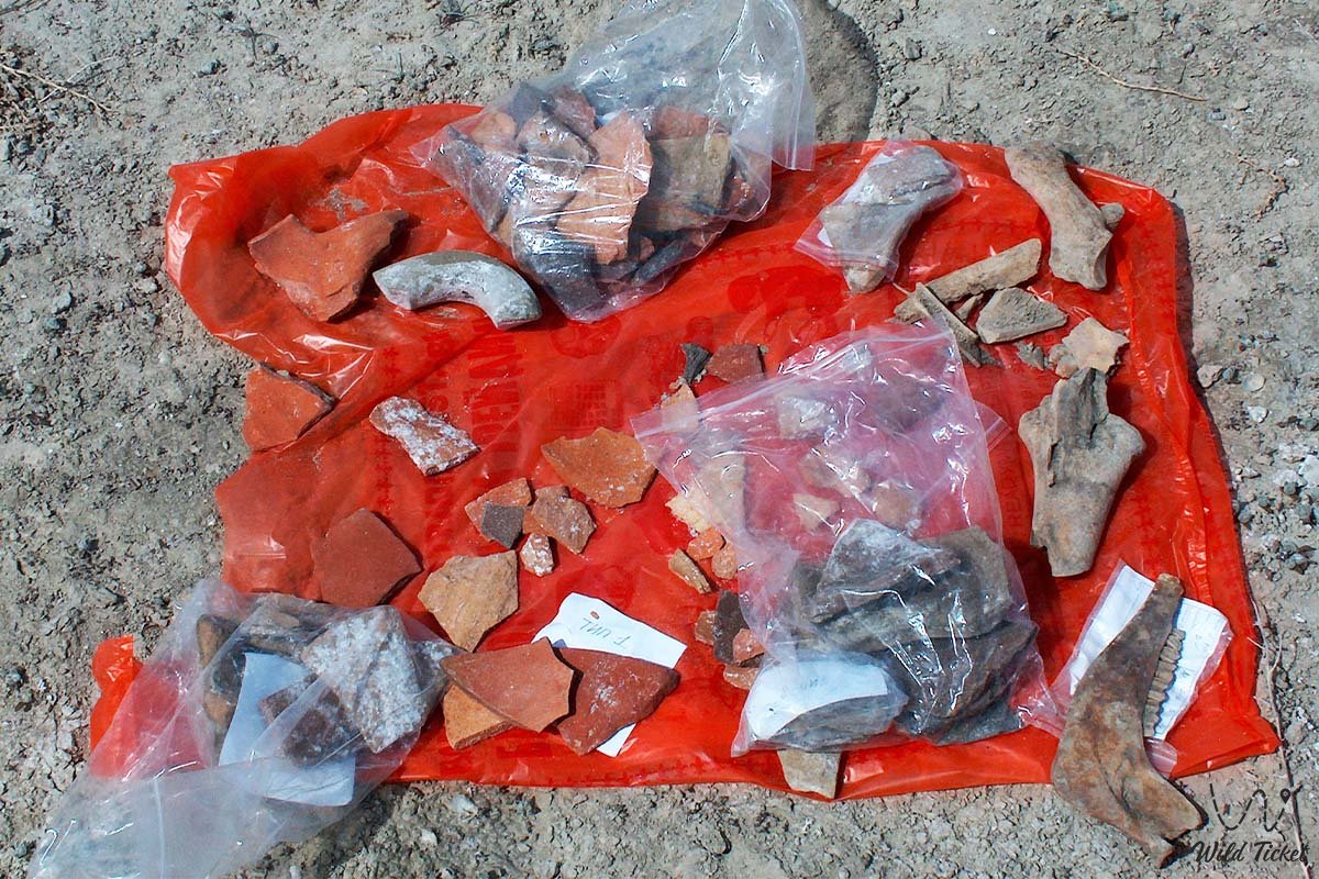
The upper cultural layer of the settlement does not exceed 40 centimeters and represents a loose dark gray deposit with the inclusion of shells, silt, and decayed remains of the root system of plants. The surface of the area is partially covered with a salt crust and densely overgrown with desert shrubs – djingil, suran, and chee grass. Fine charcoal from ancient hearths can be traced everywhere.
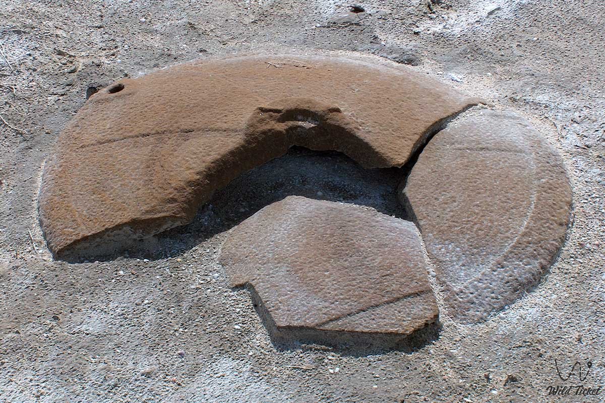
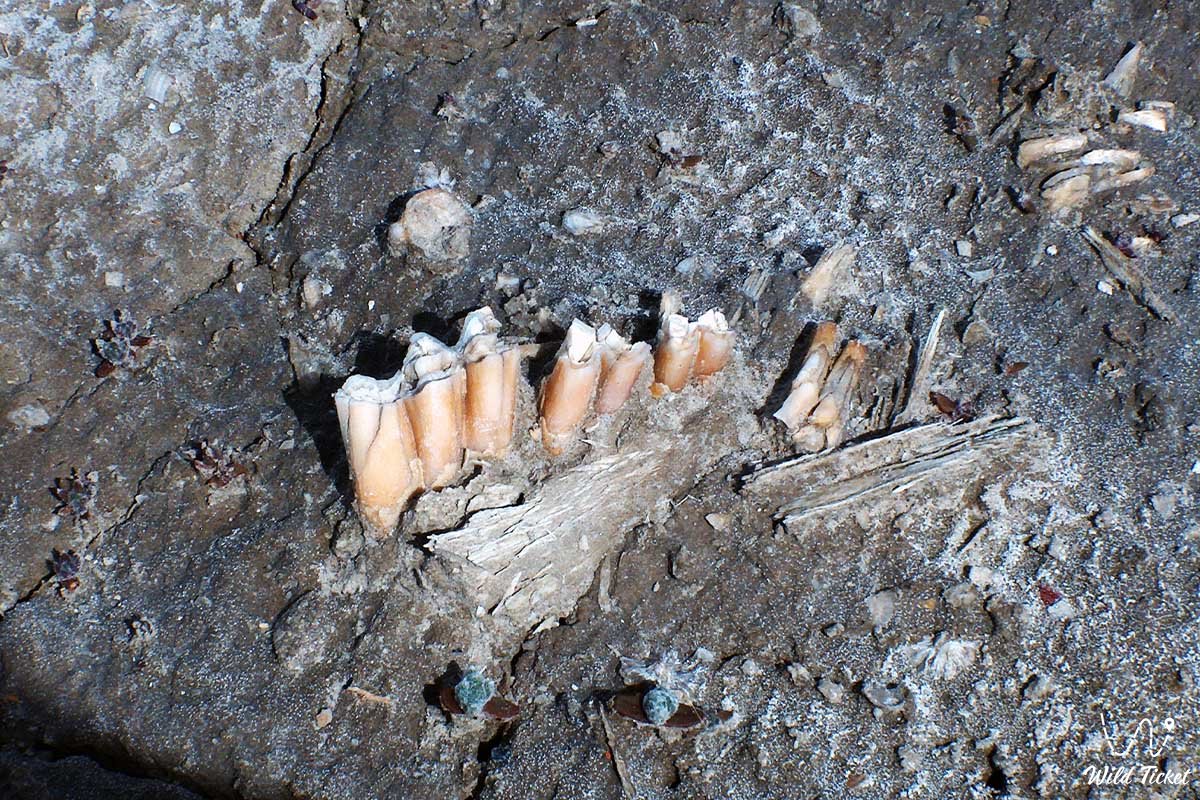
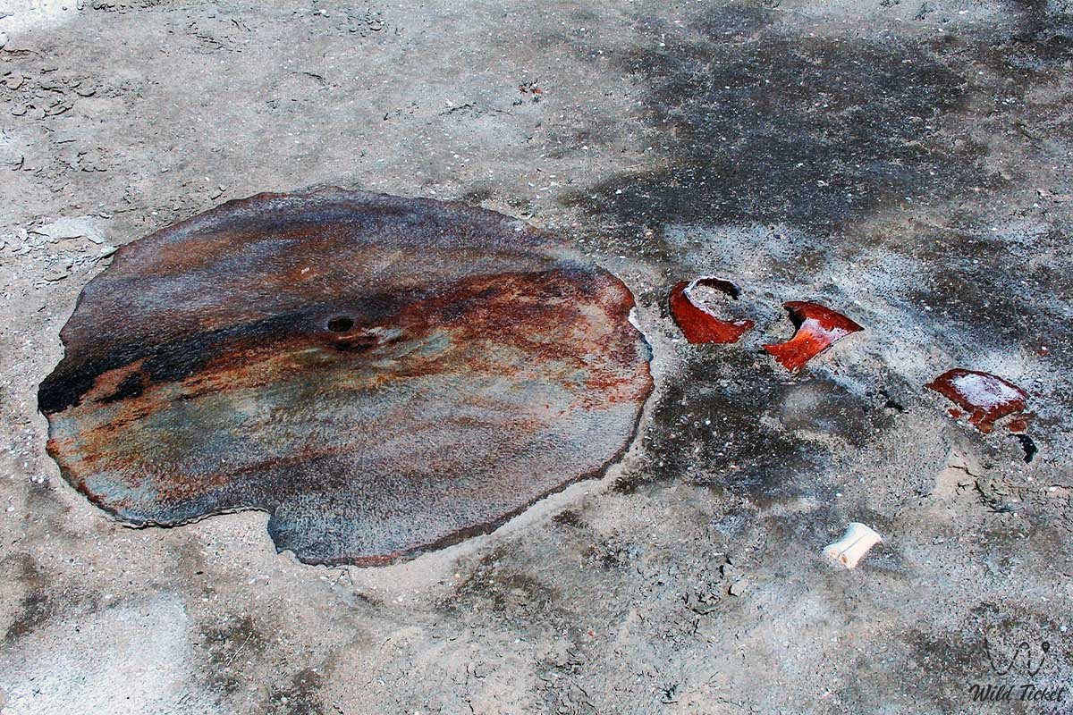
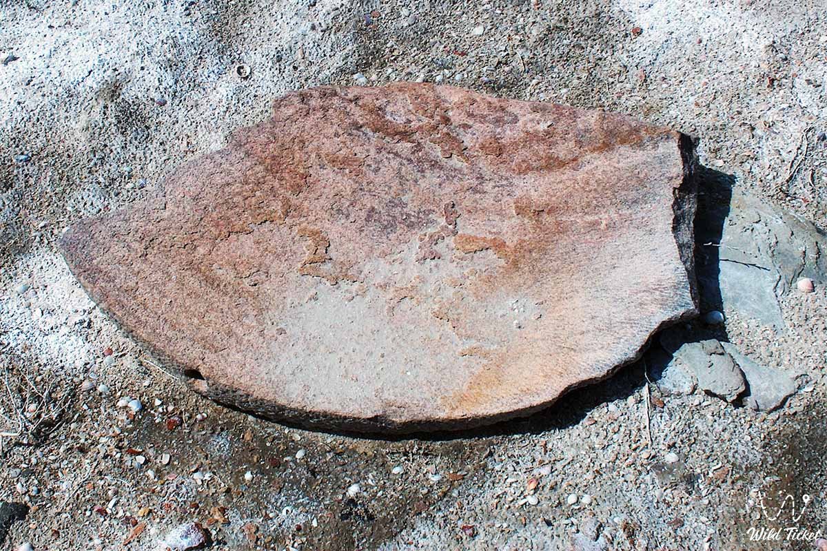
Archaeological excavations revealed a rich complex of wheel-made red-clay and gray-clay ceramics for tableware and kitchen use, covered with slip of red, light, and black colors, as well as fragments of glazed majolica of turquoise and dark blue shades. Numerous osteological materials opened up to the attention of researchers: sheep bones with traces of crushing, fragments of ribs and jaws of small and large cattle, with some of the tubular bones bearing clear signs of exposure to fire. Scientists of the A.Kh. Margulan Institute of Archaeology ask tourists to move around the territory of the monument strictly on foot, not to collect ancient bricks for souvenirs, and to respect the historical heritage of Kazakhstan.
Detailed description of the venue
The well-thought-out structure of the ancient historical and archaeological complex includes the following original locations and geographical features:
• Central residential sector – the central zone of the settlement with an area of 6 hectares, representing a bumpy surface with contours of mudbrick walls emerging from under the sand.
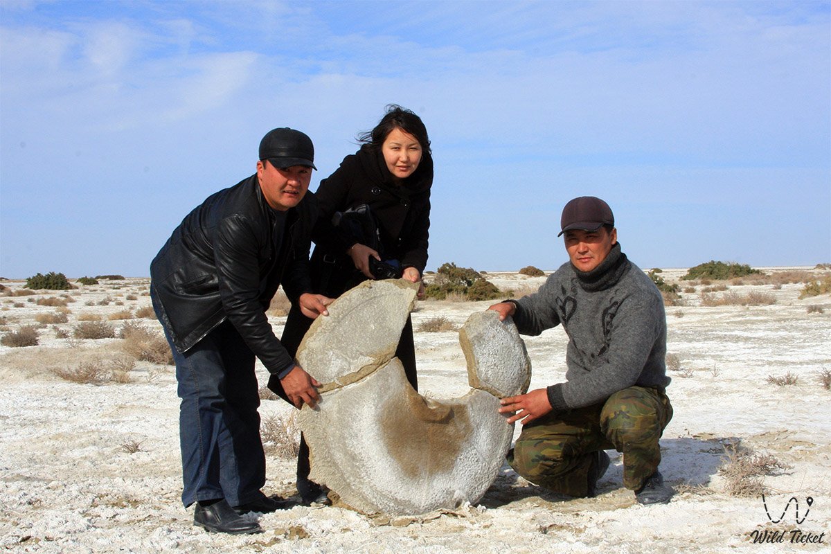
• Industrial milling zone – an industrial sector located in a crescent shape on one side of the city, where a developed flour milling production was excavated, including 14 large-scale millstones.
• Premises for storing flour (khumdans) – specialized squat economic warehouses located in the immediate vicinity of the millstones.
• Irrigation rice plantations – a developed system of agricultural fields in the form of rectangular plots stretching for kilometers from the northwestern side of the settlement and standing out in the form of washed-out ramparts.
• Main artificial canal – a powerful irrigation ditch from 2 to 3 meters wide and up to 20 cm deep, which separated agricultural plantations from residential houses and stretched for tens of kilometers to ancient riverbeds.
• Economic complex of the excavation – an excavation measuring 30×17.5 meters aligned with the cardinal points in the northern part of the settlement, combining U-shaped premises without heating systems.
• Medieval necropolis Kerderi-2 – a huge "valley of the dead" bounding the city on the other side, where in 2006 on an area of 10 sq. m a domed single-chamber facade-type mausoleum with a rectangular stone foundation up to 1.2 meters high was investigated.
Architecture
The architectural structures of Aral-Asar are heavily smoothed and eroded by centuries of lake currents. Civil residential houses represented typical adobe buildings with a layout standard for the Golden Horde time. The walls of the rooms were erected from raw brick. In the center of each dwelling, a round red-clay tandoor was equipped — a universal thick-walled oven with intersecting stripes drawn on the inside, used for heating and baking.
The tandoor was mounted into a sufa – a wide clay bed that occupied most of the room. The sides of the sufa were laid from raw material, and the internal space was filled with dense soil. At a depth of 30 centimeters, archaeologists discovered technological platforms laid with fragments of fired brick. In the center of such brickwork was a khum – a large clay vessel for liquids, more than three-quarters buried in the ground, the shoulders of which were neatly hidden by the upper rows of the brick flooring.
Legend
Among researchers and expedition guides, Aral-Asar is known as the "city of steppe Atlanteans," whose sudden disappearance generated many disputes. The main historical legend of these places is considered the phenomenon of the emergence of a developed grain and rice economy in the middle of lifeless salt marshes. Steppe aksakals pass down stories that this land originally possessed hidden fertility, and when the sea receded for the first time, ancient farmers managed to create a miracle, making the desert bloom and feed thousands of people far beyond the borders of the oasis.
The second legend is connected with the sudden return of big water and received the name "the myth of the unheeded warning." Local beliefs state that nature for a long time gave signs to the residents that the beds of the great rivers Syr Darya and Amu Darya were changing their course again. Old people claim that a few months before the flood, fresh water left the wells, and steppe kulans and saigas began to migrate en masse to the elevations of the Ustyurt chink. However, the citizens, confident in the durability of their capital adobe houses and canals, ignored the signs of nature. When the waves of the Aral rapidly rushed into the basin, people had to flee, leaving behind their heavy stone millstones, tandoor ovens, and dishes. Local guides believe that Aral-Asar went underwater as a reminder that man will never be able to fully subdue the elemental forces of Aral nature.
Conclusion
Aral-Asar ancient settlement is a magnificent historical bridge connecting the developed oasis culture of the Golden Horde era with the modern ecological chronicle and tourist potential of the Kyzylorda region. A visit to this ancient city, risen from the water, allows travelers to personally see traces of medieval irrigation, appreciate the scale of natural cataclysms of the past, and realize the variability of the geographical contours of our planet.
The settlement remains an essential reference point for scientific-research, archaeological, and adventure tourism in the Aral district. Expedition routes along the former seabed invariably include Aral-Asar in their guidebooks, providing everyone with a unique opportunity to touch the secrets of the steppe Atlantis, hidden for centuries under blue waves.
Interesting sights nearby:
• Small Aral Sea;
• Kokaral Dam;
• Shevchenko Bay;
• Barsakelmes Nature Reserve;
• Barsakelmes Island;
• Karateren village.
Photogallery: