Off-road expedition to the arrow-shaped chink of Ustyurt is a route to the third observation point of the Bozzhyra tract, occupying a commanding position over the chalk basin. While the first and second viewpoints introduce the northern sector of the Ortasha plateau and residual table mountains, the third panorama brings travelers onto the tip of a natural balcony offering the most comprehensive frontal view of the valley's iconic chalk towers.
The third panorama of Bozzhyra no. 3 is located at an altitude of 280 meters above sea level on the Western chink of the Ustyurt plateau in the Karakiyan district of the Mangistau region. It is the highest observation point along the northern sector of the chink. A 3-kilometer drive along a well-beaten track across the upper plateau separates it from the second panorama of Bozzhyra. The viewpoint itself is a narrow, arrow-shaped headland of the chink pointed with a sharp scarp to the southeast, projecting deeply into the open airspace above the basin of the ancient Tethys Ocean.
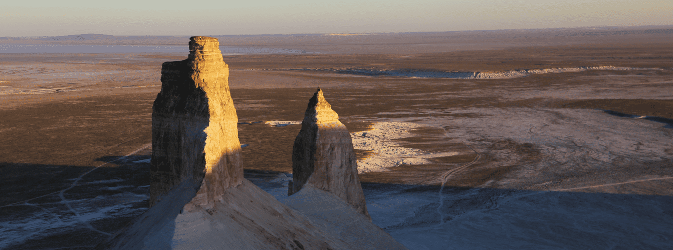
From the third panoramic platform, a grand circular vista unfolds. The primary visual highlight of the site is the first direct view of the famed limestone pinnacles of Azu tisteri ("Fangs of Bozzhyra"): the Southern (Ontustik) and Northern (Soltustik). Right before your eyes rises the snow-white dome of mount Yurt, 253.3 meters high, alongside the massive slopes of mount Borly-Tau. To the west, the Ortasha plateau and the cone-shaped mount Shokytau (266 m) appear from an entirely different perspective, accentuating the stepped subsidence of the Ustyurt strata.
The historical landscape of the area is enriched by two ancient hunting arans situated along the access dirt track. These arrow-shaped stone traps, built from flagstones by nomads hundreds of years ago, indicate that the natural headland of the chink served as a cul-de-sac for driving herds of wild saiga antelopes and goitered gazelles.
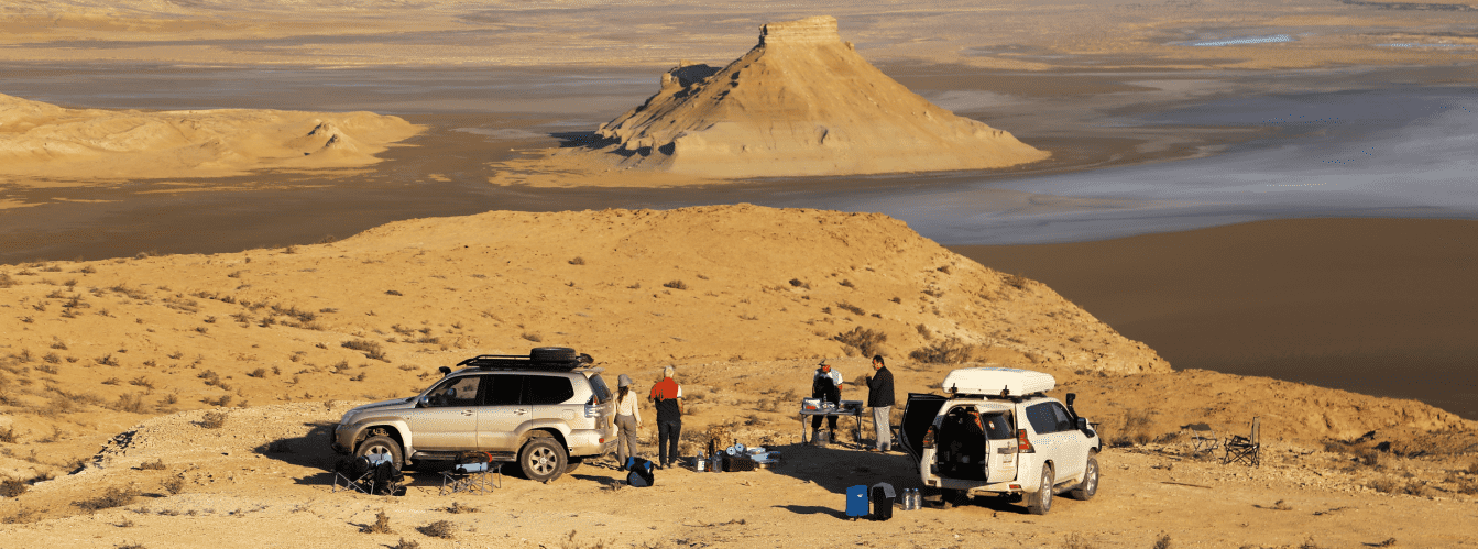
A 4x4 jeep tour along the Bozzhyra panoramas provides the opportunity to experience the stark contrasts of the Mangyshlak peninsula in a single journey, climbing onto the highest crests of the chink. You can explore the detailed 5-day tour itinerary across Mangystau.
List of panoramic viewpoints in the Bozzhyra tract:
• First panorama of Bozzhyra (no. 1);
• Second panorama of Bozzhyra (no. 2);
• Fourth panorama of Bozzhyra (no. 4);
• Fifth panorama of Bozzhyra (no. 5);
• Sixth panorama of Bozzhyra (no. 6).
--------------------------------------------
How to get there and visit –
The third panoramic point of the Bozzhyra tract is situated at an elevation of 280 meters above sea level in the Karakiyan district of the Mangistau region, Republic of Kazakhstan. The site crowns an arrow-shaped projection of the Western chink of the Ustyurt plateau, 3 kilometers southeast of the second panorama.
GPS geographic coordinates of the third panorama of Bozzhyra no. 3:
43°27'10"N 54°05'10"E
The approach begins at the 79th kilometer of the Zhanaozen – Beket-Ata underground mosque highway. From the paved road to the third panorama viewpoint, the distance along the steppe track is 6.5 kilometers. The route traverses a firm, stony-clay plateau past ancient stone corrals.
Walking access: unlike the second panorama with its extended descent, the dirt track here approaches very close to the scarp. Vehicles pull up at a safe stopping area, leaving only about a 70-meter walk across the level surface of the promontory to reach the edge of the precipice.
The itinerary is designed for 4x4 off-road vehicles equipped with durable tires resistant to sharp flint shards. In dry weather, the plateau is easily passable, but during rainy periods, driving along the softened tracks can become difficult.
IMPORTANT: the arrow-shaped headland is exposed to strong crosswinds. The limestone strata at the very tip of the promontory feature deep tension fractures and erosion-undercut ledges. Driving a vehicle closer than 20 meters to the cliff edge and approaching the outermost brink during gusty winds are strictly prohibited.
--------------------------------------------
Photography specifics and site tips:
• Perspective of the arrow-shaped headland: the shape of the promontory allows for striking compositions using the scarp of the chink as a leading line descending into the abyss toward the base of mount Yurt and the Borly-Tau massif;
• Optics for shooting the Fangs: an excellent sector opens up from here to photograph the Azu tisteri buttes. Use a lens with a focal length of 35–50 mm for a layered panorama of the entire butte group, and a 70–200 mm telephoto lens to isolate the peaks of the Southern and Northern fangs against the white scree slopes;
• Golden hour lighting: morning dawn light tints the eastern faces of the Fangs and mount Yurt in delicate pink and orange tones. About 1.5 hours before sunset, light from behind softly illuminates the entire Bozzhyra basin, creating subtle shadows across the ravines at the base of the chink;
• Aerial drone shooting: the narrow headland generates updrafts of air rising from the floor of the tract. Launch your drone strictly from the center of the promontory using a landing pad. Exercise caution when descending the craft toward the Azu tisteri buttes—the vertical drop exceeds 150 meters, requiring continuous monitoring of the radio link;
• Self-sufficiency and gear: cellular reception is unavailable at the third panorama. Working on the open, wind-swept promontory requires a windproof jacket, polarized sunglasses, and a drinking water supply of at least 4 liters per person per day.
Tours and expeditions to the third panorama: visiting the third panorama of the Bozzhyra tract is part of our comprehensive 4x4 jeep tours across the Mangistau region departing from Aktau. The program includes comfortable travel in equipped 4x4 vehicles, accompaniment by experienced driver-guides, a field lunch overlooking the Fangs of Bozzhyra, and stops at the ancient hunting arans of the Ustyurt plateau.
Nearby attractions:
• Fangs of Bozzhyra (Azu tisteri);
• Mount Yurt;
• Mount Borly-Tau;
• Second panorama of Bozzhyra;
• Mount Shokytau;
• Beket-Ata underground mosque (6.5 km to the east);
• Two hunting arans on the plateau.
Photogallery:







Comments 2