Maritime harbor of Peter the Great's expeditions and natural haven of Port Kuryk –
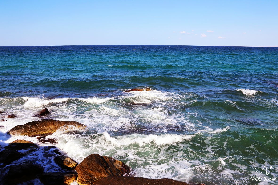
Aleksandrbay Gulf (Kaz. Aleksandrbai shyghanaghy, formerly the Gulf of Alexander Bekovich-Cherkassky) represents a large semi-enclosed sea gulf and a natural deep-water marine basin situated along the eastern coast of the Caspian Sea in the Mangystau region. The gulf indents the southwestern part of the Mangyshlak Peninsula for 9 kilometers with an entrance width of roughly 31 kilometers, extending between Cape Sarzha (Peschany) to the north and Cape Zhylandy (Gilyanly) to the south. At the head of the gulf, 4.5 miles north of Cape Zhylandy, lies the sheltered natural bay of Kuryk, on whose shores the coastal village of Kuryk developed and where the international ferry port of the same name operates.
In the travel logistics of the Southern Cluster of Mangystau, the shores of the gulf provide a convenient seaside base for road travelers. Located only 65–70 kilometers to the north is the regional center of Aktau, linked to the coastline via a high-speed highway, while directly east of the marine terrace begins the descent into the endorheic Karagiye depression (-132 meters below sea level) with the dazzling Batyr salt flat. The coastal route connects the gulf with southern beaches where, beyond the rocky headland of Cape Tokmak, lie the calm waters of Kenderli Bay and the year-round hotels of the Kenderli resort.
The coastal landscape was sculpted by the evolution of the ancient Tethys Ocean and Late Quaternary Caspian marine terraces. Chains of tall reddish dunes and sand mounds reach right up to the azure surf line, transitioning inland into stony semi-desert. From here, passing through the oil city of Zhanaozen, expedition routes lead deep into the interior: toward the golden barchans of Senek (Tuyesu), the stepped limestone chinks of the Kenderli-Kayasan Plateau, the Kenderli-Kayasan nature sanctuary, and the relict basin system of Basgurly – Zhazgurly.
The water body features a distinct hydrological regime with depths reaching 18 meters along its southeastern margin, preventing the gulf from freezing during winter and keeping it an open haven for schools of Caspian mullet, migratory swans, and the Caspian seal. For participants in extended overland off-road expeditions, the shores of Aleksandrbay Gulf serve as an ideal coastal camping site to rest before tackling the cyclopean chalk scarps of the Bozzhira tract, the banded Mount Bokty, the boundless salt pans of the Karynzharyk depression, and the strict cordons of the Ustyurt Reserve.
Today, Aleksandrbay Gulf combines its role as a key maritime transport artery with leisure opportunities: it is a favored destination for sea angling targeting mullet and pike-perch, wild camping along sand dunes, and observing marine birdlife and Caspian seals.
--------------------------------------------
How to get there and visit –
Aleksandrbay Gulf is situated on the southwestern coast of Mangyshlak between Capes Peschany (Sarzha) and Zhylandy in the Karakiyan district, Republic of Kazakhstan. The distance from the city of Aktau to the village of Kuryk and the central part of the gulf is around 70–80 km along a paved highway; from the city of Zhanaozen it is roughly 120–130 km, while Cape Zhylandy at the southern entrance of the gulf sits roughly 85 km from Aktau.
GPS geographical coordinates of Aleksandrbay Gulf:
43°09'20"N 51°37'14"E
The driving route from Aktau leads south along the high-speed paved Aktau – Kuryk highway. The solid-surface road is maintained year-round, requiring a drive of 50–60 minutes in a standard passenger car. Regular suburban bus connections and shared taxis run between Aktau and the gulf coast (to Kuryk village).
Approaching from Zhanaozen, vehicles travel over paved roads through the settlements of Munayshy and Zhetybay, or along a direct highway linking Zhanaozen with Port Kuryk.
Navigating wild shoreline sections beyond the asphalt (toward Cape Zhylandy, the reddish dunes, and secluded coves) requires a high-clearance crossover or a four-wheel-drive vehicle (4x4). The coastal strip consists of loose shore sands, coquina shell, and exposed flat limestone bedrock.
Driving heavy vehicles directly onto the wet, soft sand along the surf line is strongly discouraged to prevent bogging down to the axles. Carrying an air compressor for deflating and reinflating tires, a pressure gauge, and a dependable spare wheel is essential.
Visiting regime: the coast of the gulf outside the secured perimeters of Port Kuryk and the ERSAI shipyard is open for leisure, fishing, and camping. Due to proximity to Kazakhstan's maritime border on the Caspian, each traveler must carry an original passport or national ID card in case of coast guard inspection.
Infrastructure along the gulf is centered in the village of Kuryk: brand-name gas stations, service garages, tire repair shops, supermarkets, a local market, a district hospital, pharmacies, cafes, and small guesthouses operate here. The Yeraliyev railway station (on the Beyneu – Zhanaozen line) lies 11 km from the village. Across most of the coast and harbor waters, 3G/4G cellular coverage remains stable. Self-contained camping requires bringing potable water, camp equipment, and sun protection.
The best season to visit runs from late May through late September, when shallow sectors of the gulf warm to a comfortable +23...+26 °C, providing pleasant conditions for swimming and beach recreation. Spring (April – May) and autumn (September – October) are ideal for coastal angling, bird-watching, and regional off-road trips free from excessive heat.
--------------------------------------------
History
The history of Aleksandrbay Gulf is tied to Peter the Great's geopolitical ambitions to open Russian access to Eastern trade routes toward India and Central Asia. In May 1714, a royal decree appointed Captain Alexander Bekovich-Cherkassky of the Preobrazhensky Life Guards Regiment (born Kabardian prince Devlet-Gisden-murza before baptism) as head of a military expedition to Khiva and Bukhara. The mission had extensive objectives: chart the eastern Caspian coast, investigate the ancient bed of the Amu Darya river, win the allegiance of the Khivan khan, and erect fortified strongpoints.
Between 1715 and 1716, Bekovich-Cherkassky's expedition surveyed the eastern shore and produced the first reasonably accurate composite map of the Caspian Sea. In 1716, the prince's fleet entered a sheltered gulf in southwestern Mangyshlak. A small fortress and pier were constructed on its shores, serving as the rear base for the detachment. From that time onward, the body of water became known as "Alexandrovsky Gulf" or "Aleksandrbay," officially appearing on charts in 1718. Historian V.N. Tatishchev noted that the hydronym referred directly to the harbor of Prince Alexander Bekovich-Cherkassky.
In 1717, Bekovich-Cherkassky's inland march to Khiva met a tragic end: after crossing waterless deserts, the force was surrounded by the troops of Khan Shir Ghazi. Enticed into dividing his force among several settlements, the Russian detachments were ambushed and annihilated. Bekovich-Cherkassky was killed in captivity, giving rise to the Russian idiom "vanished like Bekovich." When Turkestan Governor-General K.P. von Kaufman mounted a punitive campaign against nomadic raiders in 1873, it was viewed in part as retribution for the fate of Bekovich's expedition.
The memory of the explorer and cartographer endured on nautical charts: in 1959, the Presidium of the Geographical Society of the USSR officially confirmed the name "Gulf of Alexander Bekovich-Cherkassky." Later, the historical name Aleksandrbay was restored, retaining the commemorative root dedicated to Alexander Bekovich.
During the Soviet era, the gulf supported coastal fishing collectives and served as a mooring point for geological survey crews mapping hydrocarbon deposits across Southern Mangyshlak. Between 2015 and 2018, its sheltered waters became the construction site for the multimodal ferry hub of Port Kuryk, an essential component of the Trans-Caspian International Transport Route.
Information
Morphometrically, the gulf is a marine abrasional-aggradational depression open to the west, indenting the peninsula's coastline to a depth of 9 kilometers with an entrance width between Capes Peschany (Sarzha) and Zhylandy of around 31 kilometers. Shoreline elevations reflect the current level of the Caspian Sea (-28 meters below world sea level), rising eastward across continental terraces to +15...+30 meters.
The hydrological regime features pronounced depth variations: western shallows over sand bars begin at 1.2–2 meters, deepening toward 18 meters along the southeastern fairway, allowing unobstructed navigation for deep-draft vessels. In 1939, hydrographic soundings at a depth of 8 meters identified an ancient submerged abrasional terrace with pothole scour features, providing evidence of dynamic sea-level fluctuations in the geologic past. A belt of submerged and exposed rock banks, islets, and stony benches fringes the coastline. Wave action depends on wind direction: westerly winds generate open swells, while the eastern sector is partly sheltered by the Sarzha ridge.
The geological foundation consists of Mesozoic and Cenozoic marine sediments of the ancient Tethys Ocean, mantled by Quaternary marine terraces from the Khvalynian and Neo-Caspian transgressions. Shoreline bluffs expose Sarmatian coquina limestones, marls, and variegated clays. Bottom sediments consist of quartz-carbonate sands, shell detritus, and dense gray muds.
Soil cover comprises saline coastal gray-brown desert soils, salt marshes, and loose coastal sands. Belts of tall reddish dunes run along the shoreline, grading inland into semi-stabilized sandy hummocks.
The climate is temperate desert with noticeable marine moderation. Winters are relatively mild, with average January temperatures of -2...-5 °C; active water circulation keeps the gulf largely ice-free (with only brief, localized fast ice in shallow corners). Summers are warm and sunny, with average July daytime temperatures reaching +28...+32 °C. Annual precipitation averages 130–150 mm under prevailing coastal breeze circulation.
Detailed description of the venue
The natural and aquatic complex of Aleksandrbay Gulf includes the following coastal sectors, zones, and landforms:
• Kuryk Bay at the head of the gulf – a natural marine cove 4.5 miles north of Cape Zhylandy with gently sloping shell beaches, sheltered from open-sea breakers by a coastal spit.
• Belt of tall reddish dunes – prominent coastal sand ridges of brick-red and ochre hue bordering the waterline and transitioning inland into hummocky sands.
• Port Kuryk ferry terminal in the village of Kuryk – a deep-water commercial terminal equipped with protective breakwaters, access channels, rail ferry ramps, and a roll-on/roll-off truck pier.
• Sarzha Ridge and Cape Peschany (Sarzha) – the northern sandy-rocky flank of the gulf, providing partial shelter against northwesterly storm winds.
• Cape Zhylandy (Gilyanly) – the southern rocky entrance headland featuring submerged reef shoals, exposed rocks, and elevated vantage points.
• Submerged abrasional terrace with scour potholes – a relict geological formation at a depth of 8 meters consisting of an ancient stone shelf with rounded erosional cavities.
Flora and fauna
Vegetation along the coast of Aleksandrbay Gulf is made up of littoral halophytic and psammophytic plant communities. Reddish dunes and beach sand berms support Russian saltwort, eastern saltwort, sea rocket, saltbush, feather grass, Aristida (selin), and couch grass. Inter-dune hollows host tamarisk (saltcedar), black saxaul, Calligonum (dzhuzgun), and camelthorn (dzhantak). The adjacent gravel plains are dominated by gray-soil wormwood, Lerche's wormwood, Anabasis salsa (biyurgun), and boyalych. In spring, ephemeral plants and wild tulips briefly blanket the shoreline. Underwater, the seabed supports meadows of green and charophyte algae.
Fauna integrates the marine life of the Caspian shelf with denizens of the coastal desert. Throughout the year, the endemic Caspian seal appears in the gulf, hunting fish along the rocky shoals and reefs of Capes Sarzha and Zhylandy. Commercial fish species include Caspian mullet (singil), pike-perch, wild carp, Caspian roach, bream, herring, and gobies, along with migratory sturgeon (stellate sturgeon, Russian sturgeon).
Avifauna along the coast features dozens of waterbird and migratory species. Caspian gulls, Pallas's gulls, common terns, common shelducks, Eurasian coots, grey herons, and great cormorants forage across the shallows. During seasonal migration passages, Aleksandrbay Gulf hosts thousands of staging mute swans, whooper swans, Dalmatian pelicans, and greater flamingos.
Terrestrial mammals inhabiting the sand hummocks and nearby plains include the corsac fox, tolai hare, long-eared hedgehog, steppe polecat, small five-toed jerboa, and gerbils. Goitered gazelles occasionally wander in from the chinks of the Karagiye depression.
Herpetofauna includes the agile steppe agama, toad-headed agama, rapid fringe-toed lizard, sand boa, arrow snake, dione snake, and four-lined snake. Solifuges, tarantulas, and scorpions inhabit the sand dunes.
Legend
An ancient Mangystau legend tells of the Prince's Stone Pier and the Sea Treasure.
Tradition recounts that during the reign of Tsar Peter, the navigator Prince Alexander Bekovich sailed to the eastern shores of the ancient Khazar sea aboard masted ships. He was guided by the desire to chart unfamiliar coasts and discover river passages leading to the trade wealth of the East.
As the vessels neared the coast of Mangyshlak, a severe storm arose, threatening to wreck the fleet upon sharp offshore rocks. Standing at the bow of his flagship, the prince offered a prayer and cast a family gold ring set with turquoise into the surging water as an offering to the spirits of the Caspian.
The tempest subsided, the waves parted, and a path opened into a quiet, deep gulf sheltered behind high sand dunes. Stepping ashore, the prince ordered the construction of a stone pier and fortress to provide shelter for future travelers. Local Aday nomads, impressed by his courage, named the haven Aleksandrbay.
A belief endures across the steppe that the prince's gold ring rests upon the seabed amidst the ancient drowned stone terraces, shielding the waters of Aleksandrbay from storms and offering safe passage to ships entering this historic harbor.
Conclusion
Aleksandrbay Gulf represents a living maritime chapter of Mangystau, where the history of 18th-century geographical expeditions converges with a modern transcontinental ferry port and the natural scenery of reddish coastal dunes. Traveling to the shores of Aleksandrbay offers the bracing air of the sea surf, productive coastal angling, sightings of Caspian seals, and sunsets across the ancient waters of the Caspian Sea.
Interesting sights nearby:
• Coastal Village of Kuryk;
• Cape Peschany (Sarzha);
• Deepest Endorheic Karagiye Depression (-132 m);
• Scenic Cape Tokmak;
• Kenderli Seaside Resort Complex;
• Shallow Kenderli Bay;
• Sand Massif and Dunes of Senek (Tuyesu);
• Oil City of Zhanaozen;
• Beket-Ata Underground Mosque in Oglandy Tract;
• Shopan-Ata Underground Mosque in Karakiyan District;
• Karaman-Ata Underground Mosque and Necropolis;
• Mausoleum of Saint Man-Ata on Manata Pass;
• Shakpak-Ata Rock-Cut Cruciform Mosque;
• Sultan-Epe Underground Mosque and Necropolis.
Photogallery: