Seventeen-kilometer rocky massif on the northern boundary of the Kenderli salt flat –
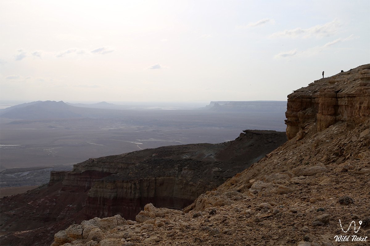
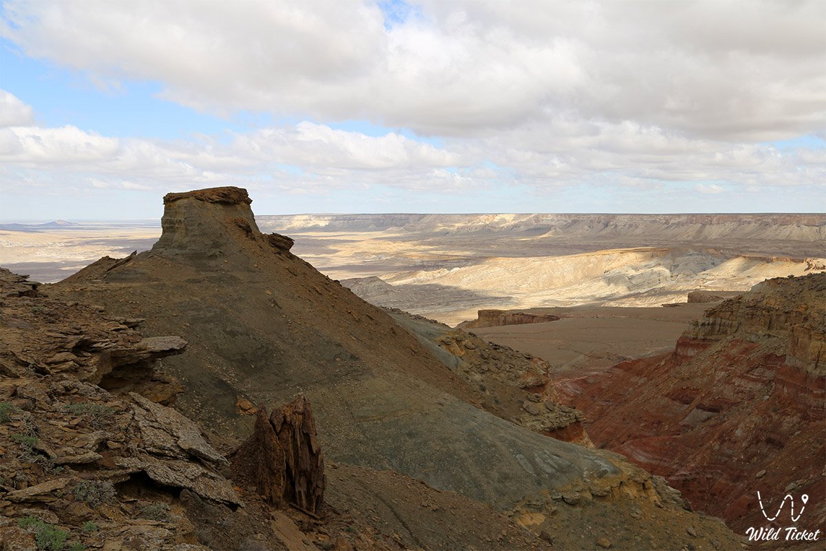
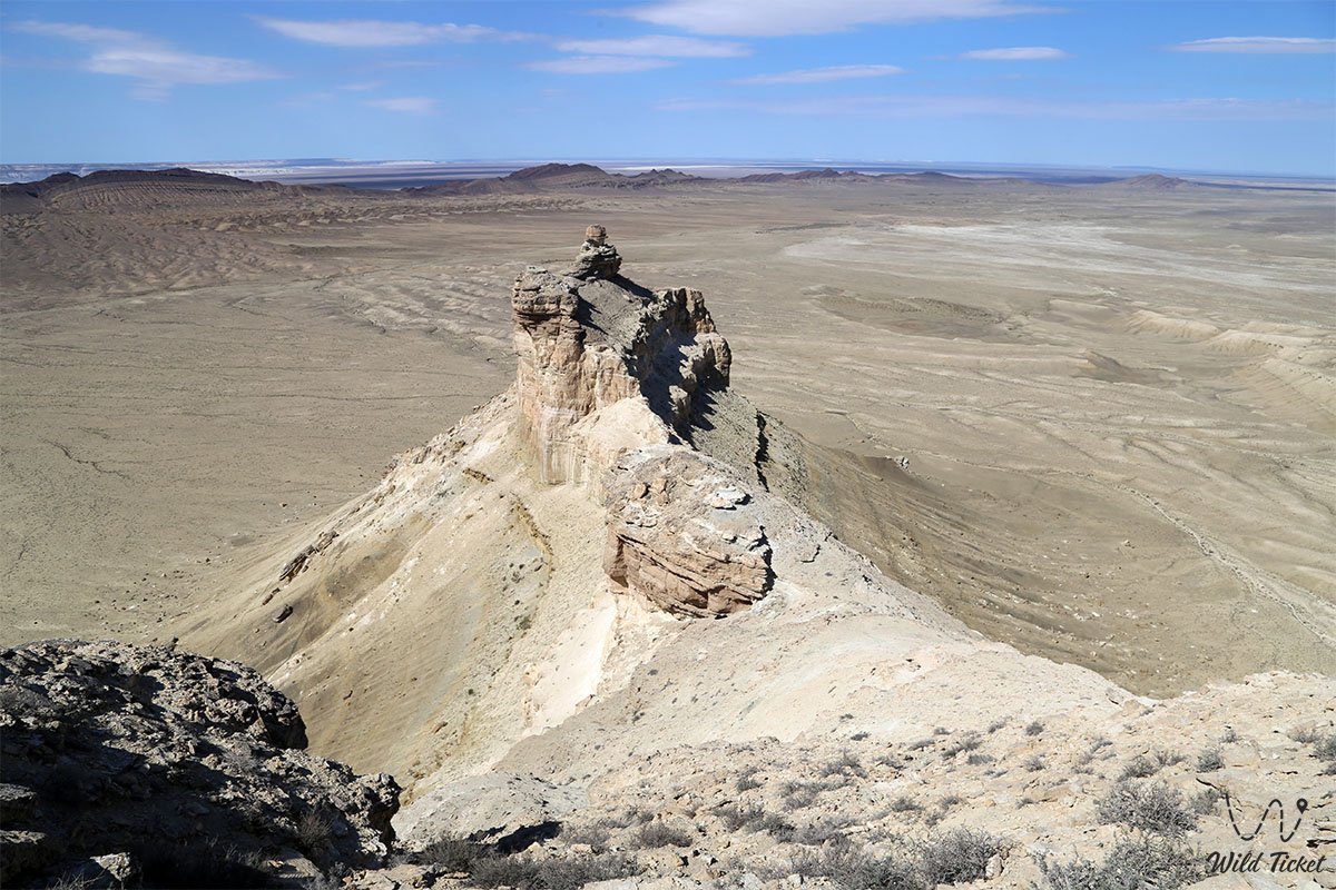
The Karamaya mountain range (Kazakh: Қара мая – Black Female Camel) is an extensive stony massif, an intricate network of narrow ravines, and a dominant upland in the eastern sector of the endorheic Karynzharyk depression in western Kazakhstan. This rocky ridge towers along the northern margin of the vast Kenderli salt flat within the boundaries of the Karakiyan district on the strictly protected lands of the Ustyurt nature reserve.
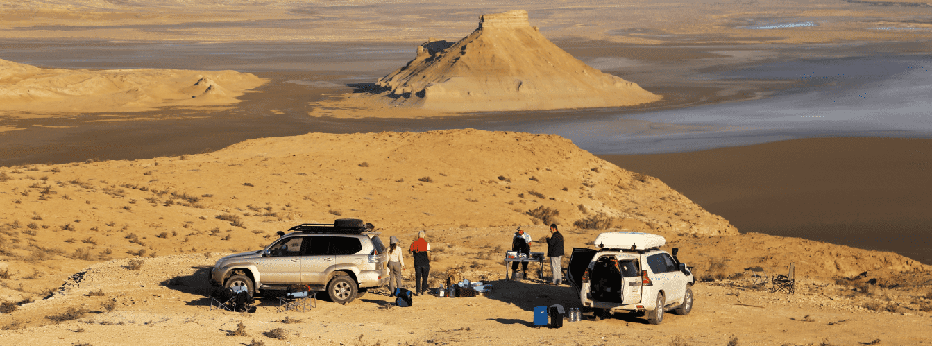
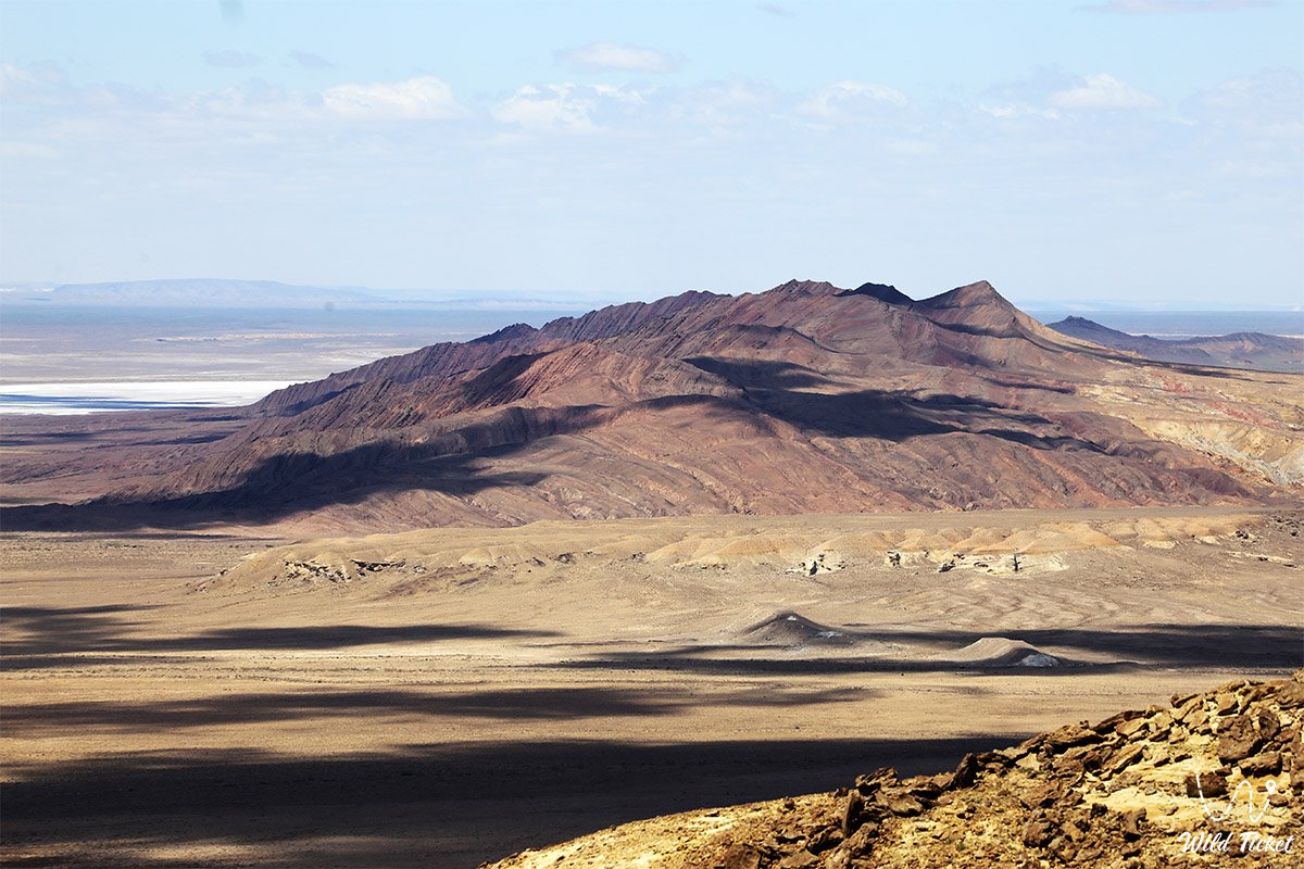
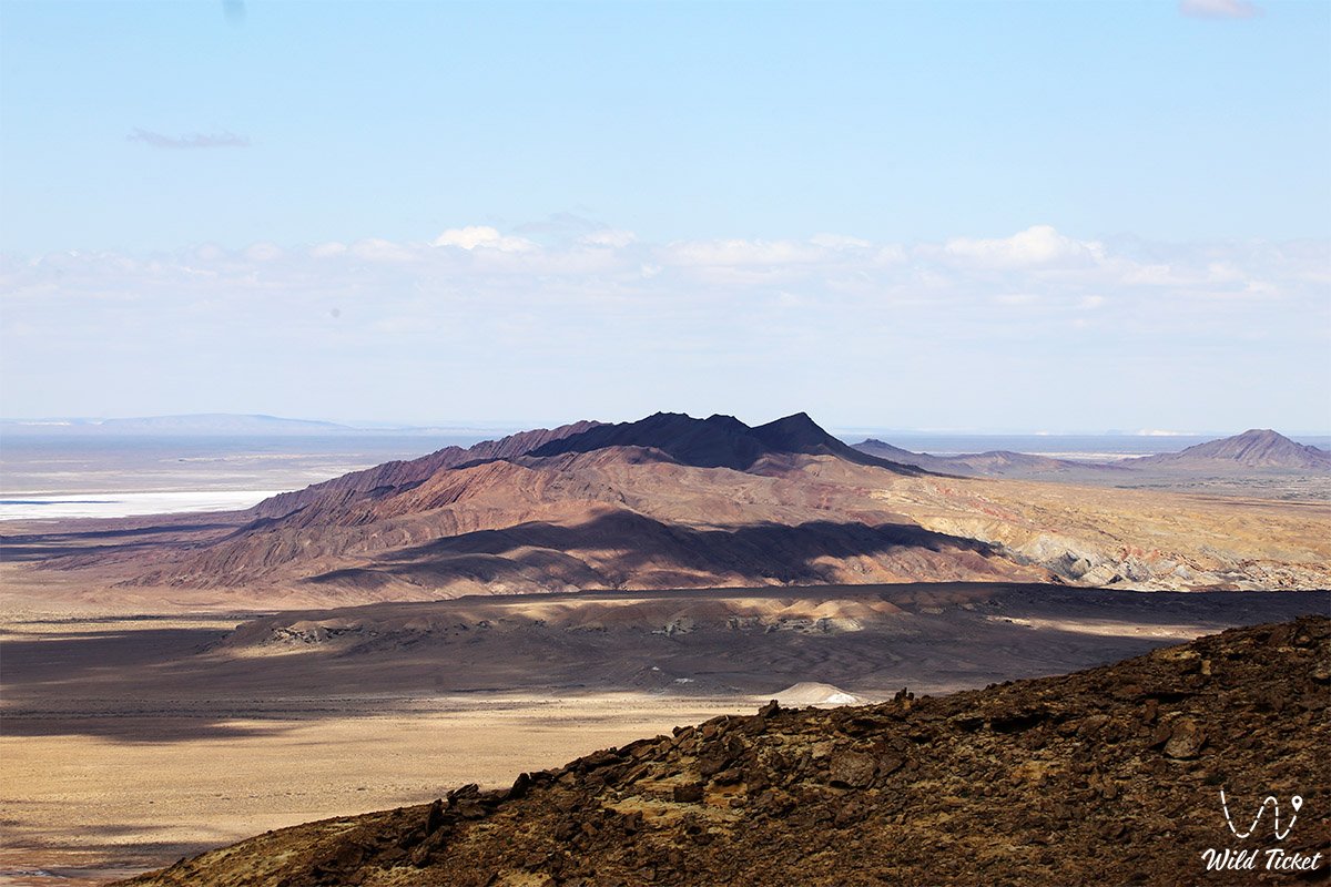
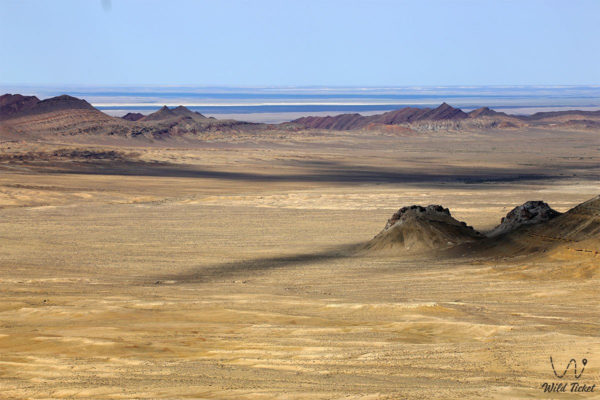
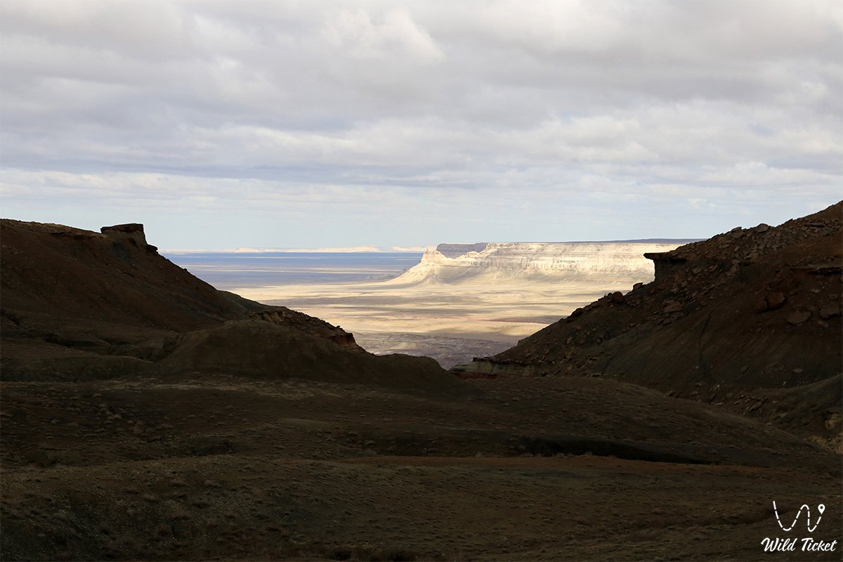
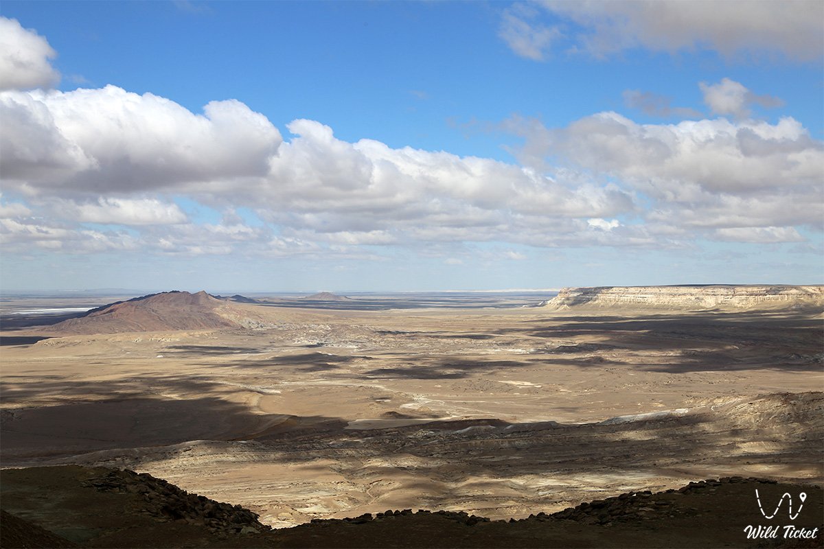
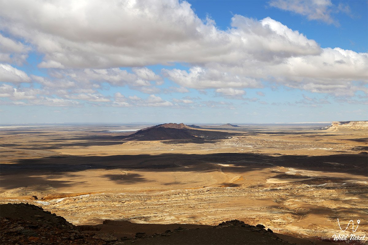
This heavily dissected mountain system serves as a key geological and landscape landmark of southern Mangystau, stretching latitudinally for 17 kilometers with a width ranging from 1.4 to 1.7 kilometers. To the east, the massif connects directly with the slopes of the Western chink of Ustyurt, while on the southwest it approaches the bitter-saline endorheic Karamaya lake, forming a sharp visual contrast between dark rocks and the dazzling white salt expanse.
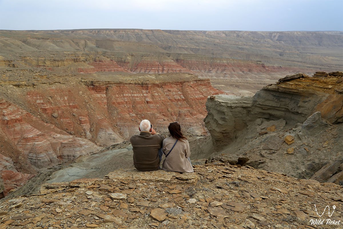
The geological framework of the range is composed of the oldest dislocated rocks in this part of the depression, dating back approximately 70 million years. Its core consists of Paleozoic and Mesozoic strata: Permian quartz sandstones, dense siltstones, mudstones, and local lenticular interbeds of coal.
Around the range, across adjacent sections of the Karynzharyk depression, folded beds of Cretaceous and Jurassic age are exposed, bearing witness to the destruction of wider prehistoric mountain chains under transgressions of the Caspian Sea and the waters of the retreated ancient Tethys Ocean, which left shell imprints and prehistoric shark teeth embedded in the stones.
In the eastern sector of the massif, approximately 6 permanent saline springs flow continuously, maintaining discharge even during prolonged droughts. The cliffs and canyons of Karamaya serve as a critical sanctuary for rare wildlife: an indigenous population of Ustyurt argali (mouflon) inhabits the rugged terraces, red-listed goitered gazelles graze along the piedmont aprons, and large raptors—including the golden eagle, Egyptian vulture, cinereous vulture, and kestrel—nest along the high ledges.
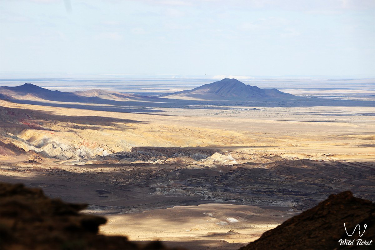
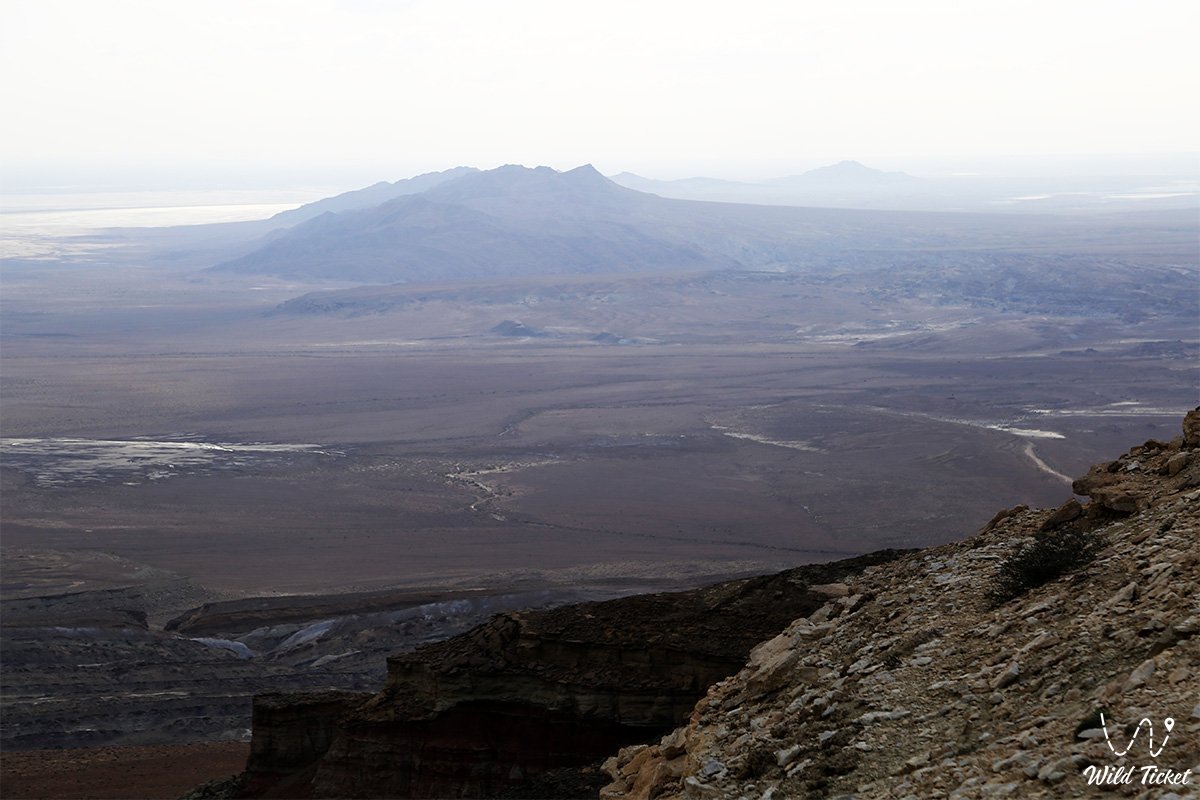
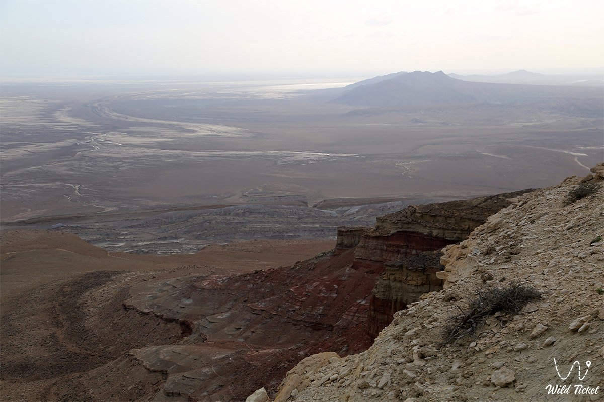
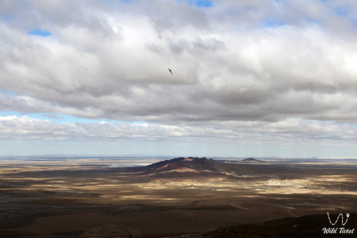
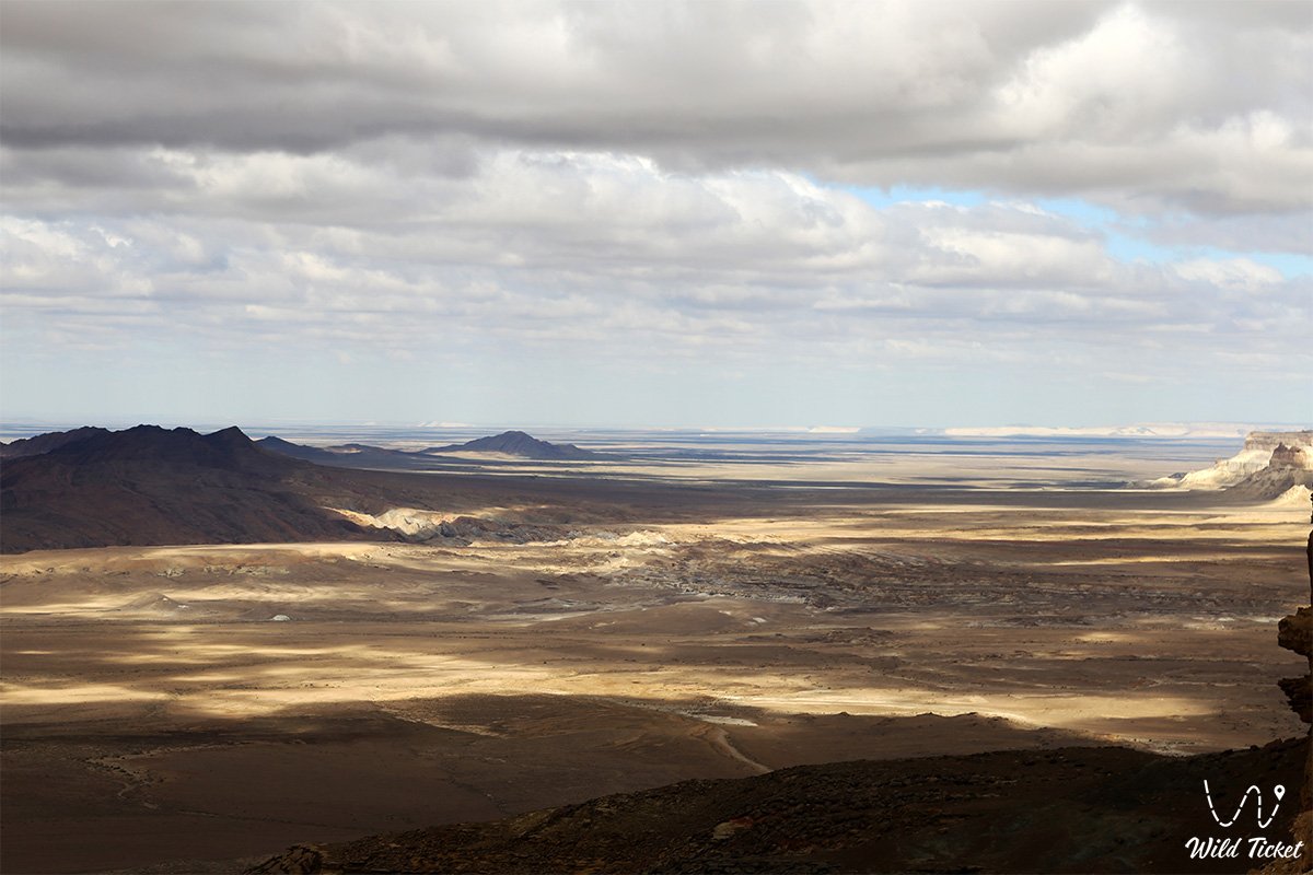
In the expedition and travel geography of Mangyshlak, the Karamaya range occupies a strategic position as an elevated vantage hub commanding expansive views over the salt flat depression. At the southern and central foot of the range, the terrain drops abruptly toward the Kenderli salt flat to negative elevations ranging from -25.4 to -40.8 meters below world sea level, while the eastern dominant peak of Mount Karamaya reaches an elevation of 209.8 meters (approximately 210 m above sea level), and the western unnamed knoll rises to 145.5 meters.
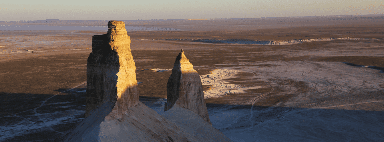
Within expedition reach are the cliffs of the Ustyurt plateau, the famous "Three Brothers" butte mountains ("Three Batyrs"), the spring-fed Onere oasis, the deep karst cavities of Balayuk cave and Utebay cave, the salt flats of Kenderli, and the Golbonshe hill.
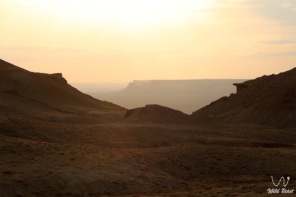
Today, the Karamaya range is recognized as an exemplary monument of Ustyurt geotectonics and arid landforms, drawing geologists, paleontologists, wildlife photographers, and overland travelers with the stark scale of its dark ravines, ancient fossil horizons, and panoramic vistas over the boundless expanse of the Kenderli salt flat. Heading west from the range, routes lead toward the Bozzhyra tract and the Kyzylkup tract.
--------------------------------------------
How to get there and visit –
The Karamaya mountain range and Mount Karamaya are located in the eastern part of the Karynzharyk depression within the Ustyurt State Nature Reserve in the Karakiyan district of the Mangistau region. The distance from the city of Aktau is around 380–400 km, roughly 230–250 km from the town of Zhanaozen, 52.1 km southeast of the Karashek salt flat, directly on the northern border of the Kenderlisor salt flat, and abutting the Ustyurt chink on the east.
GPS geographic coordinates of the Karamaya range:
43°10'10"N 54°43'32"E
The route from the city of Aktau leads southeast along a paved highway through the town of Zhanaozen (150 km). Continue south through the village of Senek toward the Karynzharyk depression. The asphalt road gives way to a crushed-stone gravel grader up to the Golbonshe hill area, after which the route turns onto challenging dirt steppe tracks running along the base of the Western chink of Ustyurt toward the northern sector of the Kenderlisor salt flat.
The track crosses clay terrain, dry wash beds, and rocky outcrops. The dark massif of the mountain, contrasting sharply with the white salt horizons, serves as a clear landmark for approach. Pure driving time from Zhanaozen by 4x4 SUV takes between 5 and 7 hours.
Reserve regulations and permits: the Karamaya range is situated within the protected territory of the Ustyurt state nature reserve. Visiting the site strictly requires an official entry permit and payment of established fees at the main office of the reserve in Zhanaozen (Tenge station).
Entry must be coordinated with wildlife and forestry rangers. All travelers must carry original identification documents (Kazakhstani citizens must have national ID cards; foreign citizens must have international passports and official permits for staying in the border zone of the Mangistau region).
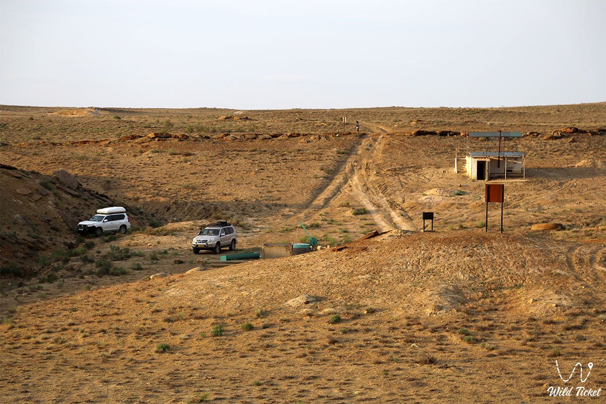
Vehicle requirements: access is possible exclusively in prepared four-wheel-drive 4x4 expedition vehicles with high ground clearance of 220–250 mm and durable All-Terrain or Mud-Terrain tires. Driving onto the smooth crust of the Kenderlisor salt flat along the base of the range is strictly prohibited: beneath the thin upper salt crust lies quick-mud silt, which immediately mires vehicles down to their axles.
Driving in a convoy of at least two vehicles is strictly mandatory. Each crew must carry a fuel reserve for at least 500 km of autonomous travel, two operational spare tires, an air compressor, dynamic tow straps, a hi-lift farm jack, sand ladders, and a satellite navigator with pre-downloaded offline maps.
Safety precautions and hiking routes: exploring the canyons of the range demands caution. Ravine slopes consist of crumbling mudstones, sandstones, and fractured flagstones. Sturdy trekking boots with rigid soles are mandatory. In the hot season, heat exhaustion and sunstroke present serious risks, so hikes should be scheduled for early morning hours.
Poisonous arthropods and snakes inhabit rocky screes, crevices, and areas near saline springs: the Halys pit viper, Steppe ribbon racer, camel spiders, scorpions, and black widows. Never flip stones by hand without protective gloves.
Environmental safety rules:
Within the Karamaya range and the reserve, it is STRICTLY MANDATORY TO:
– maintain complete silence to avoid startling grazing Ustyurt argali and goitered gazelles;
– pack out all household waste to designated municipal landfills;
– refrain from using open fires or lighting campfires;
– leave geological outcrops bearing Tethys paleontological fossils undamaged;
– stay strictly on established beaten tracks without driving onto ephemeral plant mats or salt flat clays;
– keep the watercourses of saline springs free from contamination.
Infrastructure: the area is entirely uninhabited and autonomous. For dozens of kilometers around, there are no cellular networks, settlements, fuel stations, tire repair shops, or sources of potable water. Water from the range's saline springs is unfit for drinking due to high mineralization. The full reserve of drinking and utility water must be brought along, calculated at 5 liters per person per day. Overnight stays and base camps are arranged independently using personal tents at a safe distance from salt flat depressions and rockfall-prone canyon walls.
The best time to visit is April, May, and the period from September to October. In spring following rains, the stony desert of Karamaya briefly turns green, blanketed by a carpet of blooming ephemerals, while air temperatures remain comfortable (+18...+24 °C). From mid-June through August, extreme heat sets in, with shade temperatures exceeding +42...+45 °C and the salt flat baking under direct sun.
--------------------------------------------
History
The history of the Karamaya range encompasses ancient eras of geological evolution in the Caspian region, periods of oceanic regression, and traditional migration routes of Mangyshlak nomadic pastoralists.
In deep antiquity, the area of the Karynzharyk depression formed a deepwater basin of the ancient Tethys Ocean. During successive transgressions and regressions of the prehistoric Caspian, younger sedimentary covers were eroded by torrents of water, exposing the folded ancient Permian strata of the range, which endured as an isolated rocky residual butte.
The ridge received its name from nomadic clans of the Aday tribe, who historically grazed flocks of sheep and herds of horses along the chinks of Ustyurt. Translated from Kazakh, "Karamaya" means "Black Female Camel." From afar, the dark, curved silhouette of the 17-kilometer range rising in the middle of the white salt plain reminded nomads of a recumbent dark-coated two-humped camel sheltering the base of the chink from storms.
During the Soviet era, the Karamaya range drew the focus of geologists and paleontologists. In the course of comprehensive mapping across the Karynzharyk basin, researchers discovered coal occurrences within the mudstone and sandstone sequences, alongside abundant fossil deposits of Mesozoic fauna: ammonites, belemnite rostra, prehistoric shark teeth, and mollusk shells. In 1984, with the establishment of the Ustyurt State Nature Reserve, the Karamaya range was included in the core protected zone as a vital habitat for the Ustyurt argali and a benchmark Paleozoic geological exposure.
Information
In structural and geological terms, the Karamaya range is a folded-erosional residual butte massif composed of a complex of Paleozoic and Mesozoic sedimentary rocks.
Morphometric characteristics of the massif:
– total length of the ridge in a latitudinal direction: 17 km;
– maximum width of the massif near the salt lake: 1.7 km;
– width of the massif in its eastern part: 1.4 km;
– absolute elevation of the dominant Mount Karamaya: 209.8 m;
– elevation of the unnamed western knoll: 145.5 m;
– absolute elevation of the base at the Kenderli salt flat: from -25.4 to -40.8 m below sea level;
– vertical relief from the salt flat floor to the crest: up to 250 m.
Geological cross-section and lithology:
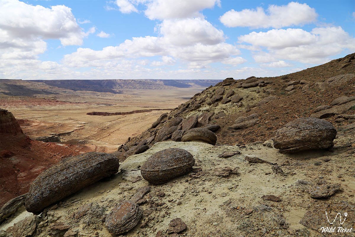
The core of the range consists of Permian deposits dating back over 70 million years. The section is composed of dark gray and brownish quartz-feldspar sandstones, dense thin-bedded siltstones, and mudstones with interbeds of carbonaceous shales and minor coal lenses. In the folded surroundings of the range, intensely dislocated Cretaceous and Jurassic strata are exposed. Paleontological finds (shark teeth, fossil shells, and fish imprints) confirm the marine genesis of the ancient Tethys terraces.
Hydrological characteristics:
In the eastern ravines of the range, a group of 6 springs flows with bitter-saline and chloride-sulfate water. In moist spring seasons, these springs form small streams flowing toward the salt flat. The bitter-saline Karamaya lake at the southwestern base of the massif is an endorheic evaporation basin holding concentrated brine.
The climate of the area is sharply continental and ultra-arid. Average July temperatures are +32...+35 °C (with daytime peaks above +45 °C), while January averages -8 to -12 °C with piercing winds. Annual precipitation does not exceed 100–130 mm, against high potential evaporation.
Detailed site description
The natural landscape structure of the Karamaya range and the adjacent northern sector of the Kenderlisor salt flat encompasses the following interrelated zones:
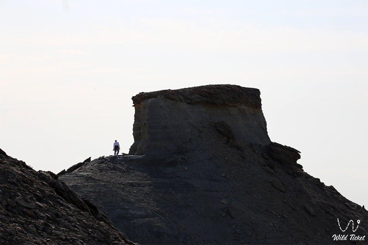
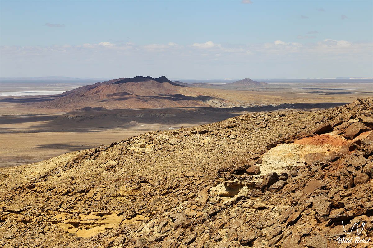
• Rocky bastion of Mount Karamaya (209.8 m) – the eastern dominant conical summit with dark scree slopes, serving as the primary panoramic viewpoint over the entire Karynzharyk depression.
• Western residual crest (145.5 m) – a gentle dome-shaped elevation featuring exposures of dense Permian sandstones descending toward the lake depression.
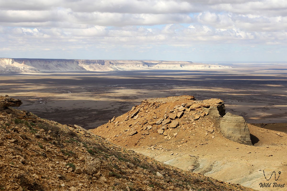
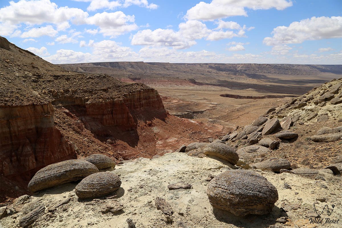
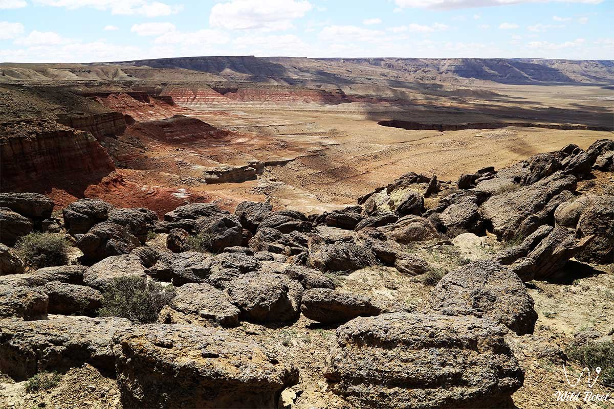
• Network of deep labyrinthine canyons – a system of winding, narrow ravines with sheer walls of bedded mudstone and sandstone dissecting the body of the massif for 17 kilometers.
• Bitter-saline Karamaya lake basin – an endorheic water body at the southwestern base of the ridge, ringed by sun-glistening salt crystals and filled with concentrated brine.
• Eastern sector of six mineralized springs – stony ravines where natural saline springs surface, providing a continuous watering source for plateau wildlife.
• Outcrops of Paleozoic and Mesozoic horizons – stratigraphic exposures of Permian, Jurassic, and Cretaceous age containing coal lenses, prehistoric shell impressions, and shark teeth from the ancient Tethys Ocean.
• Depression escarpment at the Kenderlisor salt flat – the transition zone from the base of the massif to the vast salt flats at elevations down to minus 40.8 meters below world sea level.
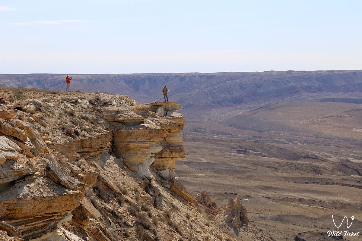
• Rocky junction with the Western chink of Ustyurt – a monumental limestone cliff at the eastern extremity of the range, where dark folded strata merge with the pale ledges of the plateau.
• Cliff shelves and mouflon resting grounds – rugged stepped terraces and crests in the upper reaches of the canyons that serve as permanent trails and daytime resting spots for Ustyurt argali.
Flora and fauna
Vegetation across the Karamaya mountains is sparse and desert-adapted. Stony slopes support arid gypsophytic and petrophytic plant communities: scattered dwarf shrubs of gray wormwood, boyalych, biyurgun (Anabasis salsa), winterfat, and eastern saltwort. In early spring after sparse snowmelt and rains, the soil briefly blooms with a carpet of ephemerals and ephemeroids (tulips, bulbous bluegrass, alyssum), which wither away by late May to leave behind dry clay-gravel terrain. Near the saline springs and along the edge of the salt flat grow glassworts, knobby sarsazan, and hardy tamarisk.
Wildlife of the range includes red-listed and rare species of desert fauna. The Karamaya mountains are a primary breeding center and permanent habitat for the endemic Ustyurt mountain sheep (argali-mouflon), which maneuvers across the sheer Permian cliffs.
Along the base of the range and beside the Kenderli salt flat, small herds of goitered gazelles reside, alongside saiga antelopes entering the area during seasonal migrations.
Predatory mammals recorded here include the steppe wolf, corsac fox, red fox, badger, and the red-listed honey badger. Tolai hares and jerboas shelter among the rocky debris.
Birdlife consists of birds of prey adapted to arid zones that nest on inaccessible canyon ledges: golden eagles, Egyptian vultures, cinereous vultures, kestrels, long-legged buzzards, and eagle owls. Desert wheatears, saxaul jays, and desert larks inhabit scrub near the springs.
Reptiles are numerous, including toad-headed and spotted toad-headed agamas, steppe agamas, rapid fringe-toed lizards, gray geckos, and dice snakes near water sources, alongside the venomous Halys pit viper, Steppe ribbon racer, camel spiders, tarantulas, and black widows.
Legend
An ancient Kazakh legend of the Faithful Camel and the Great Calamity is told of the Karamaya range.
The tale recounts that in ancient times, when the Karynzharyk depression was a flourishing valley with cool rivers, a wealthy clan led by a wise elder migrated across these lands. The greatest treasure of their camp was a powerful female camel of rare black coat—Karamaya—who possessed the gift of sensing impending storms and earthquakes.
One night, the earth trembled, a deep rumble echoed from beneath the ground, and salty waters of the ancient sea flooded in from the west, sweeping away everything in their path. The elder was asleep, but Karamaya woke the encampment with a loud bellow, guiding the people toward the high chink of the Ustyurt plateau. Once all the clan members reached safe ground, the camel remained at the foot of the cliffs, using her massive body to shelter the remaining young camels and foals from the raging saline waves.
When the storm subsided, the receded waters left the valley as a dead salt flat. The camel Karamaya remained standing watch over the valley, petrified by sea salt into a 17-kilometer dark rocky range. Local shepherds believe that the spirit of the Black Camel continues to guard the peace of the Ustyurt argali, while the saline springs in the east of the range are the enduring tears of the faithful animal.
Conclusion
The Karamaya mountain range is a monument of paleogeography and wilderness in the Karynzharyk depression, uniting dark Permian cliffs, deep canyons, and the gleaming salt flats of Ustyurt. Spotting argali on the cliffs, examining fossil relics of the ancient Tethys, and taking in vistas of the Kenderlisor salt flat make Karamaya an essential destination on overland routes through Mangystau.
Nearby attractions:
• Mount Karamaya (209.8 m);
• Karamaya salt lake;
• Karynzharyk sand massif;
• Golbonshe hill;
• Kenderlisor salt flat;
• Karynzharyk depression;
• "Three Batyrs" butte mountains;
• Onere spring tract;
• Ustyurt nature reserve;
• Bulyoyyk karst cave;
• Utebay karst cave;
• Karashek salt flat;
• Ustyurt plateau;
• Town of Zhanaozen;
• City of Aktau.
Pilgrimage sites in Mangystau:
• Beket-Ata underground mosque;
• Shopan-Ata underground mosque;
• Karaman-ata underground mosque;
• Shakpak-Ata underground mosque;
• Sultan-epe underground mosque;
• Otpan-tau memorial complex;
• Masat-Ata underground mosque;
• Sonabay underground mosque;
• Koben mosque;
• Kolbas Ishan mosque;
• Zholaskan mosque;
• Bayte sanctuary.
Photogallery:







Comments 2