Cradle of cave Sufism, Stone Age sites, and the austere breath of the Caspian –
Shakpaktysay Canyon (Kaz. Shaqpaqtysai shatqaly, also known as Shakpakatasay Canyon, Shakpak-Ata, Shakpakty) represents the most extensive erosional system of chalk canyons in the west of Kazakhstan. This grandiose geological corridor extending nearly 10 kilometers is incised into the surface of the semi-desert plateau in the northeastern part of the Tupkaragan district, opening with a broad mouth toward the coast.
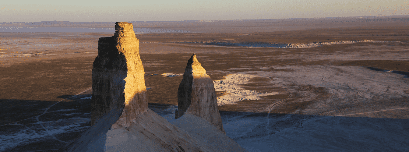
The tract serves as a prime landscape and historical gem of the Mangystau region, astonishing travelers with dazzling white and cream-colored cliffs that resemble the spines of giant dragons and bastions of ancient fortresses. Just 4–5 kilometers to the north stretch the shallow lagoons of Sarytas Bay where the waves of the Caspian Sea break, bringing welcome moisture and dense morning mists to the sun-baked chalk scarps.
In the tourism and expedition logistics of Northern Mangystau, Shakpaktysay Canyon occupies a central position thanks to the world-renowned Shakpak-Ata underground mosque and its extensive necropolis, carved directly into the chalk cliff face and inscribed in July 2026 onto the UNESCO World Heritage List.
Approximately 135–140 kilometers to the southeast along vehicular roads lies the regional center Aktau, from where expedition convoys head through the seaside village of Akshukur toward Tauchik. Literally 4.4 kilometers to the west beyond a rocky ridge lies the snow-white Kapamsay Canyon with its green mulberry grove in the grotto, while to the northwest open Kokbulaksay Canyon, the Zhygylgan sinkhole with fossil tracks of saber-toothed cats, spring-fed Tamshaly Canyon with its weeping cliffs, freshwater Turtle Lake in Saura Canyon, and rocky Cape Tyub-Karagan.
The geological framework of the canyon is formed by colossal sedimentary sequences of chalk, marls, and limestones from the Jurassic-Cretaceous period, deposited on the floor of the vanished prehistoric Tethys Ocean and sculpted over millions of years by powerful surf from the Sarmatian Sea and wind deflation.
From Shakpaktysay, caravan trails and steppe tracks head deep into the Mangyshlak Peninsula: toward the sacred height of Mount Otpan-Tau with the Aday-Ata complex, the mystical stone balls of the Torysh Valley, solitary residual Mount Sherkala, the variegated Jurassic clays of the Kokala tract, and the narrow slate gorge of Karadayirmen.
The primary highlight of the canyon is its combination of natural monumentality and sacred majesty: at the very head of the gorge sits a cruciform rock-cut cave temple with columns symbolizing the four classical elements and a central shanyrak skylight dome, while down in the Zholbart tract flows an active well with sweet artesian water.
After exploring the chalk labyrinths and medieval fortifications of Tupkaragan, overland expeditions journey southeast toward the snow-white chinks of the Bozzhira tract, the Tuzbair salt flat, Mount Bokty, the Karynzharyk depression, and the strictly protected lands of the Ustyurt State Nature Reserve.
Today, Shakpaktysay Canyon is recognized as an unrivaled natural and architectural monument of world significance on Mangystau, drawing pilgrims, researchers, geologists, and wildlife photographers with cyclopean chalk vistas, delicate stone lace of tafoni honeycombs, petroglyphs left by ancient nomads, and the timeless silence of the desert. Near the canyon also stands the sacred Mausoleum of Khazret Sultan, which serves as a pilgrimage destination and an architectural landmark of the region.
--------------------------------------------
How to get there and visit –
Shakpaktysay Canyon is situated in the northwestern part of the Tupkaragan Peninsula, among the western spurs of the Kaushe Mountains, within the boundaries of the Tupkaragan district. The natural boundaries of the canyon are Mount Ungoza (199.2 m) and Eastern Ungoza (196.5 m) to the northeast, an unnamed dominant peak of the Kaushe Mountains (234.1 m) to the southeast, the Zholbart tract to the southwest, and the shores of Sarytas Bay to the north.
The distance from the city of Aktau is around 135–140 km, from the town of Fort-Shevchenko – about 90–95 km, from Tauchik village – roughly 25–30 km, and to neighboring Kapamsay Canyon – only 4.4 km to the west.
GPS geographical coordinates of Shakpaktysay Canyon:
44°24'26"N 51°08'18"E
GPS coordinates of the Shakpak-Ata underground mosque:
44°26'00"N 51°08'20"E
The road route from Aktau leads north along a quality paved highway via the suburban settlement of Akshukur to the large village of Tauchik (about 95–100 km of excellent asphalt). Just past Tauchik, a hard-packed gravel-and-steppe dirt road branches northwest toward Sarytas Bay and the Shakpak-Ata complex (an additional 35–40 km across the steppe).
The track brings travelers to the upper reaches of the canyon, where the pilgrim guest house (shirakshi) and the entrance to the mosque are located. Driving time from Aktau takes around 2.5 hours.
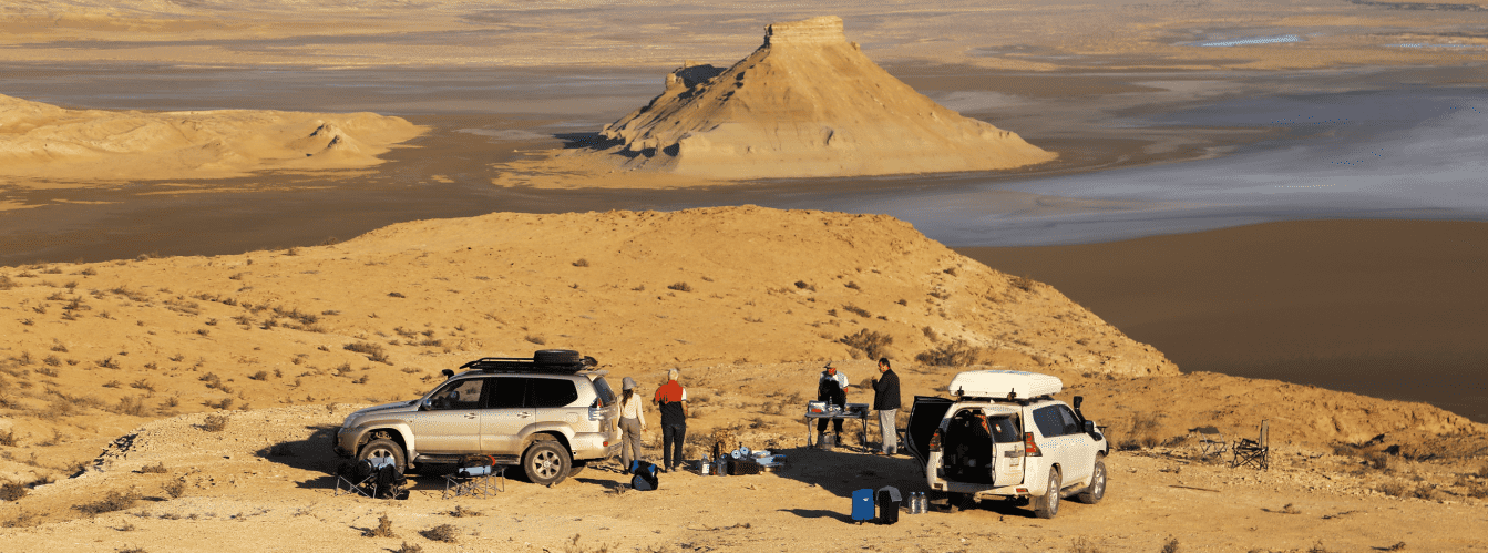
Access roads and vehicle requirements: during dry weather, passenger sedans and urban crossovers can reach the upper pilgrim parking lot near the necropolis and mosque. However, descending directly onto the sandy-clay floor of Shakpaktysay Canyon, driving along the dry rocky wash to the Zholbart well, or exiting toward Sarytas Bay strictly requires a prepared four-wheel-drive vehicle (4x4) with high ground clearance. During rain, clay sections of the steppe and descents become slick, posing a risk of skidding and bogging down.
Foot trekking and route specifics: exploring the canyon requires sturdy, closed footwear (trekking shoes or boots with deep lugged soles), as the terrain features loose gravel screes, slippery chalk beds, and sharp flint flakes. A sun hat, sunglasses, and at least 2 liters of drinking water per person are mandatory for radial hikes.
Visiting regulations and sacred etiquette: the canyon and the Shakpak-Ata mosque are an active Islamic sanctuary and a UNESCO World Heritage site.
Within the complex, the following are STRICTLY PROHIBITED:
– Entering the underground mosque and ancient necropolis wearing shorts, short skirts, or sleeveless tops (women must cover their heads with a scarf);
– Speaking loudly, making noise, playing music, or disrupting worshippers;
– Painting graffiti or scratching inscriptions onto the soft chalk and limestone walls of the canyon or inside the temple;
– Damaging ancient headstones or disturbing archaeological artifacts;
– Lighting open campfires outside designated areas at the pilgrim house;
– Leaving behind plastic garbage, glass, and food waste.
Infrastructure: a traditional pilgrim house (tunehana) operates at the entrance to the shrine, where the keeper (shirakshi) welcomes visitors, offering shaded resting areas, a teahouse, and a freshwater well. At the floor of the canyon in the Zholbart tract, an active well provides sweet artesian water, supplying the local shepherd settlement.
The nearest brand-name gas stations, grocery stores, pharmacies, and tire repair services are in Tauchik (30 km). Tent camping inside the canyon requires complete self-sufficiency: food supplies, drinking water (at least 3 liters per person per day), gas camping stoves, and warm layers for chilly desert nights. Cellular reception is absent on the canyon floor due to shielding by massive cliffs, though it connects intermittently on plateau elevations around Mount Ungoza.
The best season to visit is spring (mid-April to early June): the steppe is carpeted with green, wild tulips bloom, and daytime temperatures stay comfortably between +20 and +25 °C. Early autumn (September – October) is ideal for off-road expeditions thanks to stable dry weather and gentle sunshine. In July and August at midday, temperatures inside the white canyon basin soar above +38...+42 °C; tours and walks should be scheduled for early morning or before sunset.
--------------------------------------------
History
The history of Shakpaktysay Canyon spans a vast chronological timeline – from prehistoric flint-knapping sites of the Stone Age to the flourishing of medieval cave architecture and Sufi enlightenment.
The name "Shaqpaqtysai" originates from the Kazakh word "shaqpaq" (flint, firesteel) and means "Flint Ravine". Outcrops of durable black flint within the chalk cliffs attracted humans as early as the Paleolithic and Neolithic epochs: archaeological surveys along the canyon terraces revealed dozens of ancient stone-working workshops, hunter encampments, flint cores, arrowheads, and scrapers. During the Bronze and Early Iron ages, nomadic warriors were interred here, as evidenced by burial kurgans. In the Middle Ages, two stone refuge fortresses were erected atop dominant rock shelves overlooking the canyon to guard caravan tracks descending toward Sarytas Bay.
The paramount historical chapter of the canyon is the founding of the Shakpak-Ata underground mosque. According to tradition, in the 9th–10th centuries (with some archaeological studies suggesting the 13th–14th centuries), a Sufi ascetic, healer, and teacher named Shakhmardan settled among these silent rocks, remembered by the people as Shakpak-Ata (Father of Flint). The holy elder was renowned for healing the sick, deep wisdom, and the miraculous ability to strike sparks of true faith directly from the stone.
Shakpak-Ata carved a singular cave complex out of the white limestone bedrock. The layout of the mosque forms a strict cruciform plan oriented to the cardinal points. The central hall is crowned by a circular skylight dome with a shanyrak aperture admitting sunlight, while the ceiling rests upon four monumental corner columns symbolizing the four classical elements of creation: fire, water, air (wind), and earth.
The entrance portal and interior pilasters feature stalactite friezes and cornices, while the white walls are inscribed with hundreds of epigraphic texts in Arabic, Persian, and Chagatai, Sufi verses, depictions of war steeds, protective open palms (hamsa), and tribal tamgas of Aday clans.
Around the shrine grew an extensive necropolis where batyrs, ishans, and respected elders were buried over centuries. At the lower exit of the canyon toward the Caspian Sea stand the revered mausoleum and mosque of Yerzhan Khazret. In July 2026, the Shakpak-Ata underground mosque and necropolis were officially inscribed onto the UNESCO World Heritage List by decision of the World Heritage Committee, affirming their outstanding universal value.
Information
Morphometrically, Shakpaktysay Canyon represents the largest and most intricate erosional canyon network on Tupkaragan. The length of the main gorge from north to south spans roughly 9.5 kilometers, while its maximum width in the central basin reaches 4.7–5 kilometers. The western flank plunges as vertical cliffs, the southern reach is carved by a dense network of ravines, and to the north the valley broadens into a gentle mouth toward Sarytas Bay. The vertical drop between the dominant peak of the Kaushe Mountains (+234.1 m) and the Caspian waterline (-28 m) exceeds 260 meters.
The geological structure exposes thick sedimentary strata of the Jurassic, Cretaceous, and Paleogene periods of the ancient Tethys Ocean. Canyon walls consist of horizontal beds of white writing chalk, gray marls, and durable cream-yellow coquina limestones of the Sarmatian Sea.
The primary geomorphological feature of Shakpaktysay is its remarkable weathering and erosional sculpture. Wind, temperature swings, and maritime fogs transformed the limestone cornices into stone lace and honeycombs (tafoni). Discrete residual massifs resemble the ridged spines of giant dragons, white knightly castles, and colossal weathered heads, creating a surreal primeval landscape.
The hydrological regime is arid. There are no permanent surface streams in the canyon; spring meltwaters and flash floods carve dry washes (says). However, abundant aquifers of sweet groundwater lie trapped within the limestone strata. In the southwestern section (Zholbart tract), the deep, active Zhelbard (Zholbart) well provides fresh, low-mineral artesian water year-round at +12...+14 °C.
Soil cover is sparse: the canyon floor is composed of alluvial deposits of sand, gravel, and chalk fragments with a light salt bloom, while primitive stony gray-brown desert soils cover the surrounding plateaus.
The climate is sharply continental, temperate desert with marked marine moderation. In summer, daytime air temperatures inside the canyon reach +38...+42 °C, yet within the underground halls of the mosque temperatures remain consistently cool (+15...+17 °C). Winters are moderately cold, with sharp gale-force winds across the plateau (temperatures dropping to -15...-20 °C) and dense sea fogs veiling the cliffs in white. Mean annual precipitation does not exceed 130–150 mm.
Detailed description of the venue
The natural and archaeological ensemble of Shakpaktysay Canyon encompasses the following key sectors, unique monuments, and hydrological landmarks:
• Shakpak-Ata rock-cut underground mosque (UNESCO site) – a cruciform cave sanctuary carved into chalk stone, featuring four corner columns of the elements, a central shanyrak skylight, and hundreds of ancient petroglyphs of horses and protective palms.
• Ancient Shakpak-Ata necropolis – an extensive memorial complex spanning different eras, including Oghuz headstones, Turkmen koytases, and carved Kazakh saganatams.
• Snow-white chalk dragon ridges – colossal erosional ridges and outliers of white and yellow chalk in the central canyon basin, sculpted by wind and rain.
• Honeycomb weathering walls (tafoni) – sheer limestone cornices perforated with deep cellular cavities and delicate stone lattice.
• Zholbart artesian well – an active freshwater source in the southwestern reach of the gorge supplying sweet water to the local shepherd settlement.
• Ruins of medieval refuge fortresses – remnants of dry-stone masonry defensive structures on high canyon ledges that safeguarded ancient trade caravans.
• Paleolithic encampments and workshops – archaeological terraces with black flint outcrops and scatters of Stone Age implements.
• Panoramic heights of Mount Ungoza (199.2 m) – a northeastern vantage point opening onto sweeping views across the ten-kilometer canyon valley and Sarytas Bay.
• Yerzhan Khazret memorial complex – a historic mosque and mausoleum of the respected theologian near the northern exit of the gorge toward the Caspian shore.
Flora and fauna
The vegetation of Shakpaktysay Canyon has an arid character, adapted to life on chalk, salt flats, and rocky screes. Shaded gullies and dry washes support thickets of tamarisk, wild rose hips, silverberry, and spiny hawthorn. Gravelly slopes and chalk debris harbor gray-soil wormwood, boyalych, Anabasis salsa (biyurgun), itsigek (Anabasis aphylla), sea lavender, and camelthorn (dzhantak). In spring, the canyon transforms: ephemerals, wild steppe tulips, irises, and feather grasses bloom briefly, scenting the air with herbal sweetness.
Fauna in the canyon finds shelter from the heat and predators inside rock niches and caves. Corsac foxes, badgers, steppe polecats, long-eared hedgehogs, gerbils, and tolai hares inhabit fissures. In the morning, small bands of Ustyurt mountain sheep (mouflons / urials), listed in the Red Data Book of Kazakhstan, venture onto steep chalk ridges.
Avifauna is diverse, making Shakpaktysay a rewarding destination for birdwatching. Weathered niches host nesting colonies of rock doves, swifts, swallows, desert ravens, and chukar partridges. Raptors soaring over the chalk ramparts include golden eagles, steppe eagles, long-legged buzzards, saker falcons, common kestrels, and Eurasian eagle-owls.
Herpetofauna is represented by the agile steppe agama, toad-headed agama, gray and Caspian geckos, arrow snake, and dione snake.
Invertebrates active on stony terraces include solifuges (camel spiders), tarantulas, and steppe scorpions sheltering under flat limestone fragments by day.
Legend
A revered legend tells of the Fire of True Faith and Saint Shakhmardan in connection with Shakpaktysay Canyon and the Shakpak-Ata mosque.
Tradition recounts that in a distant age, when nomadic clans roamed the shores of the Caspian and pestilence and conflict troubled the steppe, a righteous sage named Shakhmardan arrived in these silent chalk mountains. For his spiritual purity and mastery over elements, the people named him Shakpak-Ata – Master of Flint. It was said the elder needed no firesteel: whenever his fingers touched the white cliffs of the canyon, brilliant sparks burst forth from the rock, warming freezing travelers and driving dark spirits away.
When fierce invaders attacked peaceful nomadic settlements, Shakpak-Ata mounted a high ledge above the canyon. Striking flint against flint, he called down a dazzling radiance from heaven that illuminated the entire ravine with sacred light. Terrified, the invaders fled, their commanders blinded by the flash of divine wrath.
Following this victory, the hermit retreated into the cliffs and carved a cruciform mosque out of the limestone bedrock, dedicating it to the four elements of the Creator: the fire of faith, the water of mercy, the wind of freedom, and the sacred soil of ancestors.
Renown of the holy healer spread across the East. Thousands of travelers journeyed to Shakpaktysay Canyon: a touch of the elder's hand and a sip of water from the Zholbart well healed grave illnesses, returned sight to the blind, and brought comfort to despairing souls. Passing into eternity, Shakpak-Ata promised that the sparks of divine fire would forever dwell within the walls of this stone sanctuary. Ever since, believers hold that prayer in Shakpaktysay Canyon can kindle hope in any heart and cleanse the soul of darkness.
Conclusion
Shakpaktysay Canyon is a triumph of natural architecture and a sacred treasure of Mangystau, where the chalk bastions of the prehistoric Tethys Ocean merge in harmony with the masterpieces of cave Sufi masonry inscribed into UNESCO's heritage. An expedition into Shakpaktysay offers travelers a connection to the beginnings of regional history, wonder before the ridges of stone dragons, and the blessed coolness of an ancient sanctuary on the edge of the Caspian Sea.
Interesting sights nearby:
• Shakpak-Ata Mosque;
• Shakpak-Ata Necropolis;
• Kapamsay Canyon;
• Zhygylgan Geological Sinkhole;
• Fossilized Tracks in Zhygylgan;
• Tamshaly Canyon;
• Saura Canyon and Lake Karakup;
• Rocky Cape Tyub-Karagan;
• Bautino Seaport Village;
• Fort-Shevchenko Town-Museum;
• Torysh Valley of Stone Balls;
• Kokbulaksay Canyon;
• Summit of Mount Ungoza;
• Zholbart Artesian Well;
• Yerzhan Khazret Mosque;
• Sarytas Bay.
Sacred sights and pilgrimage destinations:
• Beket-Ata Underground Mosque;
• Karaman-Ata Underground Mosque;
• Sultan-Epe Underground Mosque;
• Kolbas Ishan Mosque;
• Koben Mosque;
• Zholaskan Mosque;
• Zhaman Sauran Mosque;
• Ishan Khozha Mosque;
• Itolla Mosque;
• Sonabay Underground Mosque;
• Masat Ata Mosque;
• Uytoly Ata Underground Mosque;
• Bayte Sanctuary.
Photogallery: